Advanced Geographic Information Systems & Science
Advanced GIS (Spring 2013) was taught in the Urban Planning department of Columbia's Graduate School of Architecture, Planning and Preservation (GSAPP), is a hybrid course simultaneously teaching concepts of human and physical geography, critical GIS, and comparative spatial research methodologies, and decision support within the context of questions relevant to planning in urban environments.
Featured here are excerpts from example student projects from the course.
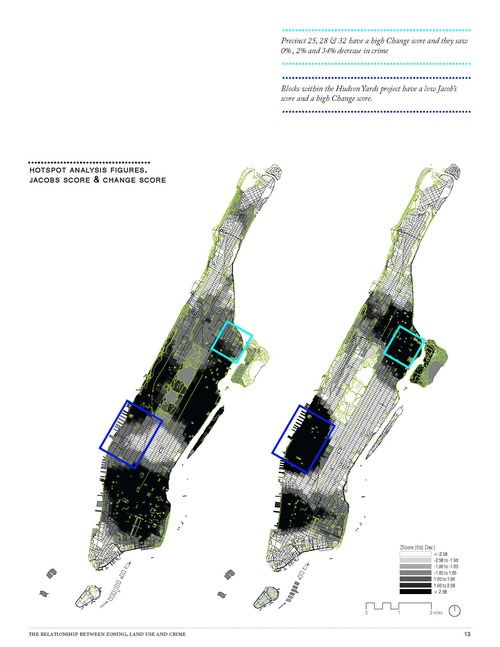
Lucrecia Montemayor Solano. "Eyes on the Street: The Relationship Between Zoning, Land Use, and Crime."
(Advanced GIS, Spring 2013)
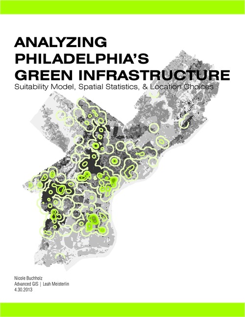
Nicole Buchholz. "Analyzing Philadelphia's Green Infrastructure: Suitability Model, Spatial Statistics, and Location Choices."
(Advanced GIS, Spring 2013)
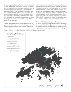
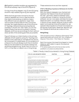
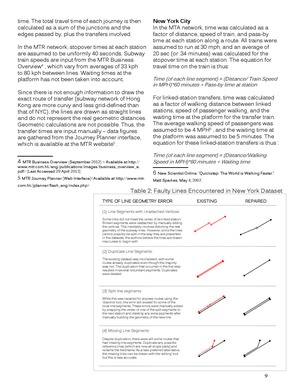
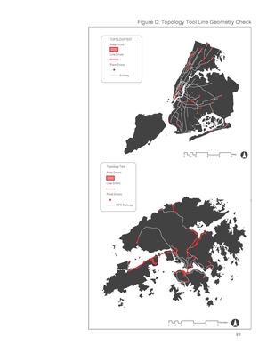
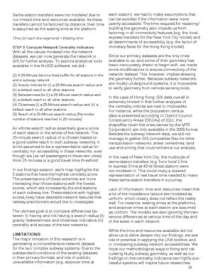
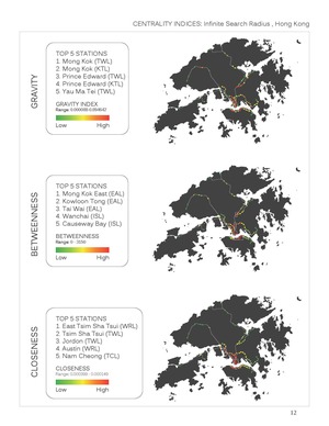
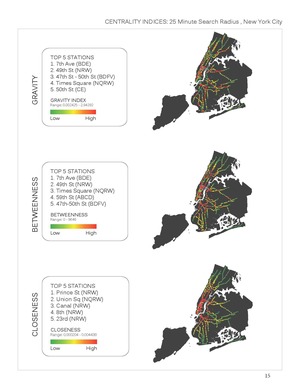
Clara Chung and Ranjani Sarode. "Modeling Subway Network Accessibility, Connectivity, and Centrality: A Comparative Case Study of Hong Kong and New York City."
(Advanced GIS, Spring 2013)
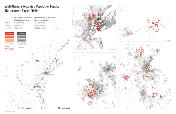
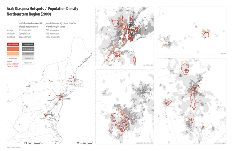
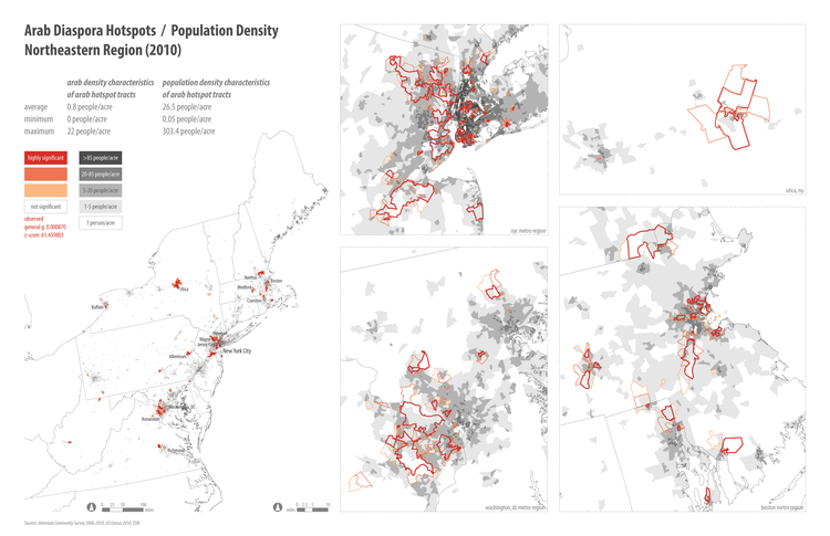
Sarah Almukhtar. "An Analysis of the Clustering of Arab Diaspora Populations in the Northeastern Region of the United States."
(Advanced GIS, Spring 2013)
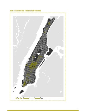
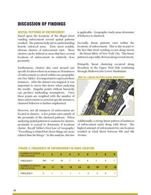
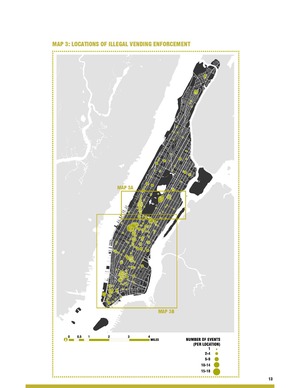
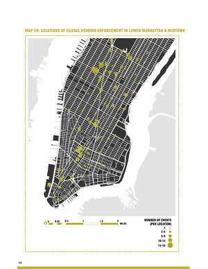
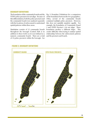
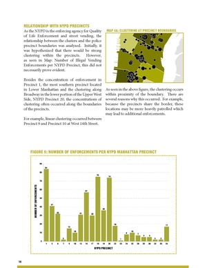
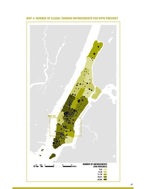
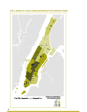
Leslie Deacon. "Enforcing Illegal Street Vending: Spatial Analysis to Understand Patterns of Enforcement in Manhattan."
(Advanced GIS, Spring 2013)