What Urban Data Can & Can't Tell You
Knowing Cities (Spring 2013) was a six-week Visual Studies course, taught in the Architecture program at Columbia's GSAPP, questioning what can('t) be known of cities through the data they produce. Students were tasked with telling three distinct stories through a single dataset, highlighting the roles of interpretation and authorship in data visualization.
Featured here are excerpts from example student projects from the course.
Reihaneh Ramezany Mahonaky's investigation of obesity data in New York City, targeting (L to R) the dietary supplements industry, city parks planners, and 'concerned' parents.

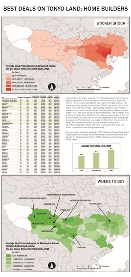
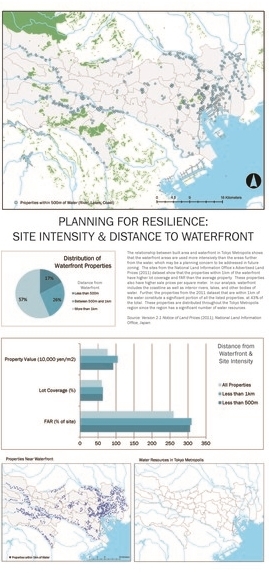
Caroline Lebar's interpretations of real estate sales in Tokyo, constructing separate arguments on (L to R) transit development, real estate decision making, and sea-level rise resilience planning.

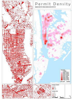
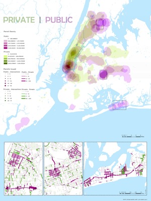
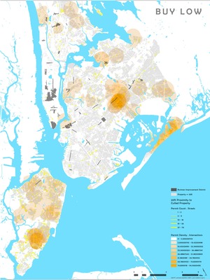
Michael Schissel's arguments on (L to R) the intensity of infrastructural investment, the role of the public and private sectors in urban change, and real estate bargain hunting, all derived from the locations of curb cuts in NYC.