Datascapes & the Informal City (Fall 2013)
During the Fall 2013 semester, Datascapes & the Informal City was a Special Topics Seminar offered at the Barnard + Columbia Colleges Architecture Department. The seminar asked questions on urban informality combining methods of spatial analysis, data collection and criticism, visualization and representation, and rapid prototyping with 3D printing.

The Course
For the course’s purposes, the ‘informal’ was defined as the typically undocumented processes and relationships within the city which are often predicated on perception, on tradition, or on social behaviors that either are not or cannot be easily recorded through the standard means of data collection. Often these include topics for which quantitative metrics or otherwise reliable survey instruments fail, those for which the most affected populations are systematically excluded through sampling biases, those for which ecological fallacies corrupt statistical results, as well as those which simply change faster than information is gathered.
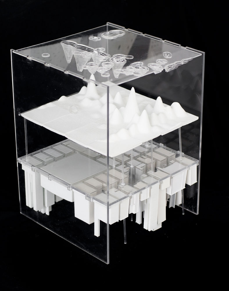
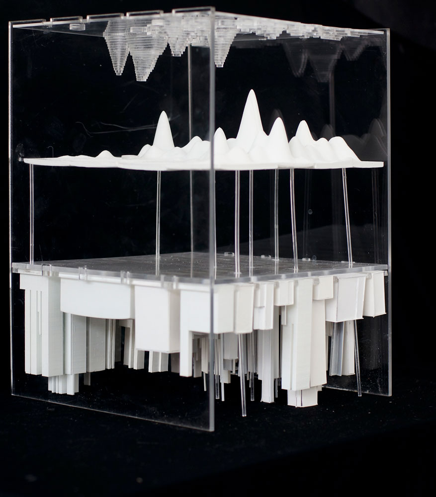
In many ways, the course sought to test the extent to which we may understand and describe what we cannot readily sense in a dynamic and complex geosocial system as the interaction between the layers of information we can quickly access. As such, these informal urban processes were modeled as the resultant spatial relationships between analyzed datasets either publically available or created through field work.
Through project-based learning, students engaged topics and skills that are often taught separately, synthesizing theory with practice and the development of critical hypotheses with the design of rigorous methodologies. The final deliverables function not only as the product of their endeavors, but as communicative objects for the discussion of urban issues often difficult to describe, as further evidence that no singular dataset may sufficiently describe complex conditions, and as proof of concept for currently evolving techniques of analysis and design. This multifaceted and situated approach to teaching and to social systems inquiry has become invaluable at a time when urban informatics is ever-growing, quality data is more widely available than ever, and yet social landscapes change faster than at any time before, and crucial questions remain either unanswered or unasked.


The Projects
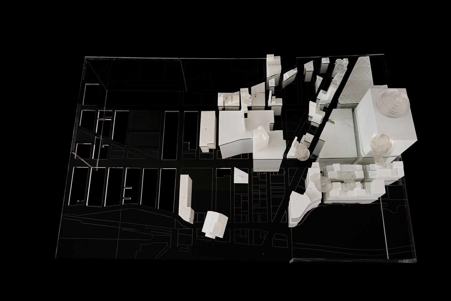
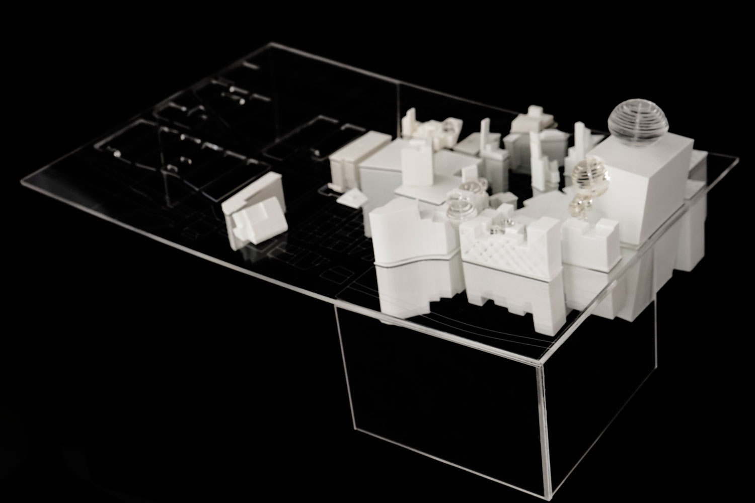
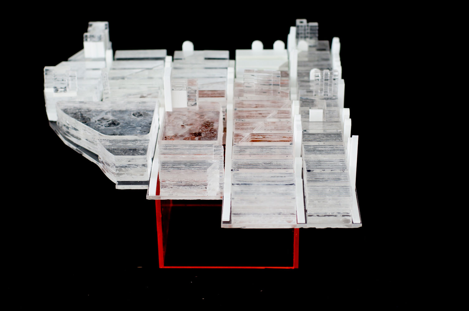
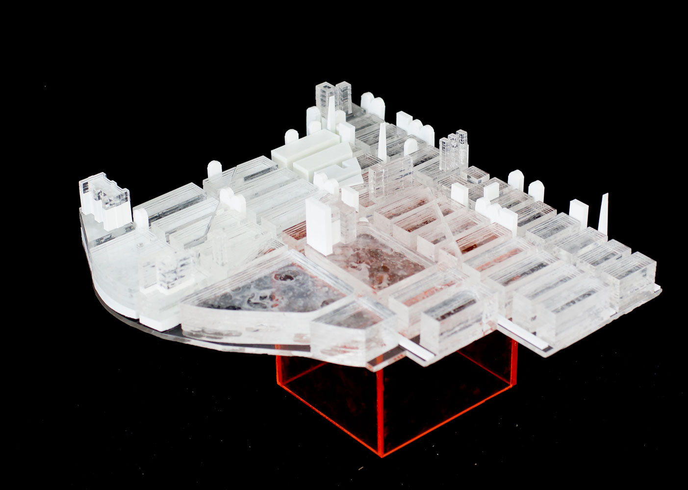
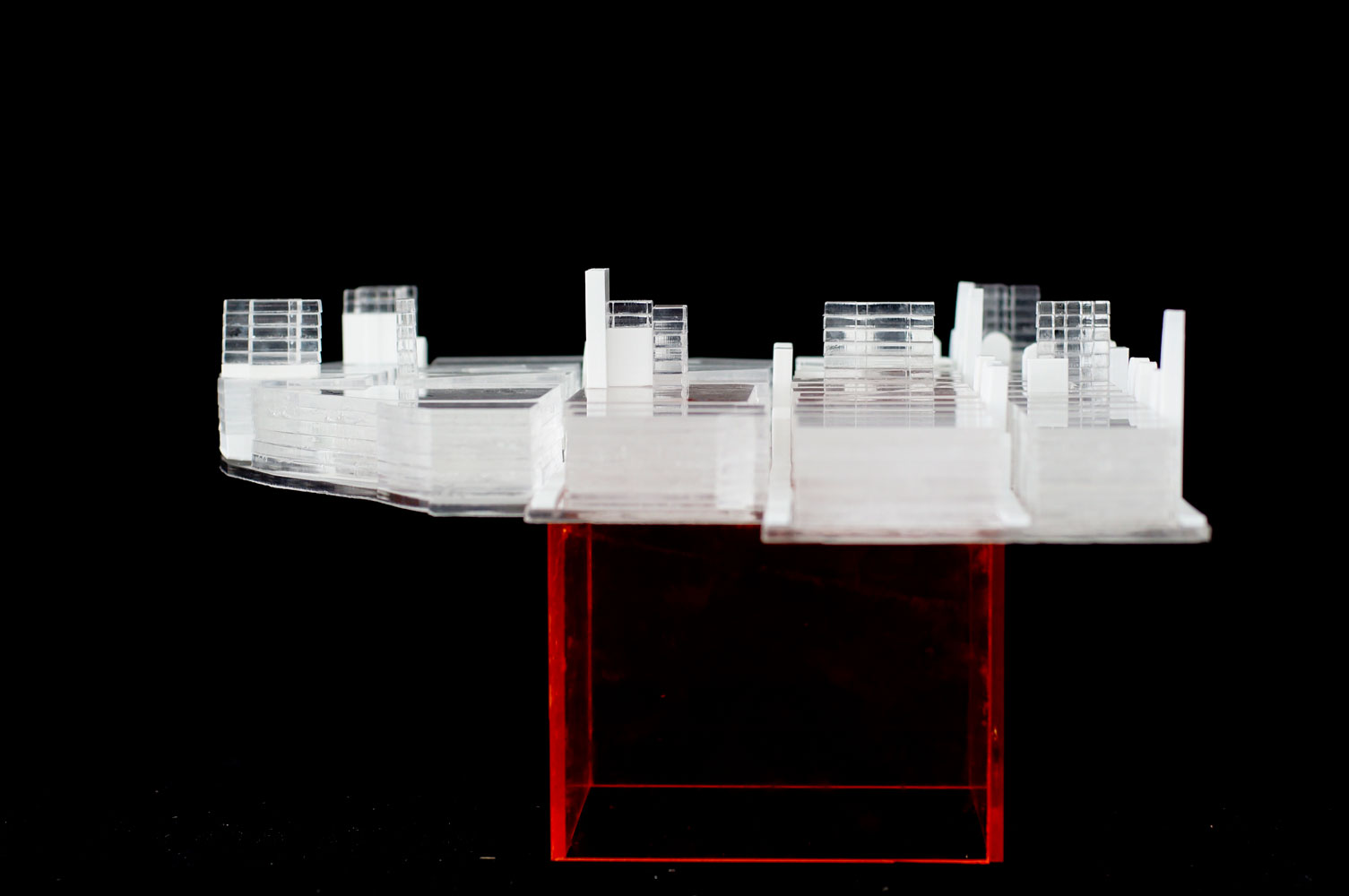
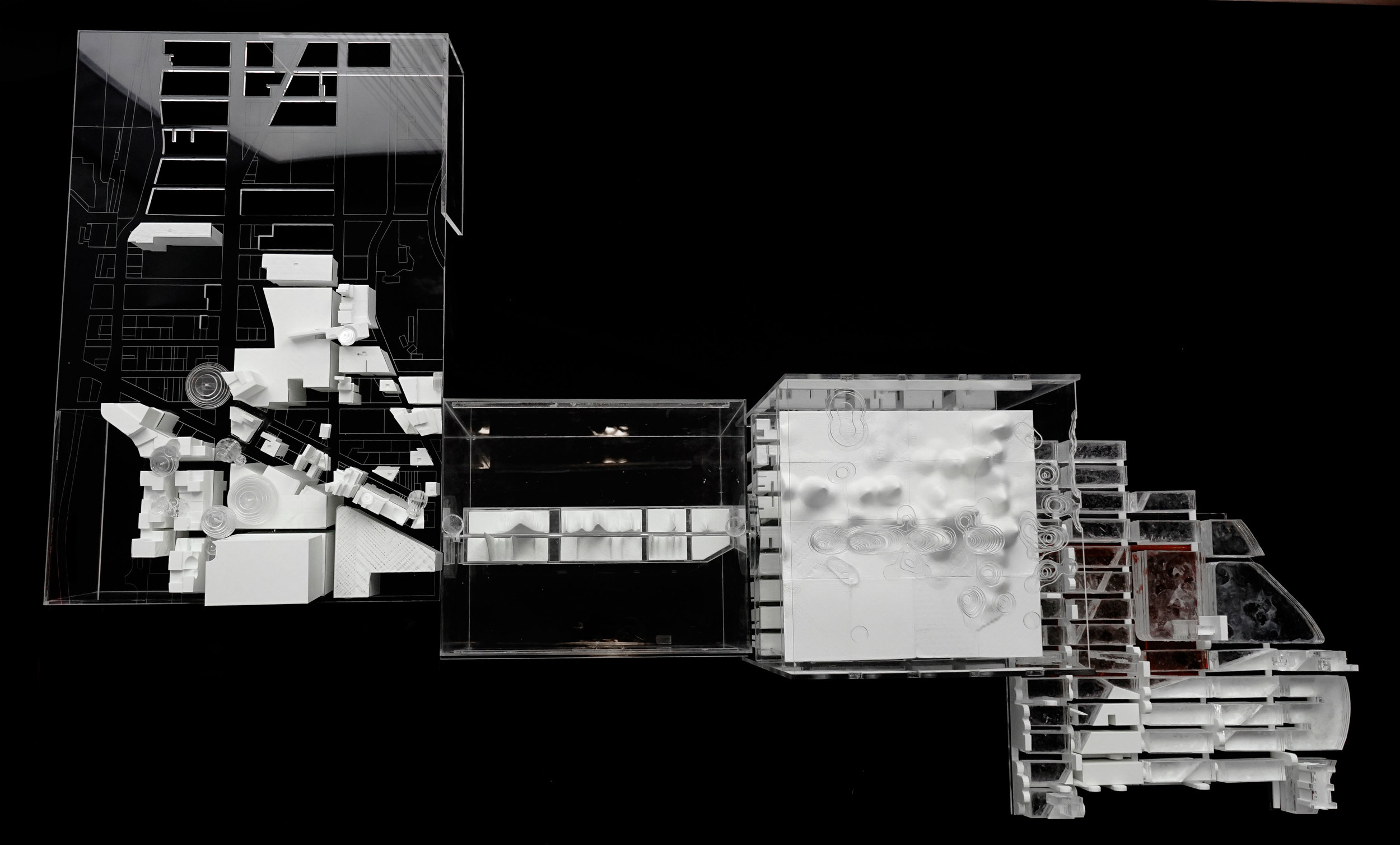
Students worked in groups, operating on four contiguous sites stretching across Manhattan’s 125th Street from the Hudson to the East River. Each group chose their topic and datasets, defined their methodology and design process, and determined the northern and southern boundaries of their study areas based on the spatial resolution of the available data. Design constraints included a requirement of at least two material choices (including the 3D printed plastic output) and a mandated geographic scale in the x- and y-dimensions.
From west to east, the projects include
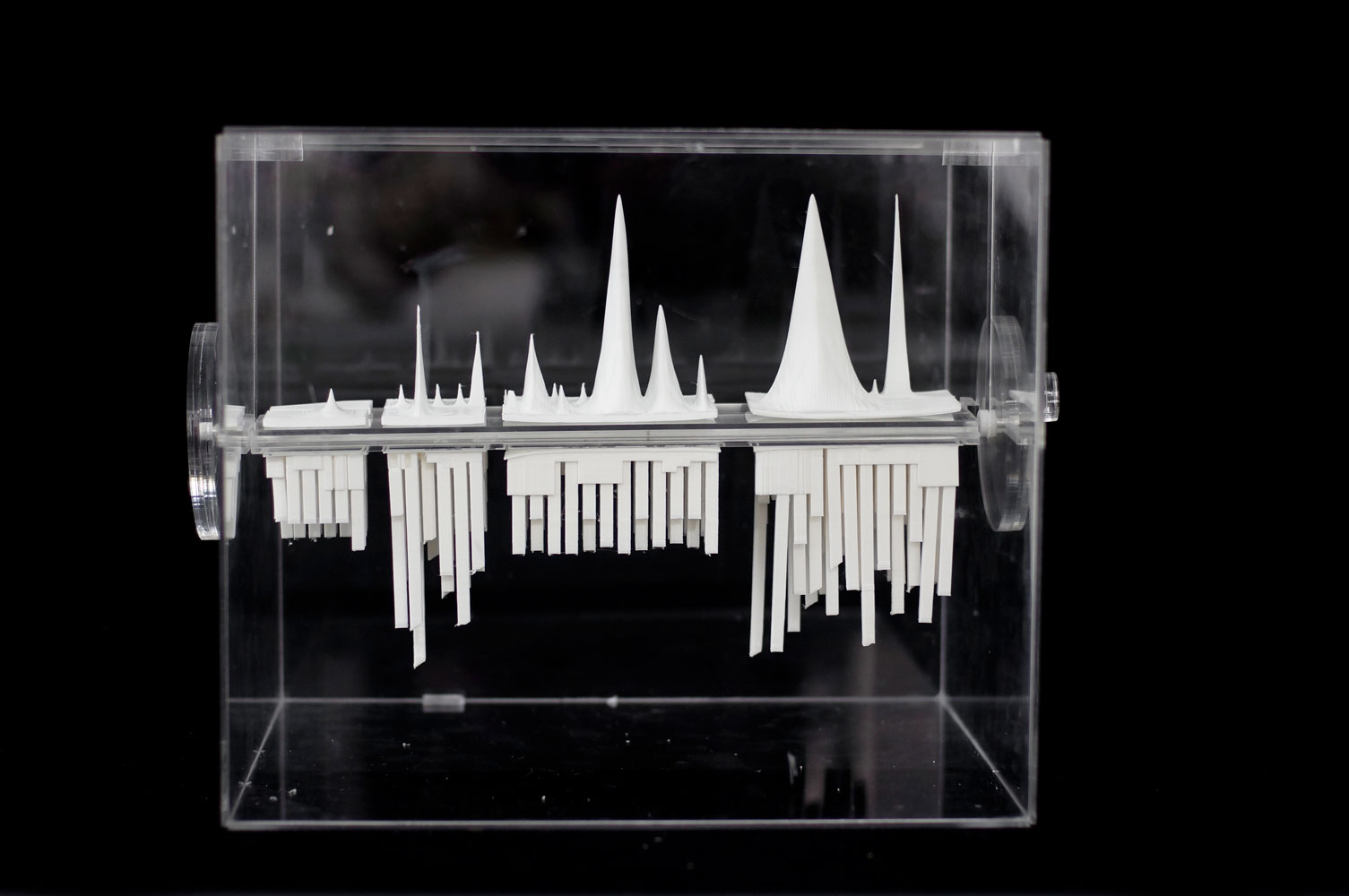
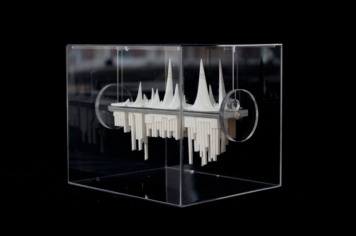
a volumetric visualization of homeownership opportunities and barriers,
a comparison of formal, brick-and-mortar retail activity with informal, street vending,
an juxtaposition of neighborhood change trends set against the existence of graffiti versus publicly lodged complaints of graffiti, and
an analysis of access to sexual health resources defined as the combination of educational opportunities and condom availablility.
In total, data sources included the New York City Department of City Planning and 311 Dataset, the US Census Bureau, ReferenceUSA's database of business listings, the Federal Financial Institutions Examination Council, observational field work, and structured surveys.
Acknowledgements & Credits
Richard Tyson provided insight through guest lecture and crit, while Liz Arum generously gave time, patience, skills workshops, and technical support. Brian Brush offered lessons from his experience in bringing GIS and data analysis into architectural design processes.
Students involved included Sandra Bonito (Project 3), Dare Brawley (1), Helen Chen (3), Anthony Langhorne (2), Kelly-Anna Louloudis (4), Fatema Maswood (2), and Alejandra Ramos (4).
Also: In February 2014, Dare Brawley presented work from the course at the GeoNYC Meetup's Student Showcase. Video is available; her presentation begins at about 32:00.