210 Cities in San Diego
at Lightroom Gallery, Carleton University Azrieli School of Architecture & Urbanism (2019)
Cartography Spotlight recipient, Human Geography’s 2020 Art Contest (v.13, i.1 journal link).

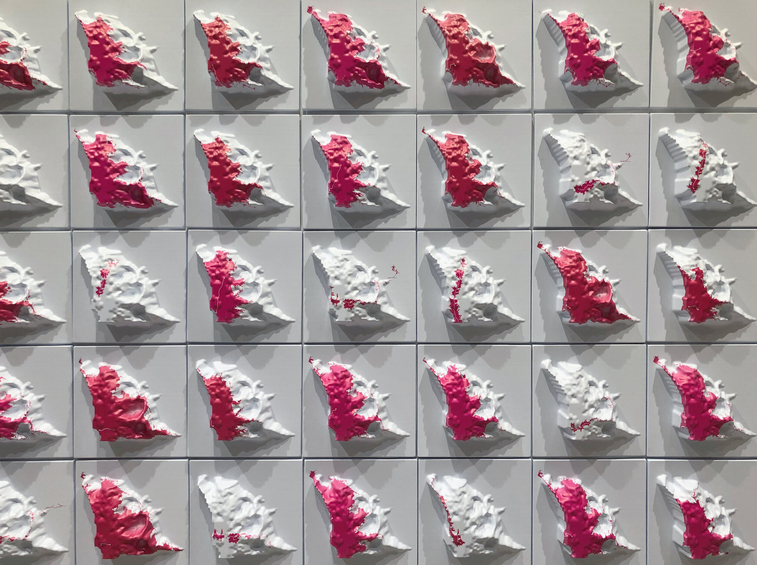
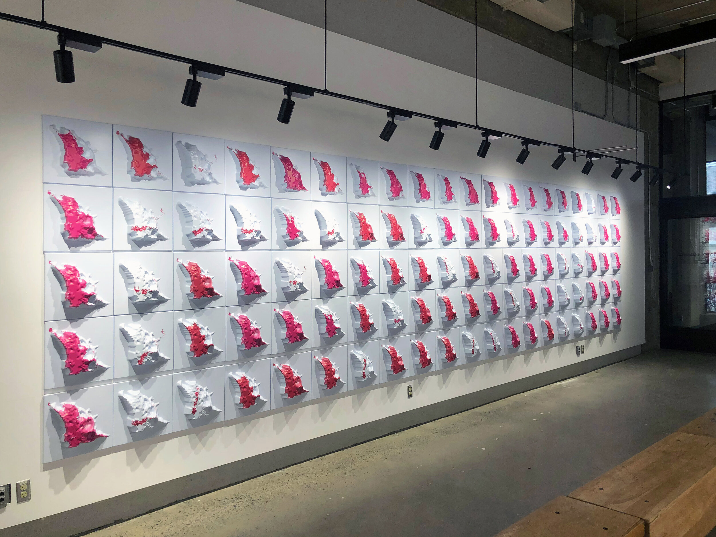
Cities are where strangers live together—collectively enacting urbanism through overlapping spatial practices and priorities, individually constrained by geographies of structure and circumstance. 210 Cities in San Diego is a cartographic exploration of distance, difference, and discrepancy. Culled from an investigation of employment statistics, including over 430,000 unique commuters, the work illustrates the variety of boundaries that delineate individual opportunity, set against the uneven landscape of combined experience. Each panel describes the singular and the whole, drawing out the many edges within any city and redefining access as a function of relationships between multiple locations and vectors. Together, they map San Diego as a pluralistic space of daily life, characterized by simultaneity rather than similarity.
With the Time Left in the Day.
Assuming eight hours at work and 12 hours at home, how far can one reach to spend an hour there? Whether running errands or enjoying a night out, the city to which we have ready access without sacrificing our day is the city in which we live.
While significant, the time spent commuting is not our only constraint. The arrangement of land uses, the geography of jobs, and the relative connectivity of our road and transit networks also contribute to differentiation.
The Aggregate City: Cumulative Opportunity.
Of course, not all areas we can access are equally convenient. Some are closer, some more connected. Some allow for trip-chaining and multiple destinations. Others, at the far edges of our personal boundaries, require an undistracted, there-and-back journey on the way home from work.
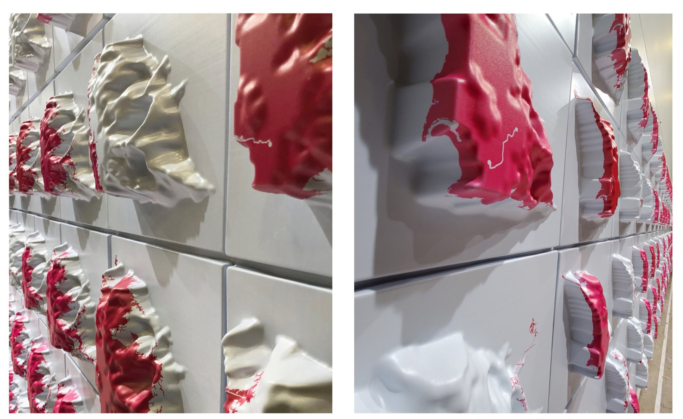
The panel surface represents the cumulative opportunity for commuters living in the city of San Diego, working anywhere within the county. Its highest point (downtown) is the most accessible location for the greatest number of commuters. Relative access drops off from there, generating highway ridges upon which most rely as well as valleys only some can claim as part of their everyday city.
210 ultraviolet-inkjet printed, vacuum-formed polystyrene panels. 15 x 15 x 4.5 inches each.
Project Assistants: Alanna Browdy, Jacey Chon, Rebecca Cook, Eri Furusawa, Jean Kim, Fatima Koli, Gloria Serra Coch
Production Support: Columbia GSAPP Maker Studio