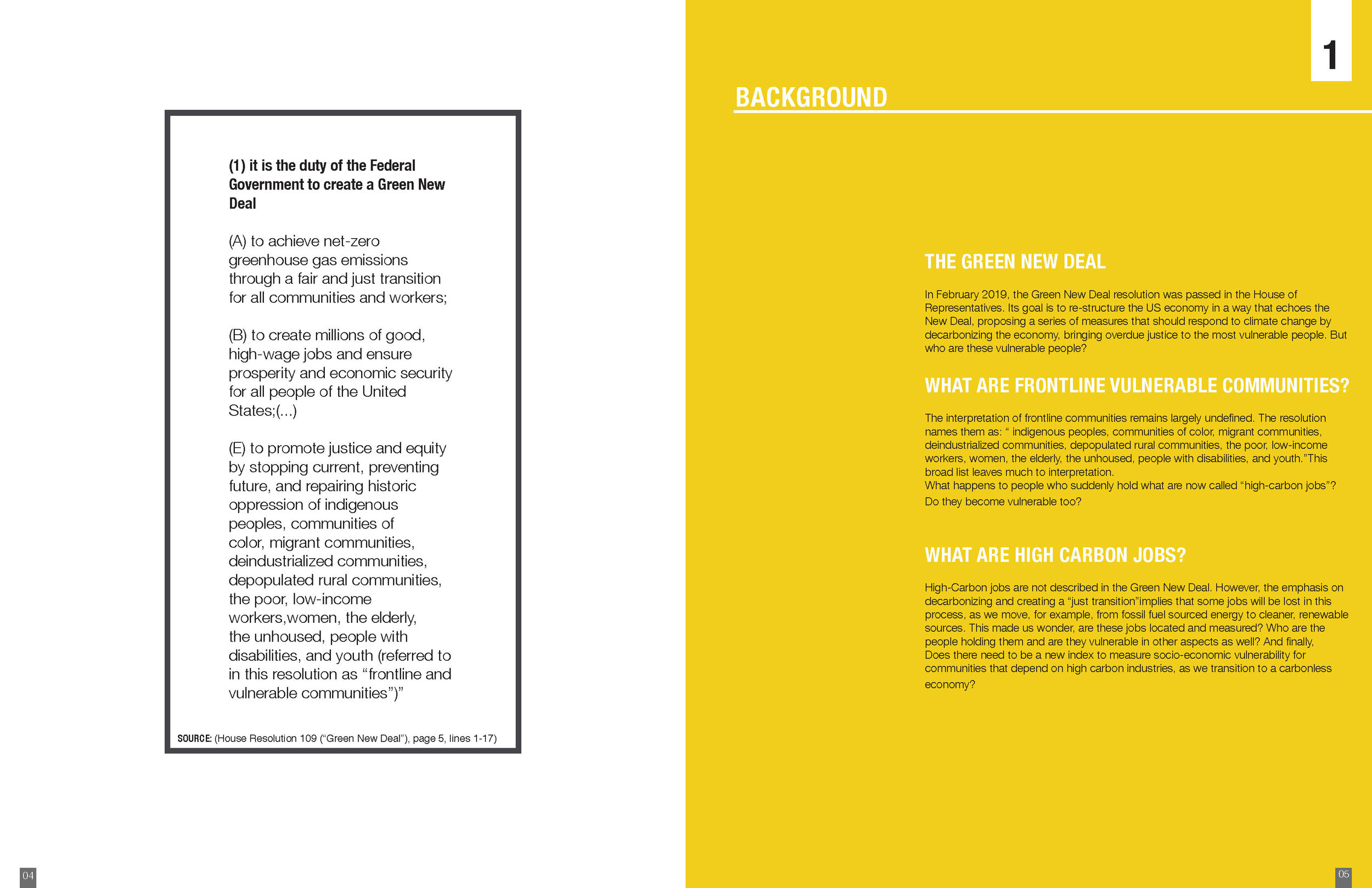
Critical Geographic Information Systems & Science:
Studying Spaces, Cities, and Stories
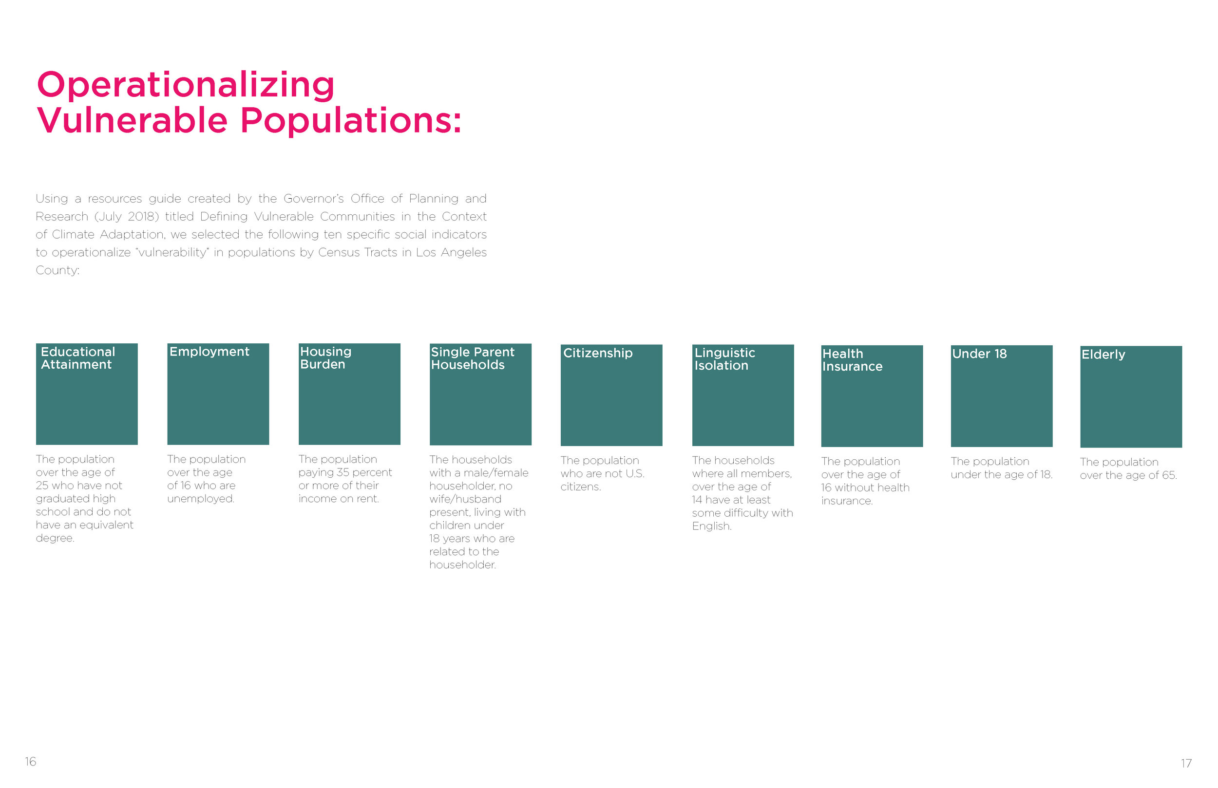
Geographic Information Systems, taught in the Urban Planning program of Columbia's Graduate School of Architecture, Planning and Preservation (GSAPP), is a critical GIS course on human and physical geography, information systems, and data-driven spatial research methodologies, within the context of questions relevant to working in urban environments. The course is required for MSUP students and a Visual Studies elective for architecture students.
Featured here are excerpts from example student projects from the Fall 2019 and Fall 2020 courses. Lab instructors: Clara Chung, Carsten Rodin, Kazuki Sakamoto, and Anna Stokes.
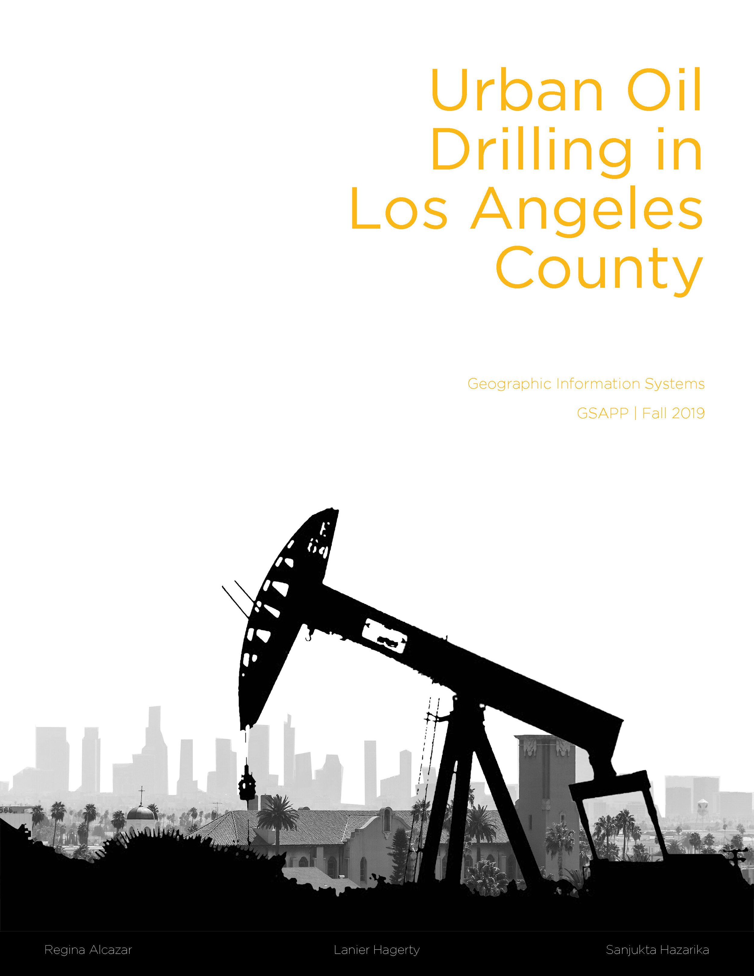
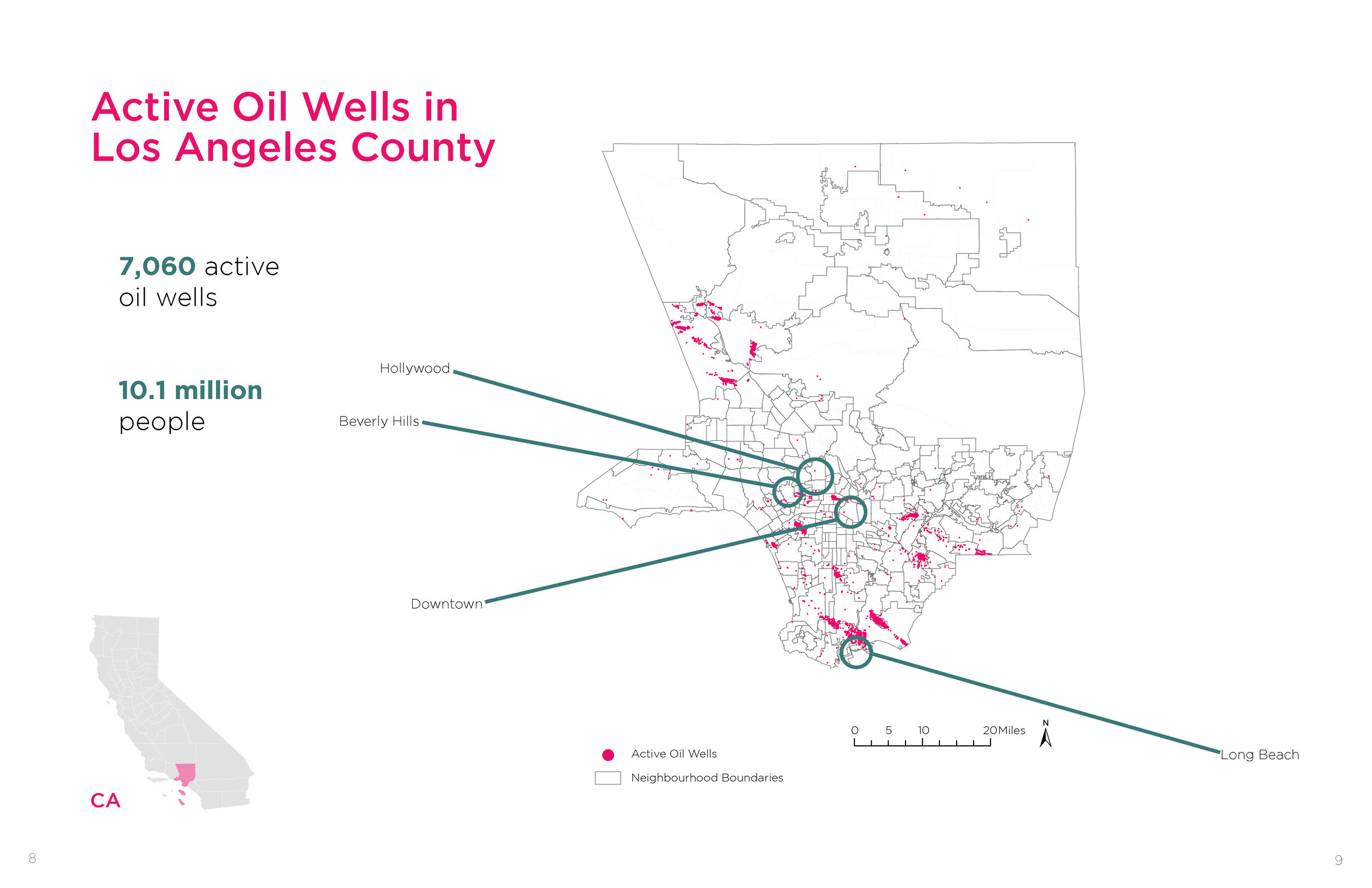
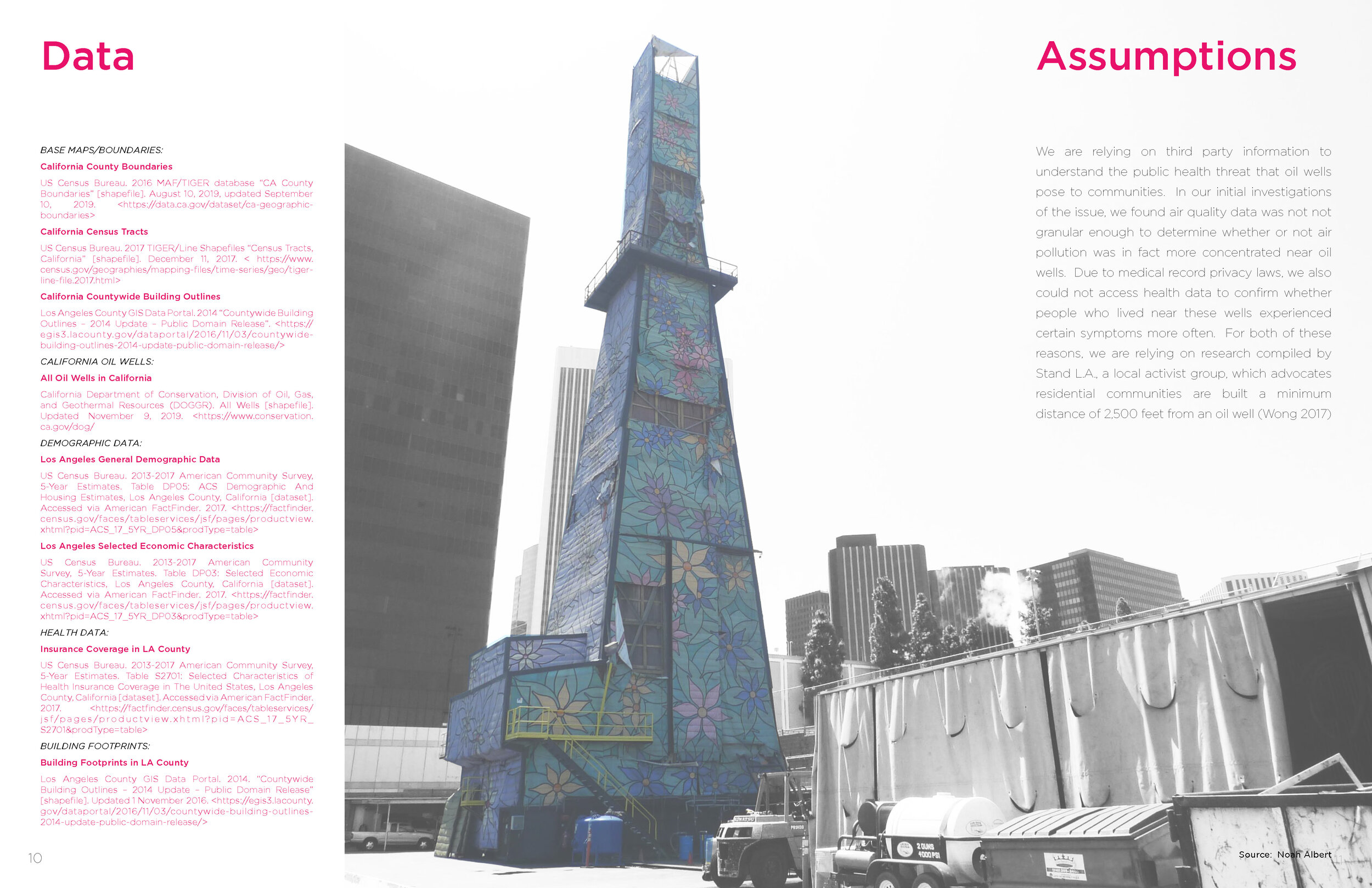
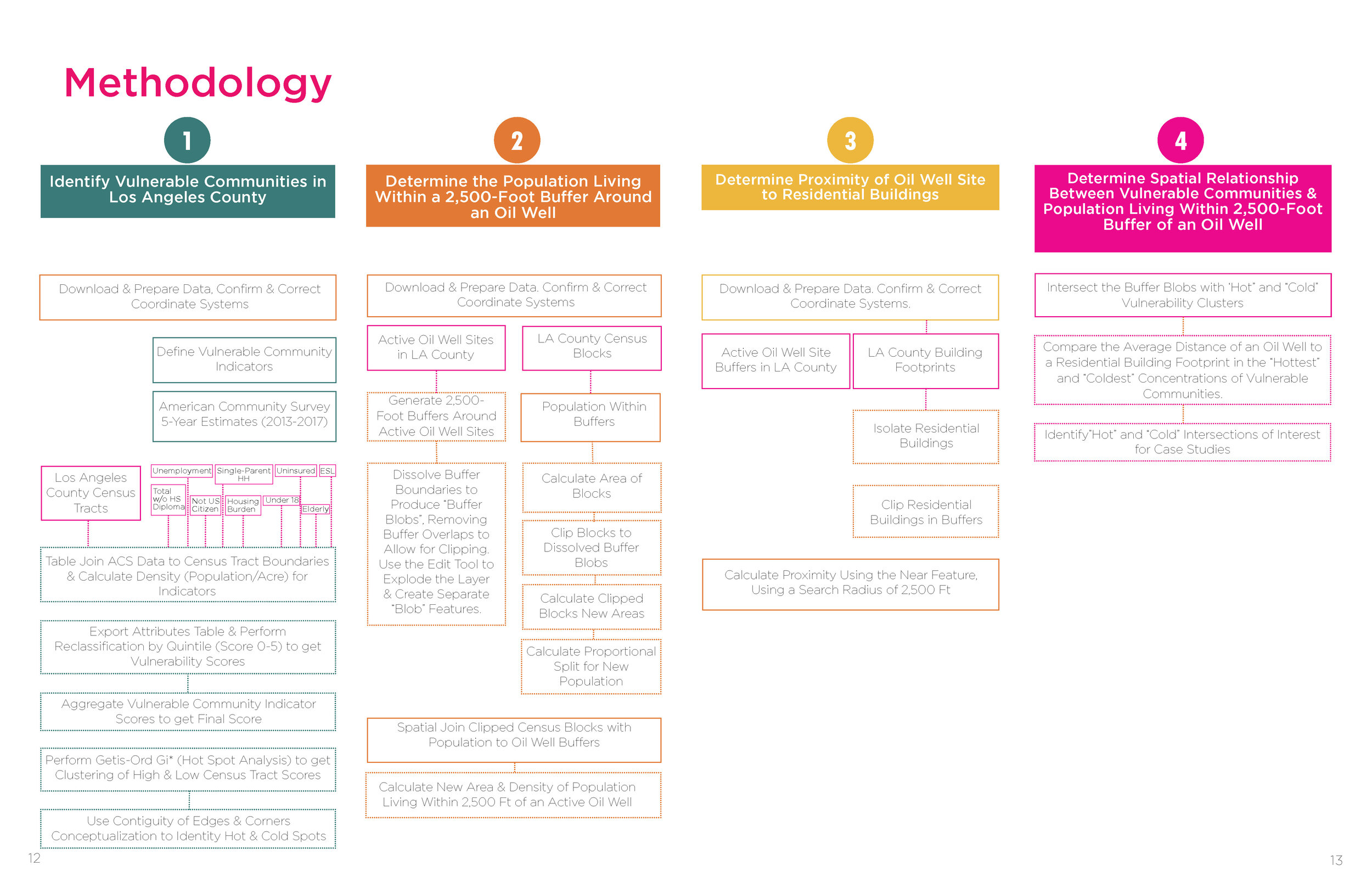
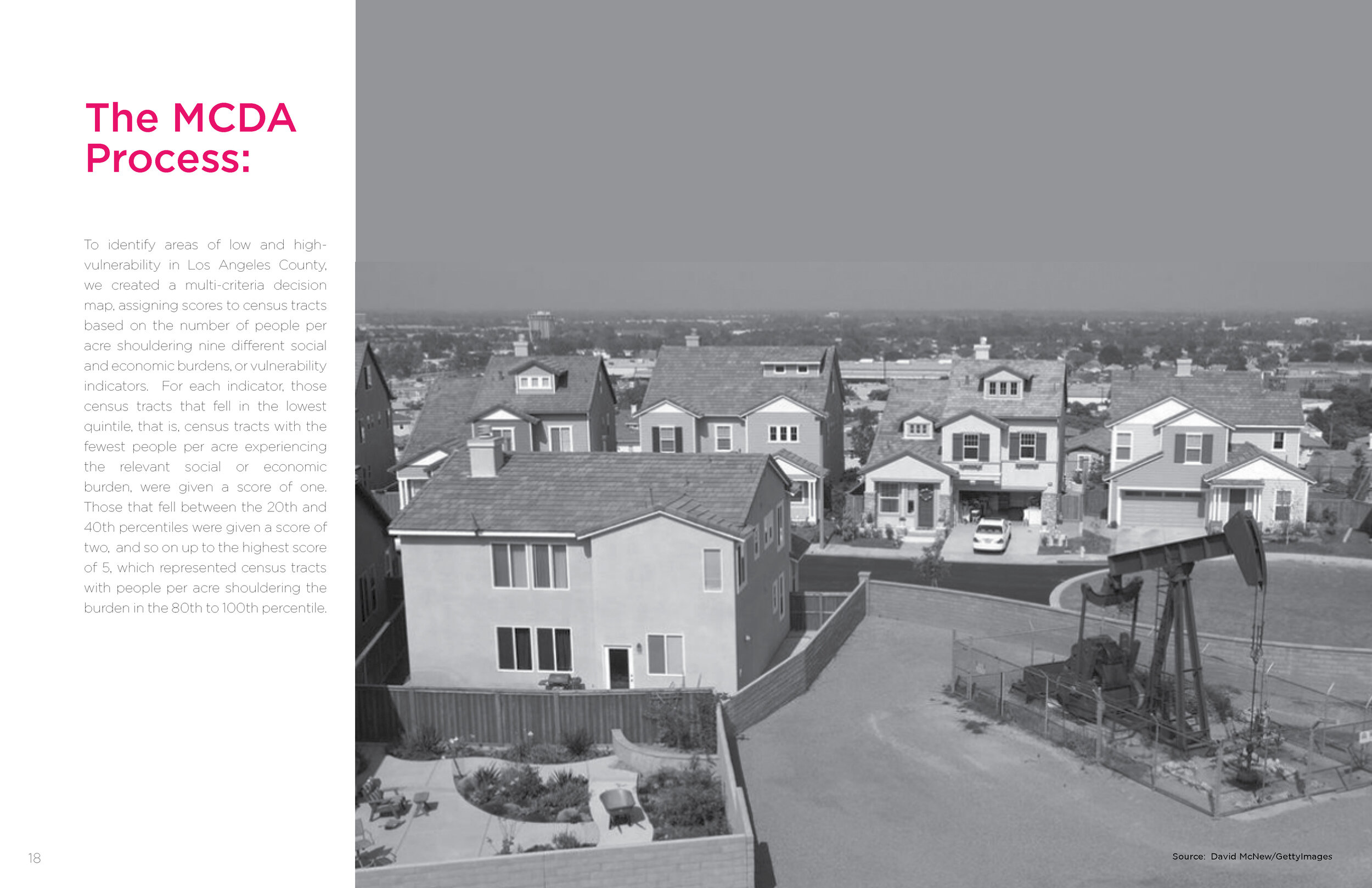
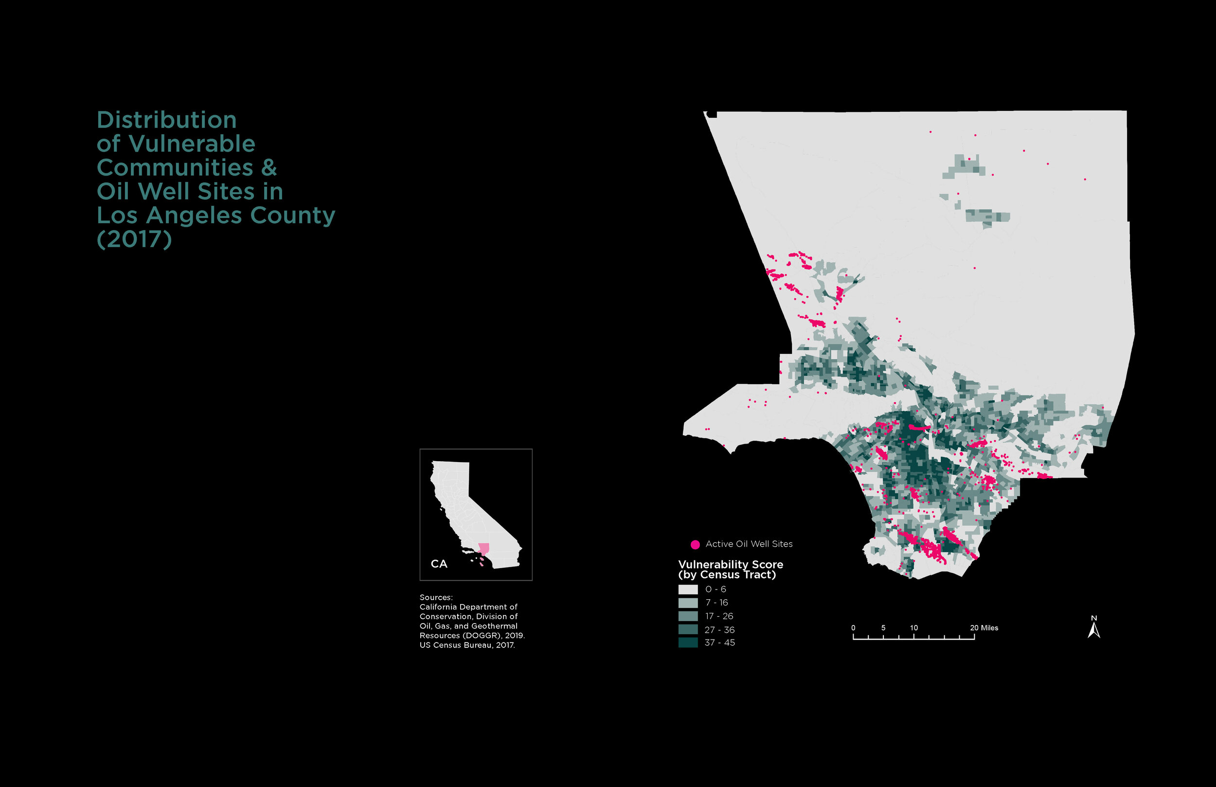
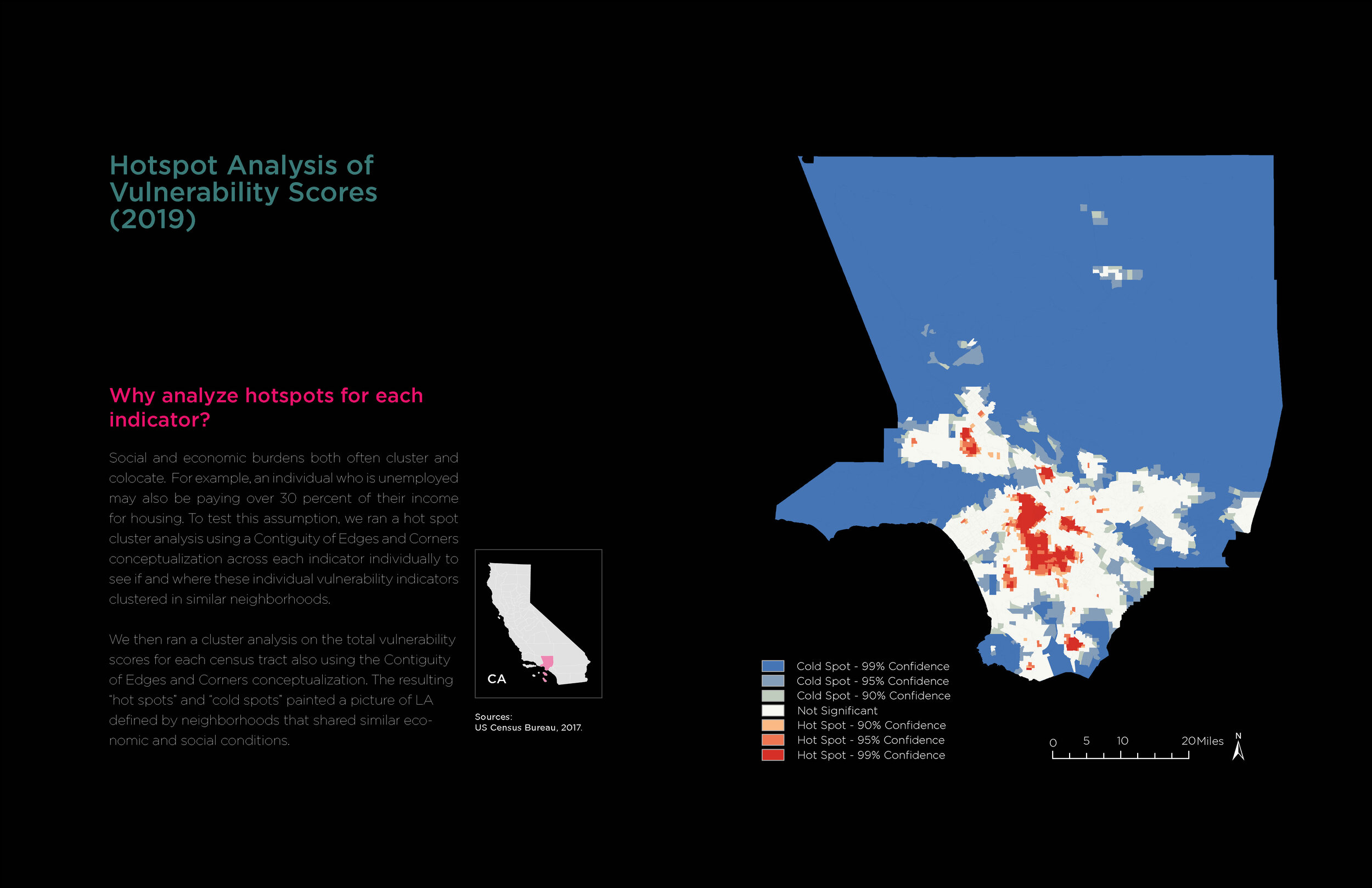
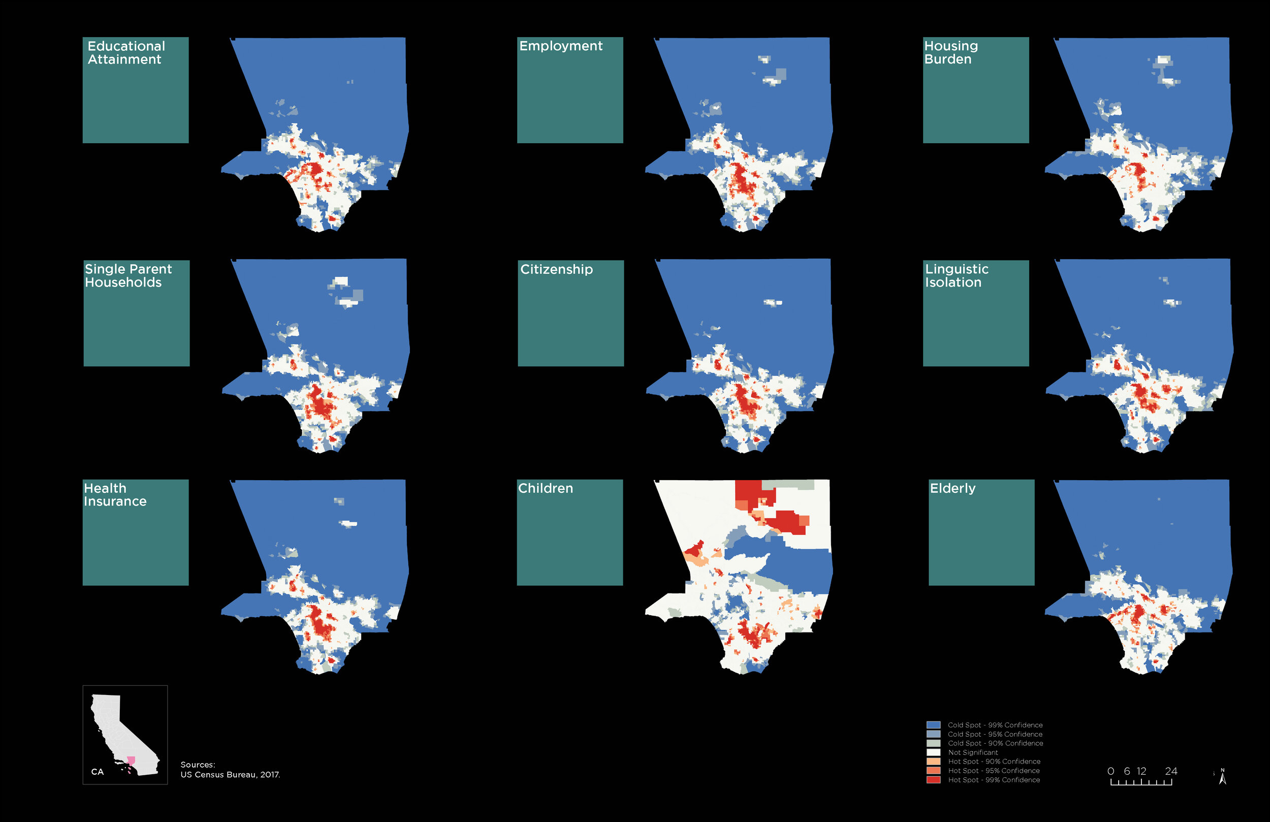
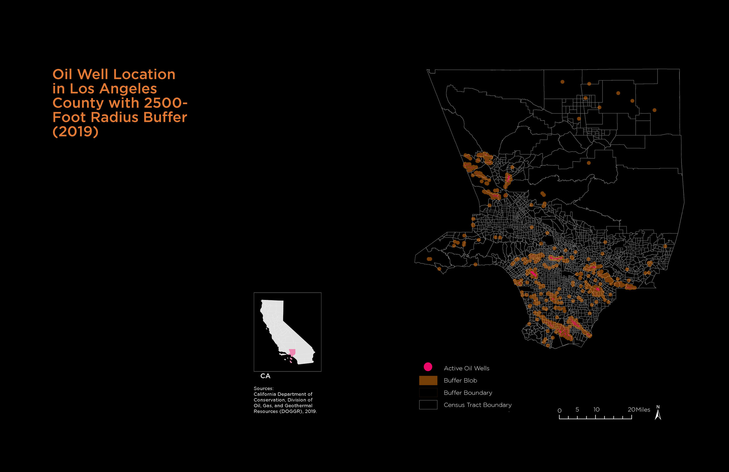
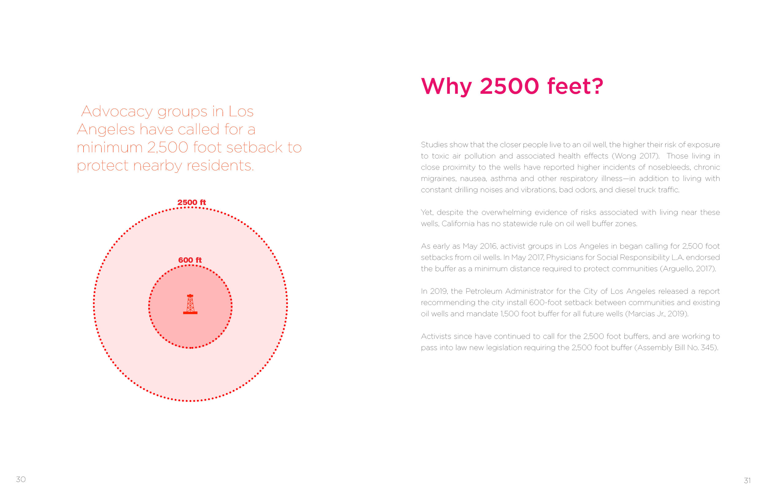
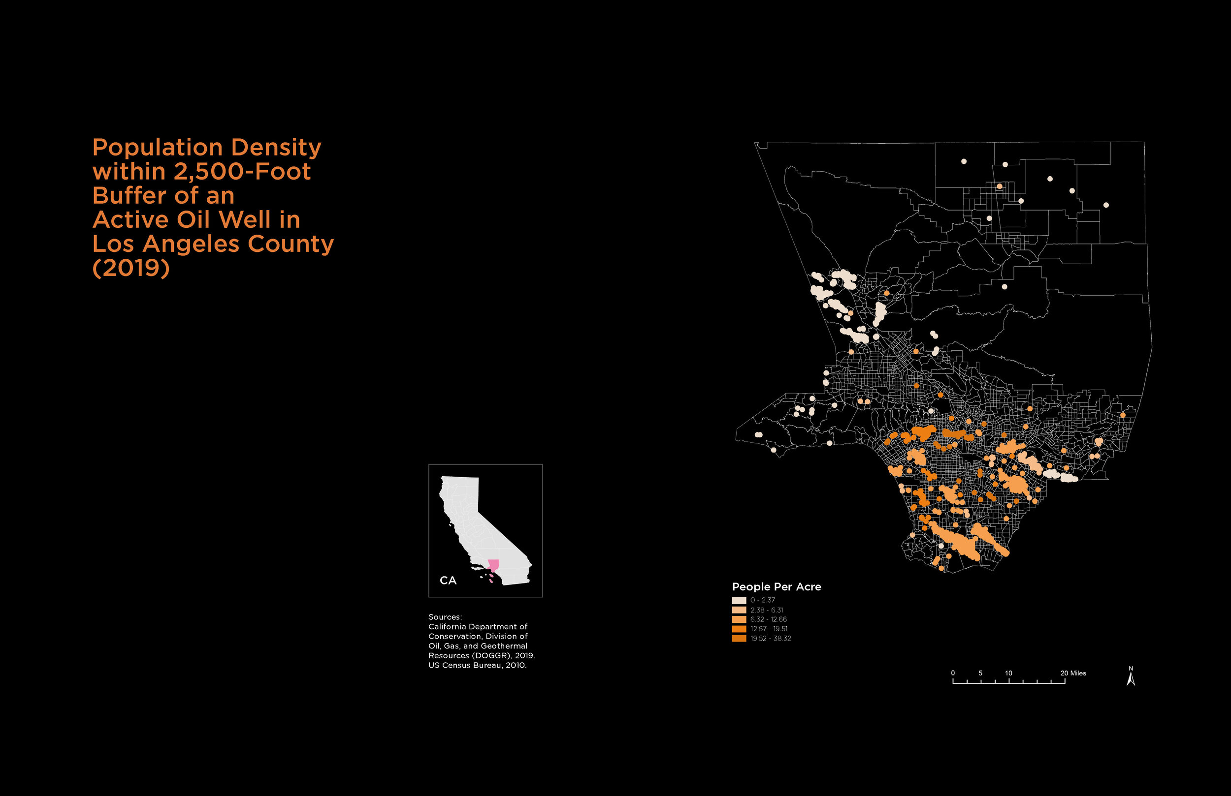
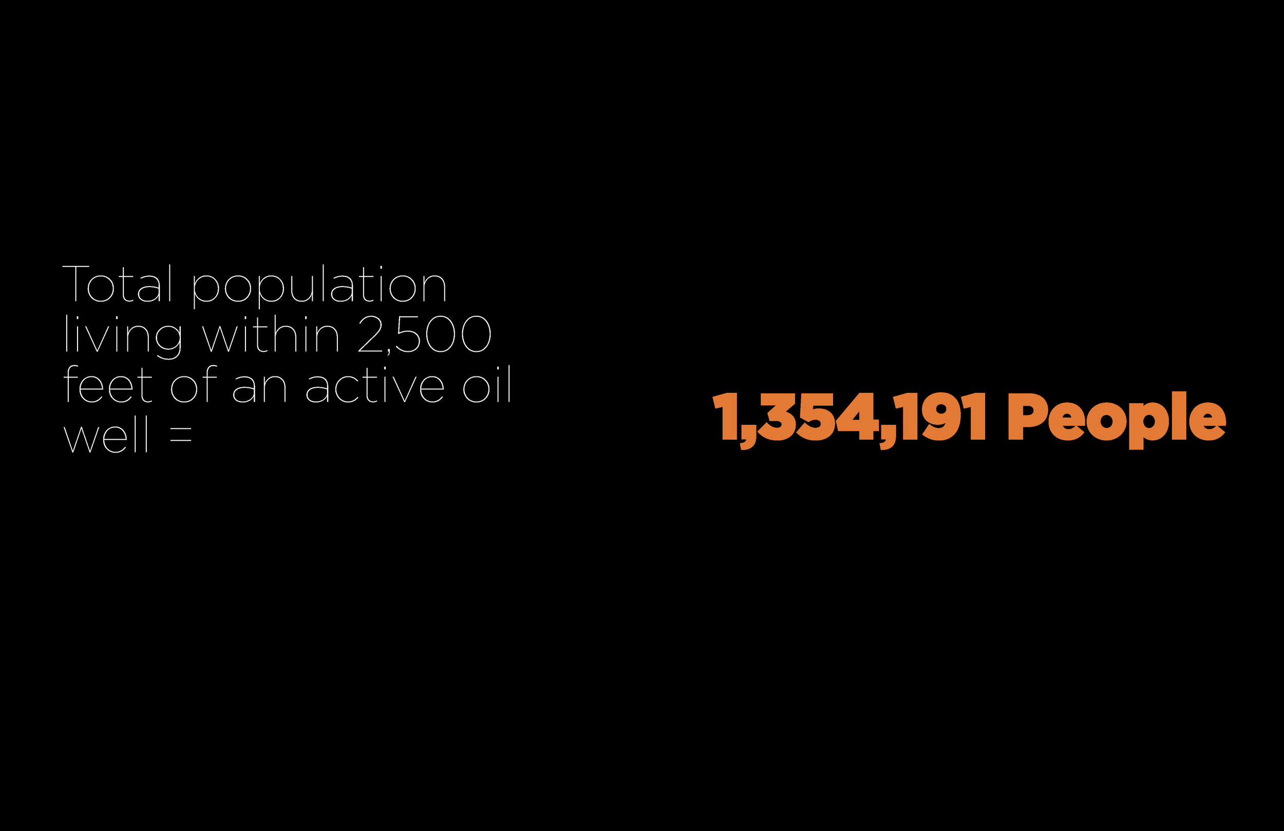
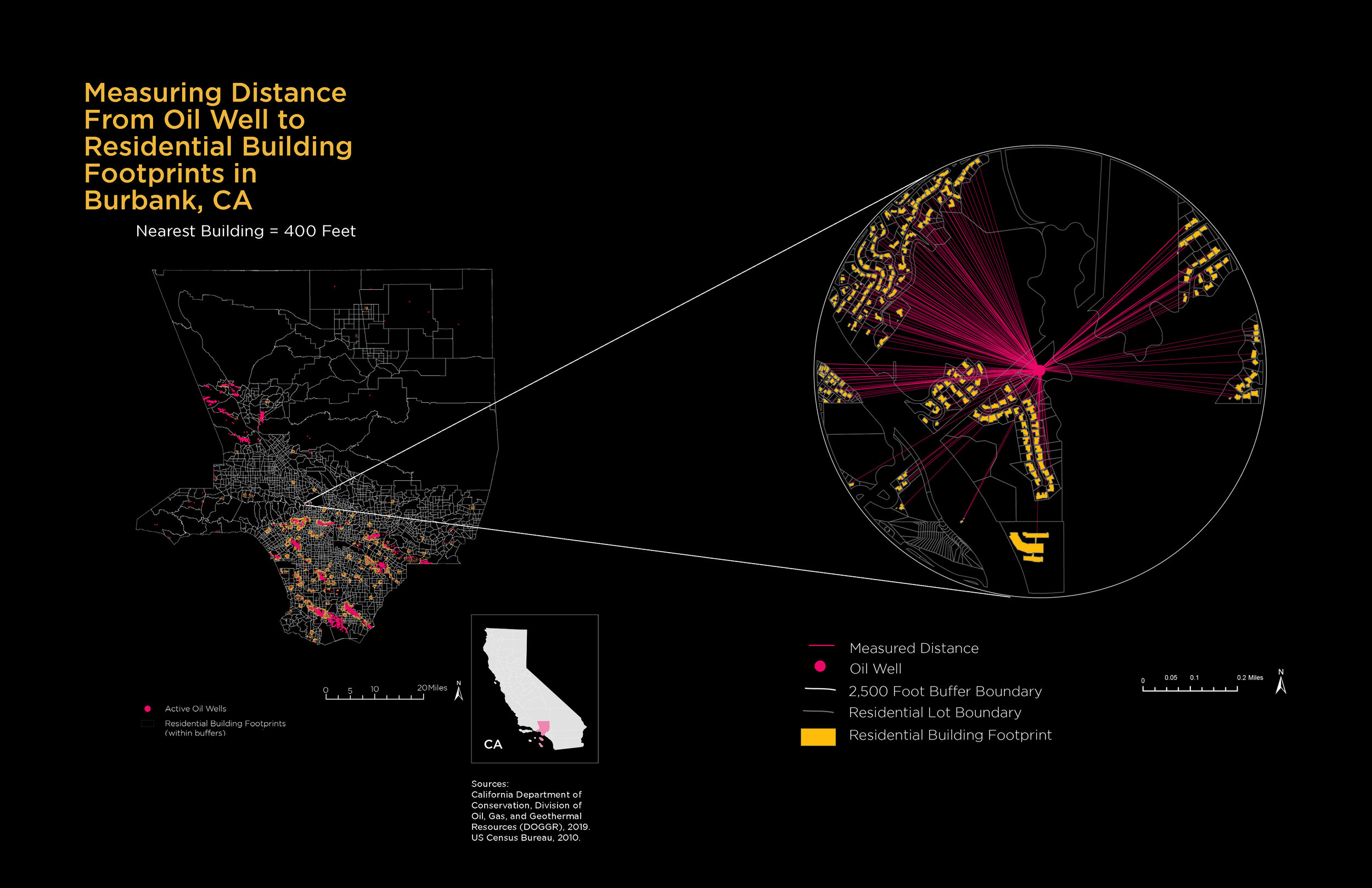
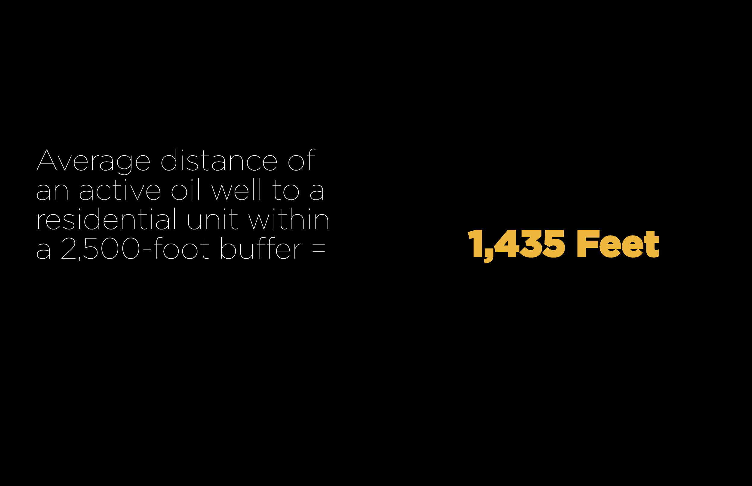
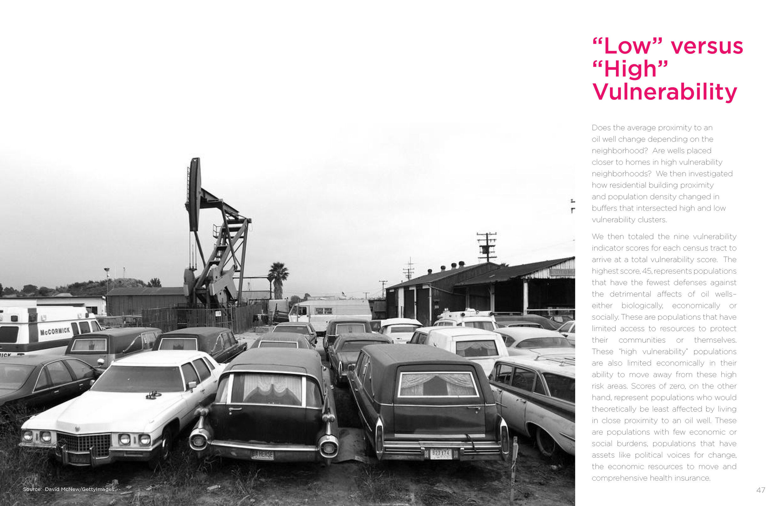
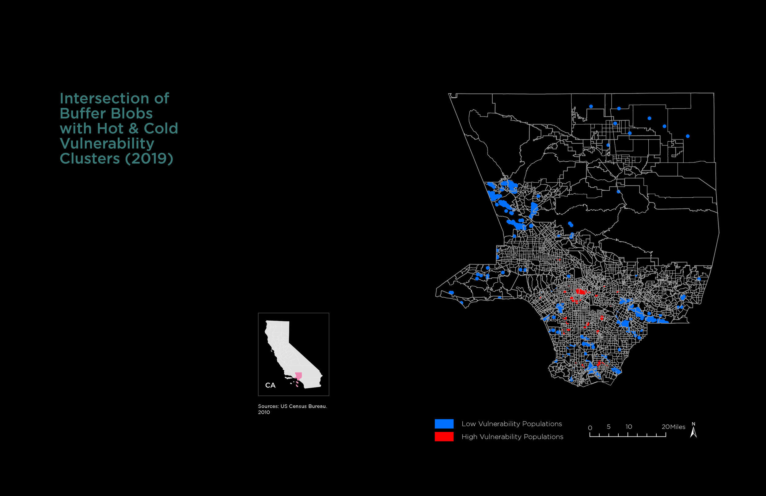
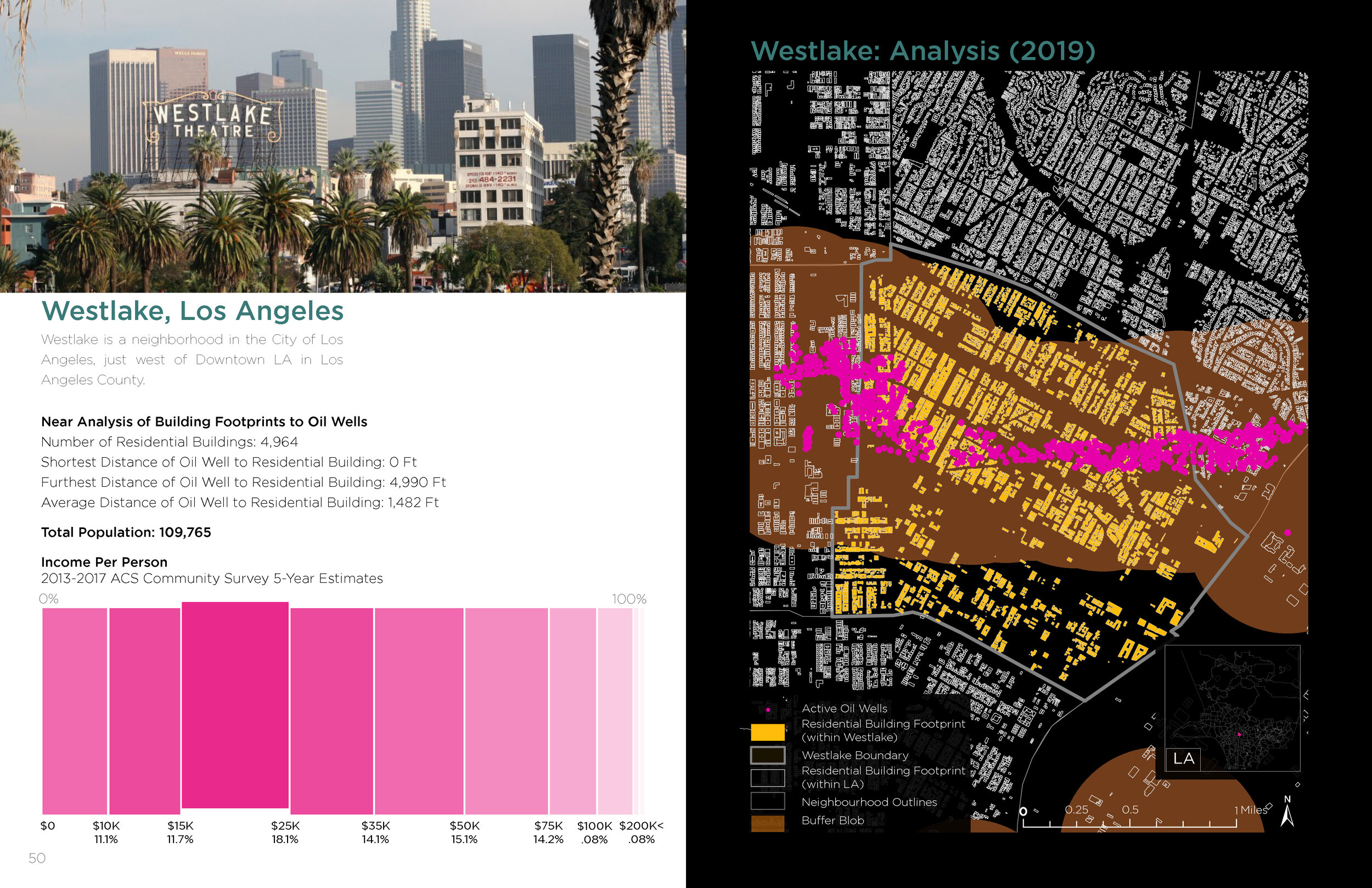
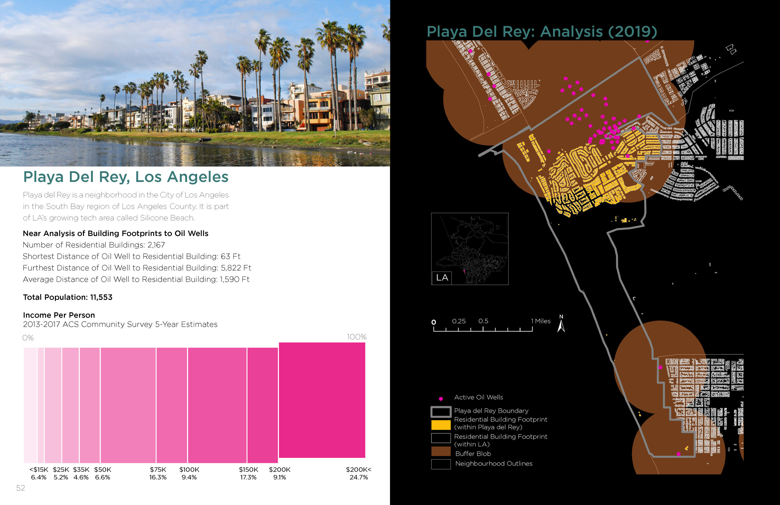
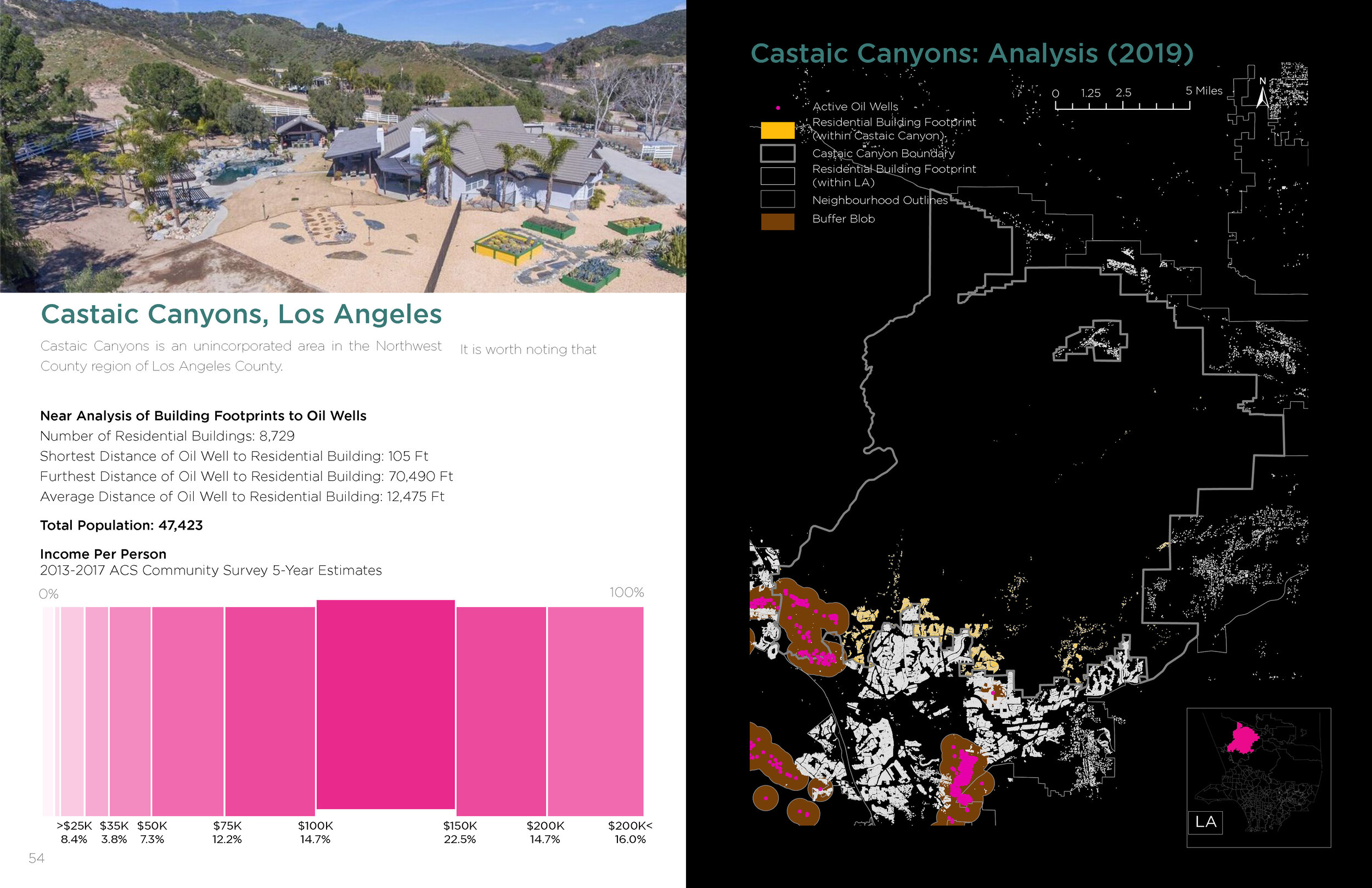
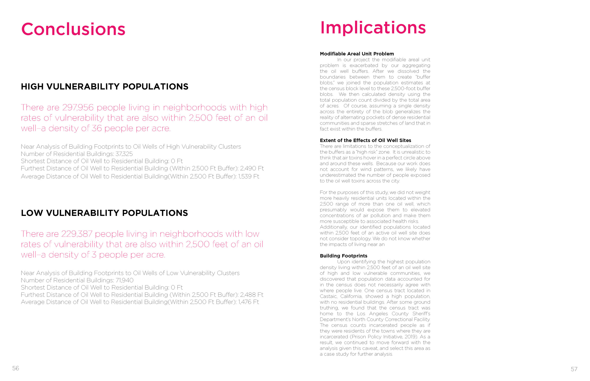
Regina Alcazar, Lanier Hagerty, Sanjukta Hazarika. “Urban Oil Drilling in Los Angeles County.” (Fall 2019)
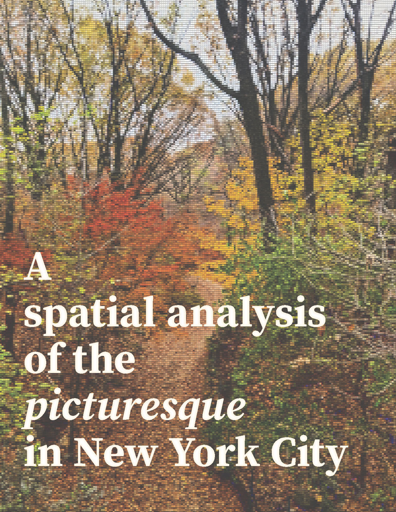
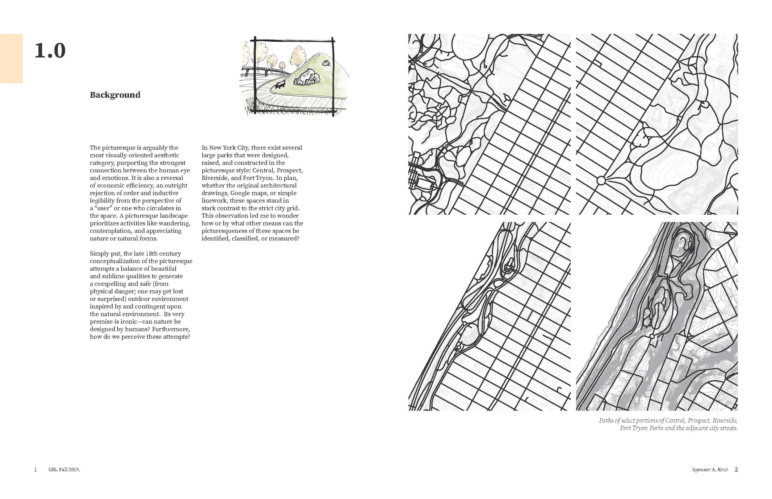
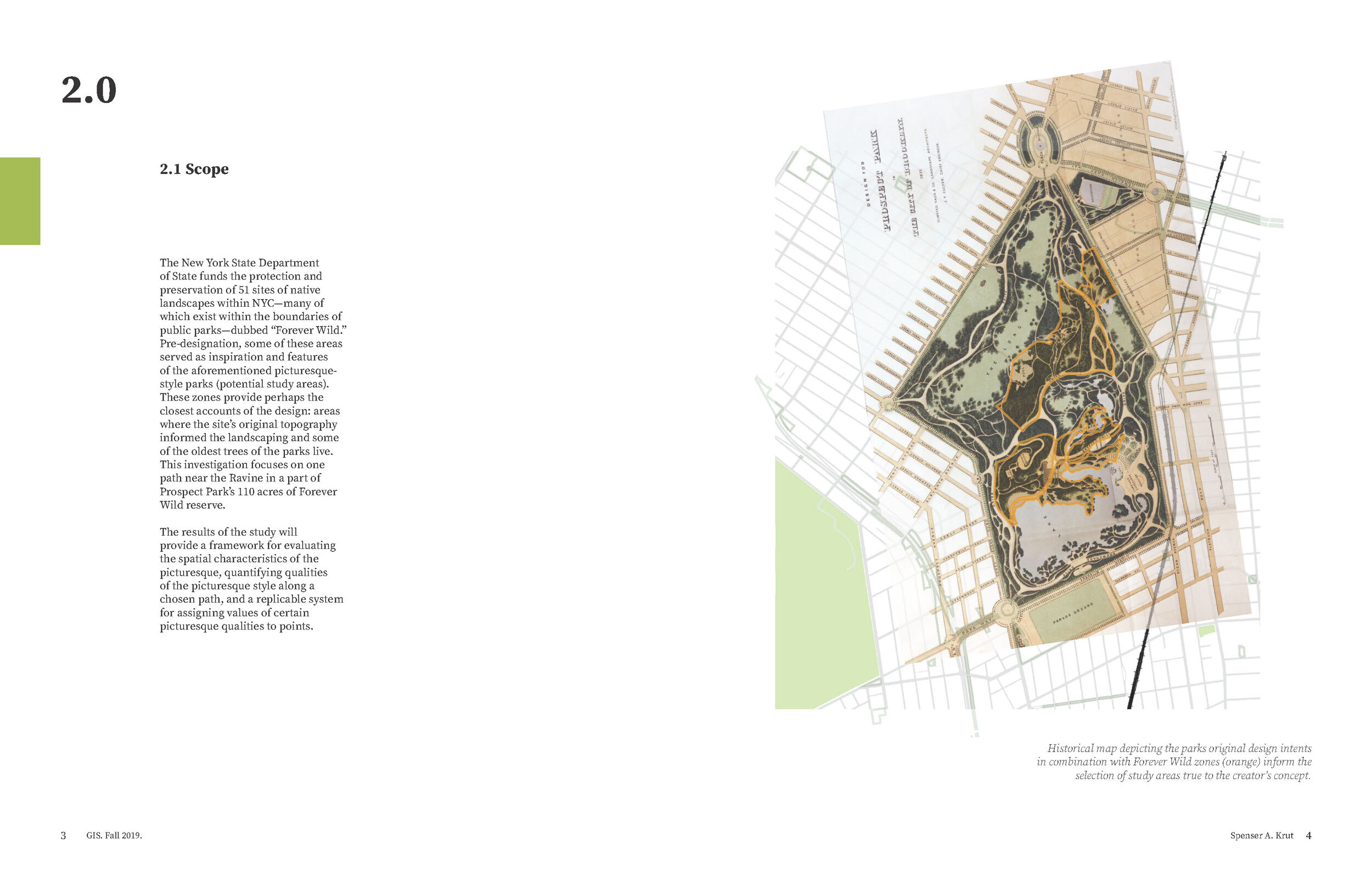
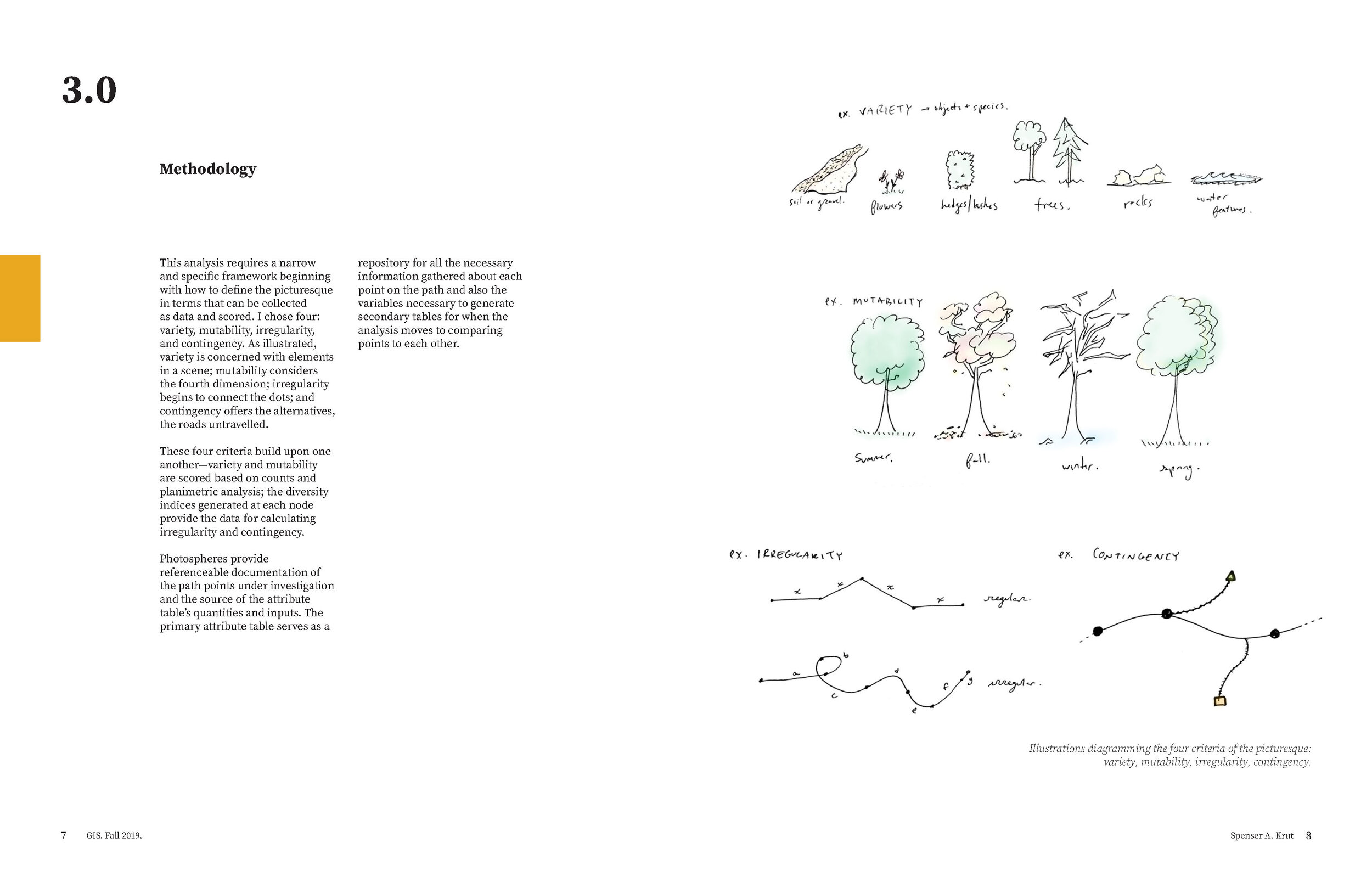
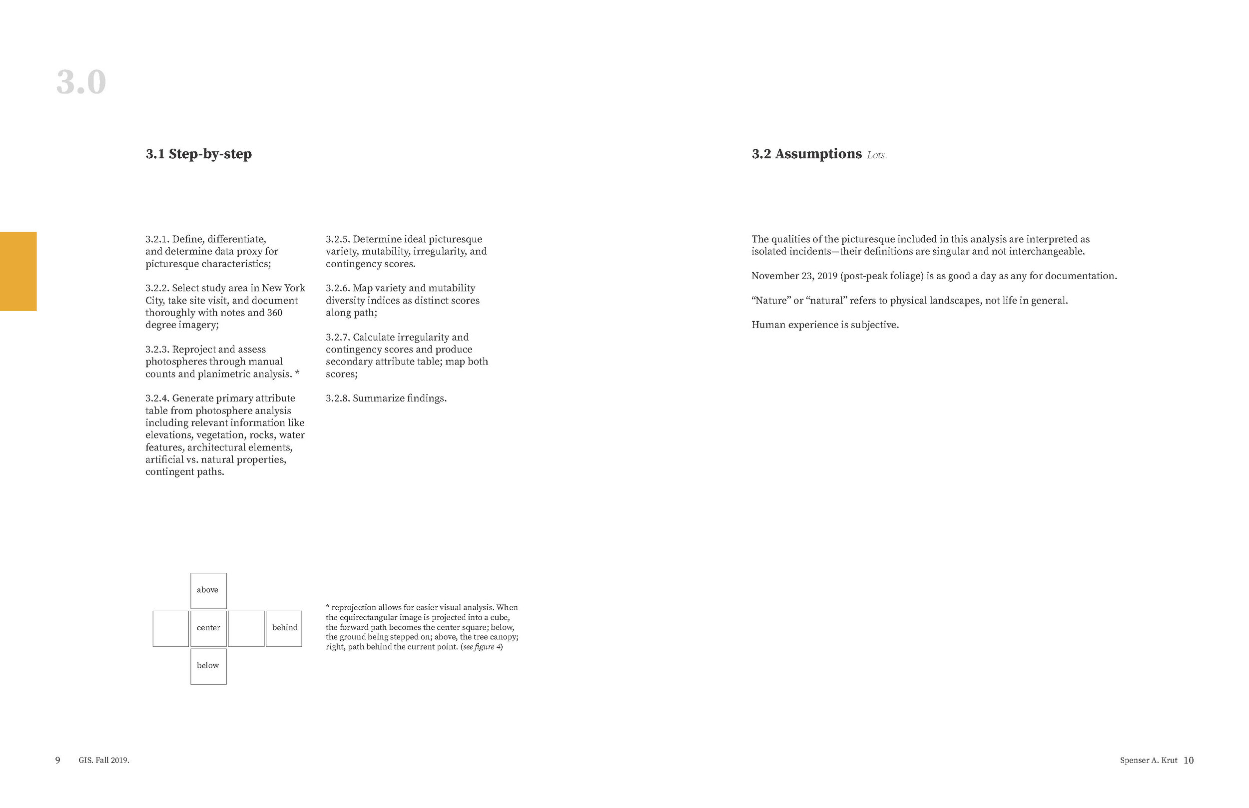
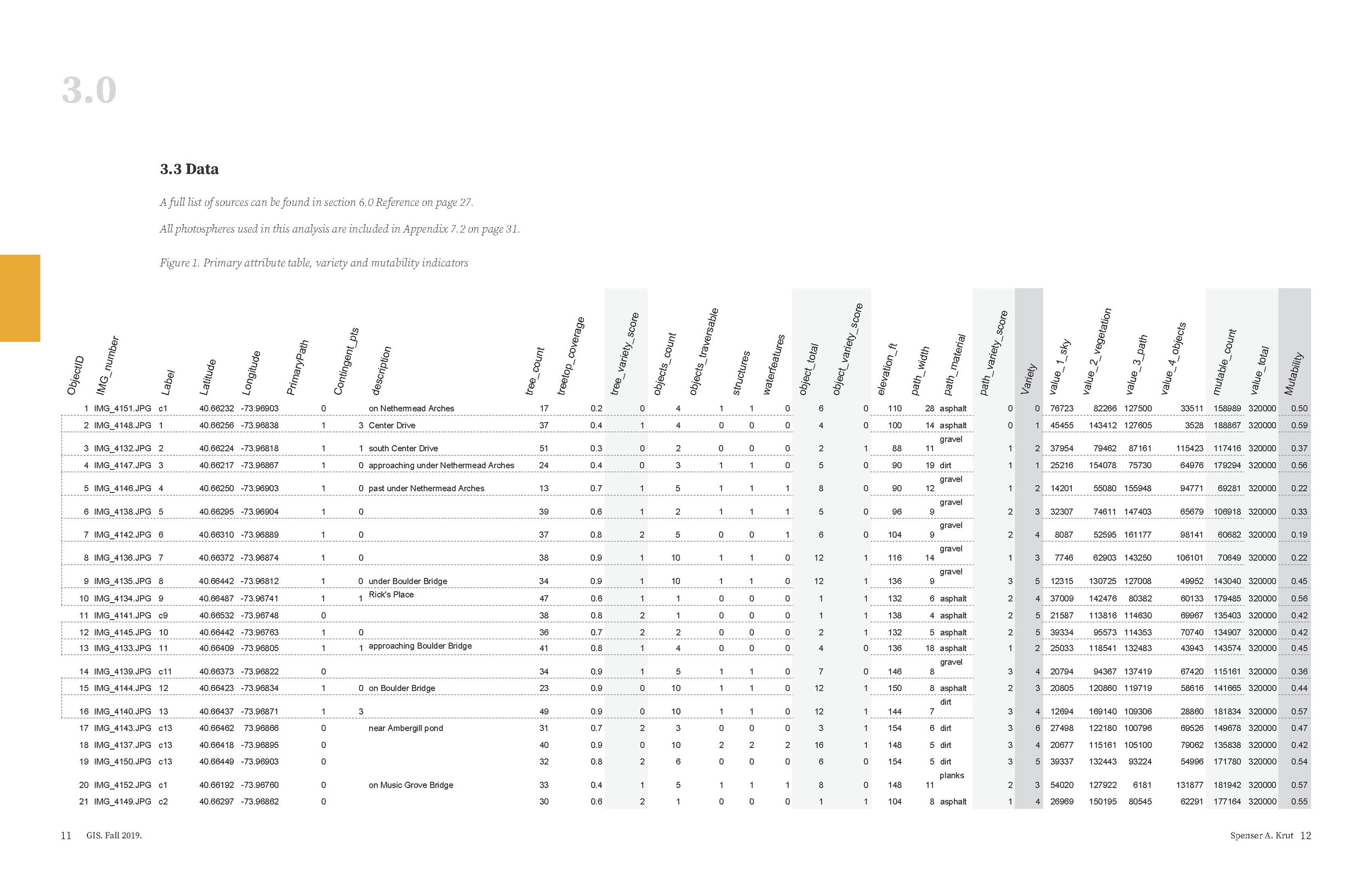
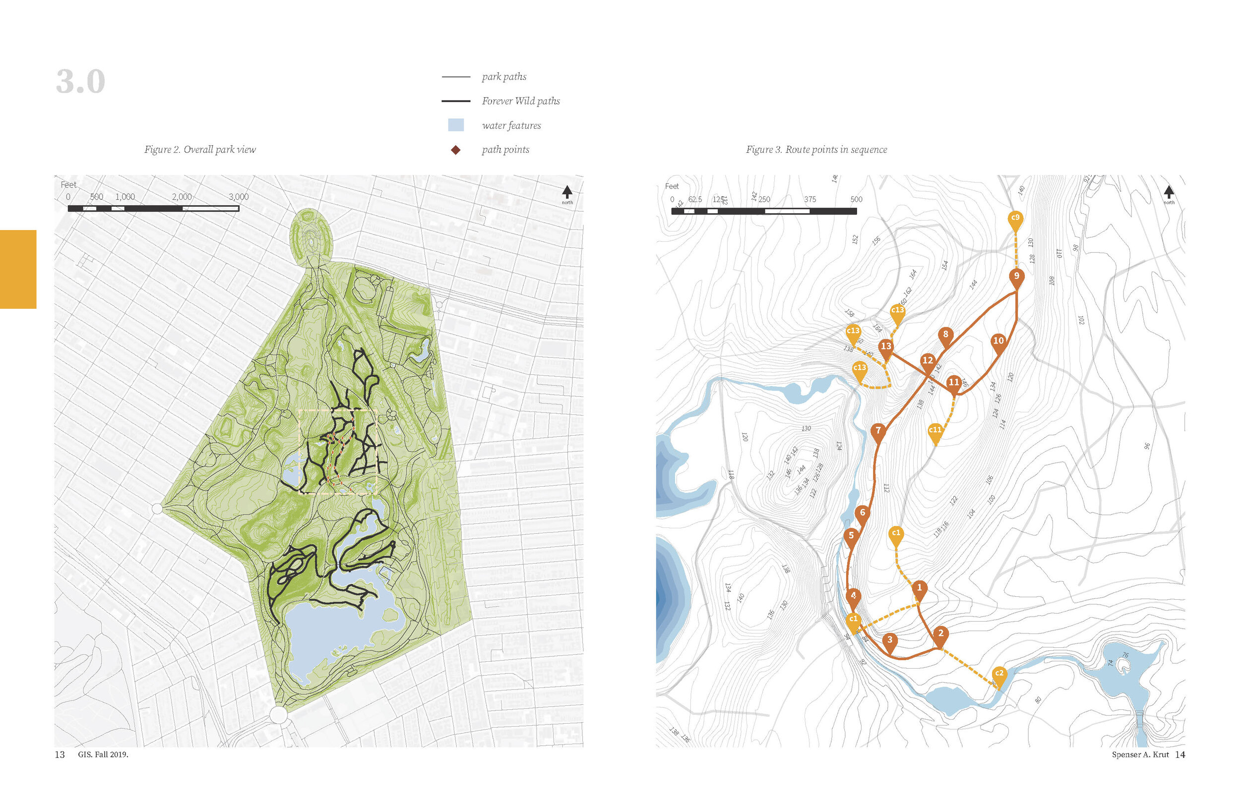
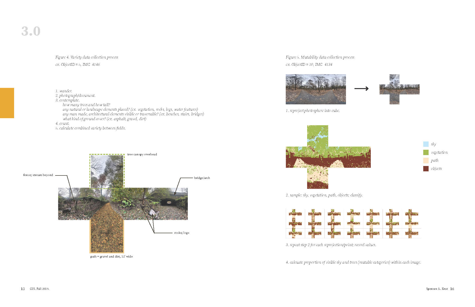
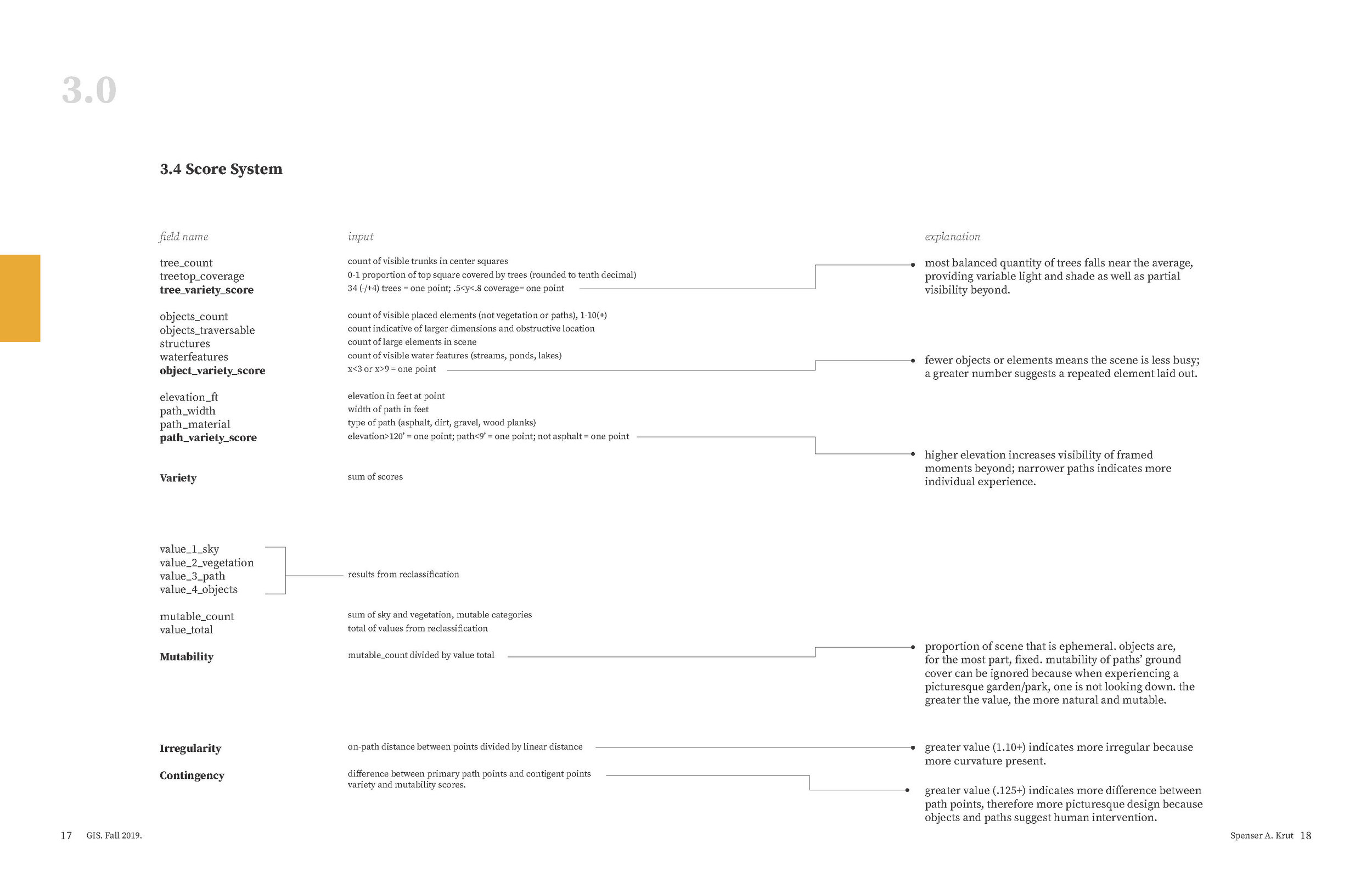
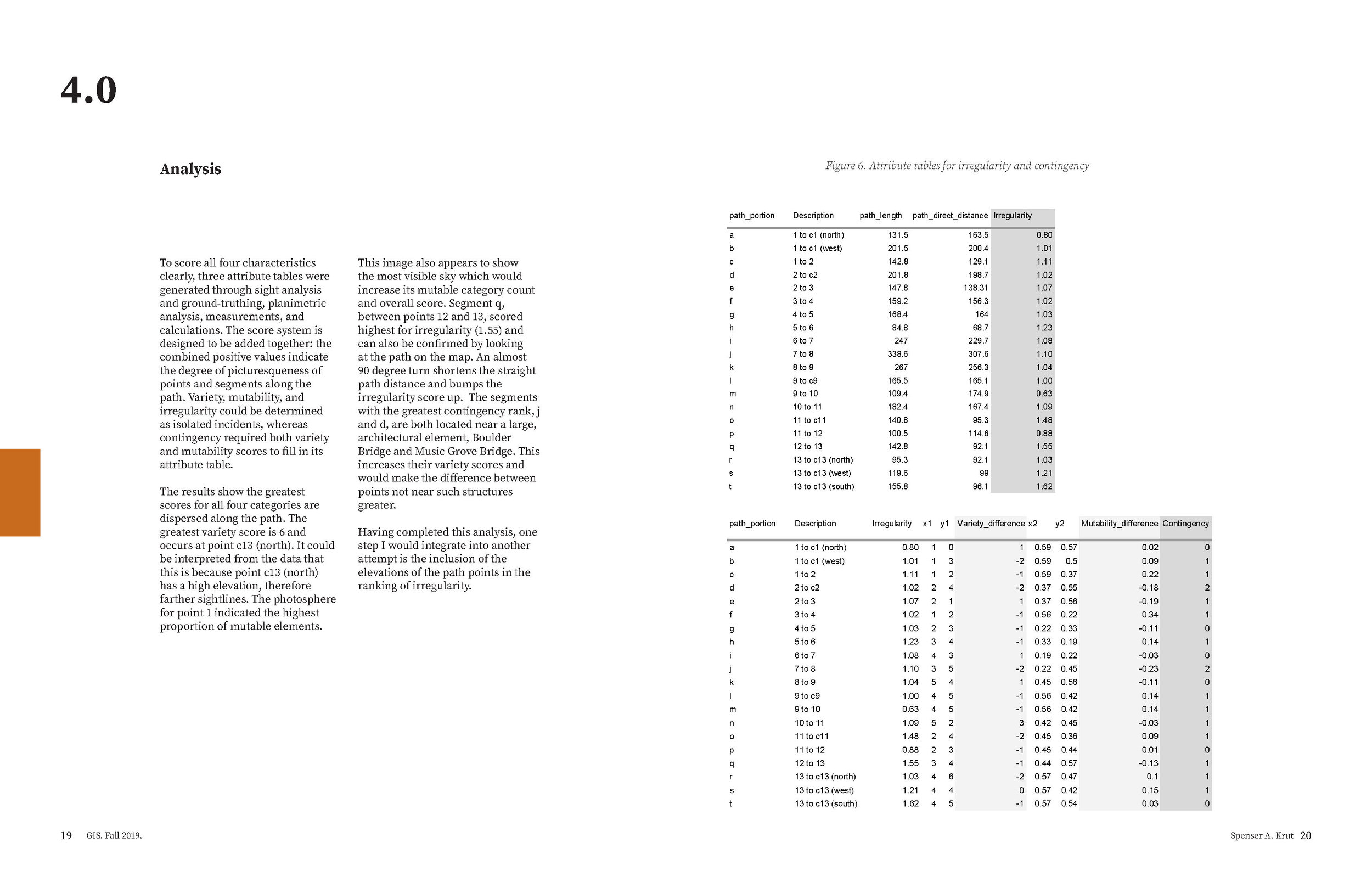
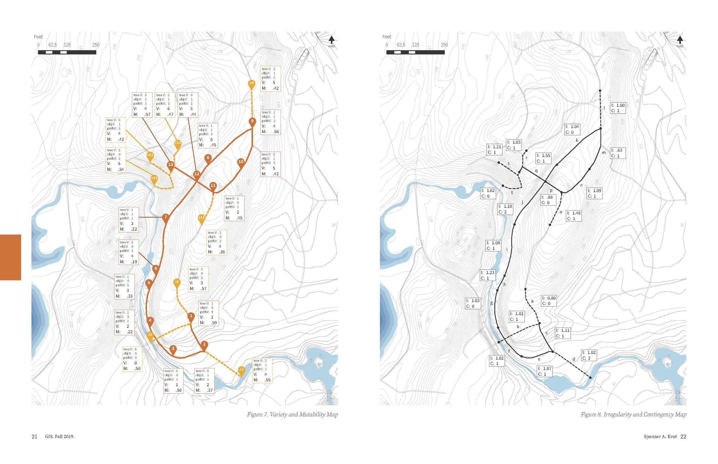
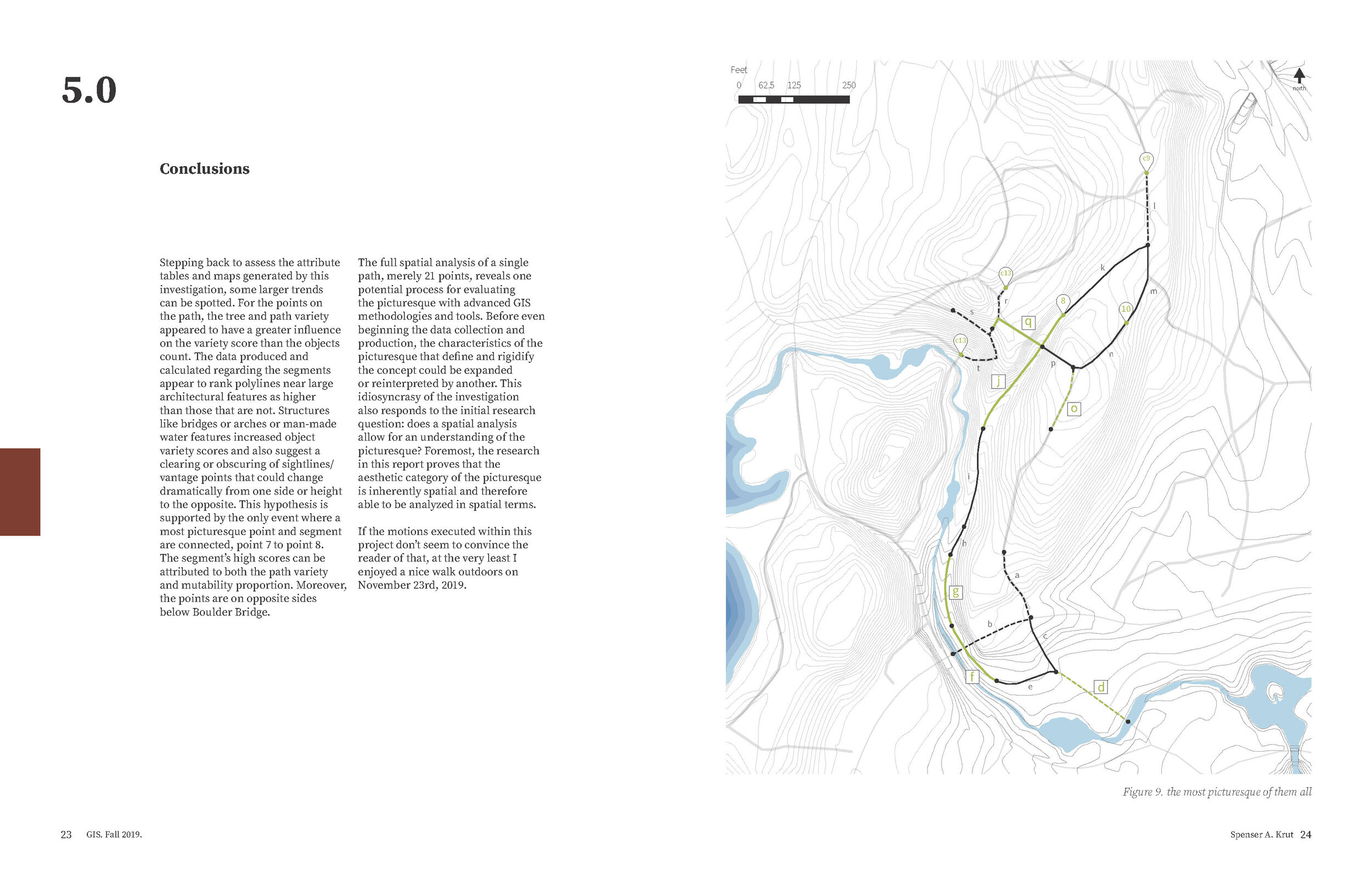
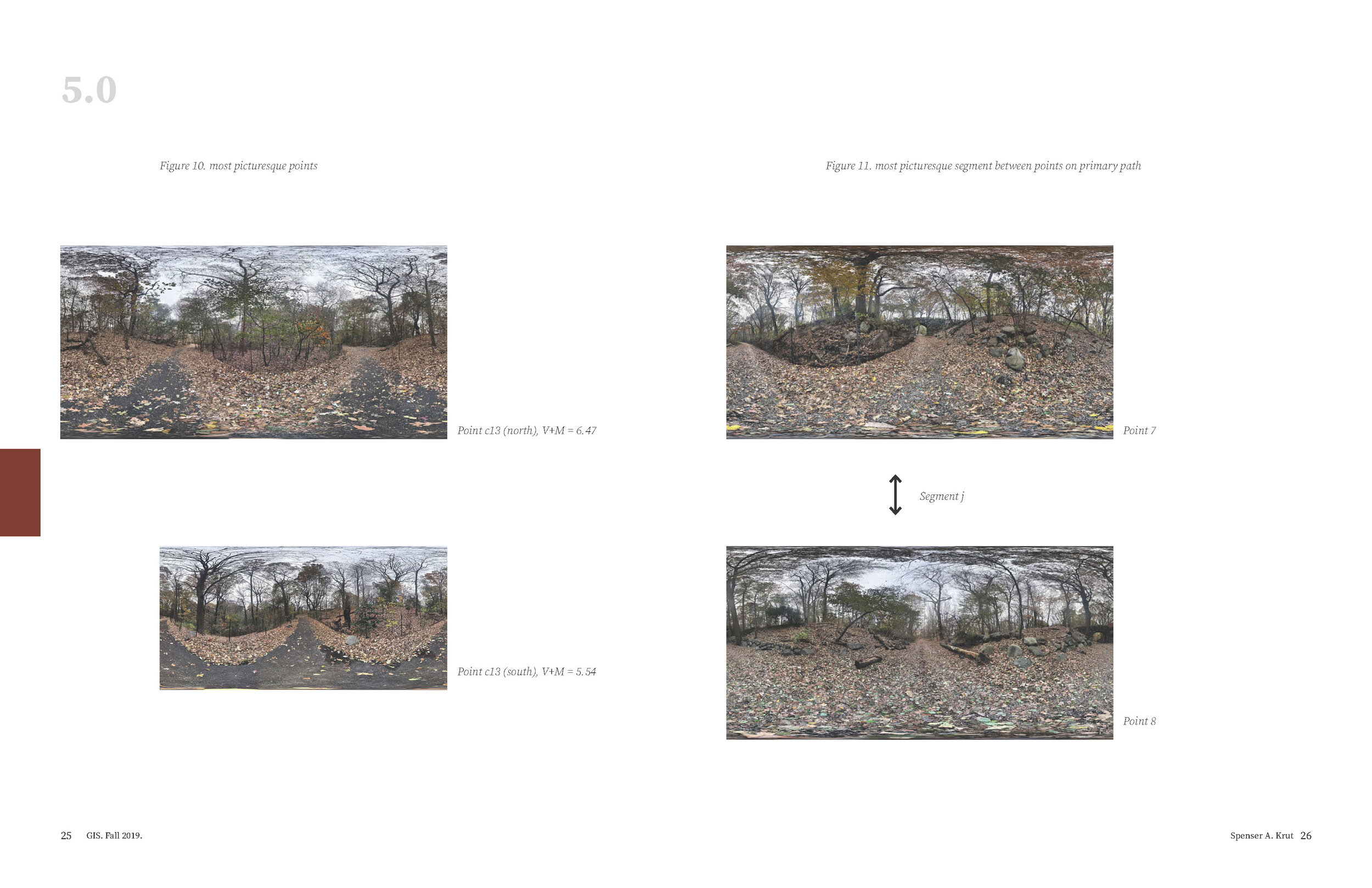
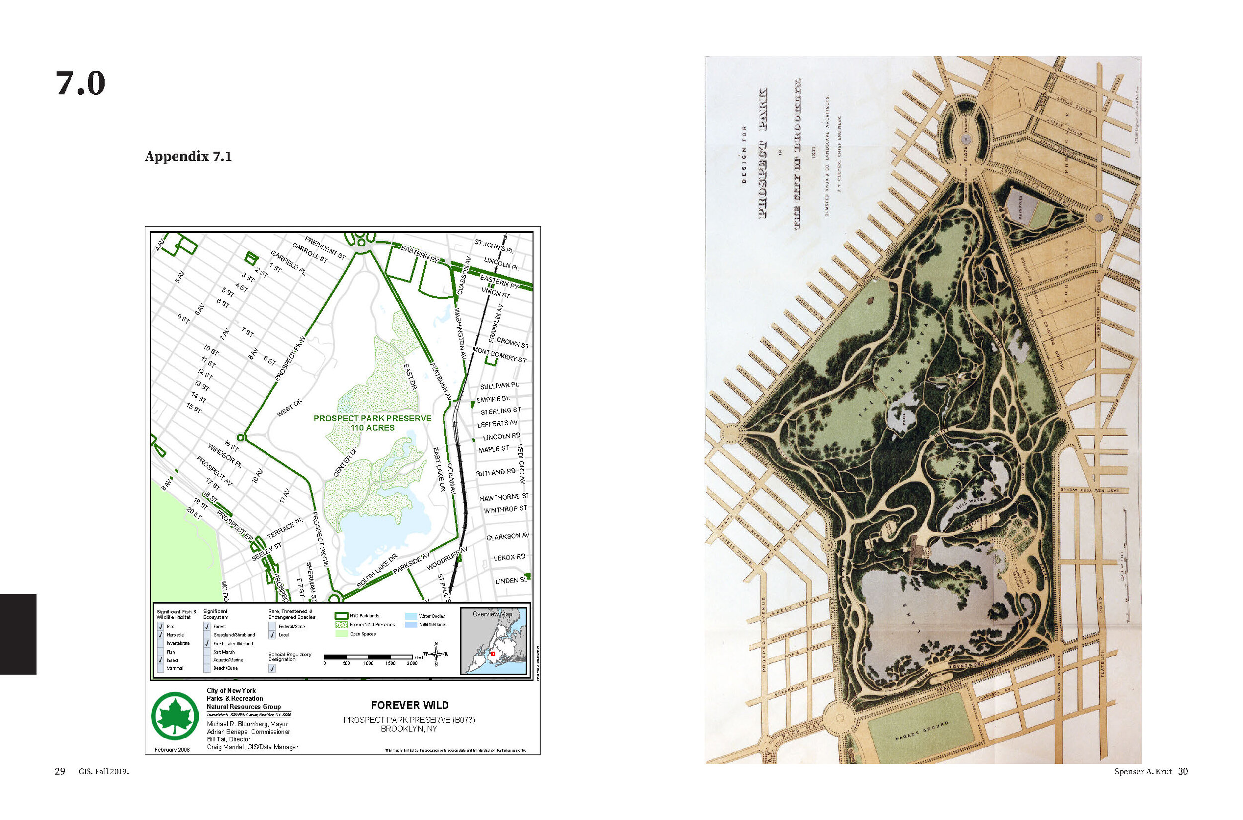
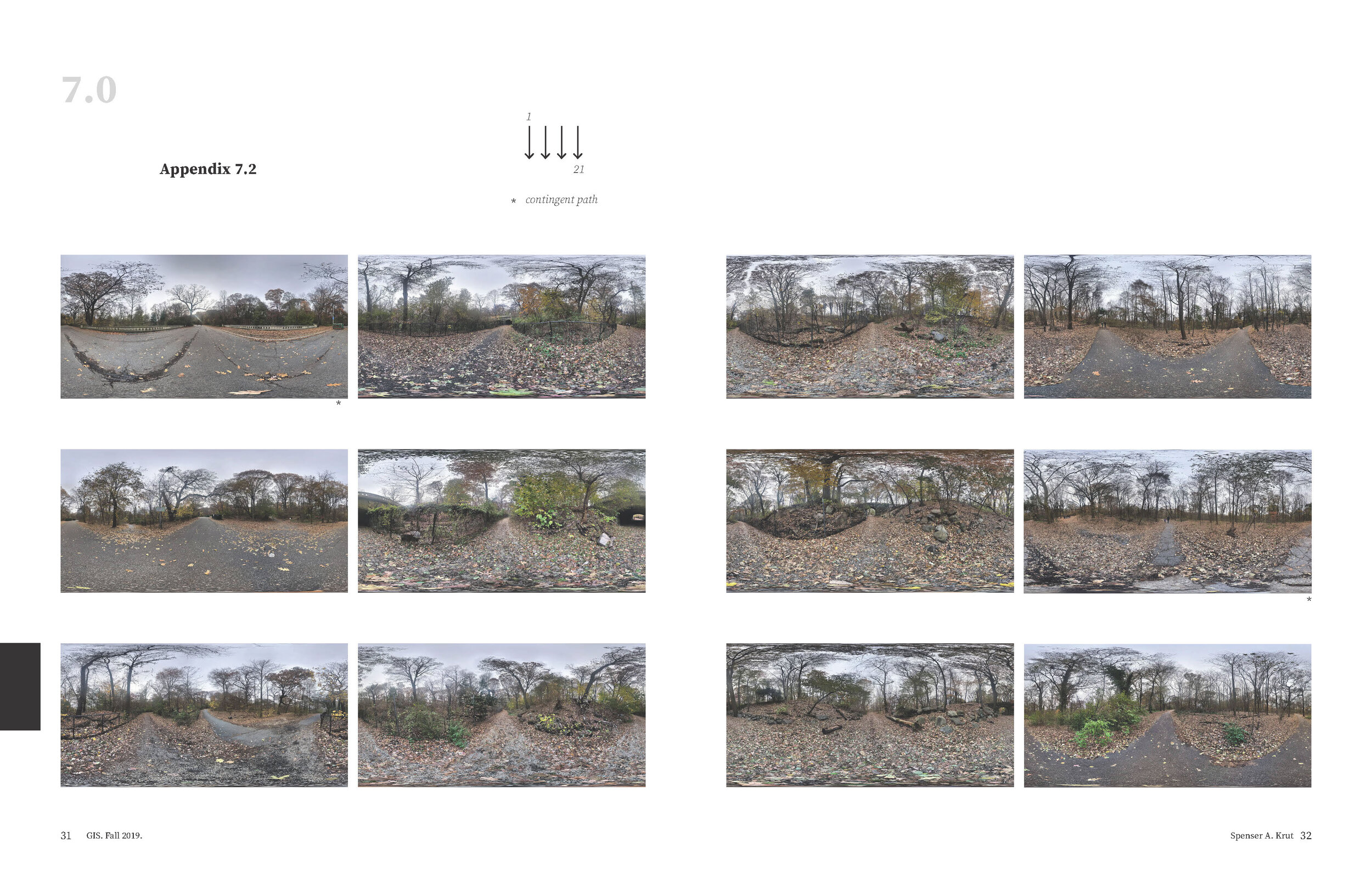
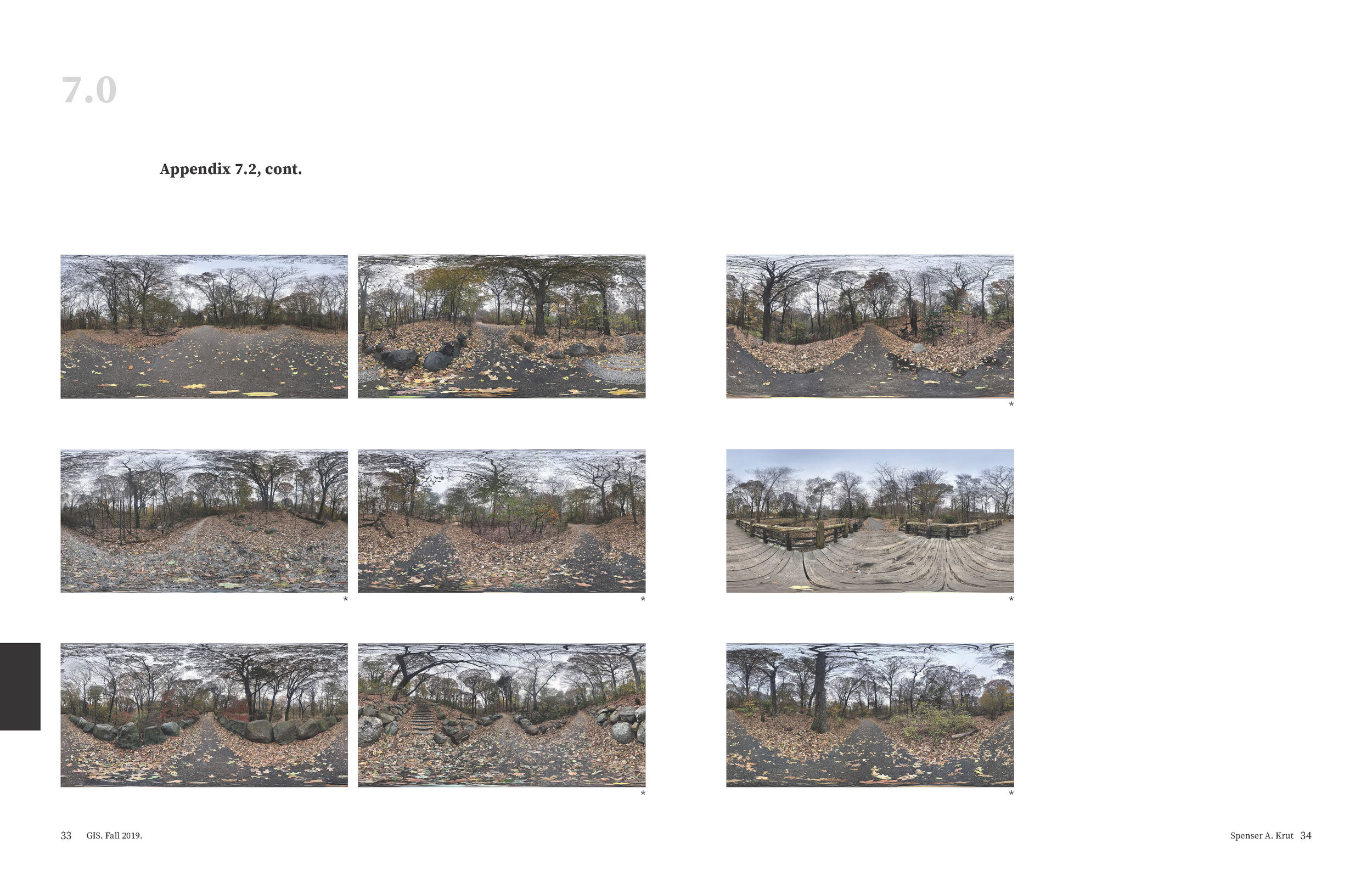
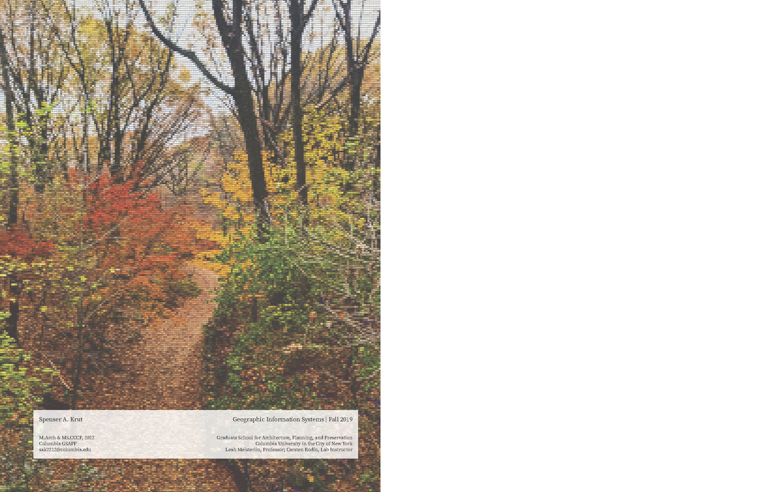
Spenser Krut. “A Spatial Analysis of the Picturesque in New York City.” (Fall 2019)
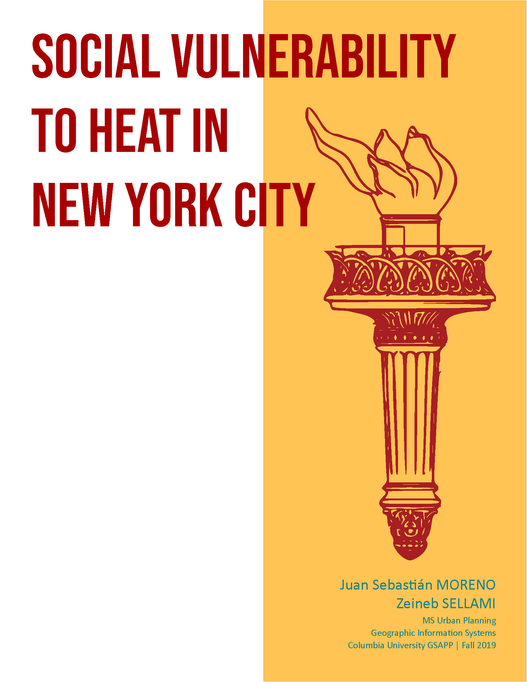
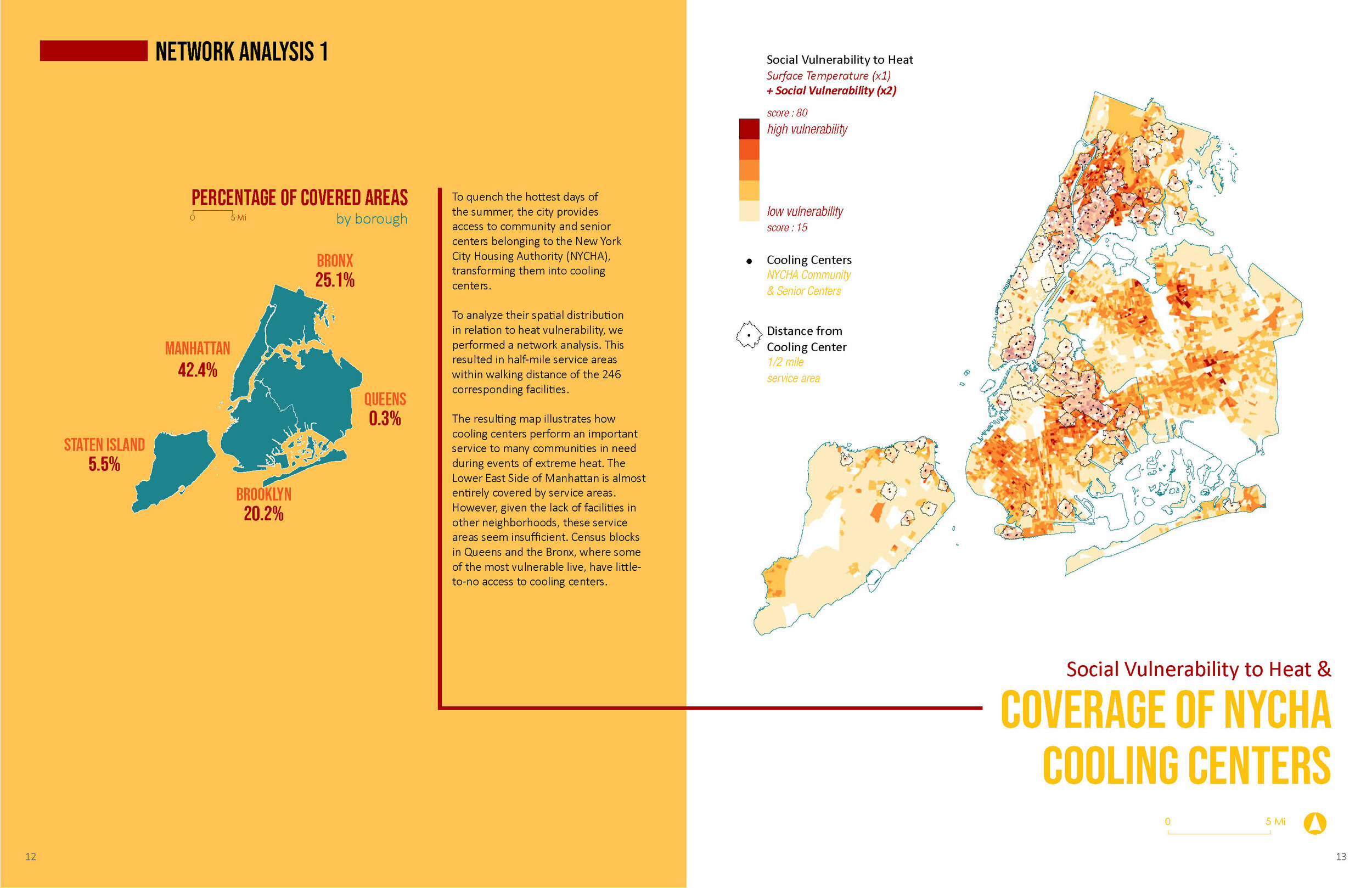
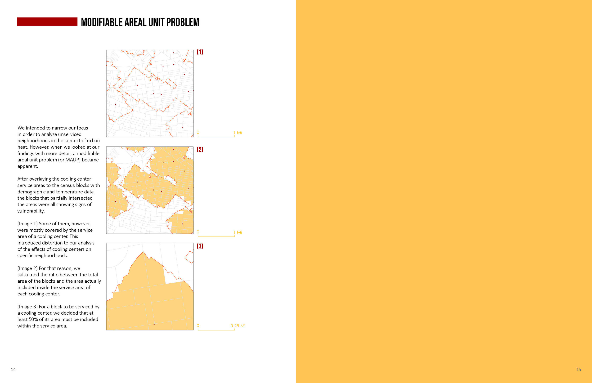
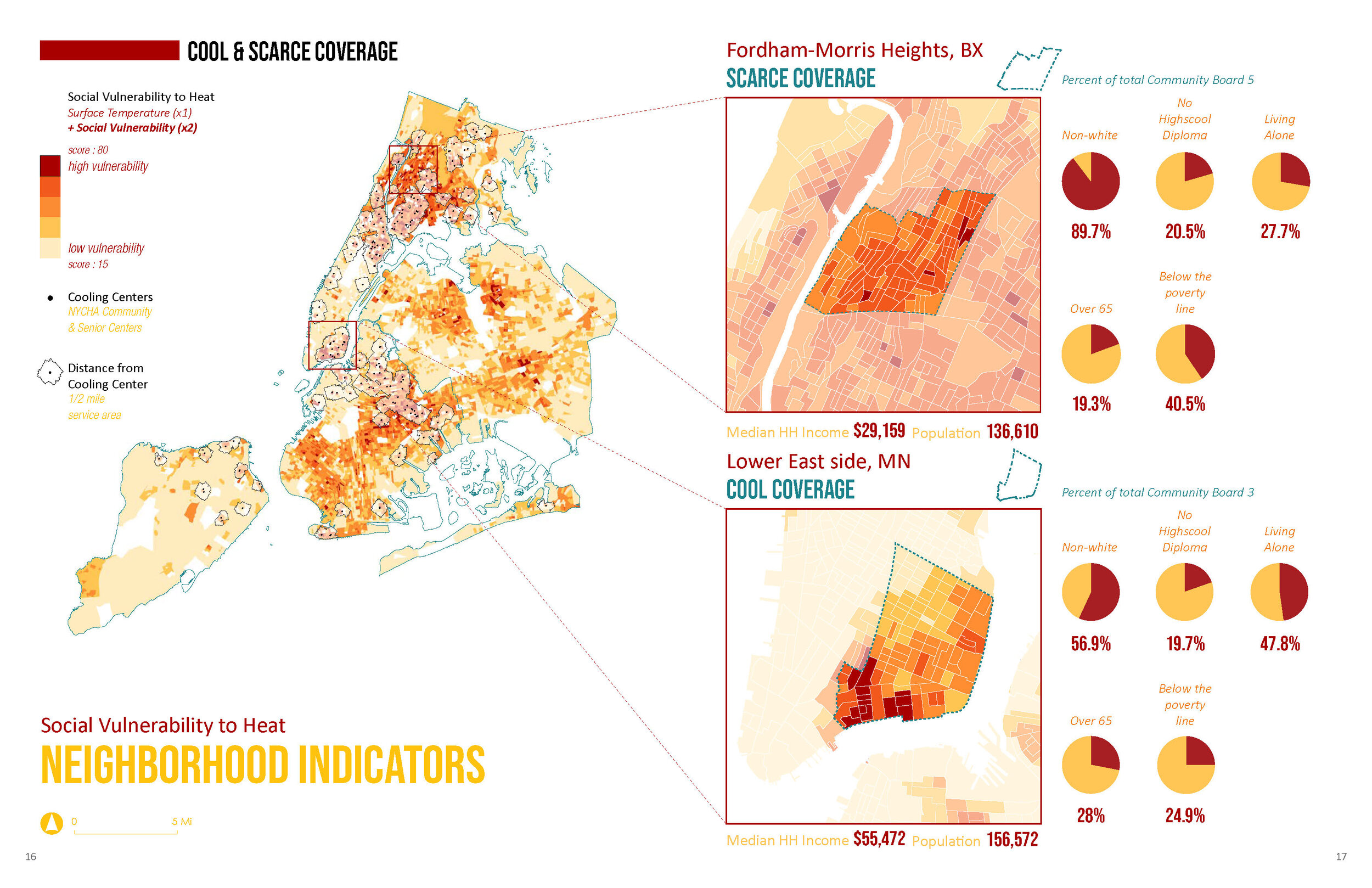
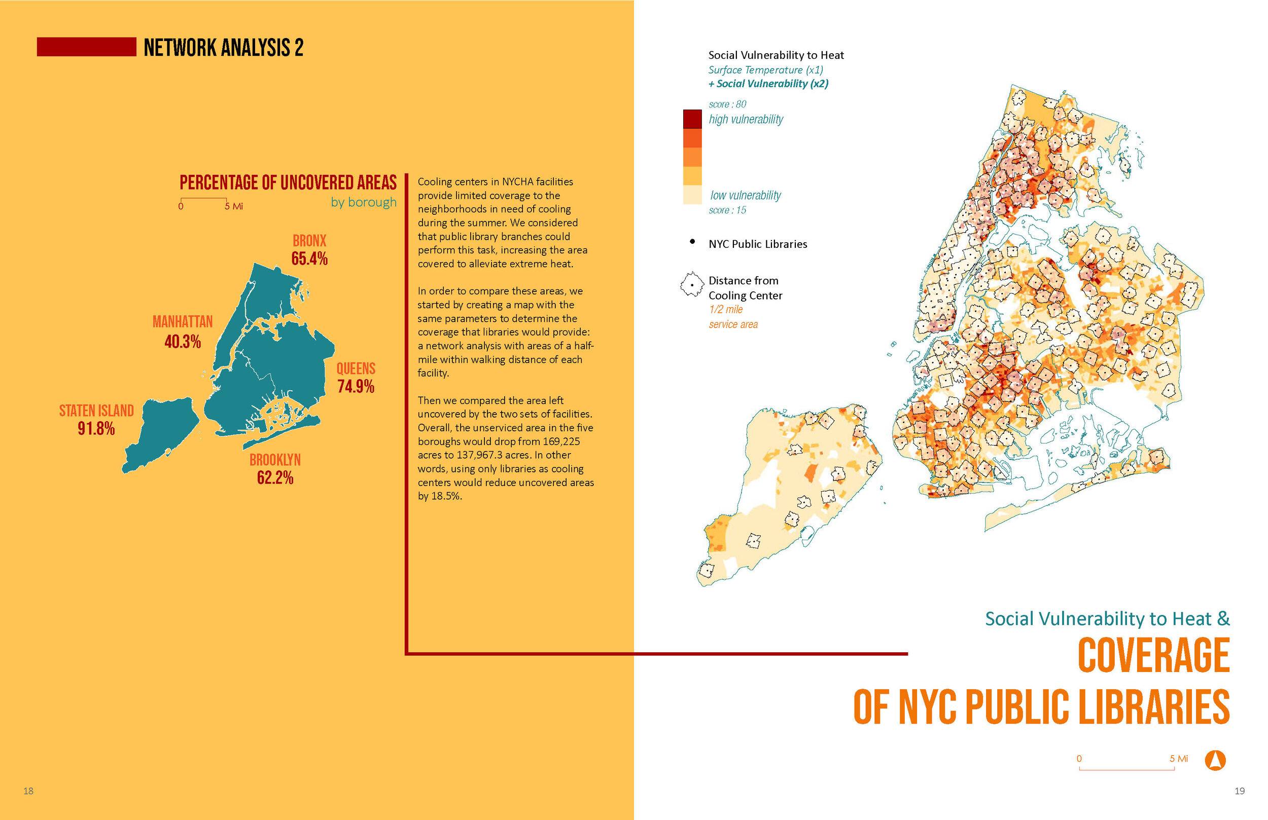
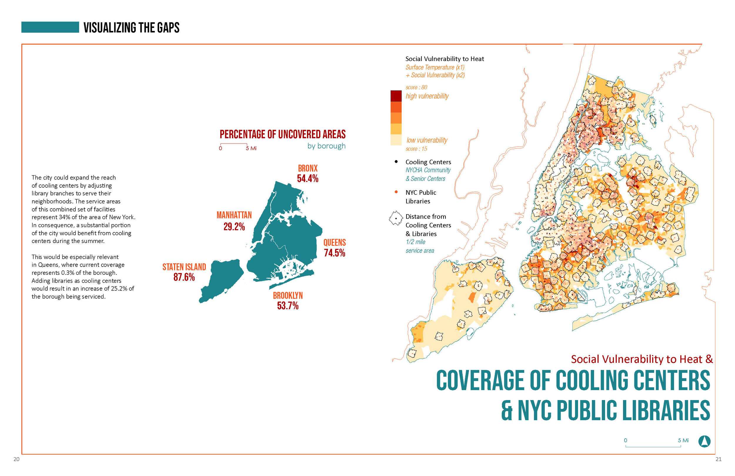
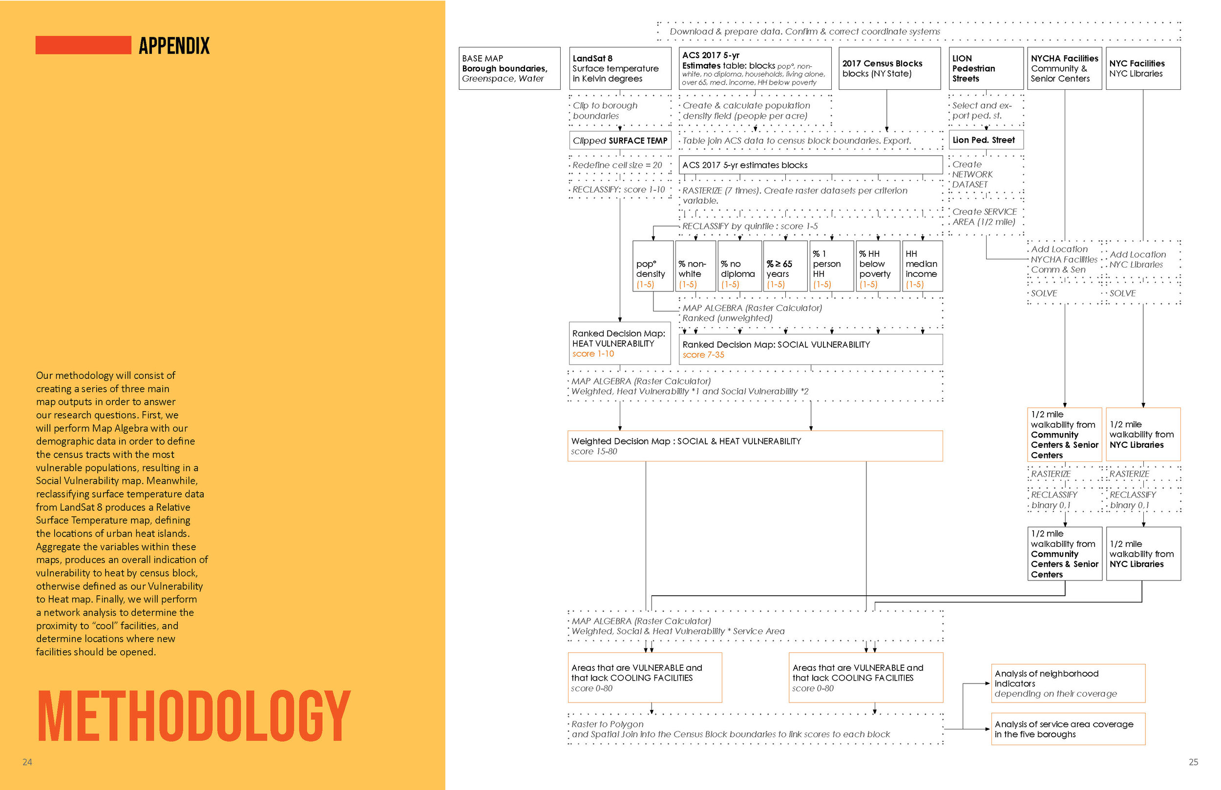
Juan Sebastian Moreno and Zeineb Sellami. “Social Vulnerability to Heat in New York City.” (Fall 2019)
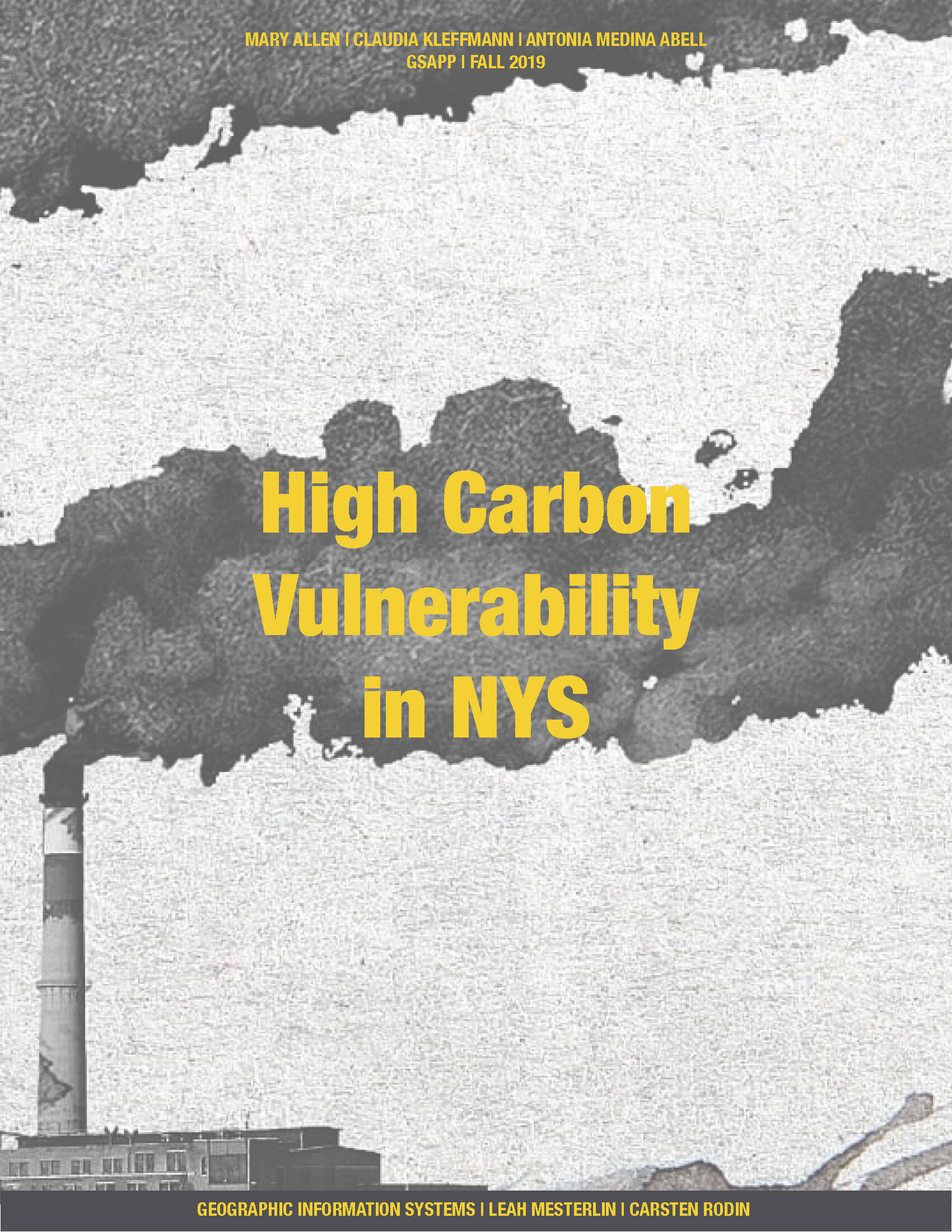
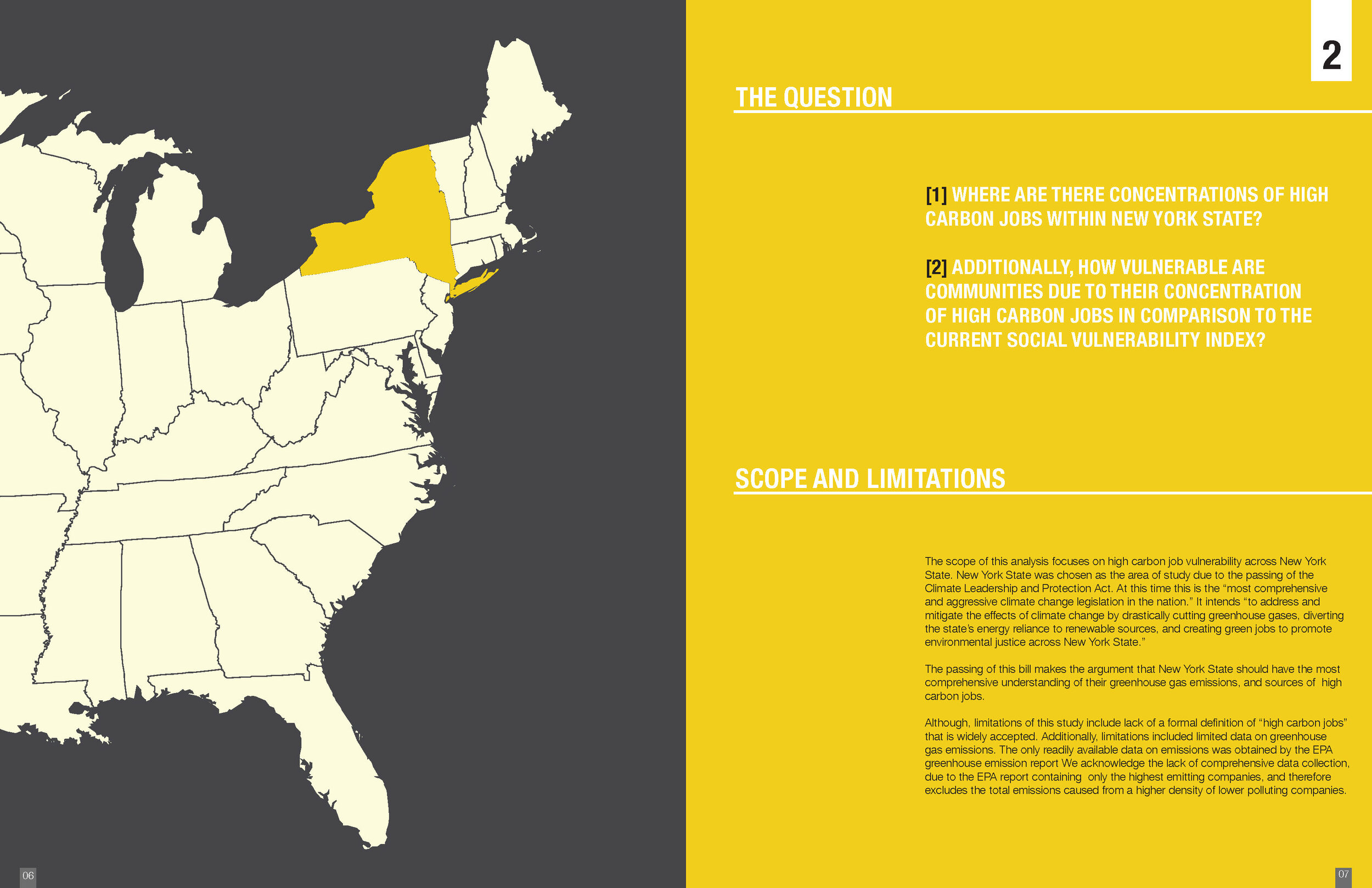
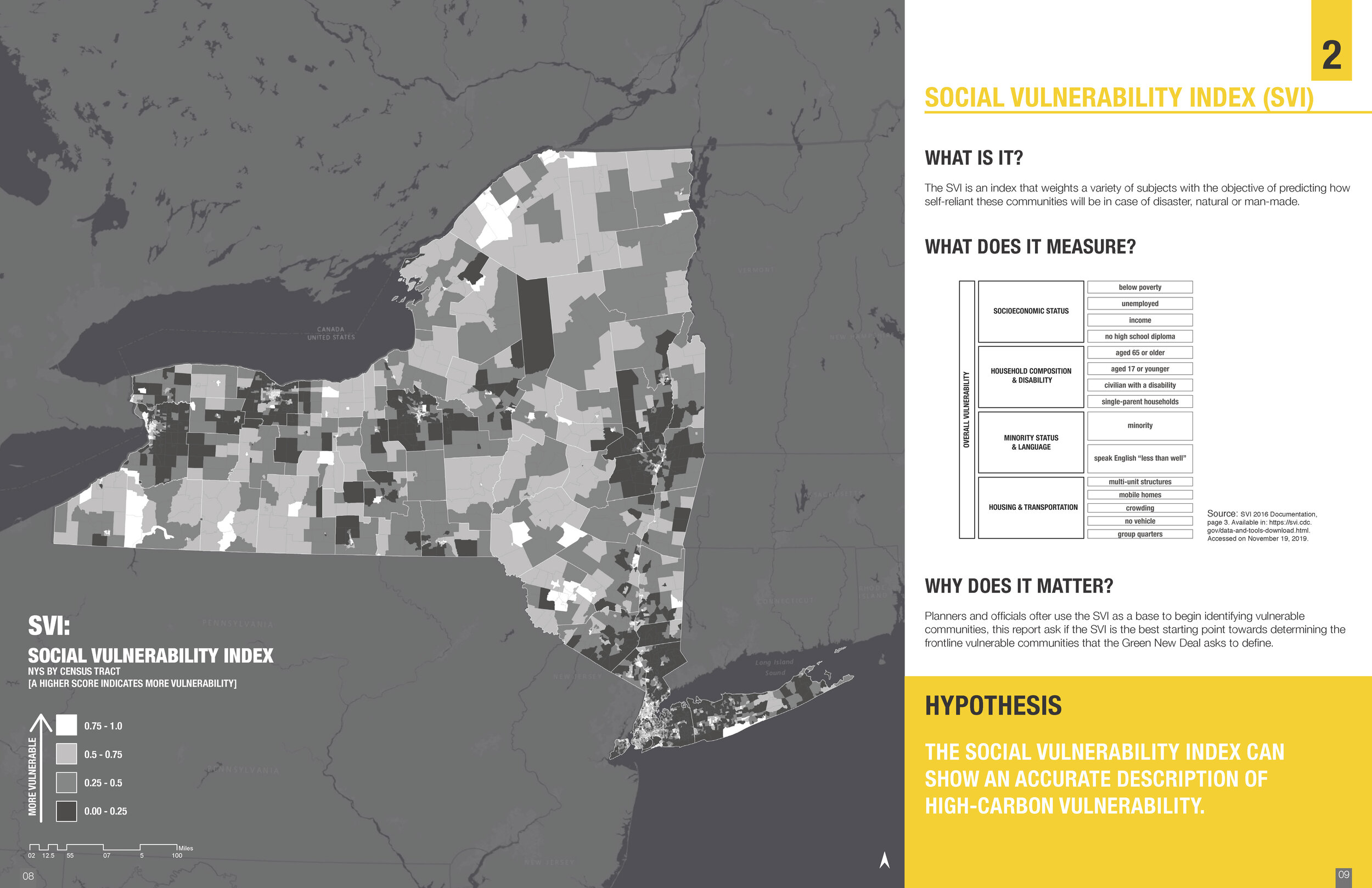
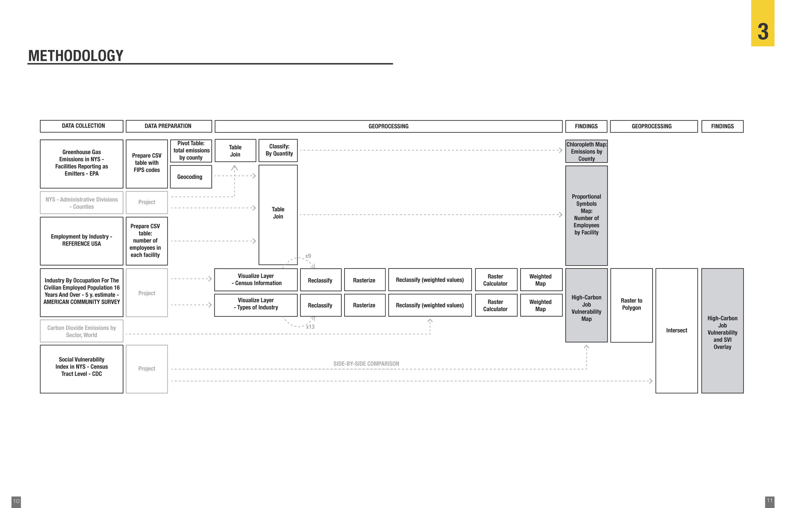
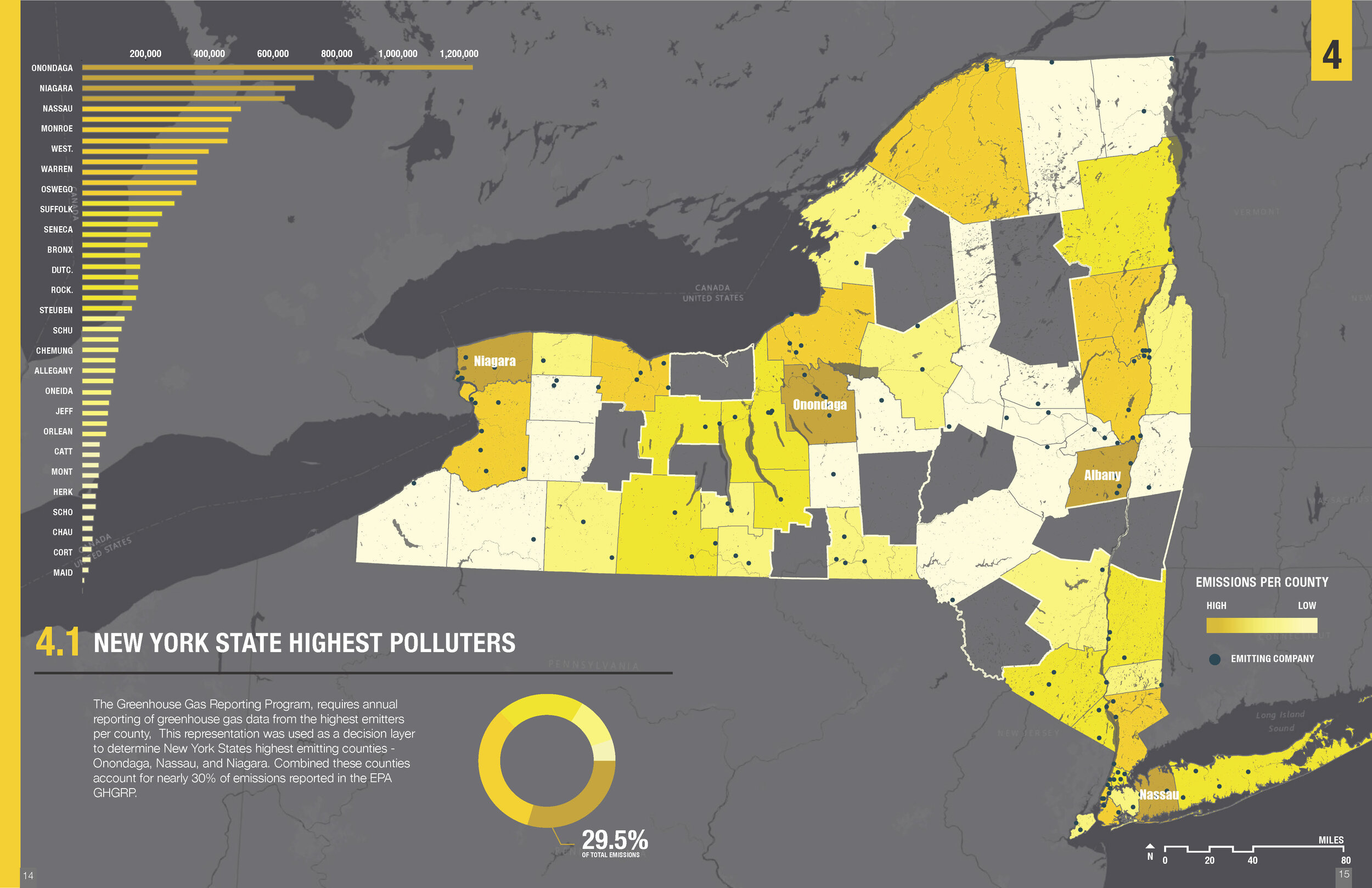
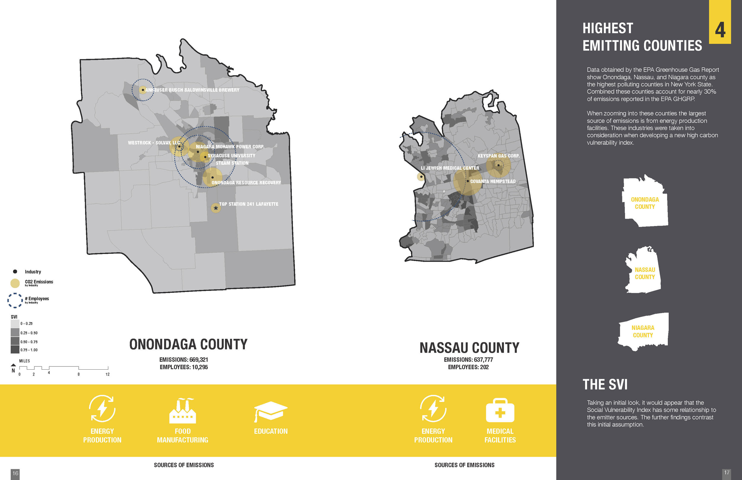
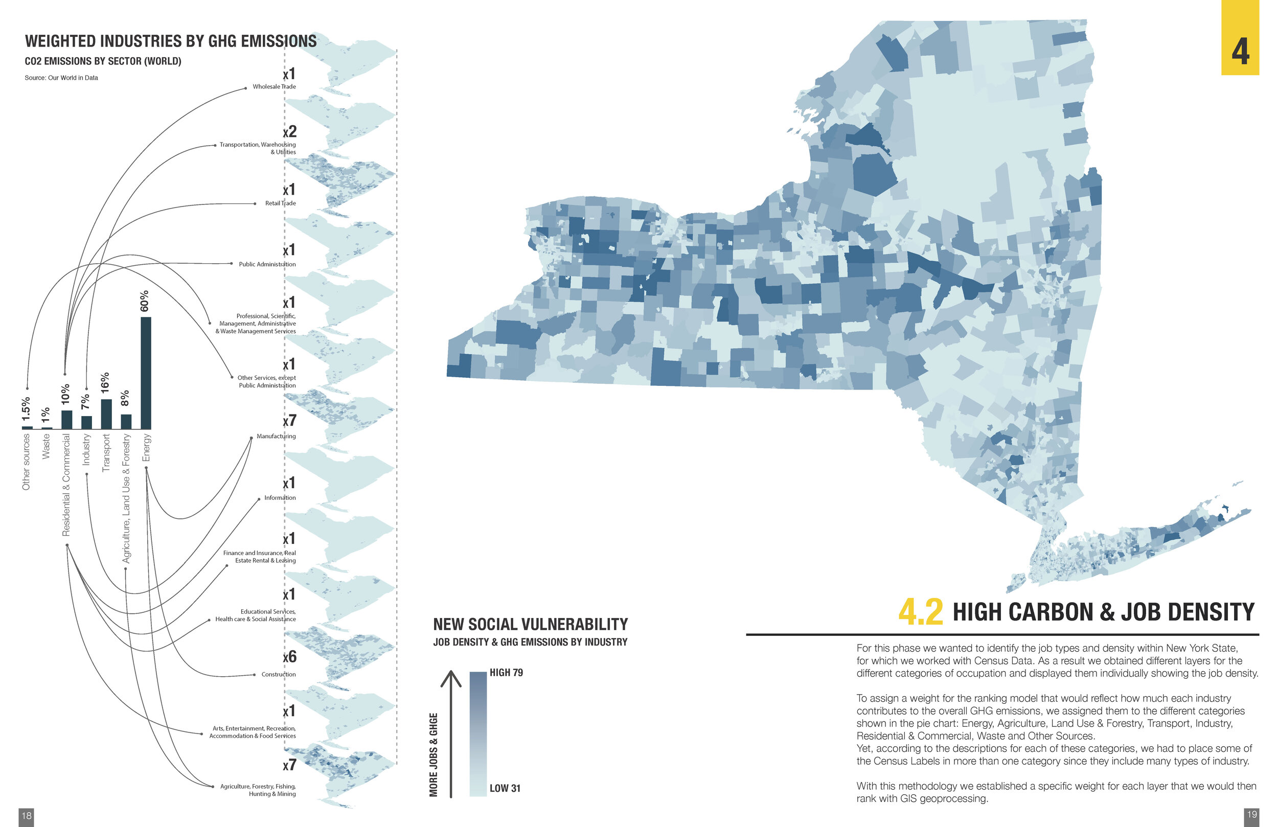
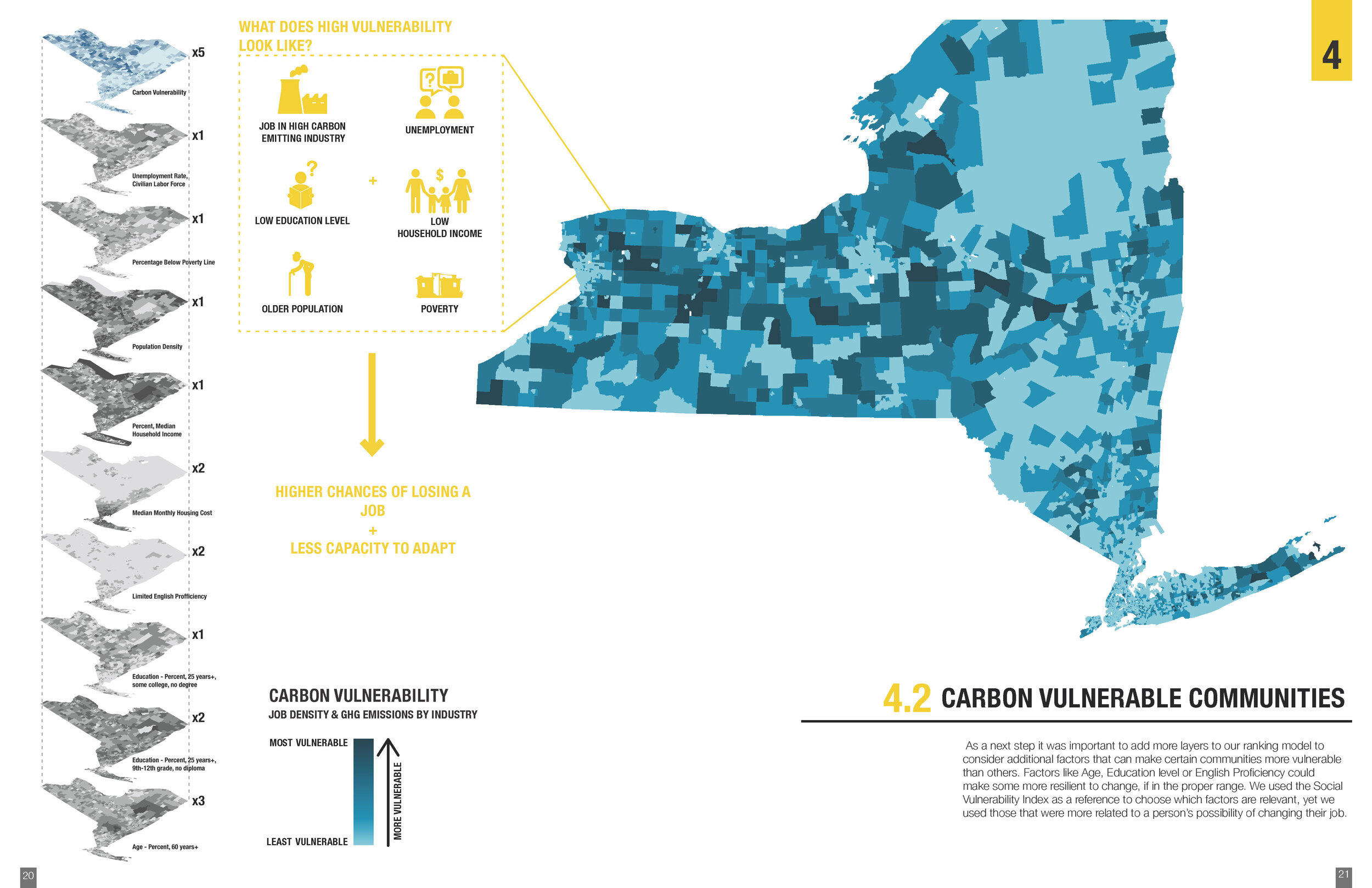
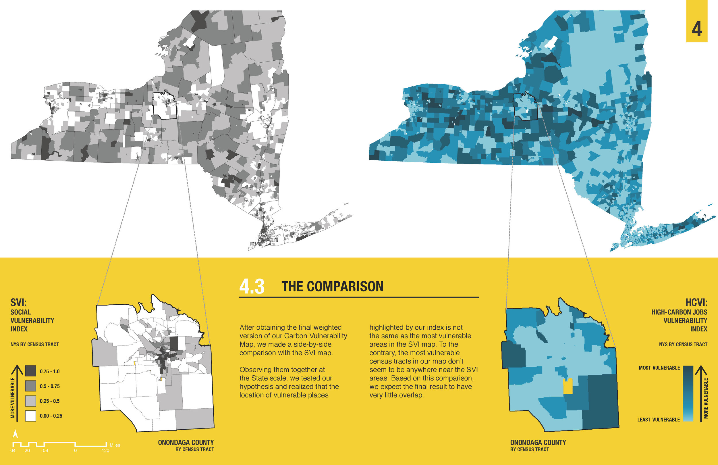
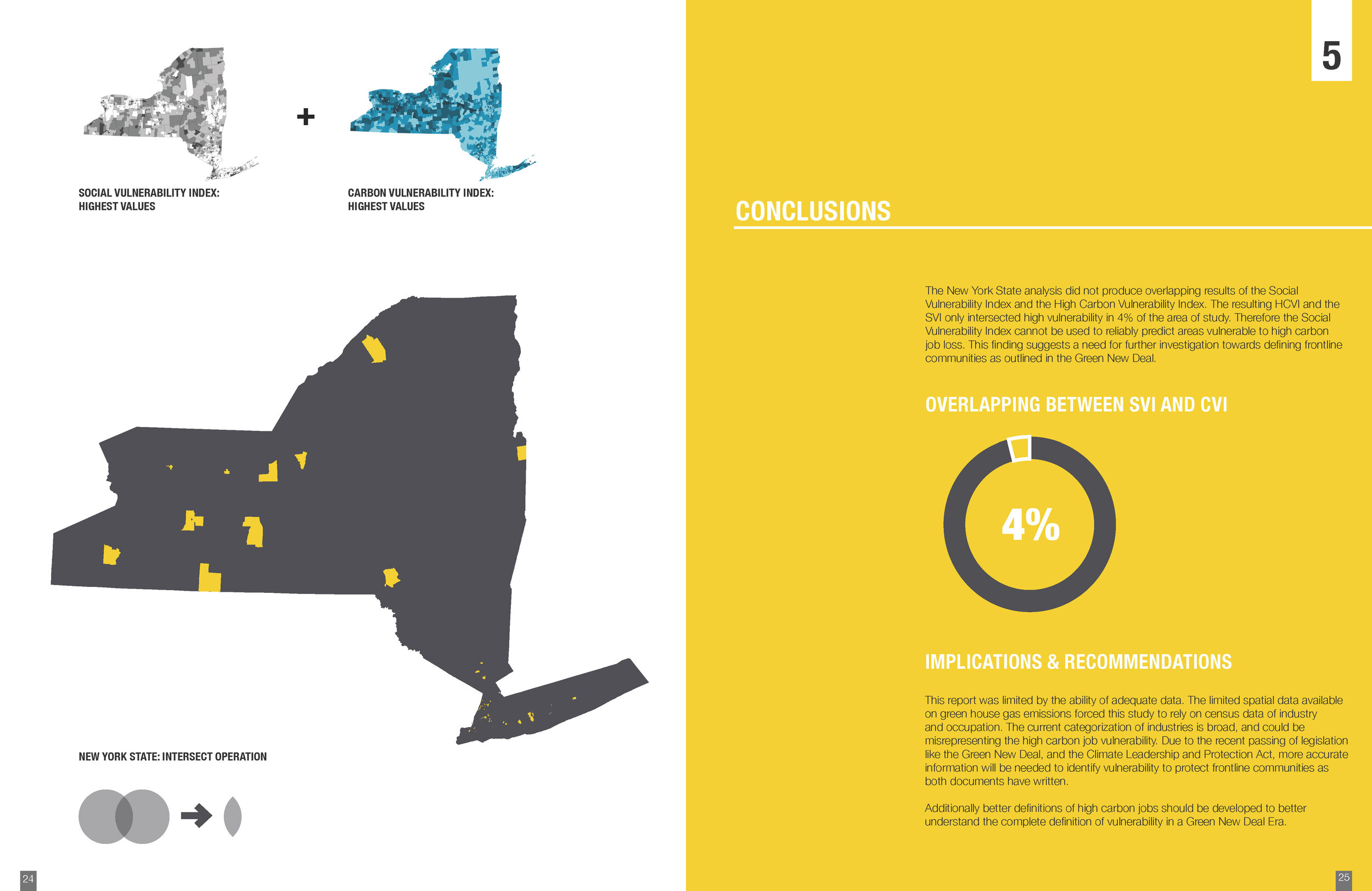
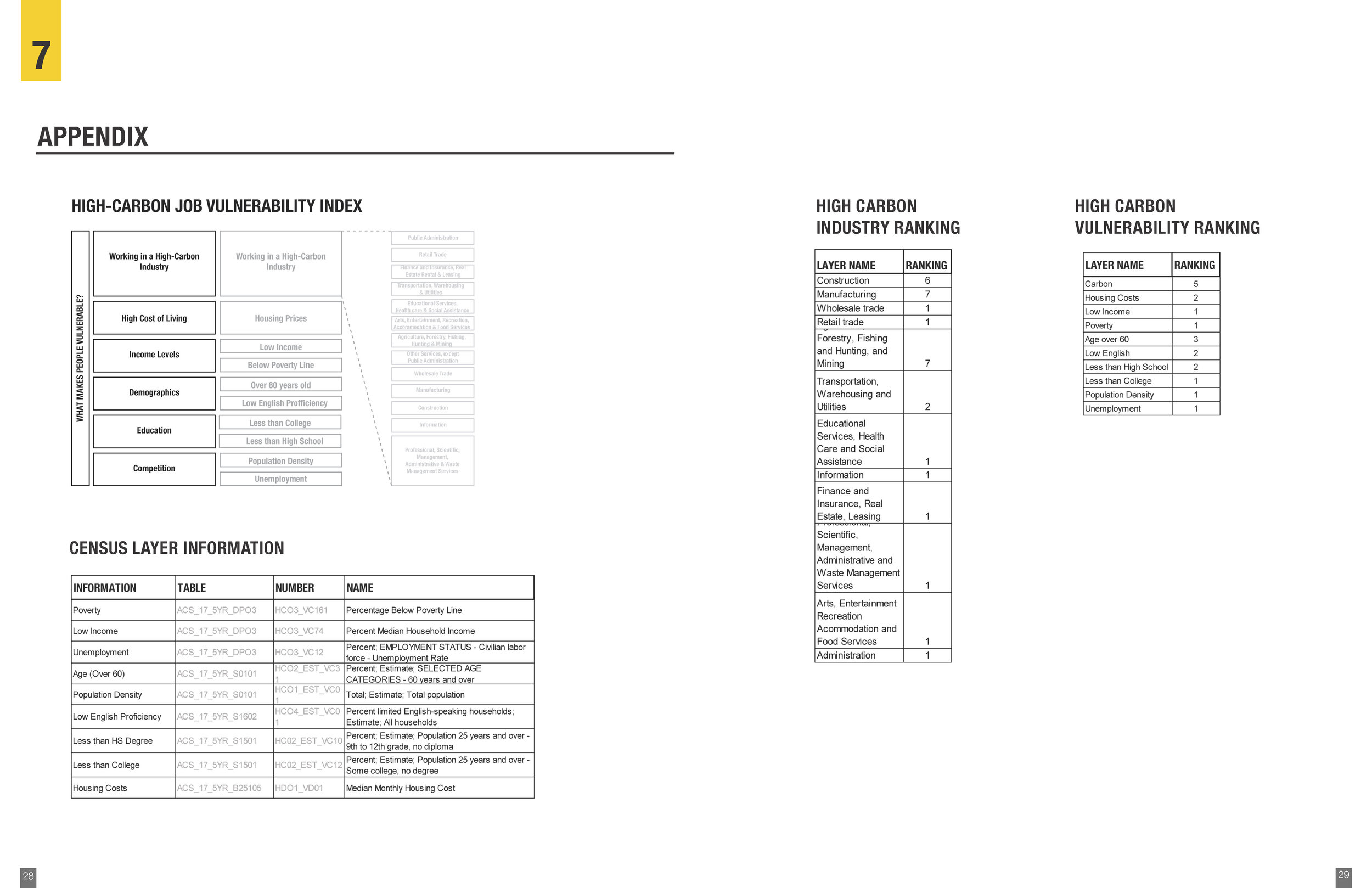
Mary Allen, Claudia Kleffmann, and Antonia Medina Abell. “High Carbon Vulnerability in NYS.” (Fall 2019)
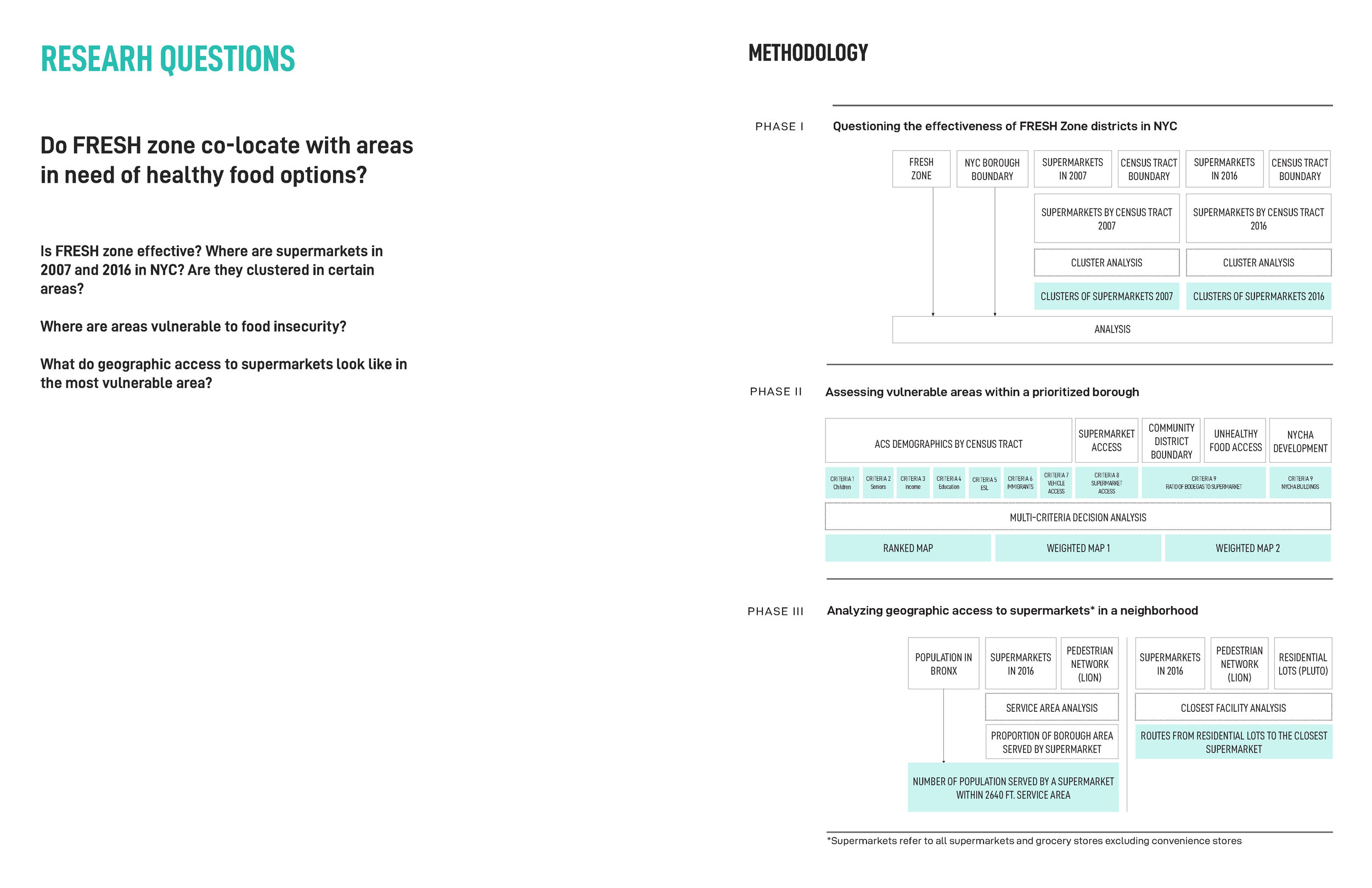
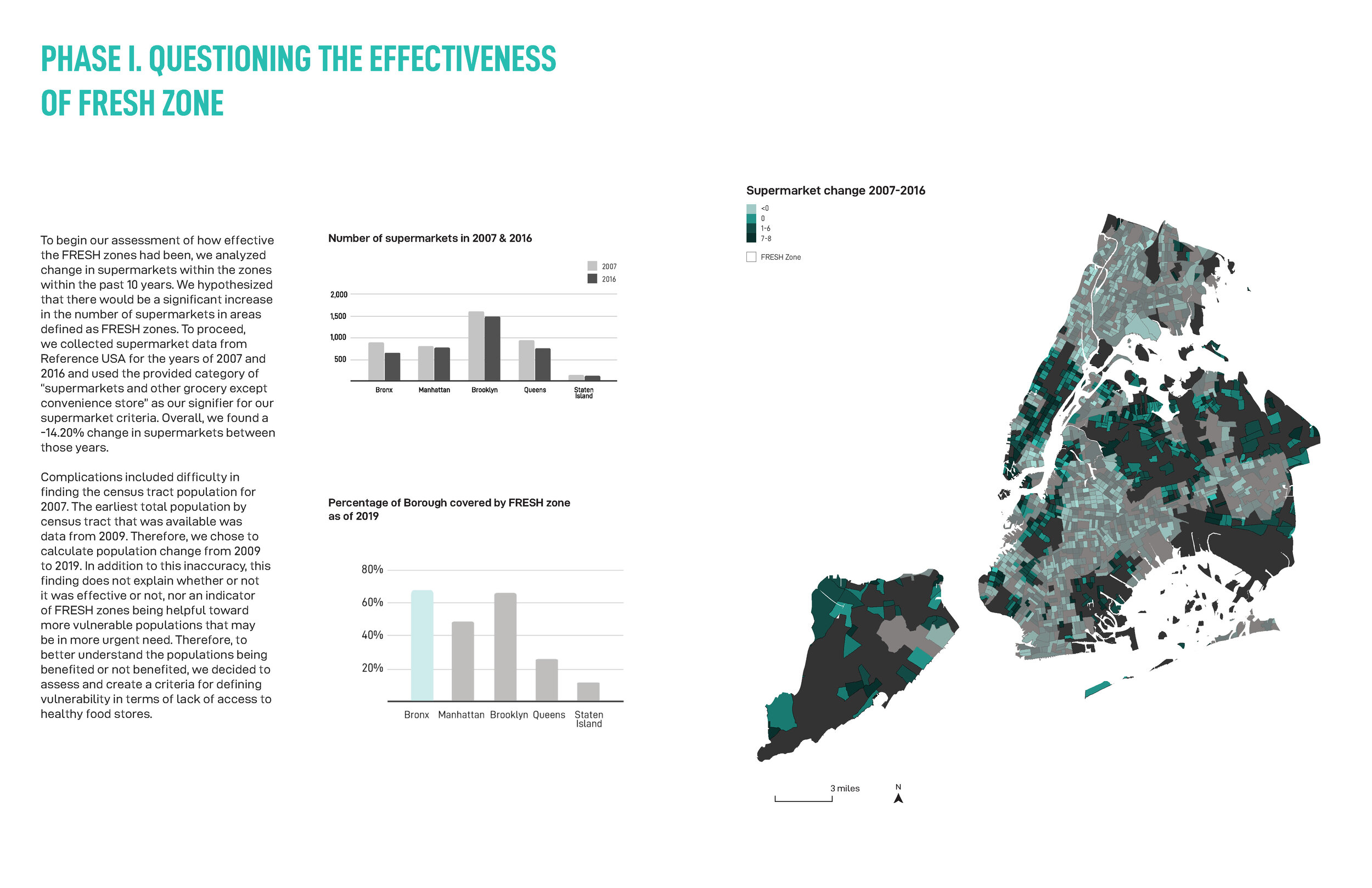
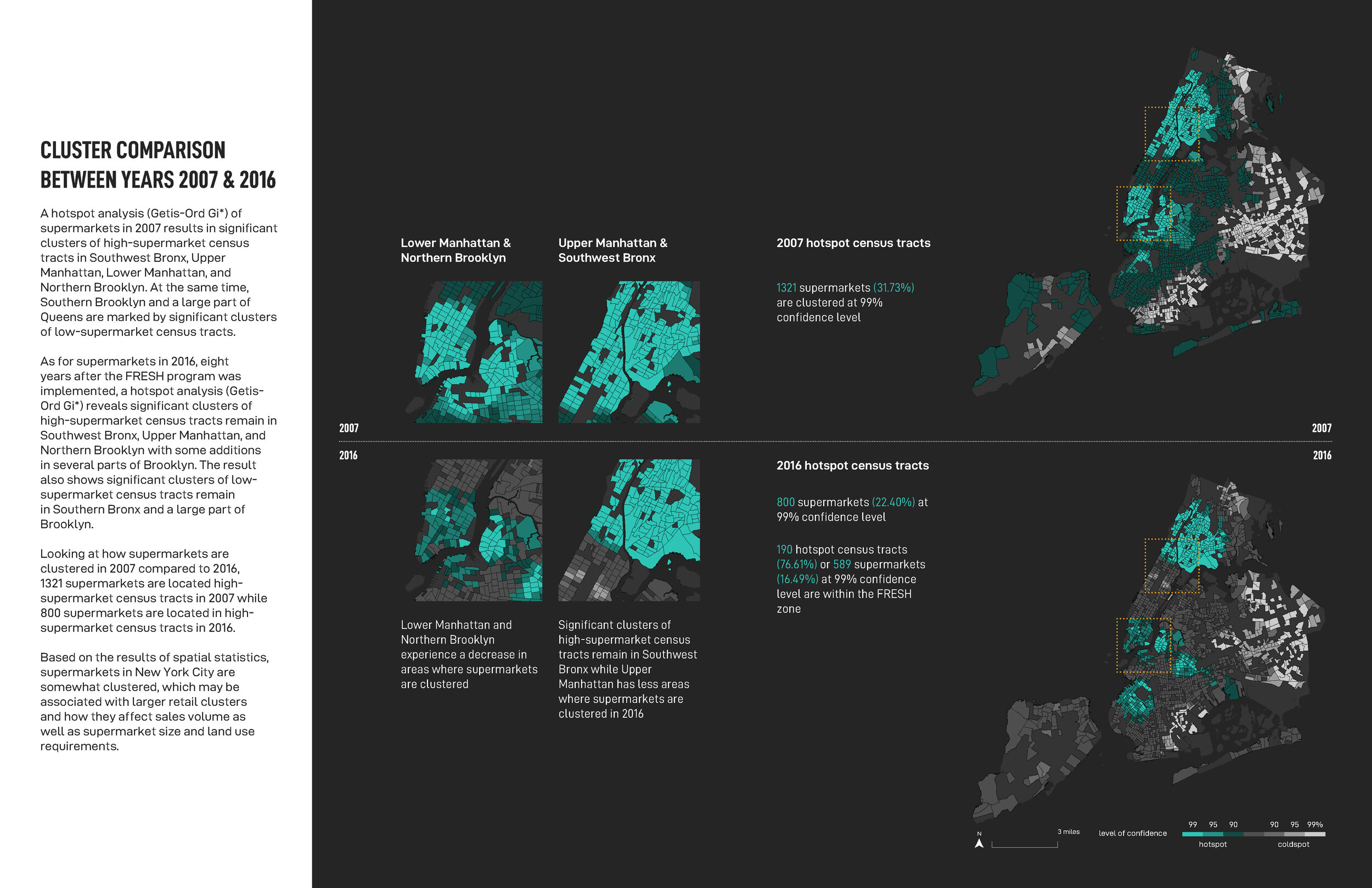
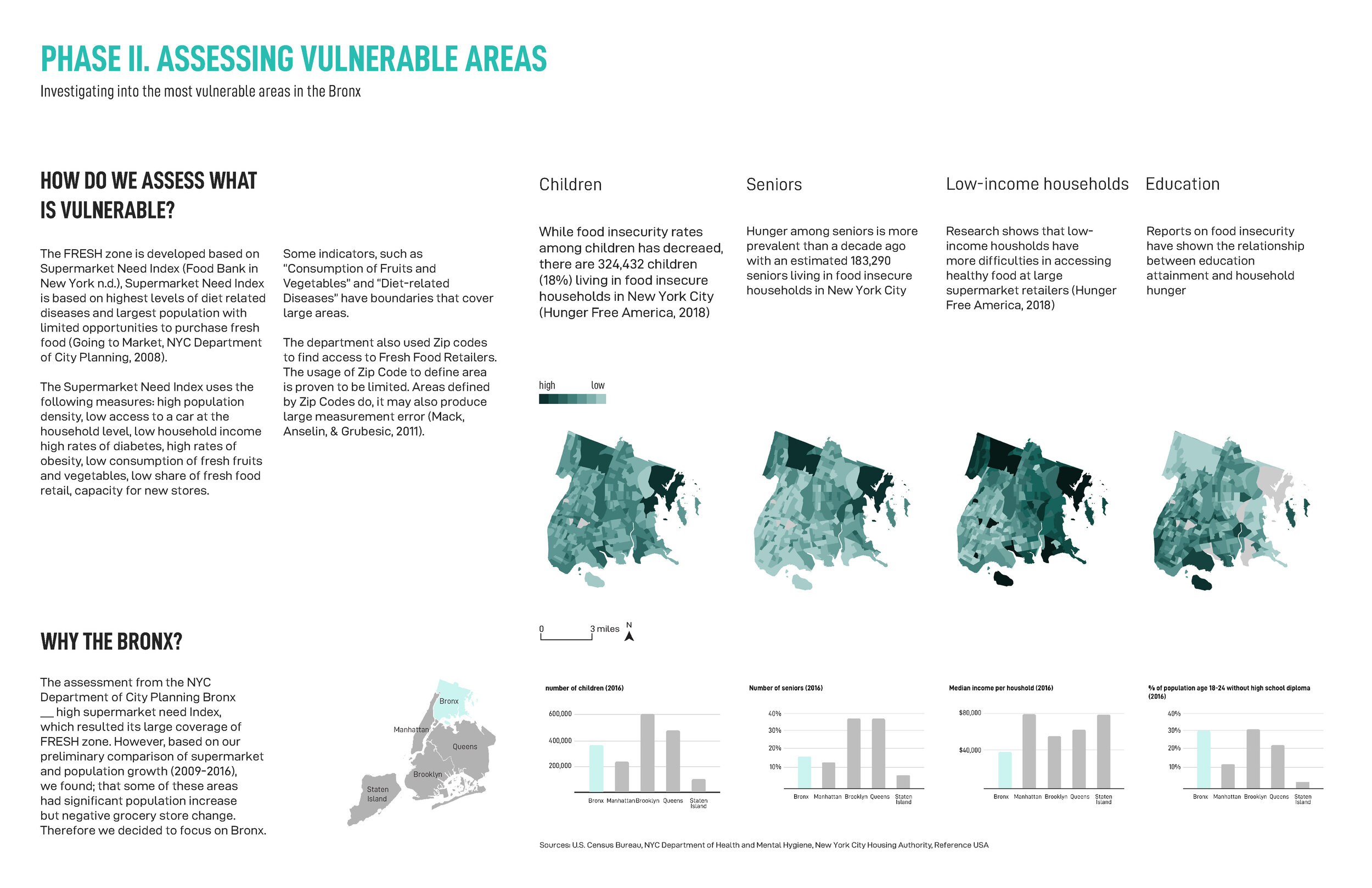
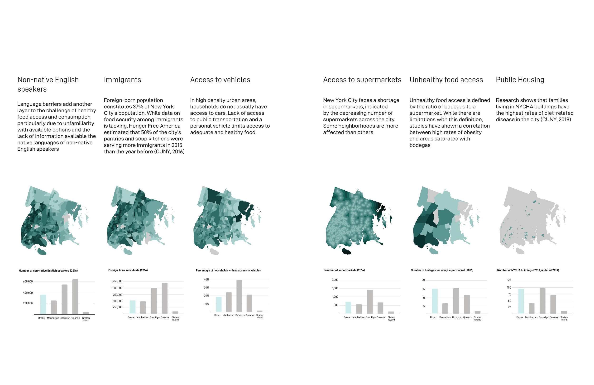
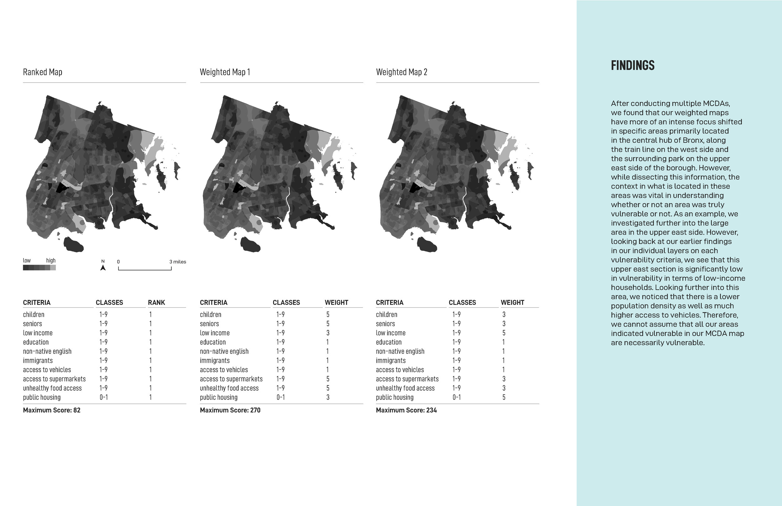
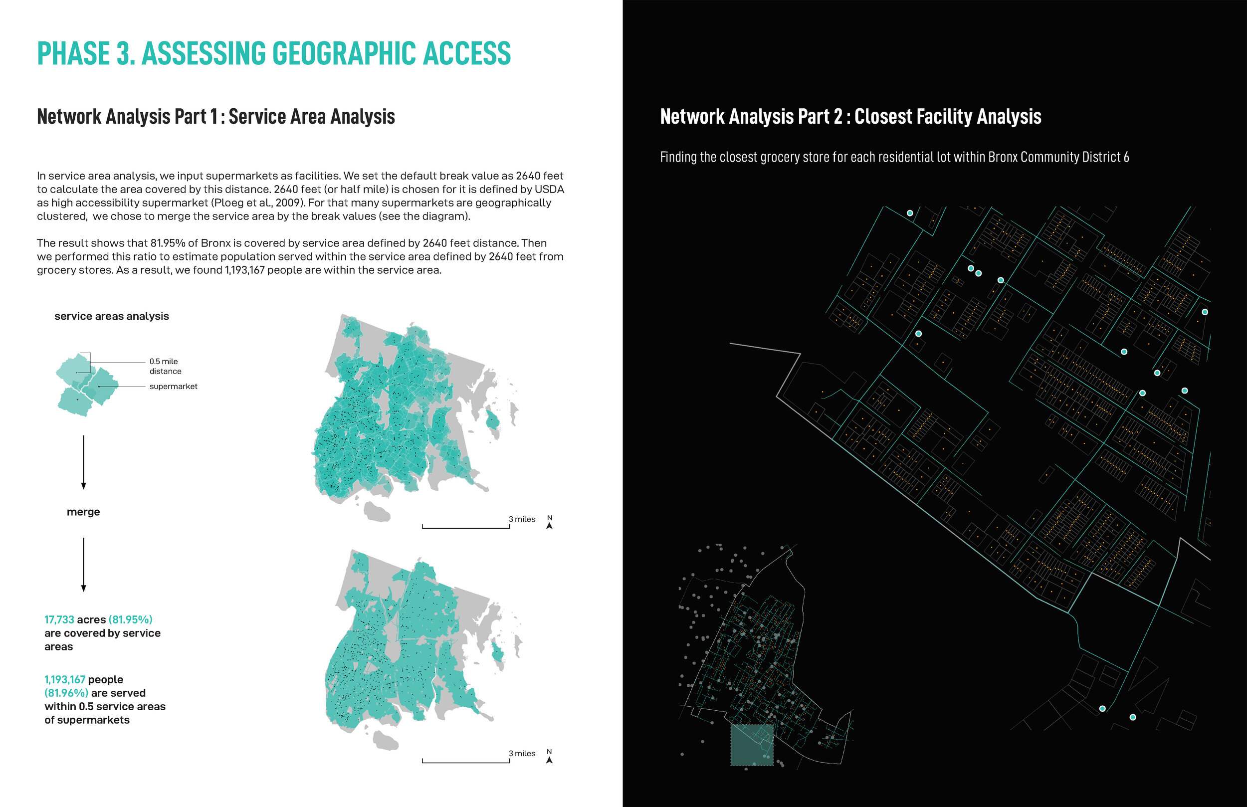
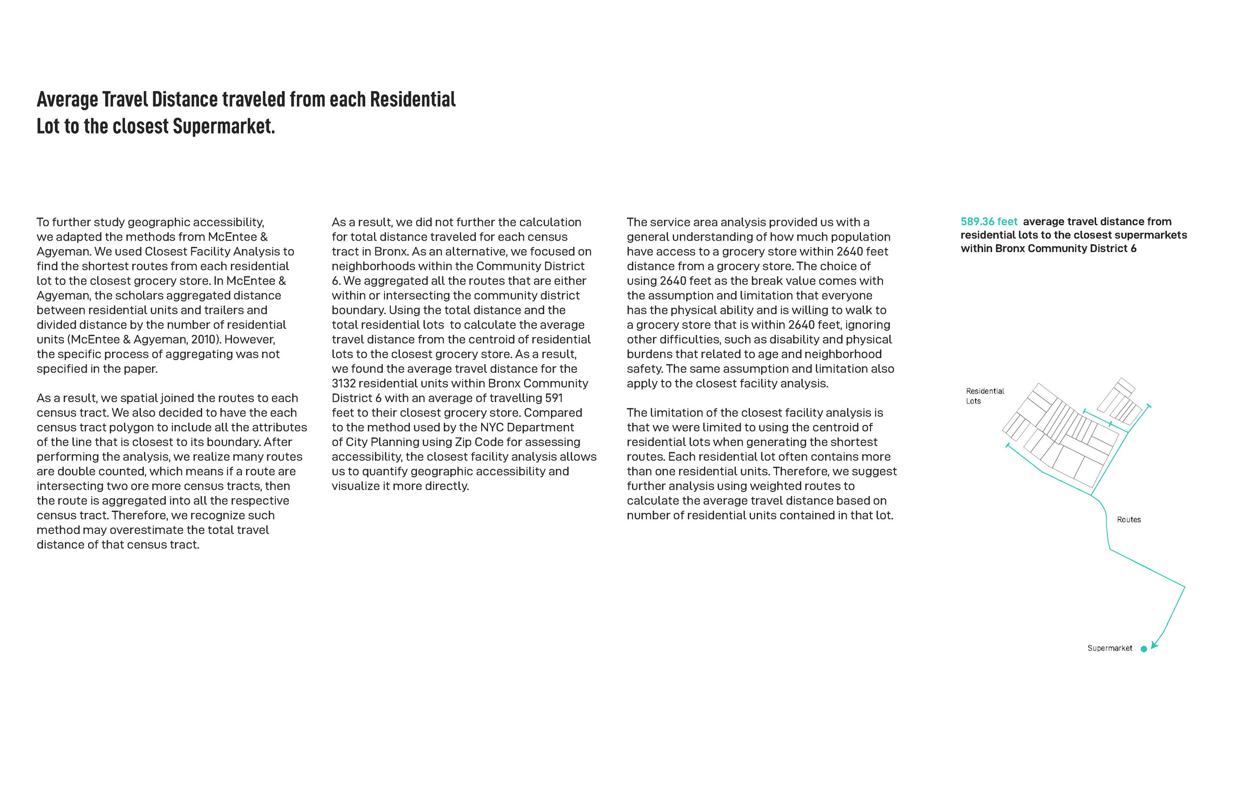

Yuning Feng, Elaine Hsieh, Priska Marianne. “Access to Healthy Food in NYC.” (Fall 2019)
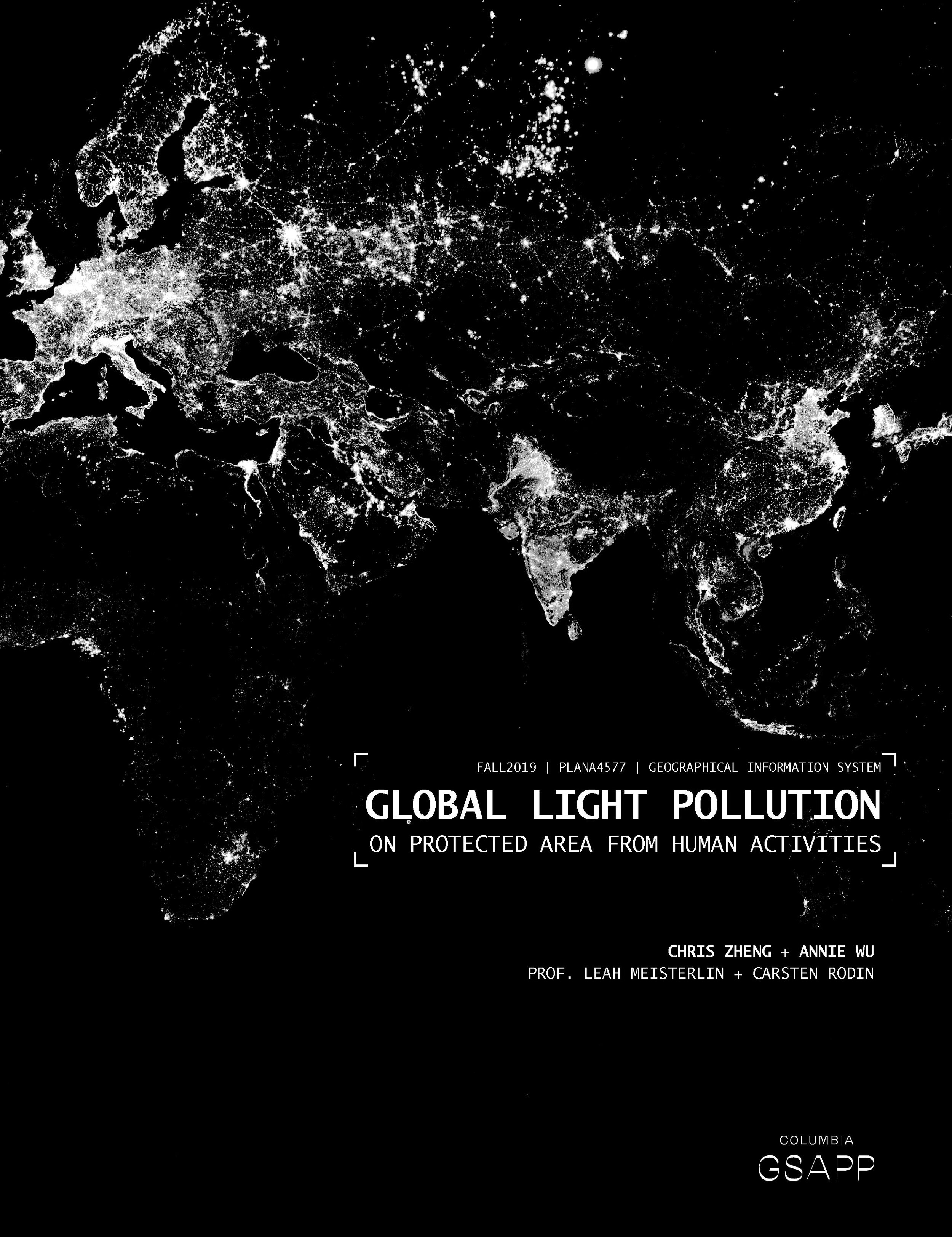
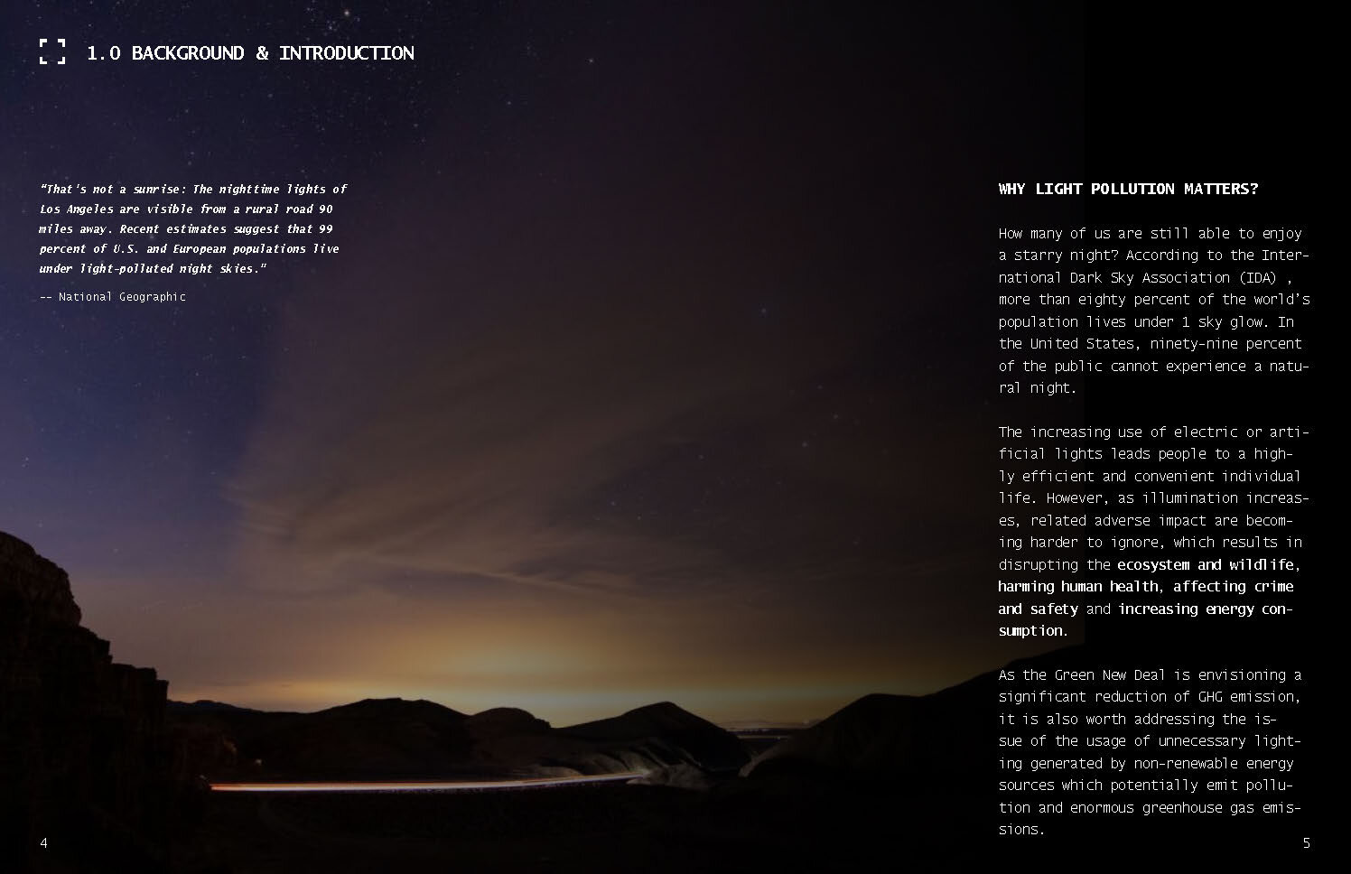
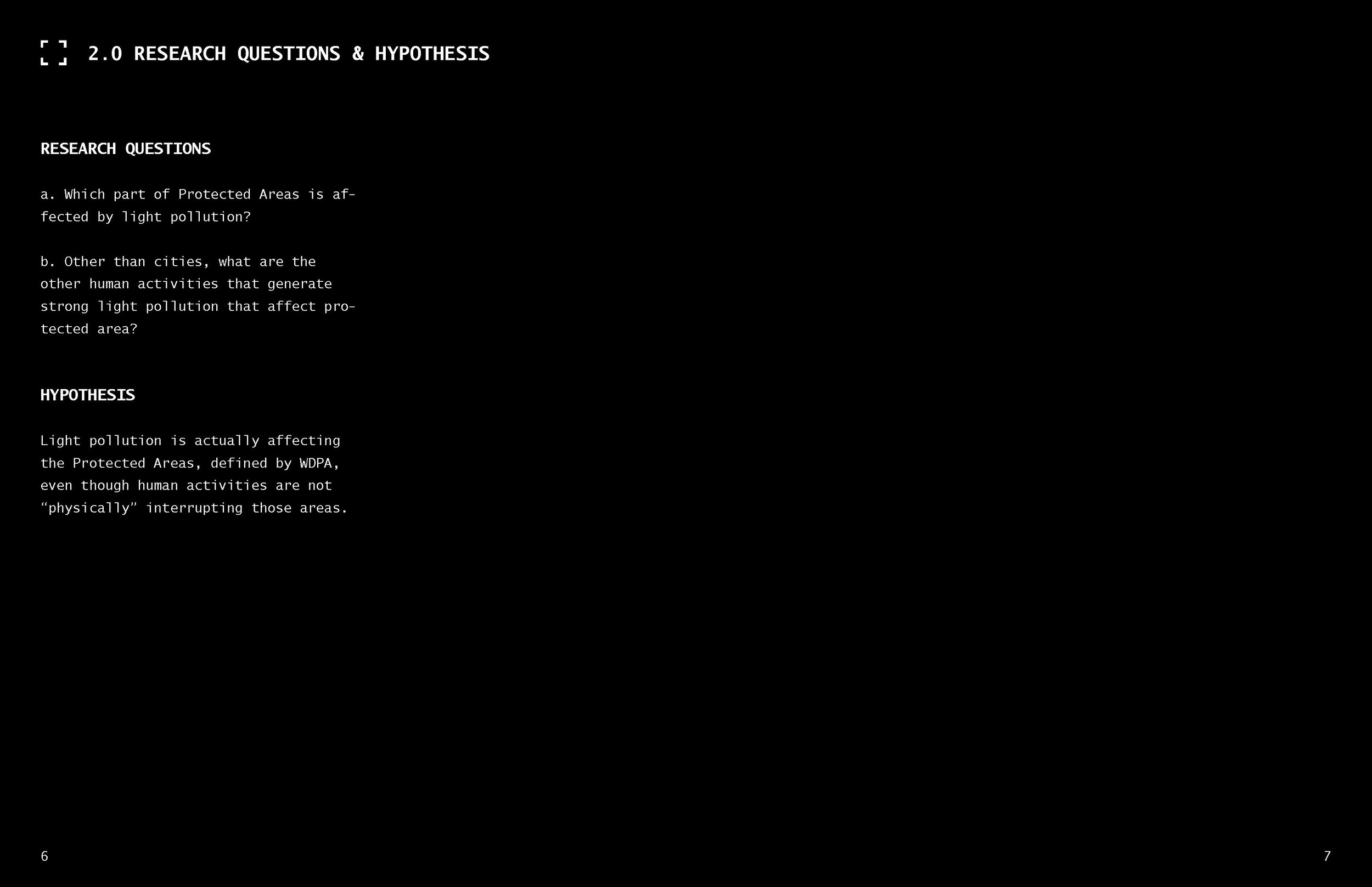
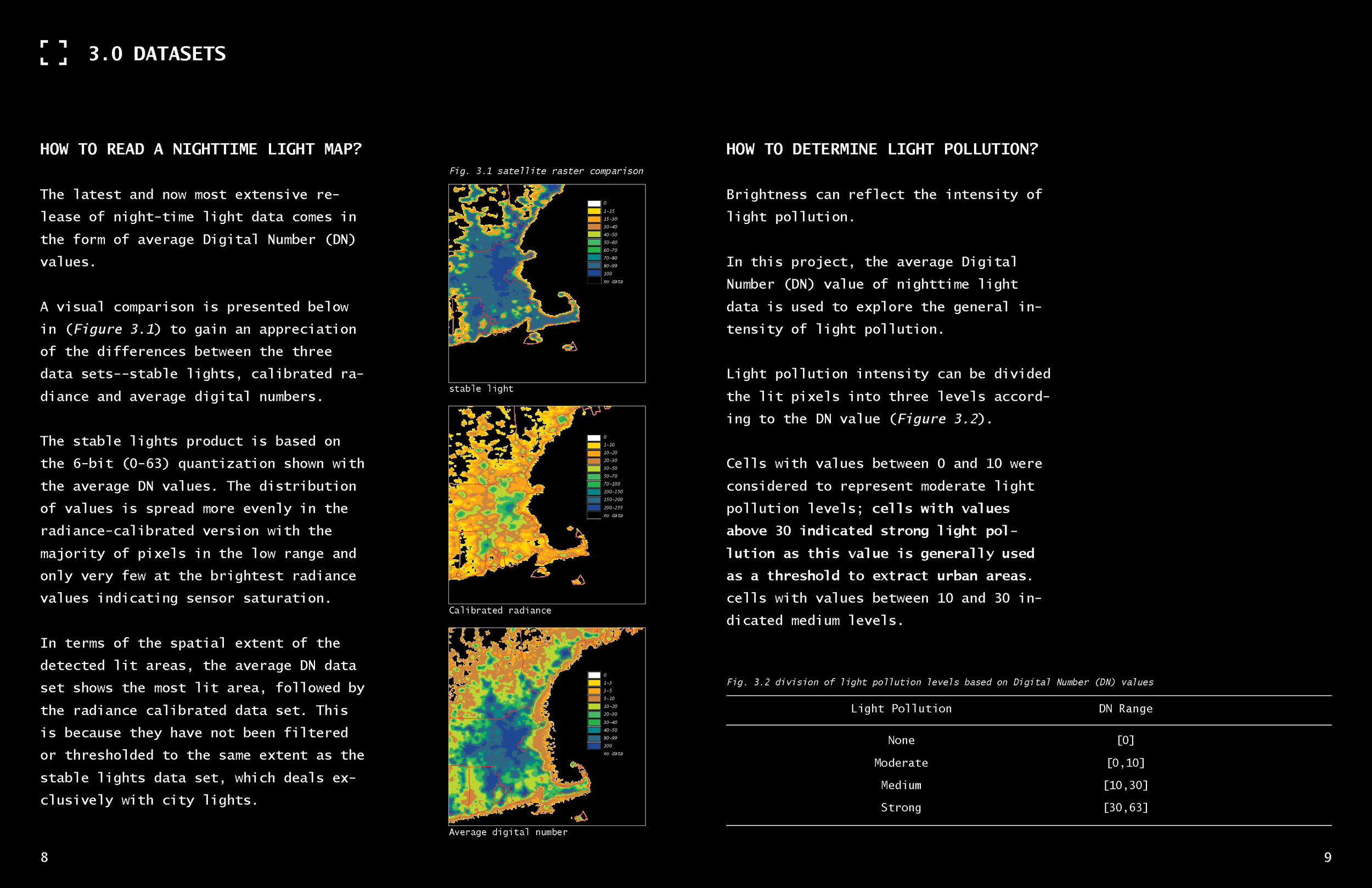
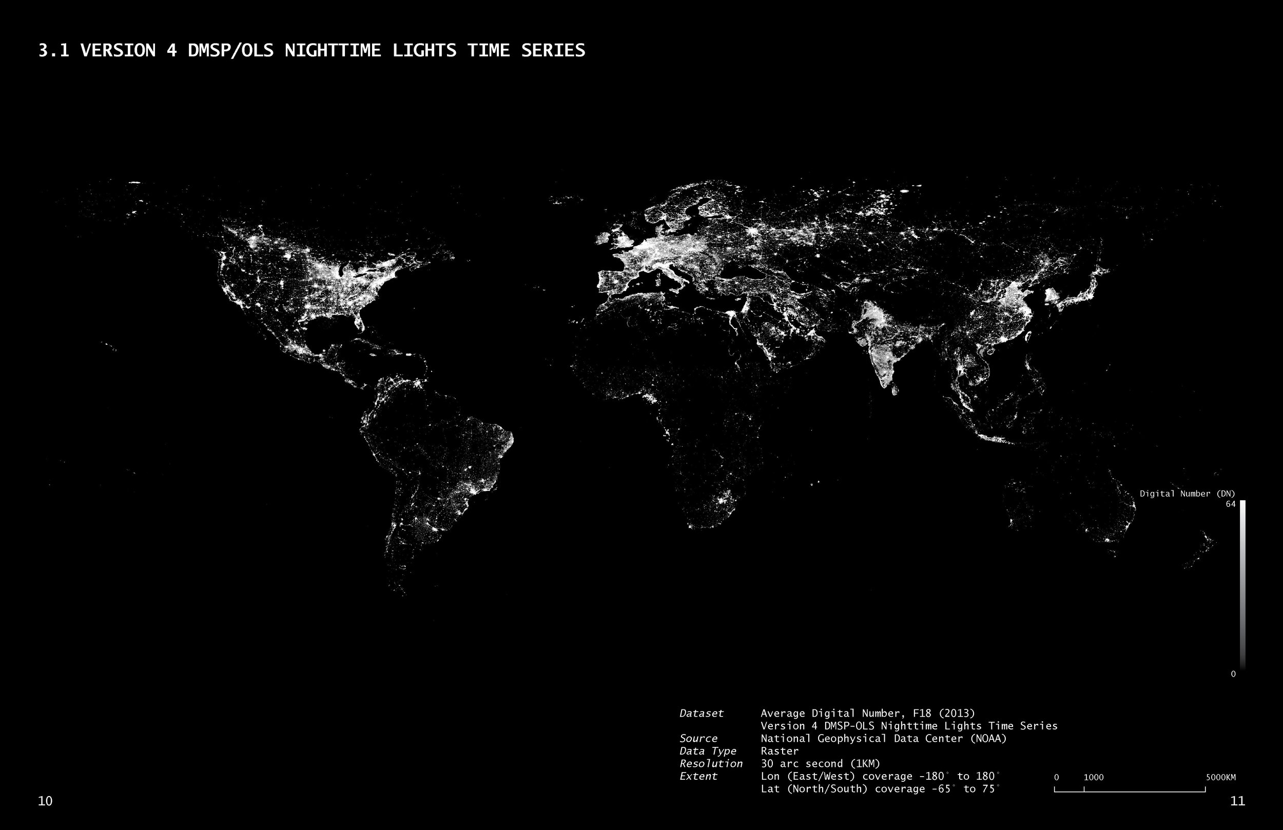
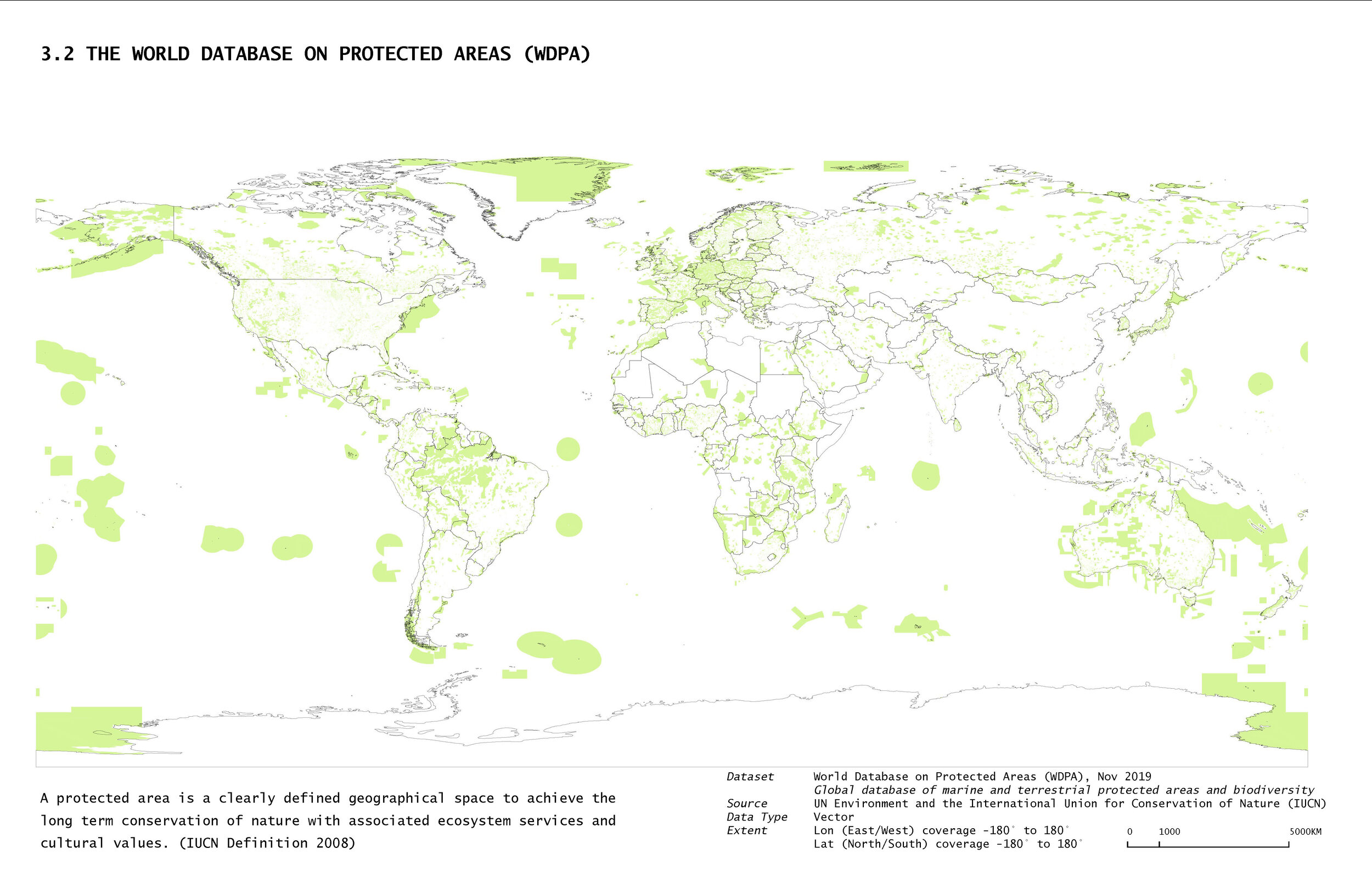
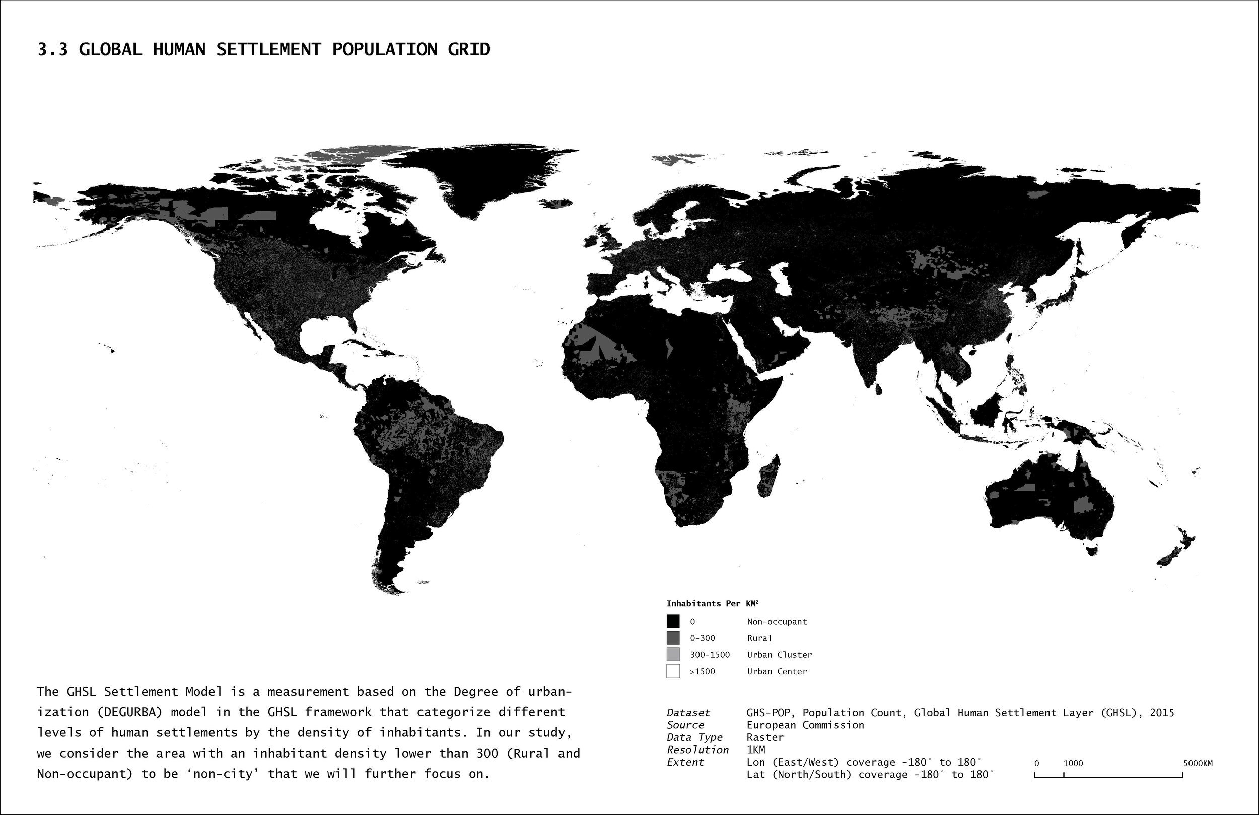
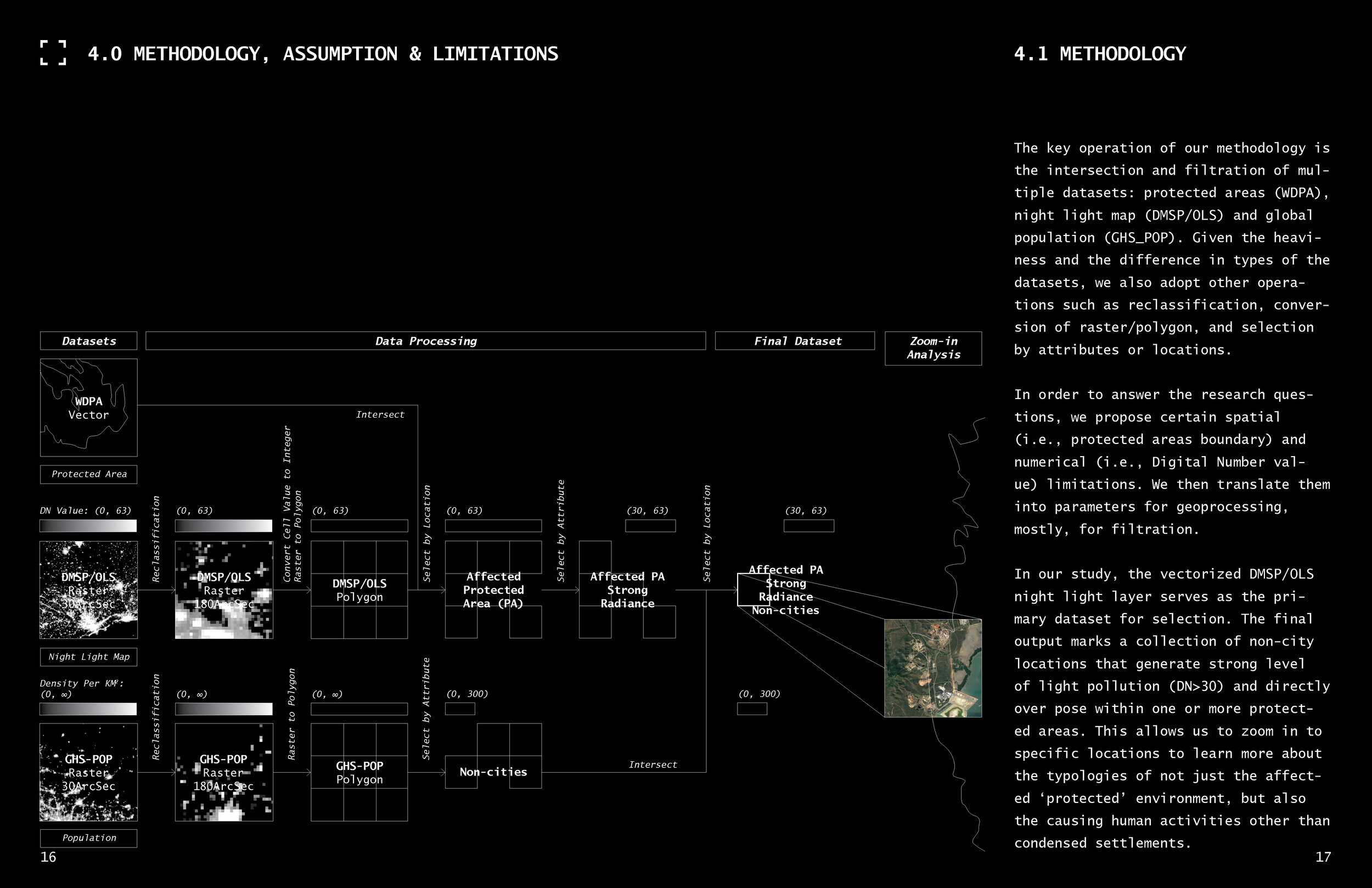
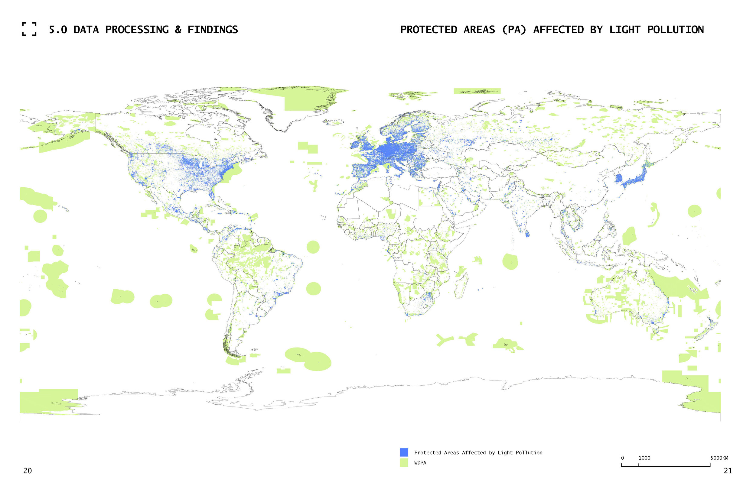
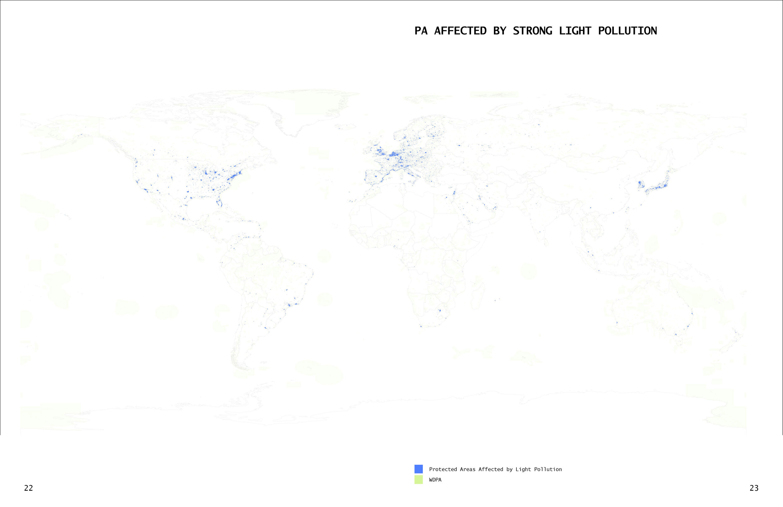
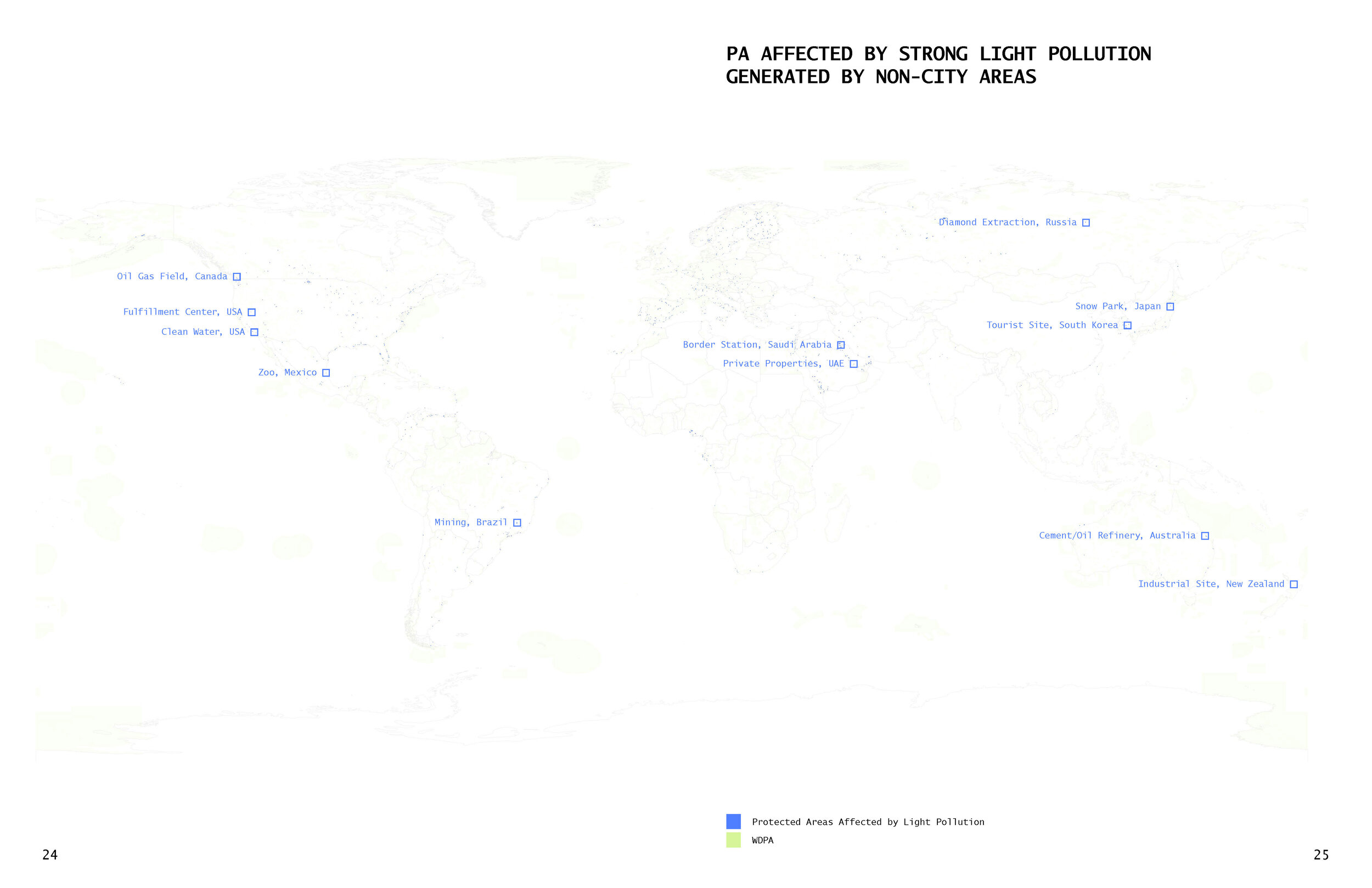
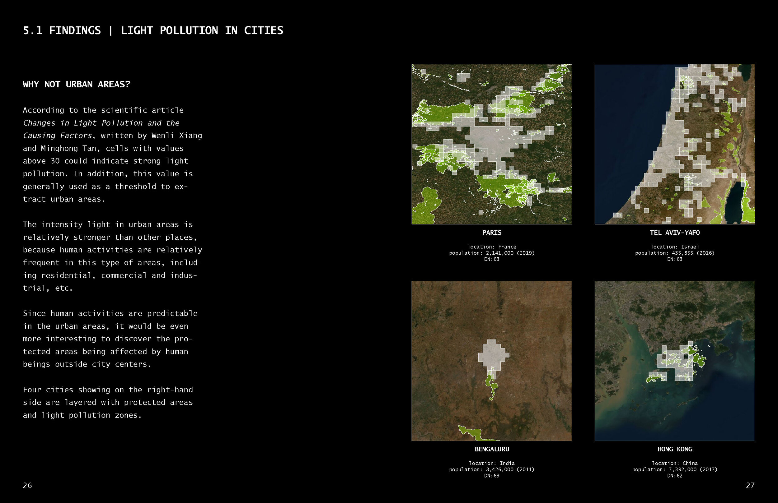
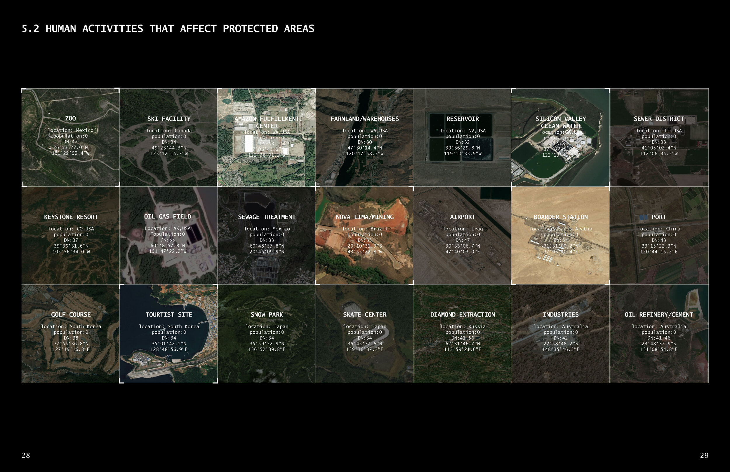
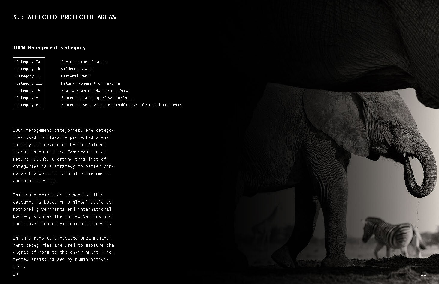
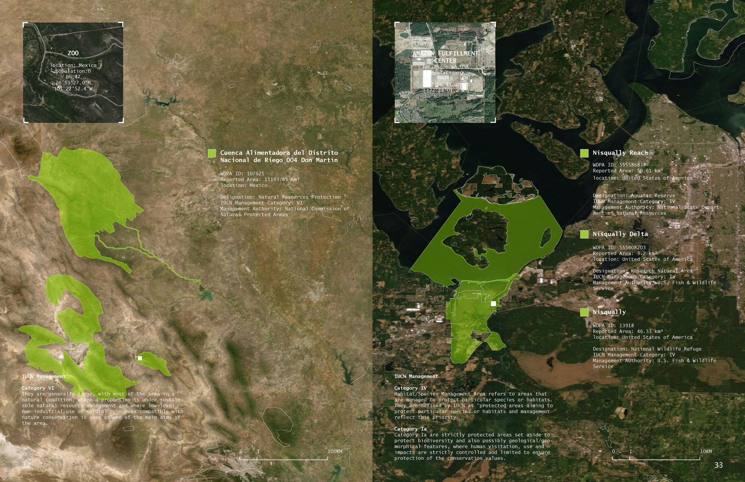
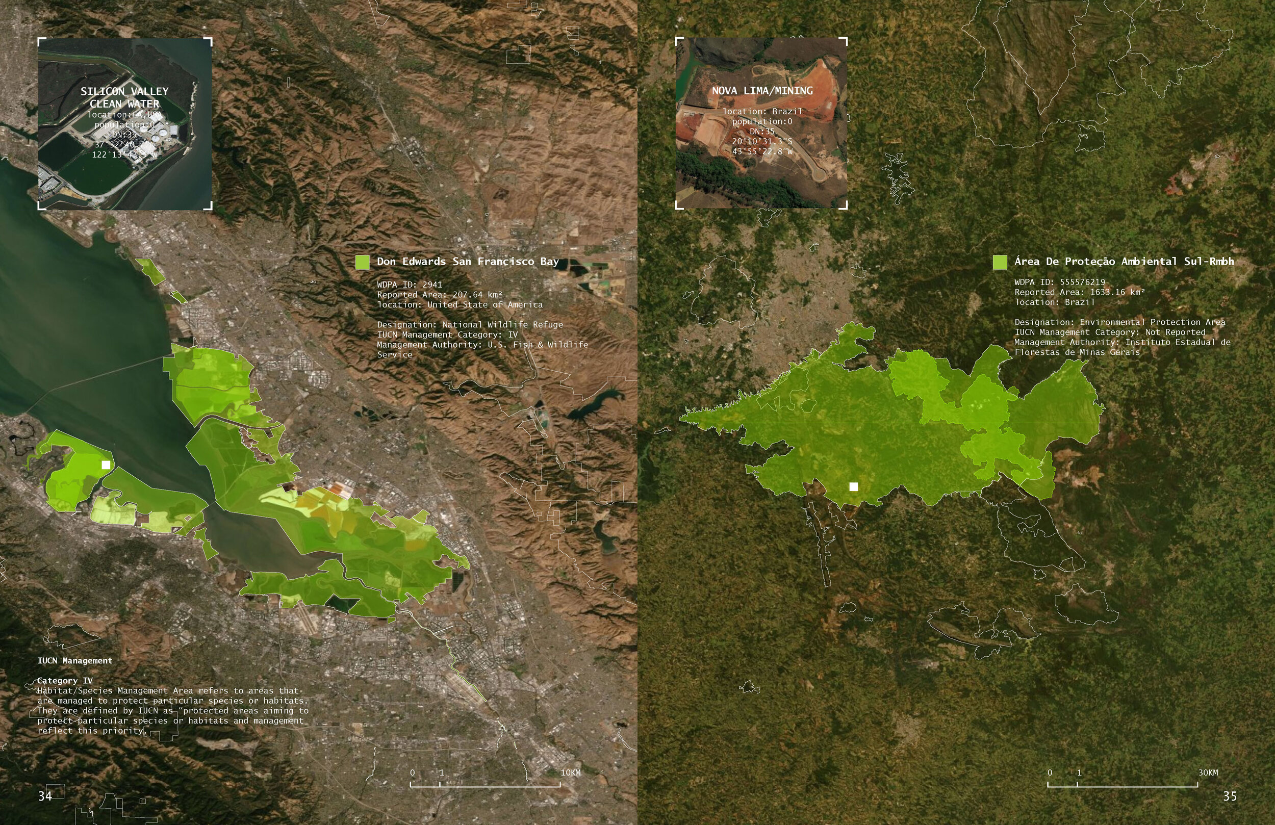
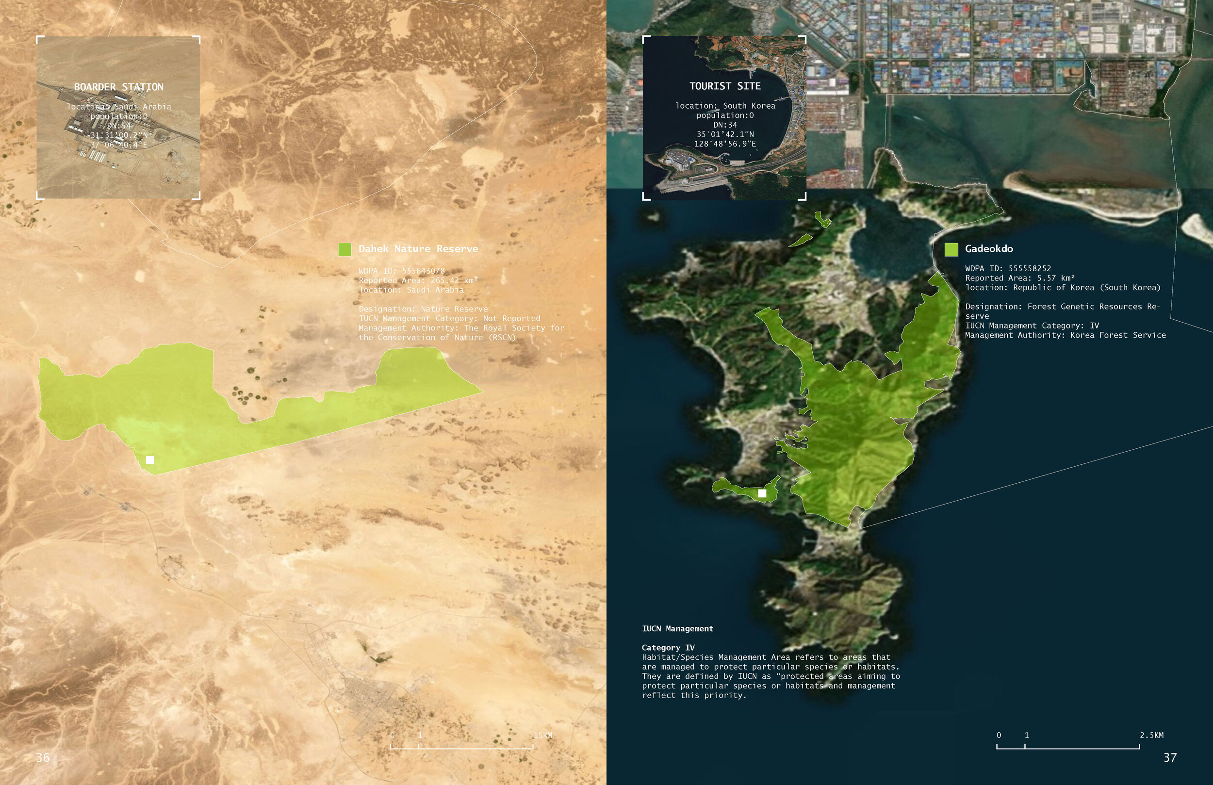

Chris Zheng and Annie Wu. “Global Light Pollution on Protected Areas from Human Activities.” (Fall 2019)
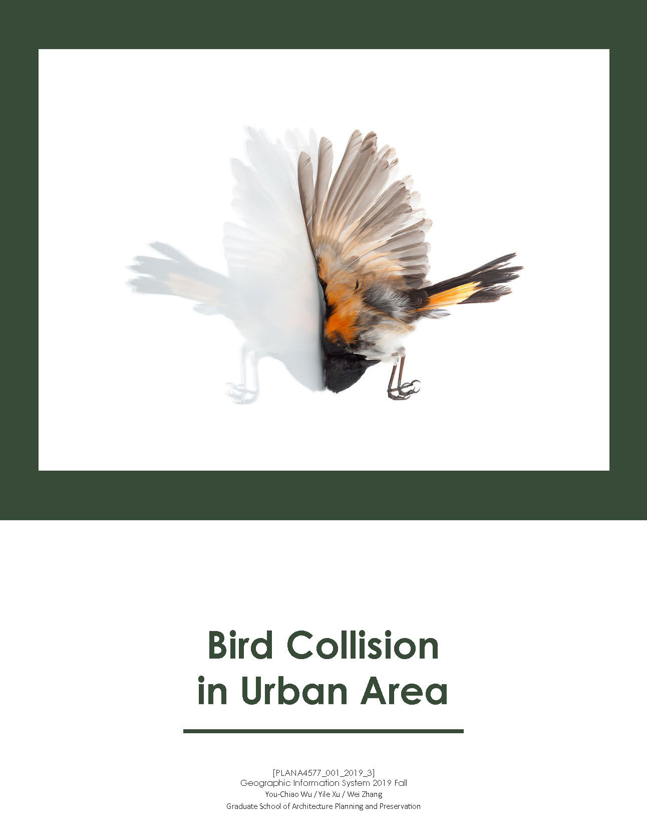
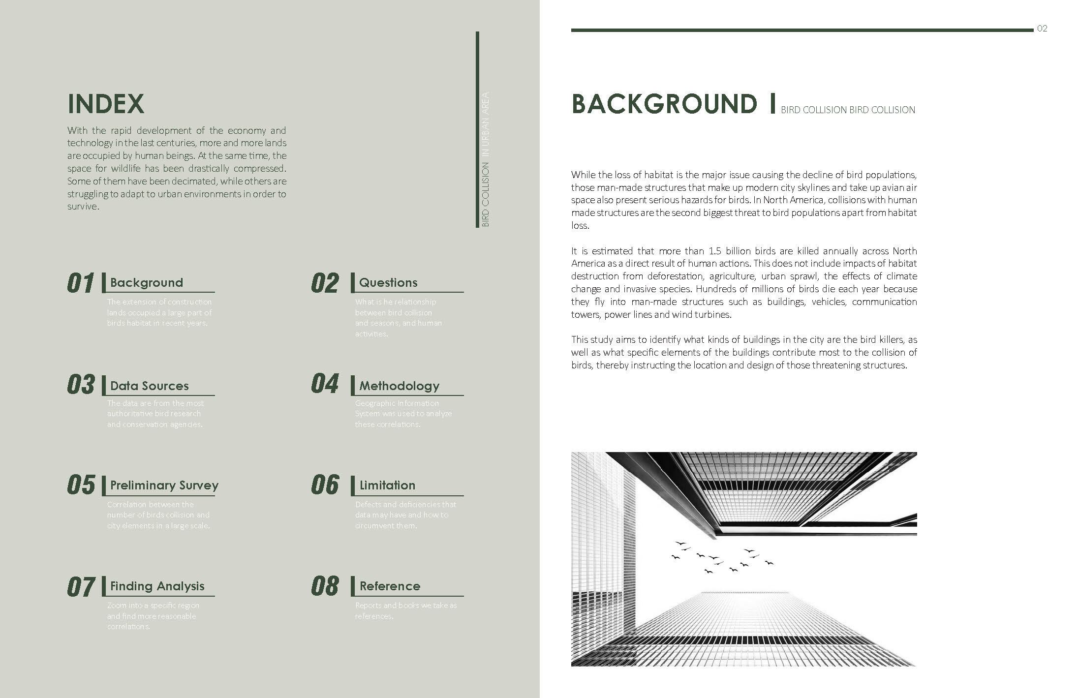
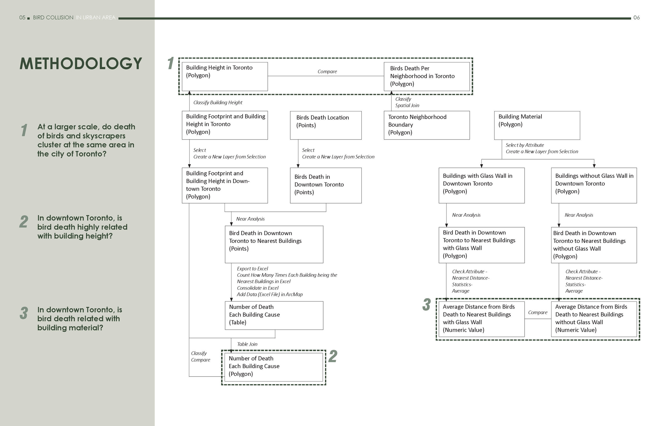
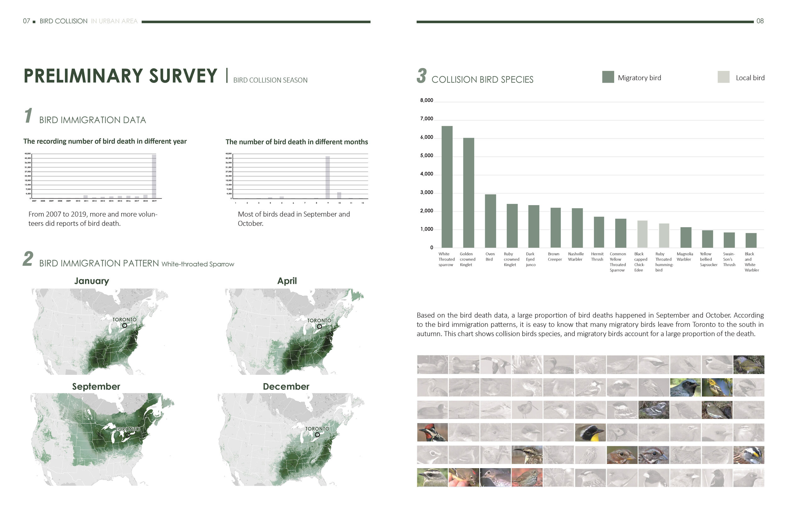
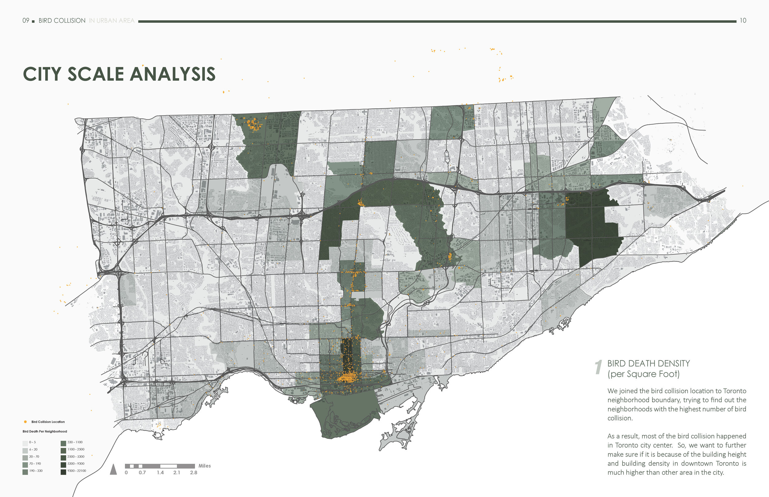
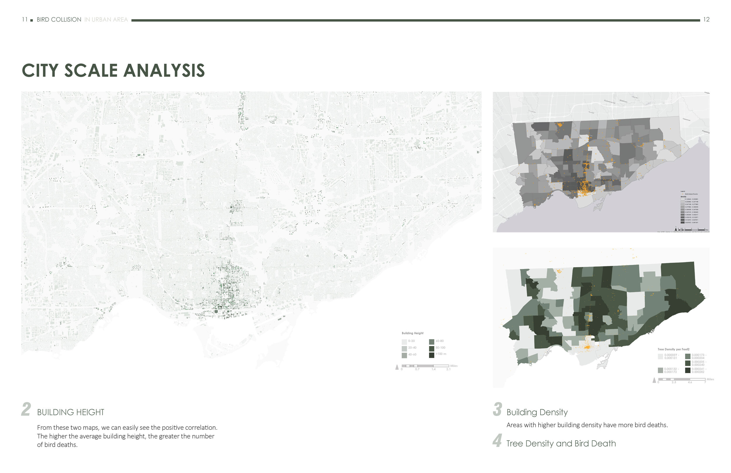
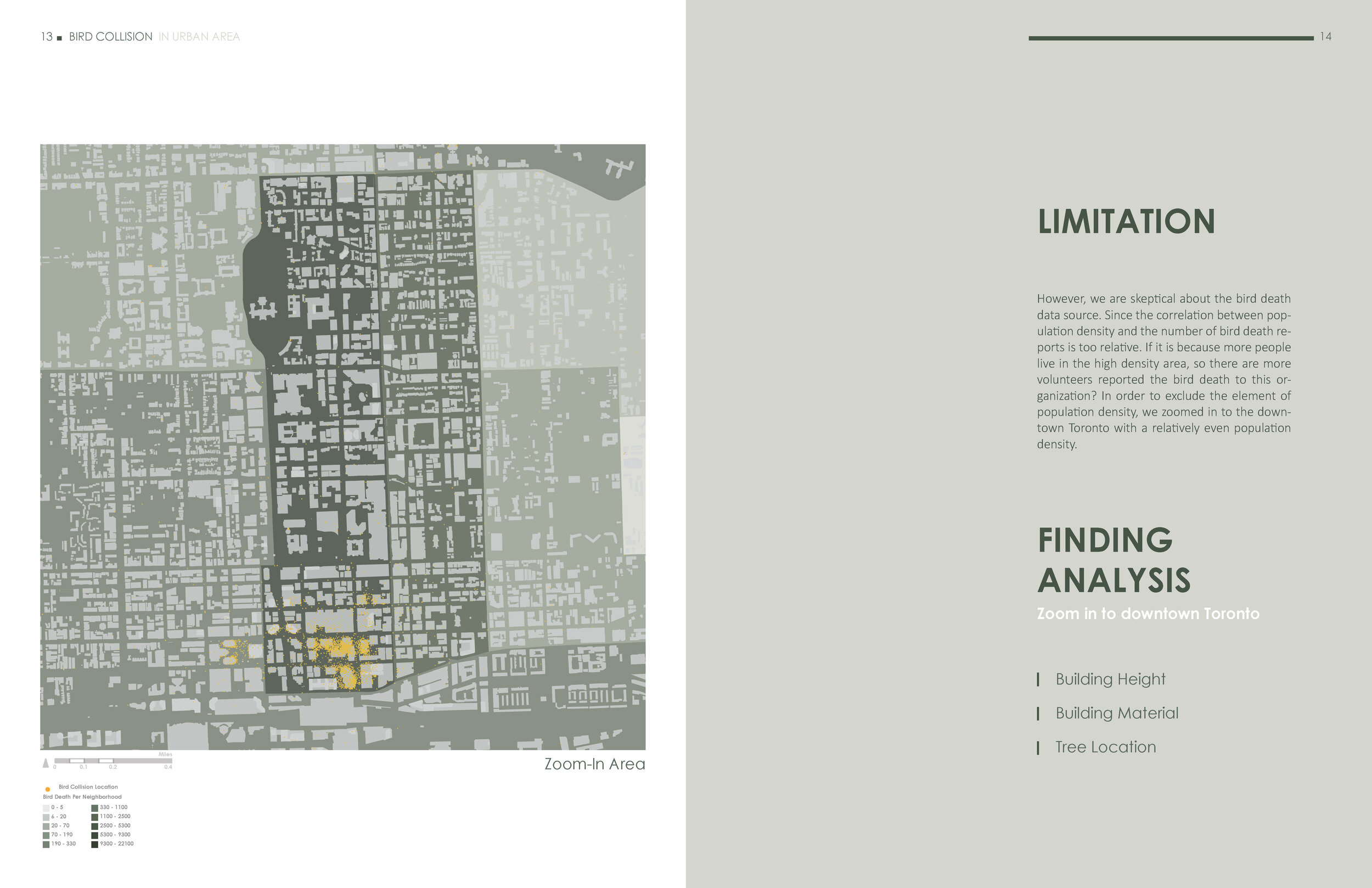
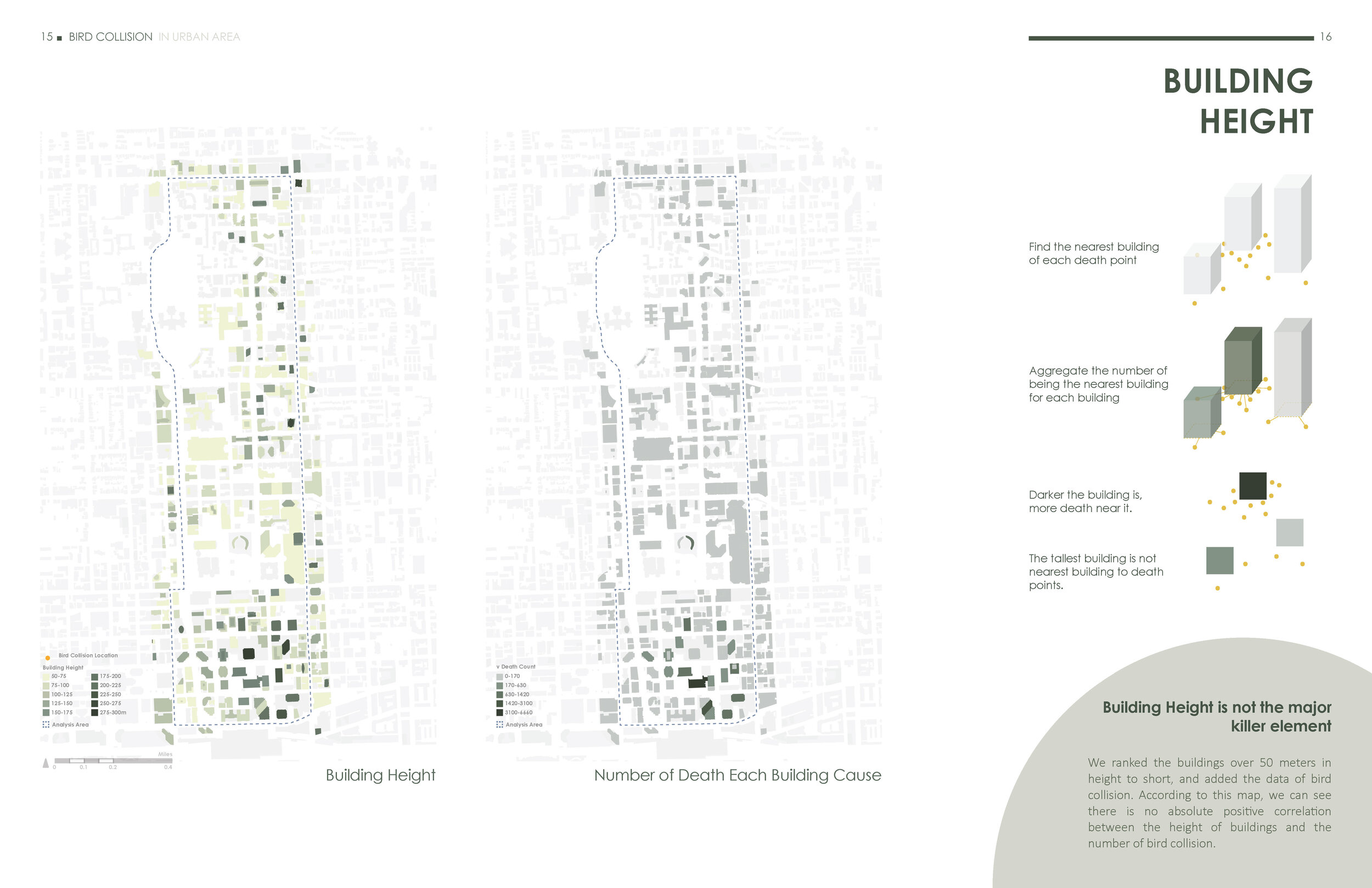
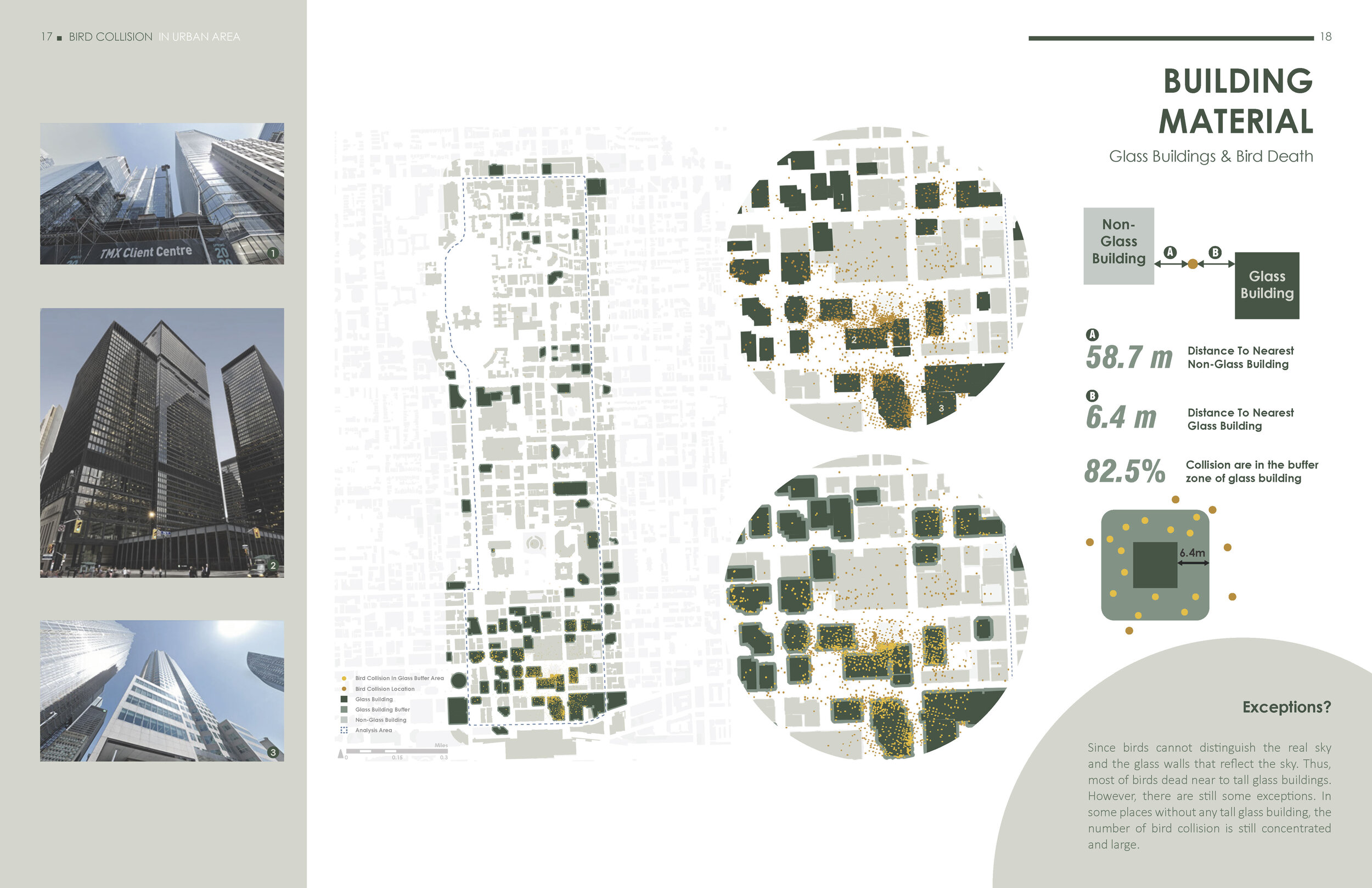
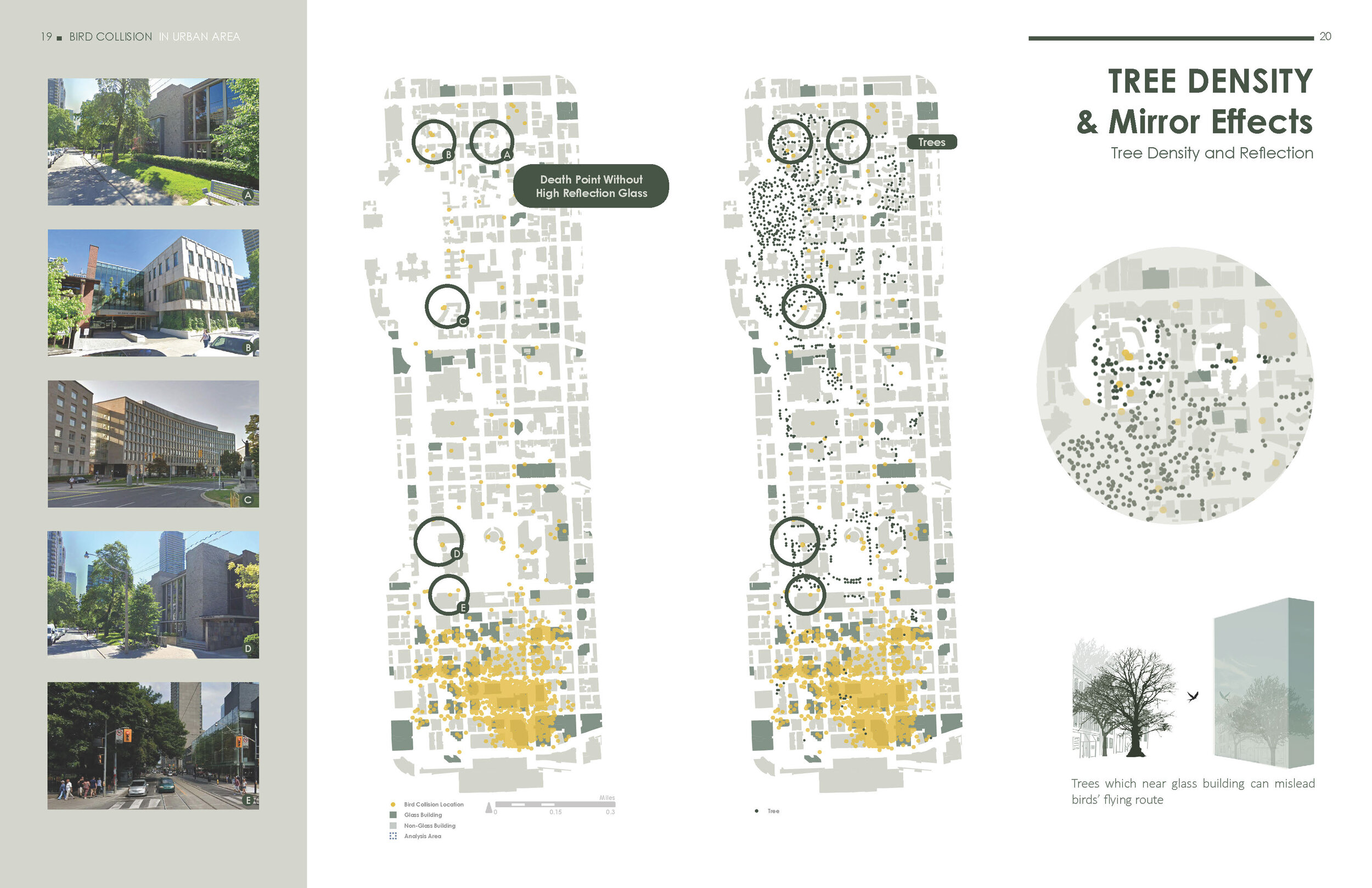
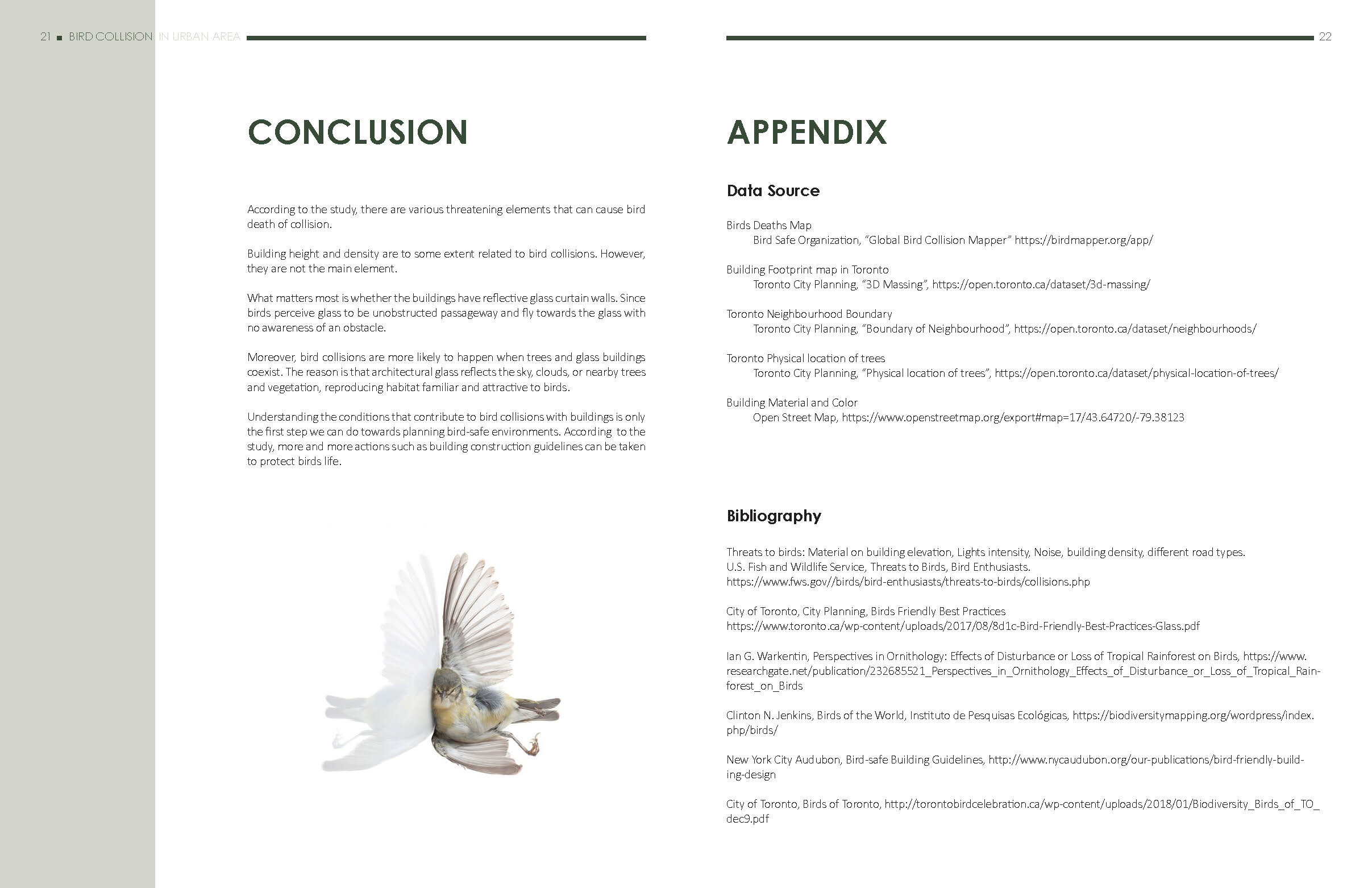
You-Chiao Wu, Yile Xu, and Wei Zhang. “Bird Collisions in Urban Areas.” (Fall 2019)
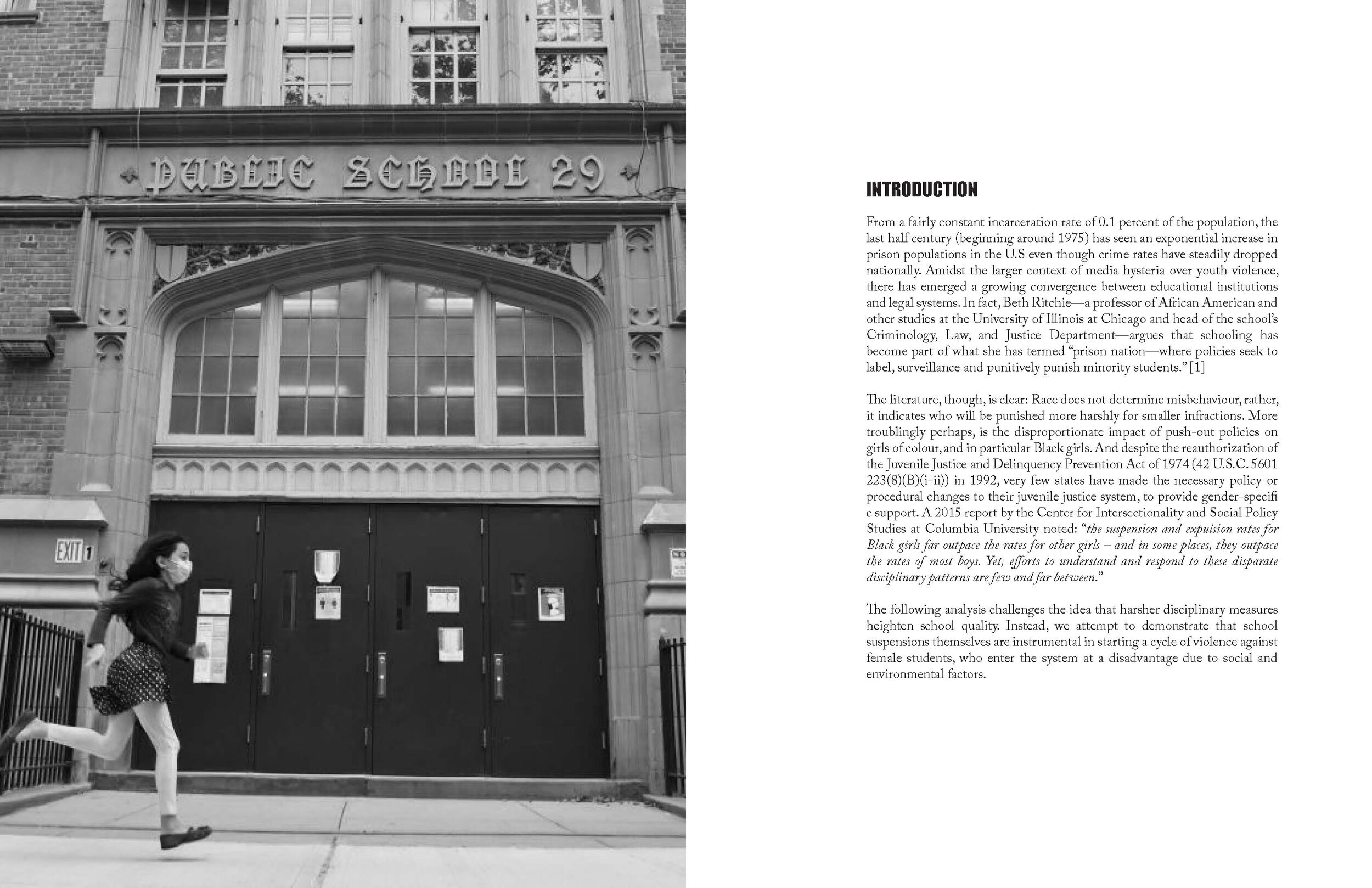
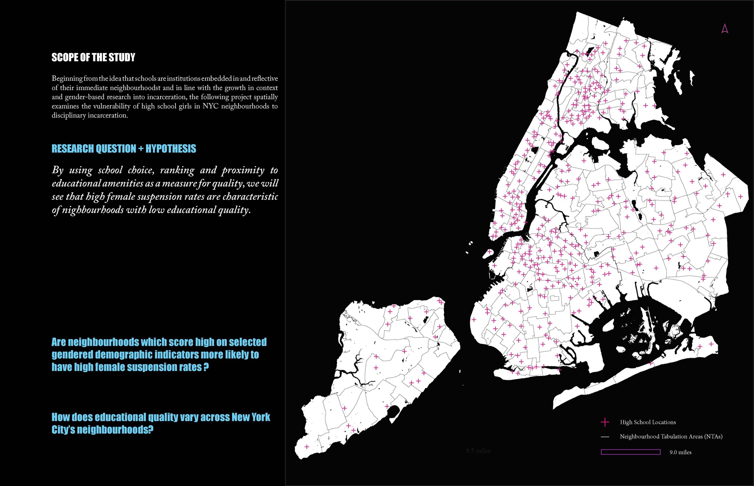
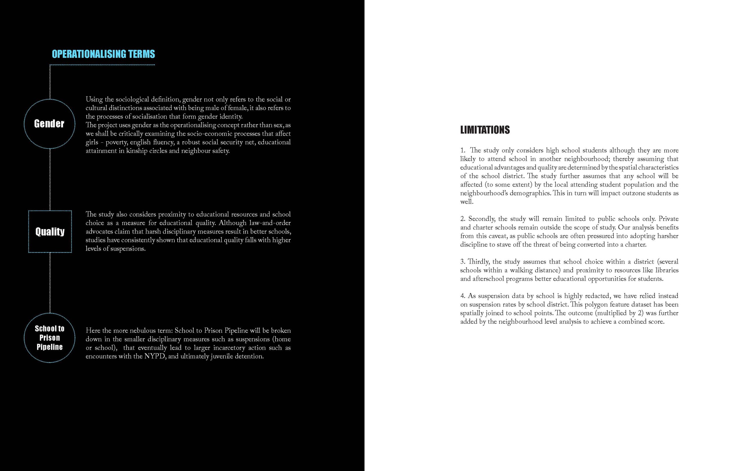
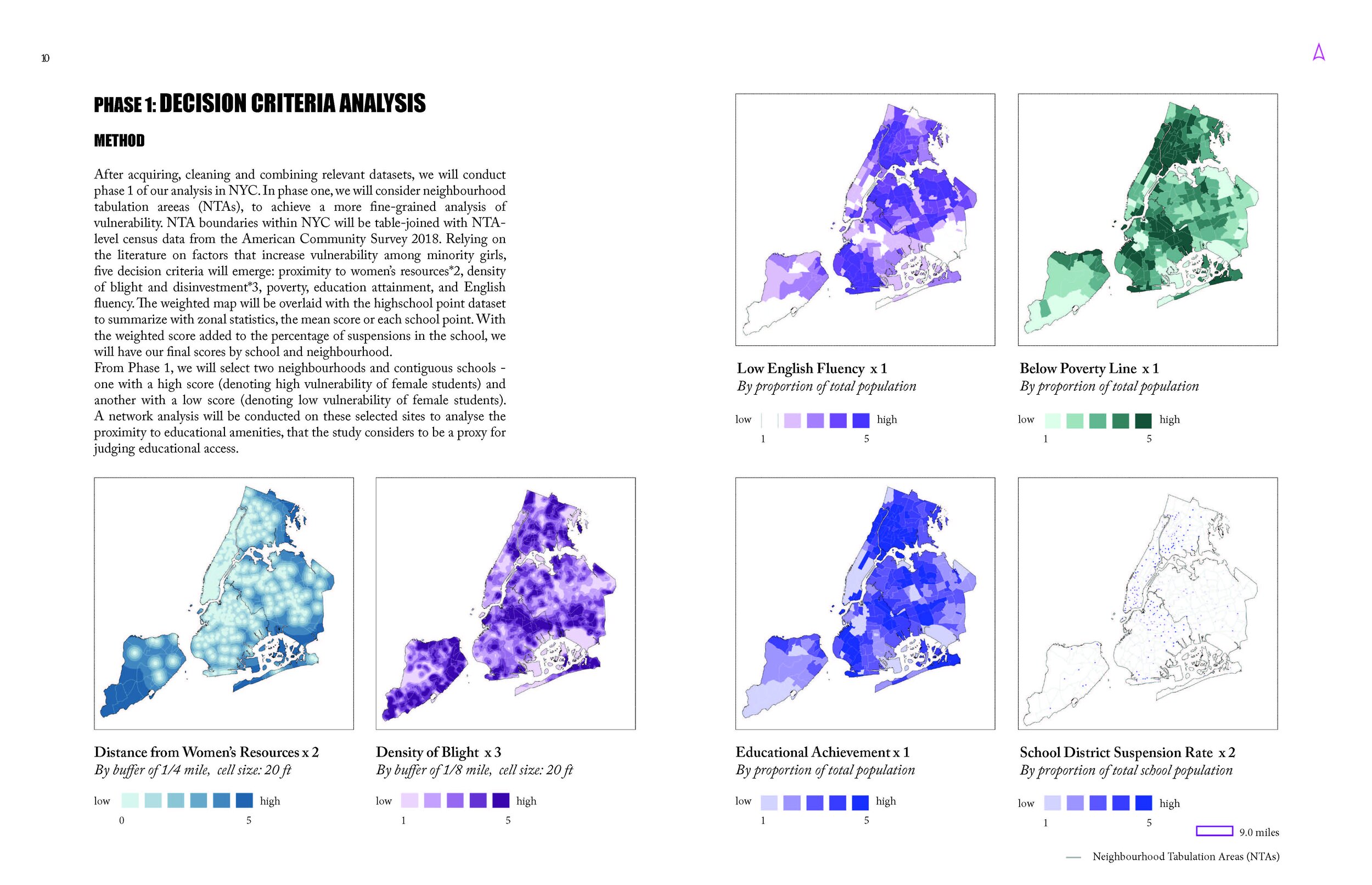
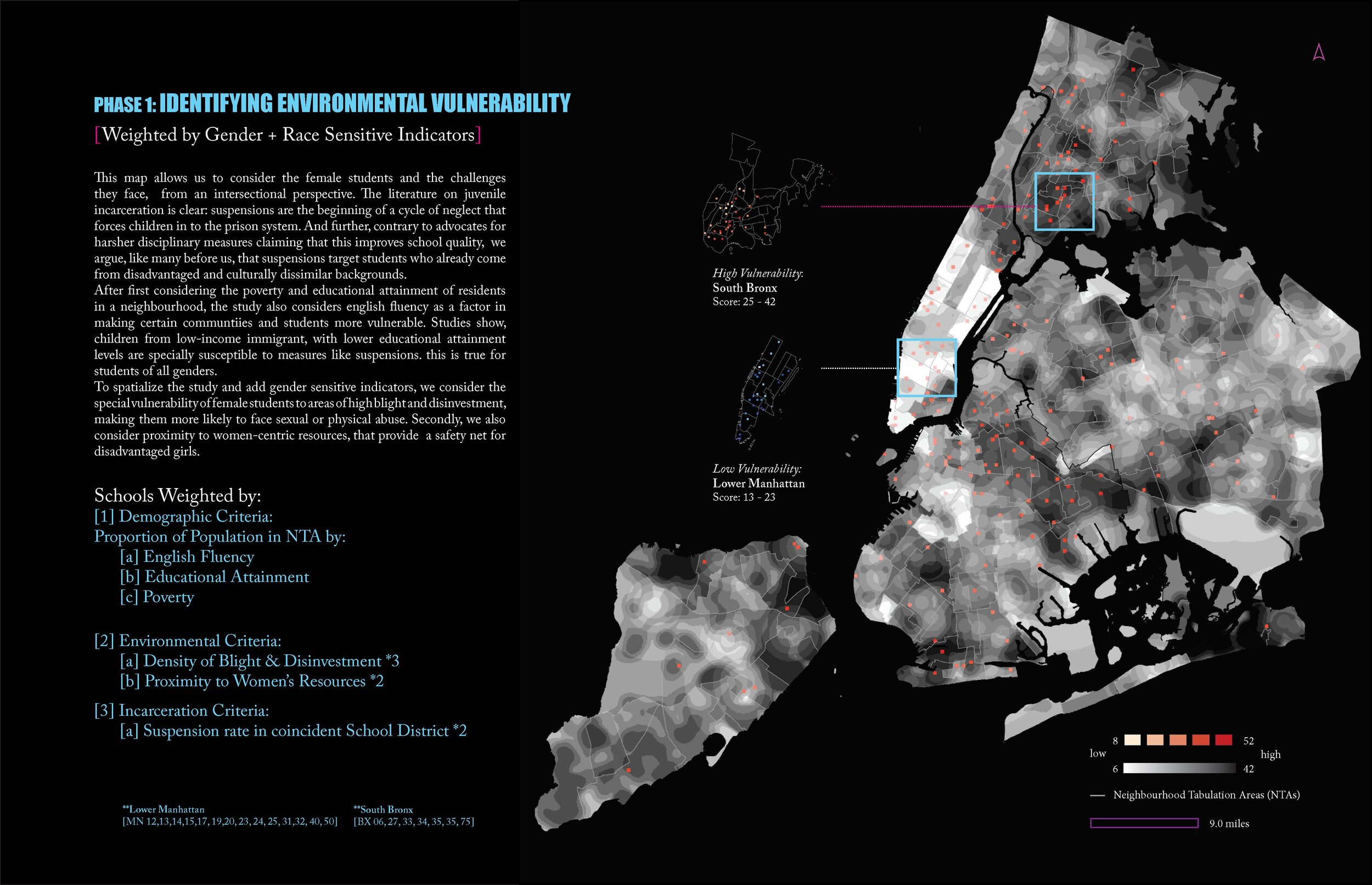
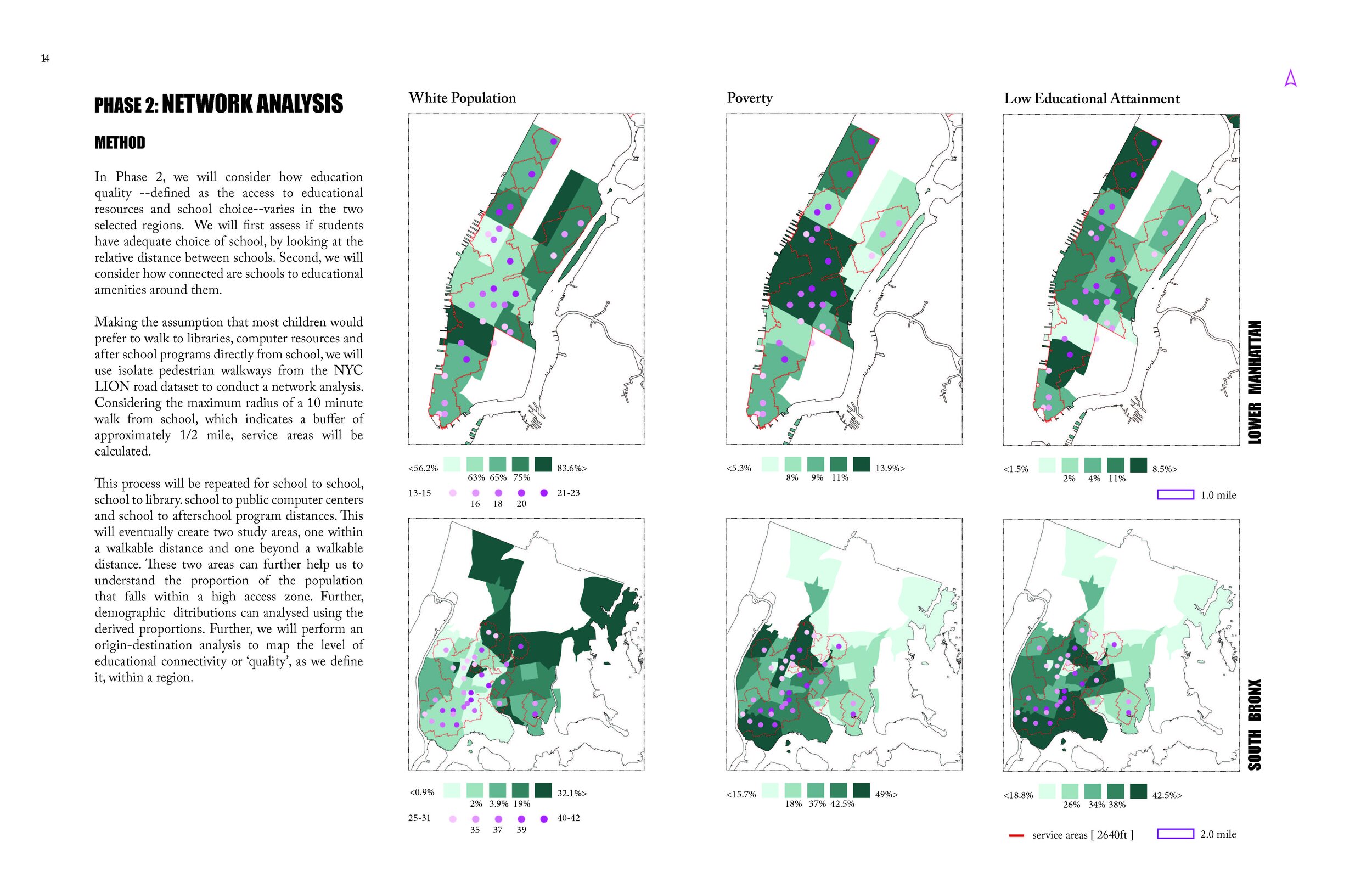
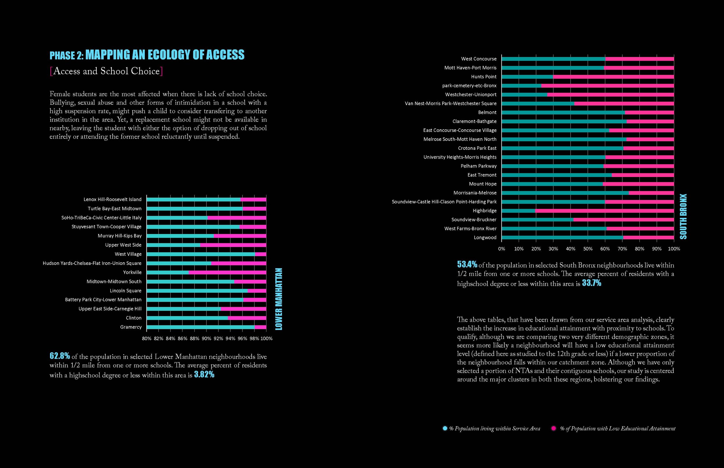
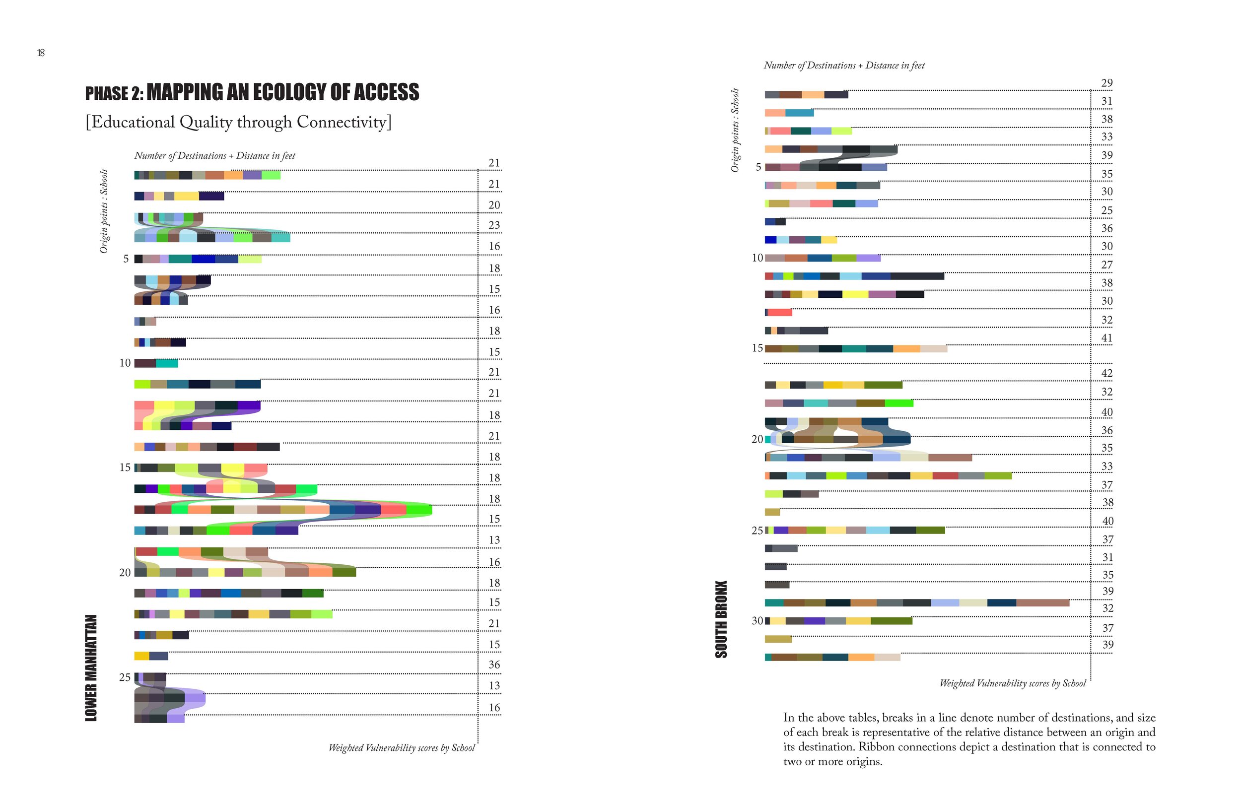
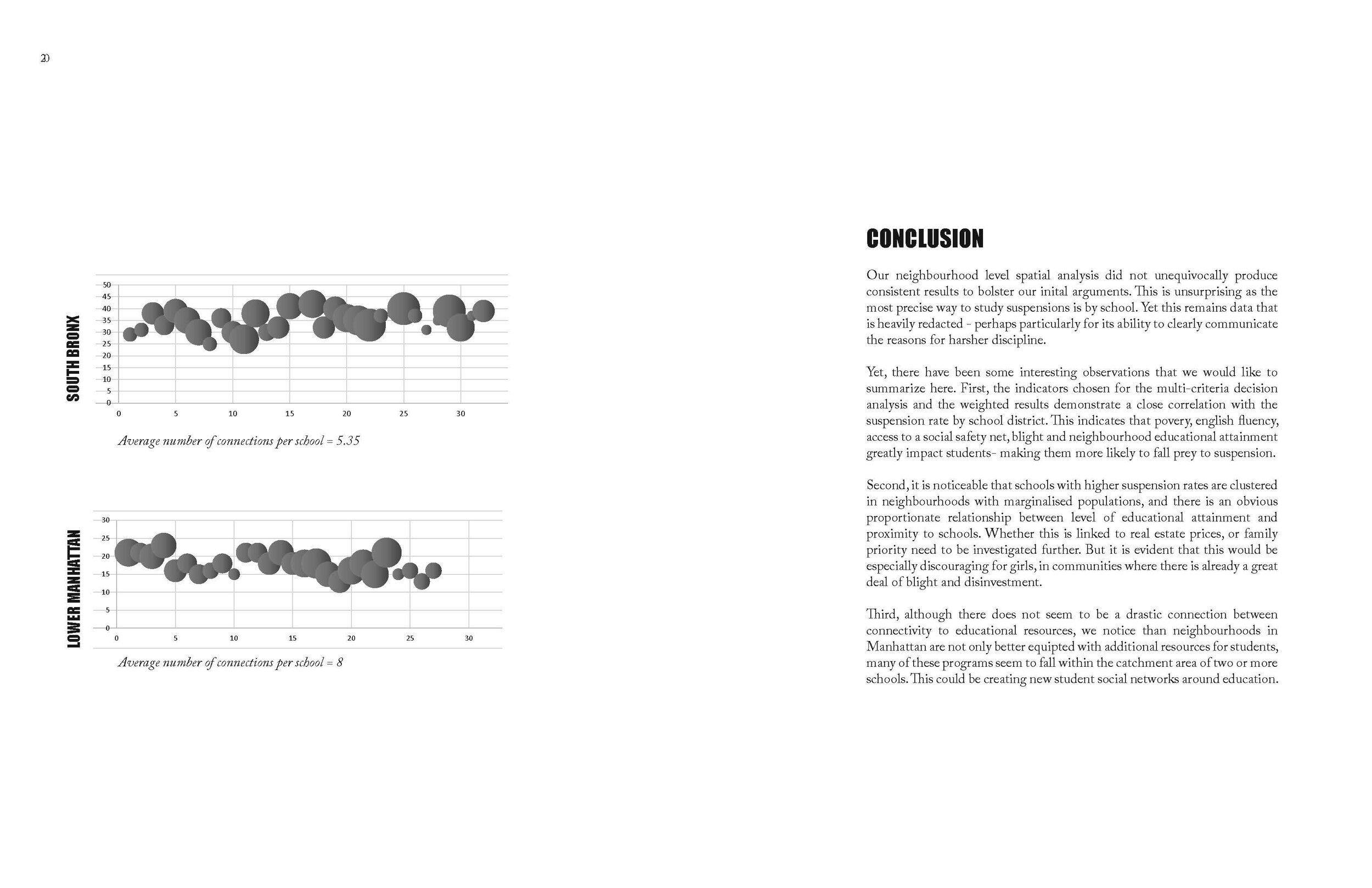
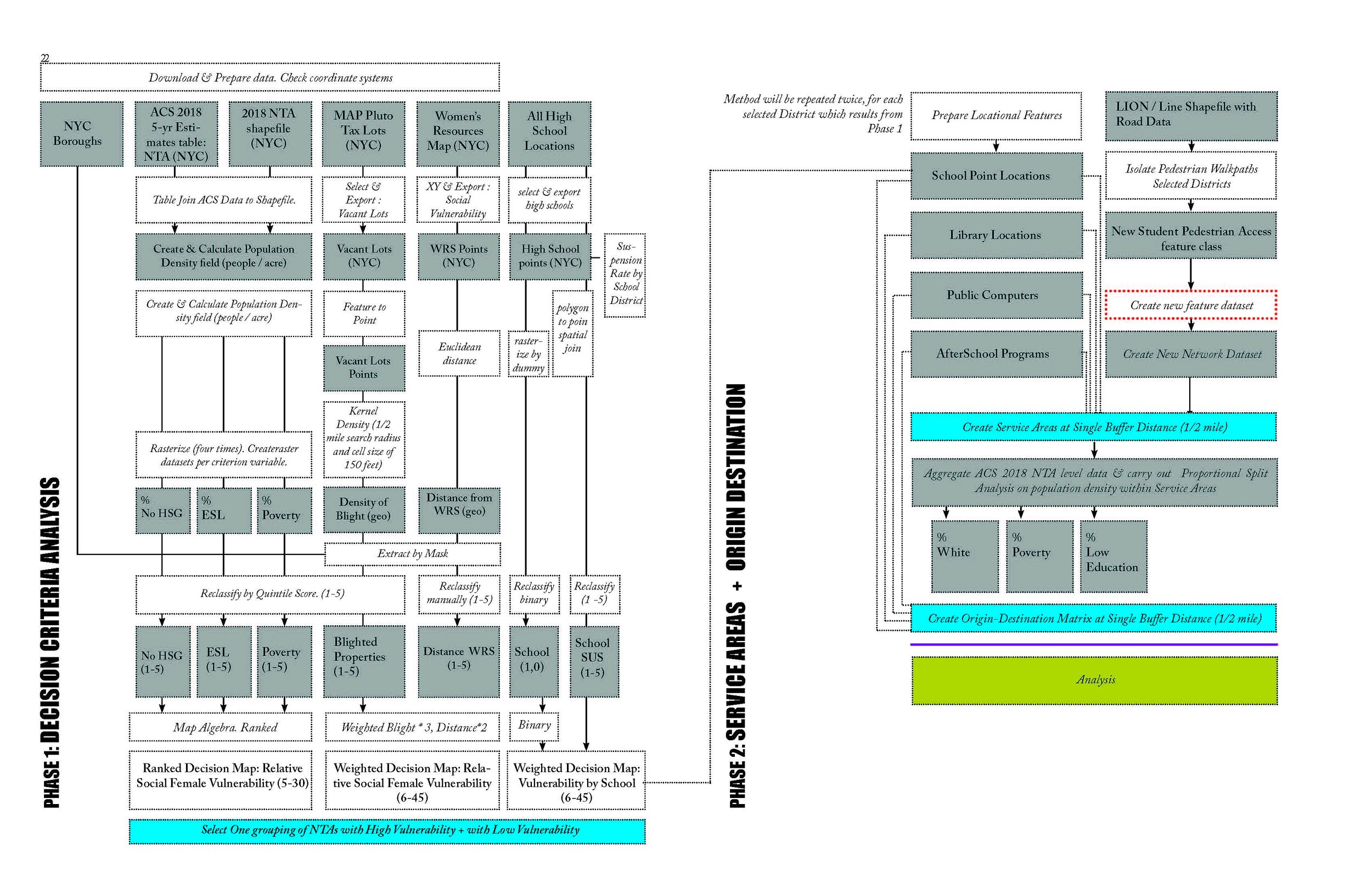

Ranjani Srinivasan and Nile Meridian Johnson. “Gendering Juvenile Incarceration.” (Fall 2020)
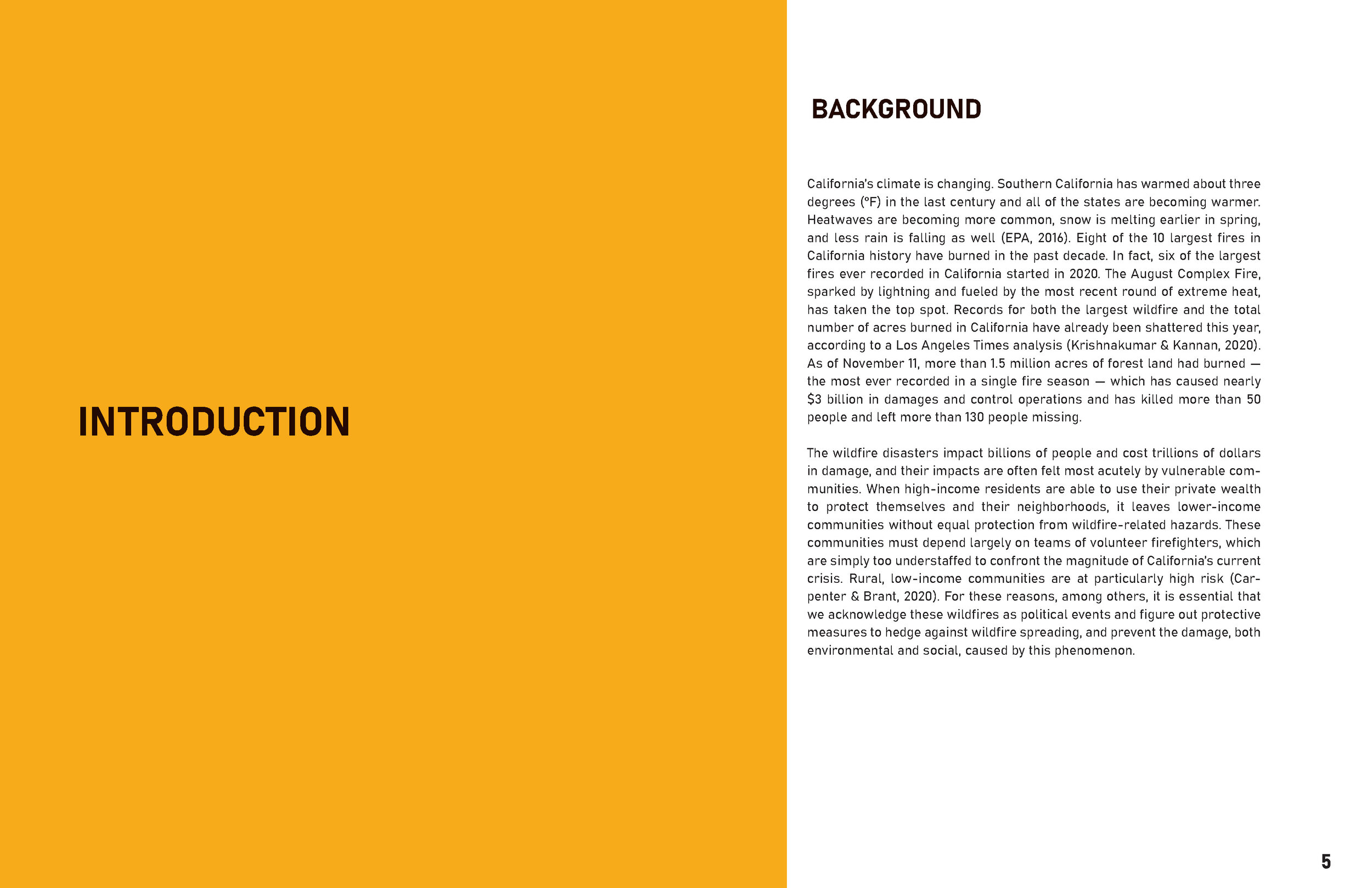
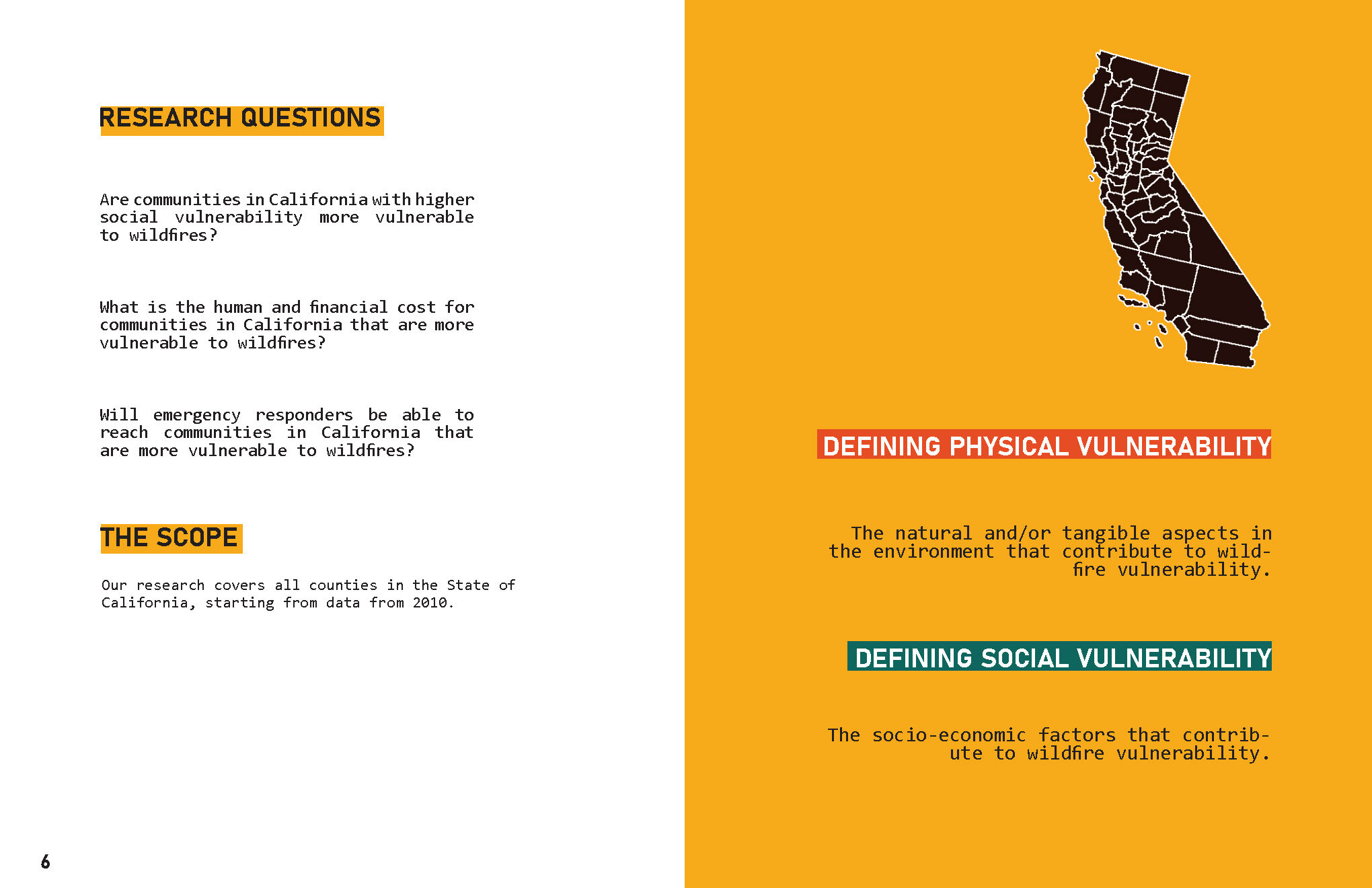
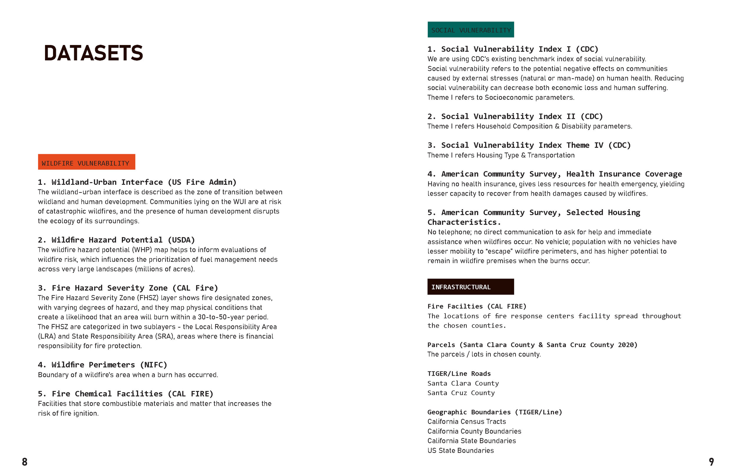
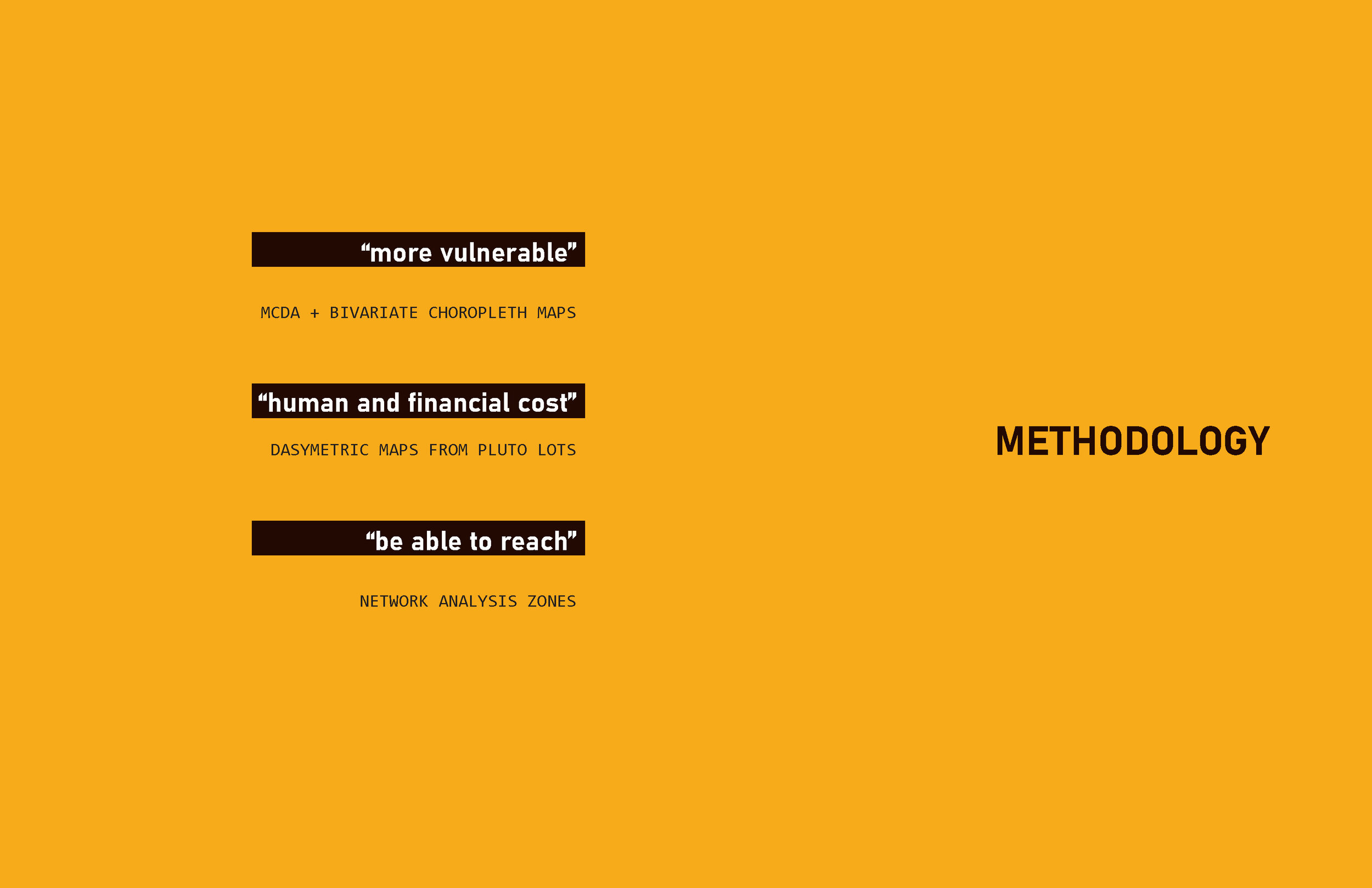
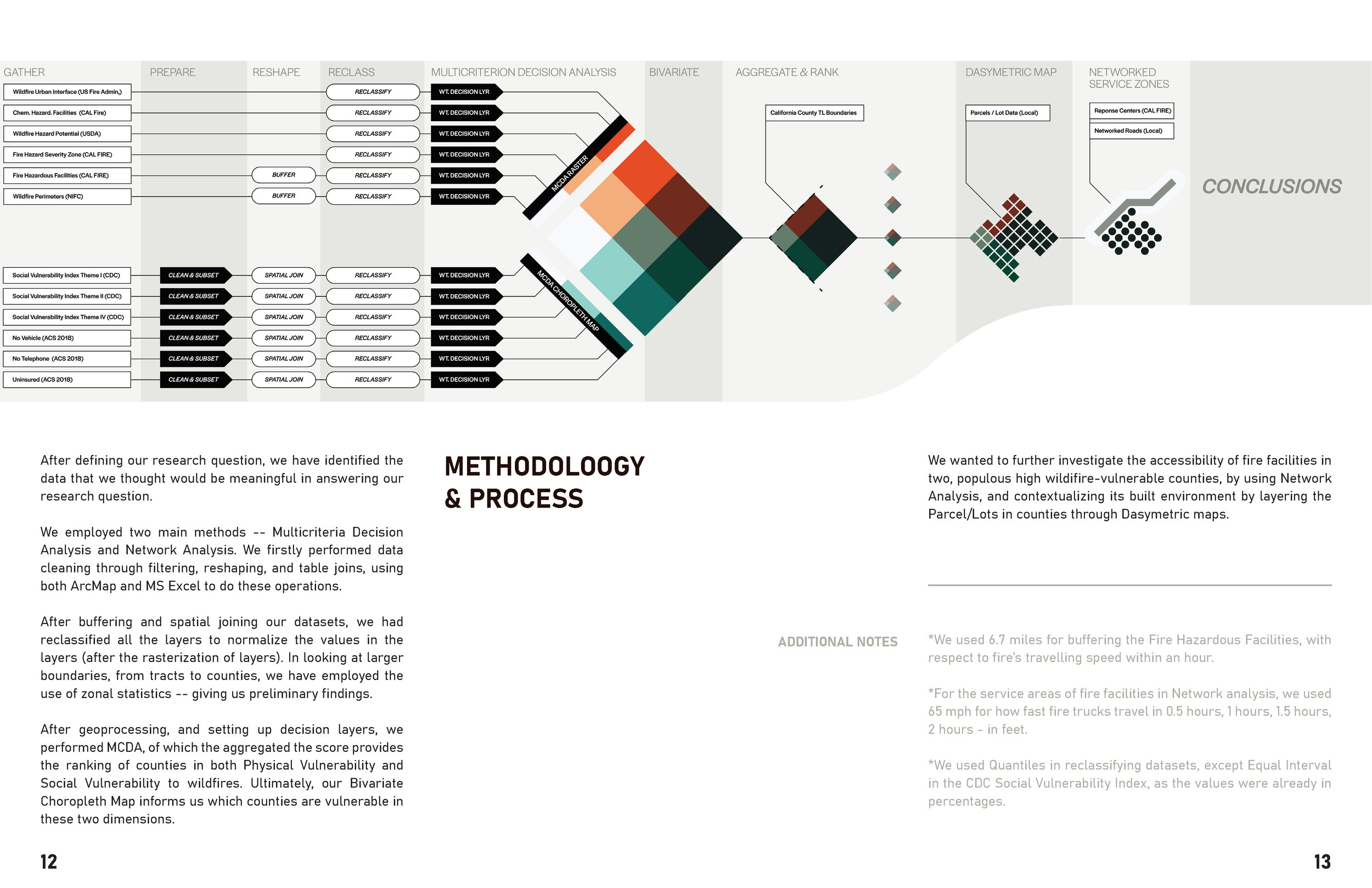
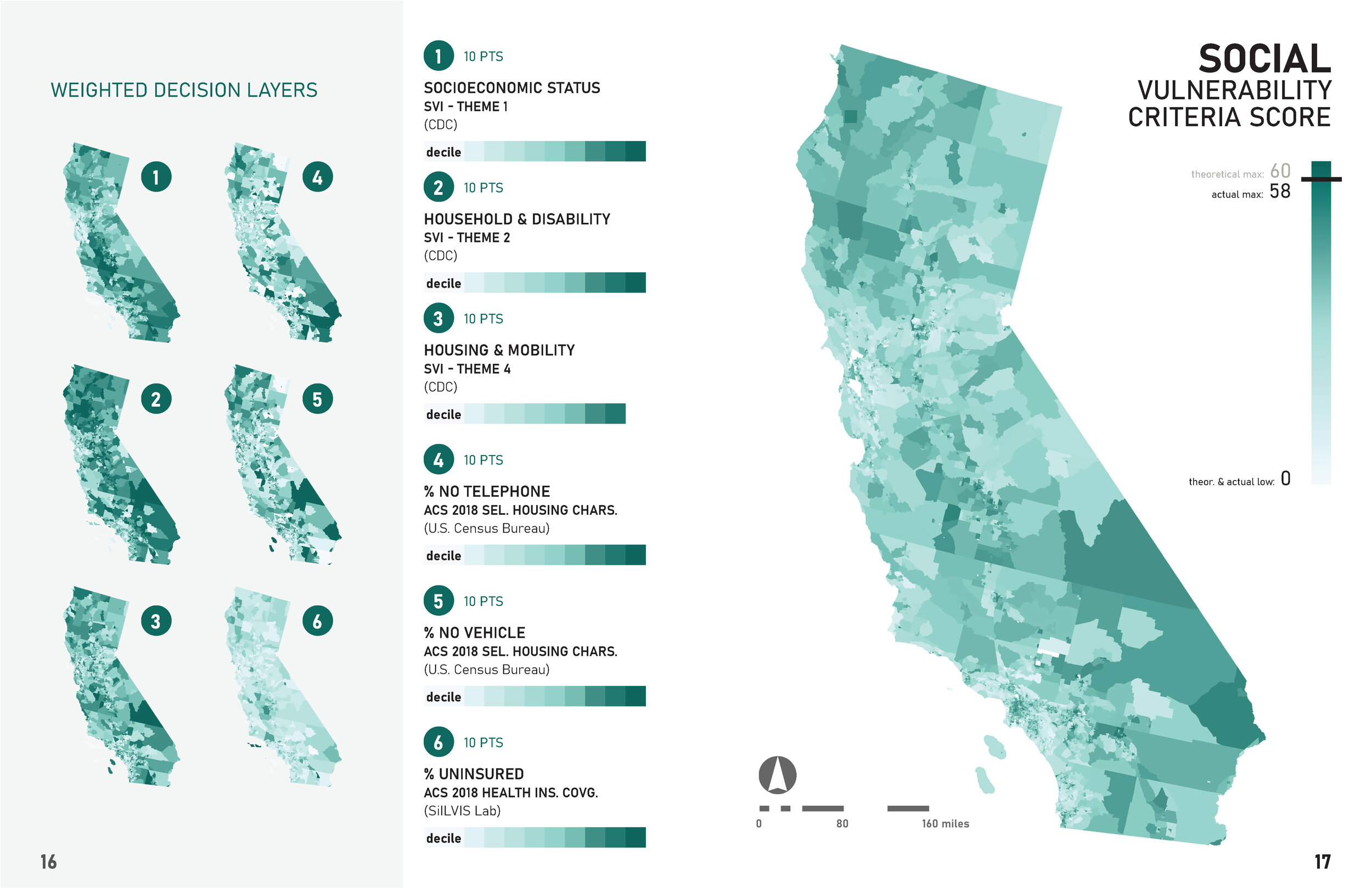
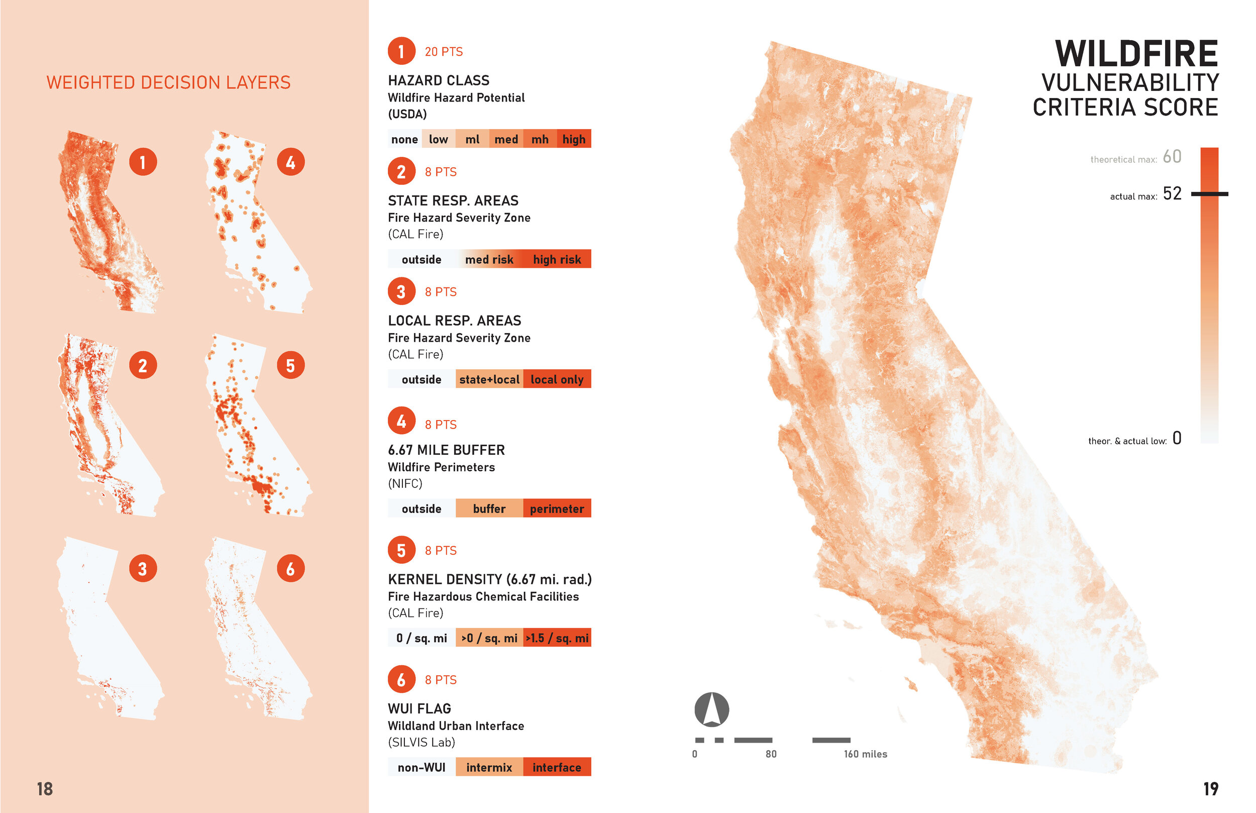
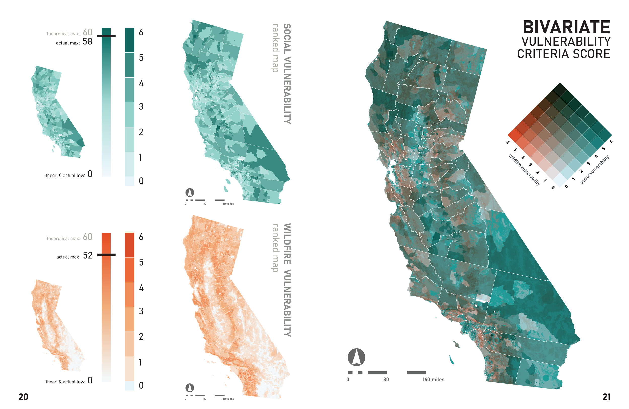
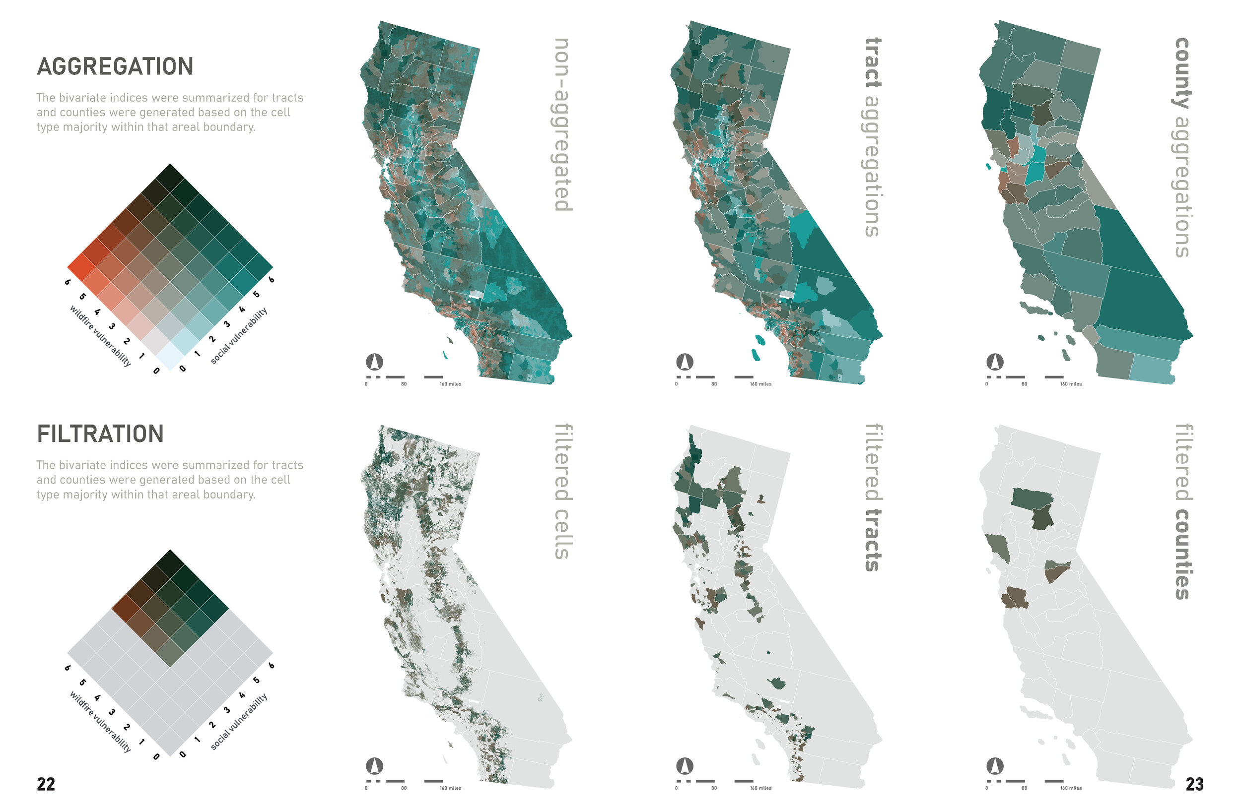

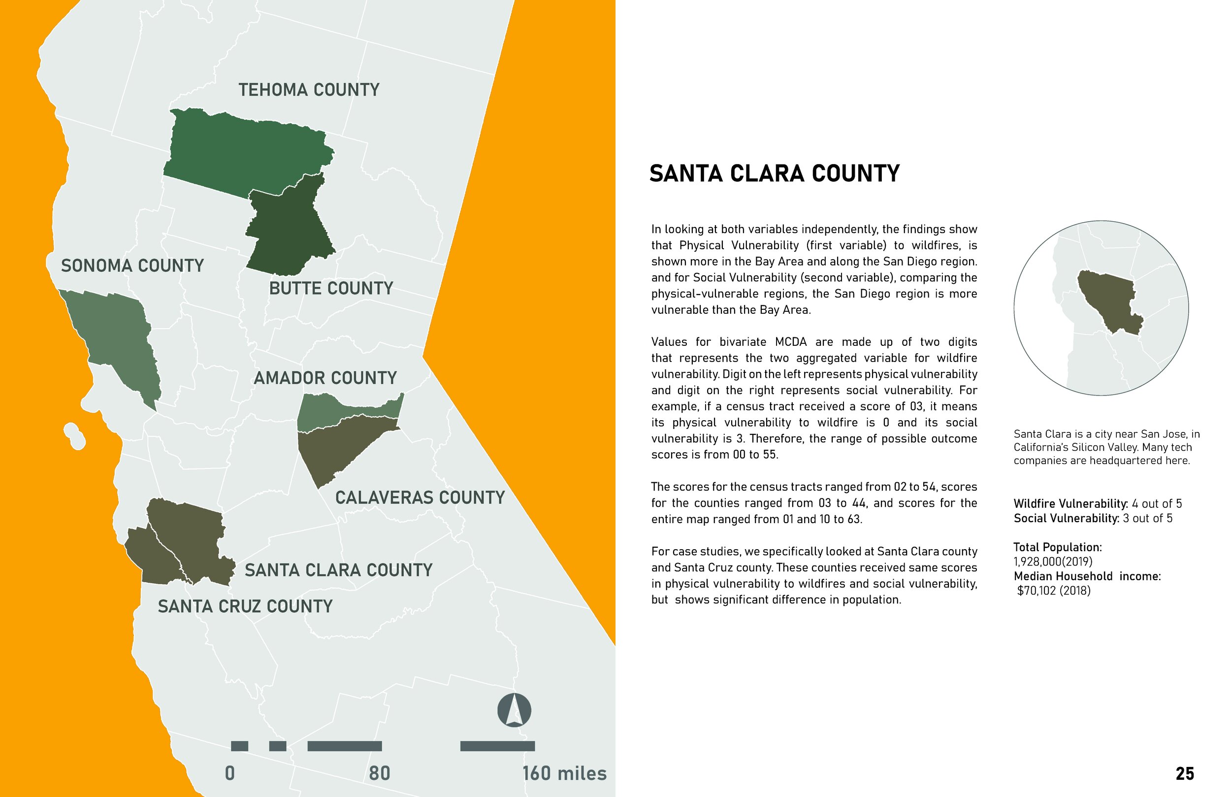
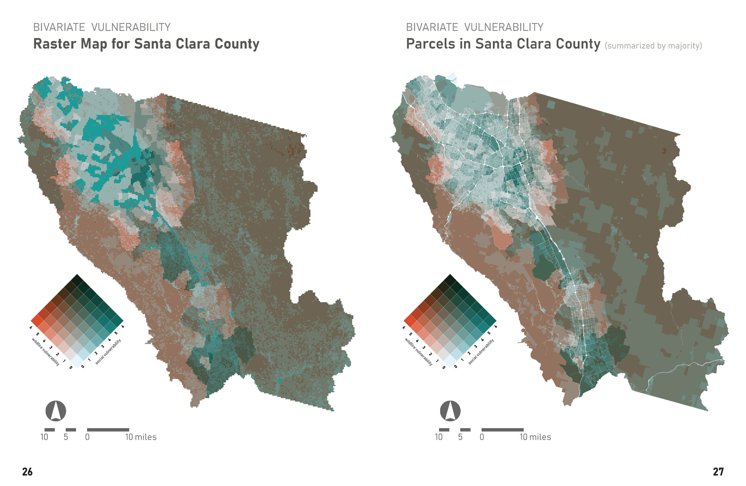
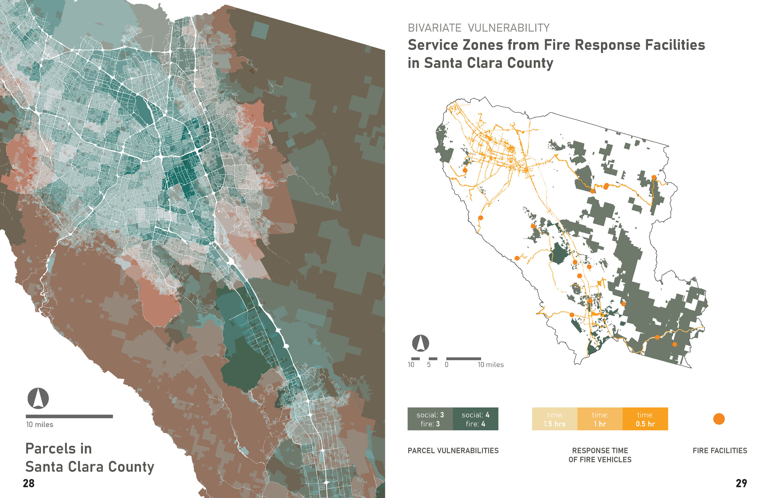
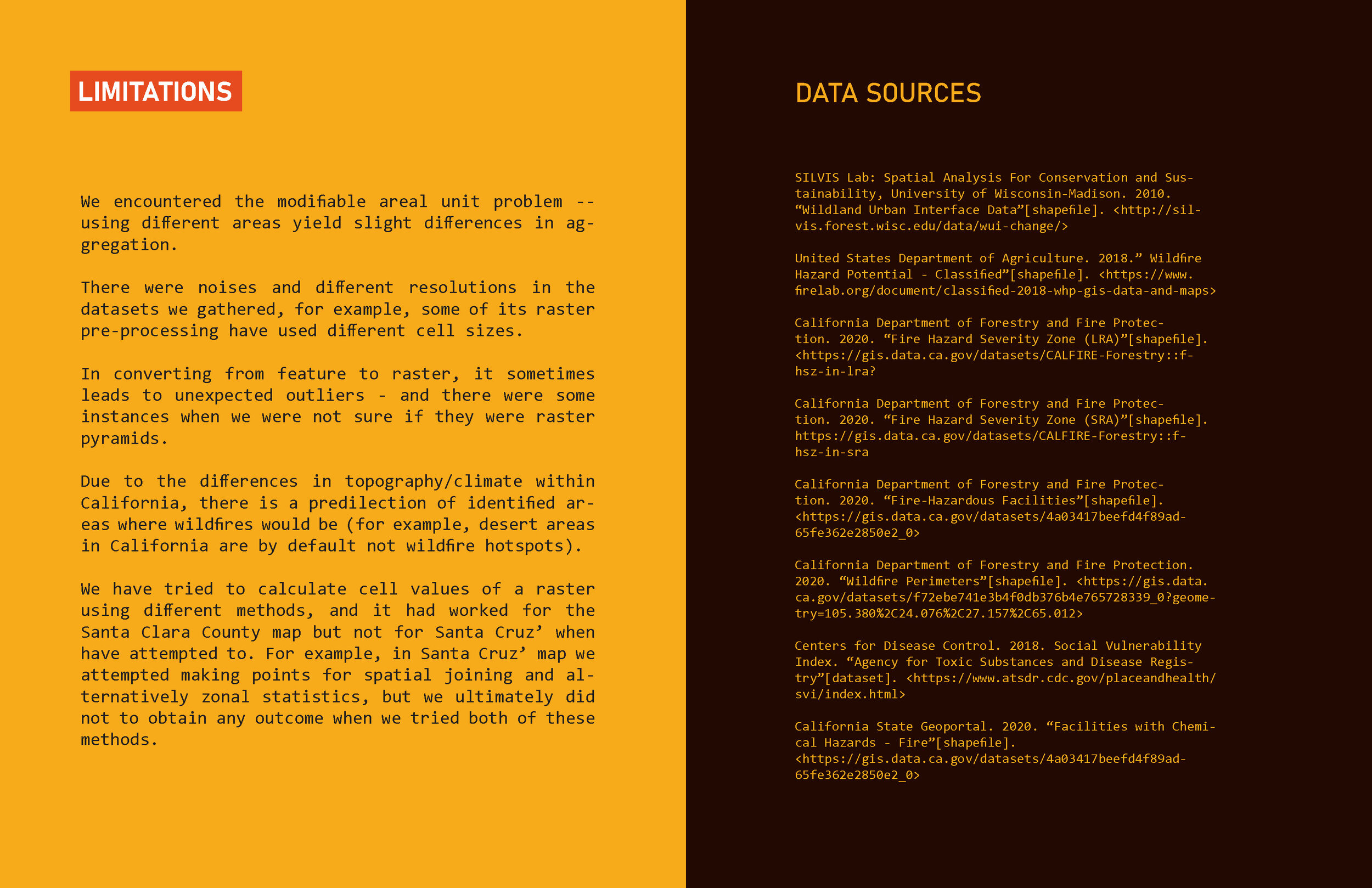
Will Cao, Sherry Te, and Sori Han. “Wildfire: Risk & Vulnerability in California.” (Fall 2020)