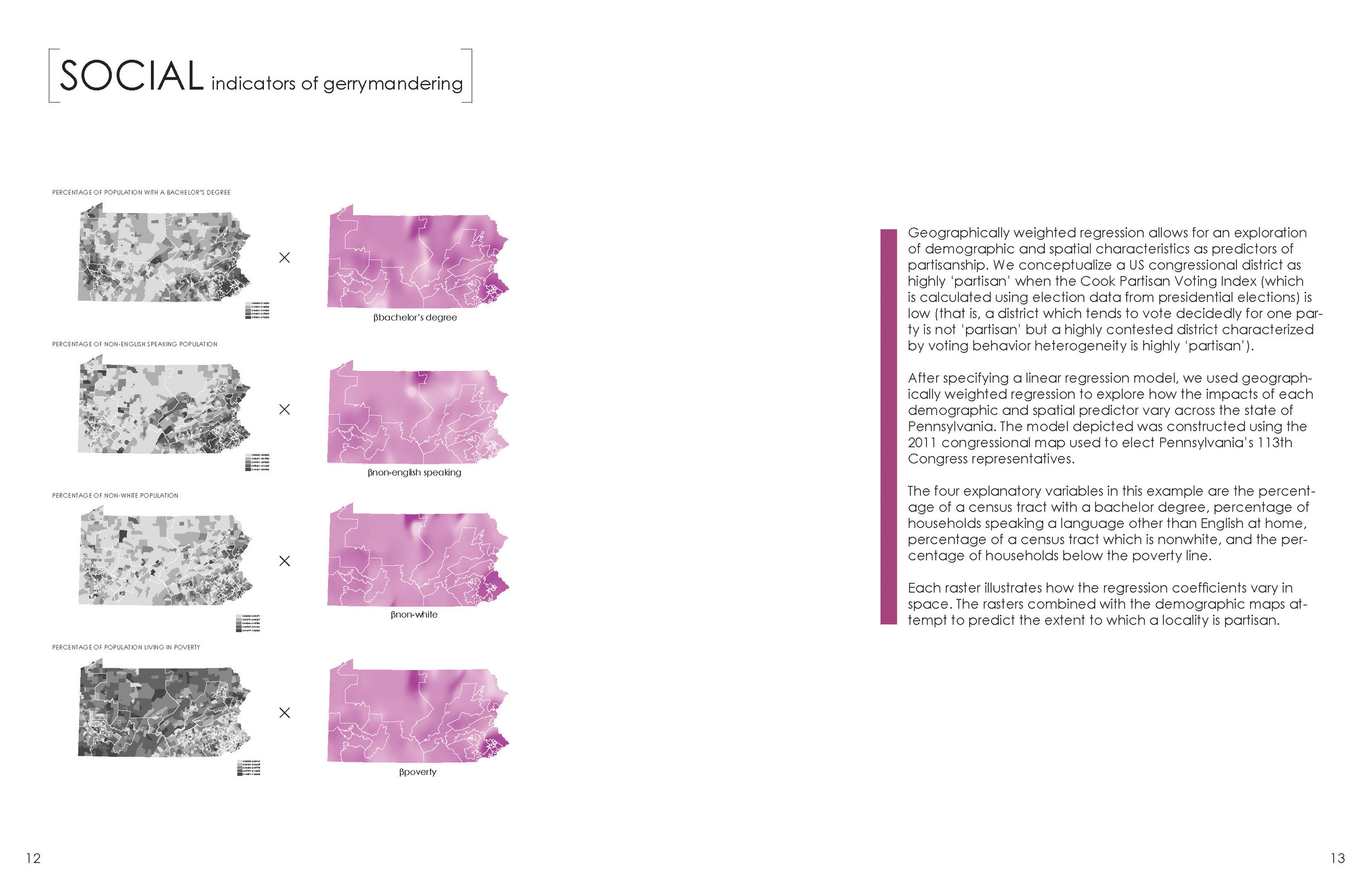
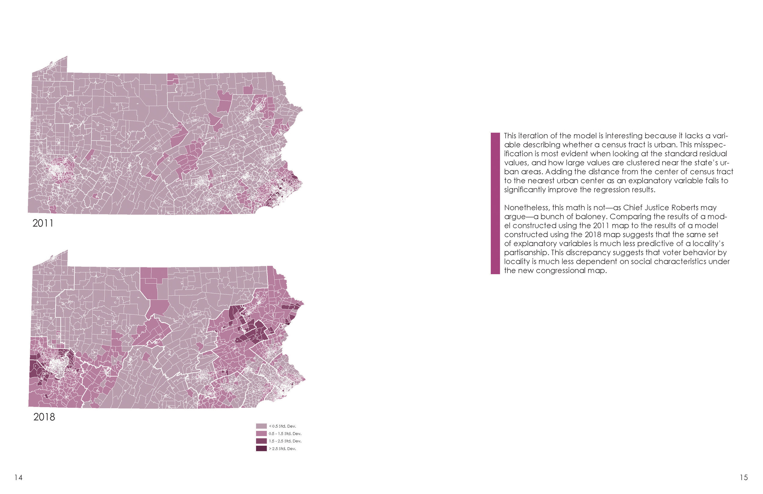
Advanced Research Methods in Geographic Information Systems & Science
Advanced Spatial Analysis, taught in the Urban Planning department of Columbia's Graduate School of Architecture, Planning and Preservation (GSAPP), is a hybrid course simultaneously teaching concepts of human and physical geography, critical GIS, and comparative spatial research methodologies, and decision support within the context of questions relevant to planning in urban environments. Its primary aims are teaching contextualized and thoughtful approaches to spatial methodologies, questioning the measures used in planning research, and developing sensitive and mixed methods of answering complex research questions that are often open to several interpretations.
Featured here are example student projects from the Spring 2018 course. The final deliverables include a research poster and an elaborated report.
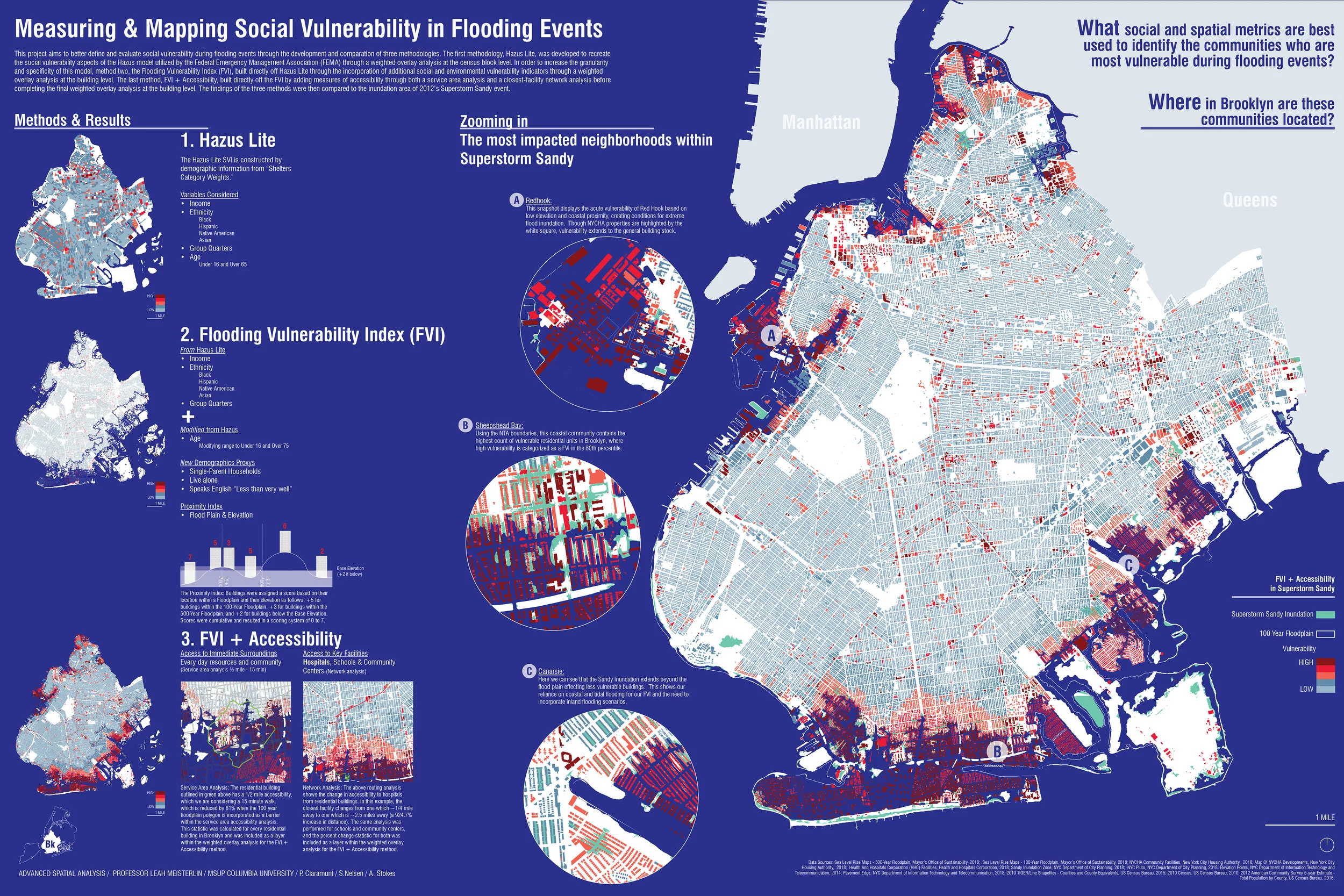
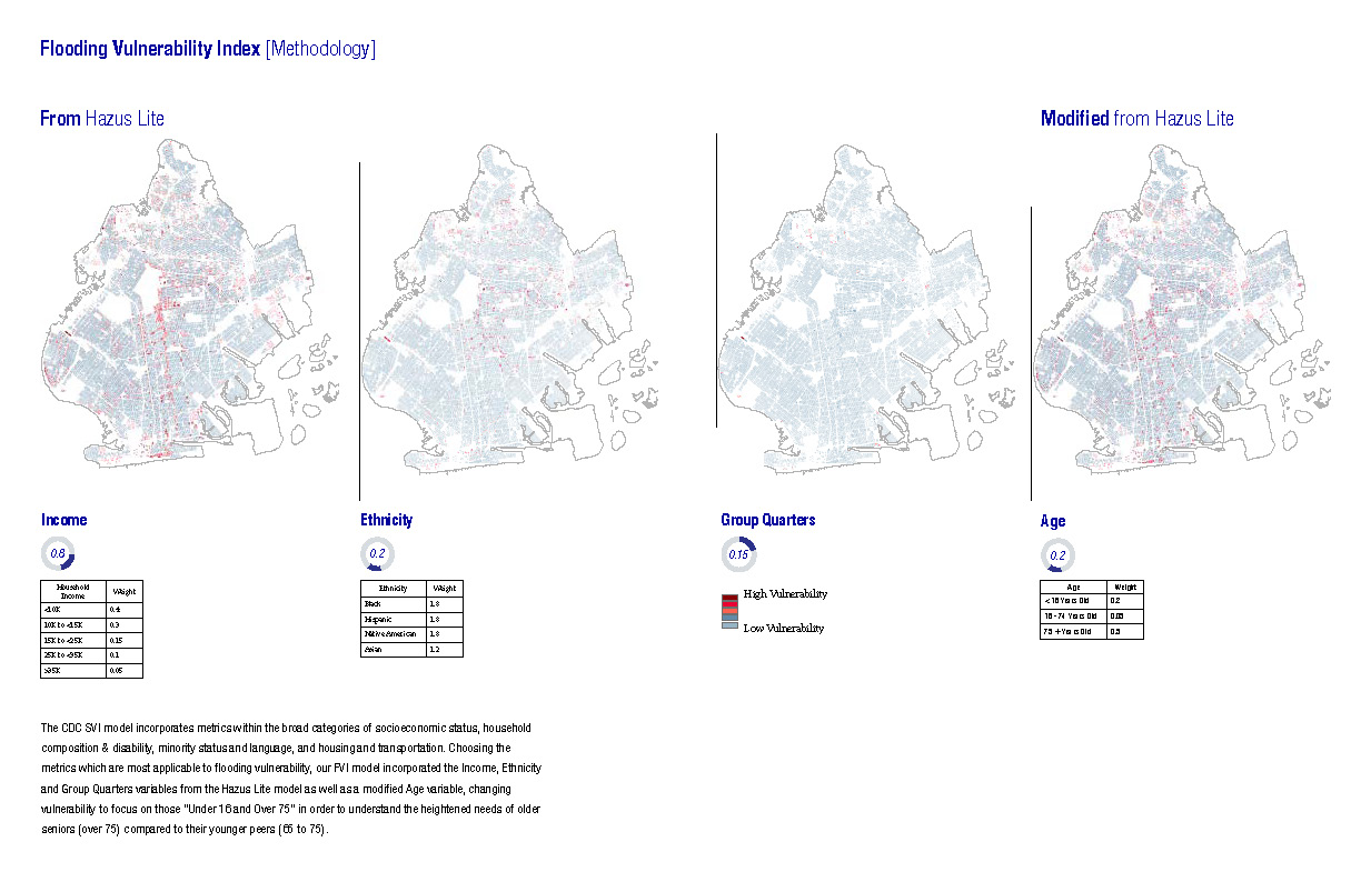
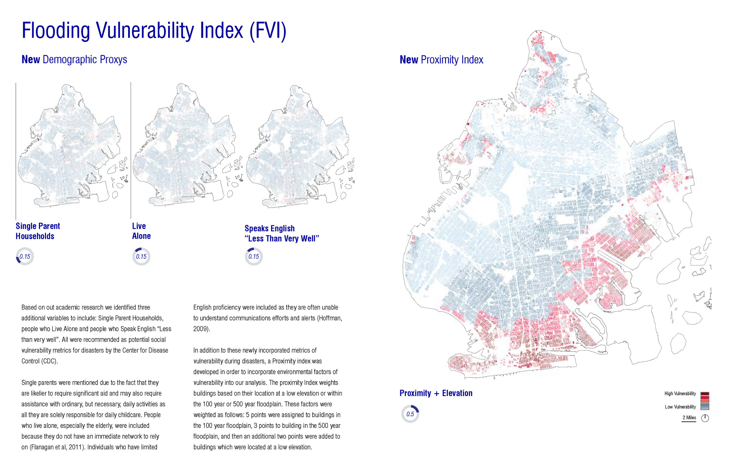
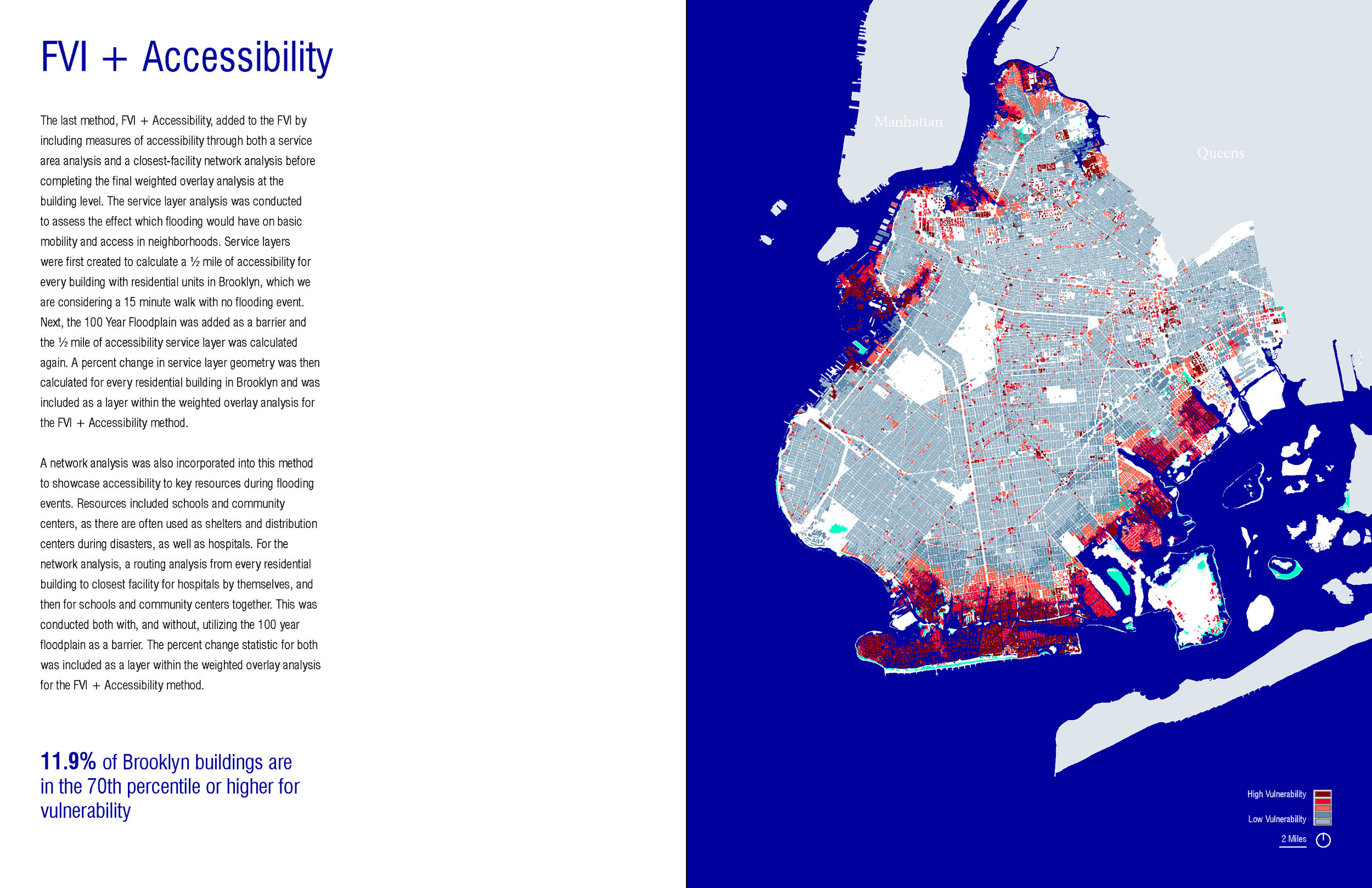
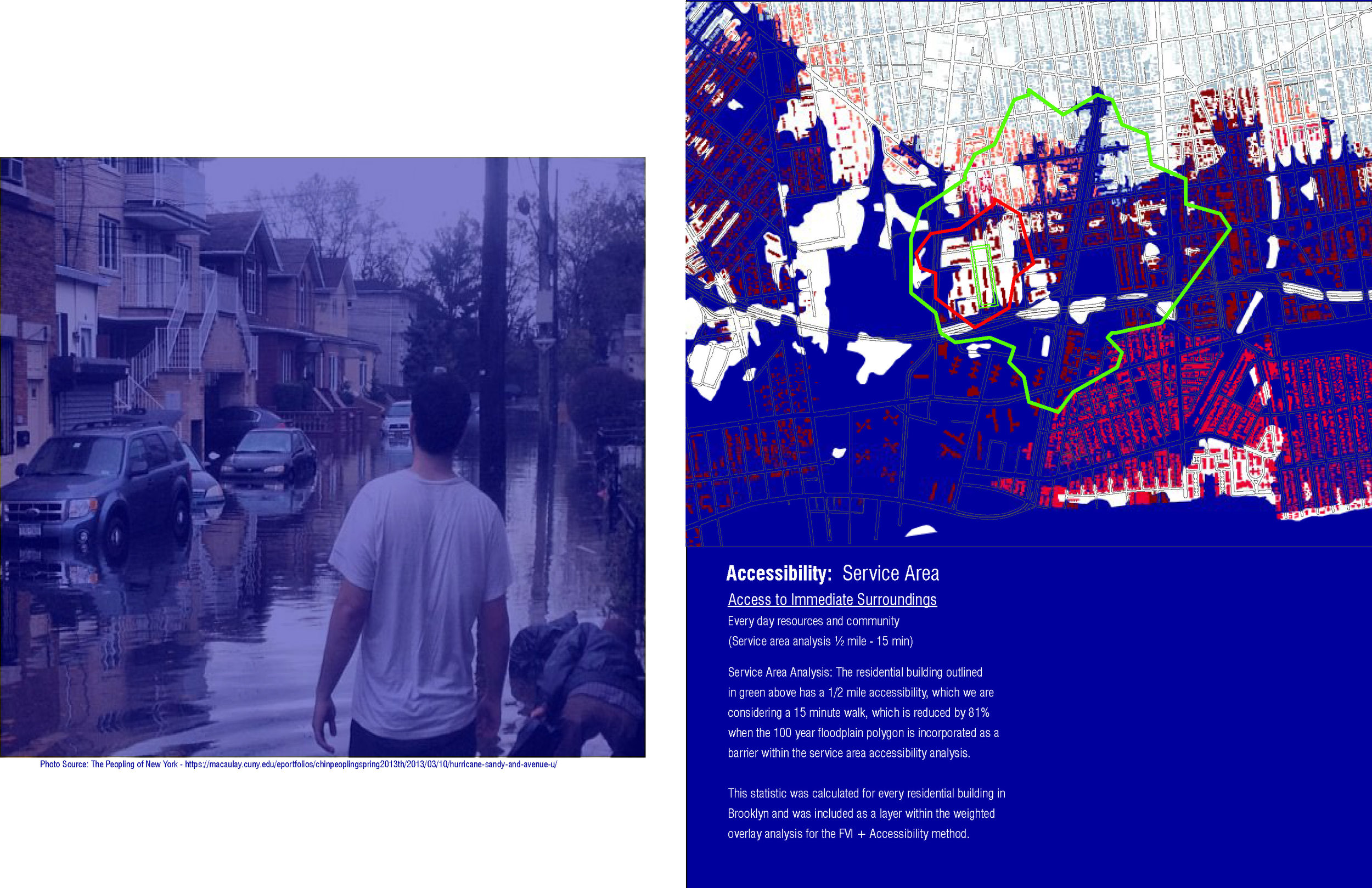
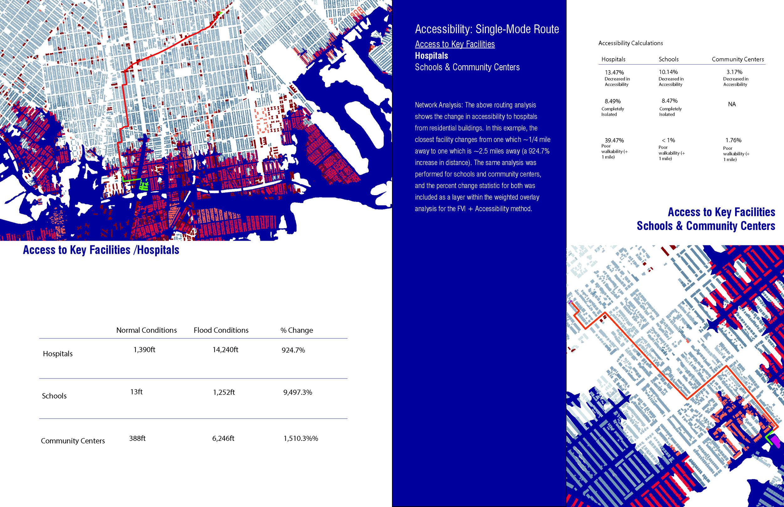
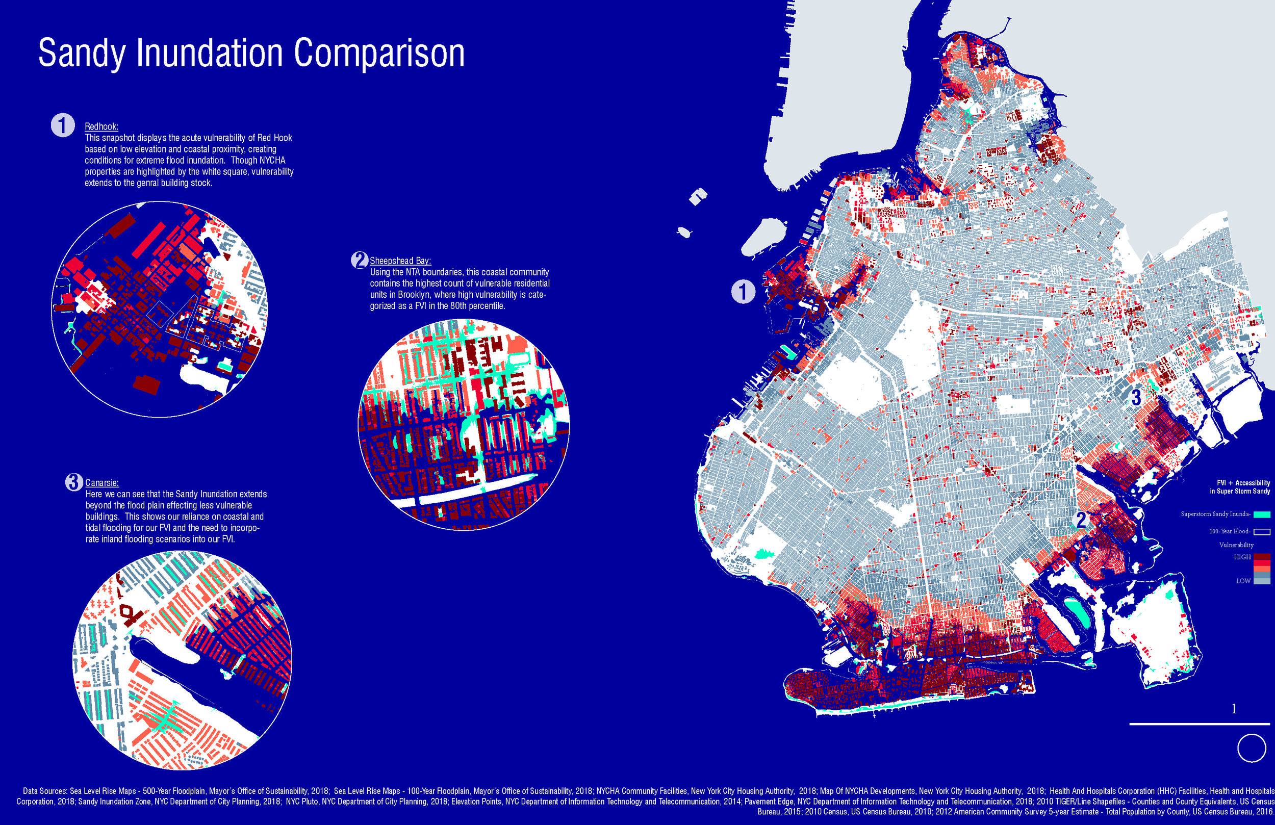
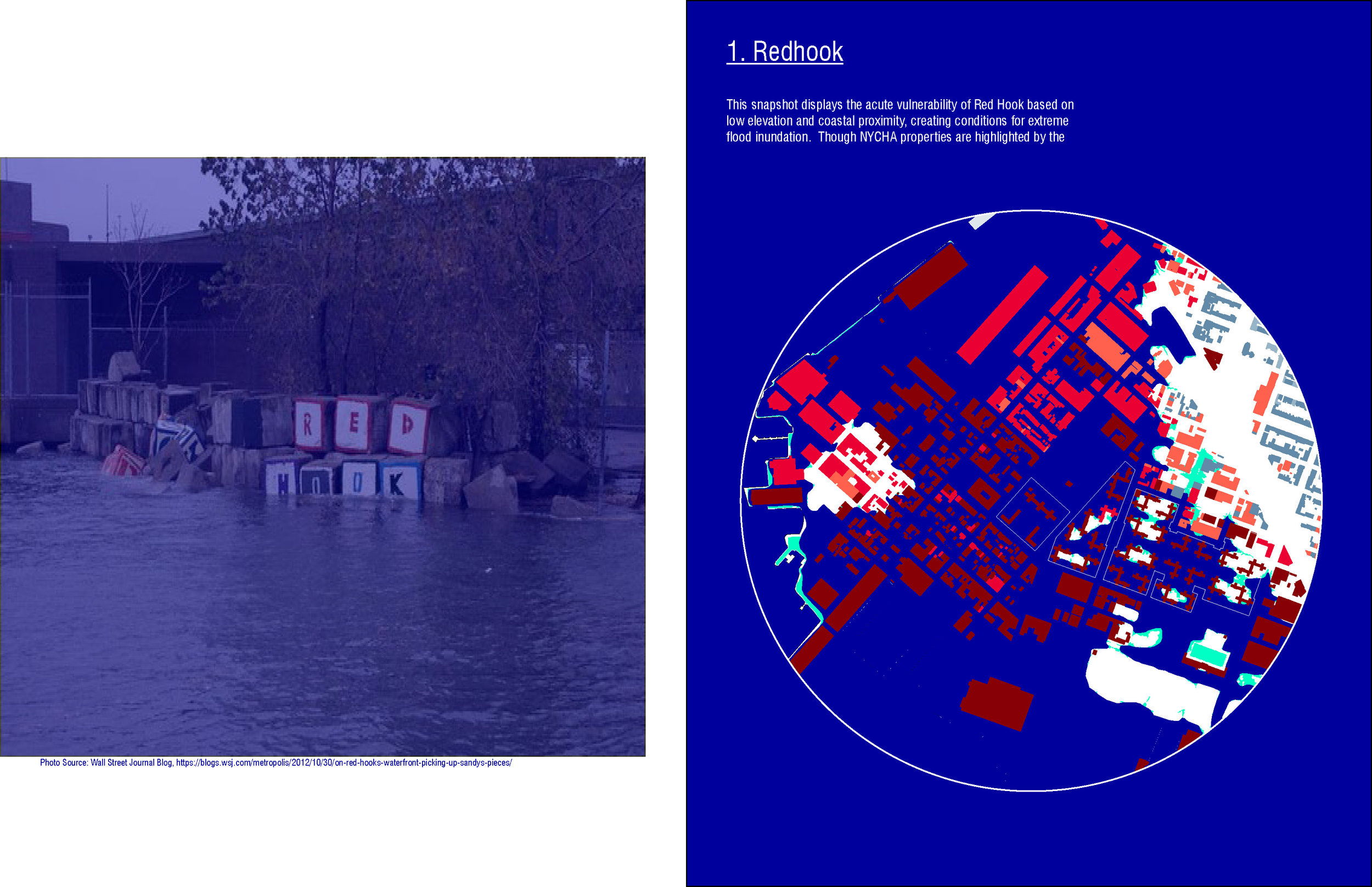
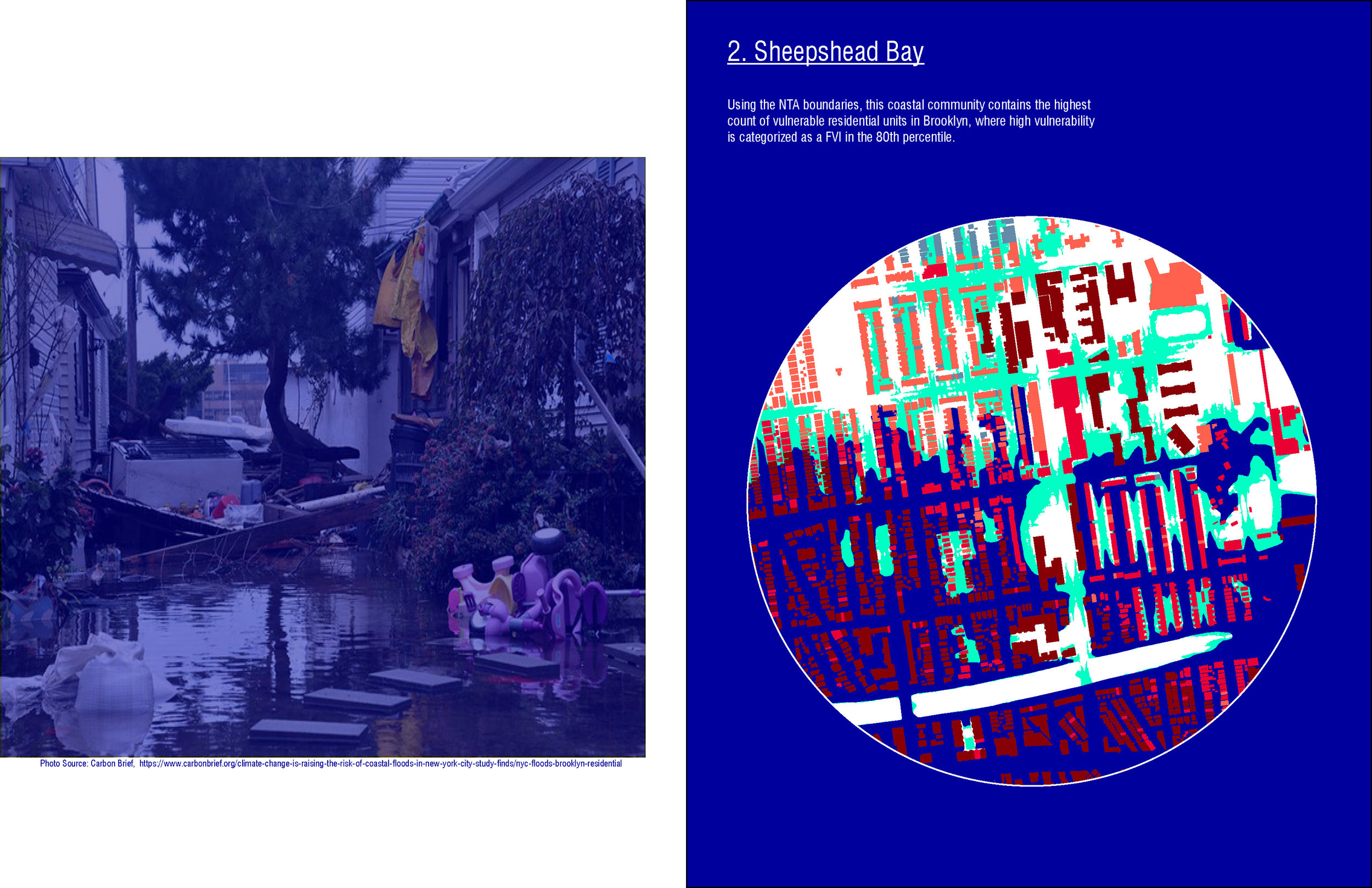
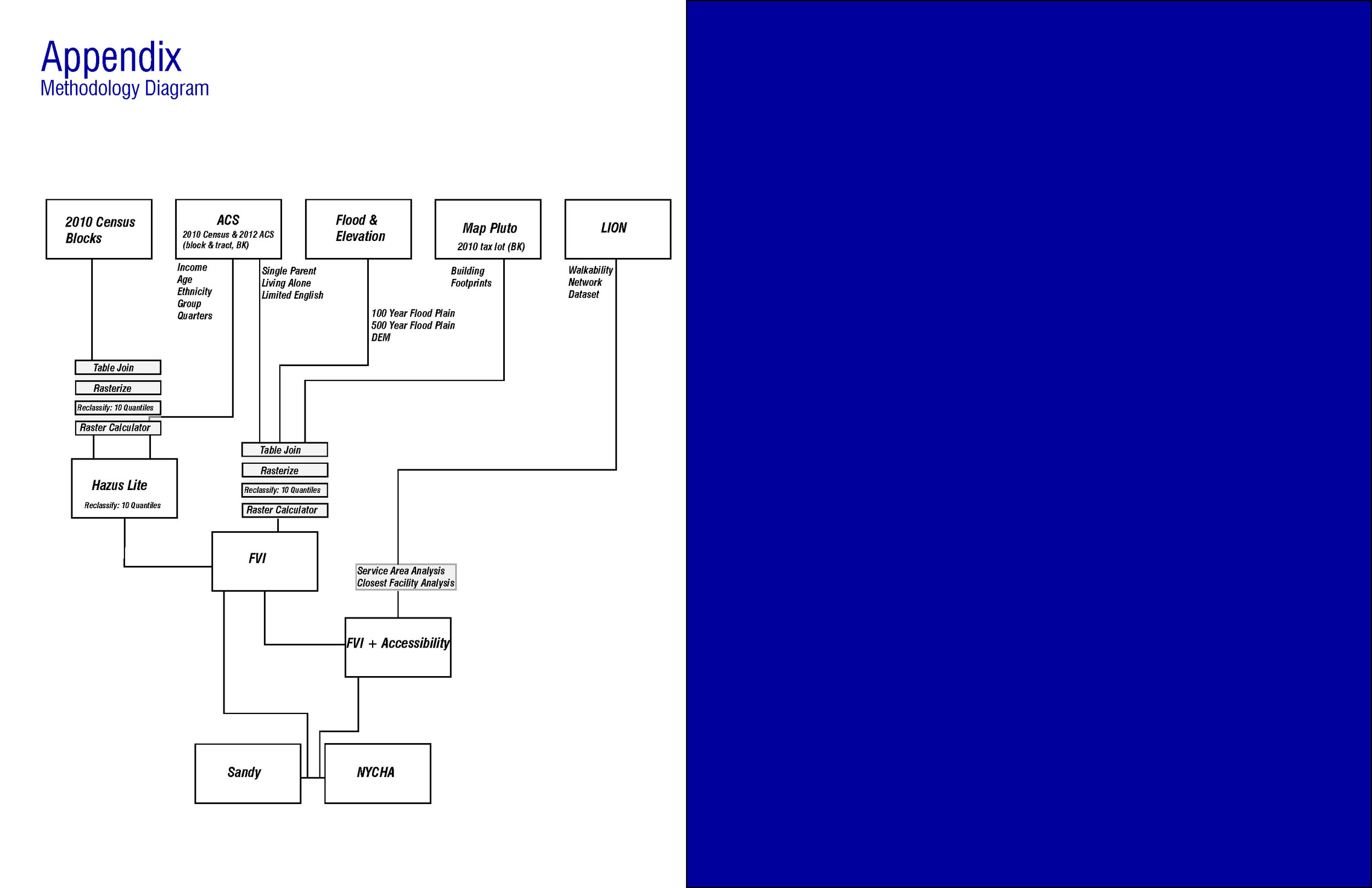
Pauline Claramunt, Sean Nelson, and Anna Stokes. "Measuring and Mapping Social Vulnerability in Flood Events."

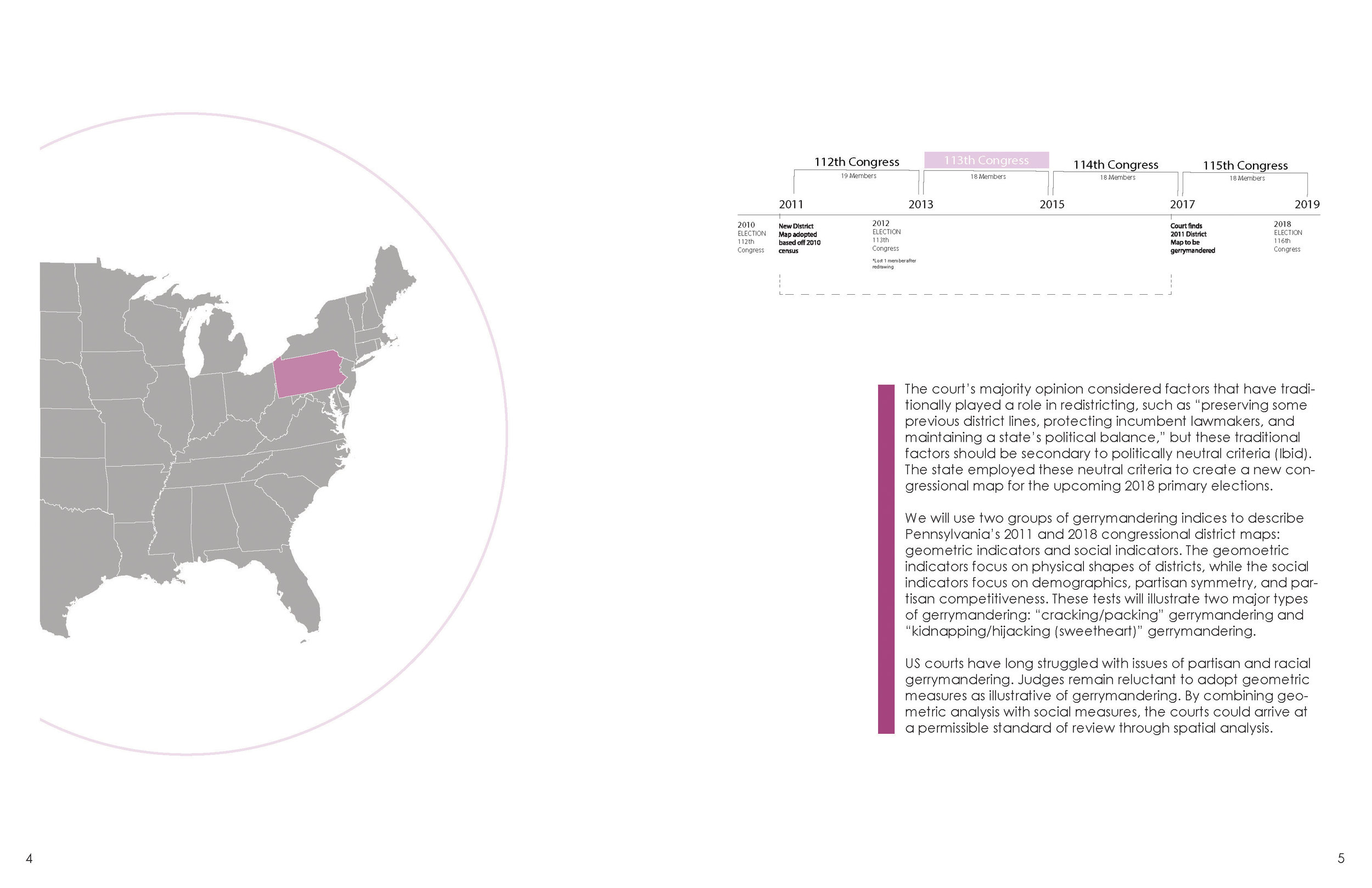
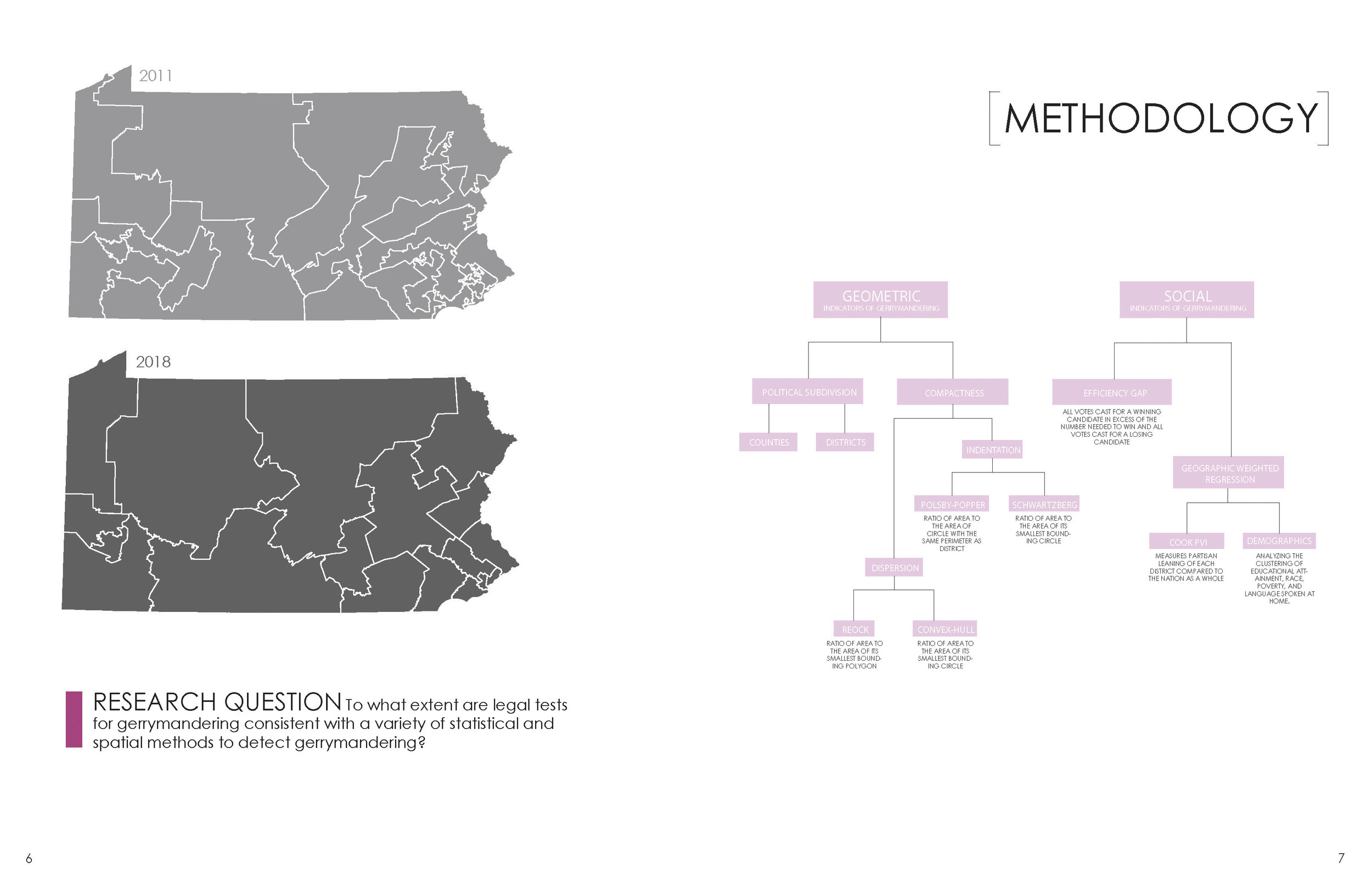
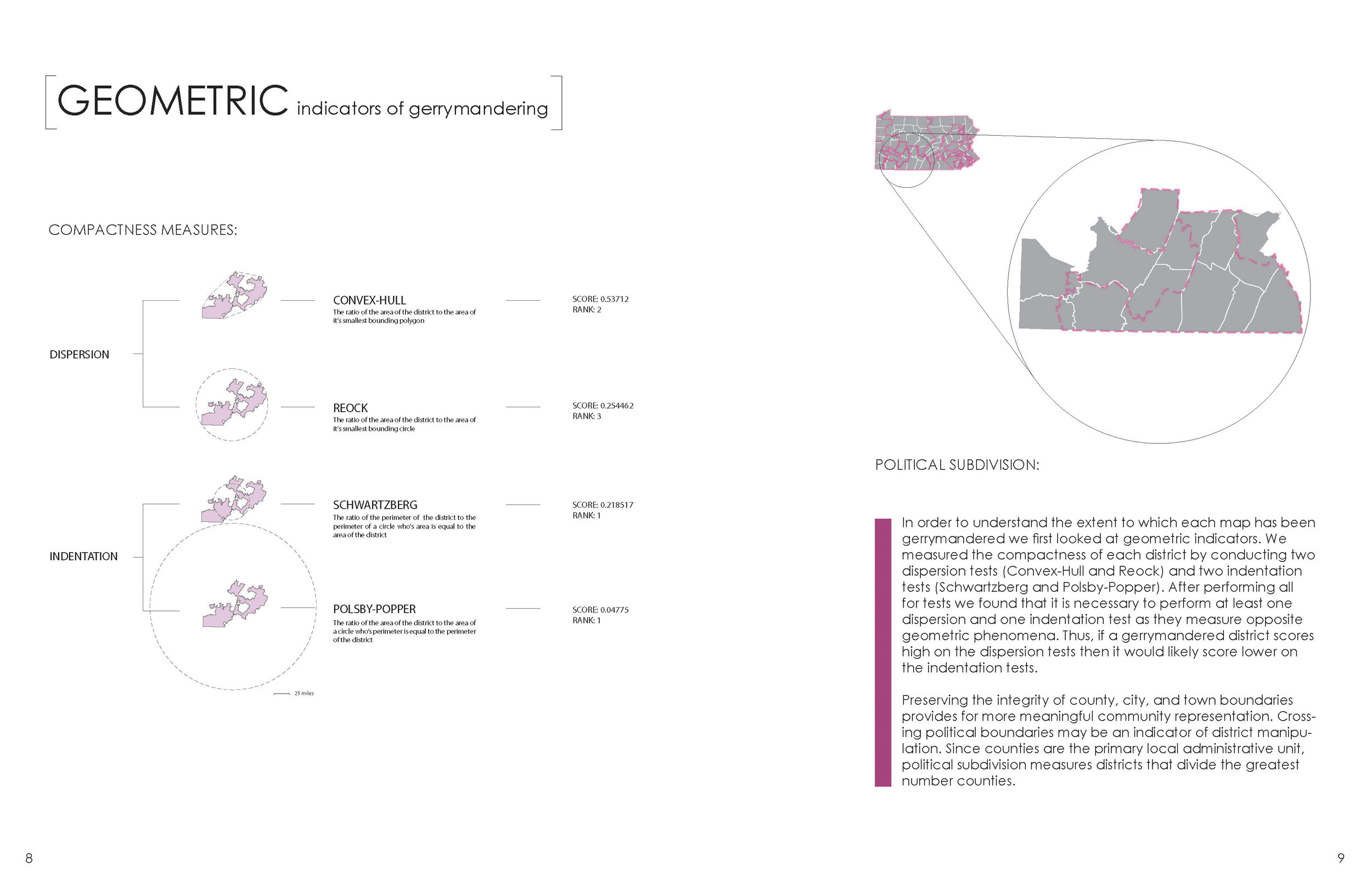
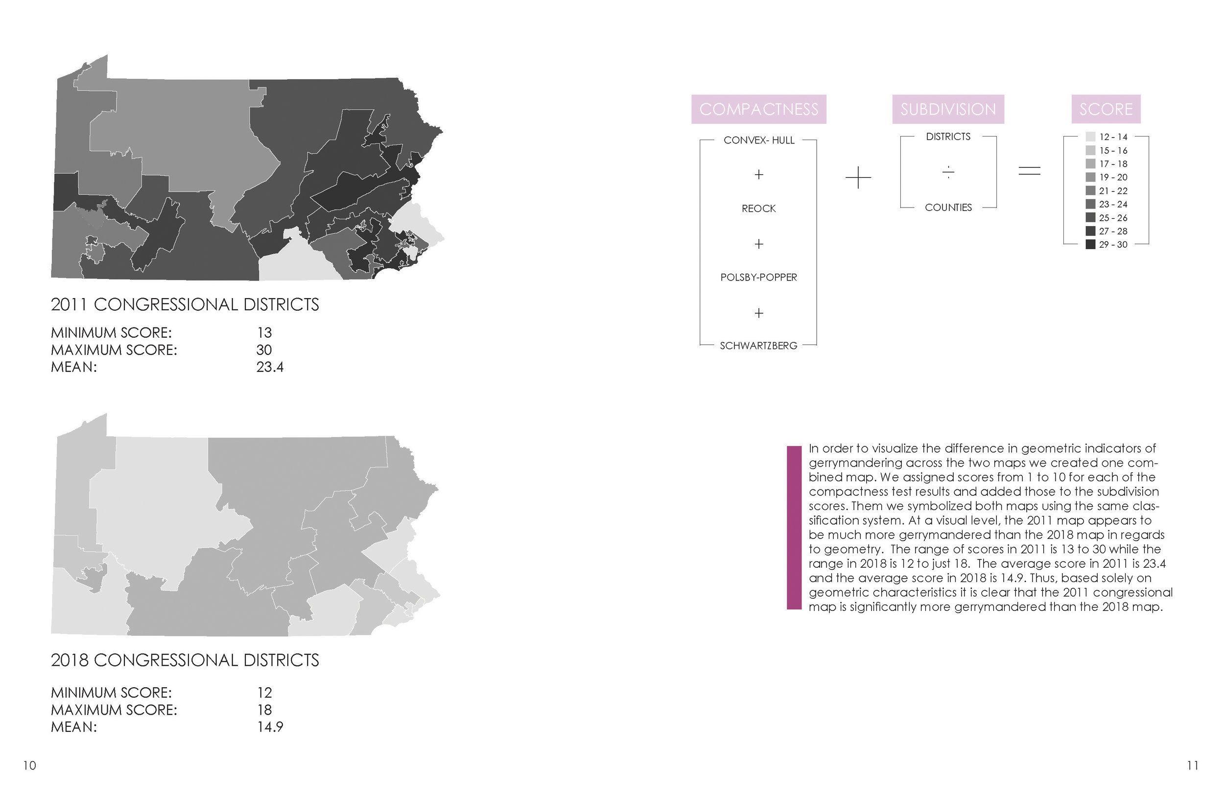
Caitlin Bone, Whigham Covington, Madeline Entrikin, and Kenneth Warner. "The Liberty Bell: Cracked & Packed."

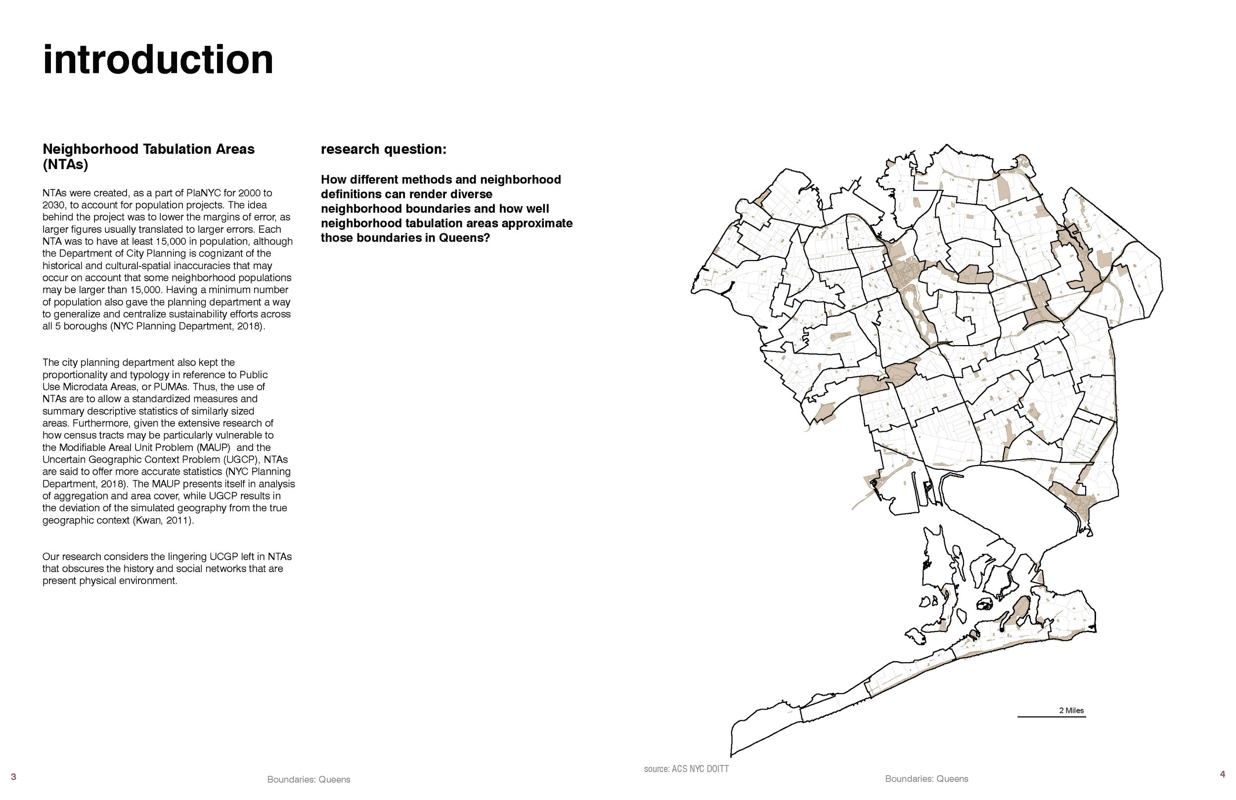
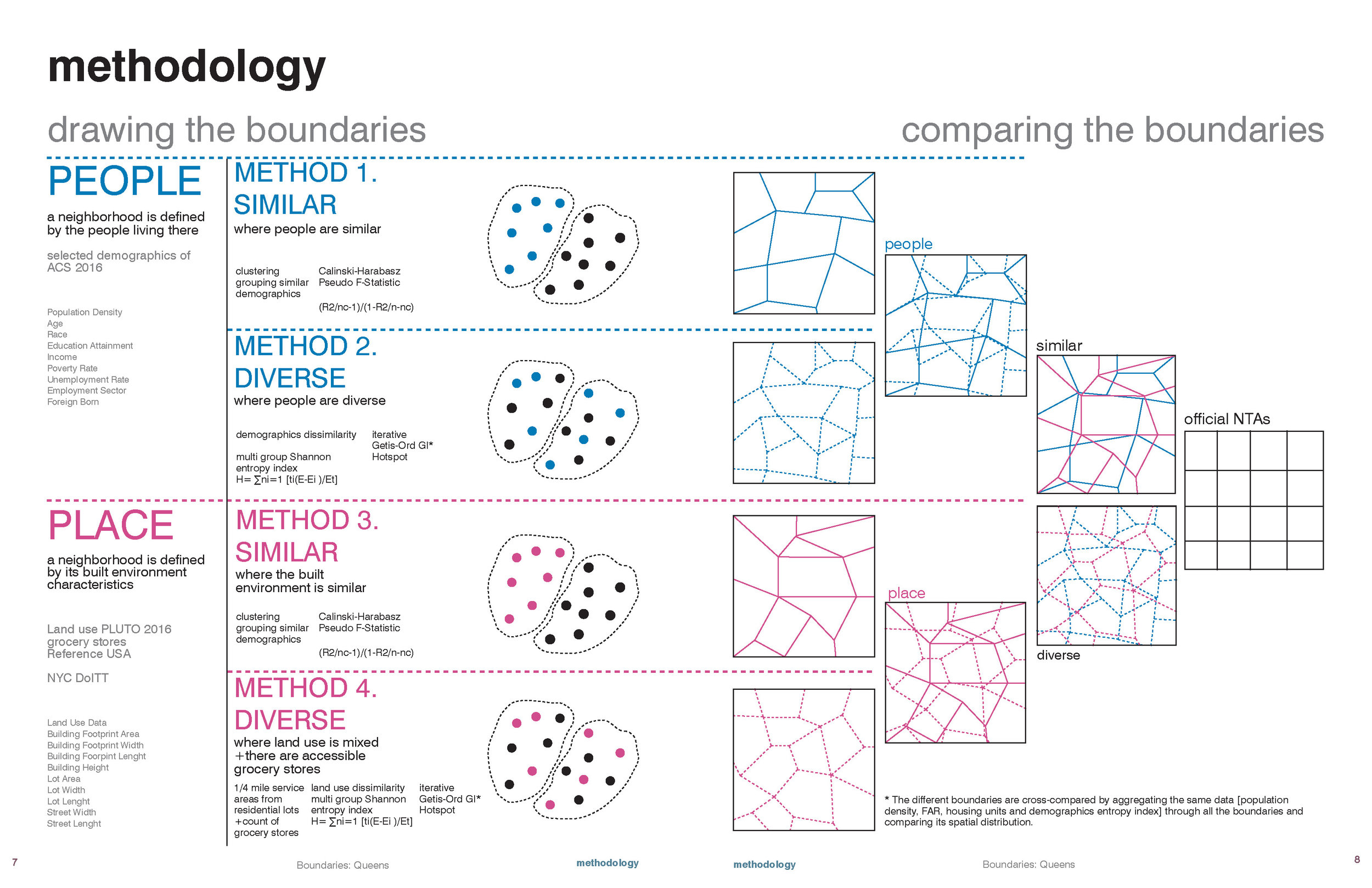
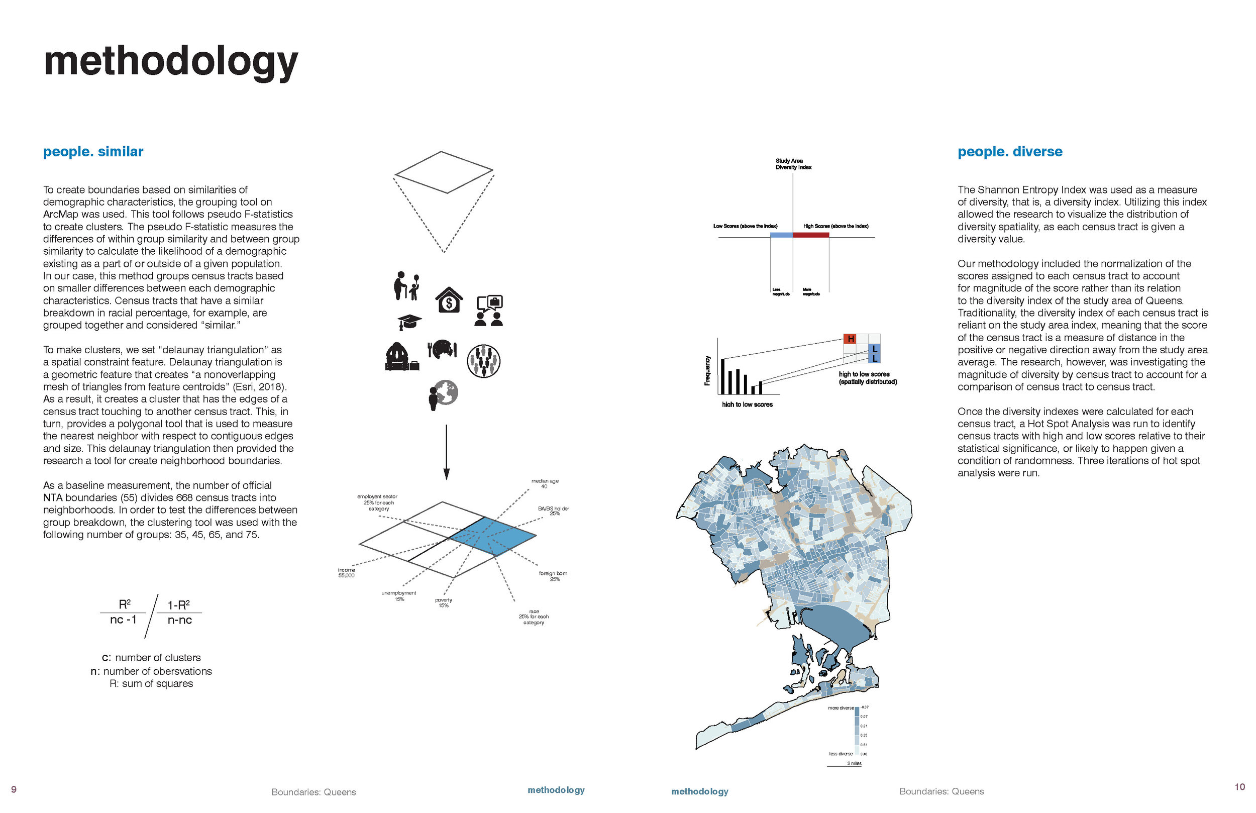
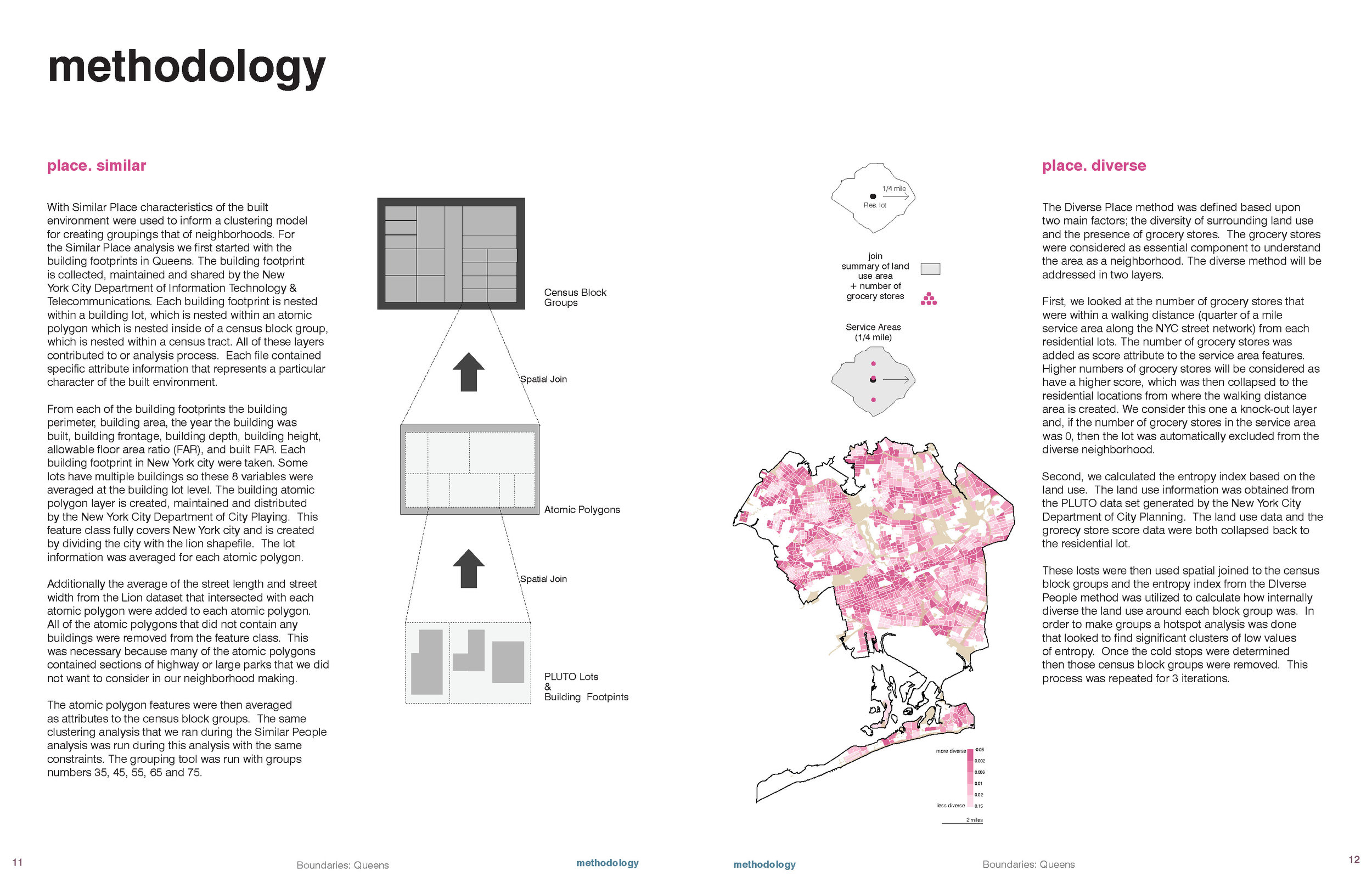
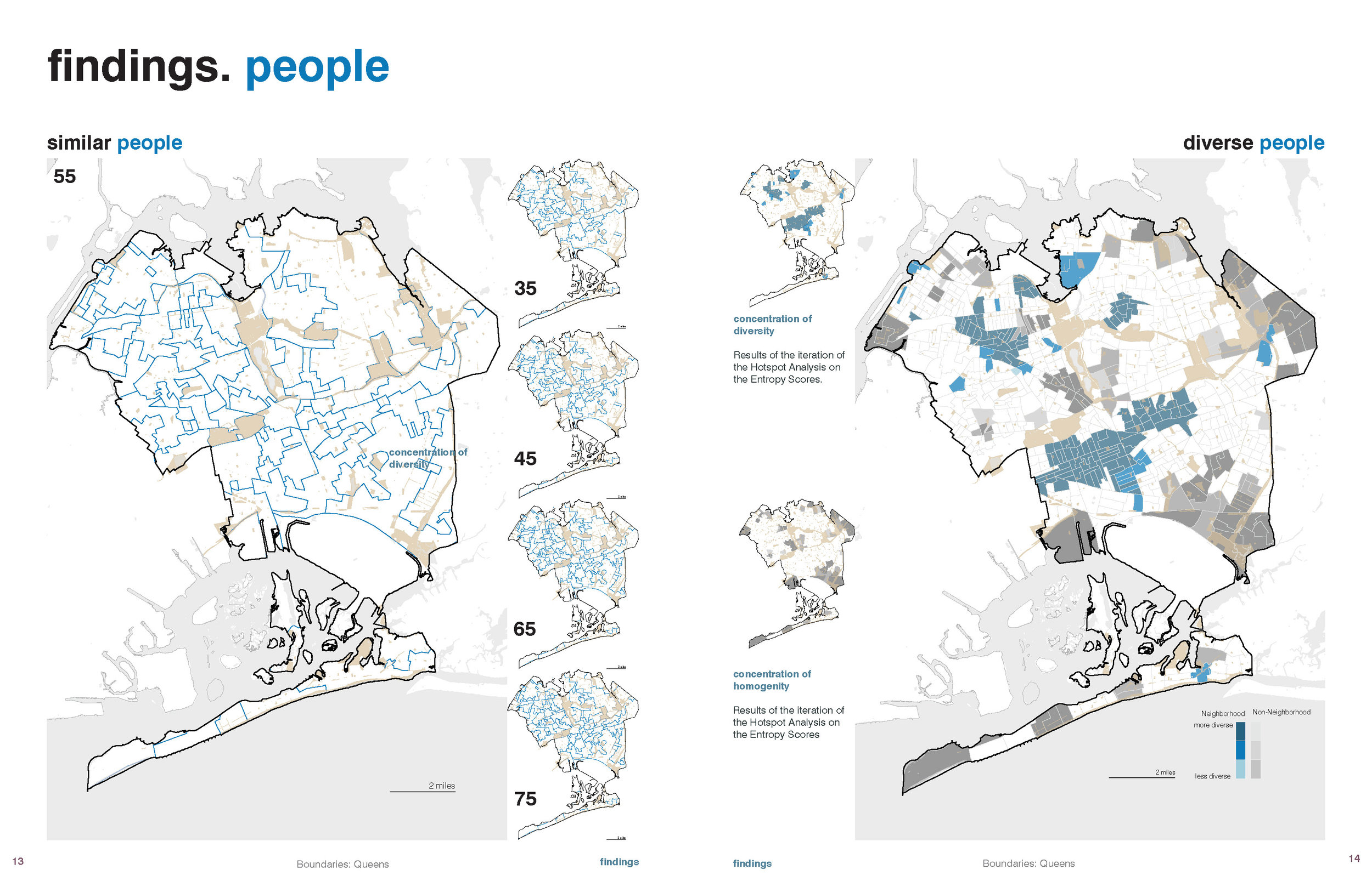
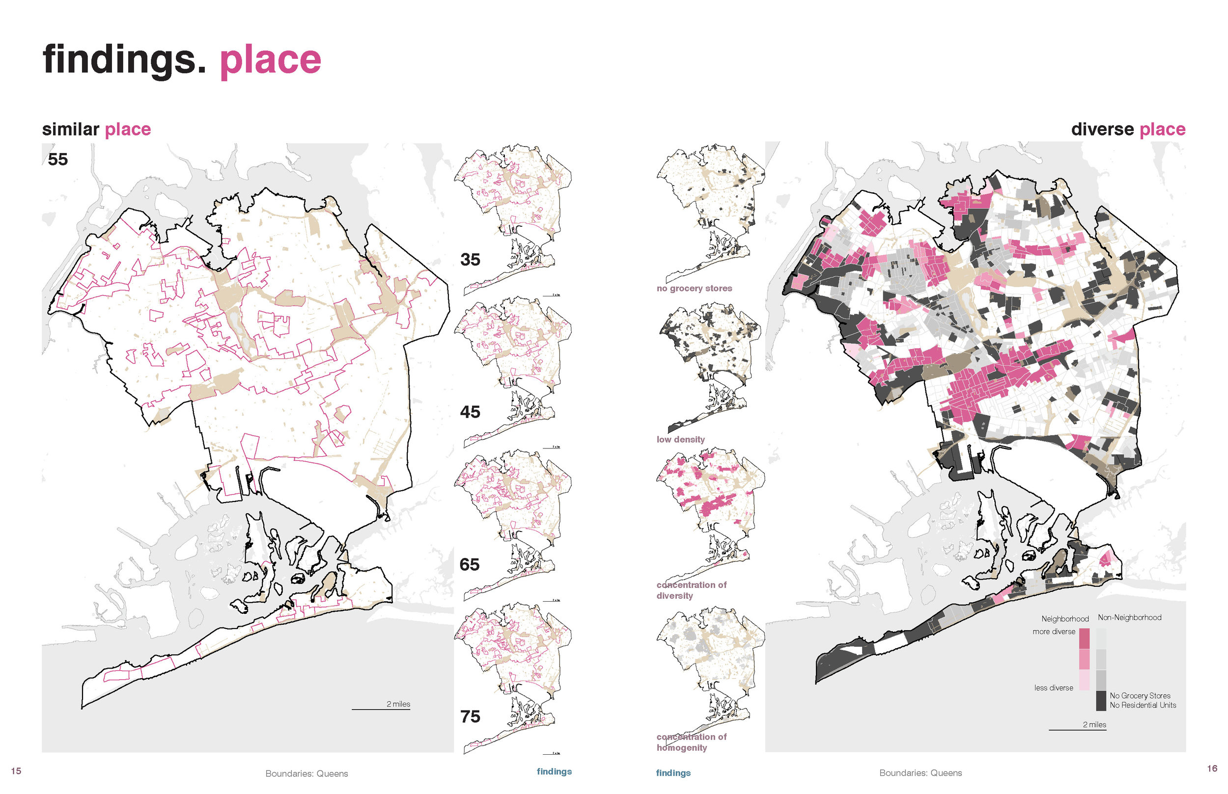
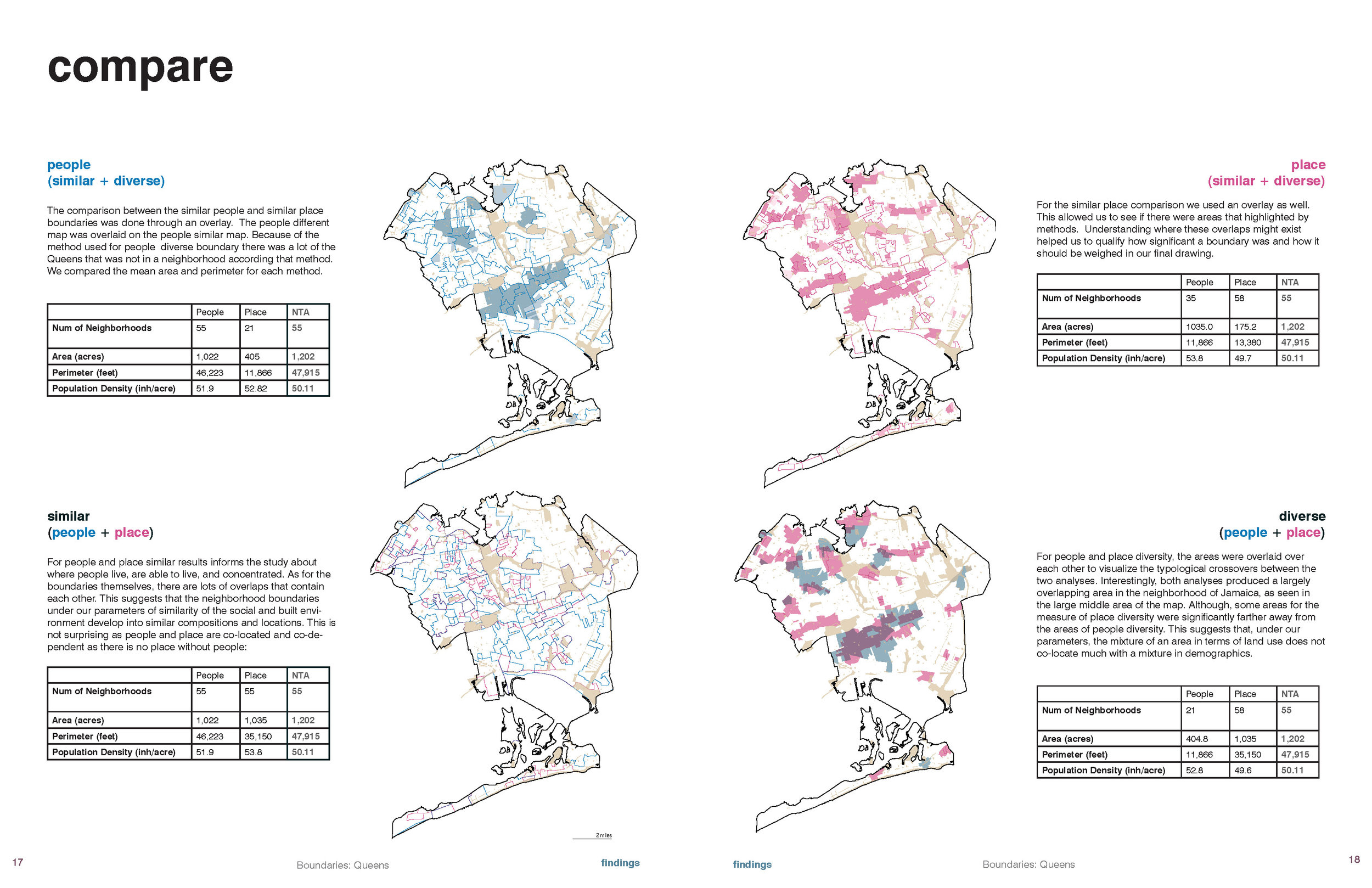
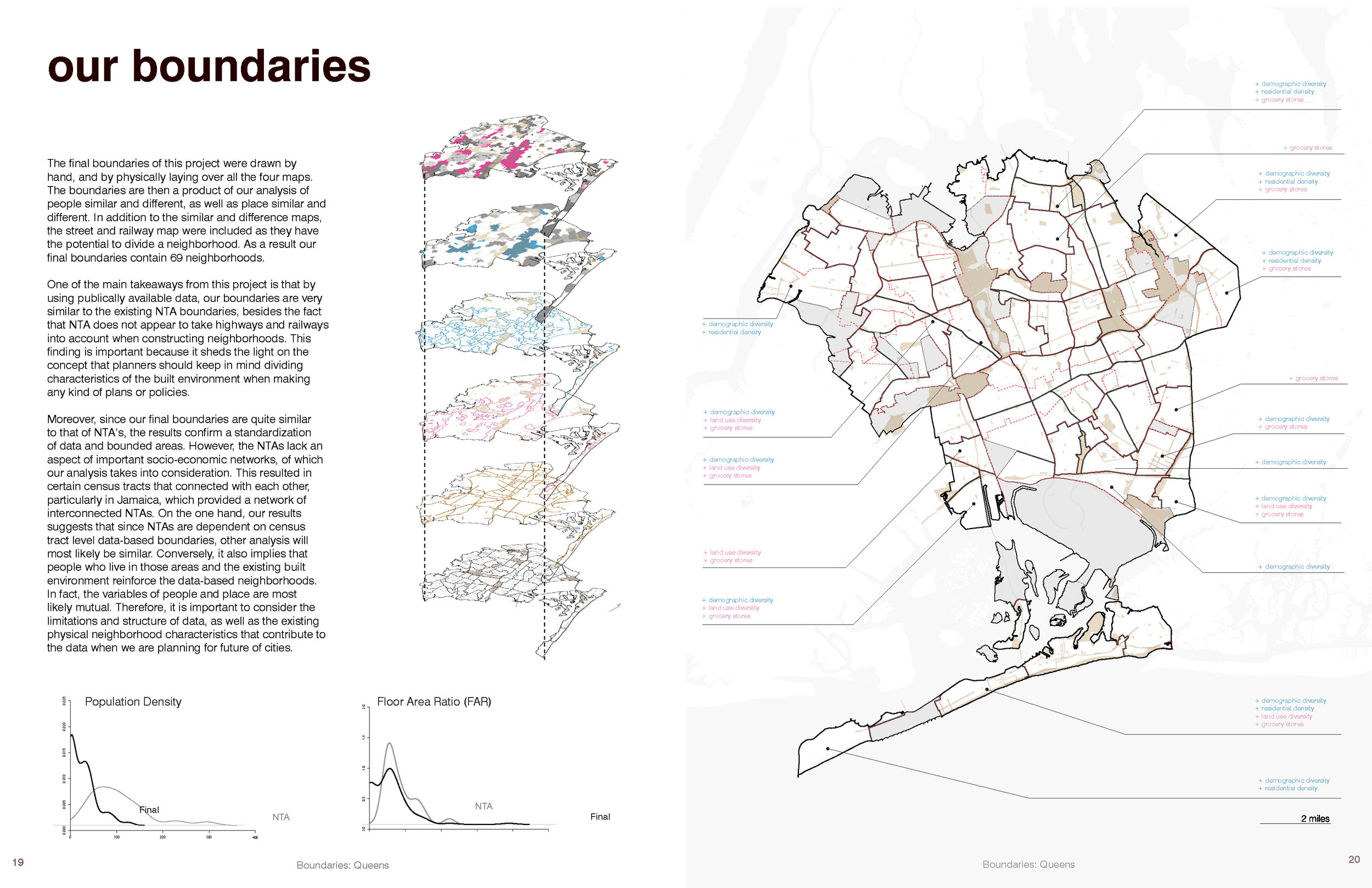
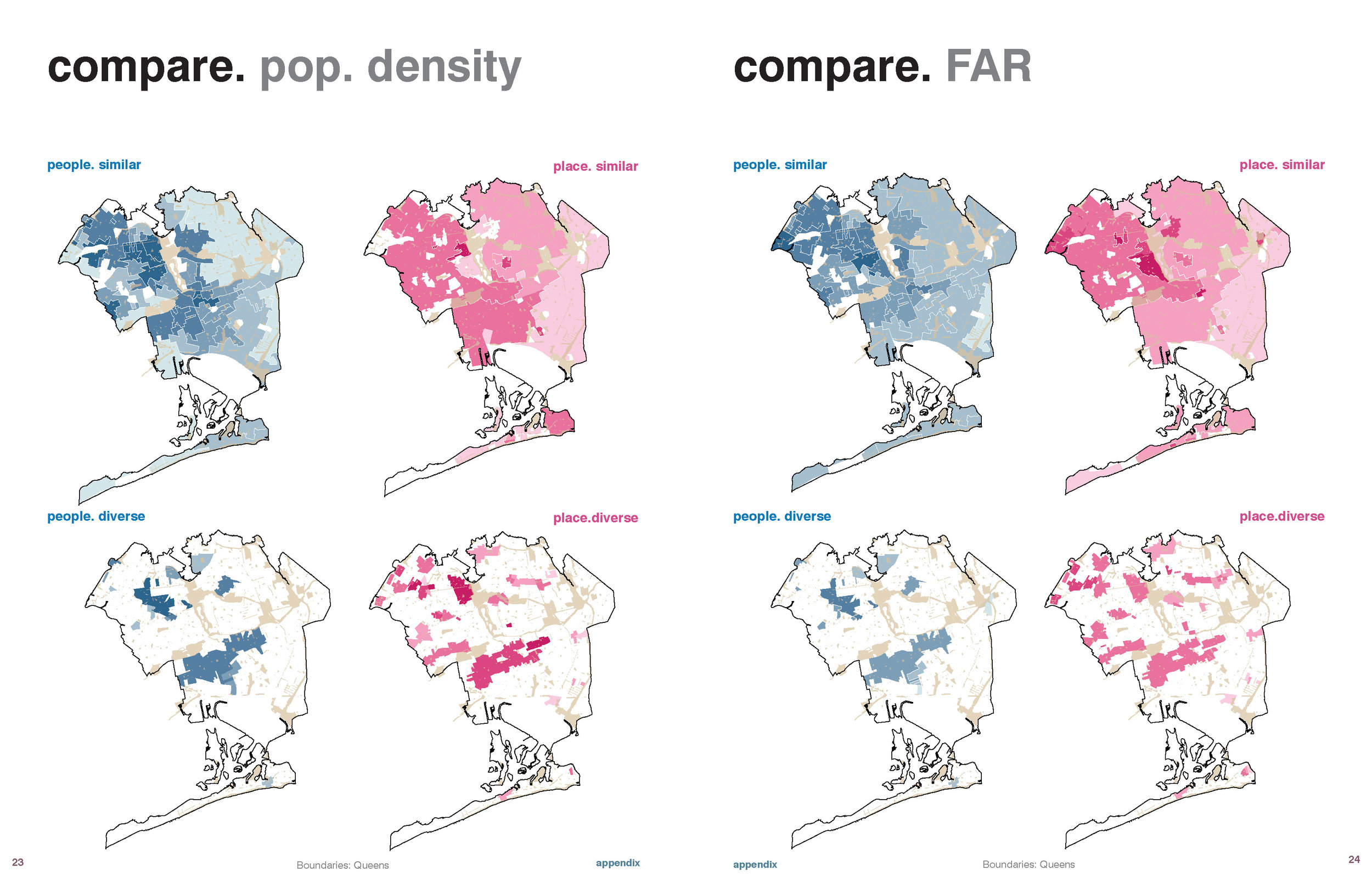
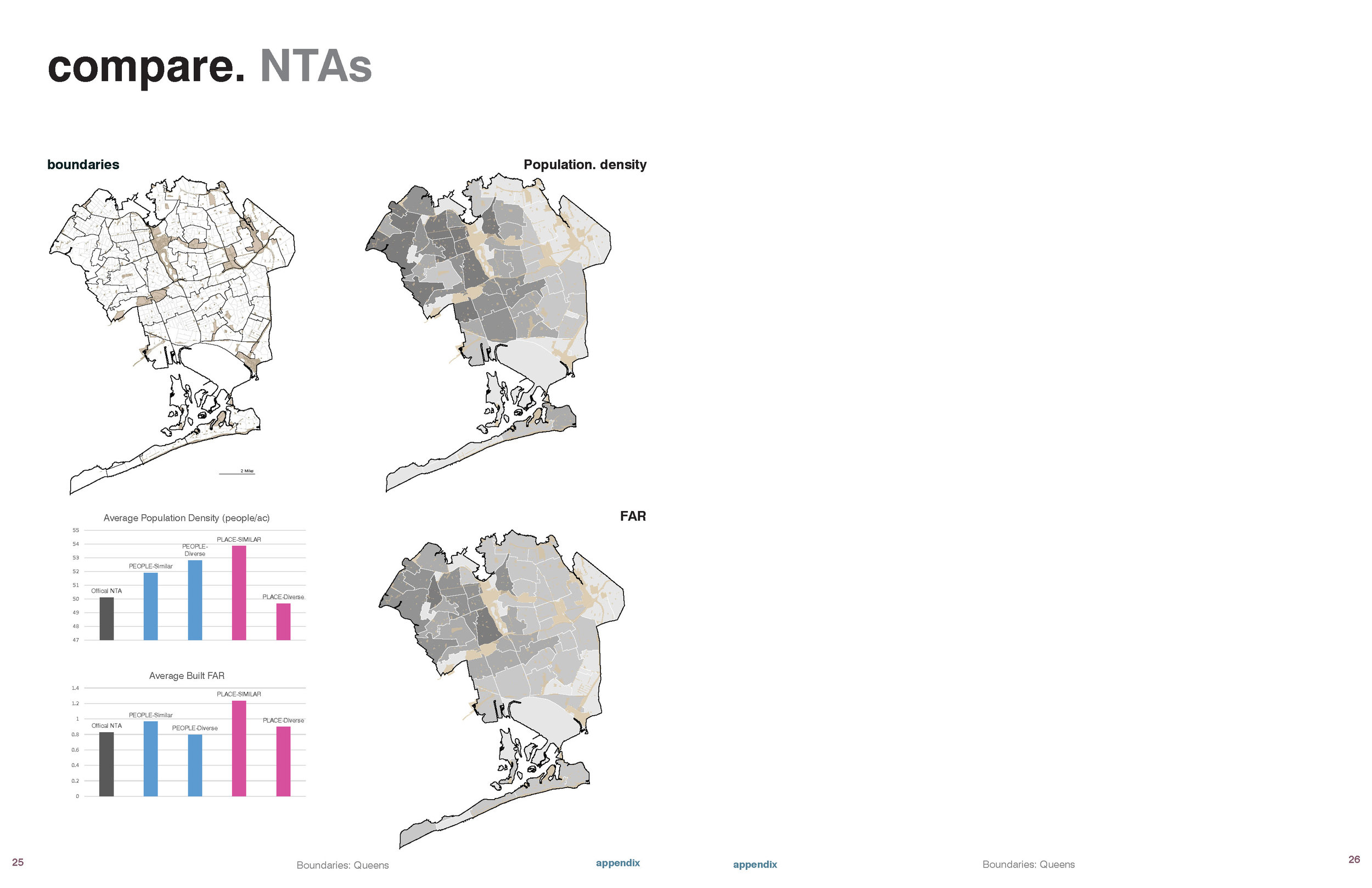
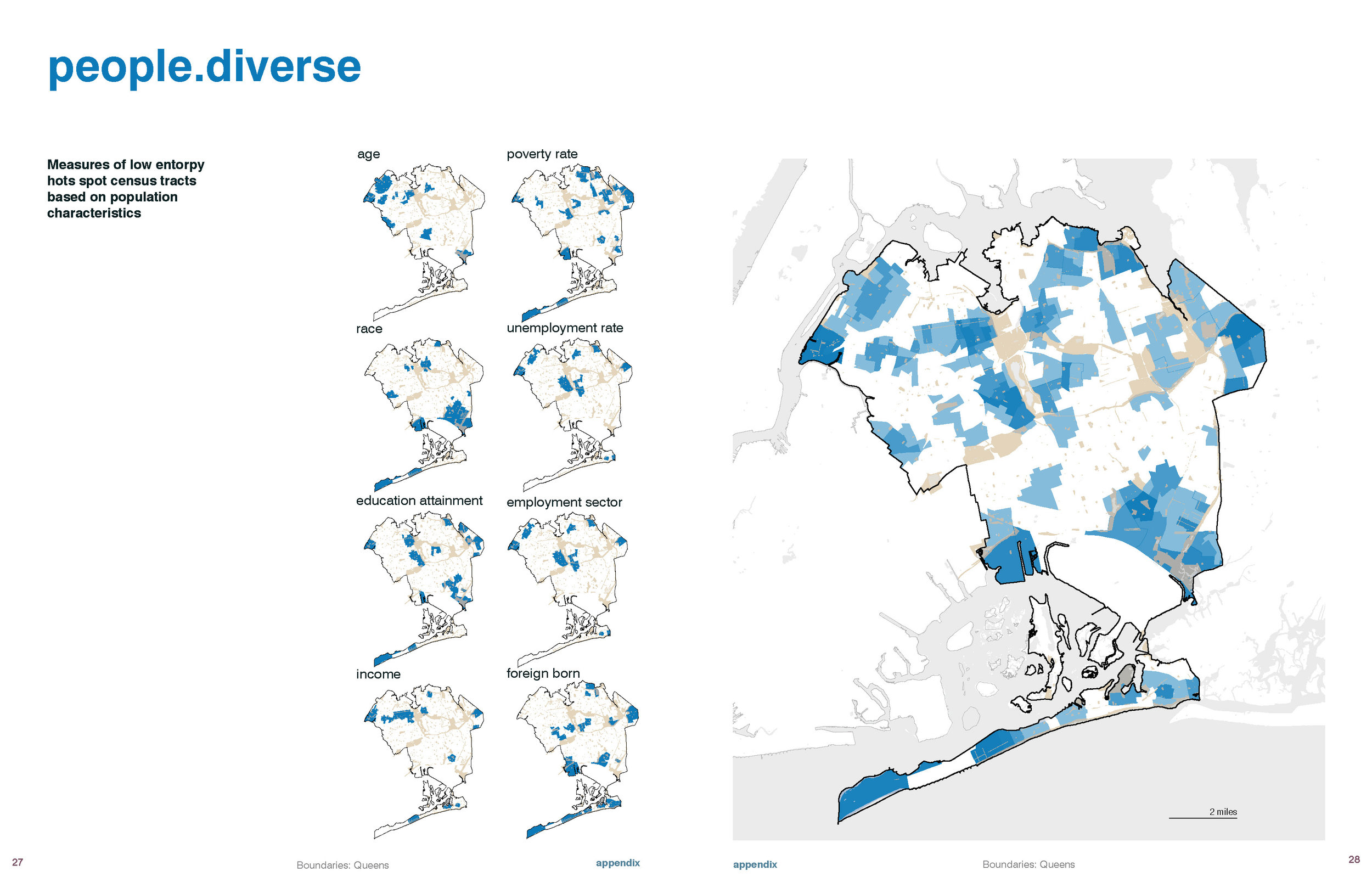
Angel Feliz Lopez Zamora, Justin Romeo, Gloria Serra Coch, and Mai Uchida. "Drawing Neighborhood Boundaries in Queens, NY."


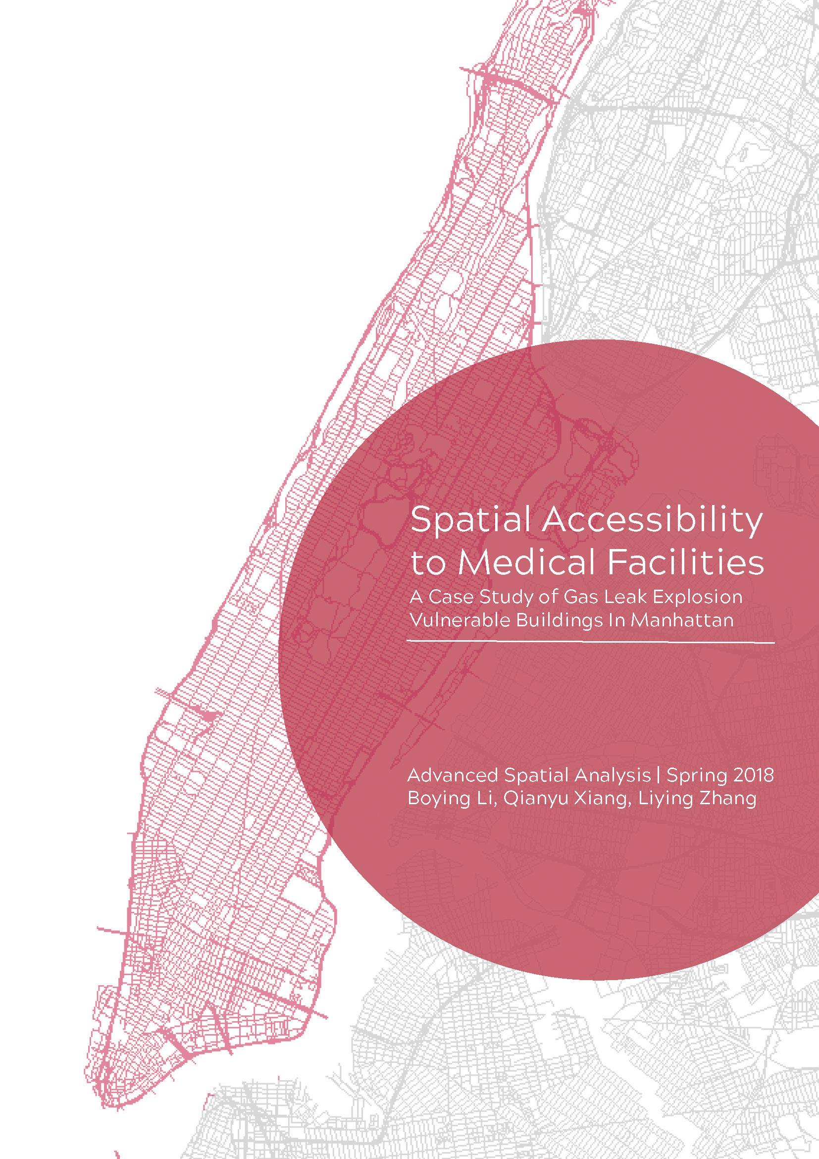
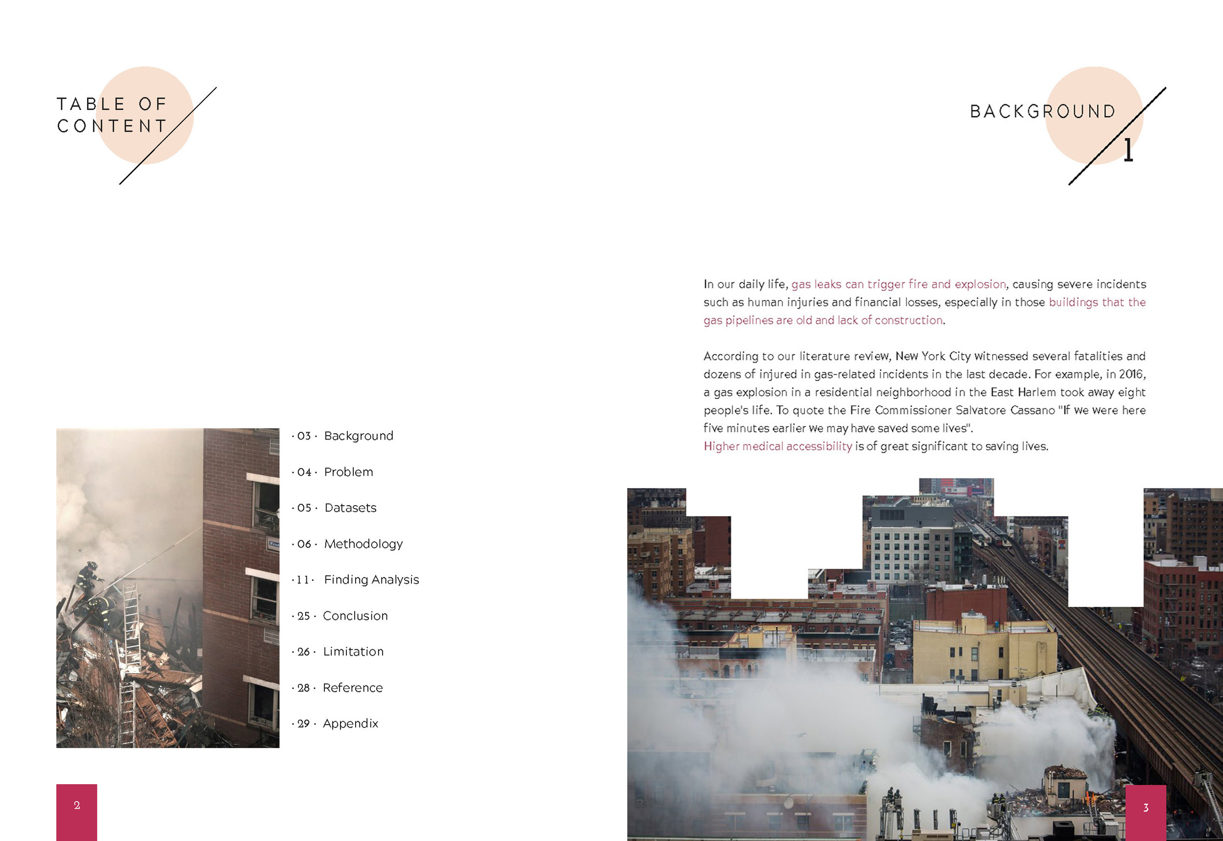
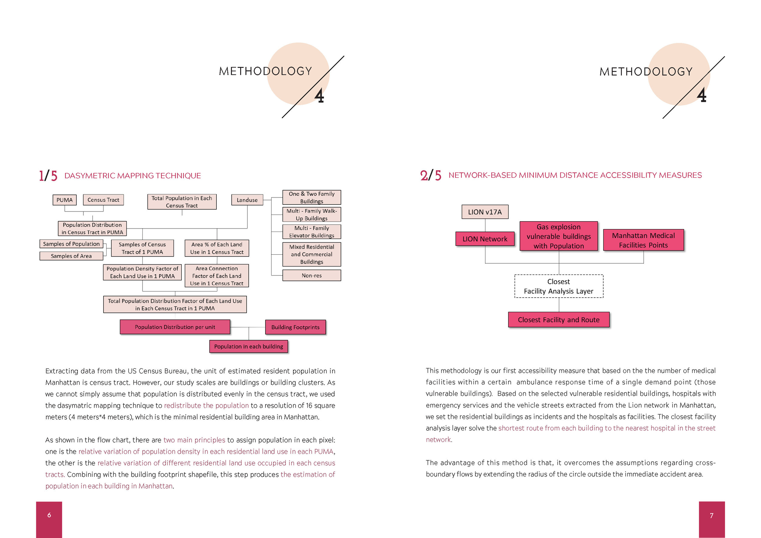
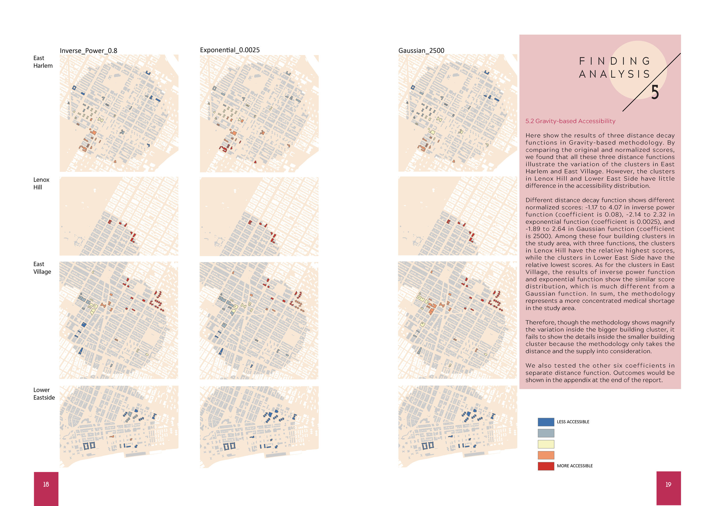
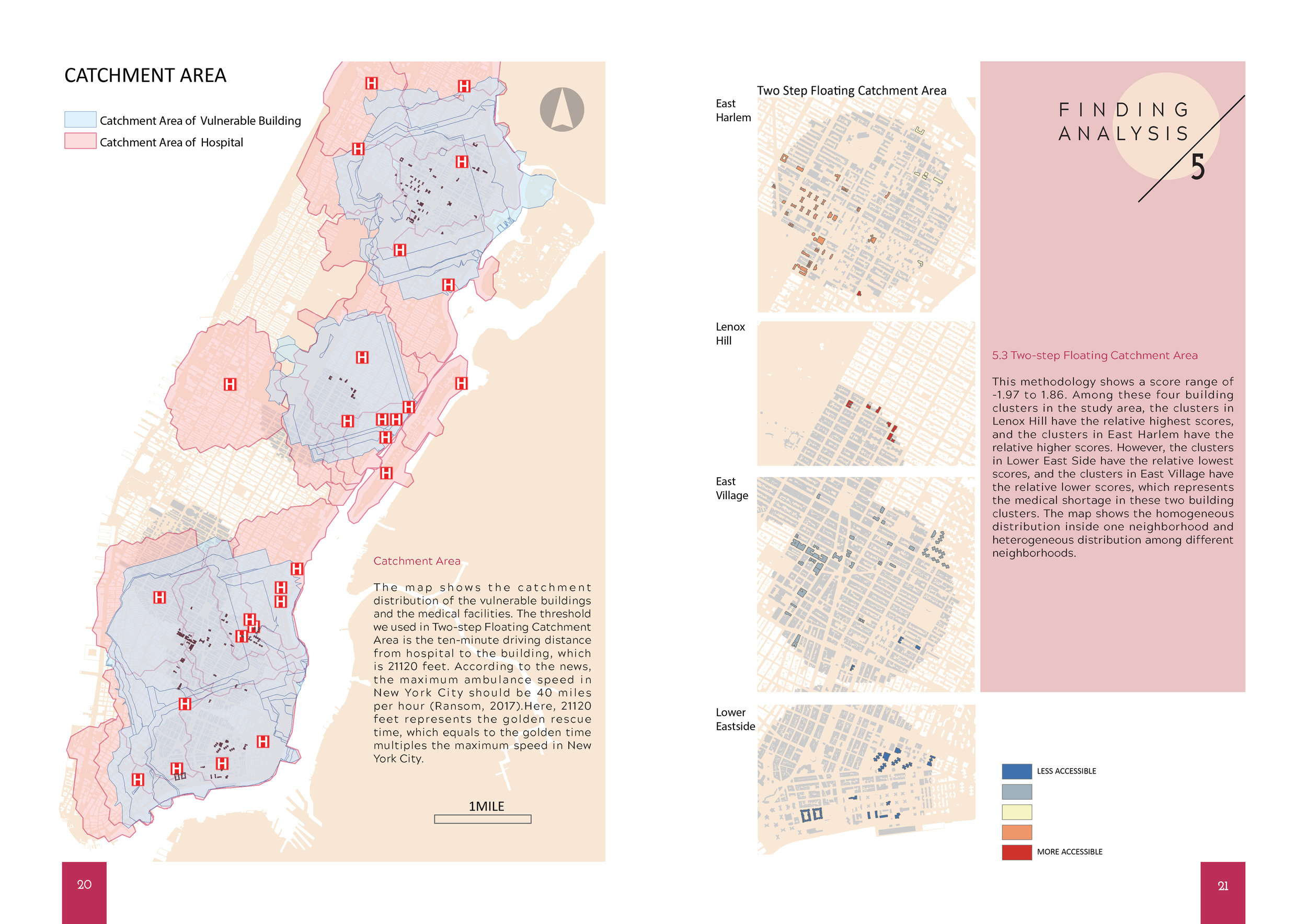
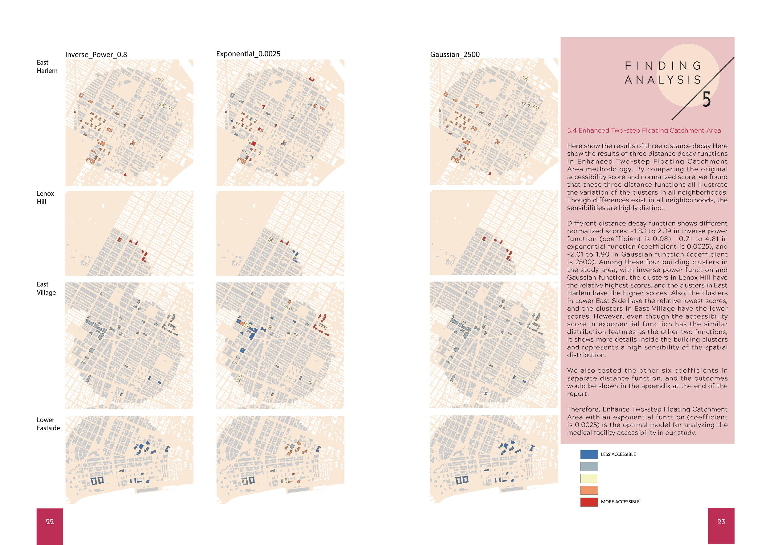
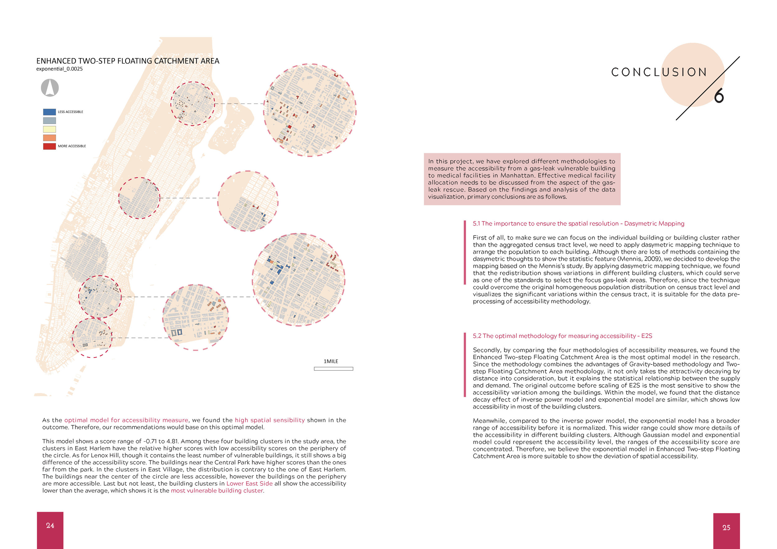
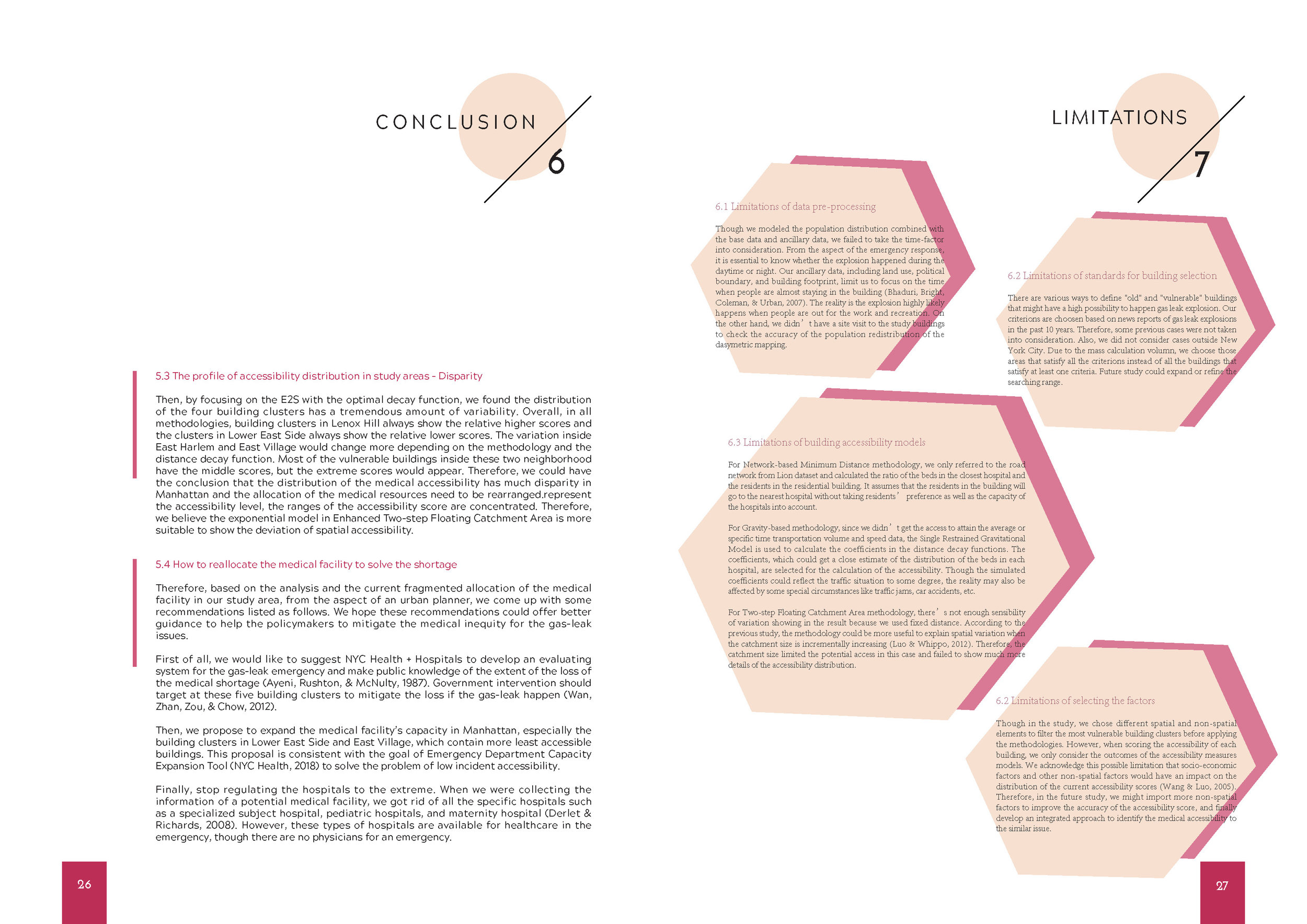
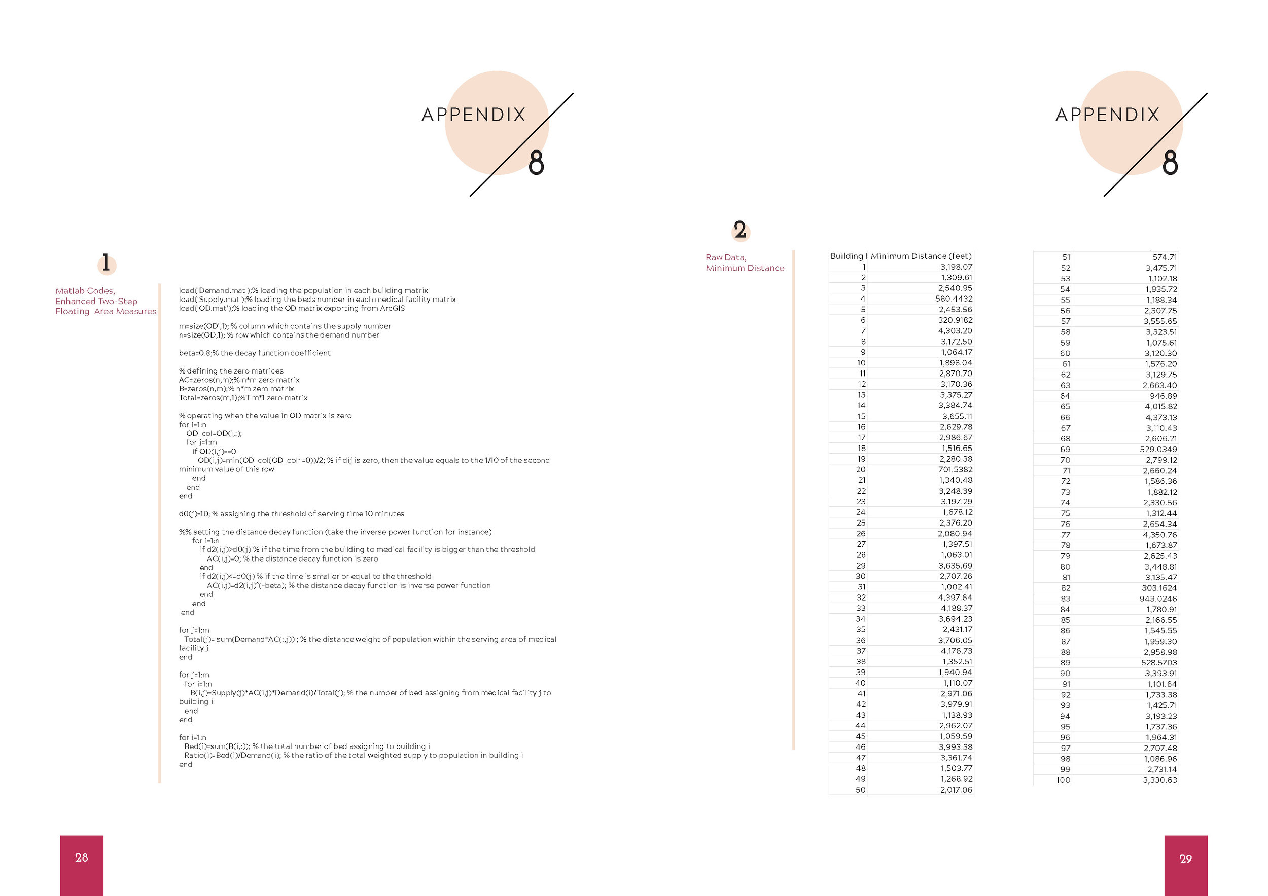
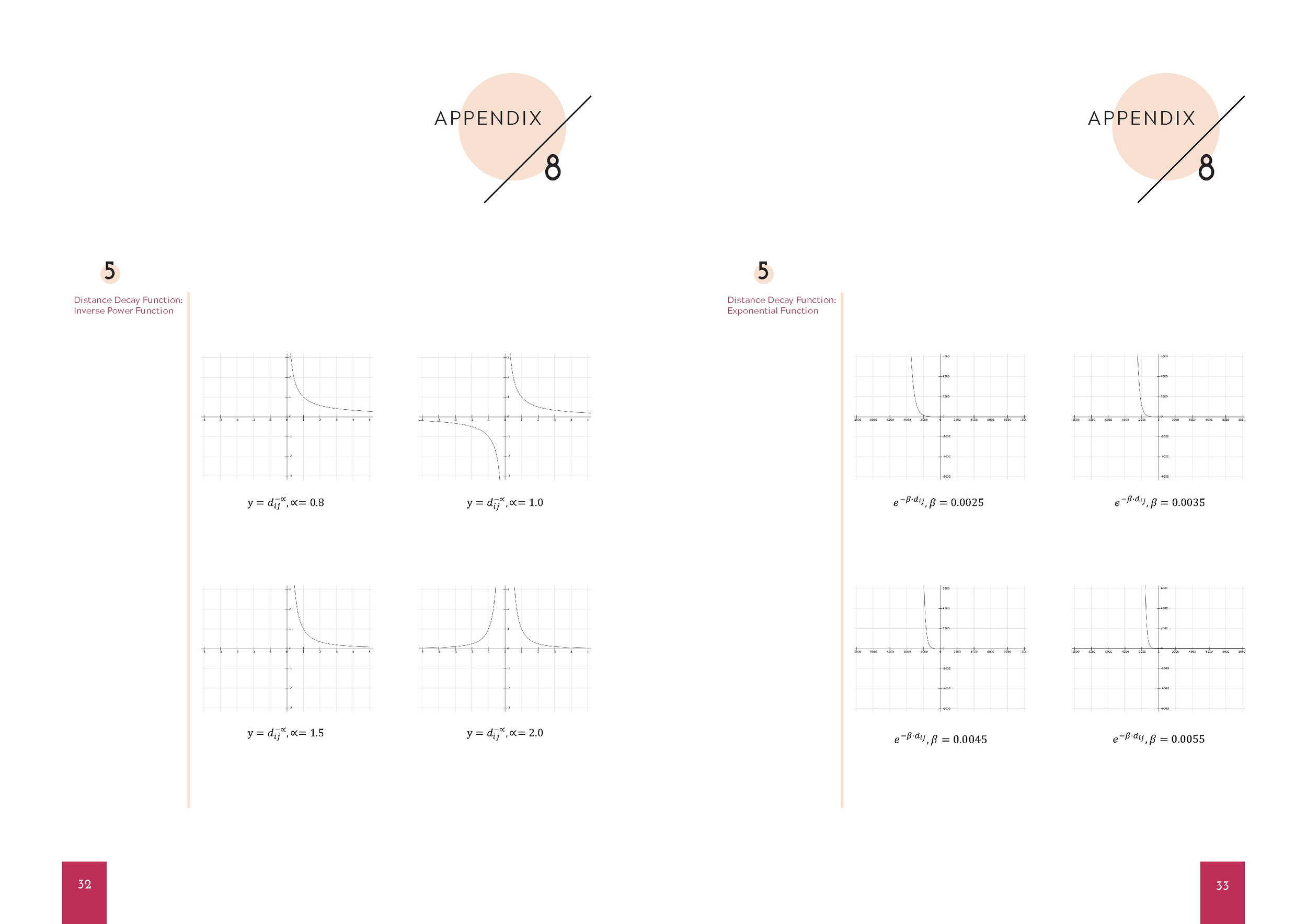
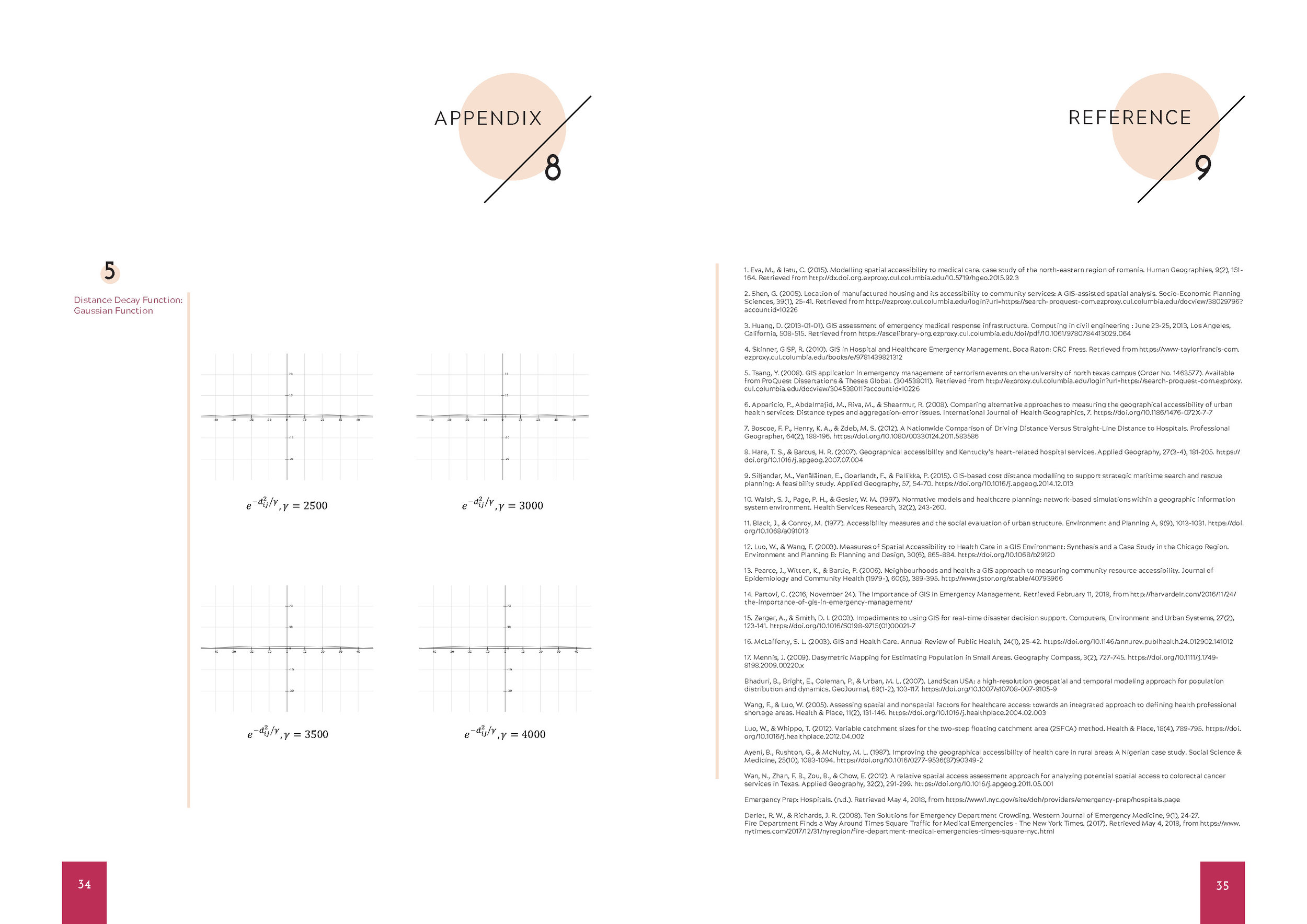
Boying Li, Qianyu Xiang, and Liying Zhang. "Spatial Accessibility to Medical Facilities: A Case Study of Gas Leak Explosion Vulnerable Buildings in Manhattan."