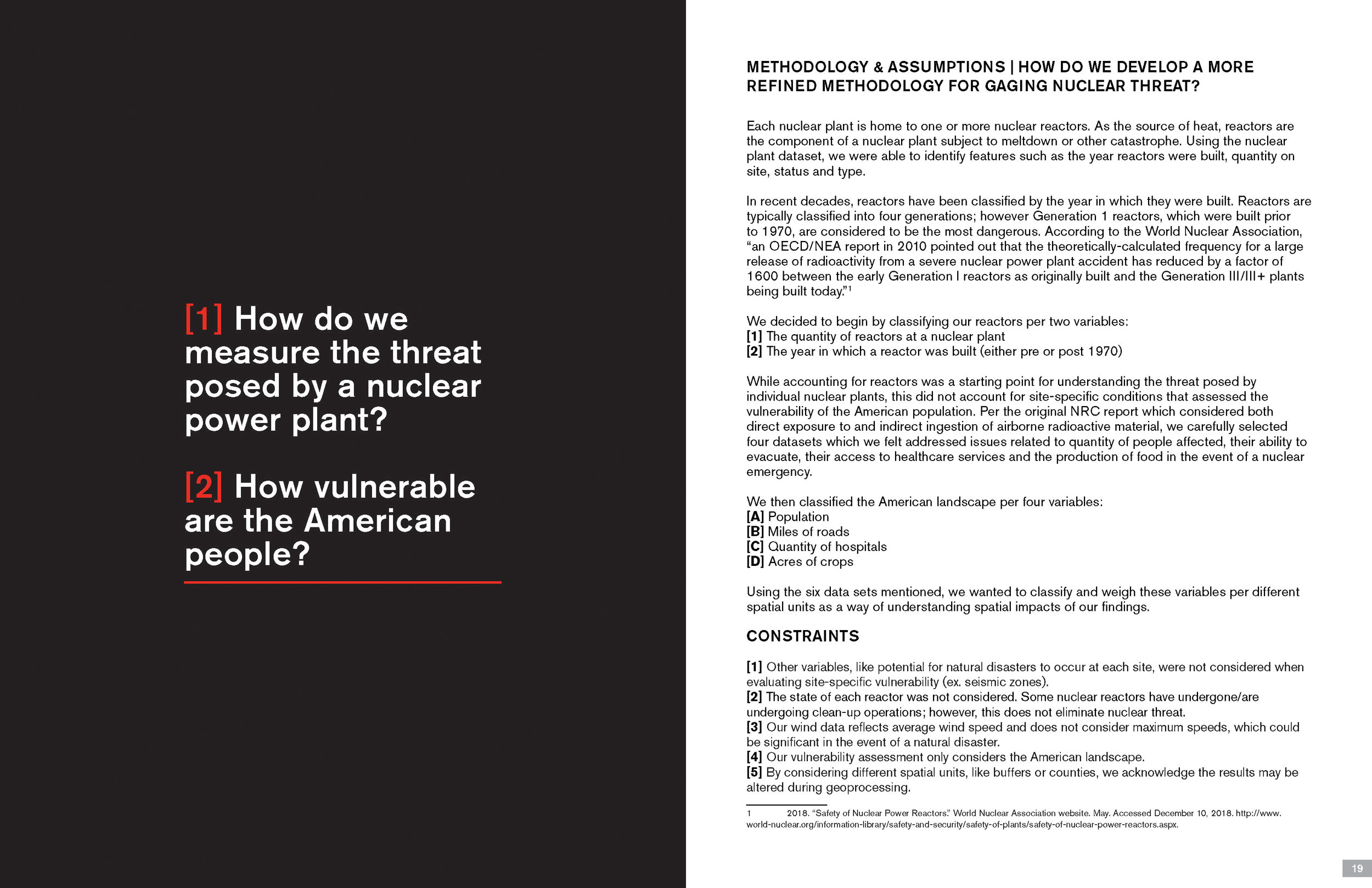
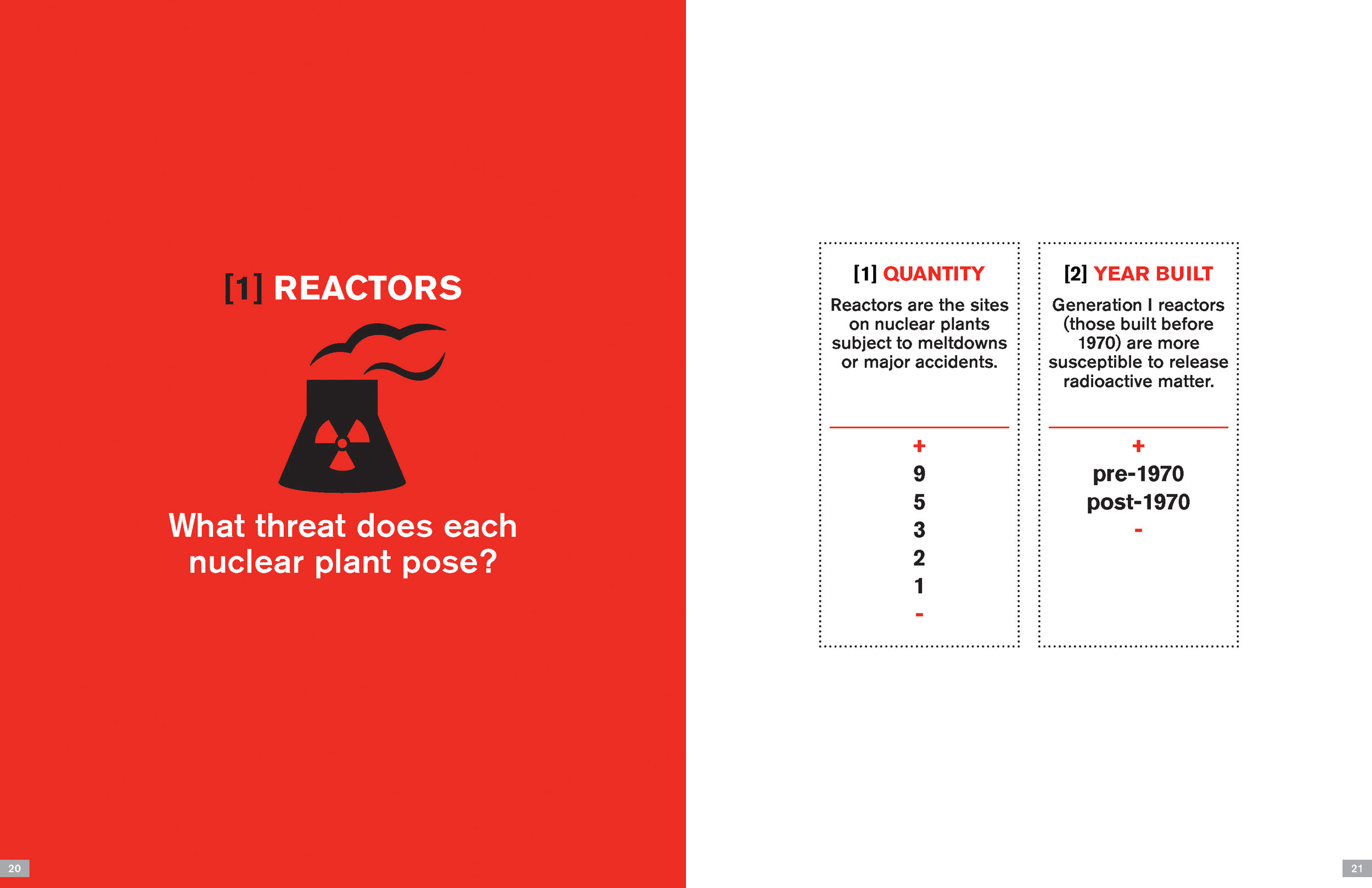
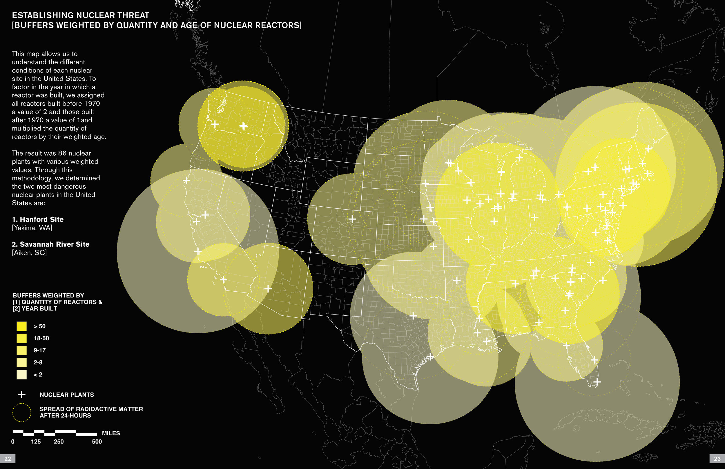
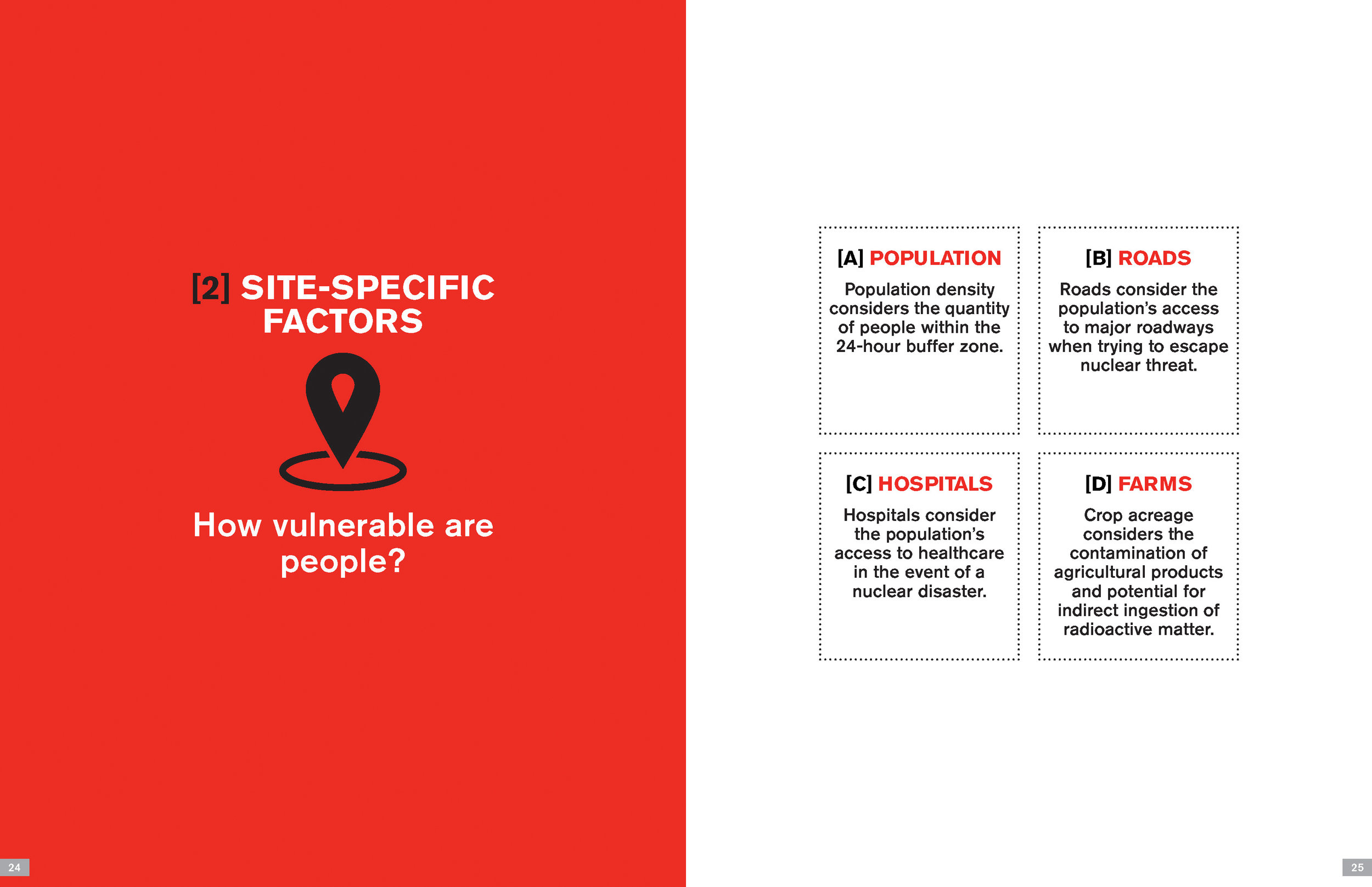
Critical Geographic Information Systems & Science:
Studying Spaces, Cities, and Stories
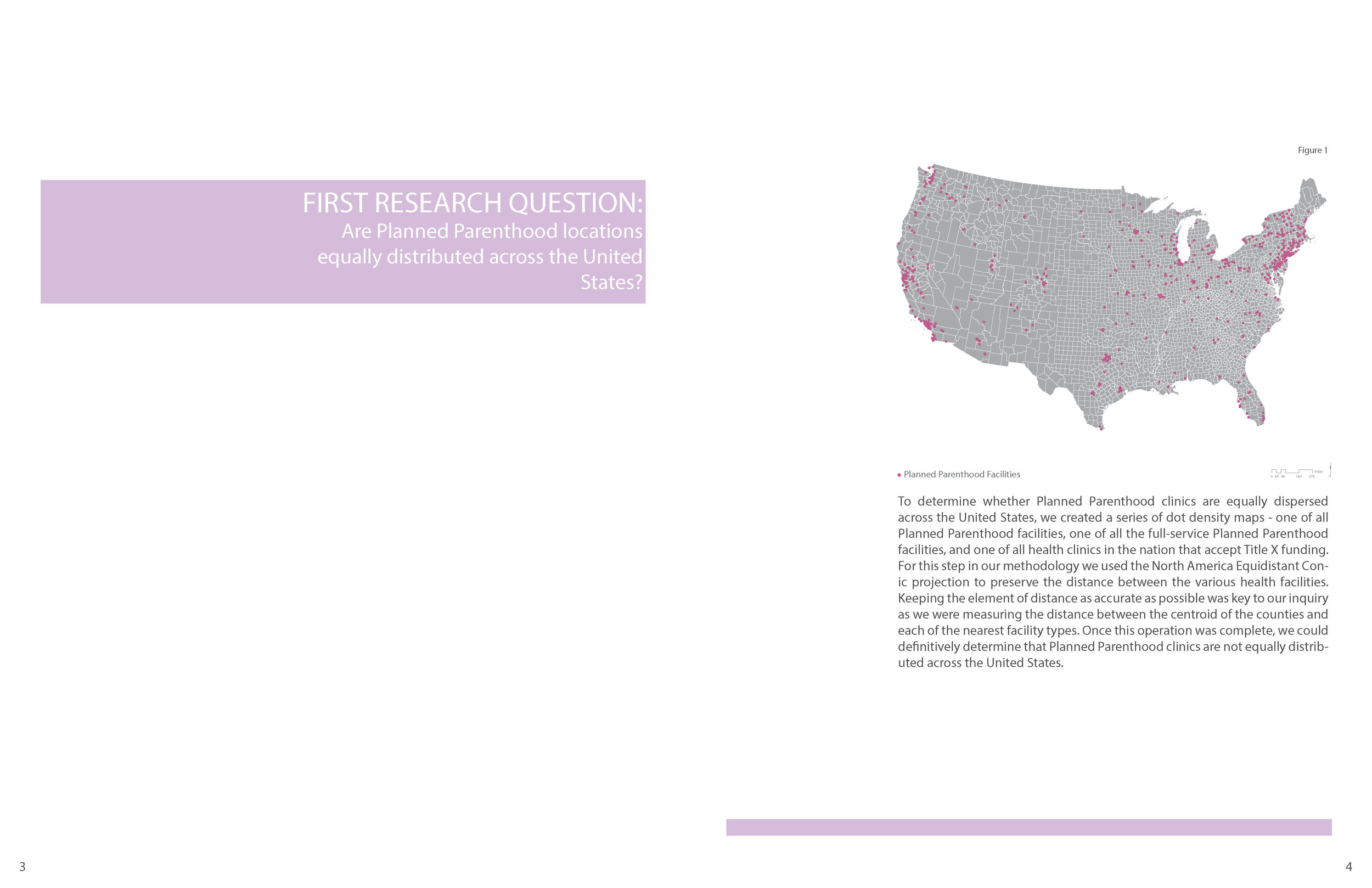
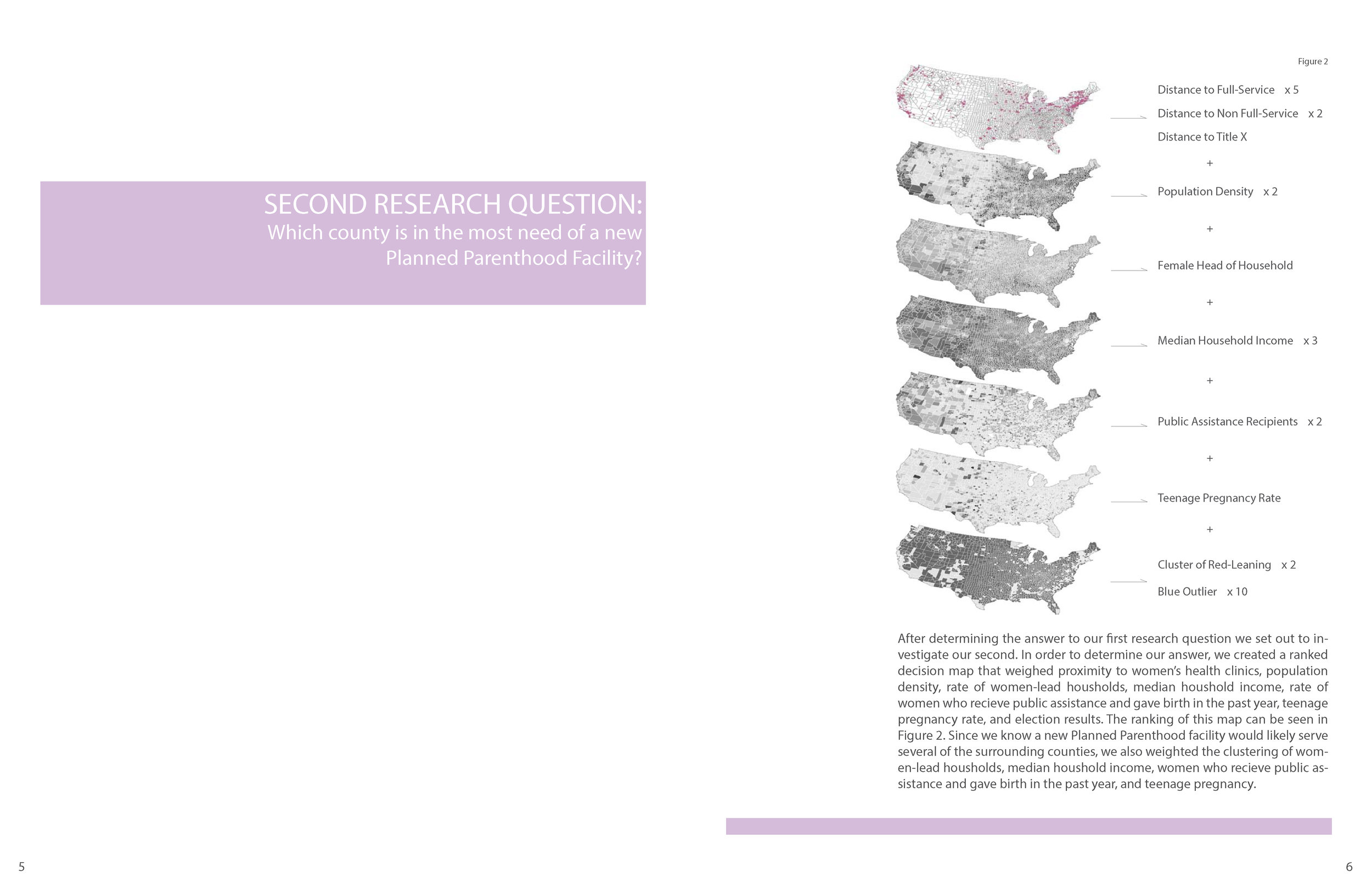
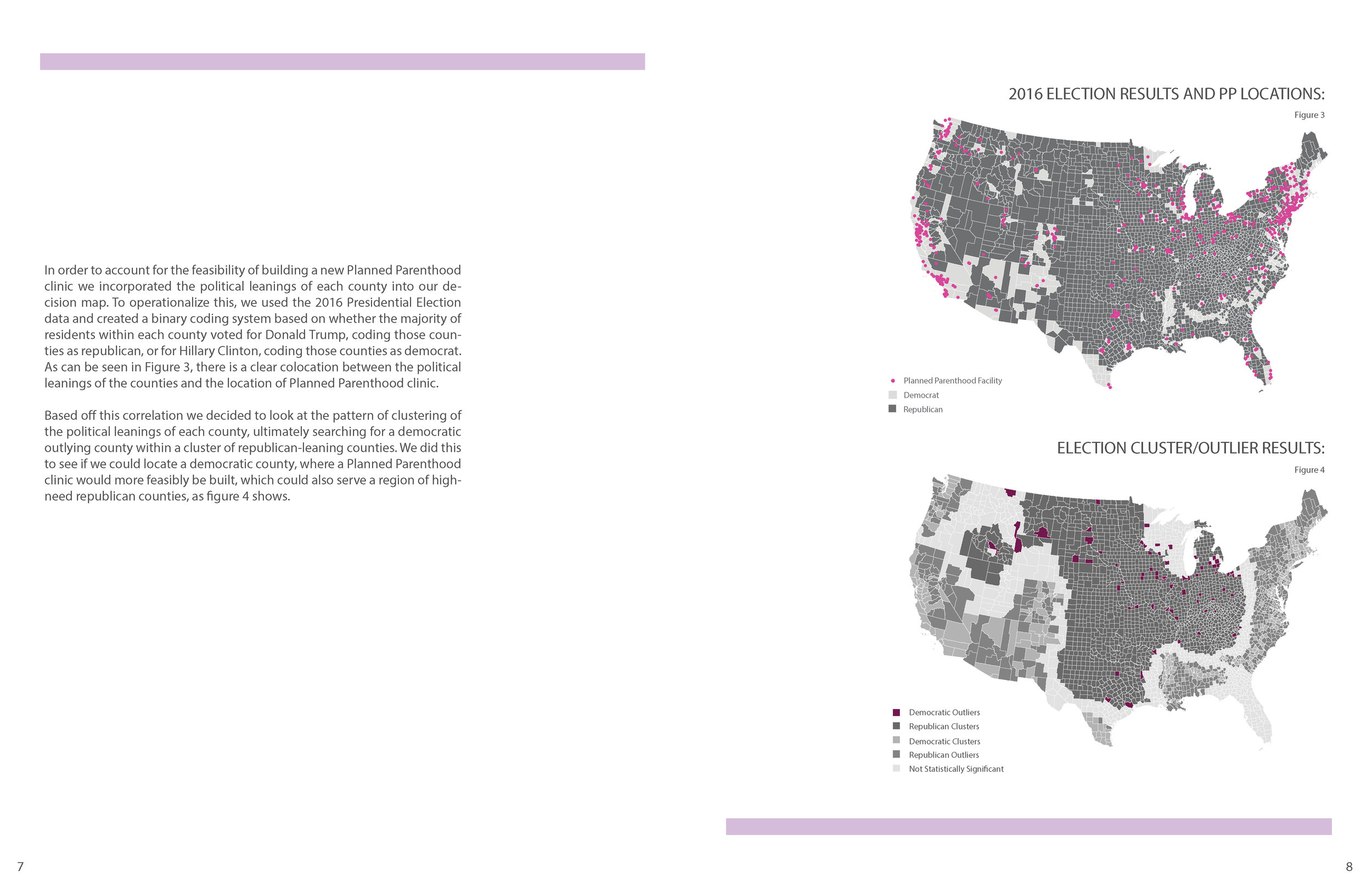
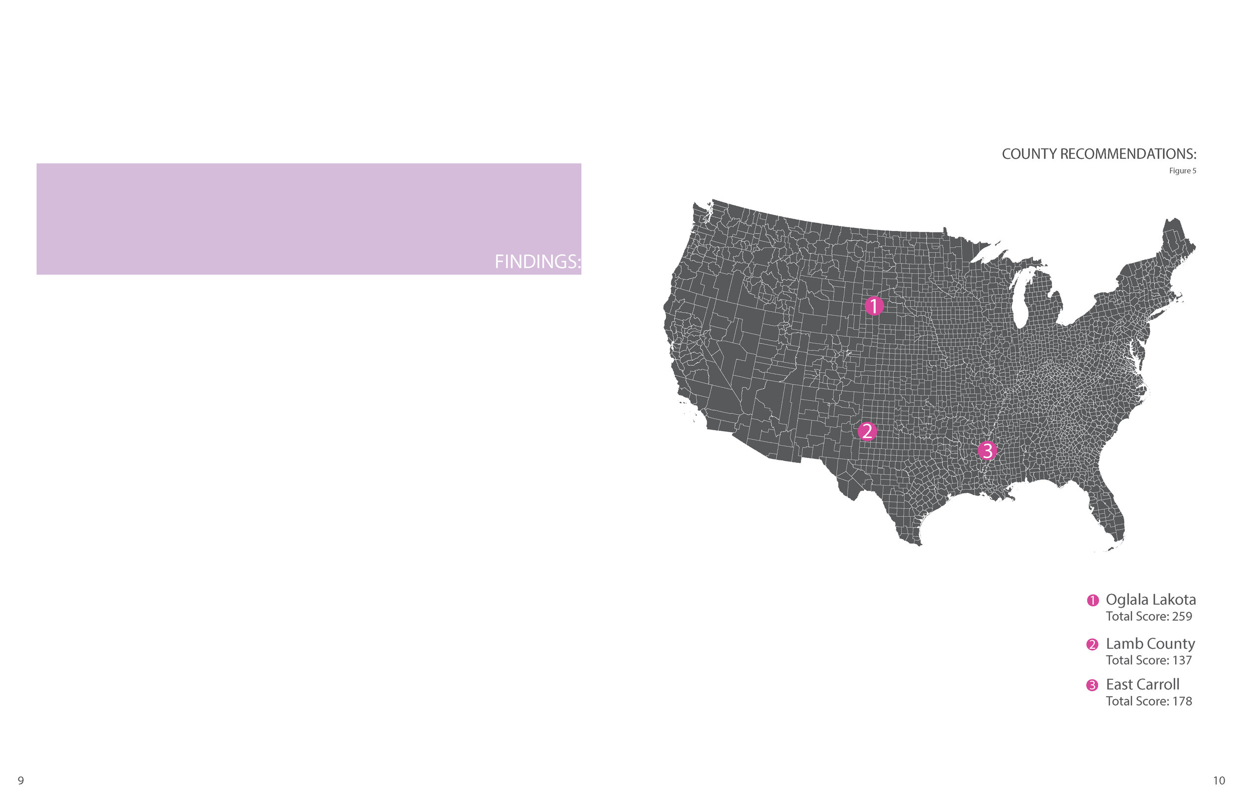
Geographic Information Systems, taught in the Urban Planning program of Columbia's Graduate School of Architecture, Planning and Preservation (GSAPP), is a critical GIS course on human and physical geography, information systems, and data-driven spatial research methodologies, within the context of questions relevant to working in urban environments. The course is required for MSUP students and a Visual Studies elective for architecture students.
Featured here are excerpts from example student projects from the Fall 2017 and Fall 2018 courses. Lab instructors: Grga Basic, Clara Chung, and Kazuki Sakamoto
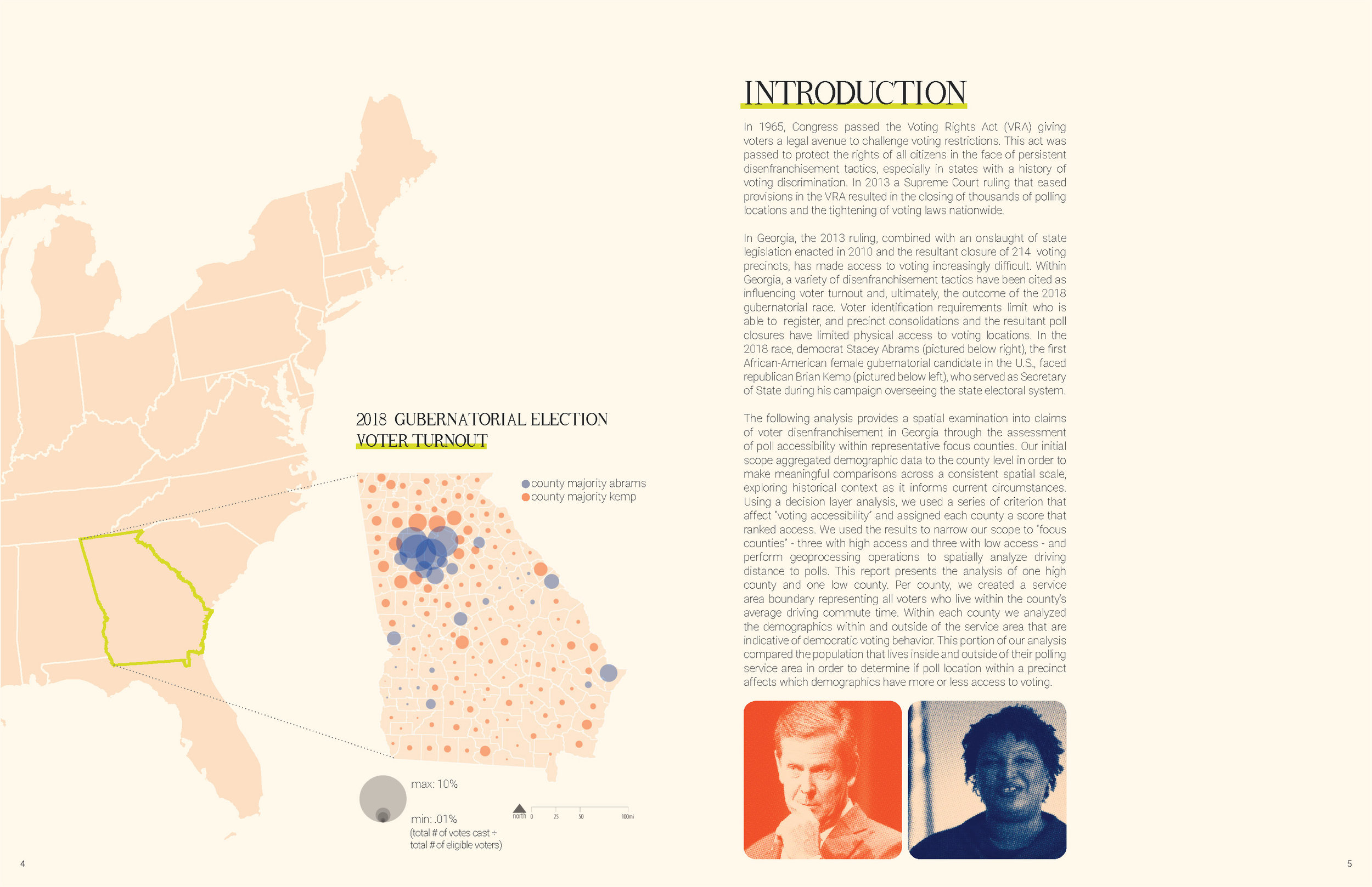
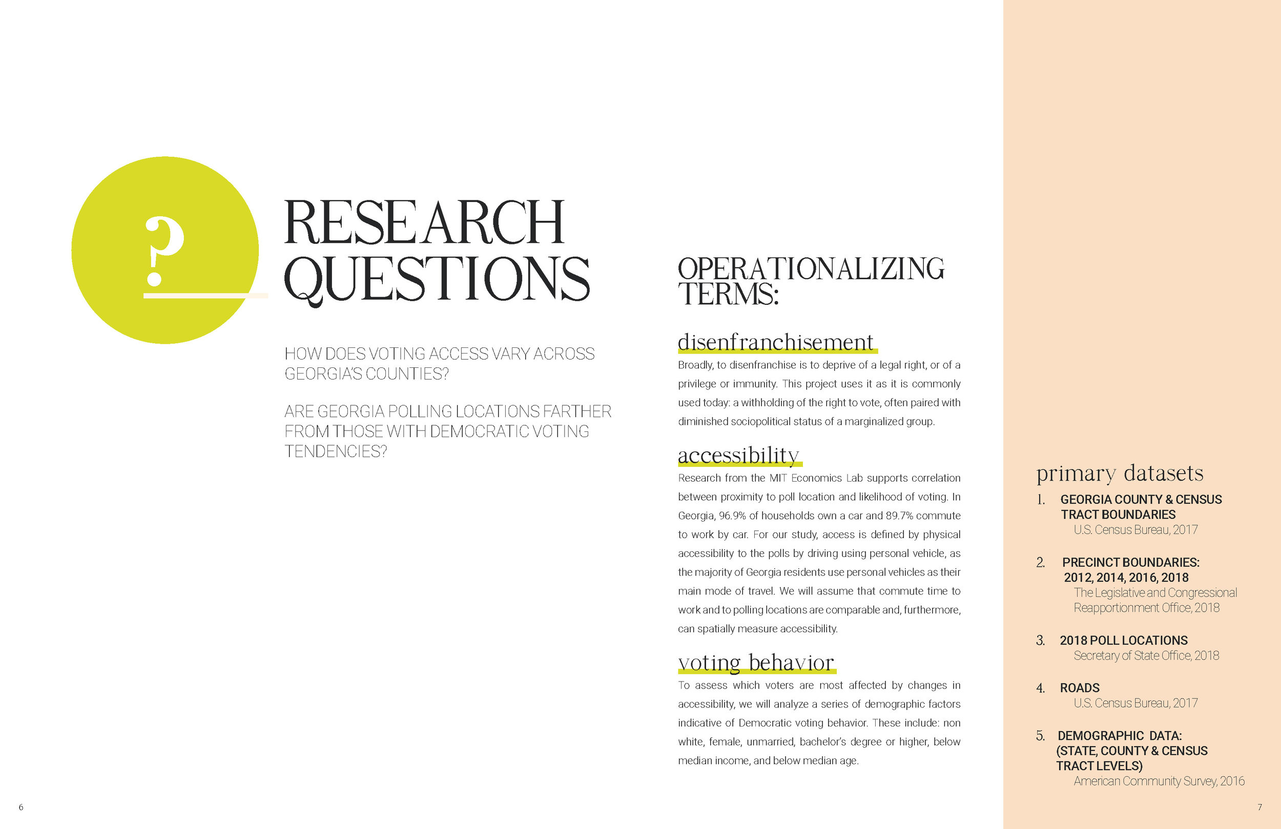
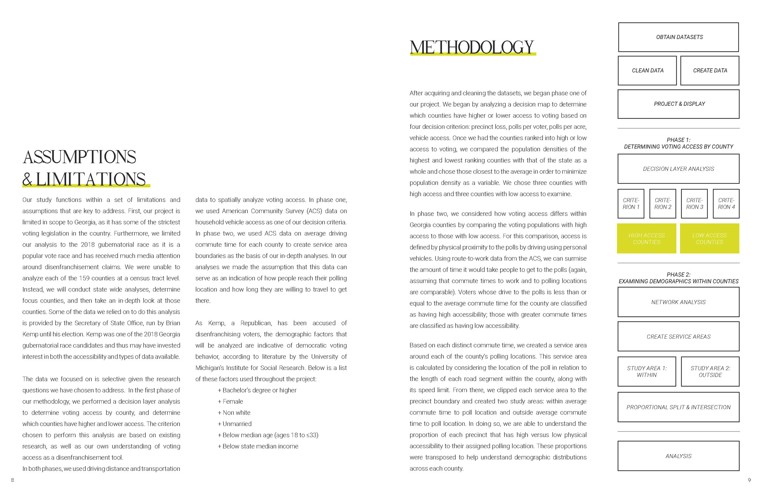
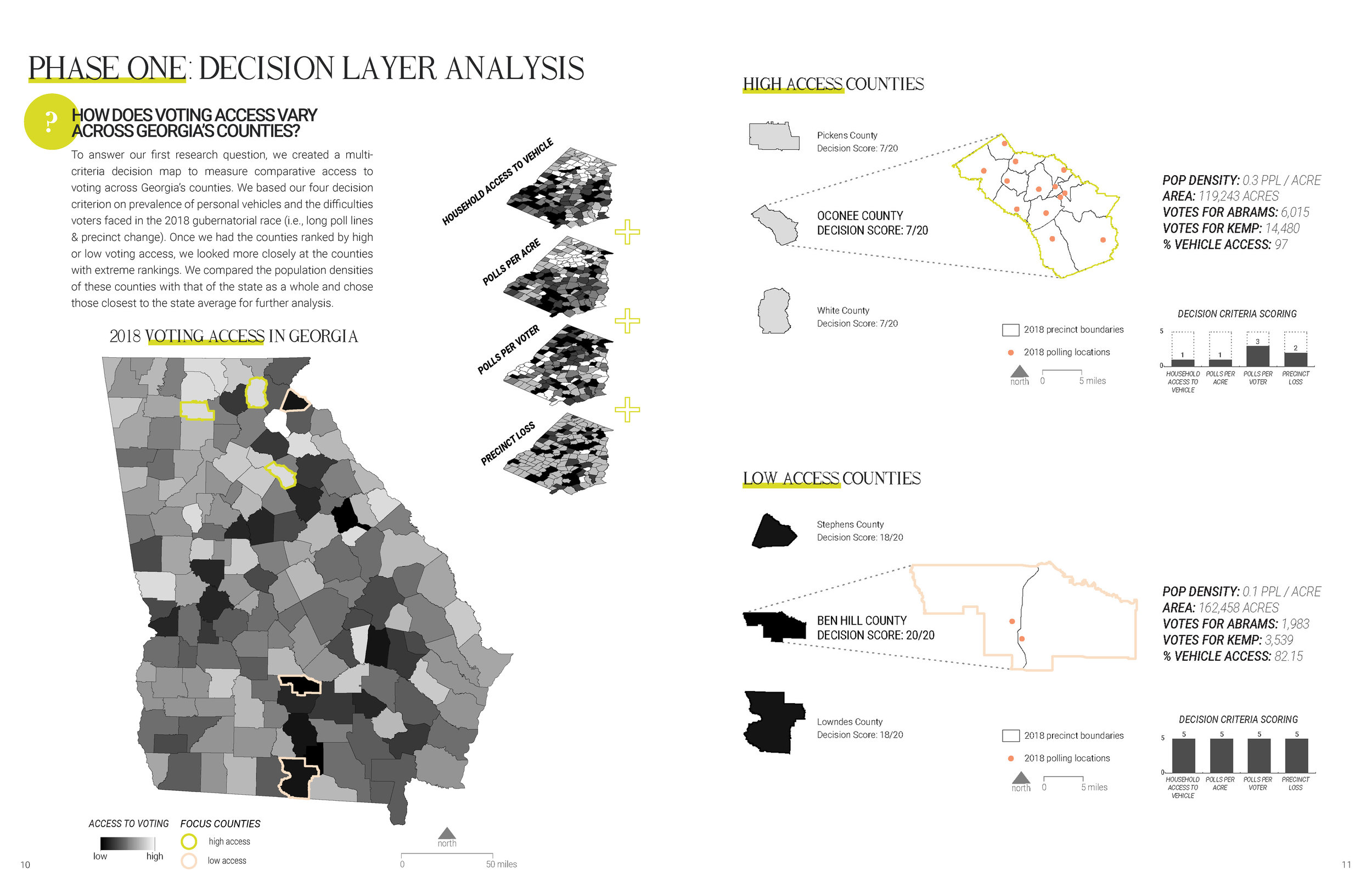
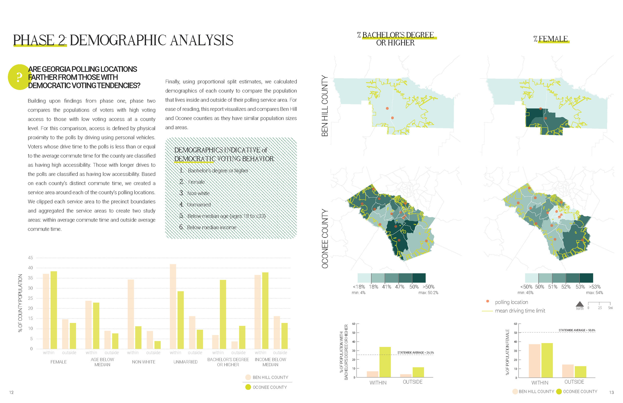
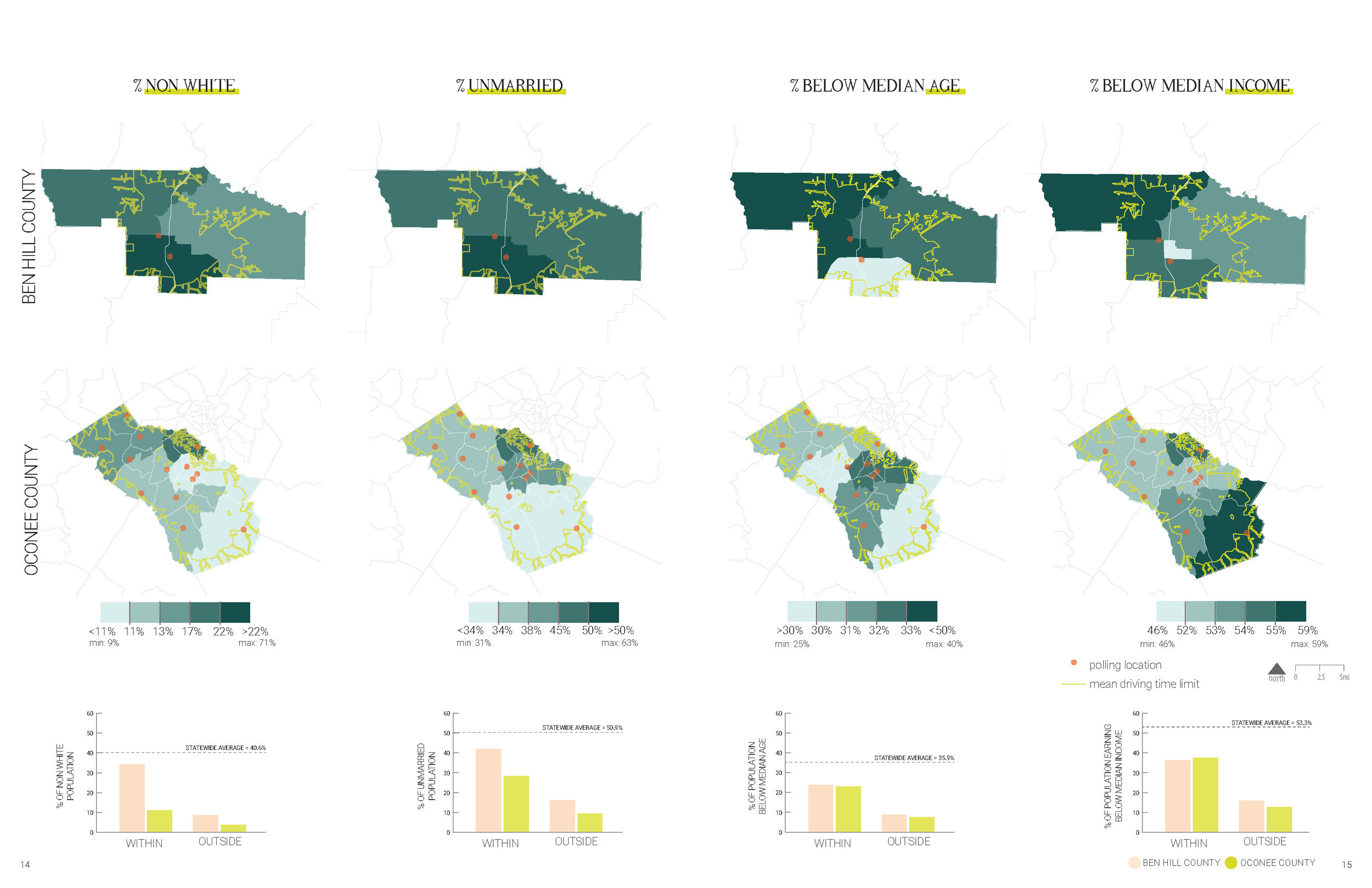
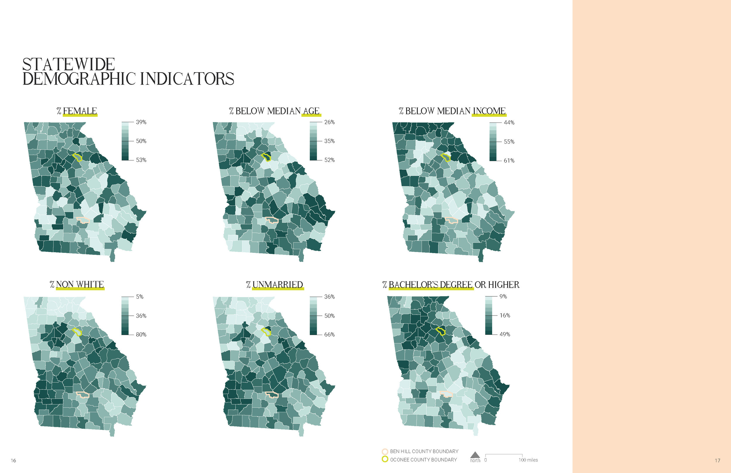
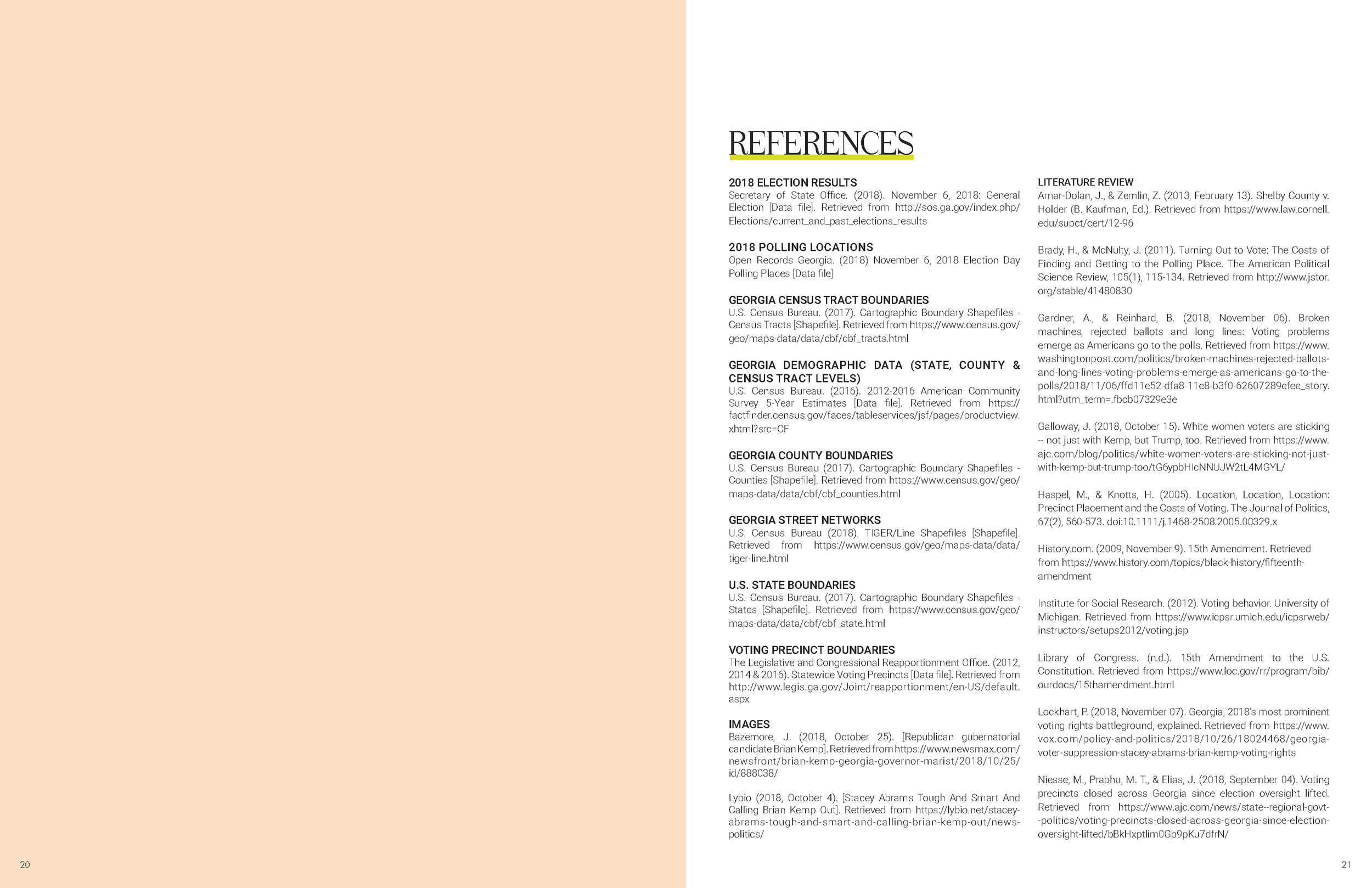
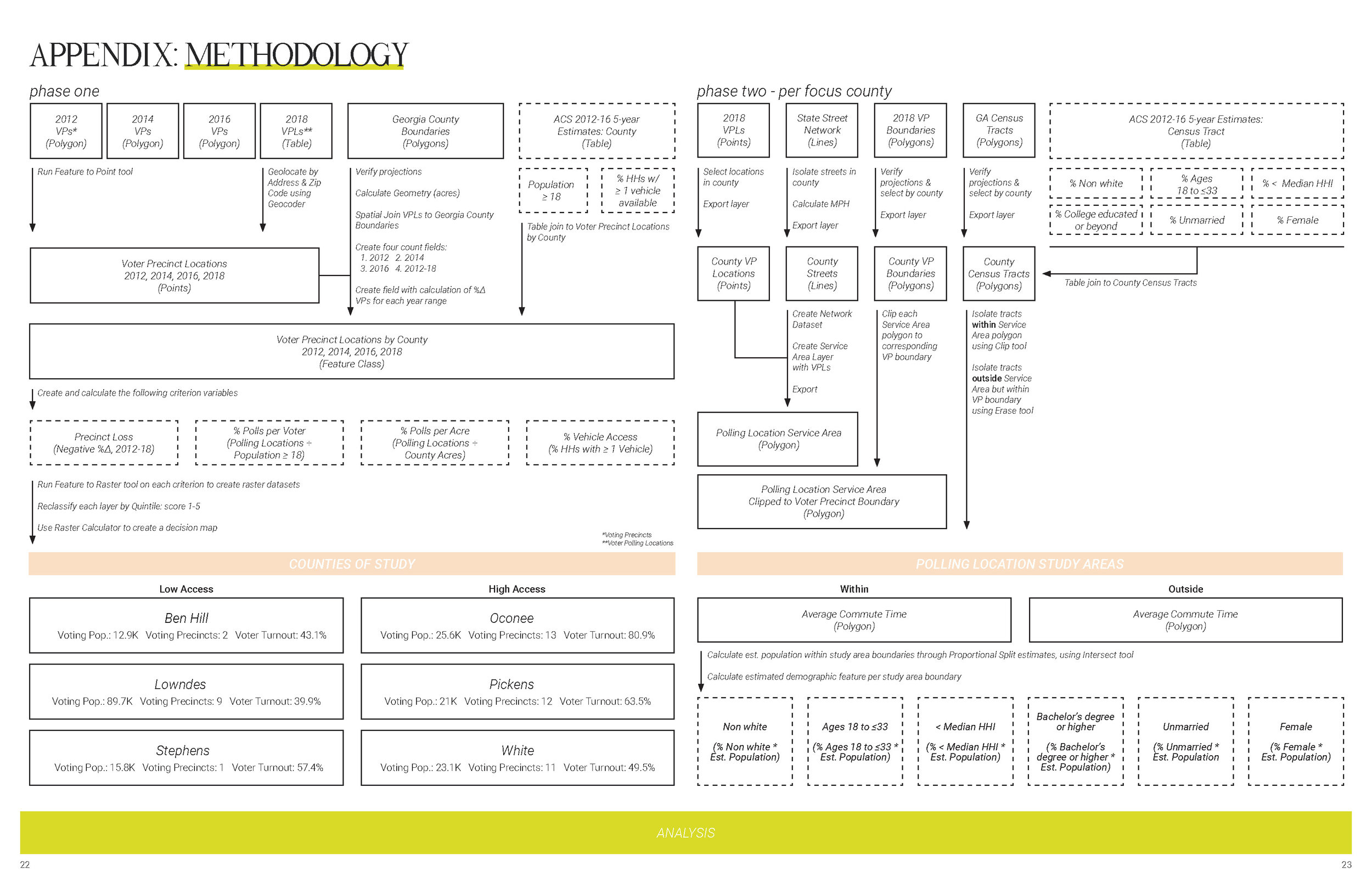
Alanna Browdy, Rebecca Cook, and Helen Pierson. “Voter Disenfranchisement in Georgia (2018).”
(Fall 2018)
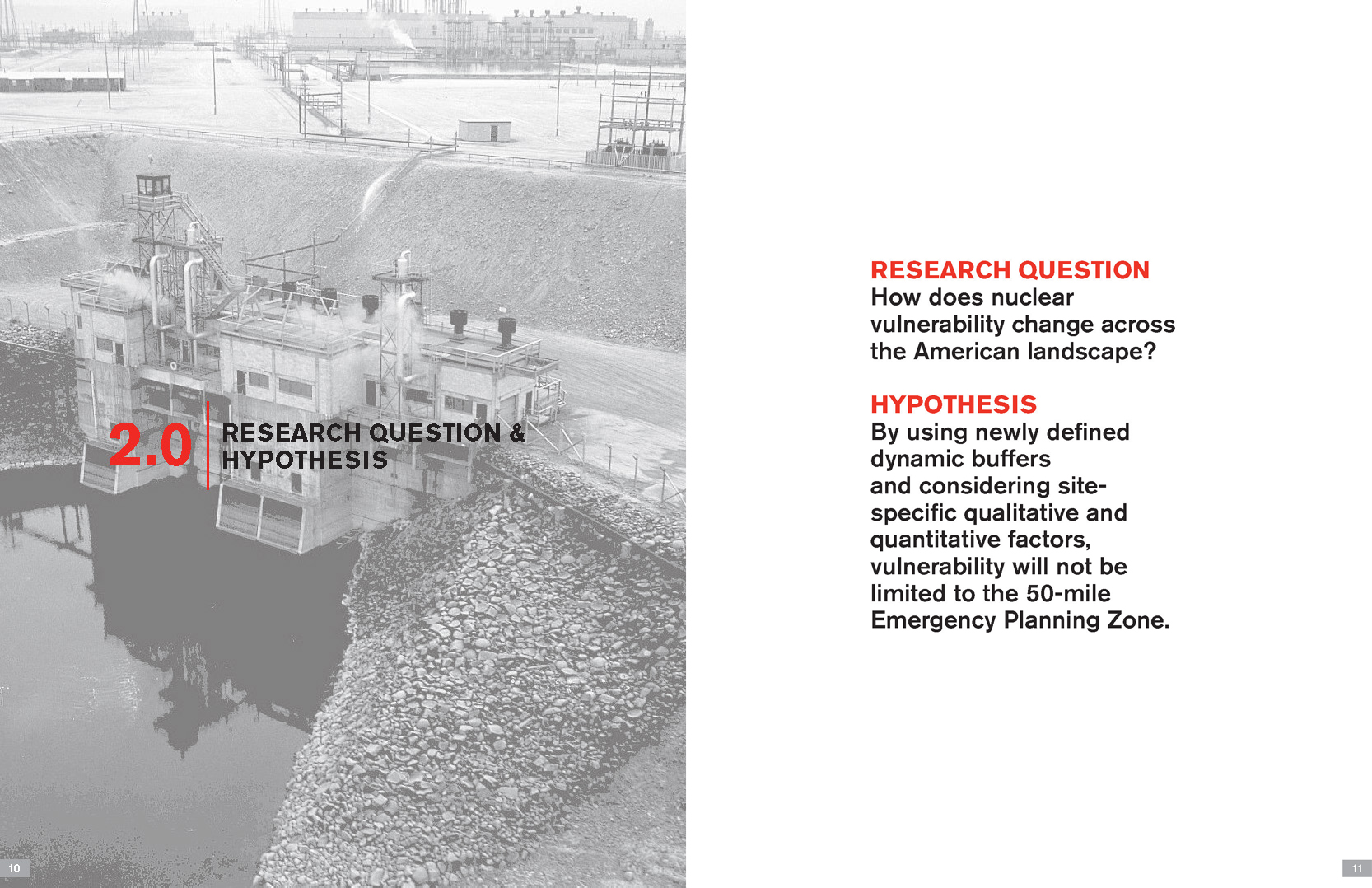
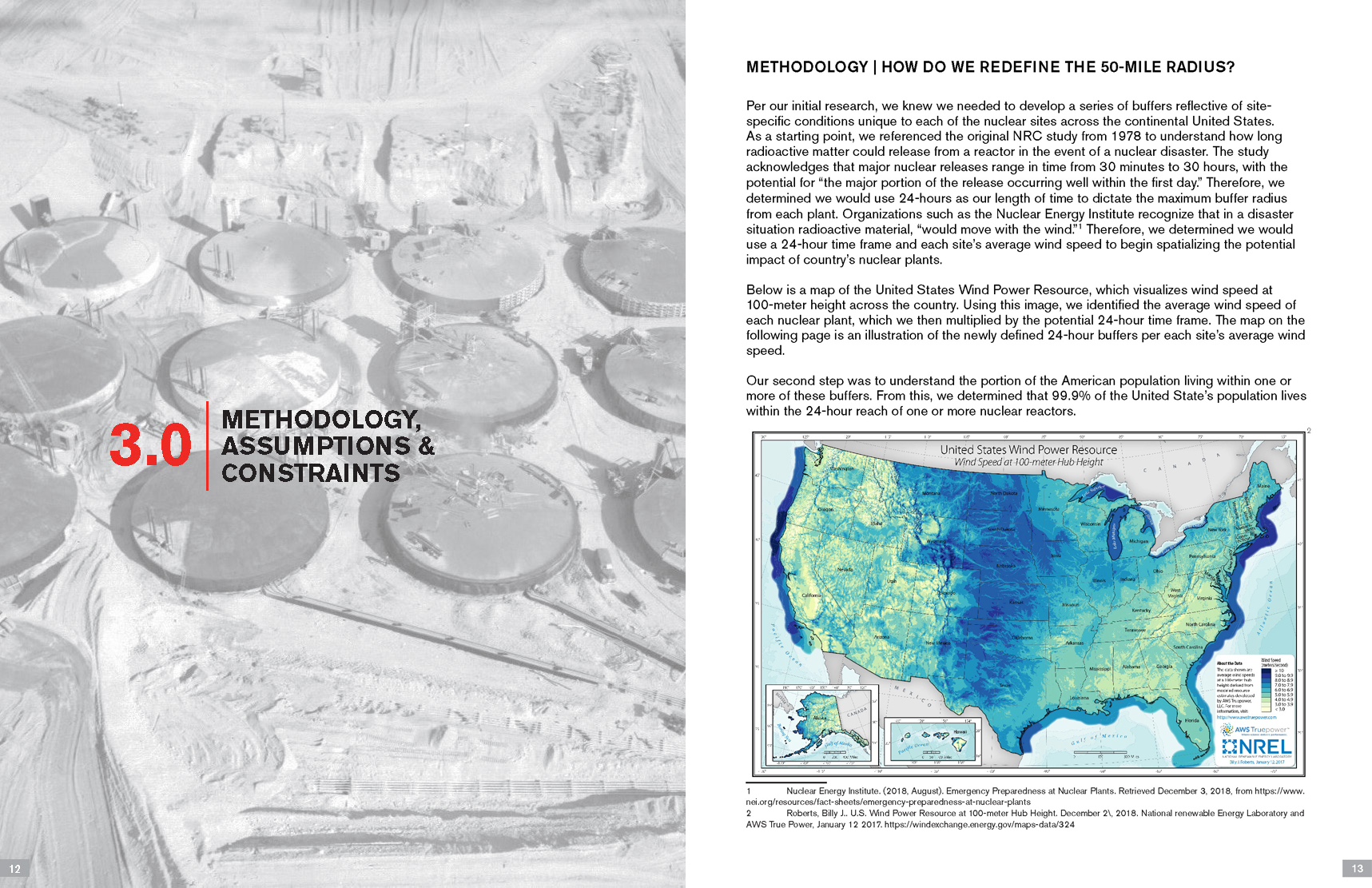
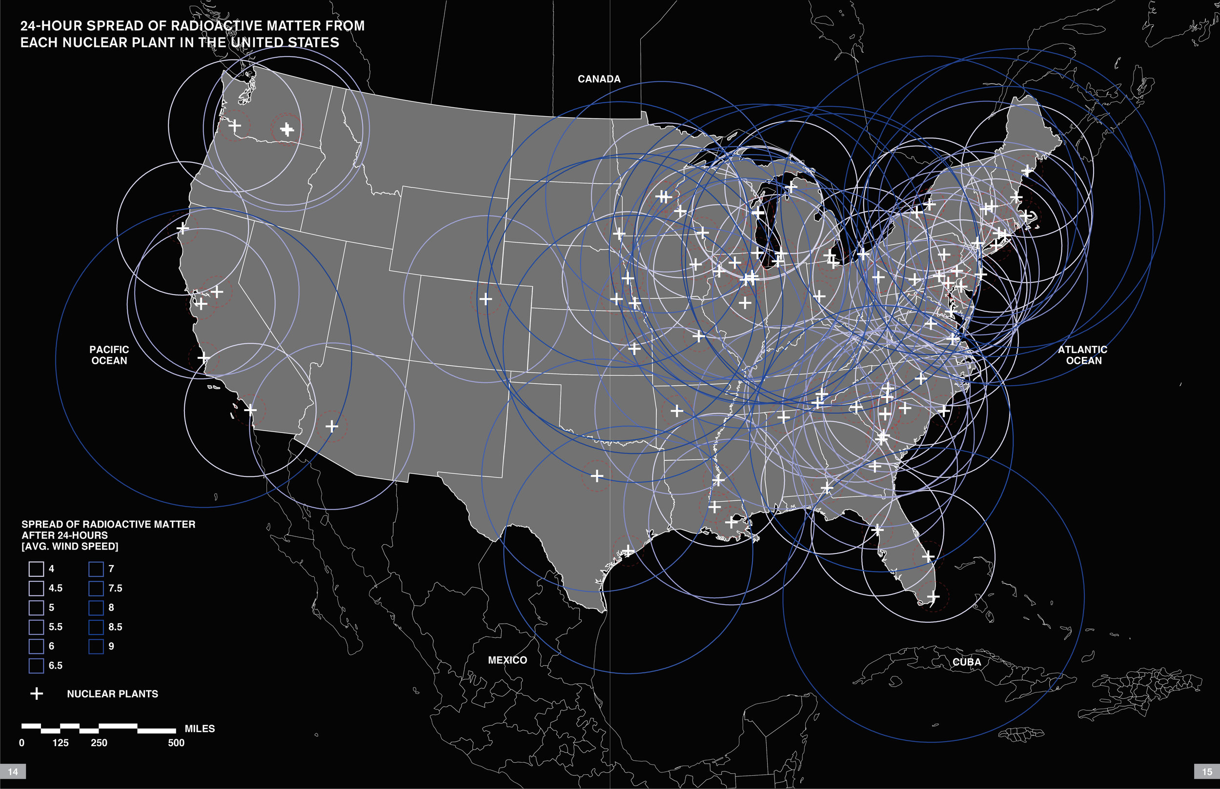
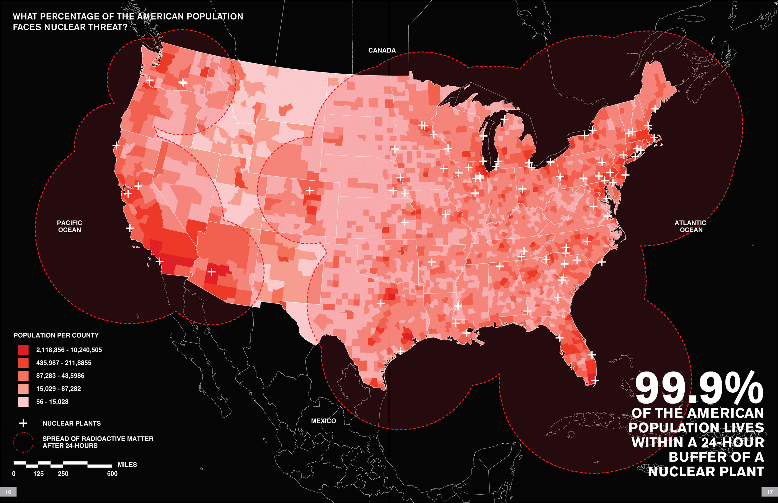
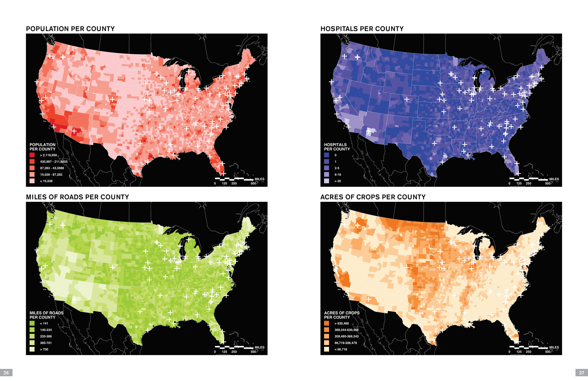
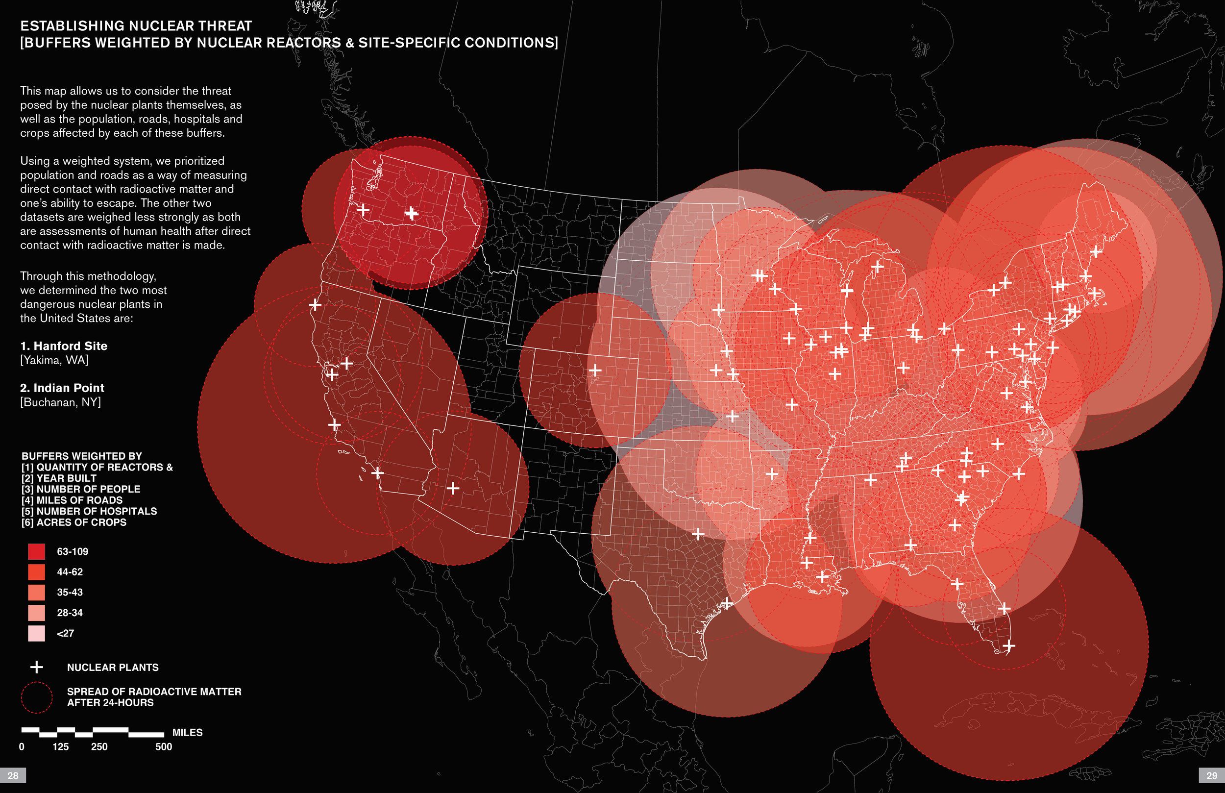
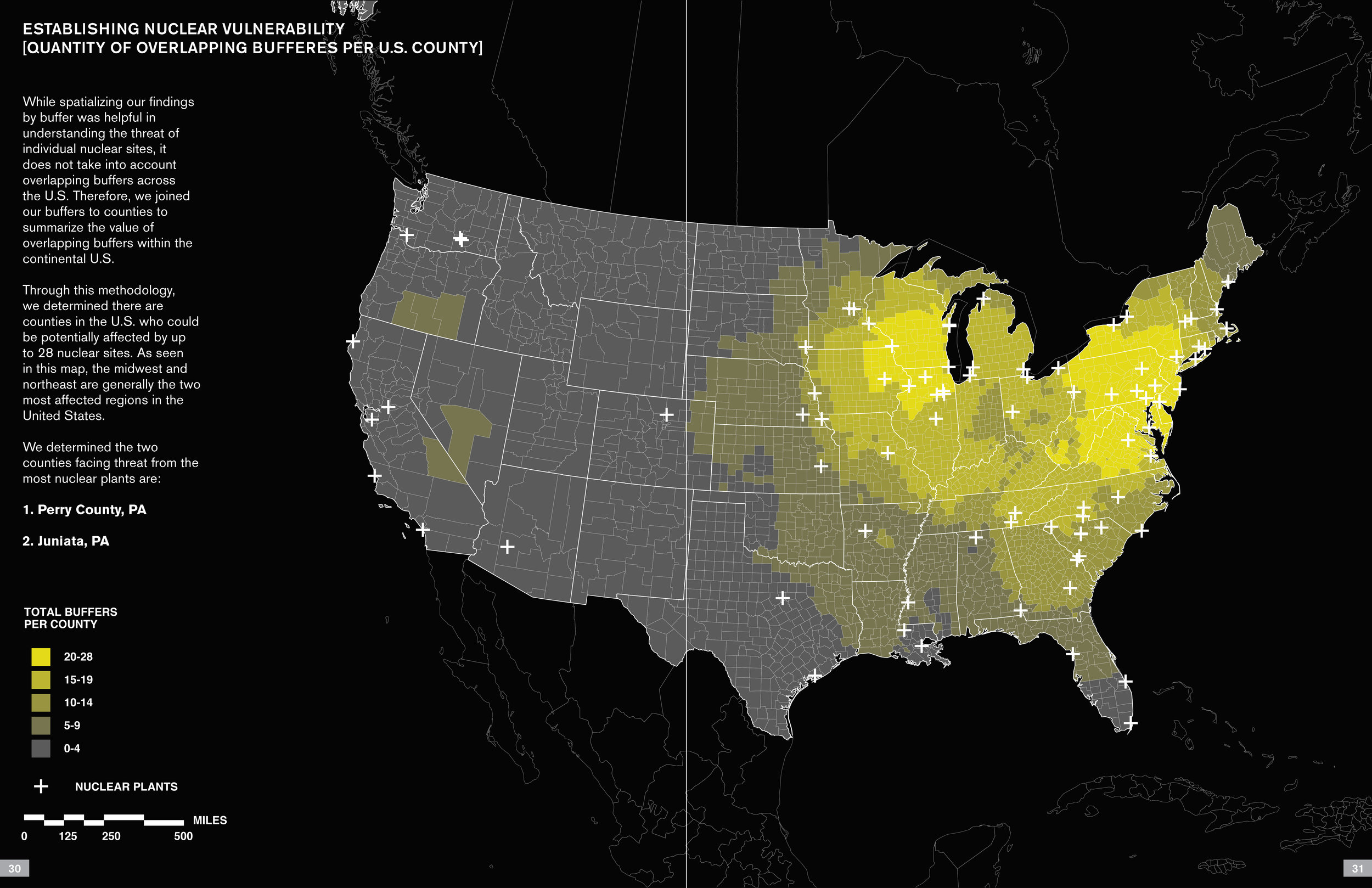
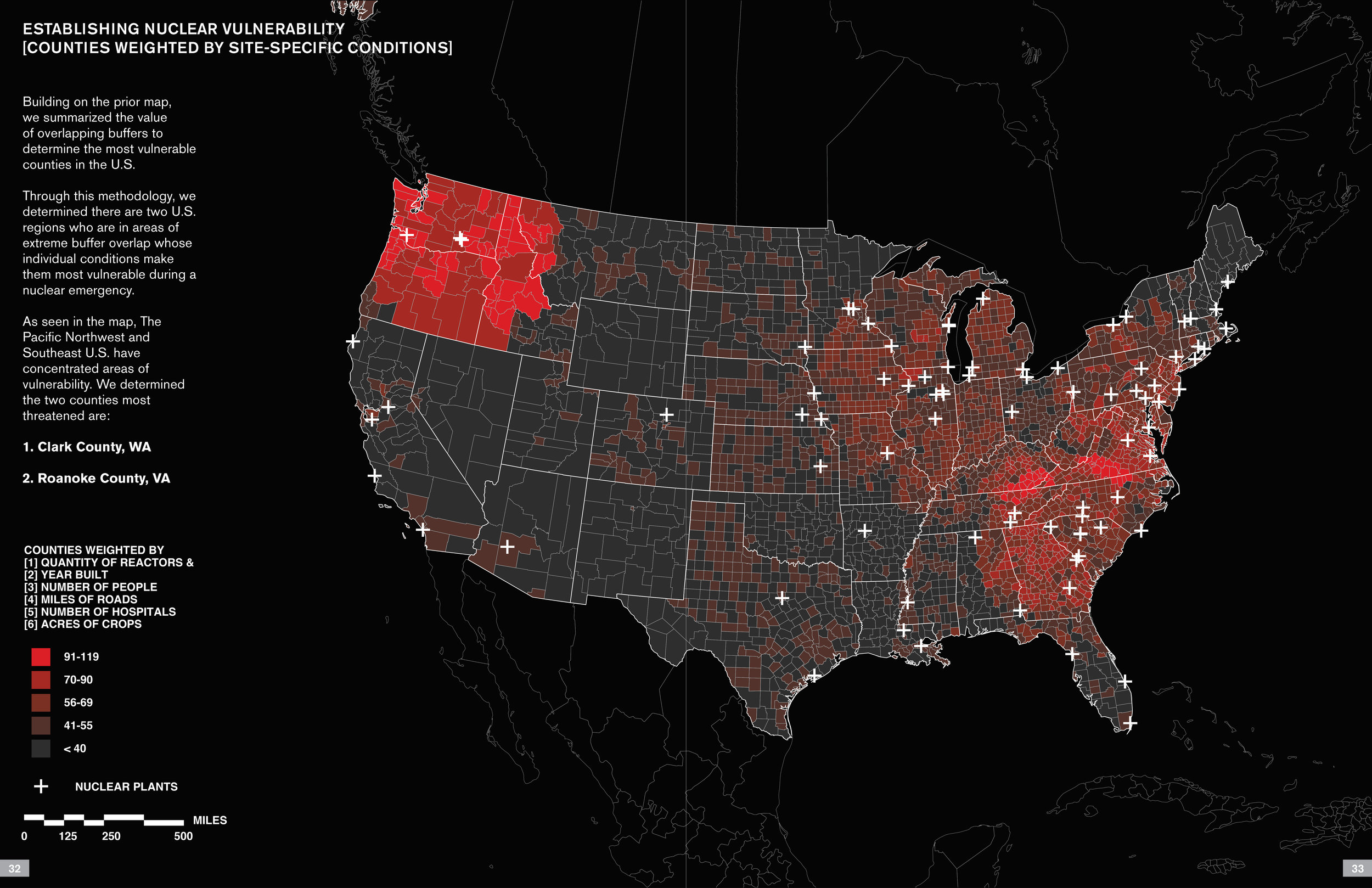
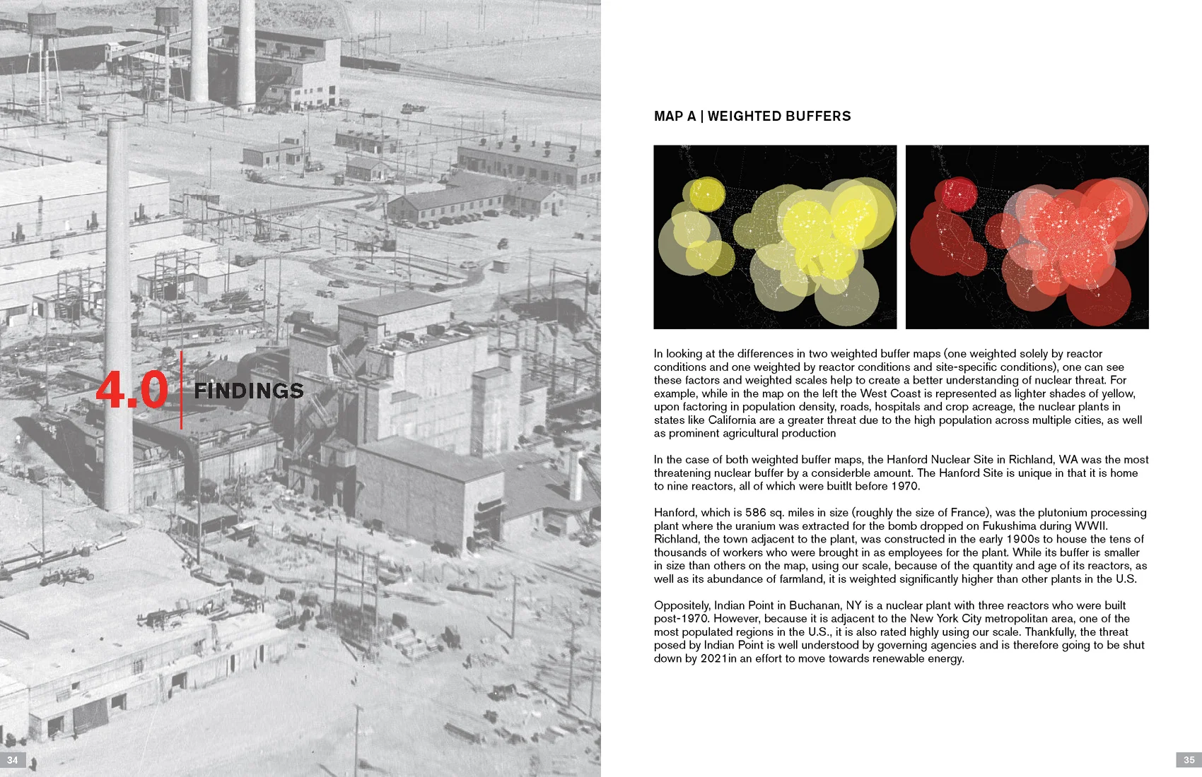
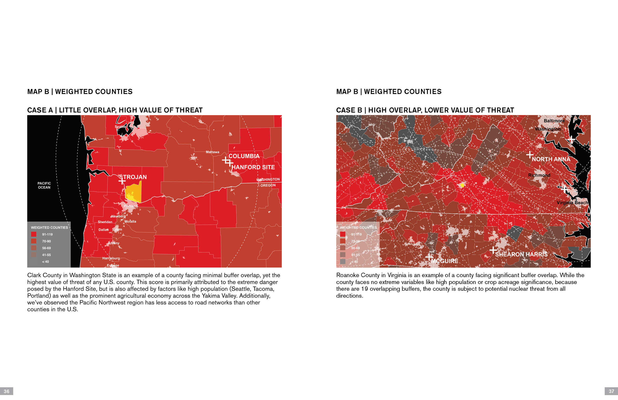
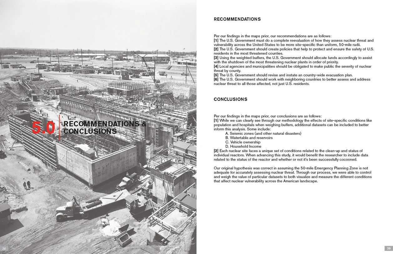
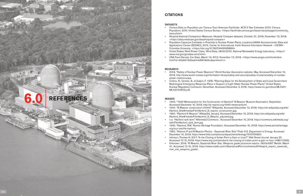
Alexandra Burkhardt and Maria Palomares. “Redefining the 50-mile Radius.”
(Fall 2018)
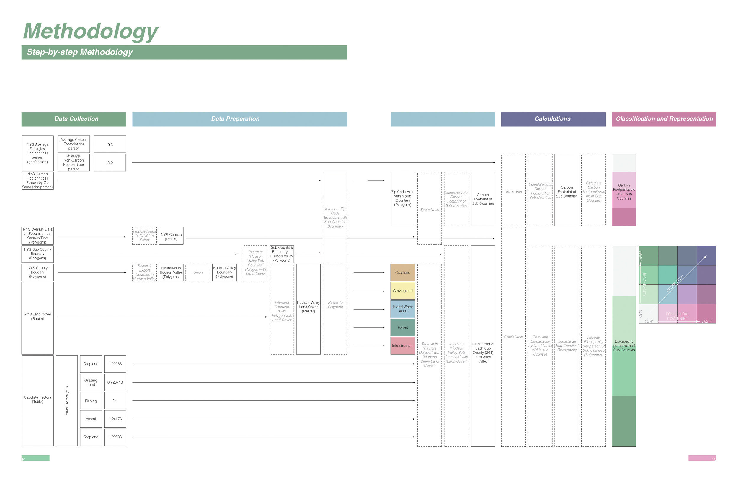
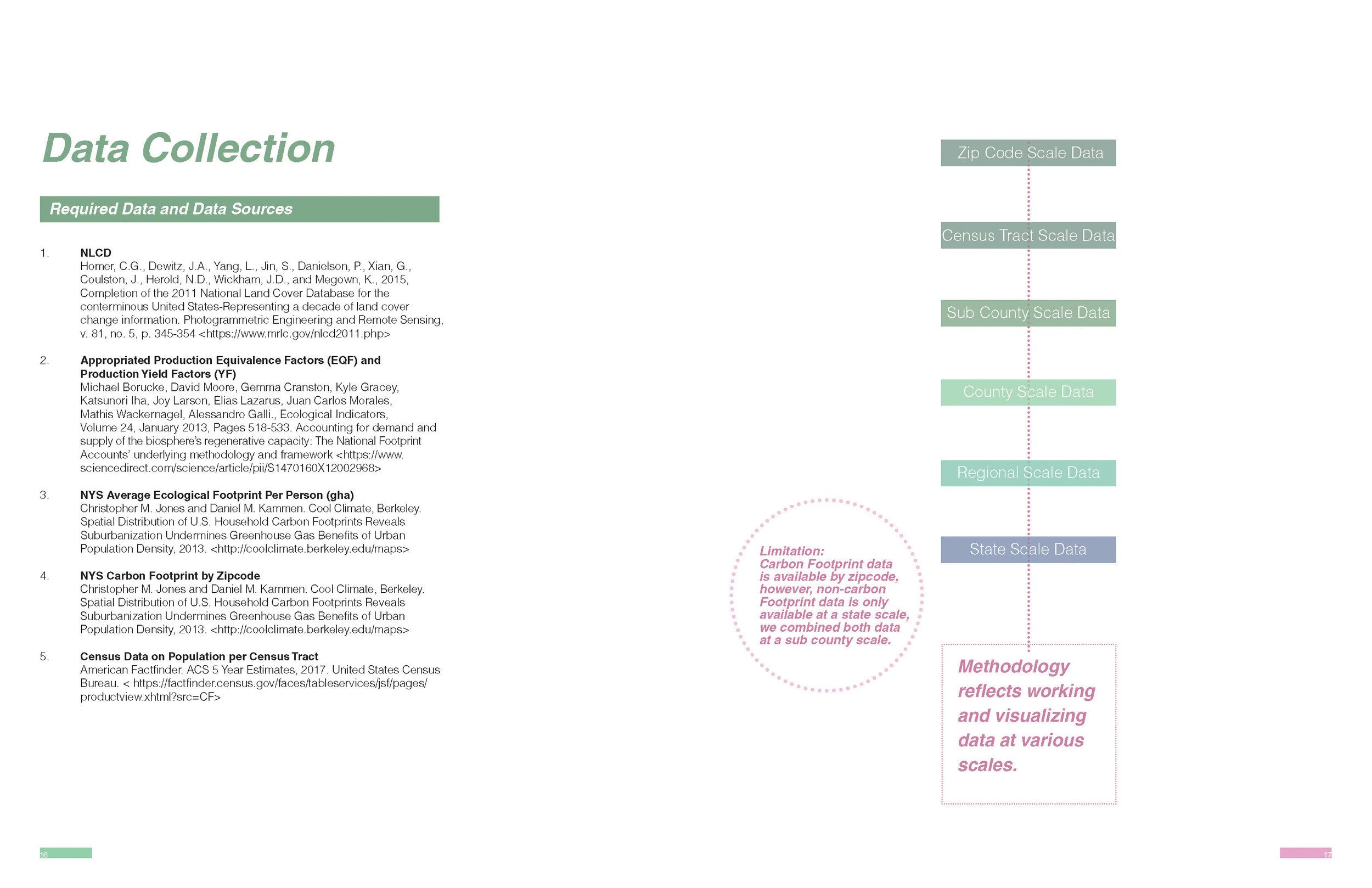
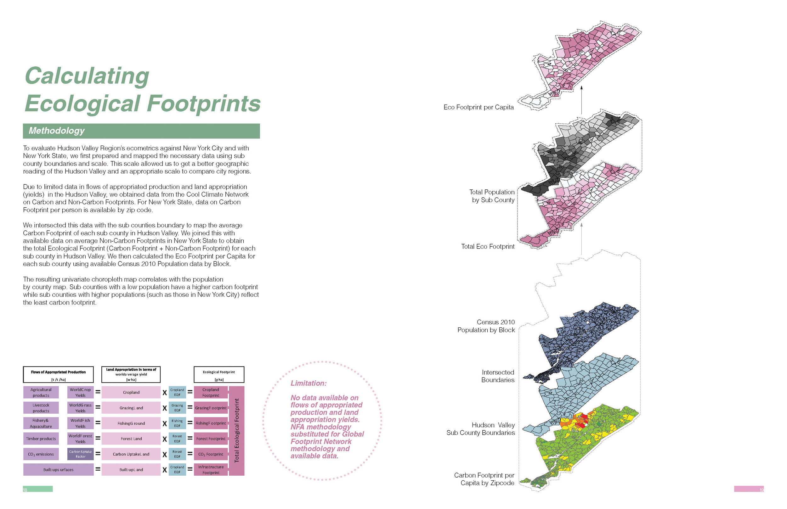
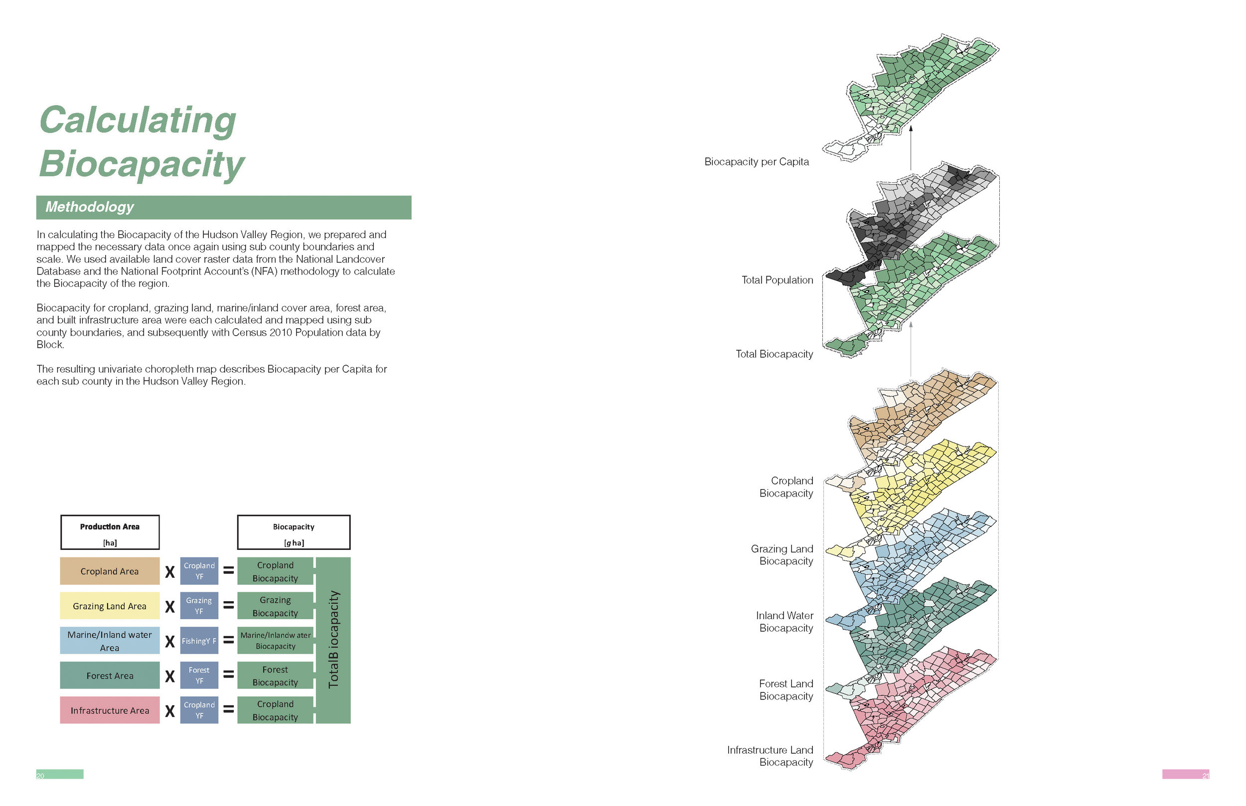
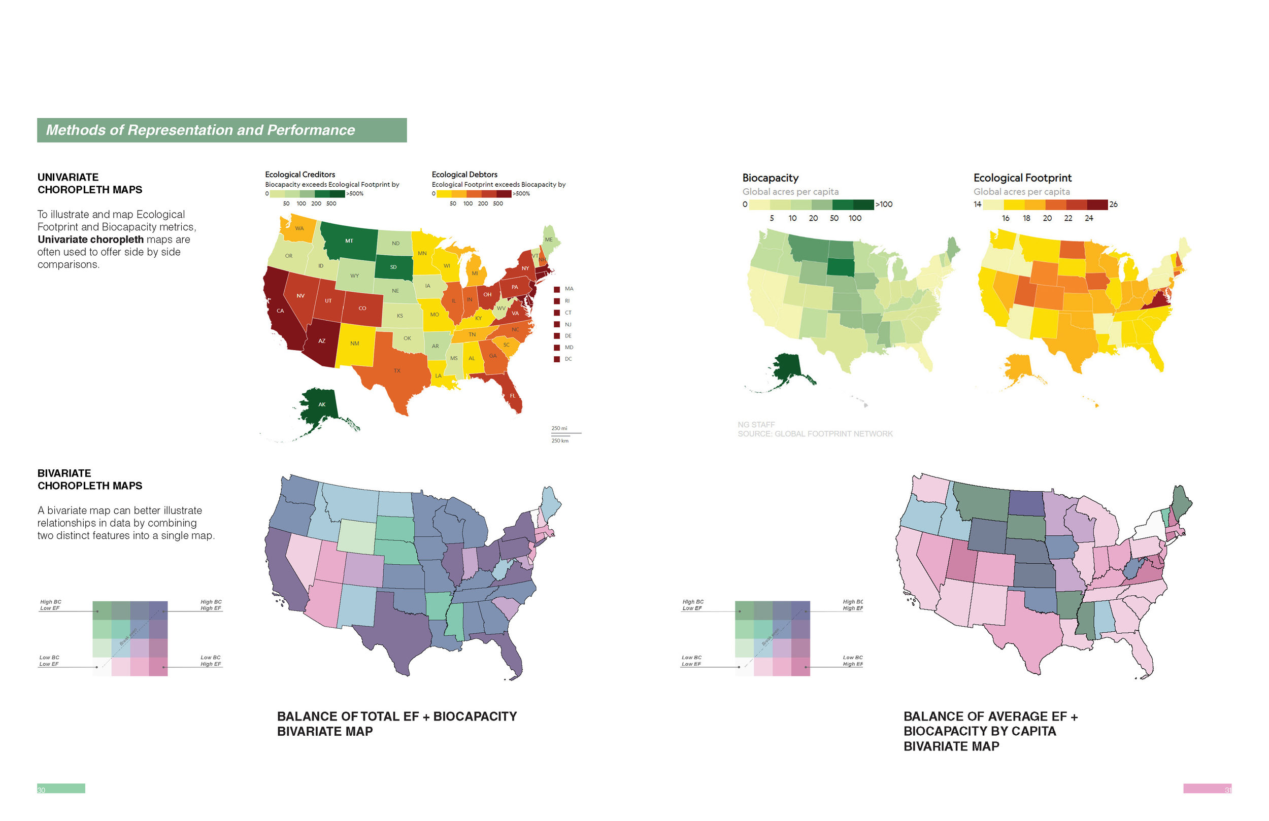
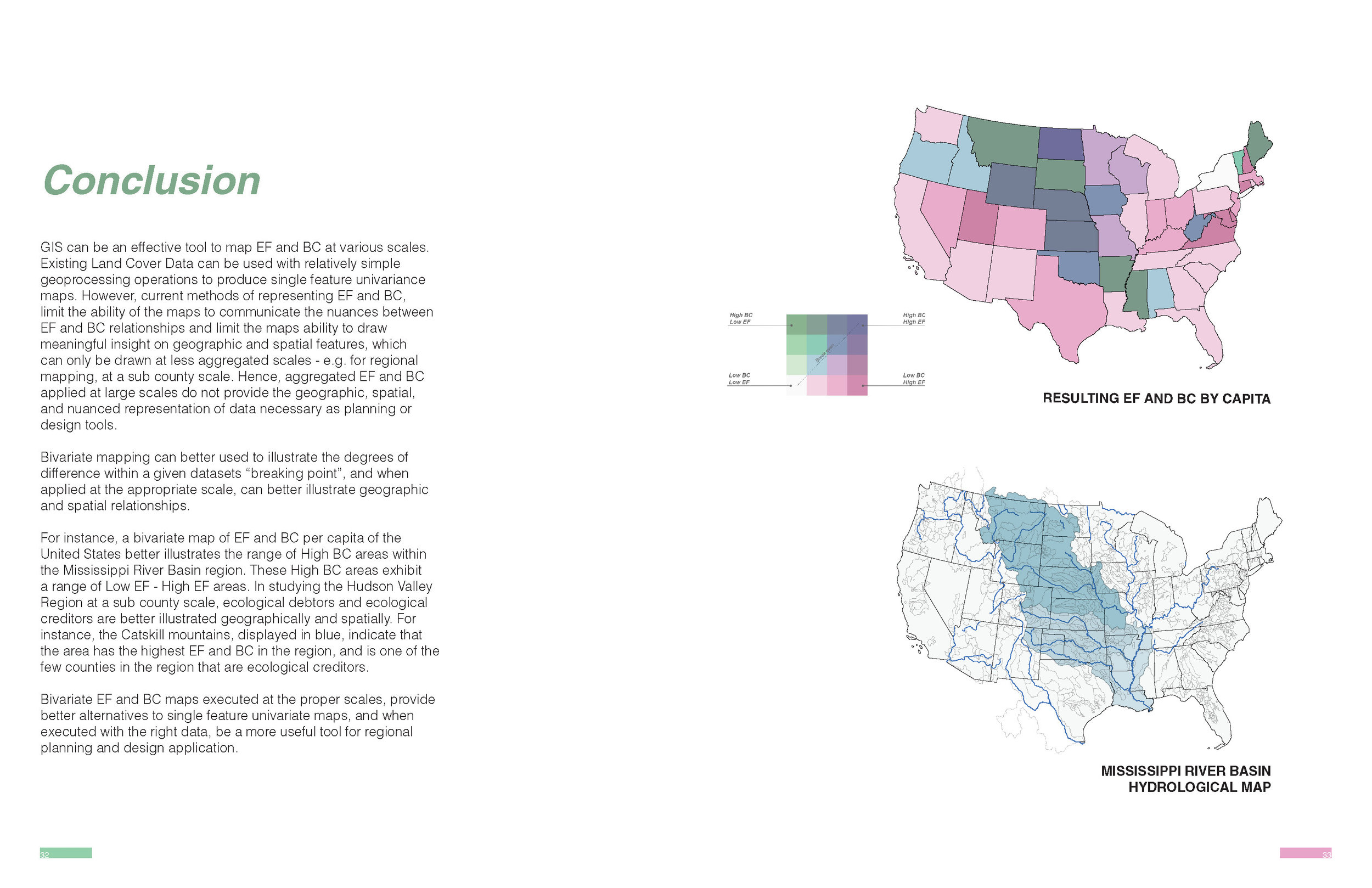
Hsin Yi Chao, Richard Chou, and Angela Crisostomo. “Ecometrics: New Methods of Representation for Ecological Footprint and Biocapacity.”
(Fall 2018)
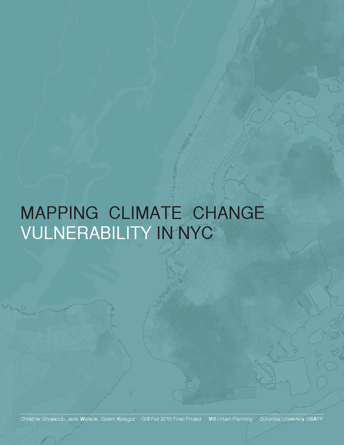
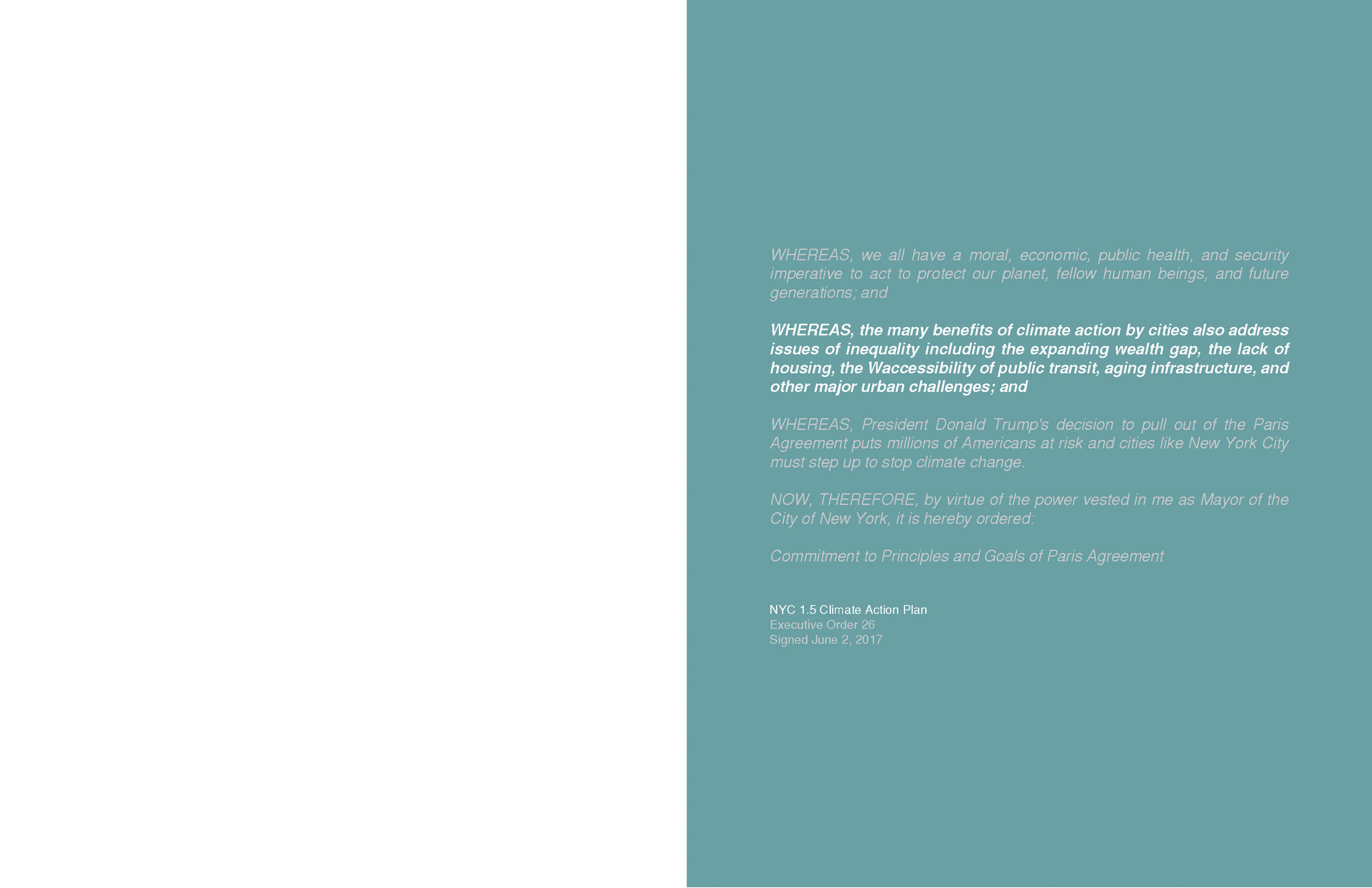
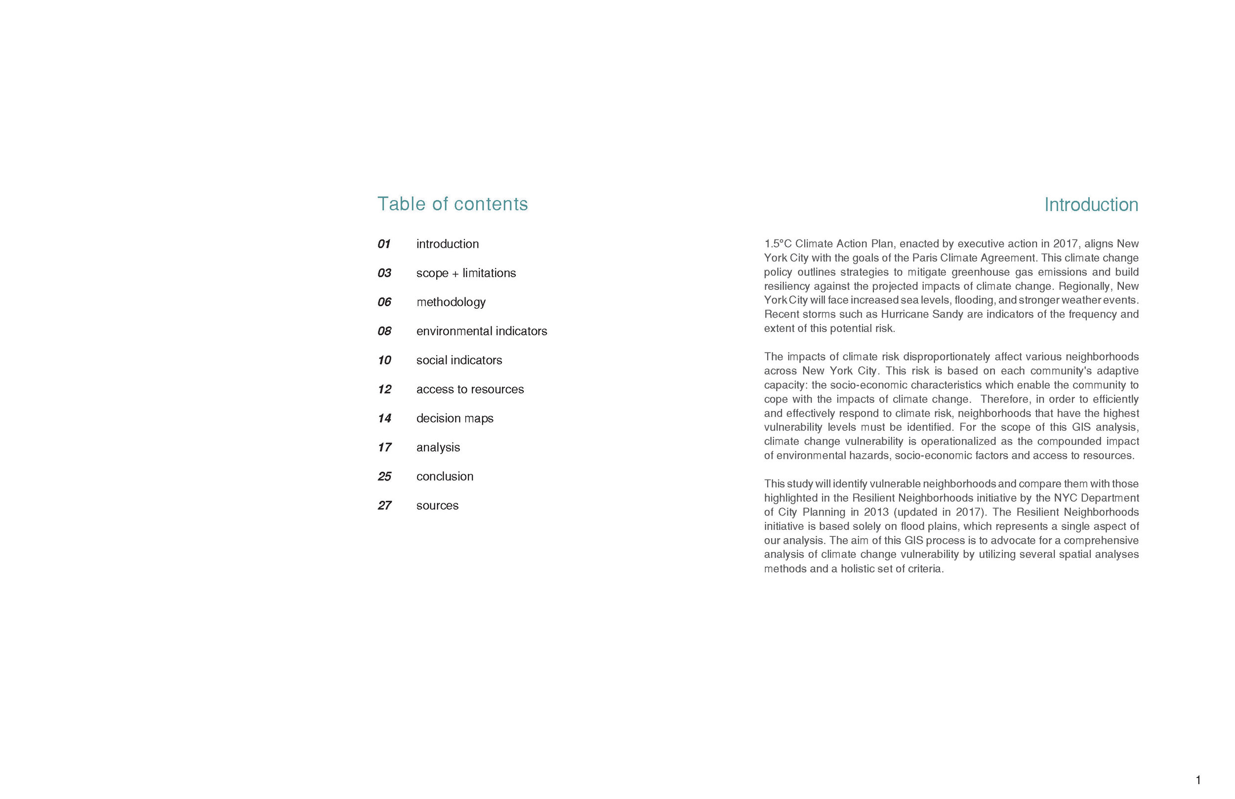
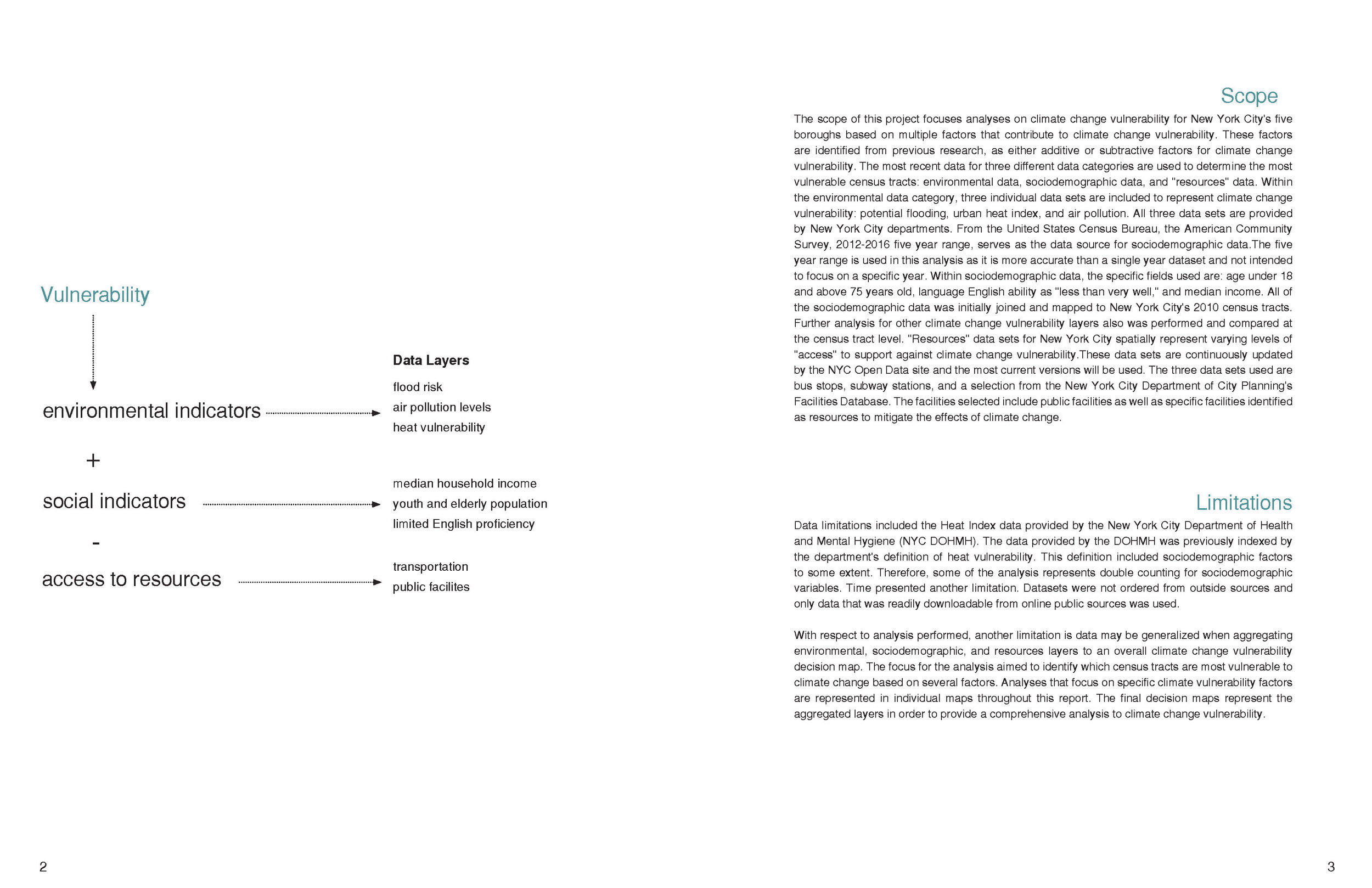
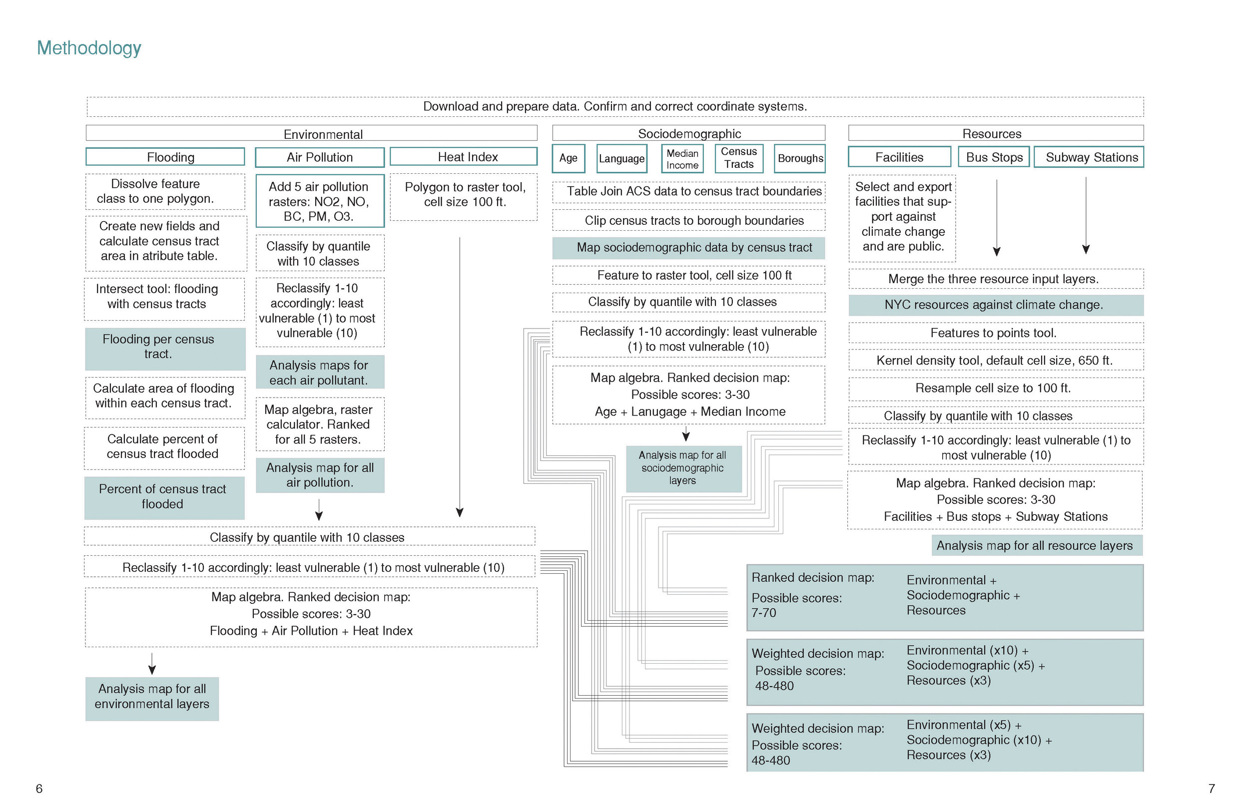
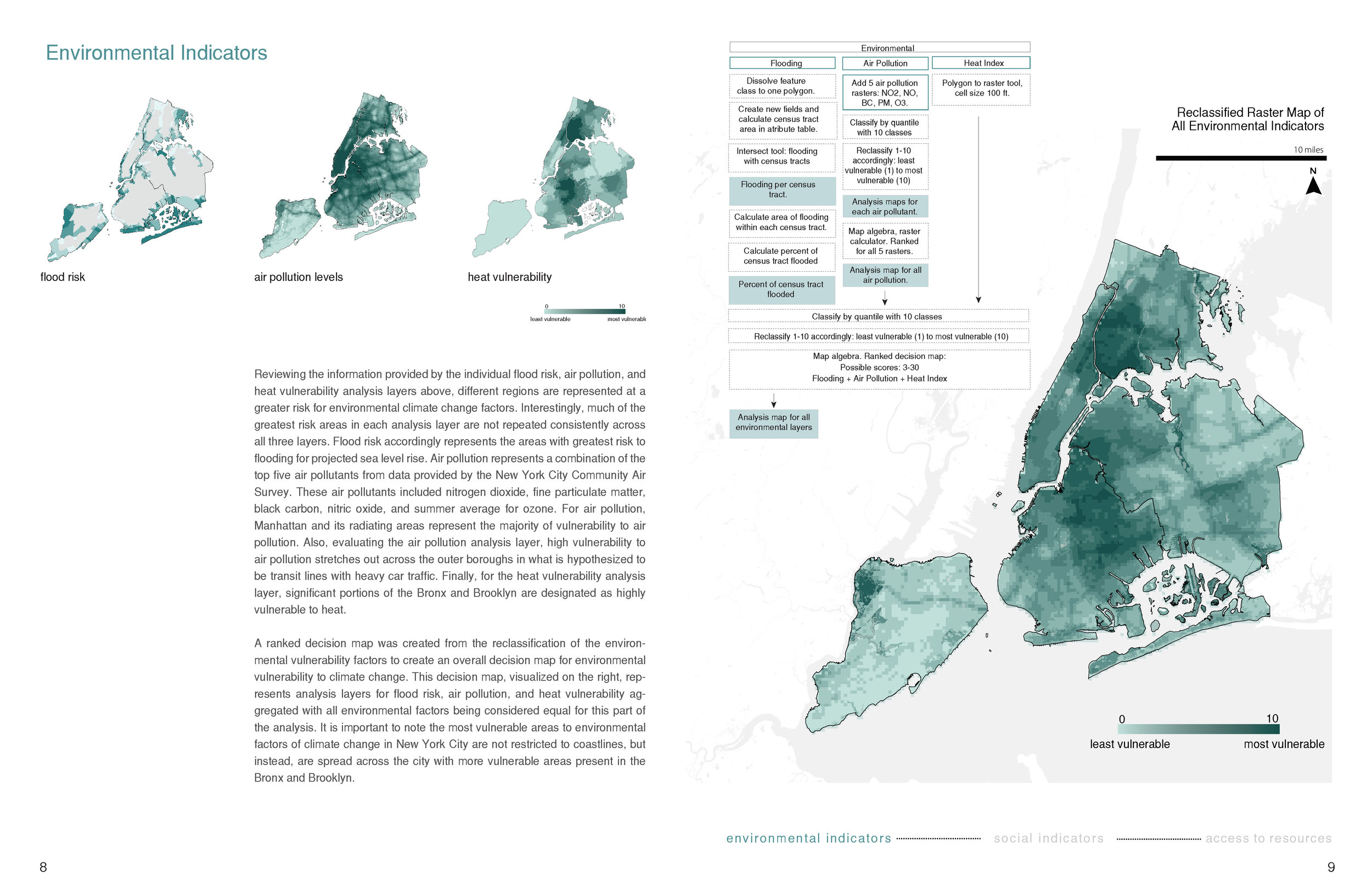
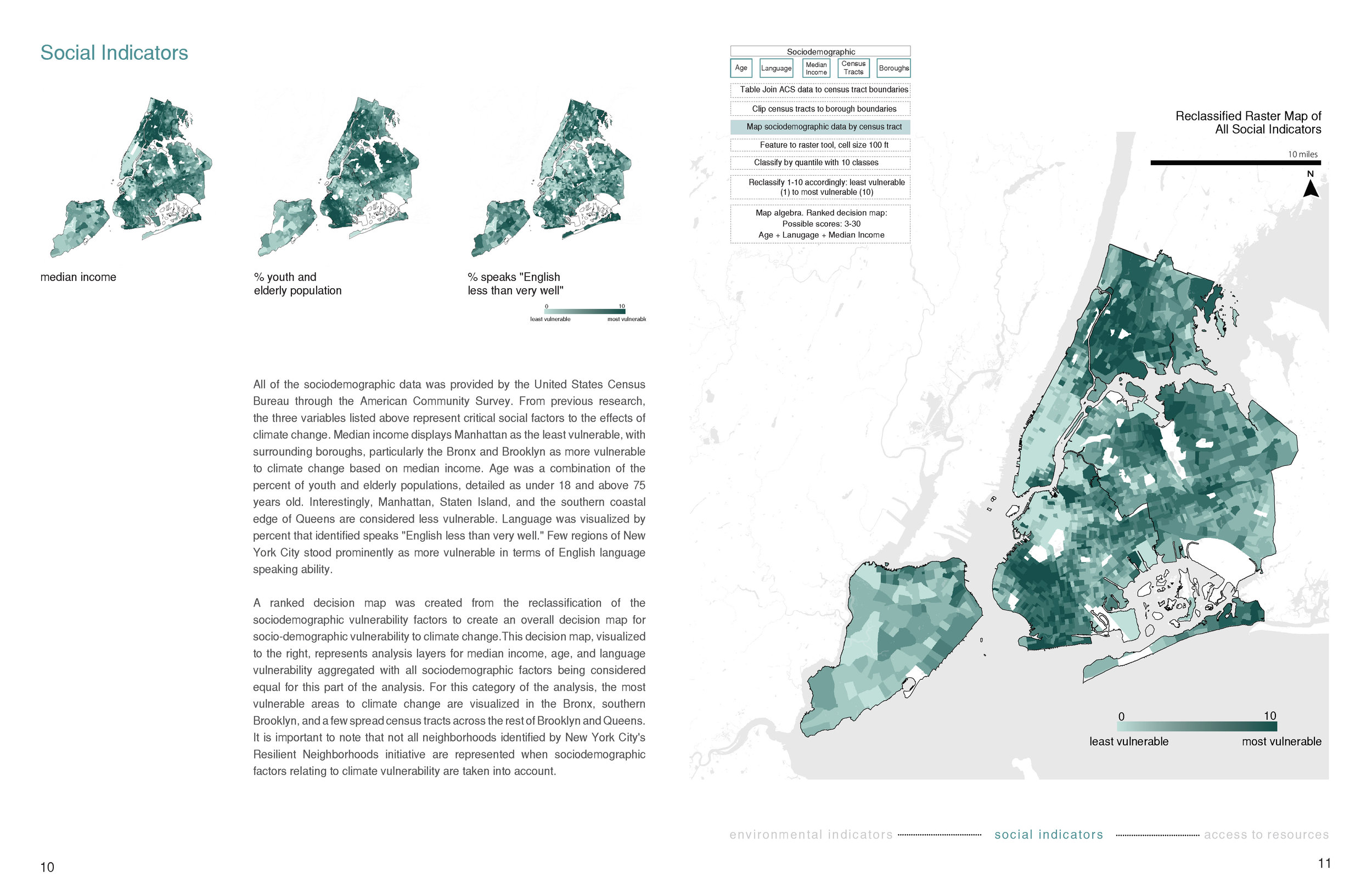
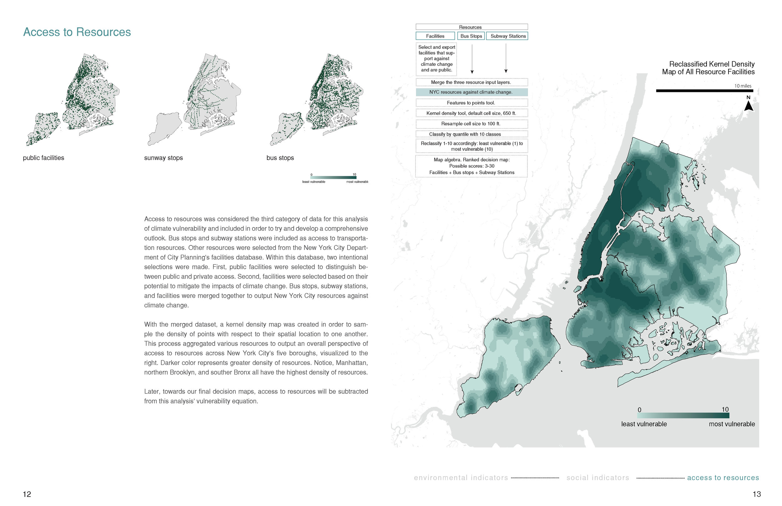
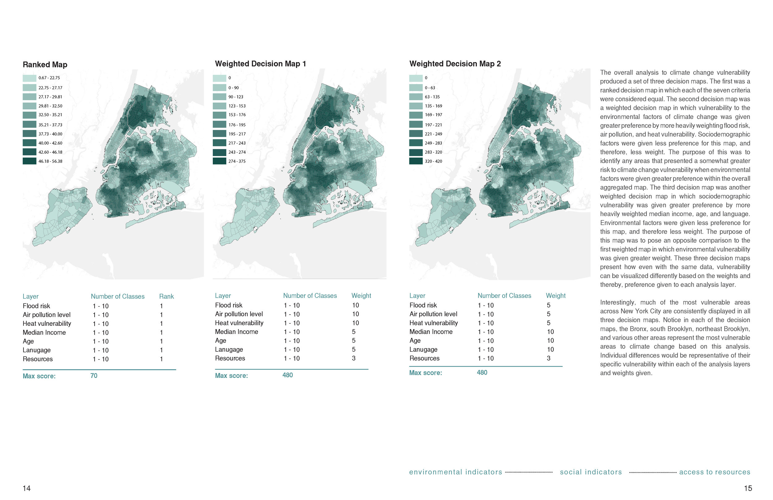
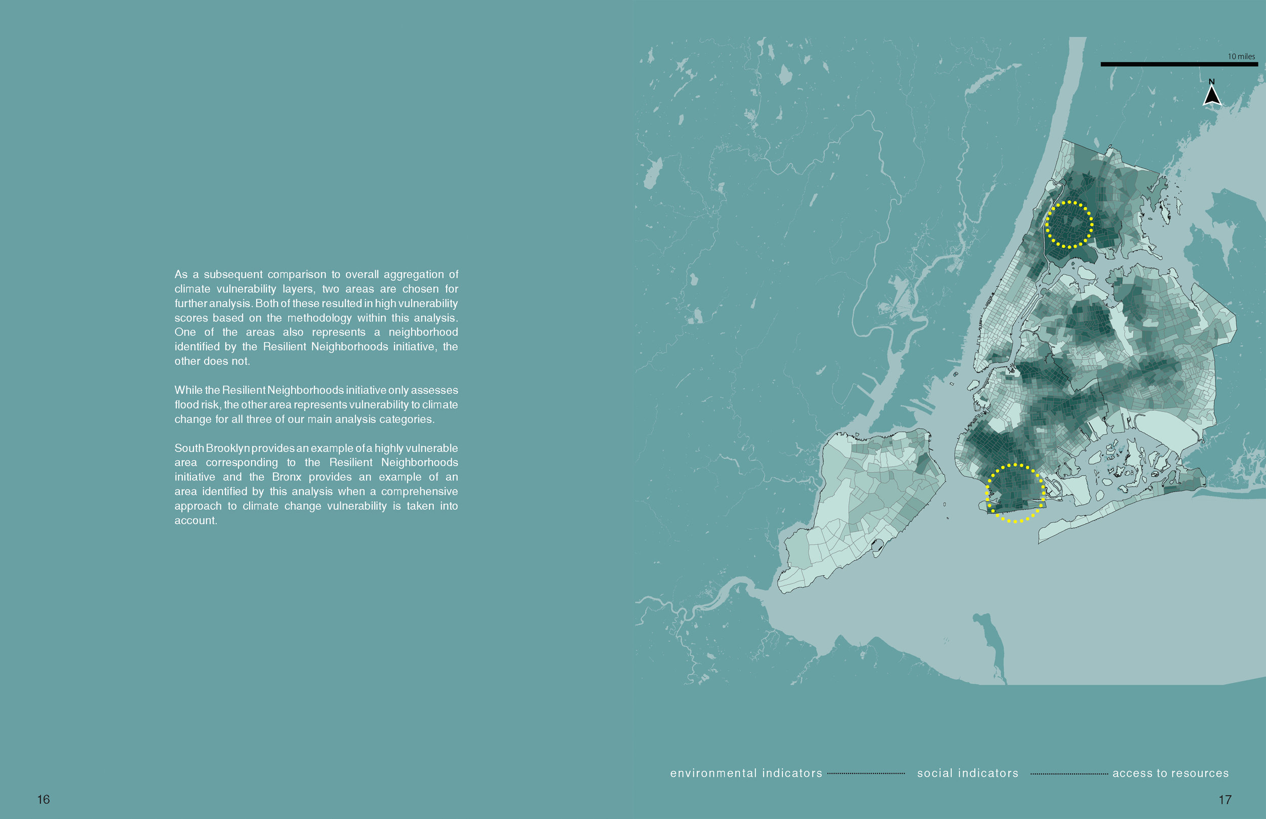
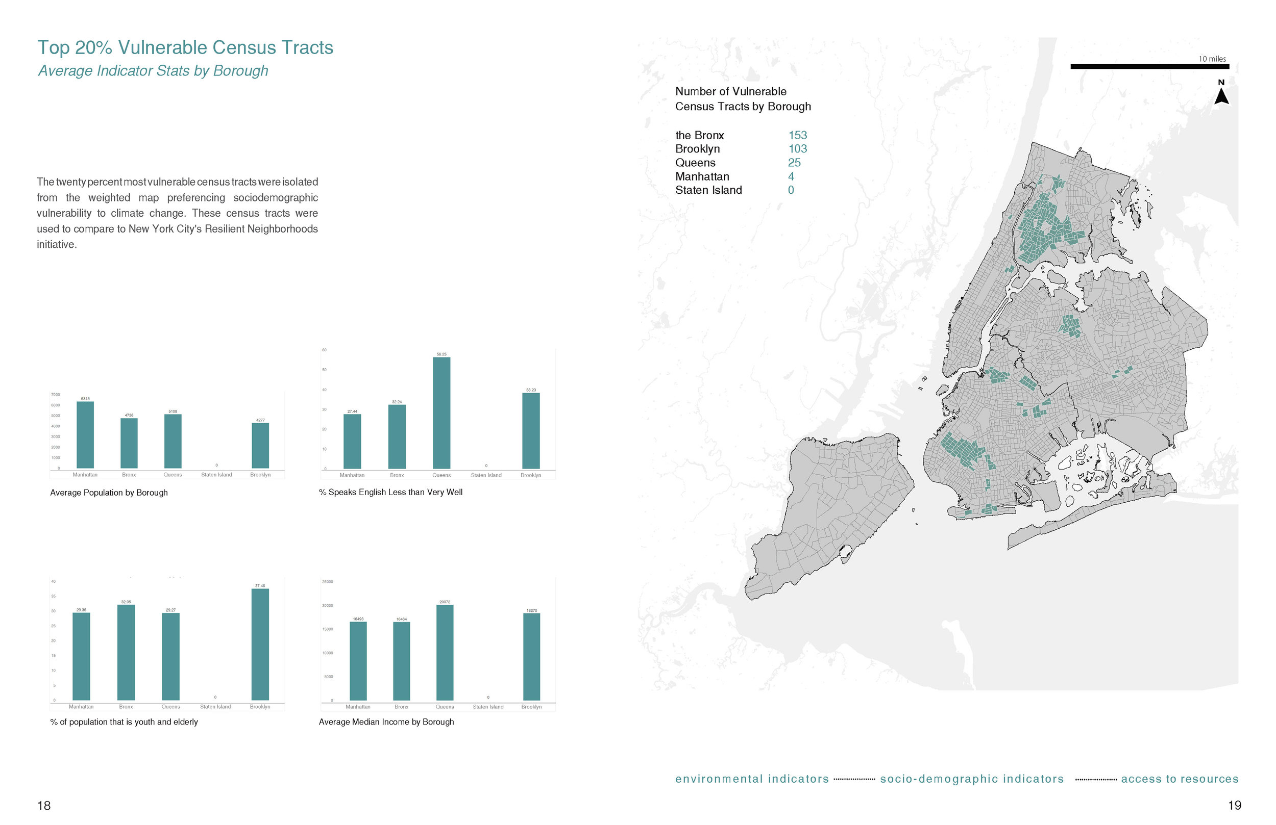
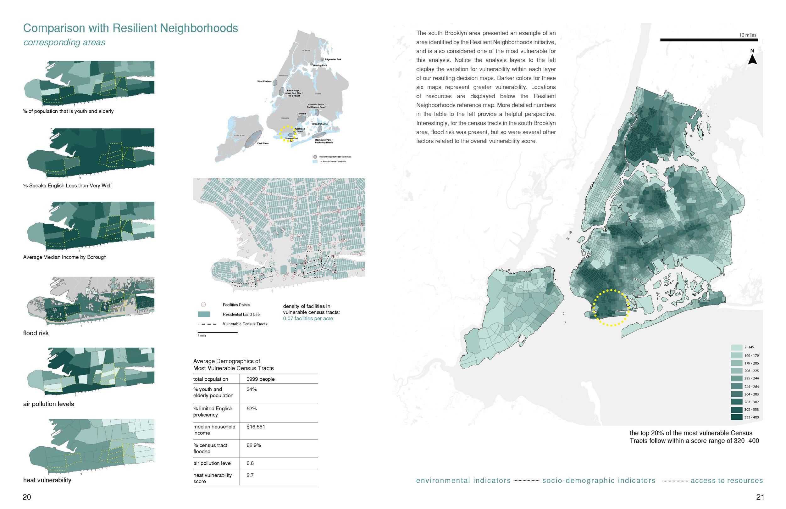
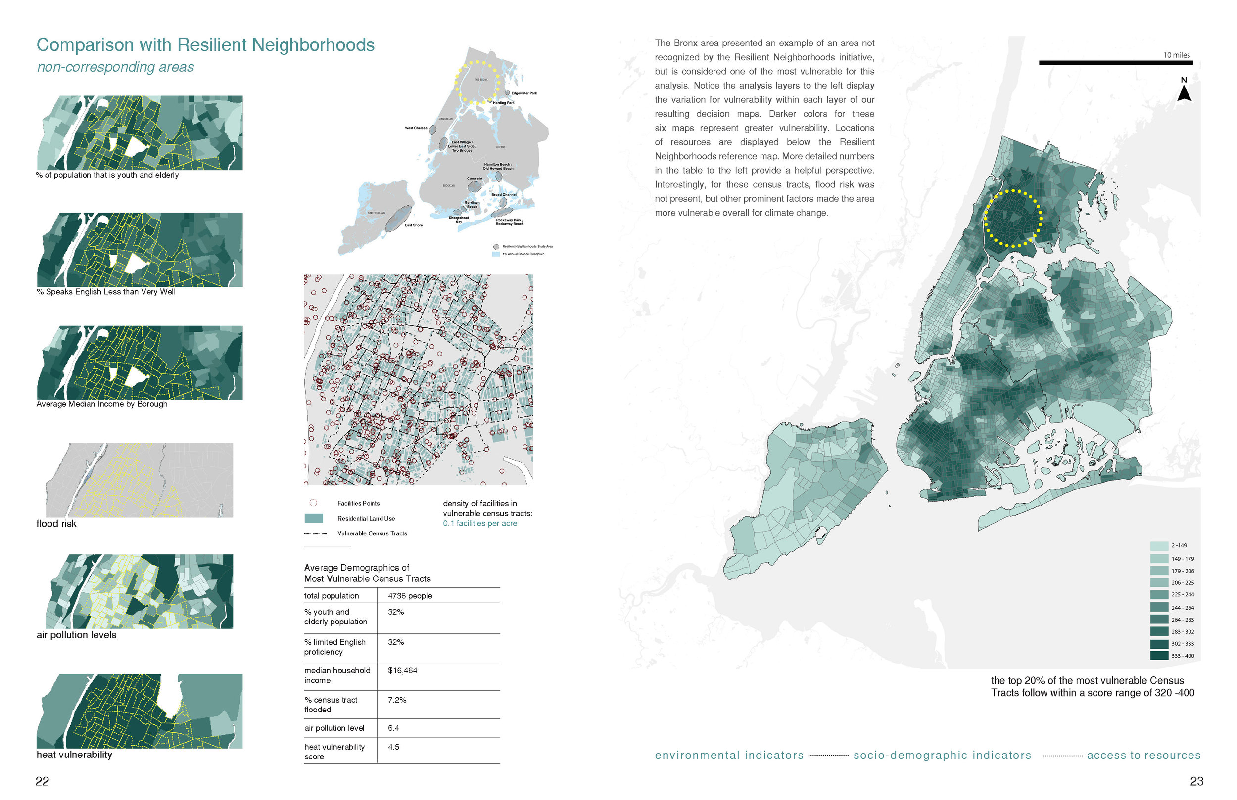
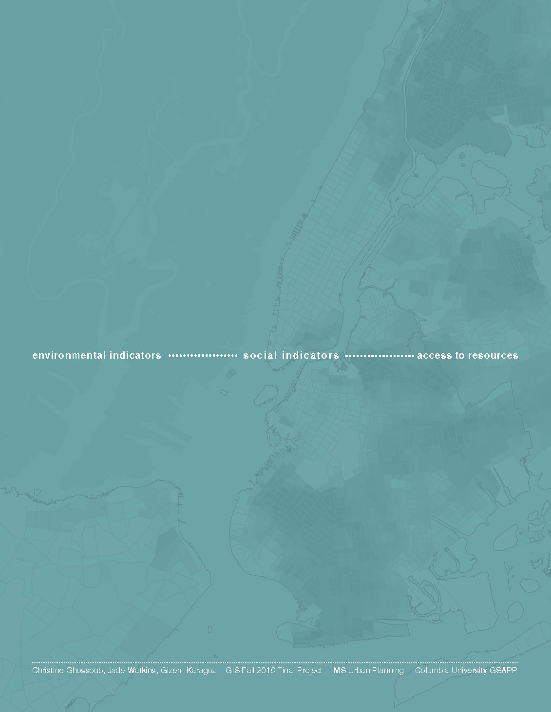
Christine Ghossoub, Jade Watkins, and Gizem Karagoz. “Mapping Climate Change Vulnerability in NYC.”
(Fall 2018)
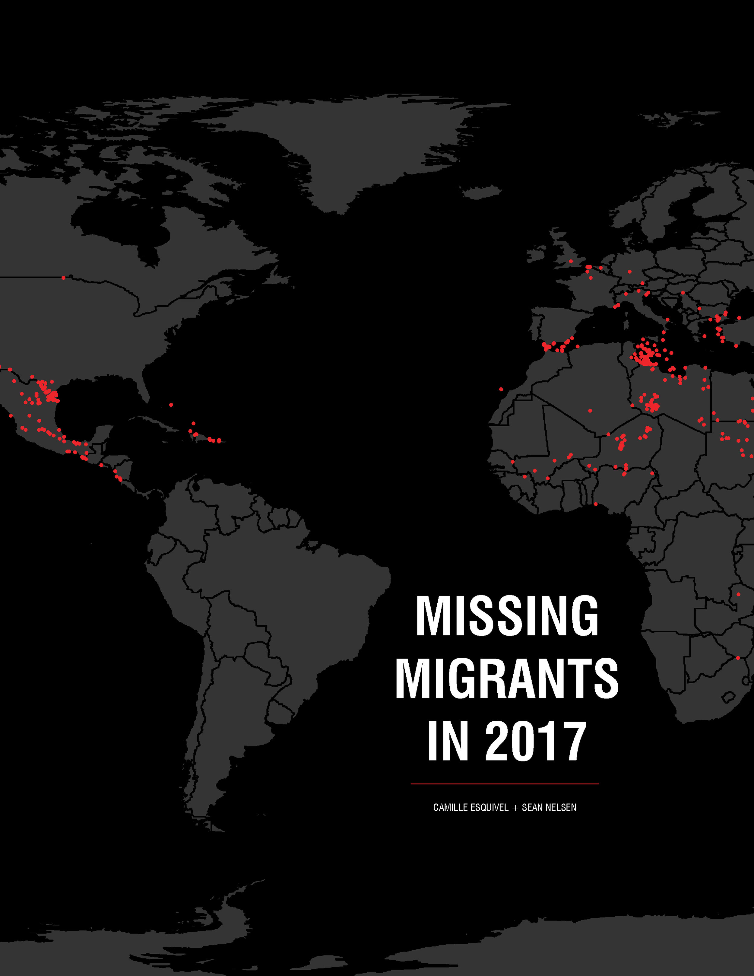
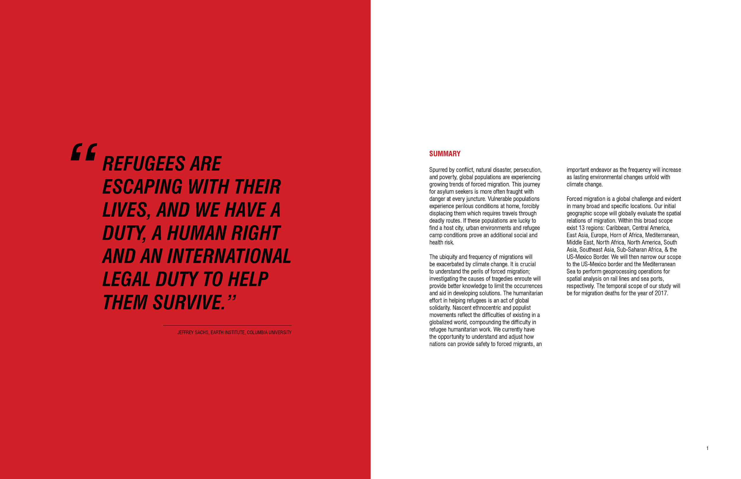
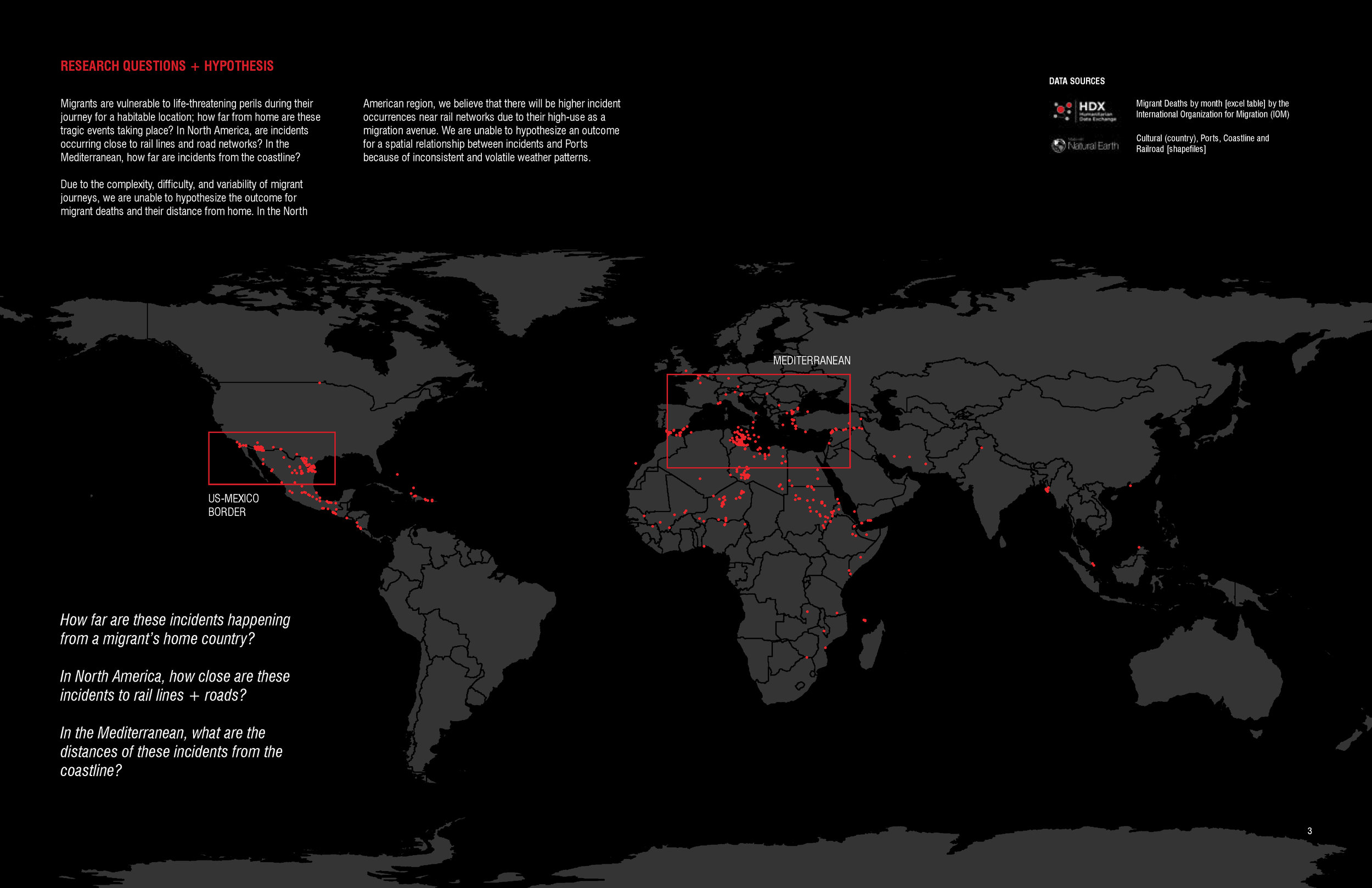
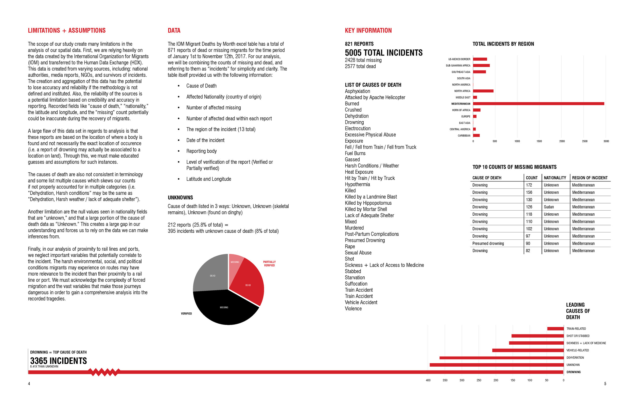
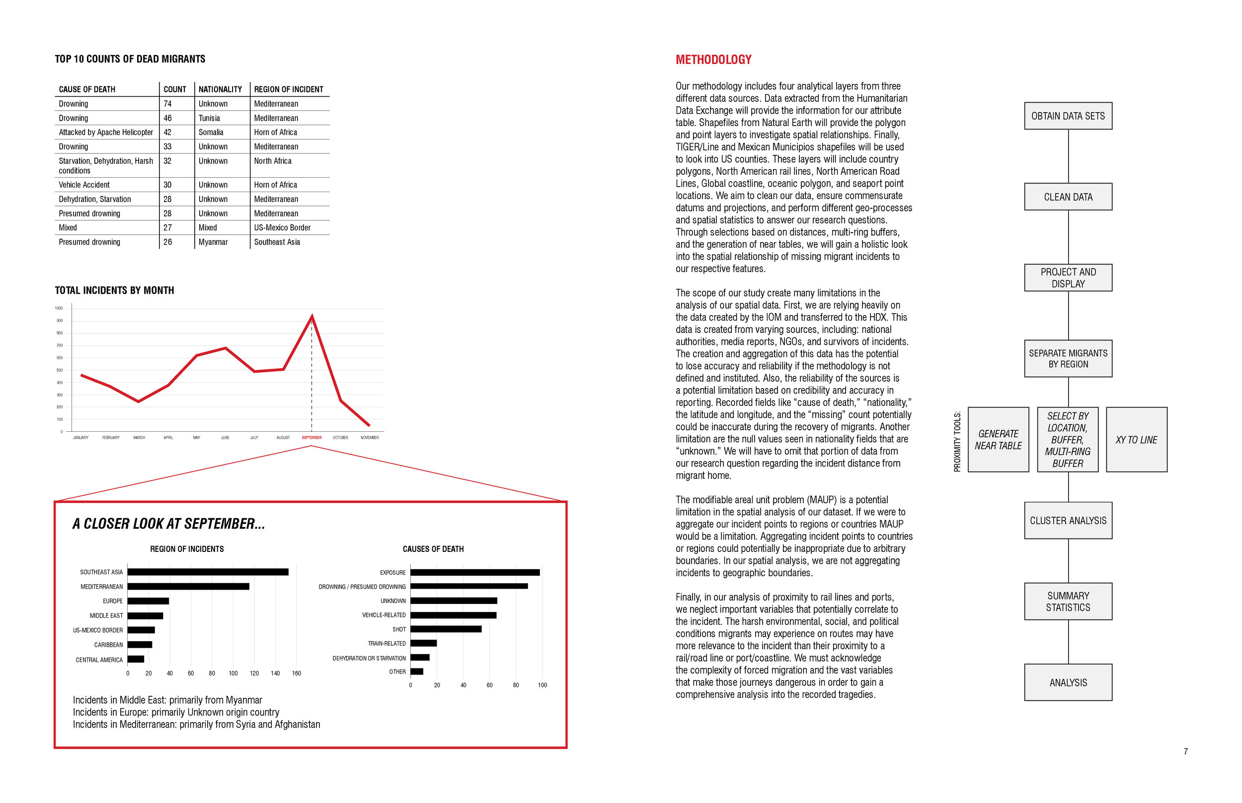
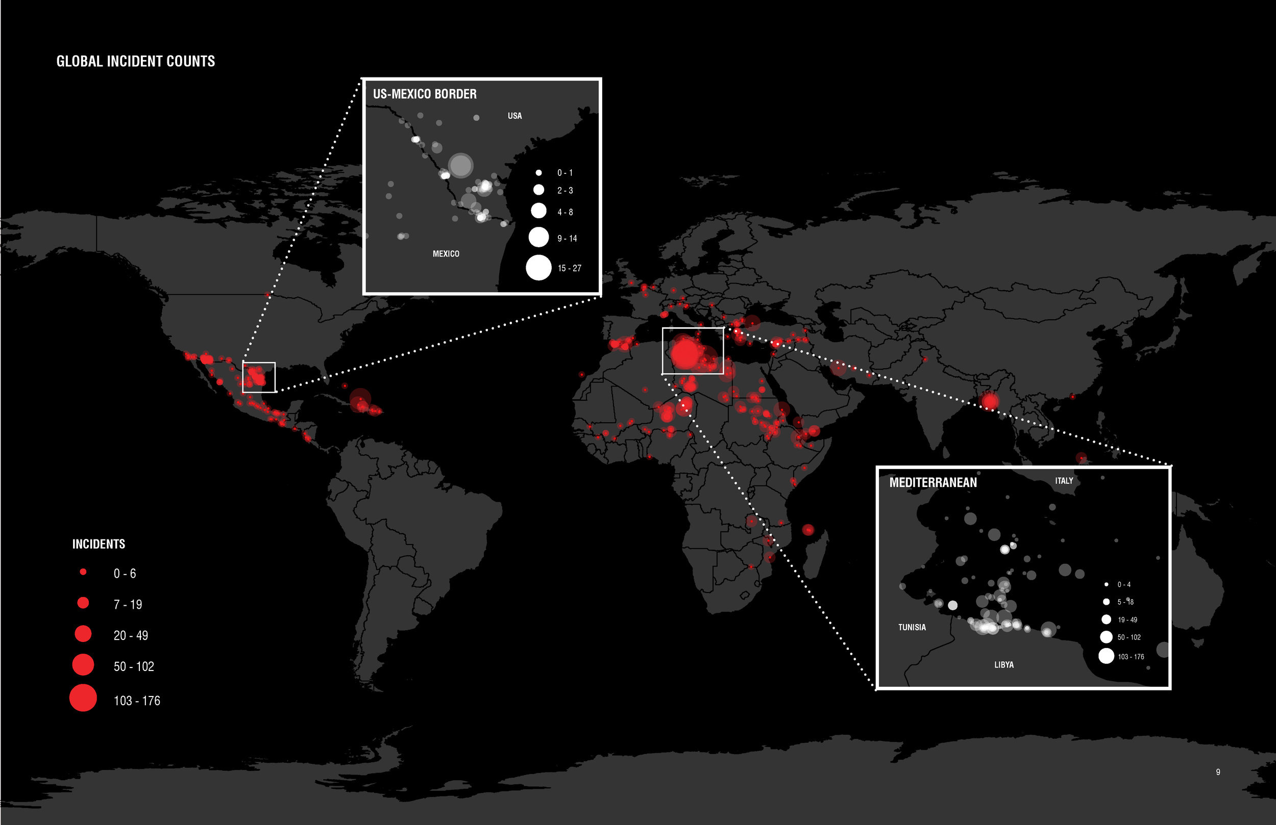
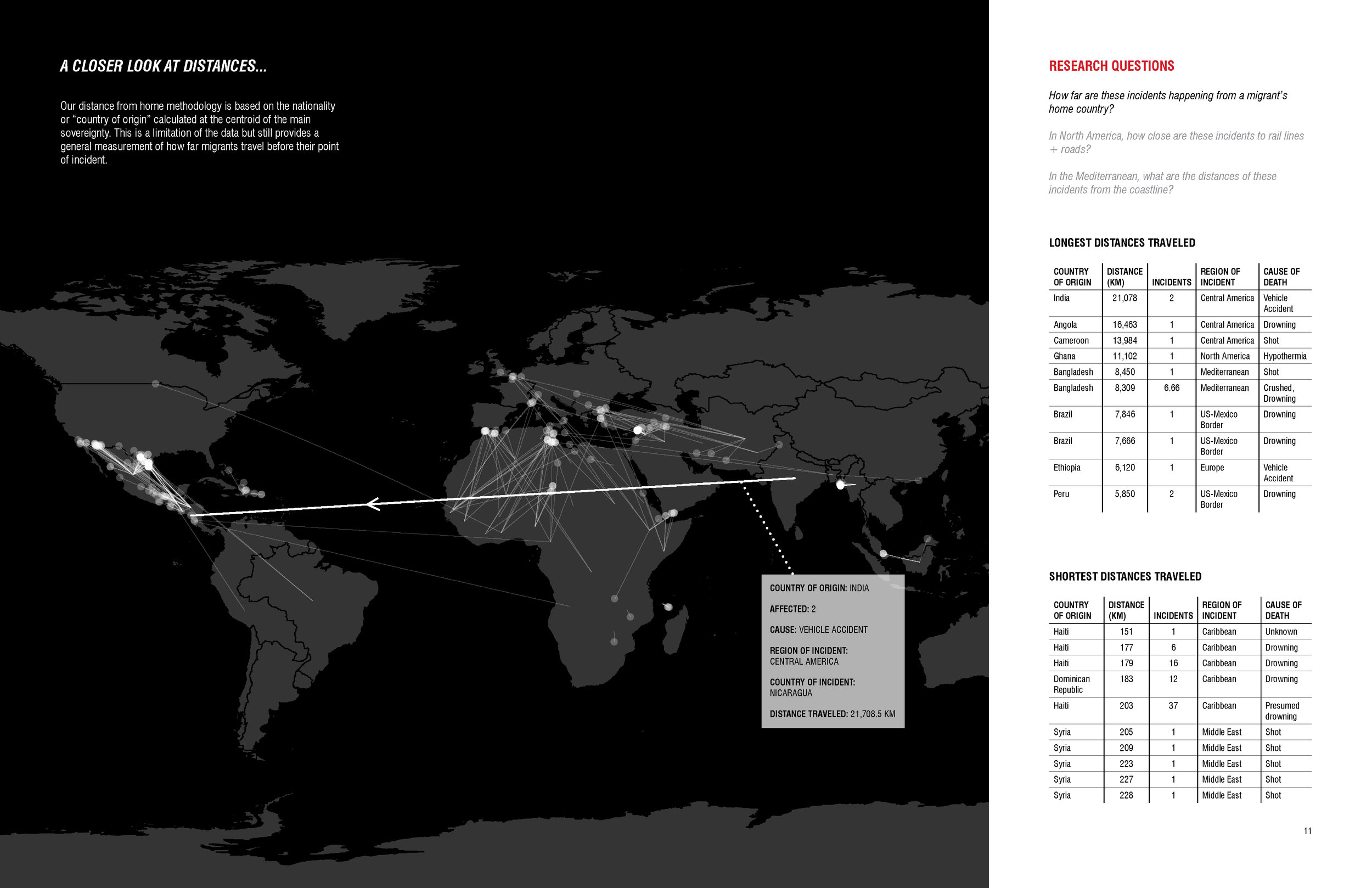
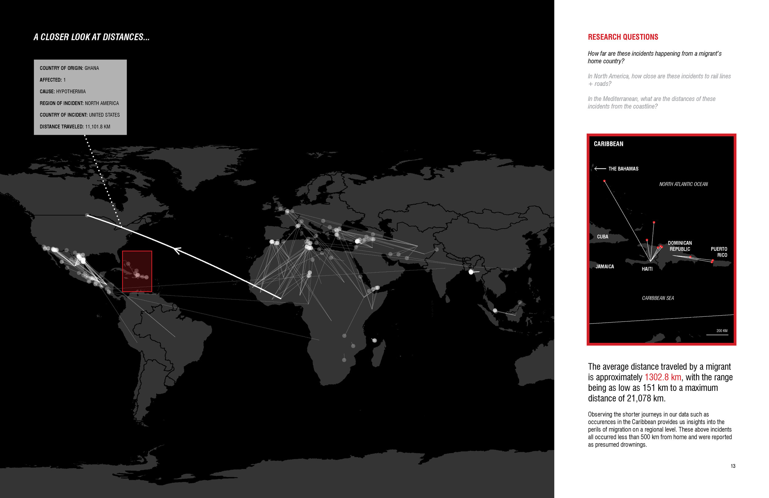
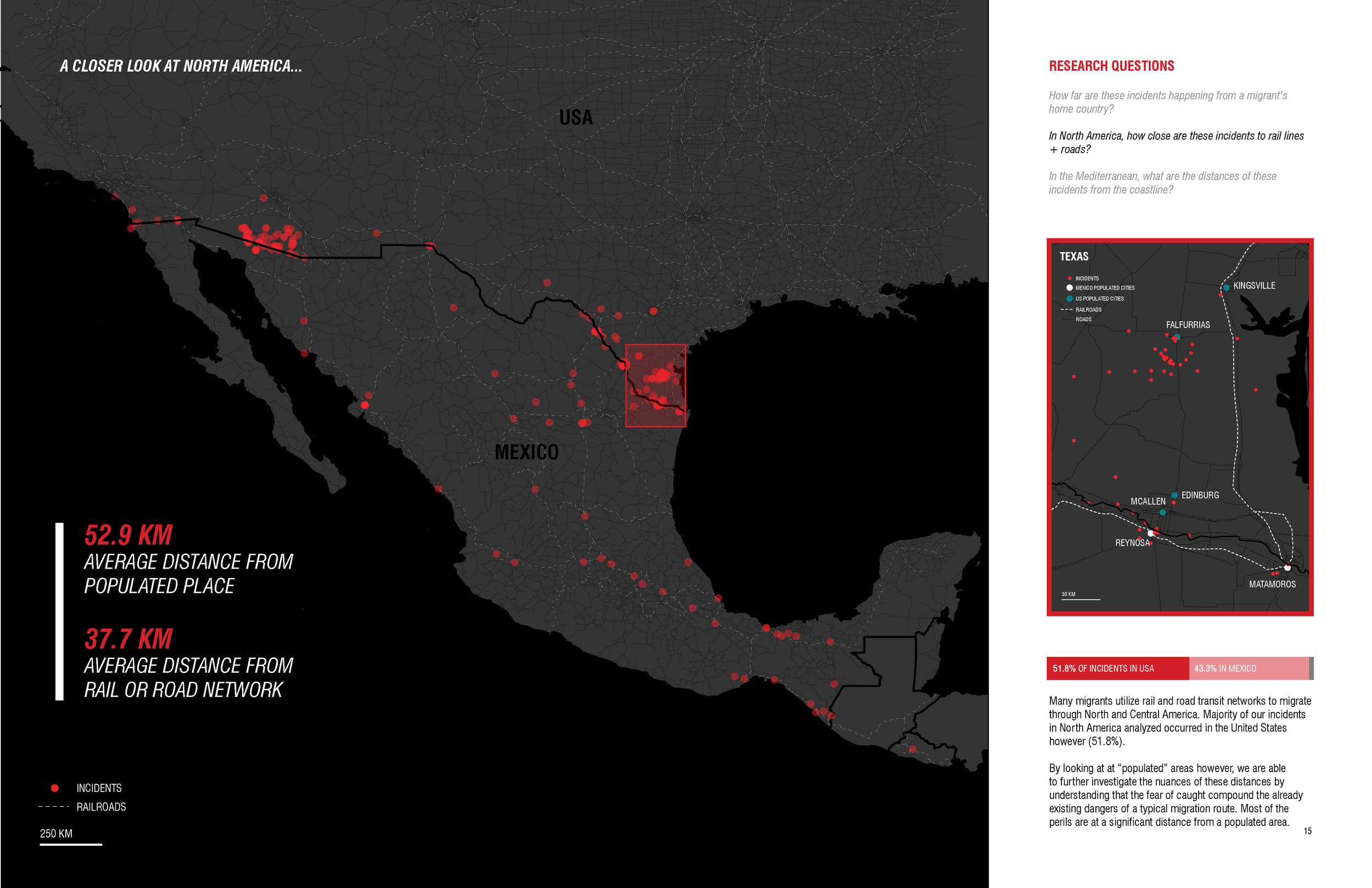
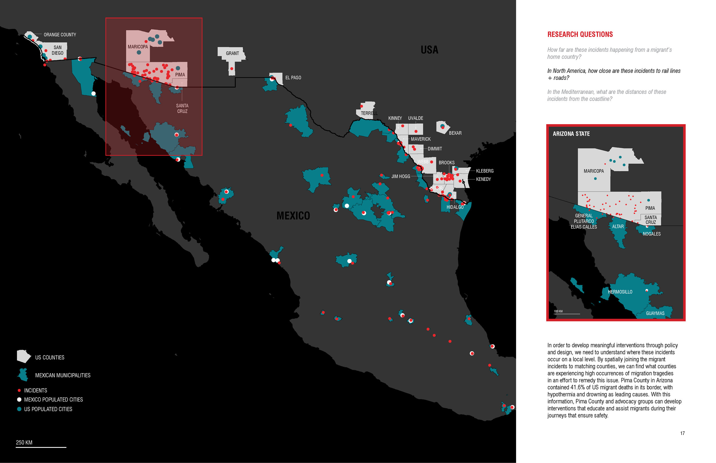
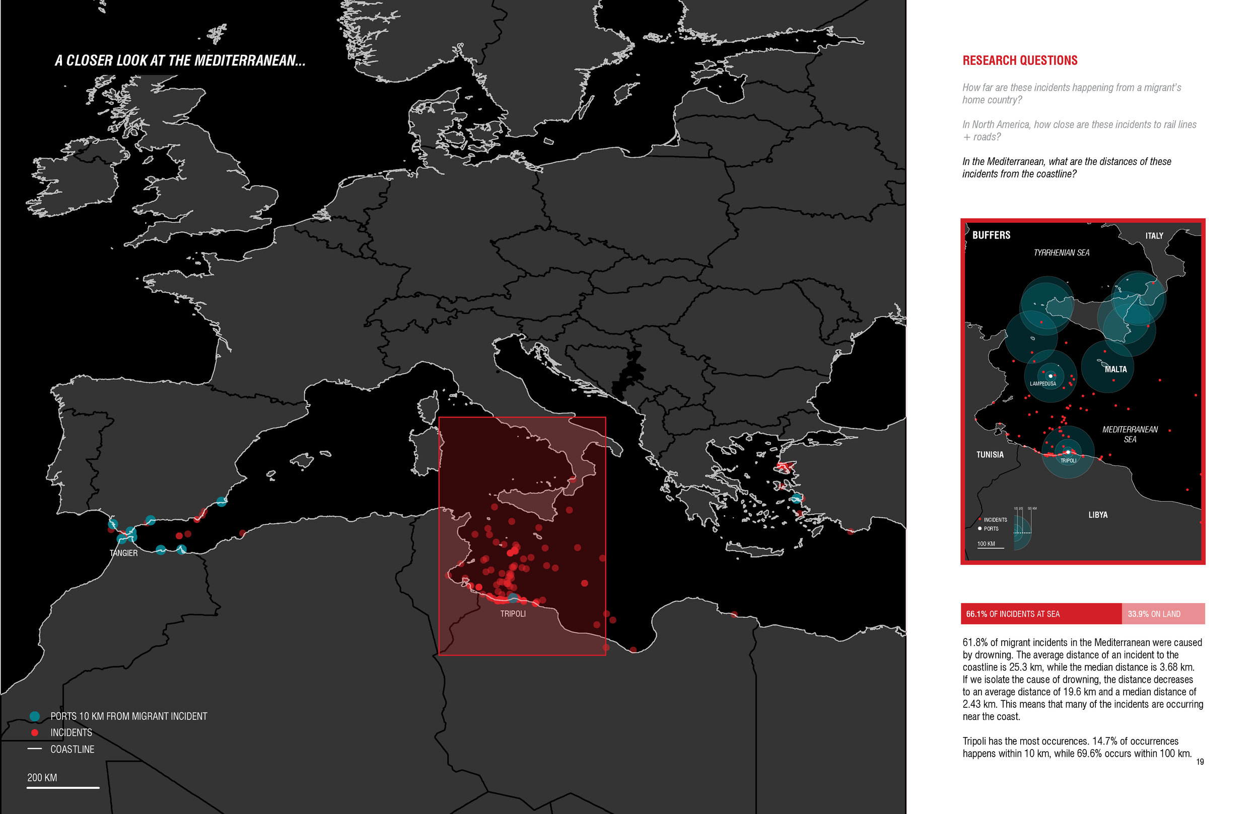
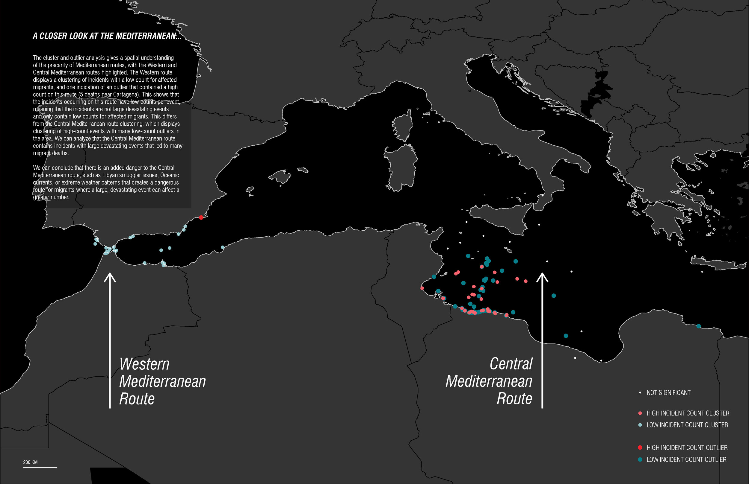
Camille Esquivel & Sean Nelson. "Missing Migrants in 2017."
(Fall 2017)

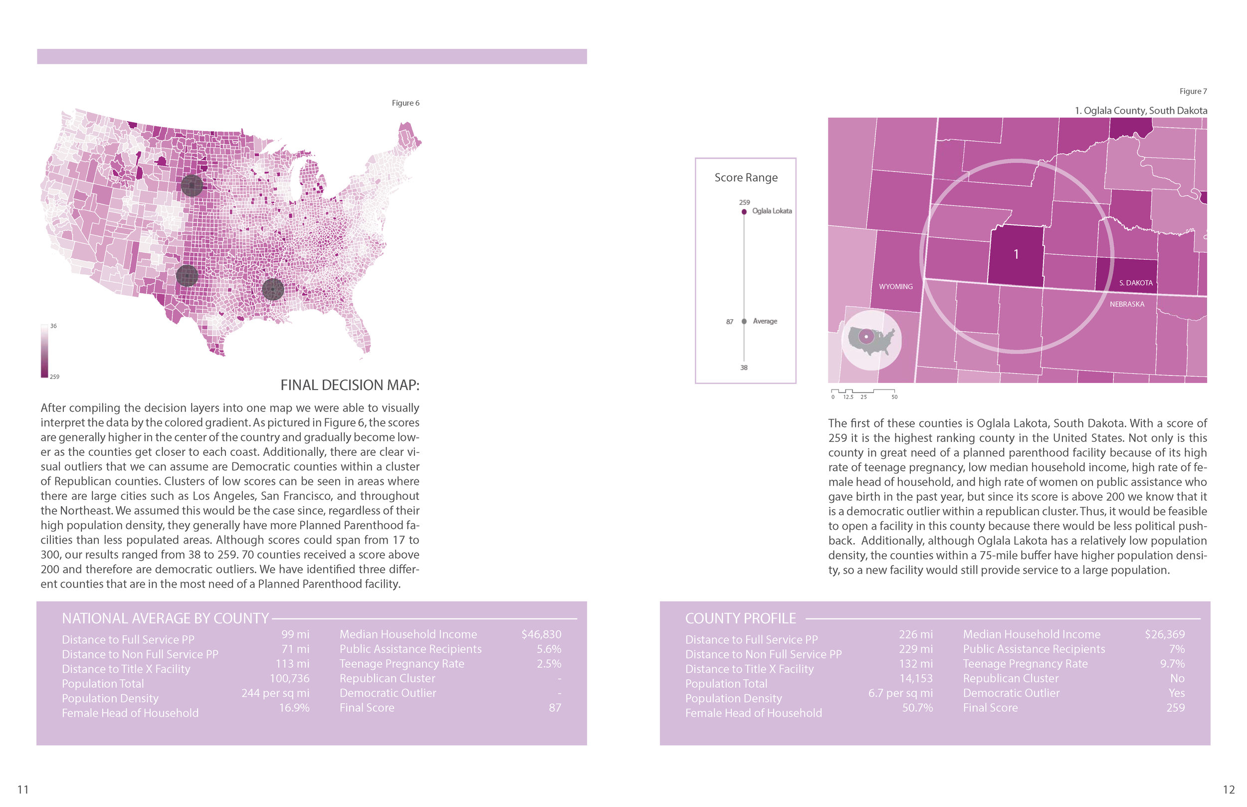
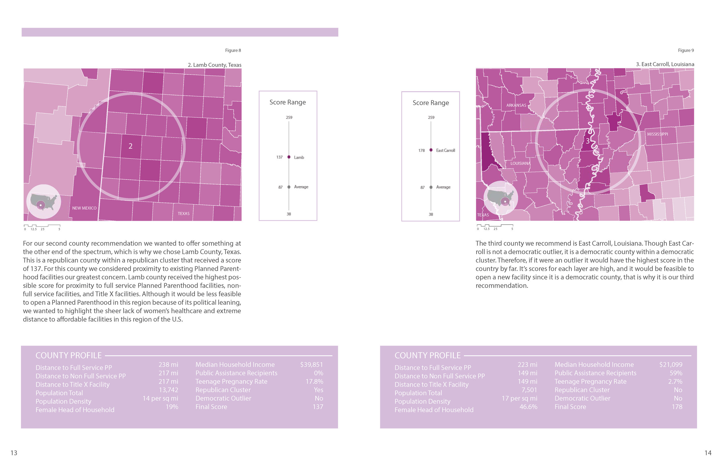
Caitlin Bone, Madeline Entrikin, and Shelby Smith. "Care. No Matter Where."
(Fall 2017)
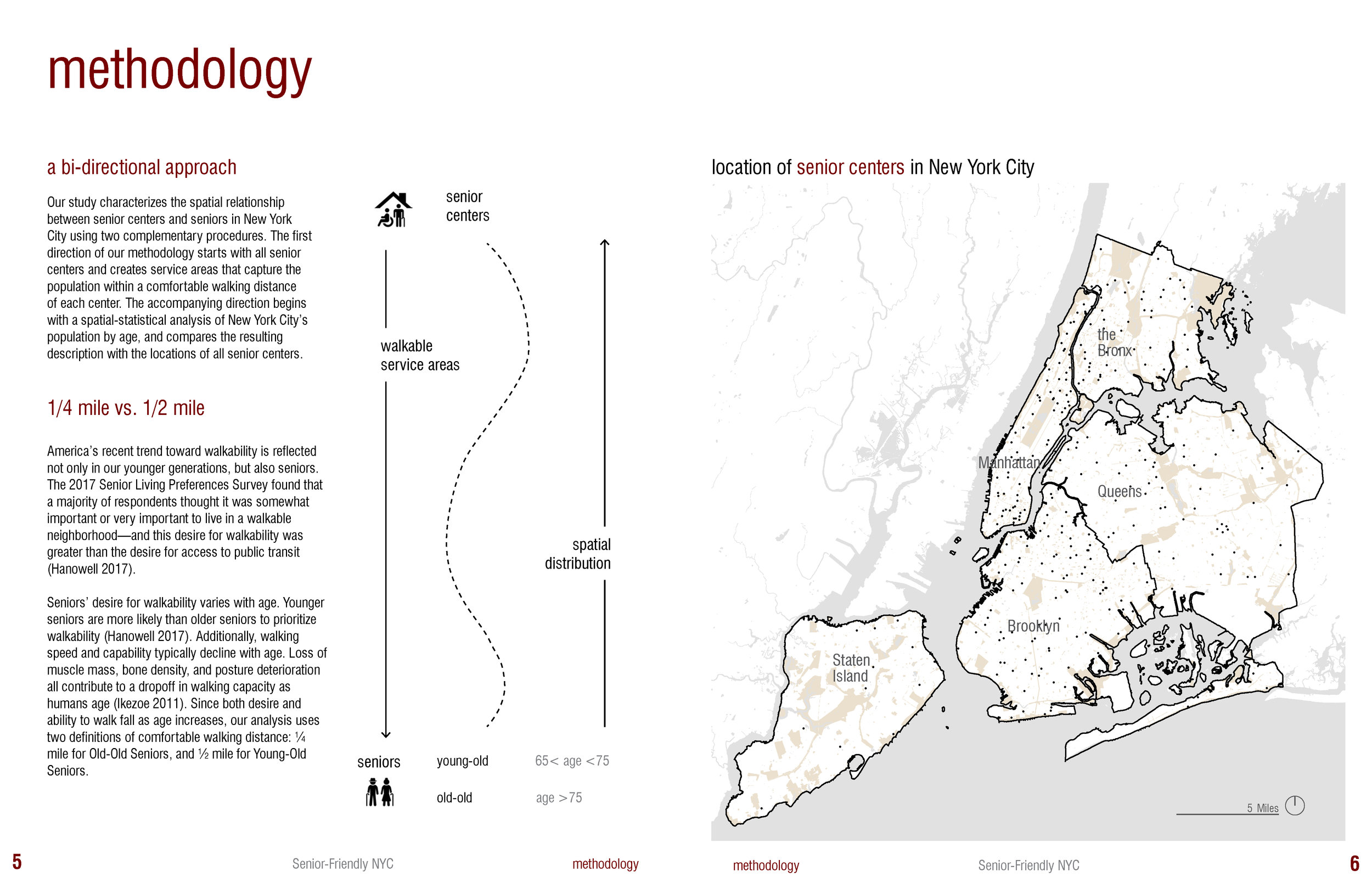
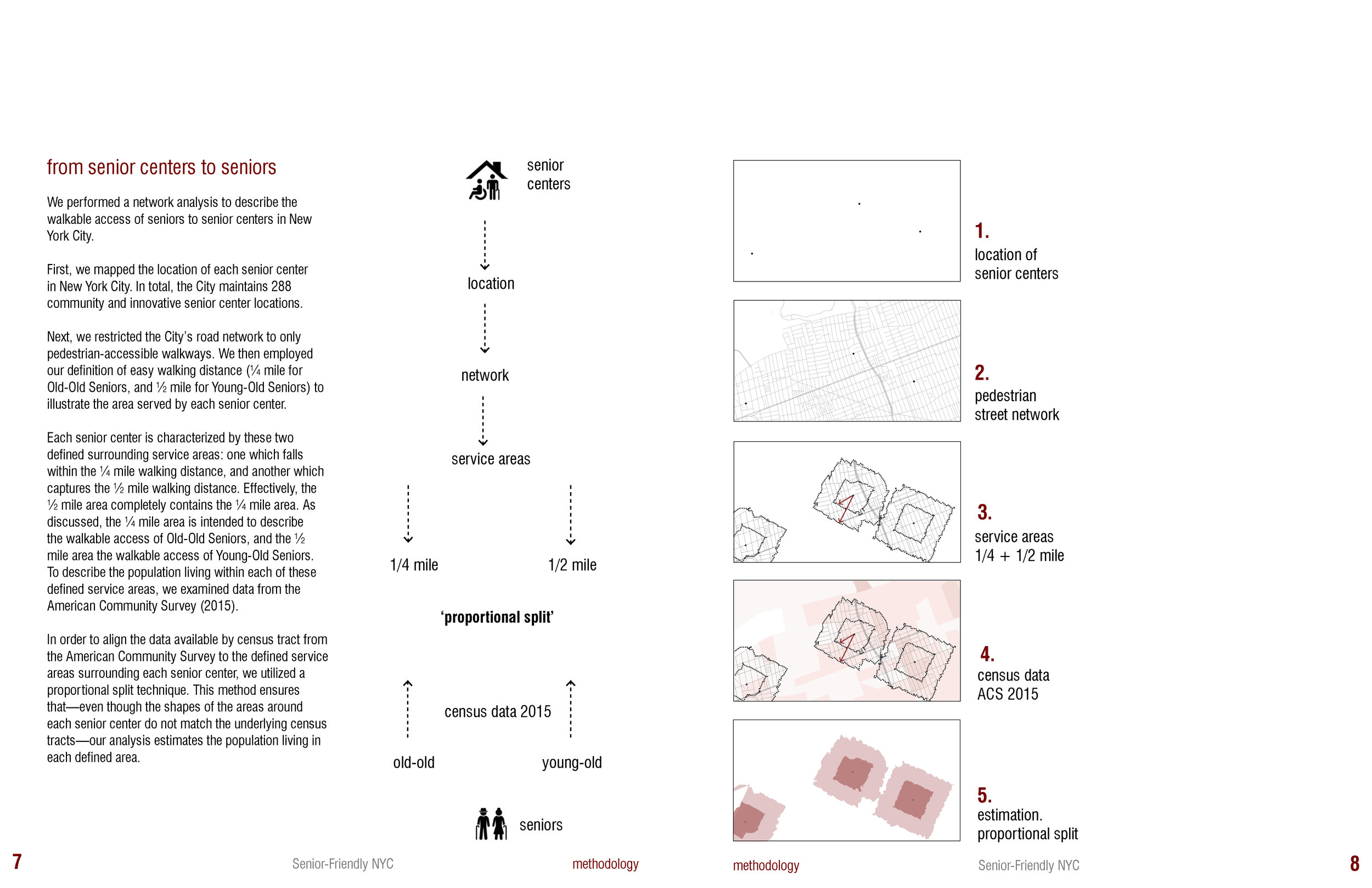
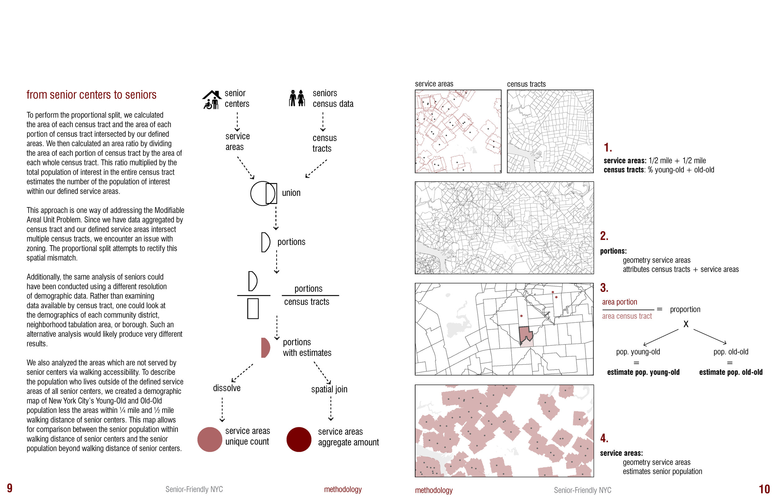
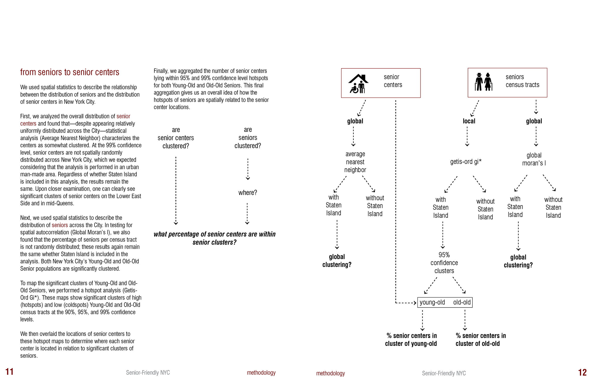
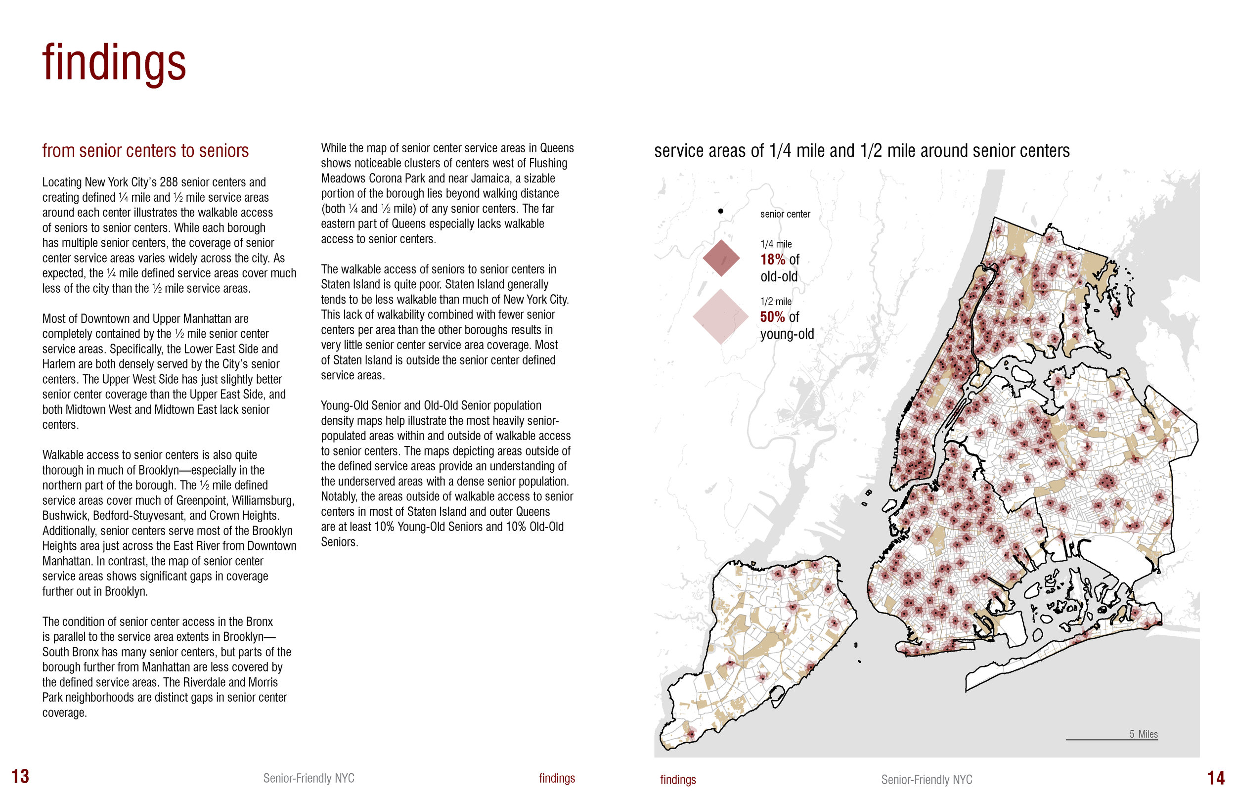
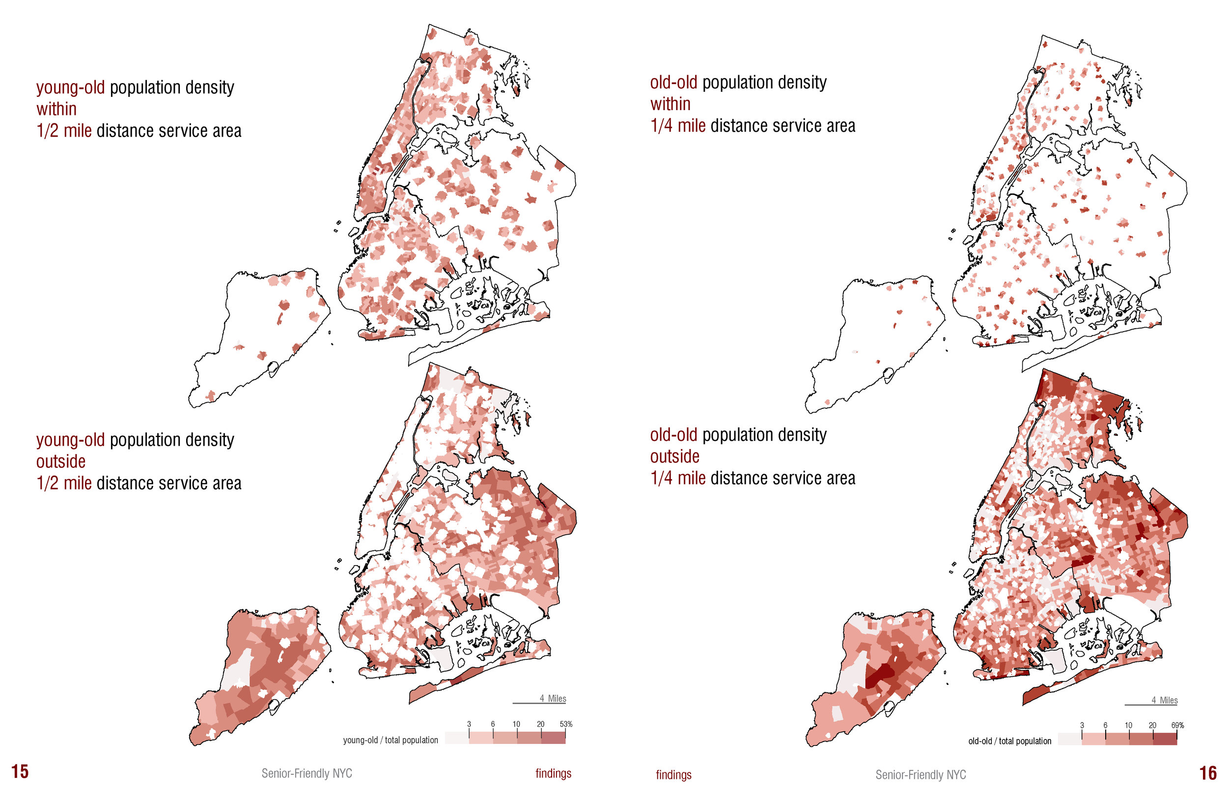
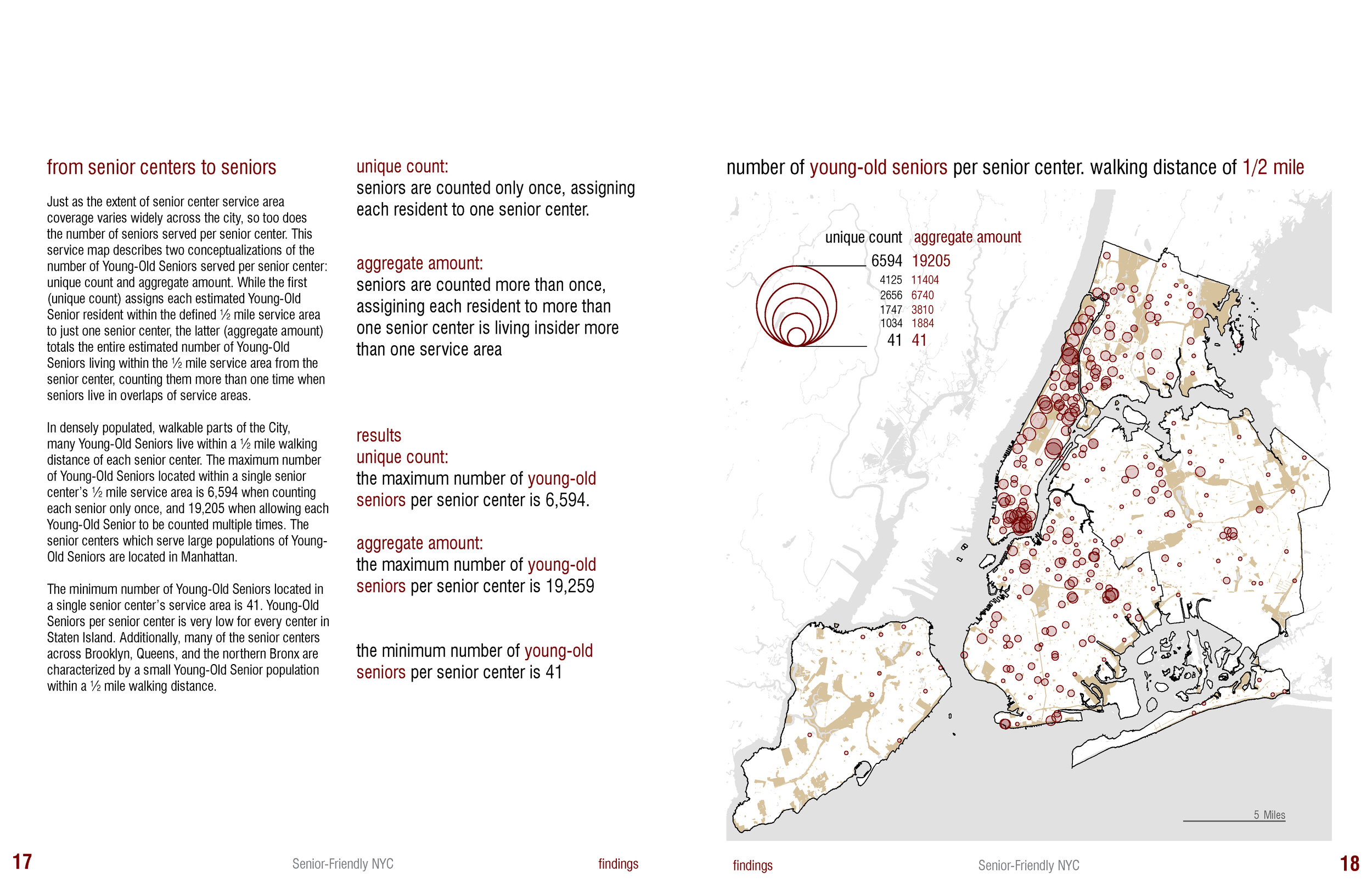
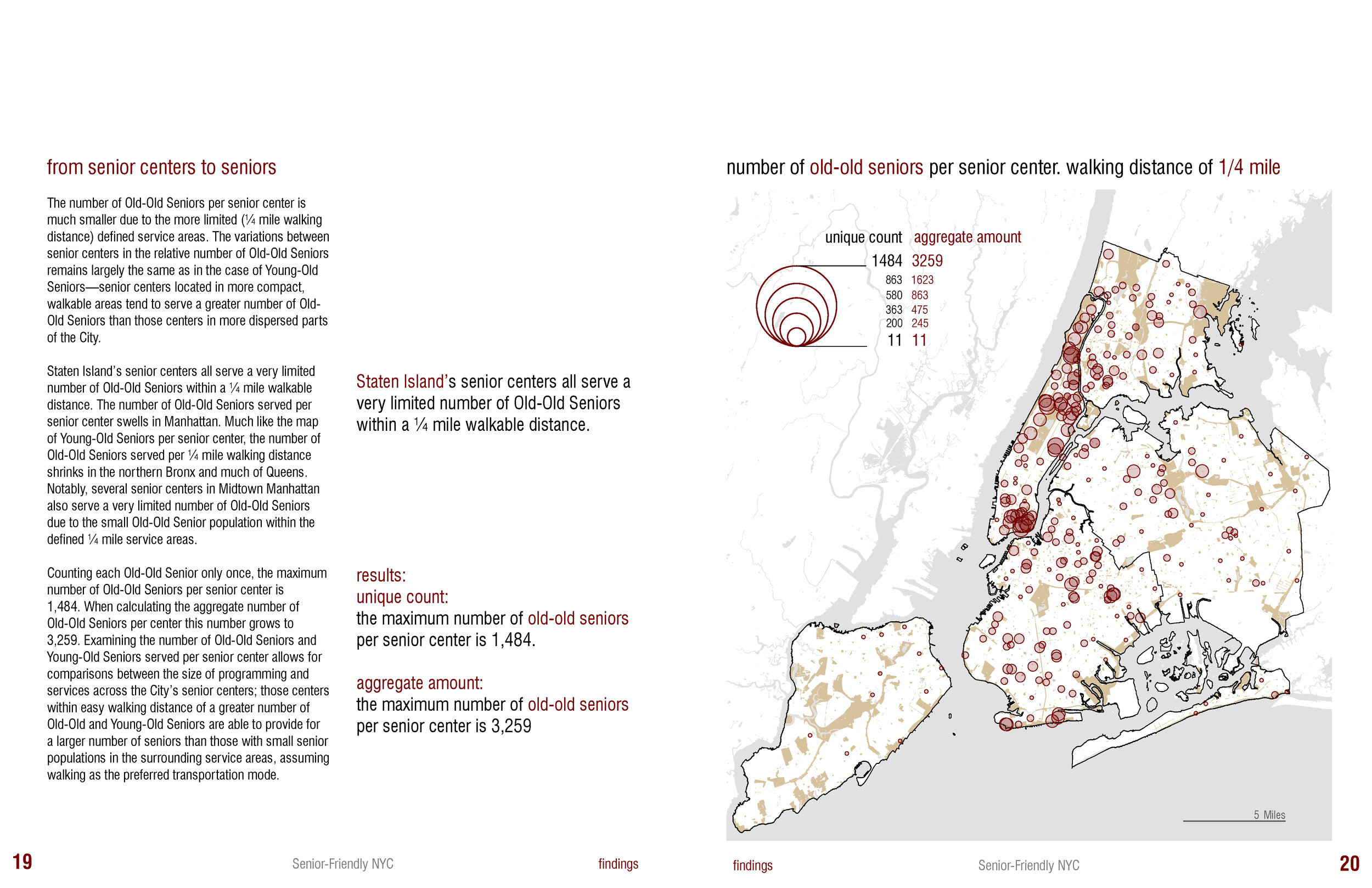
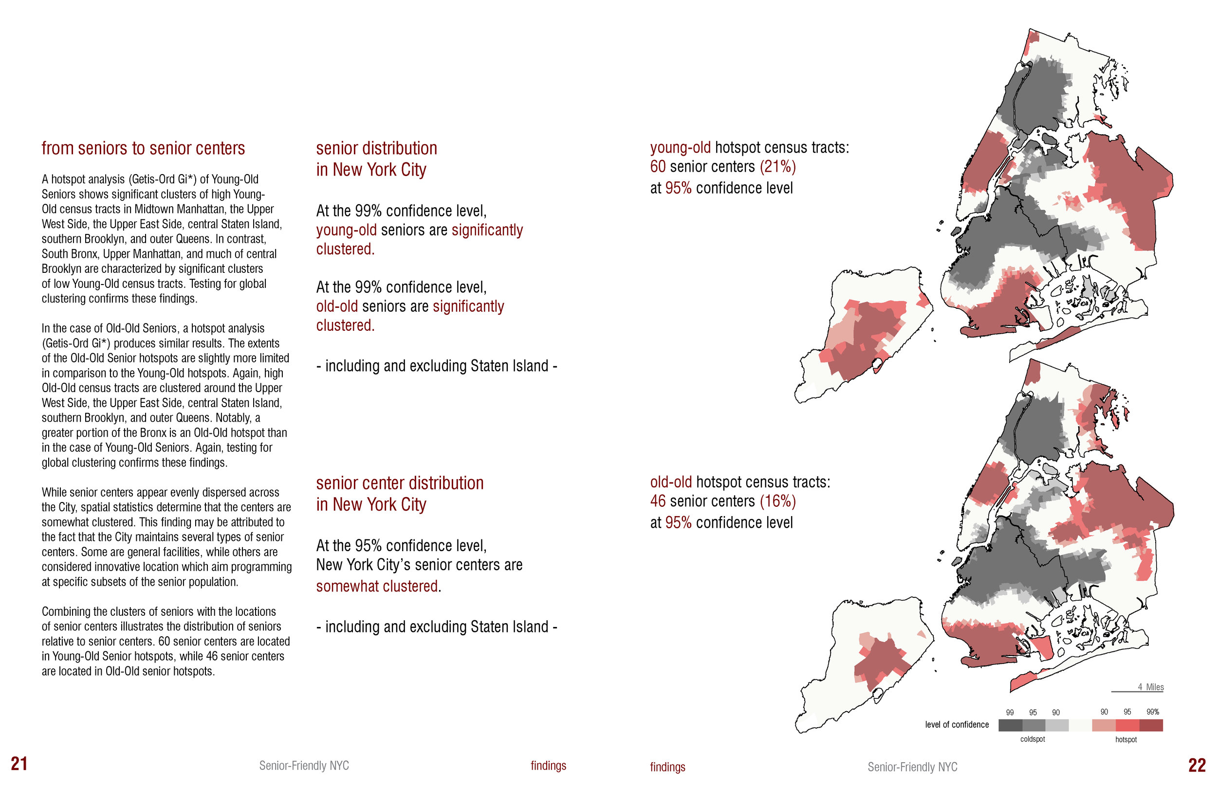
Gloria Serra Coch & Kenneth Warner. "Senior-Friendly NYC: Senior Access to Senior Centers."
(Fall 2017)


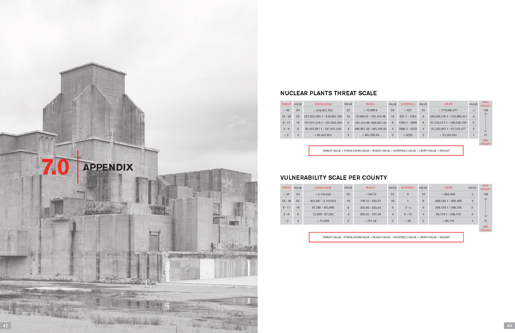
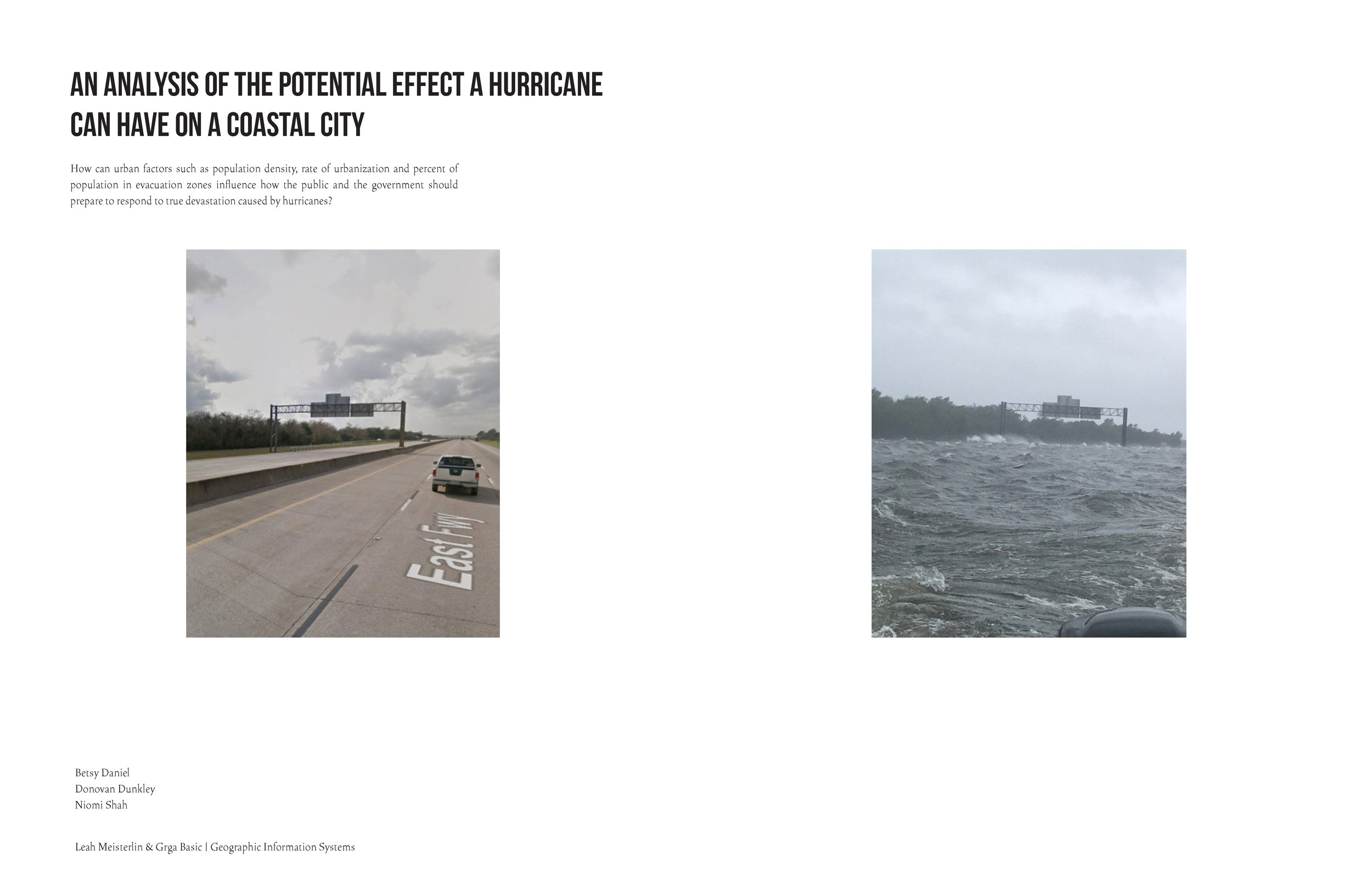
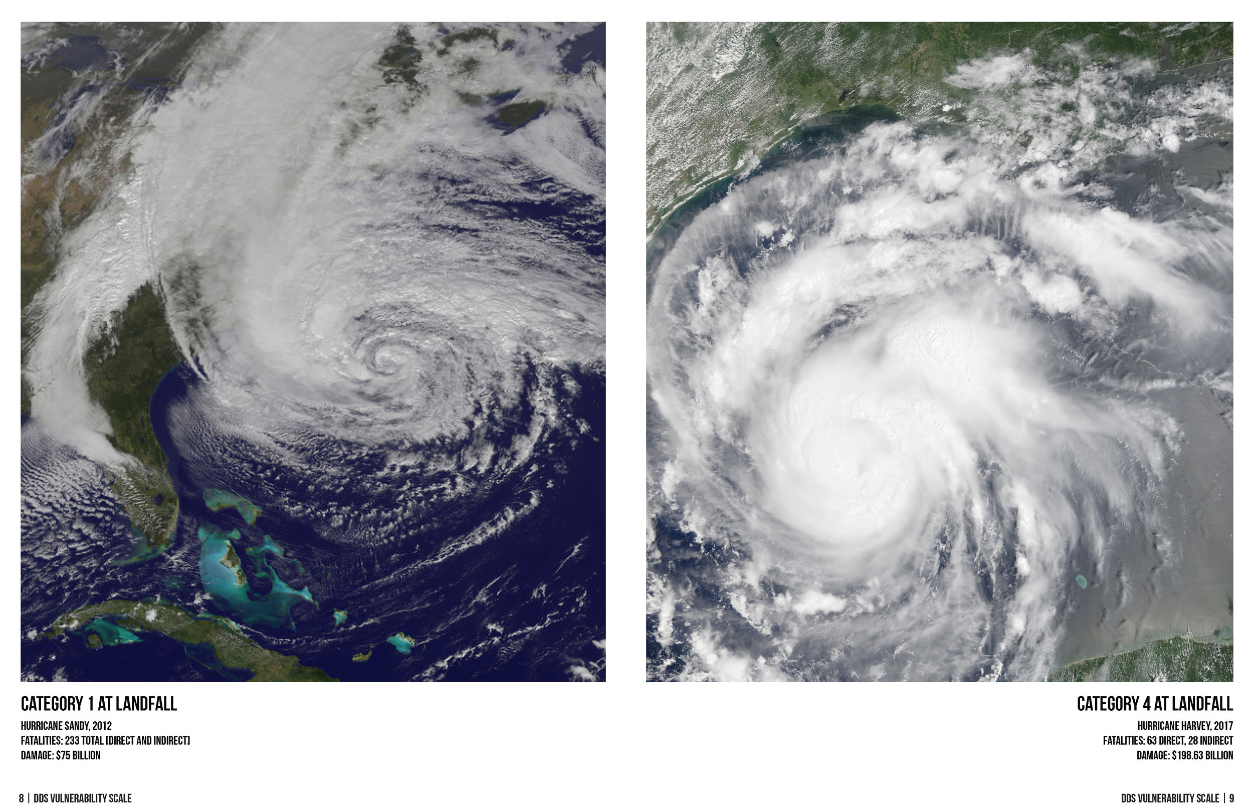
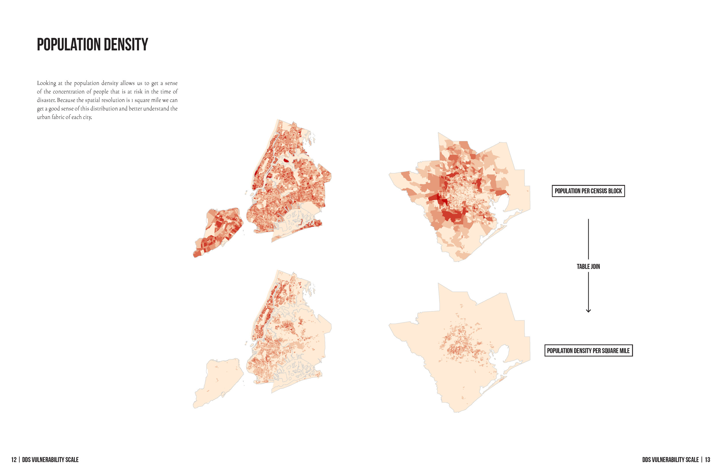
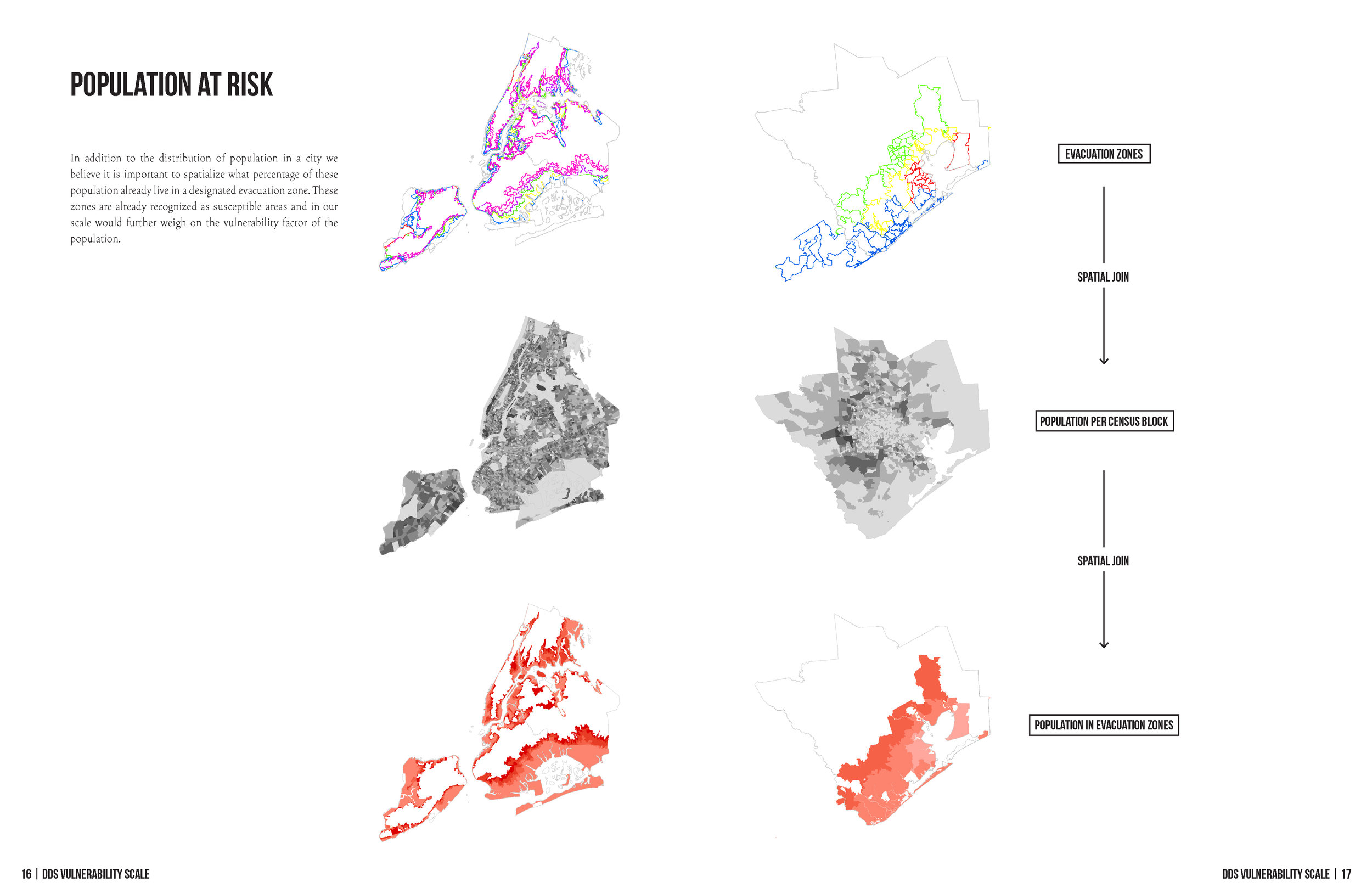
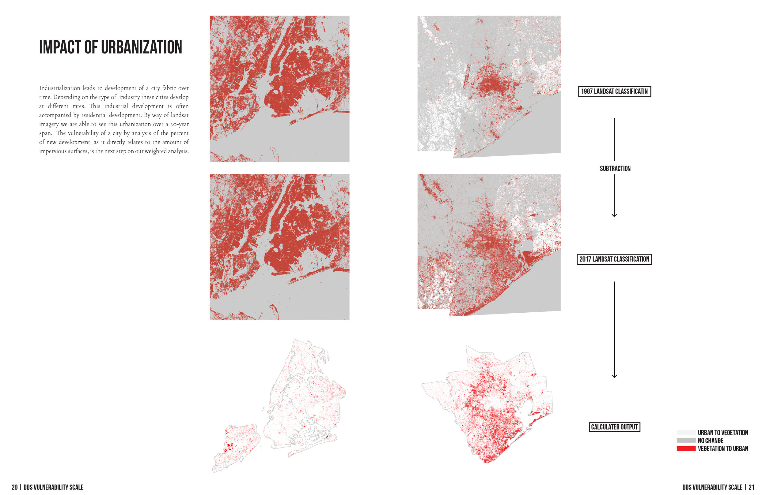
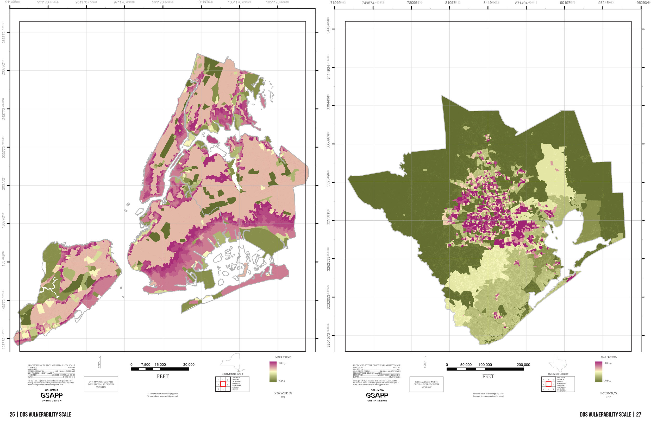
Betsy Daniel, Donovan Dunkley, & Niomi Shah. "DDS Vulnerability Scale: an Analysis of the Potential Effect a Hurricane Can Have on a Coastal City."
(Fall 2017)

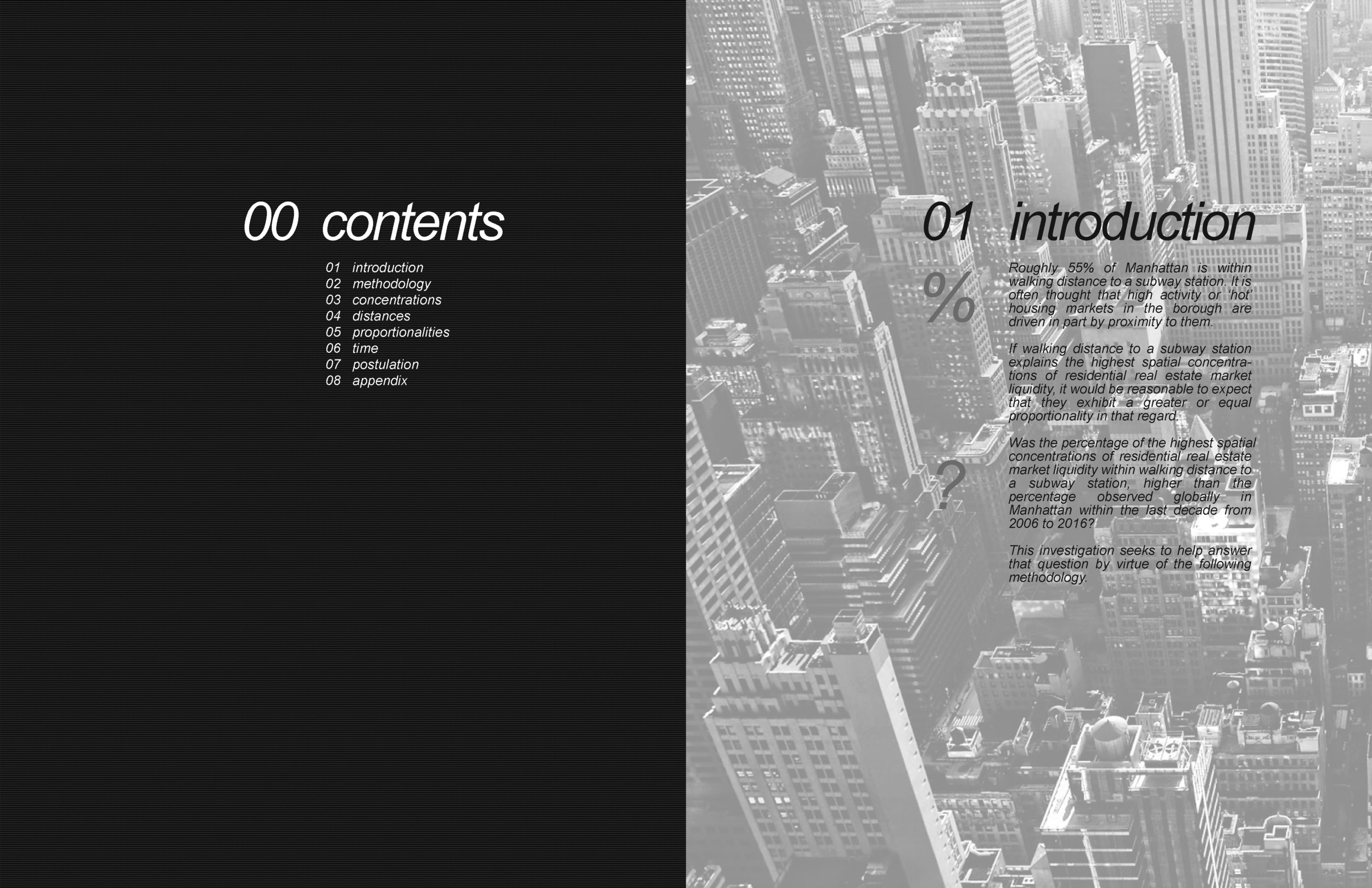
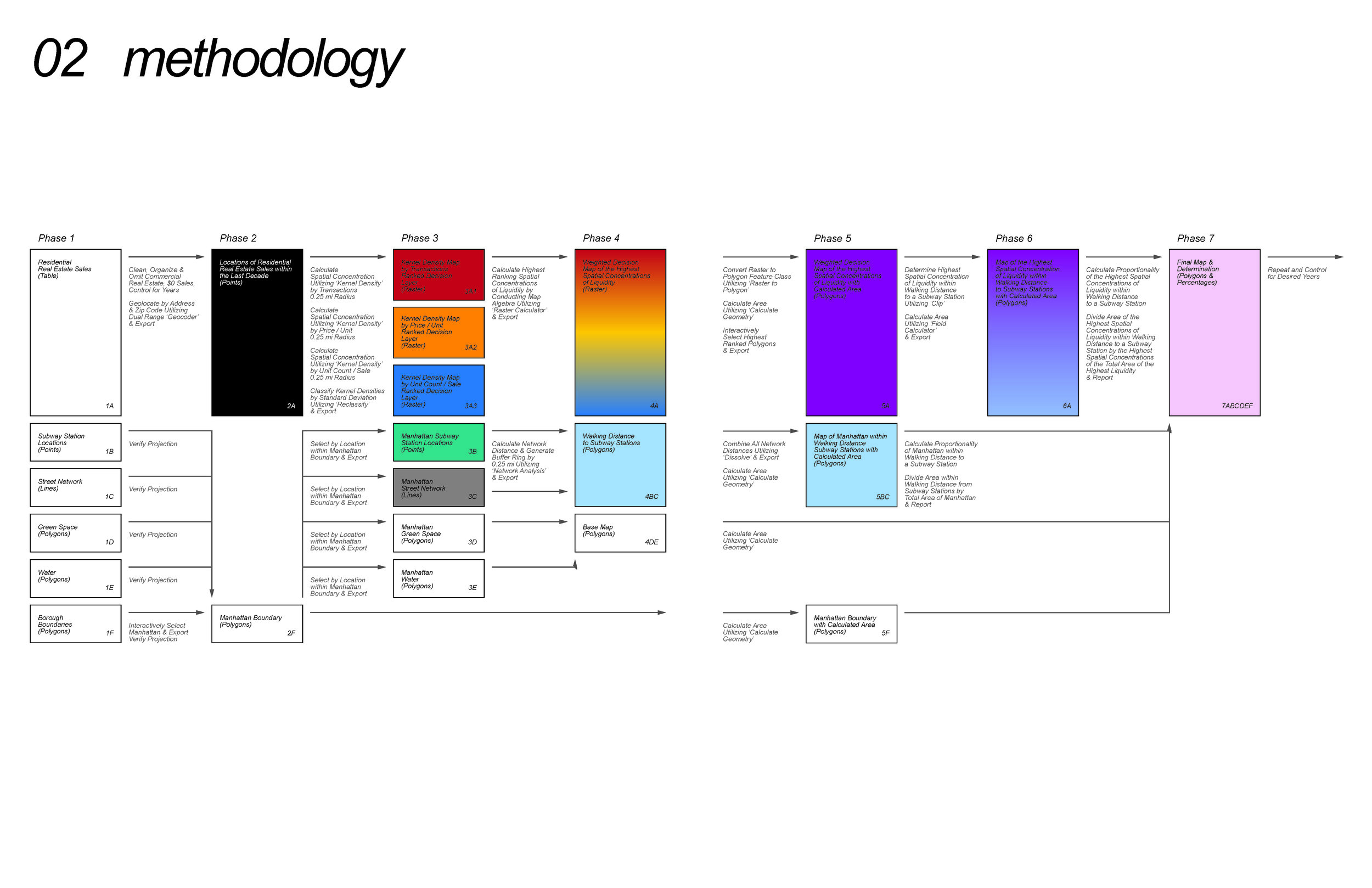
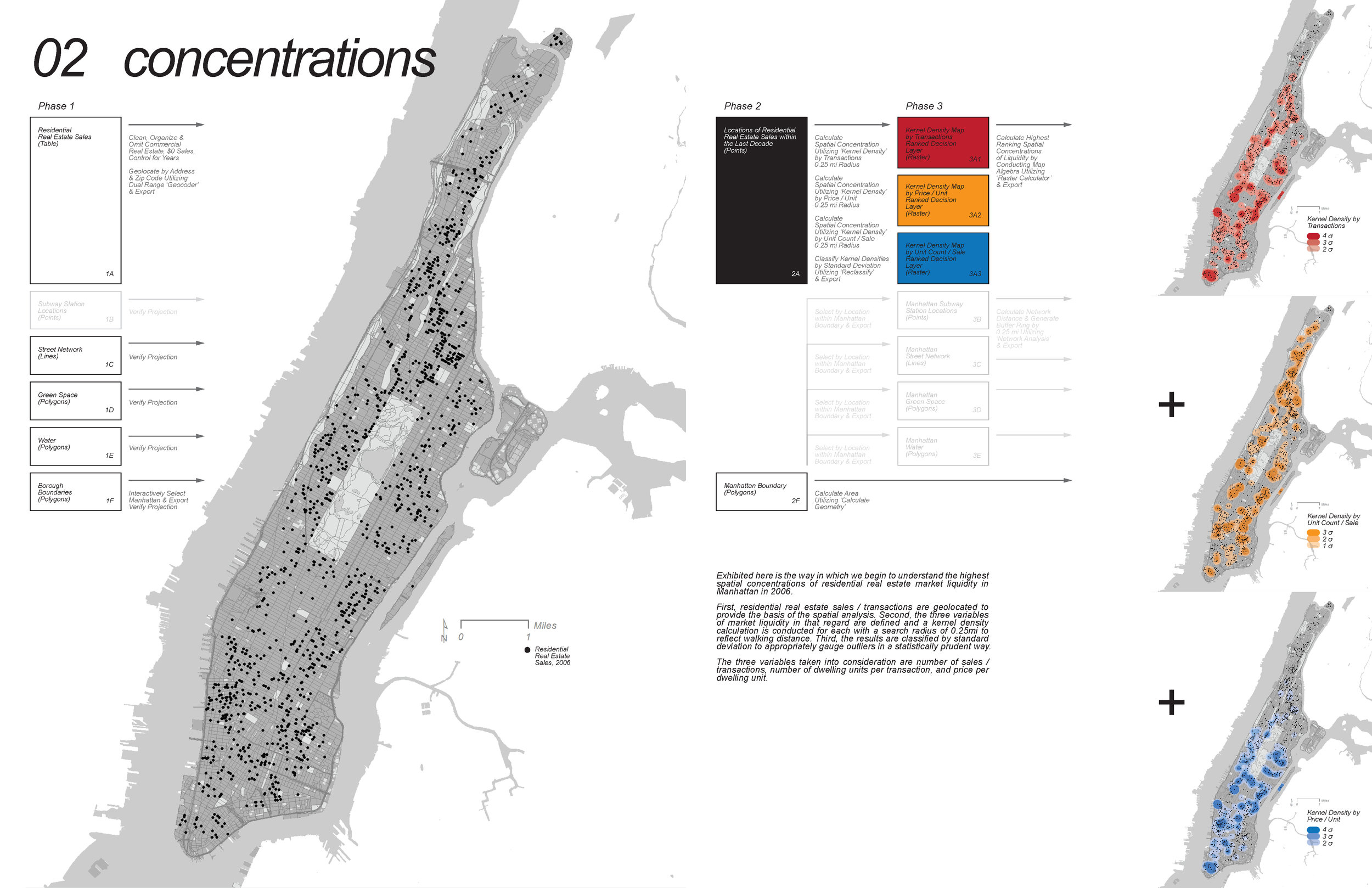
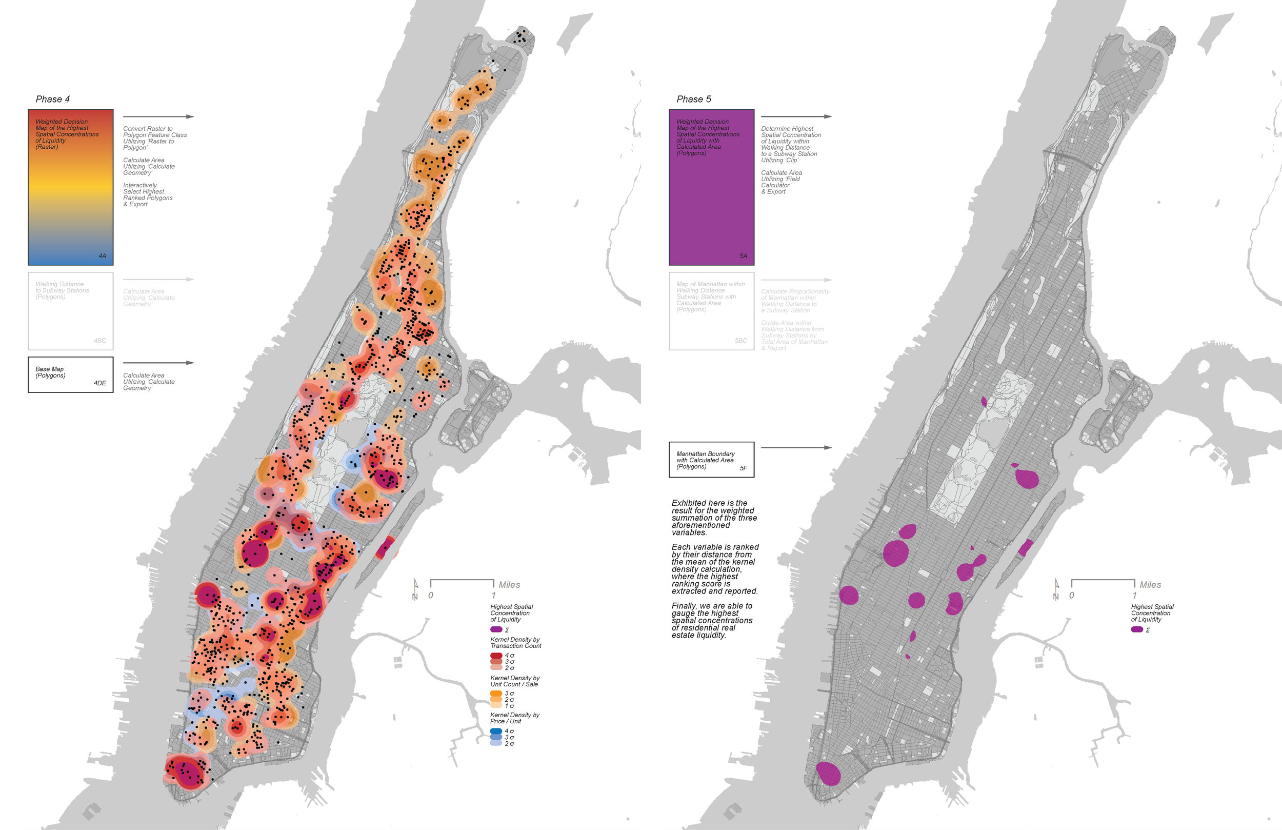
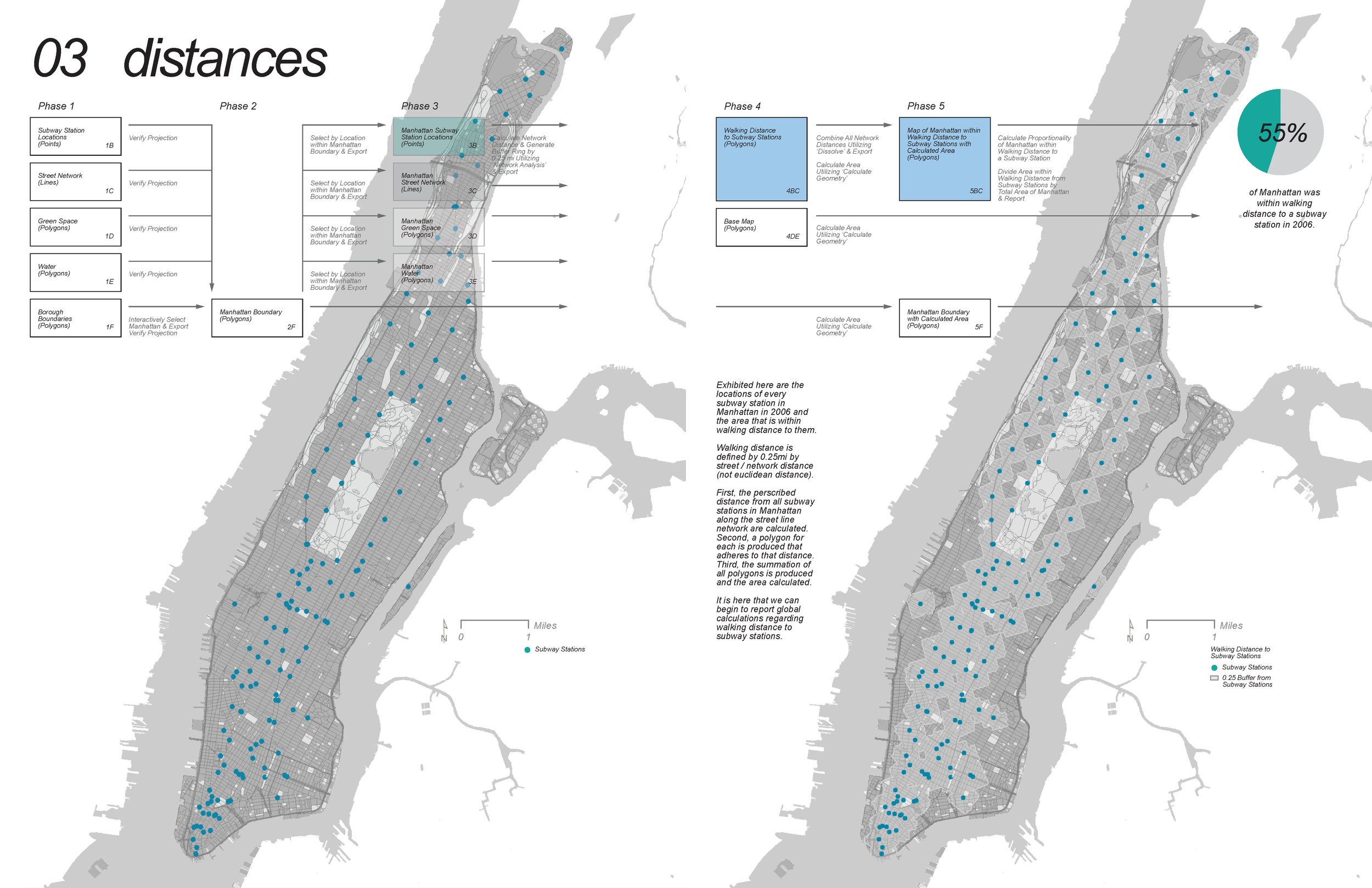
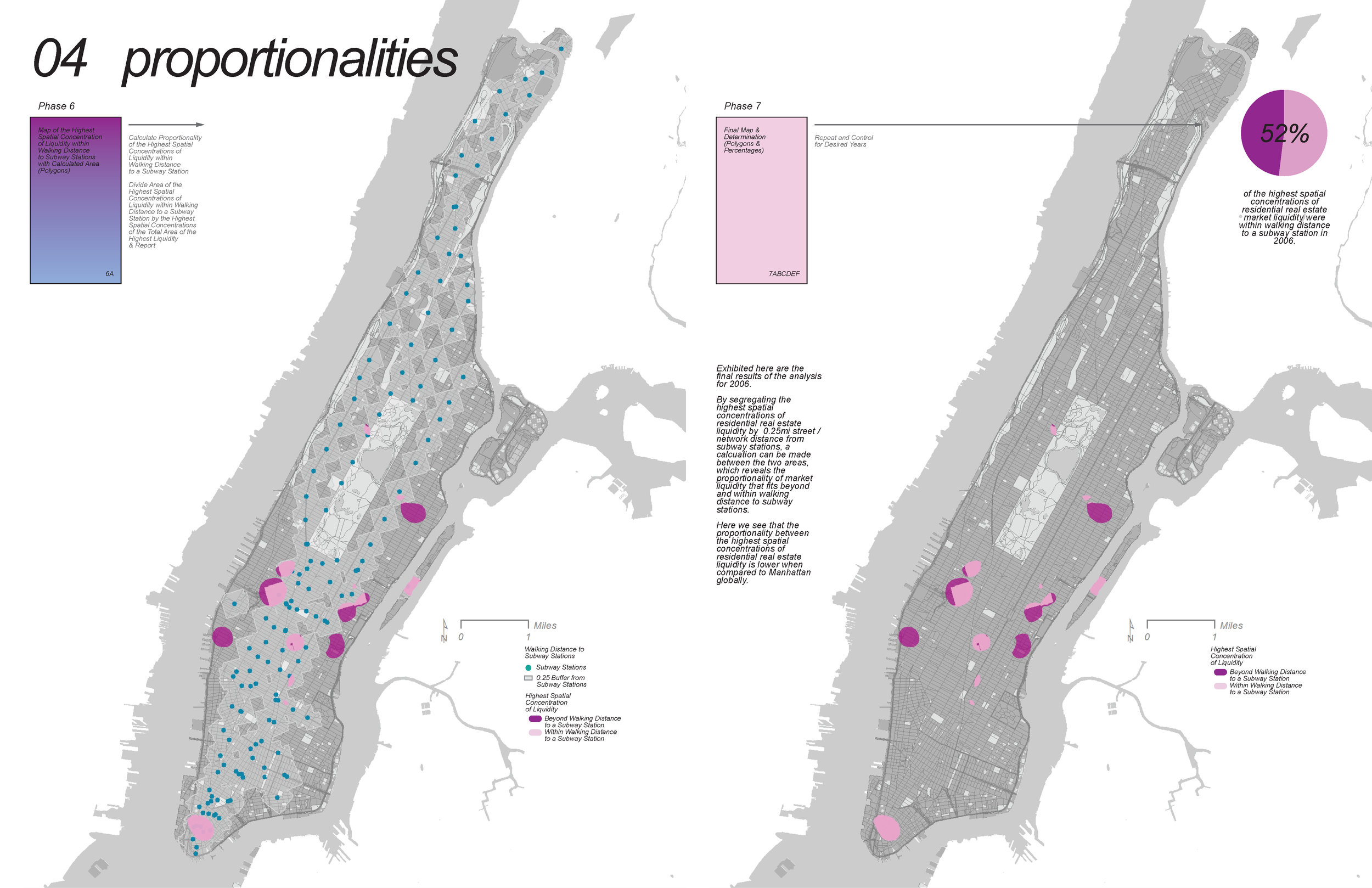
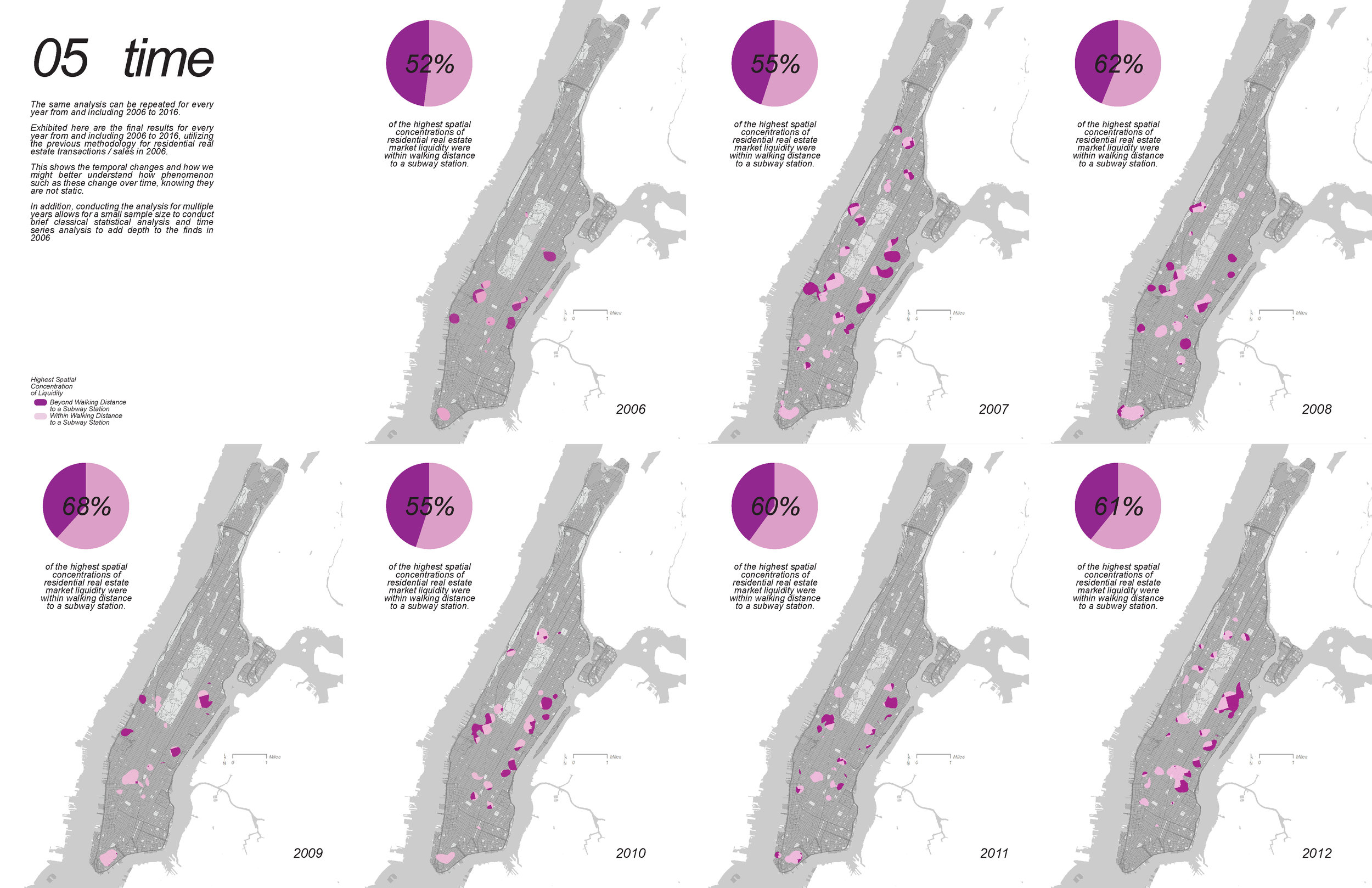
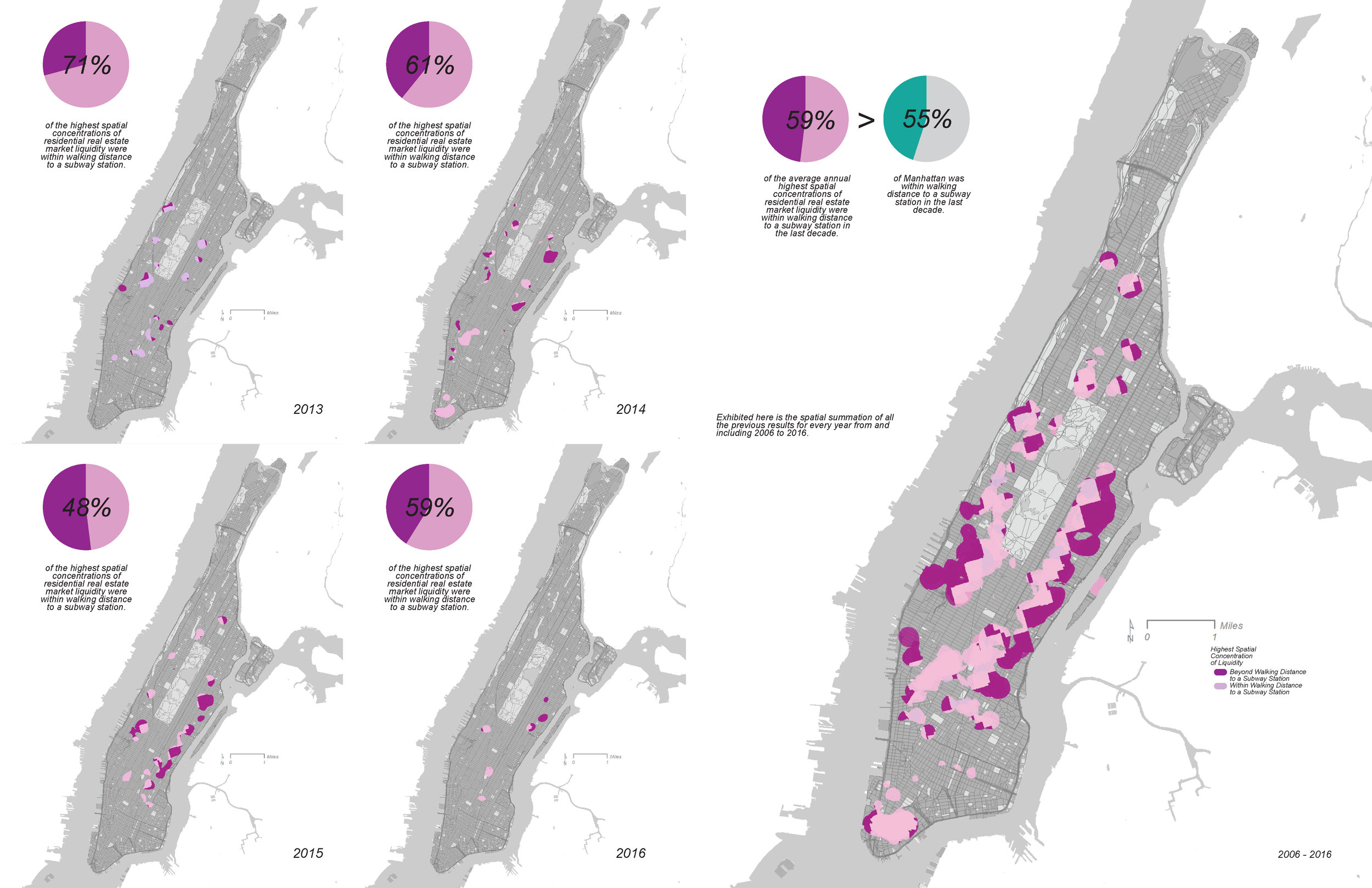
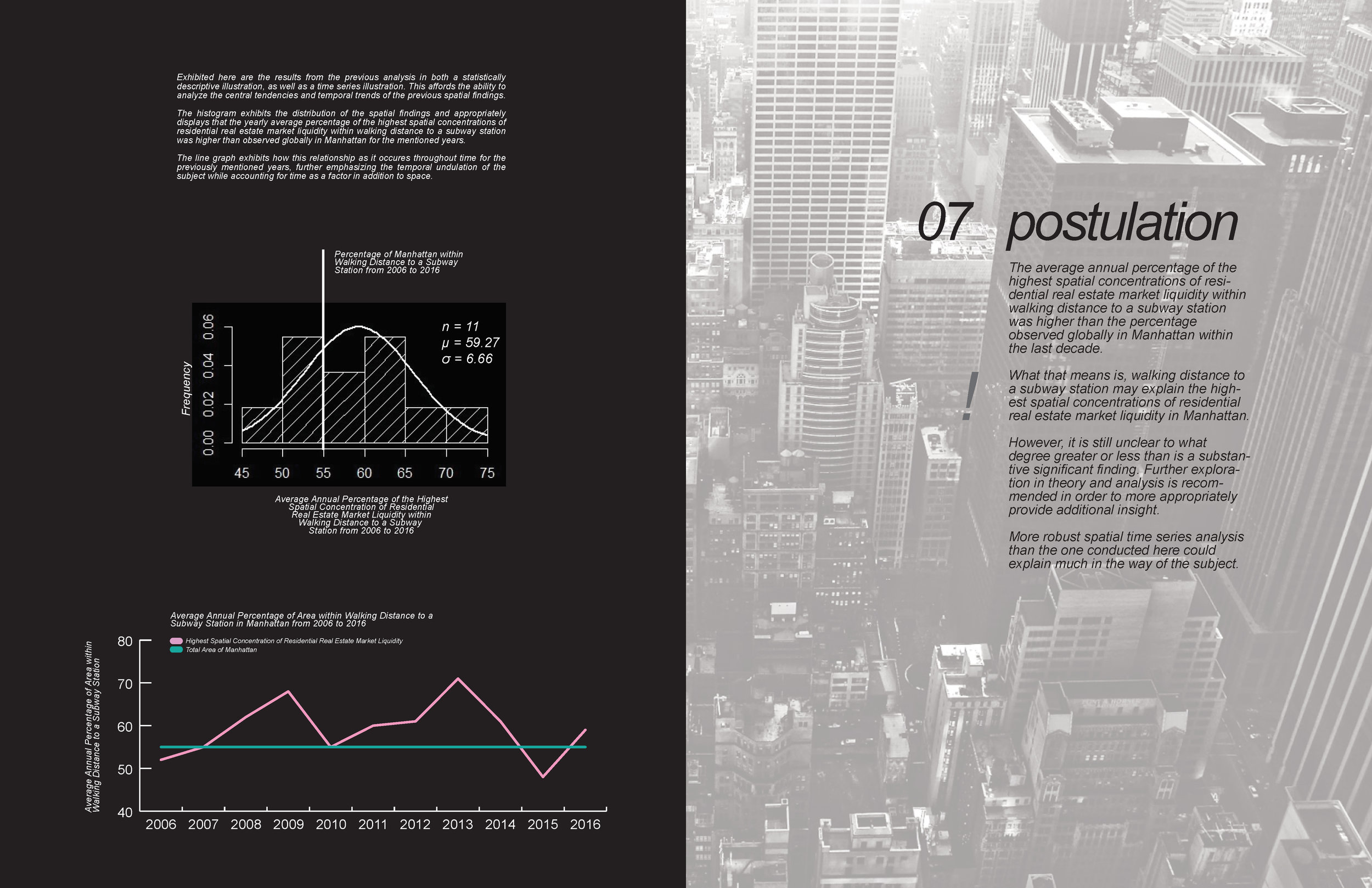
Nick Kunz. "Proportionalities: a Decade of Housing Markets to Subway Stations in Manhattan from 2006 to 2016."
(Fall 2017)