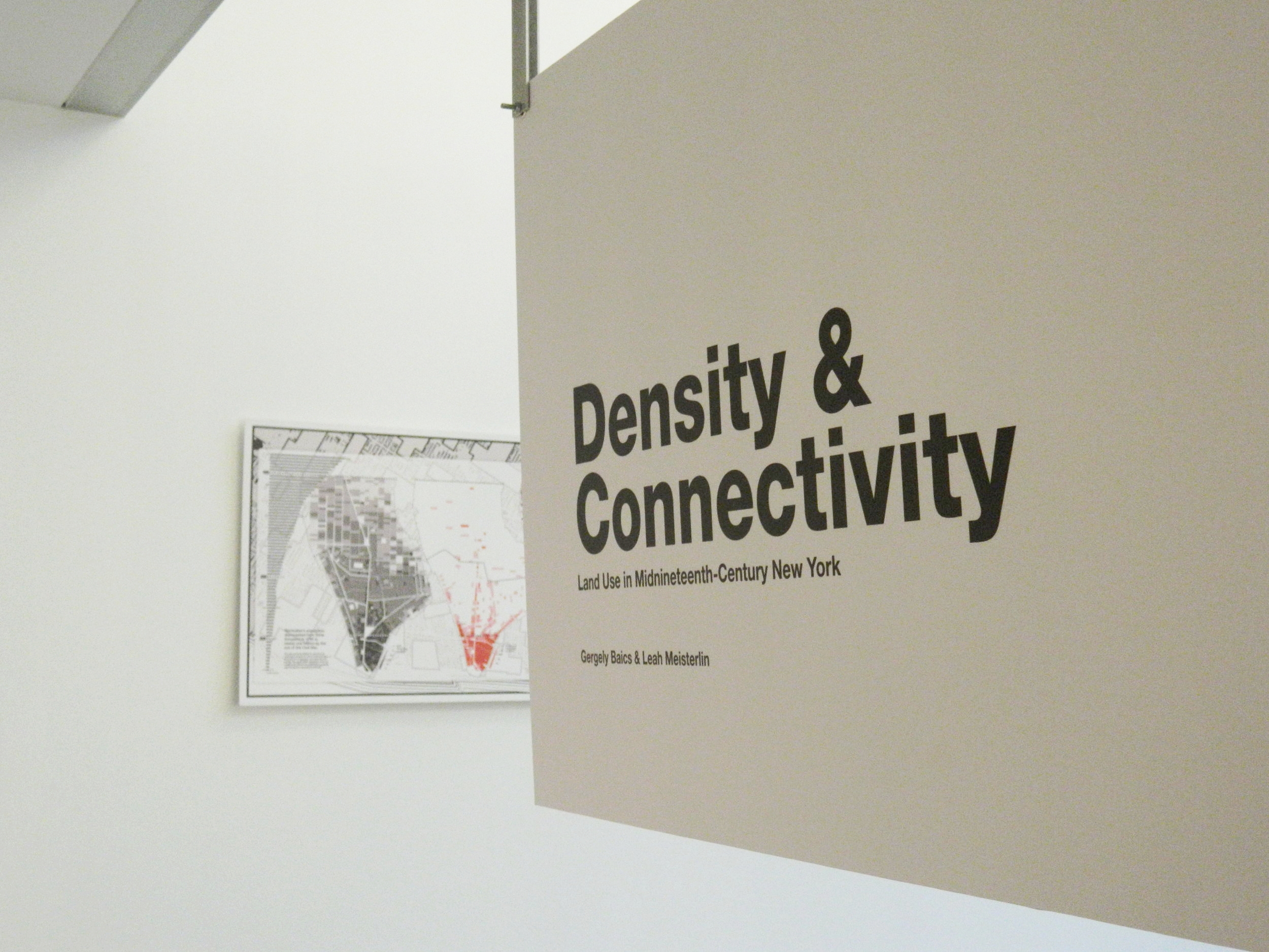
Density & Connectivity: Land use in Mid-nineteenth-Century New York
with Gergely Baics
at McCagg Gallery, Barnard College (Spring 2017)
at the Metropolitan New York Library Council (Summer 2017)
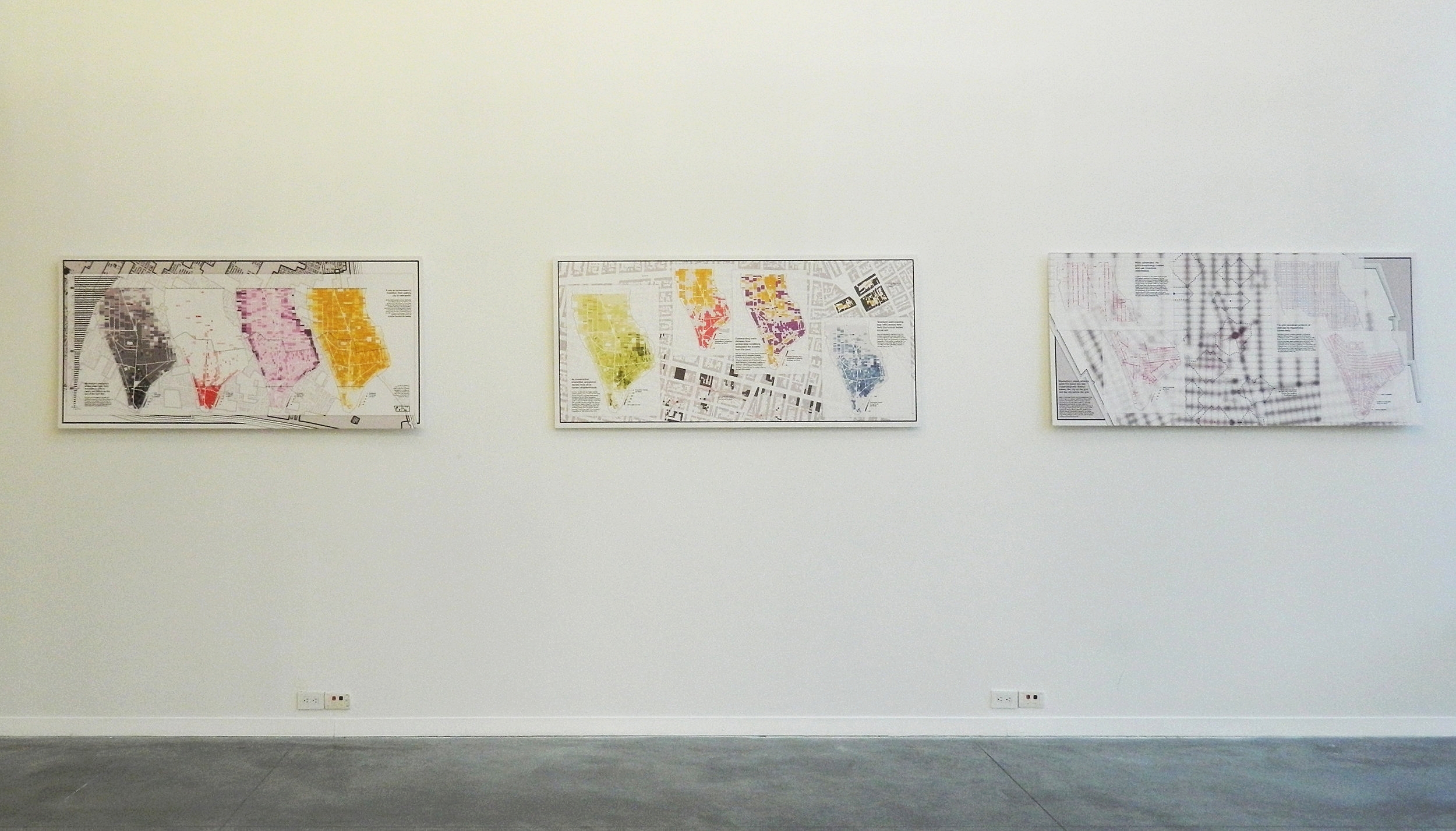
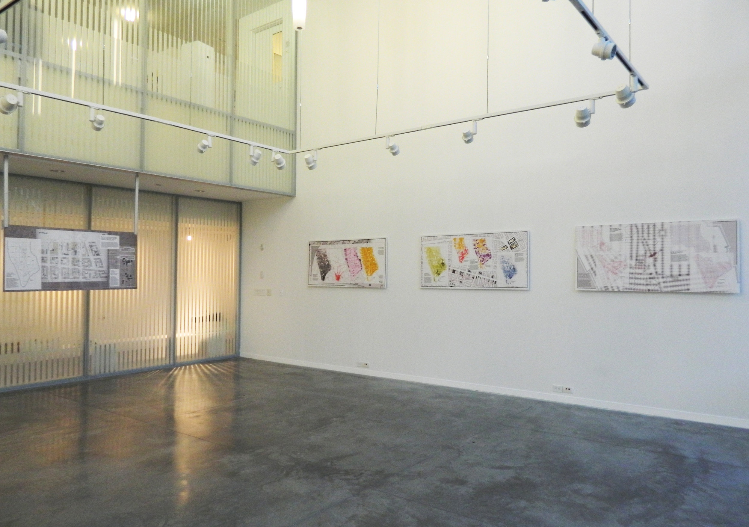
installation views, McCagg Gallery, Barnard College
Four Panels
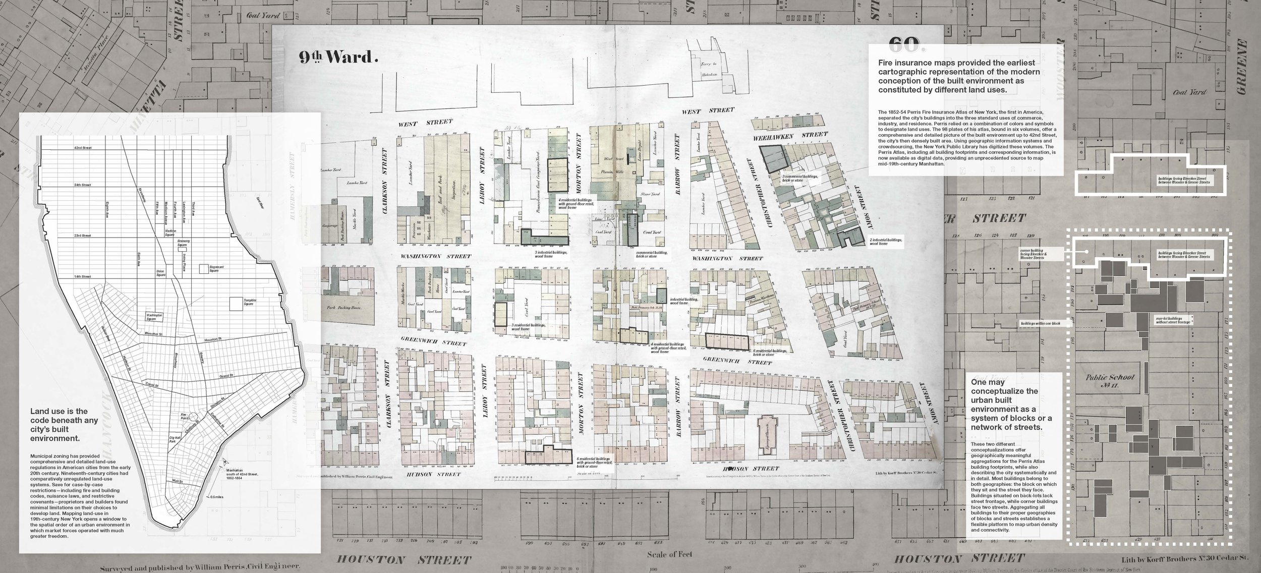
Atlas Unbound. Orientation map, Source Material, and Aggregation Methodology. 66 in x 30 in.
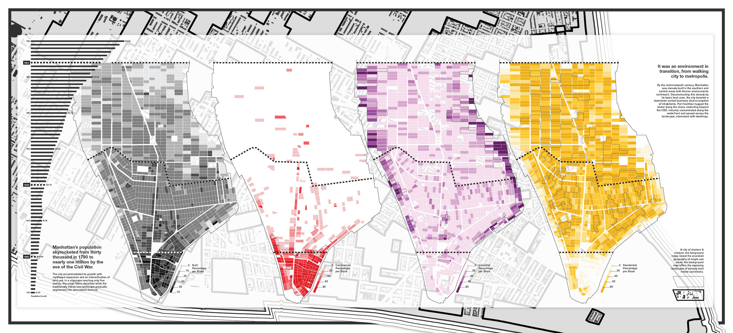
Built Density. Manhattan's Population Growth and Building Intensity by Land Use. 66 in x 30 in.
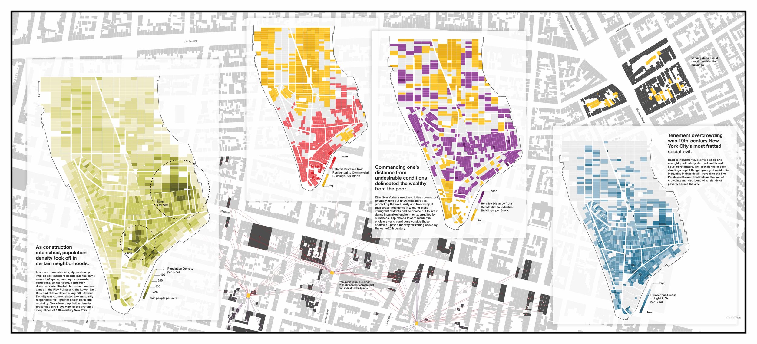
Social Density. Population Density, Relative Land Use Mixing, and Residential Overcrowding. 66 in x 30 in.
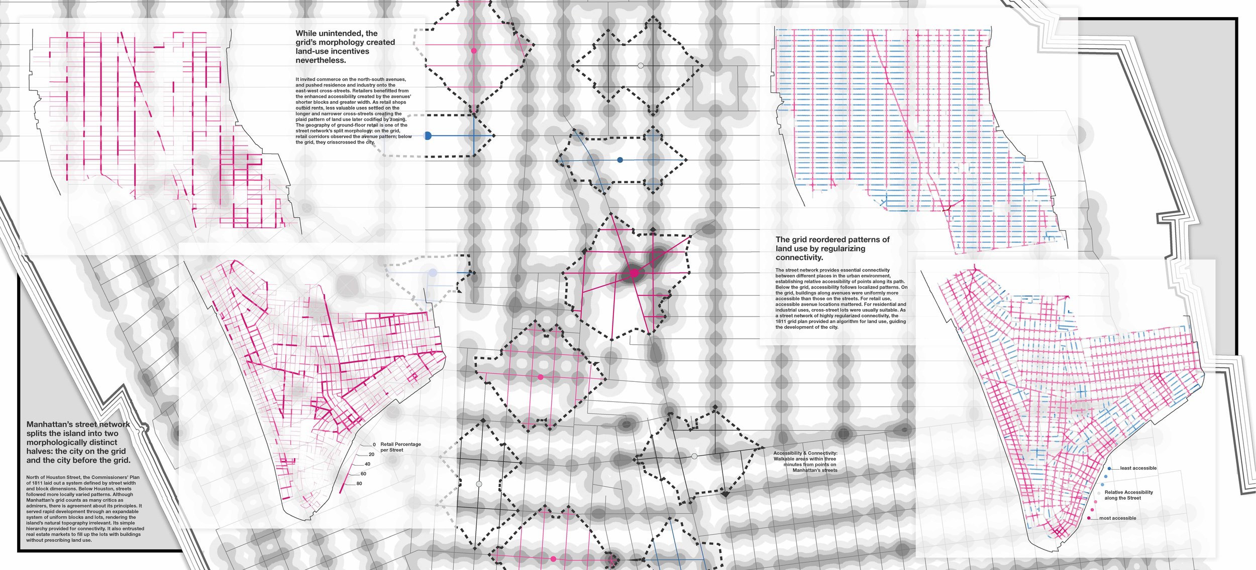
Street Connectivity. Effects of the 1811 Grid: Retail Patterns and Accessibiilty. 66 in x 30 in.
Related
Zoning Before Zoning: Land Use and Density in Mid-19th-Century New York