Introductory Research Methods in Geographic Information Systems & Science
Introduction to GIS (Fall 2012, Spring 2017) taught in the Urban Planning program of Columbia's Graduate School of Architecture, Planning and Preservation (GSAPP), was an introductory course on human and physical geography, information systems, and data-driven spatial research methodologies, within the context of questions relevant to working in urban environments.
GIS Methods & Case Studies (Fall 2013), taught in the Urban Studies Program at Barnard College, is an undergraduate introductory GIS course designed around using spatial data in pragmatic use-case scenarios culminating in a final student-directed research report.
Featured here are excerpts from example student projects from each course.
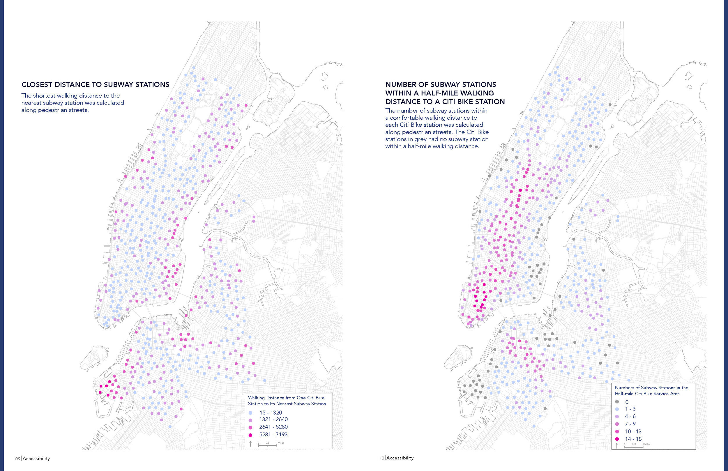
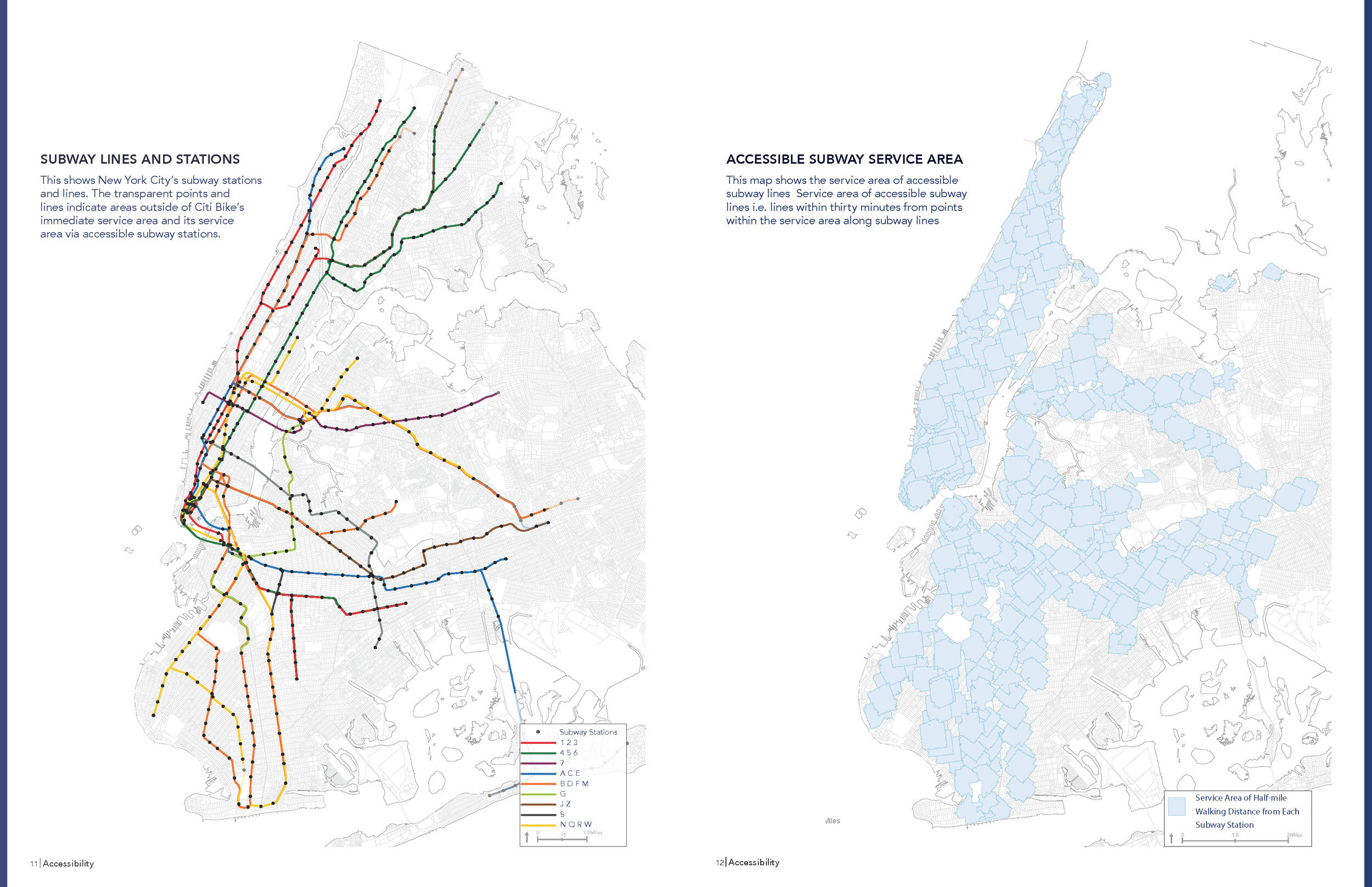
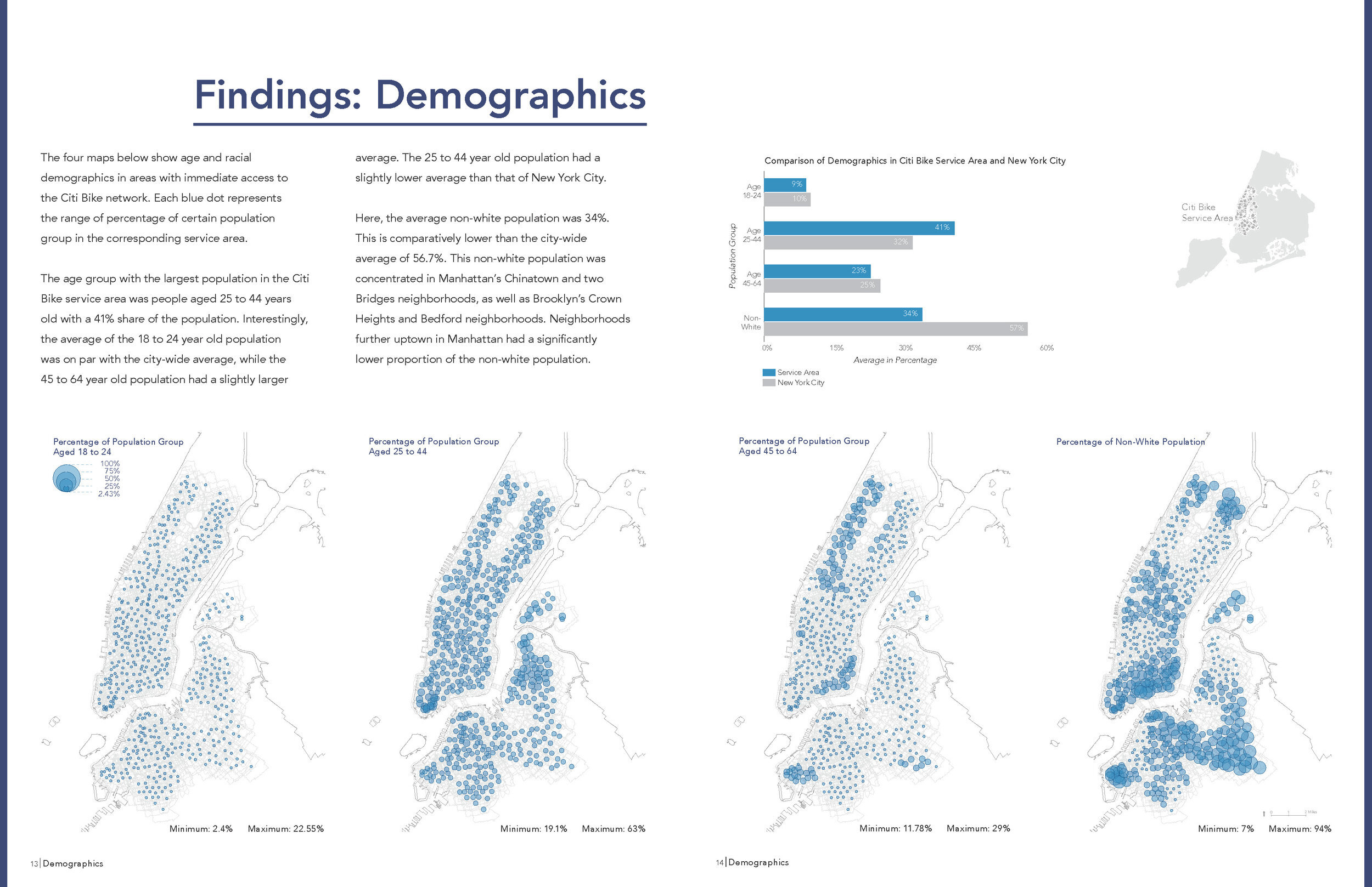
Tola Oniyangi & Joan Zhang. "Citi Bike's Network & Accessibility."
(Introduction to GIS, Spring 2017)
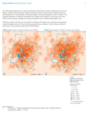
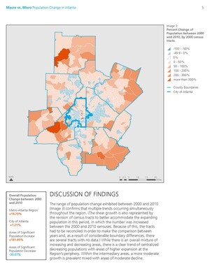
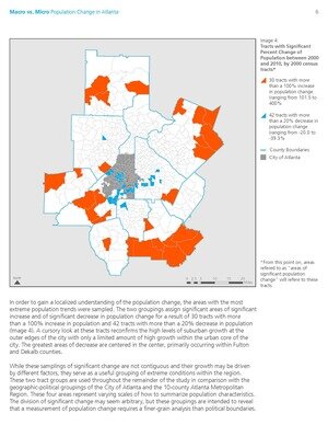
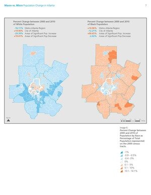
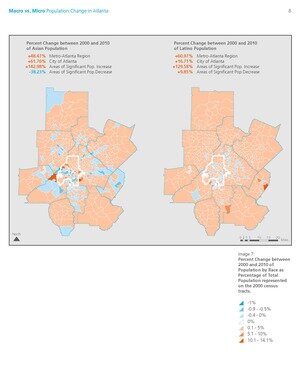
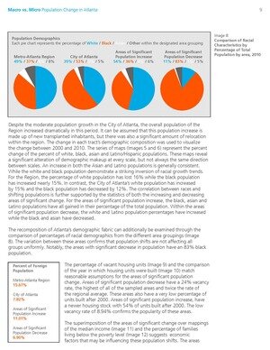
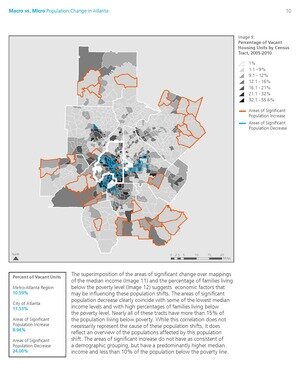
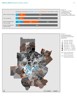
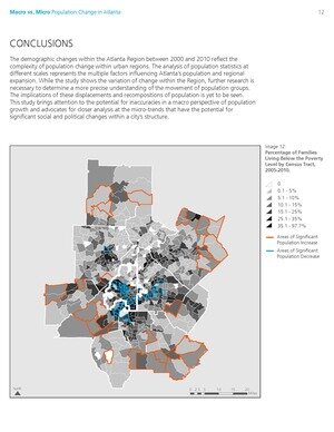
Allison Schwartz. "Macro vs Micro: Recent Population Change in Atlanta."
(Introduction to GIS, Fall 2012)
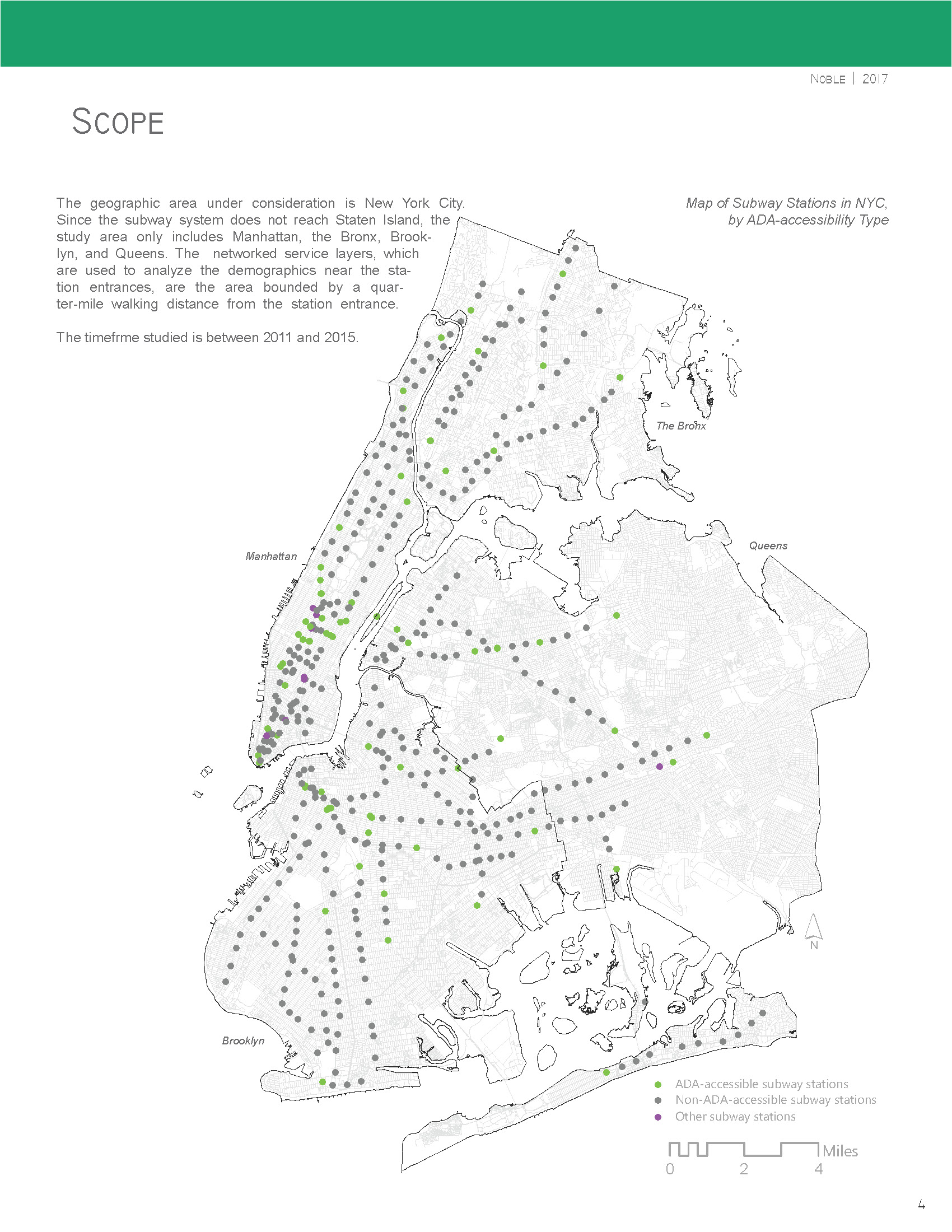
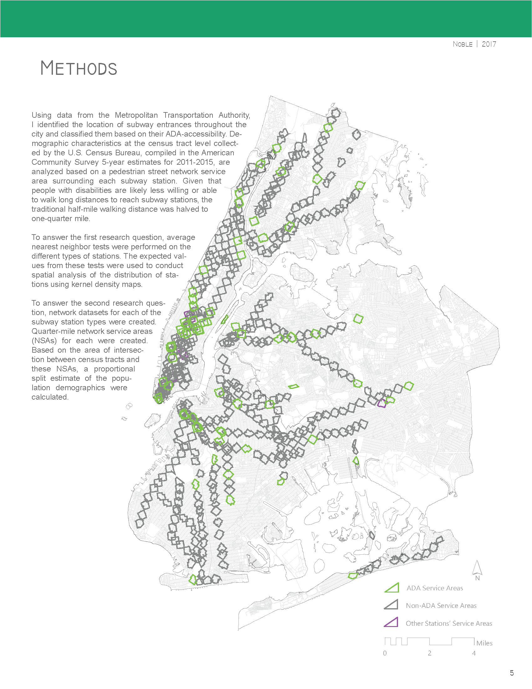
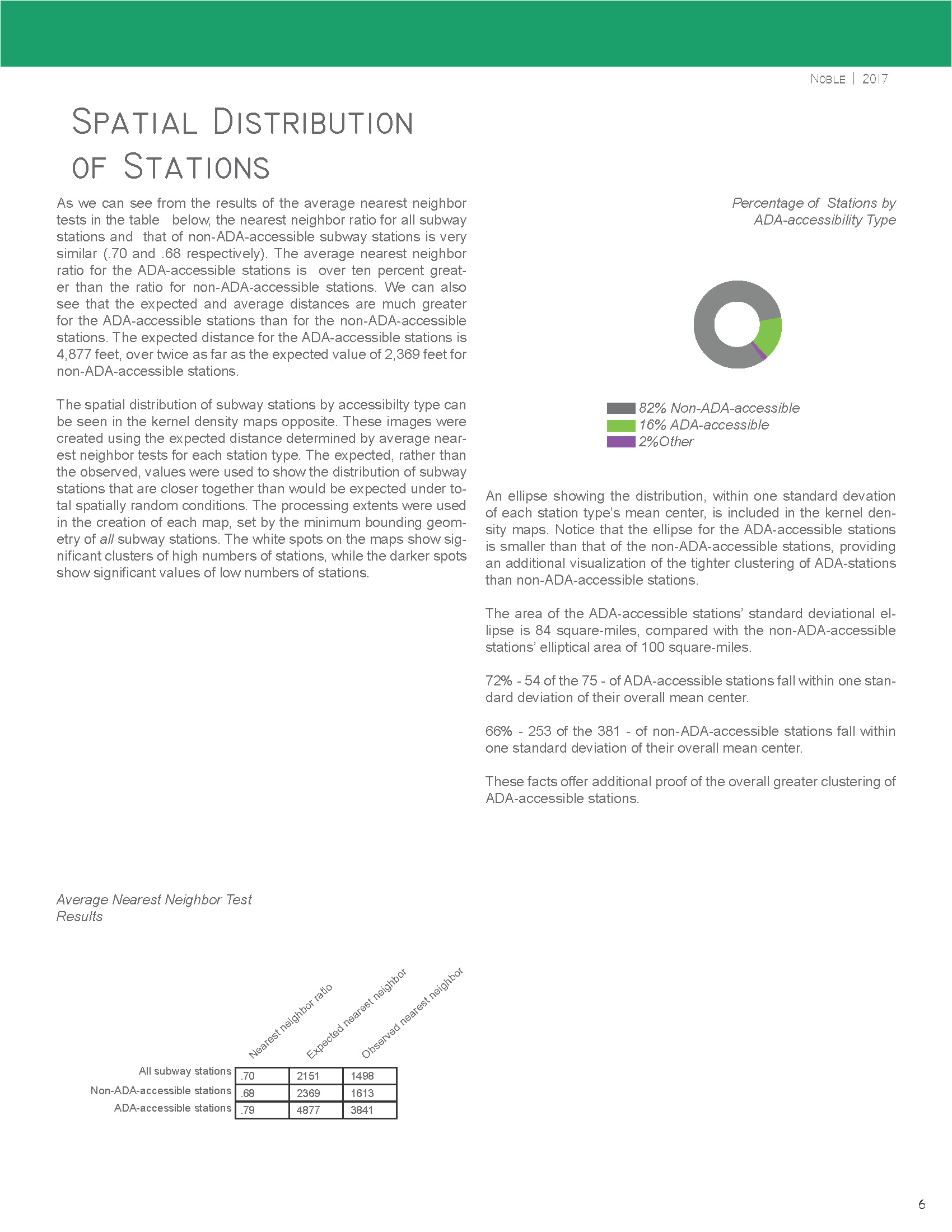
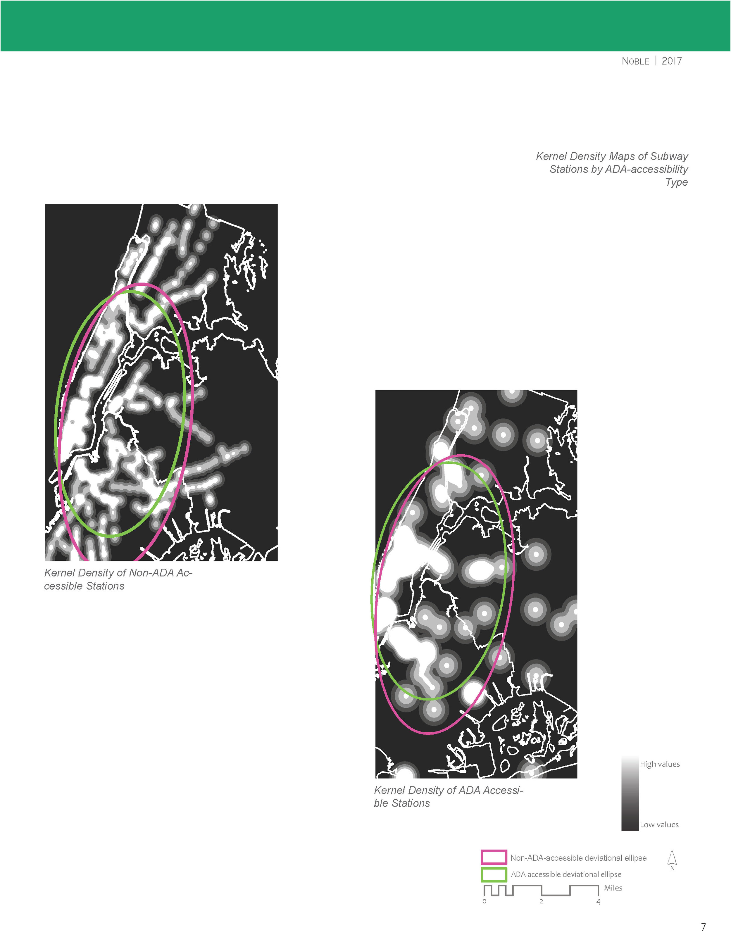
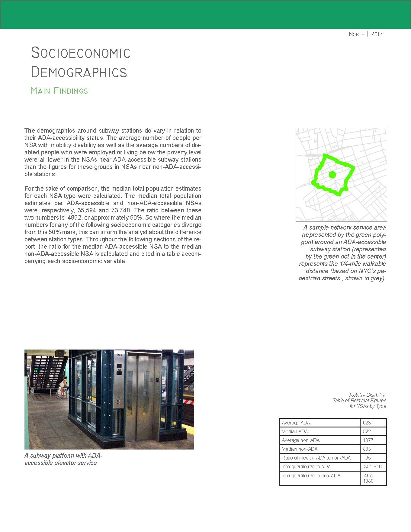
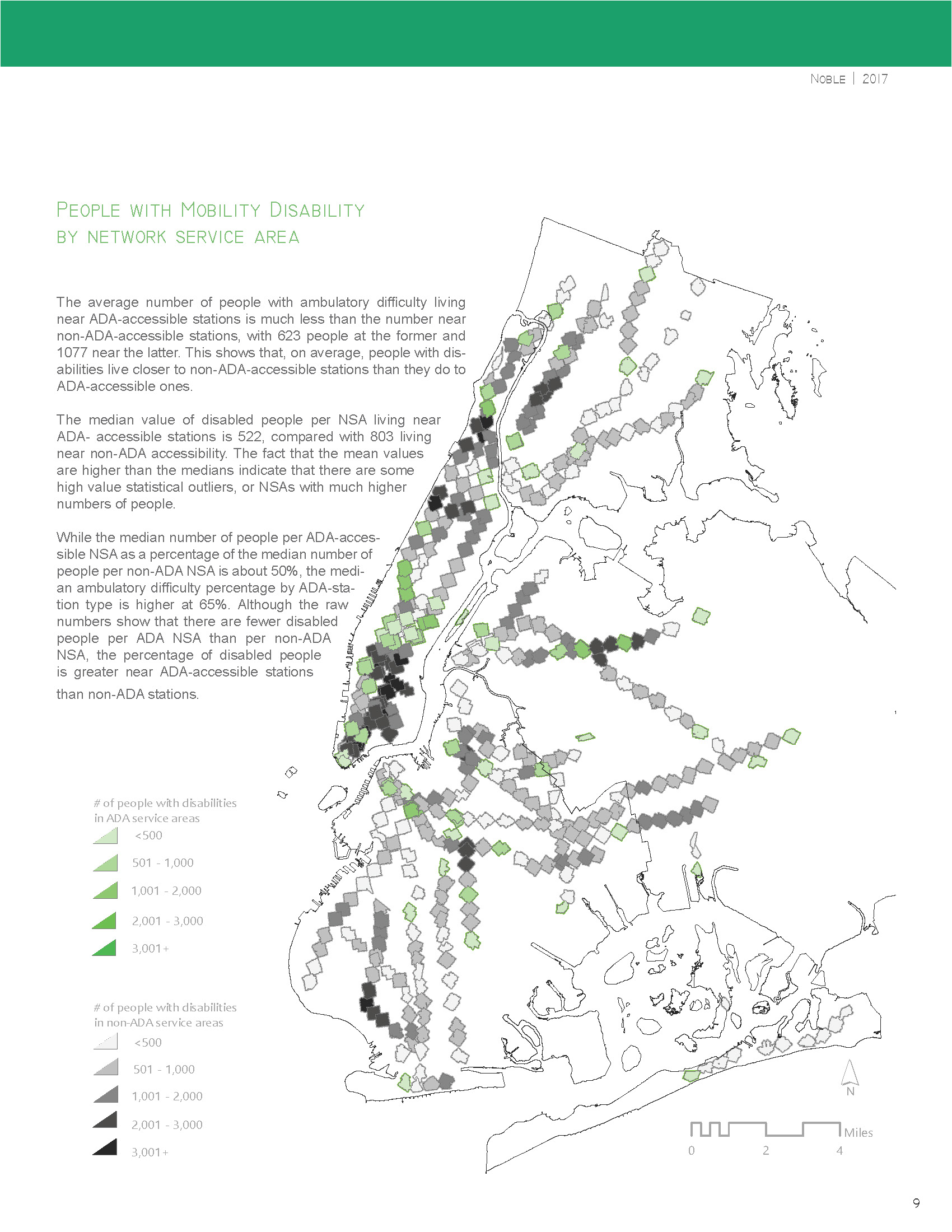
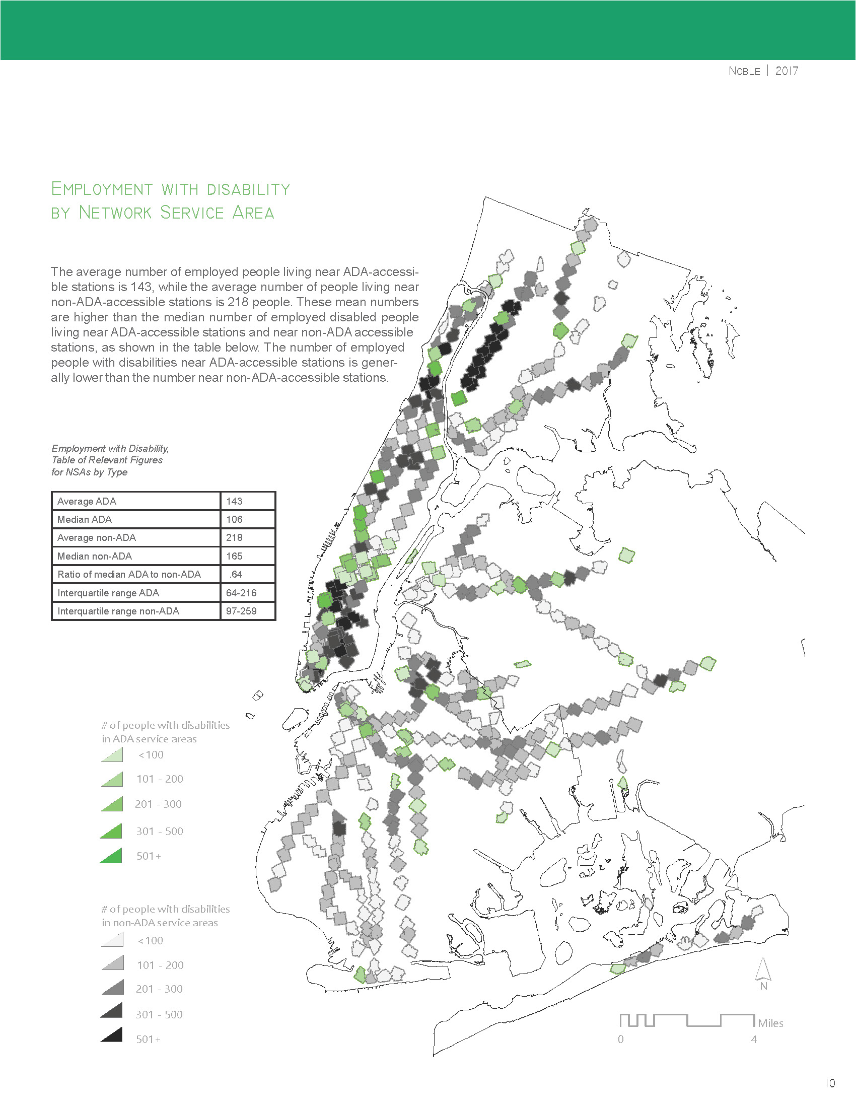
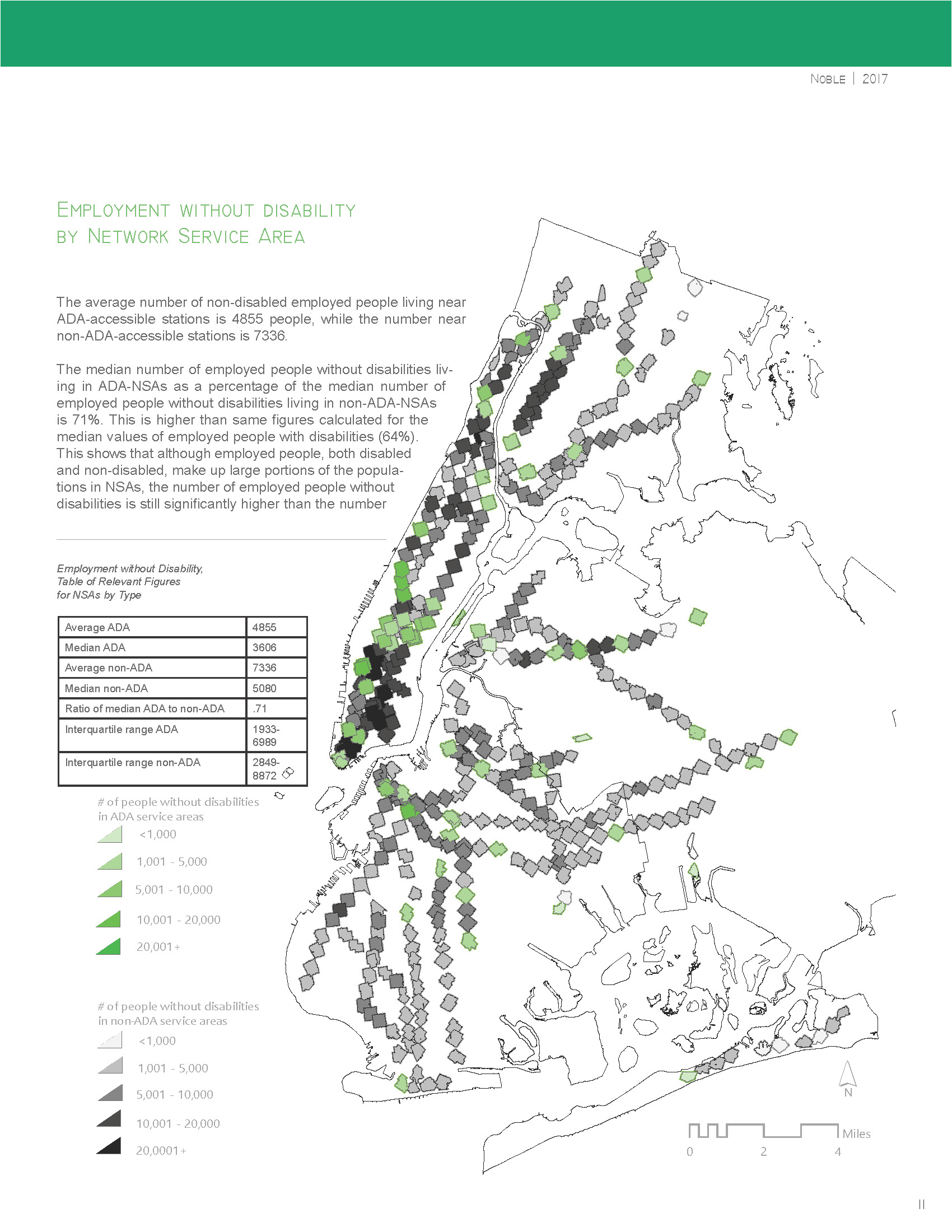
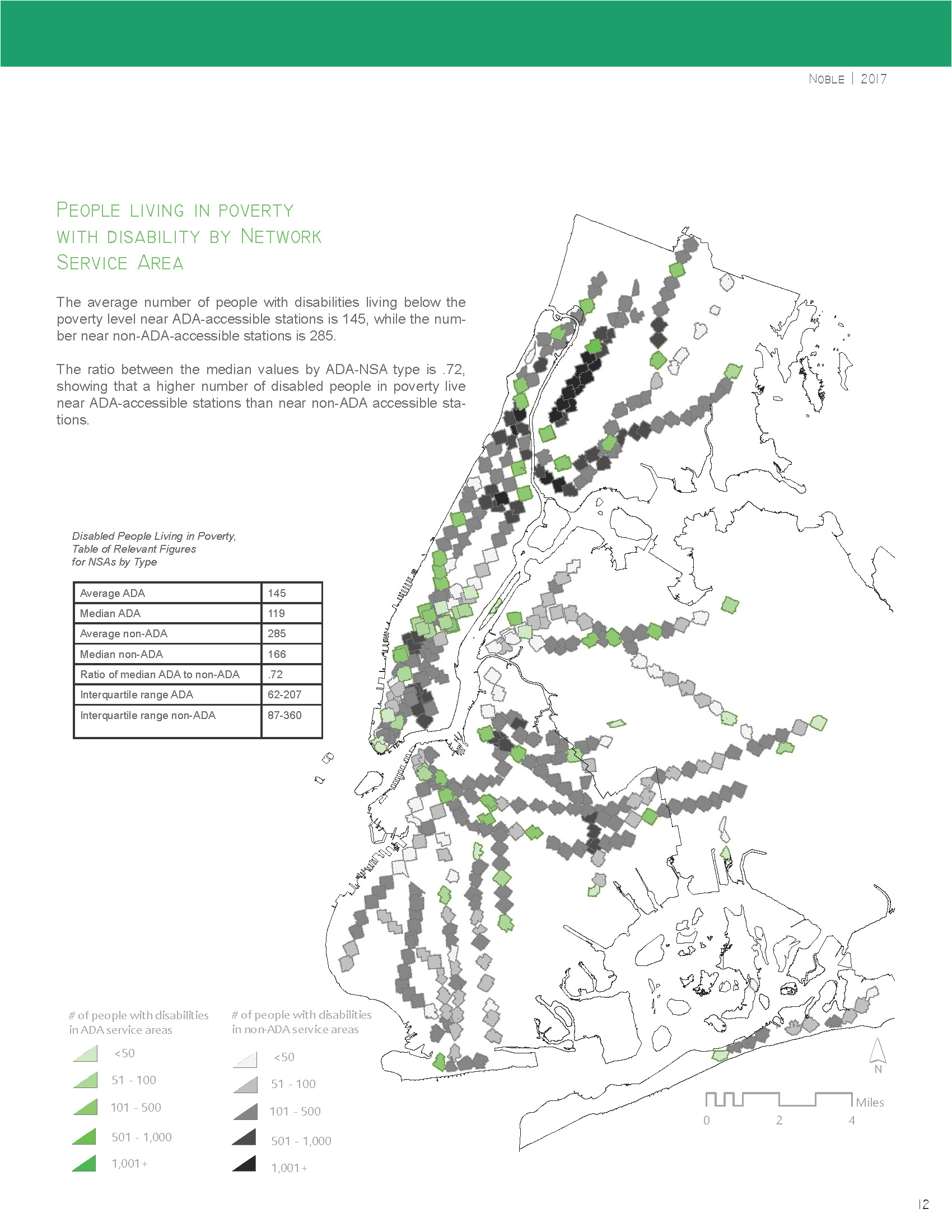
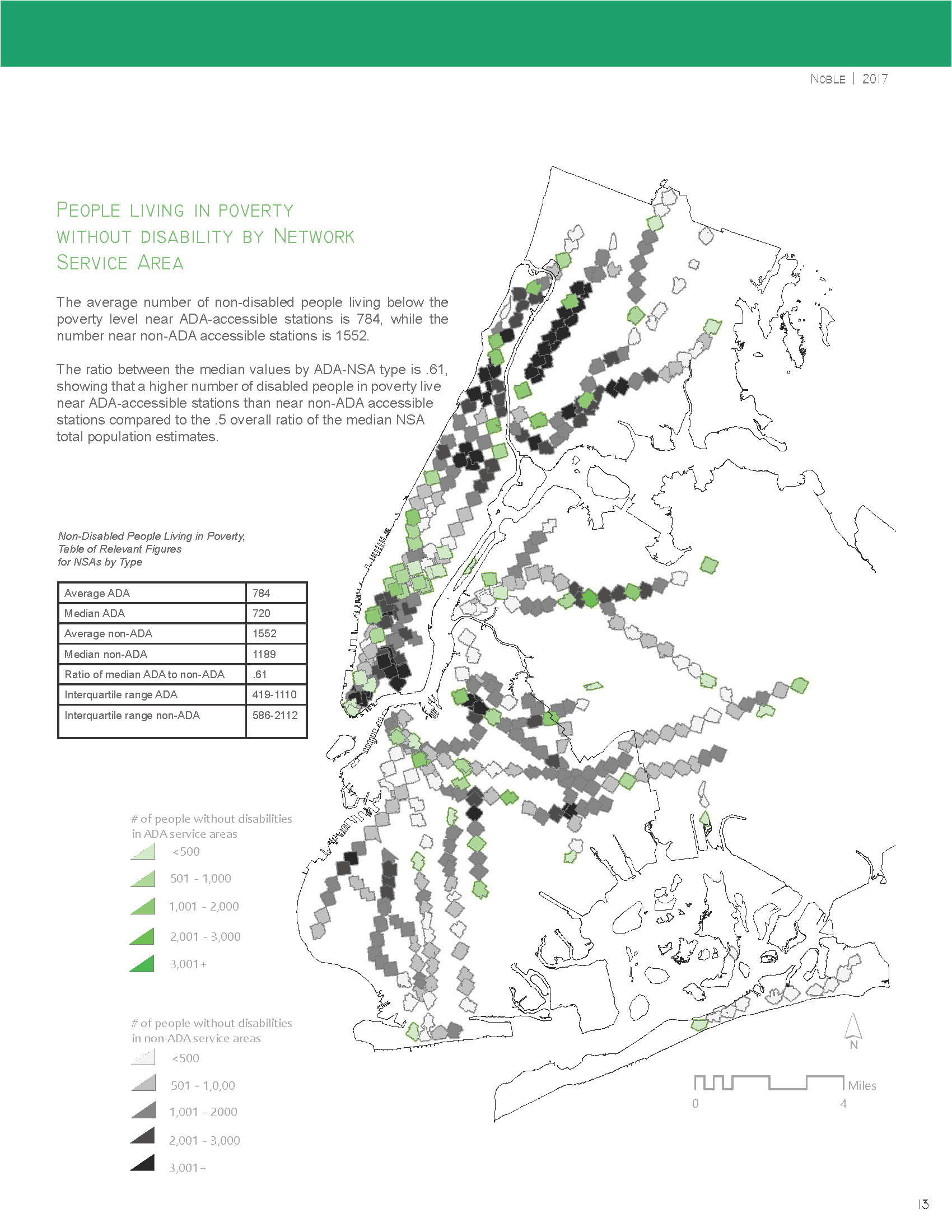
Rebecca Noble. "Subway Accessibility: An Analysis of NYC Subway Stations' ADA-Accessibility and their Surrounding Demographics."
(Introduction to GIS, Spring 2017)

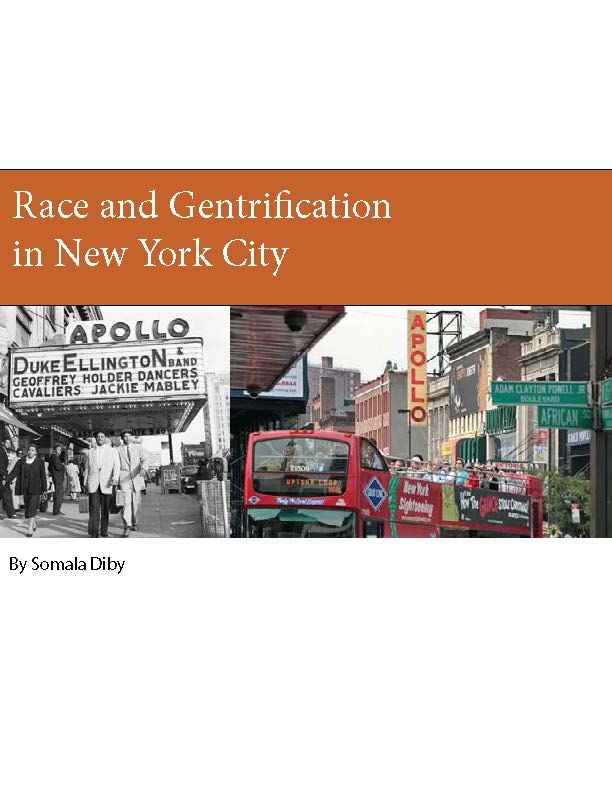
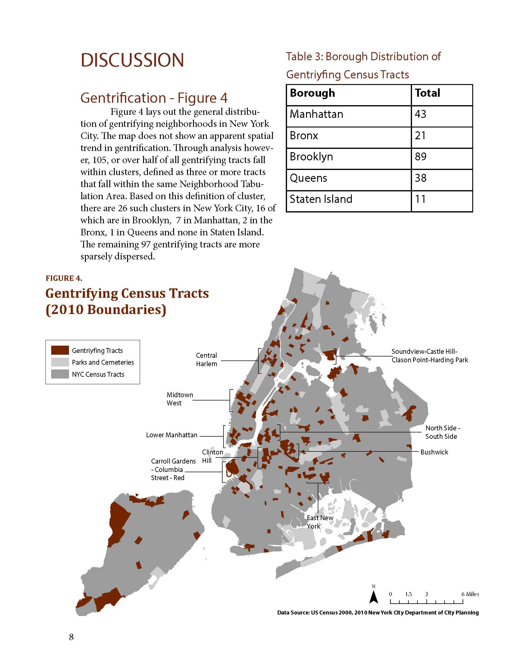
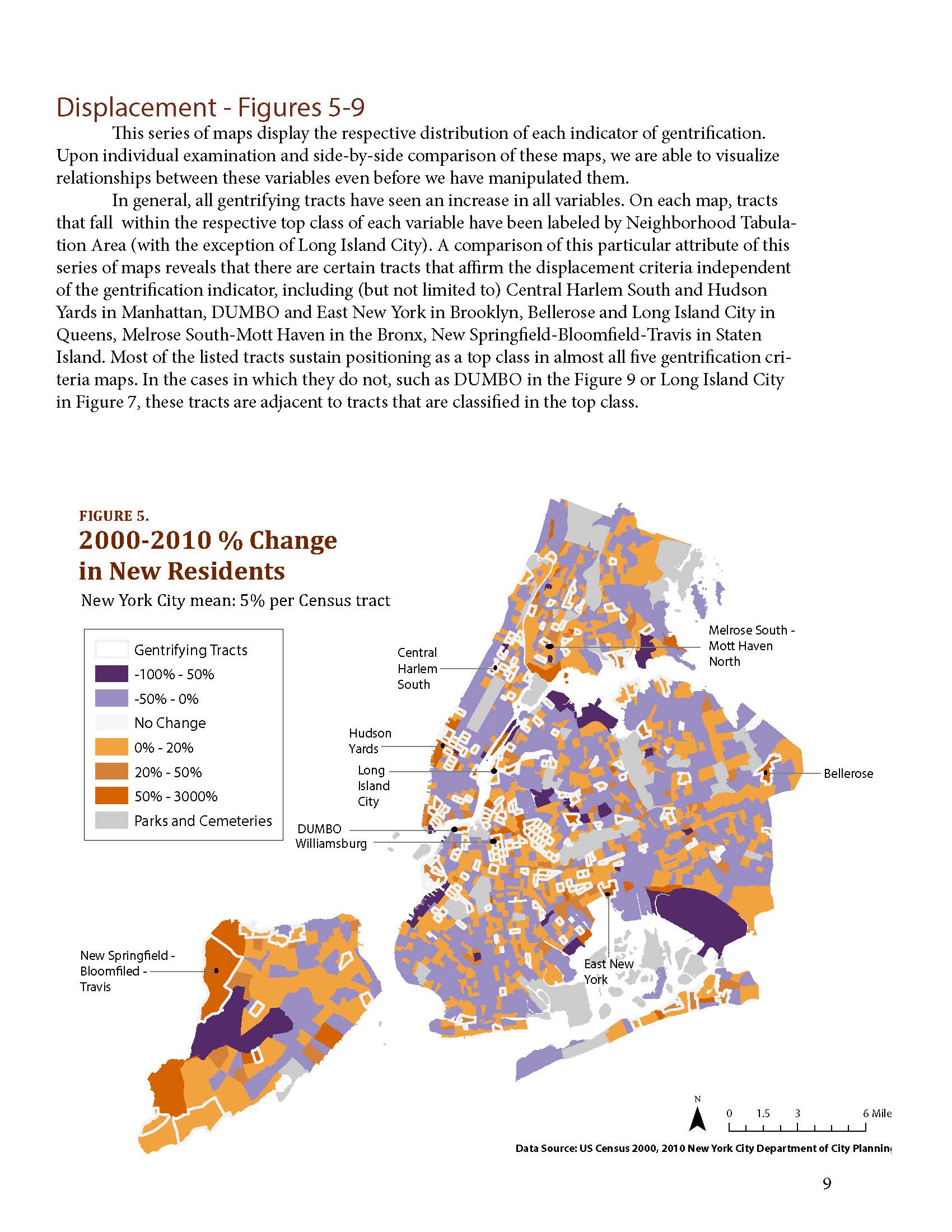
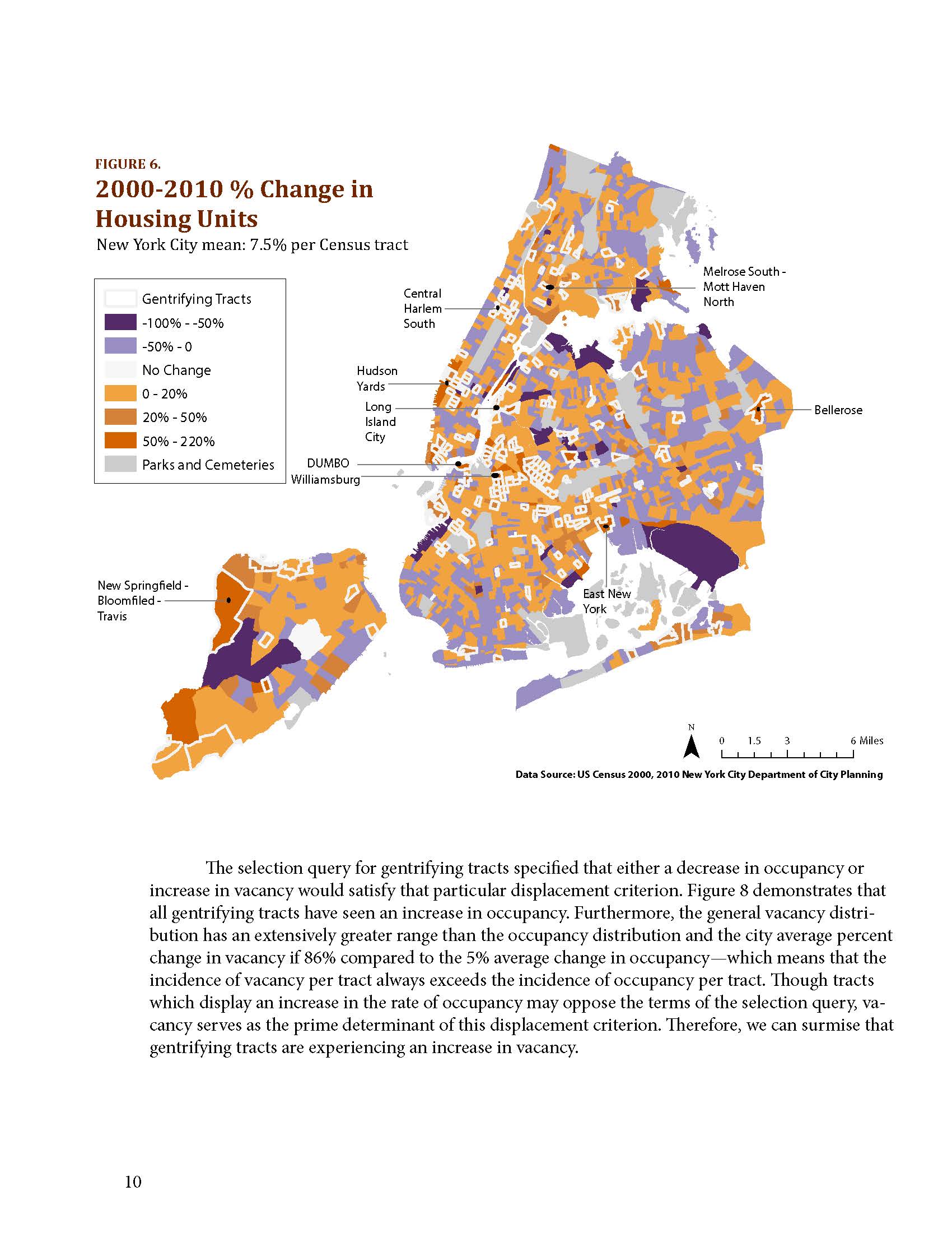
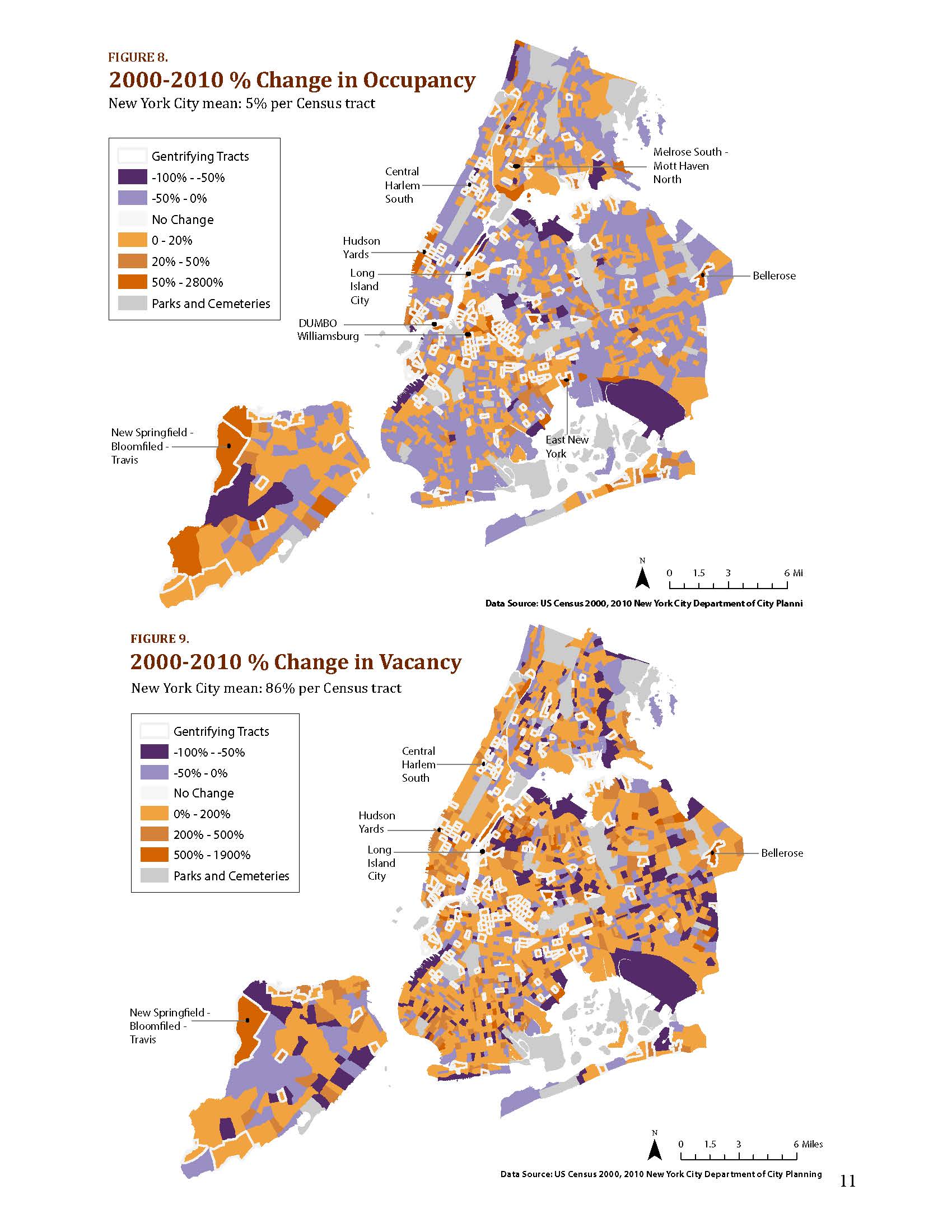
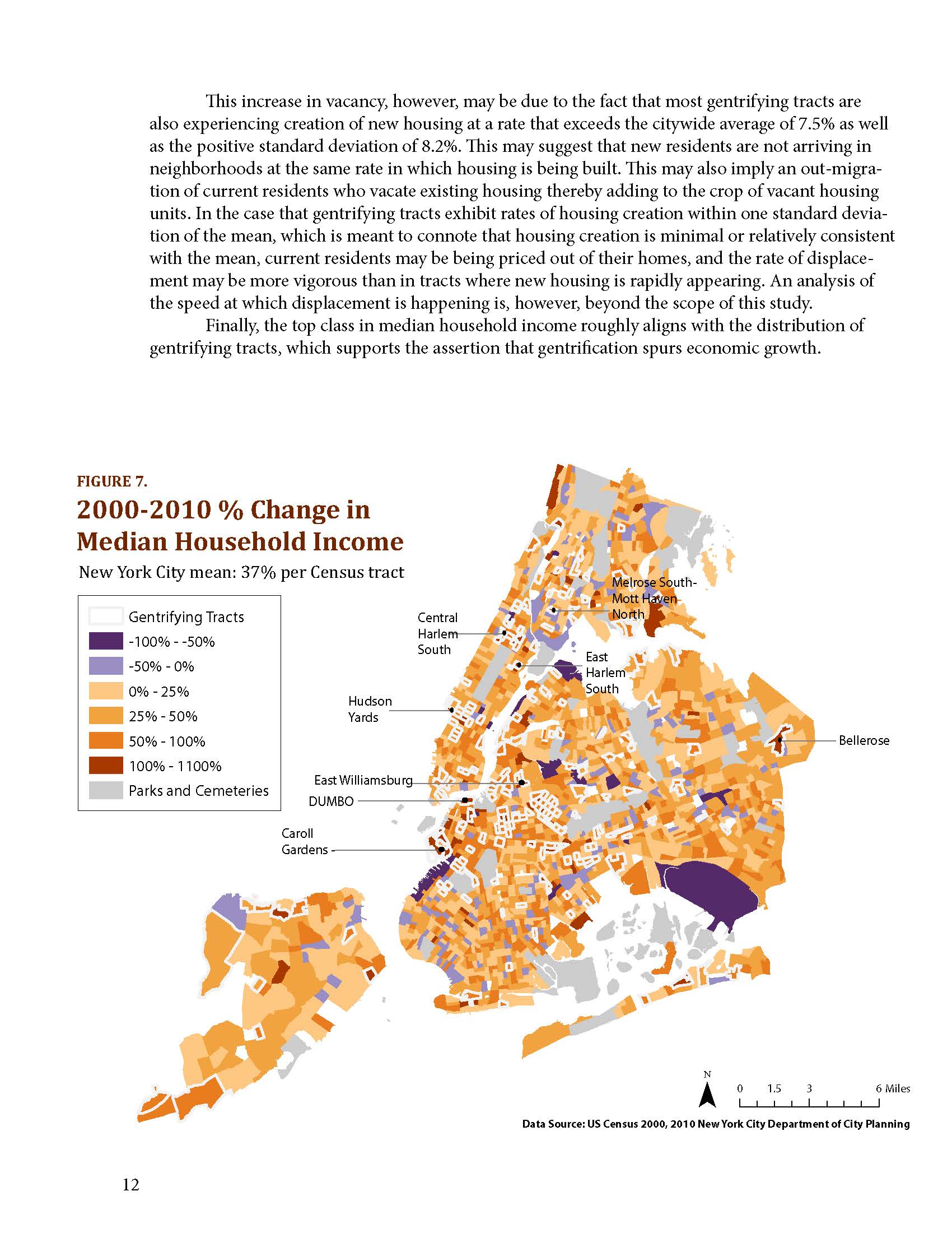
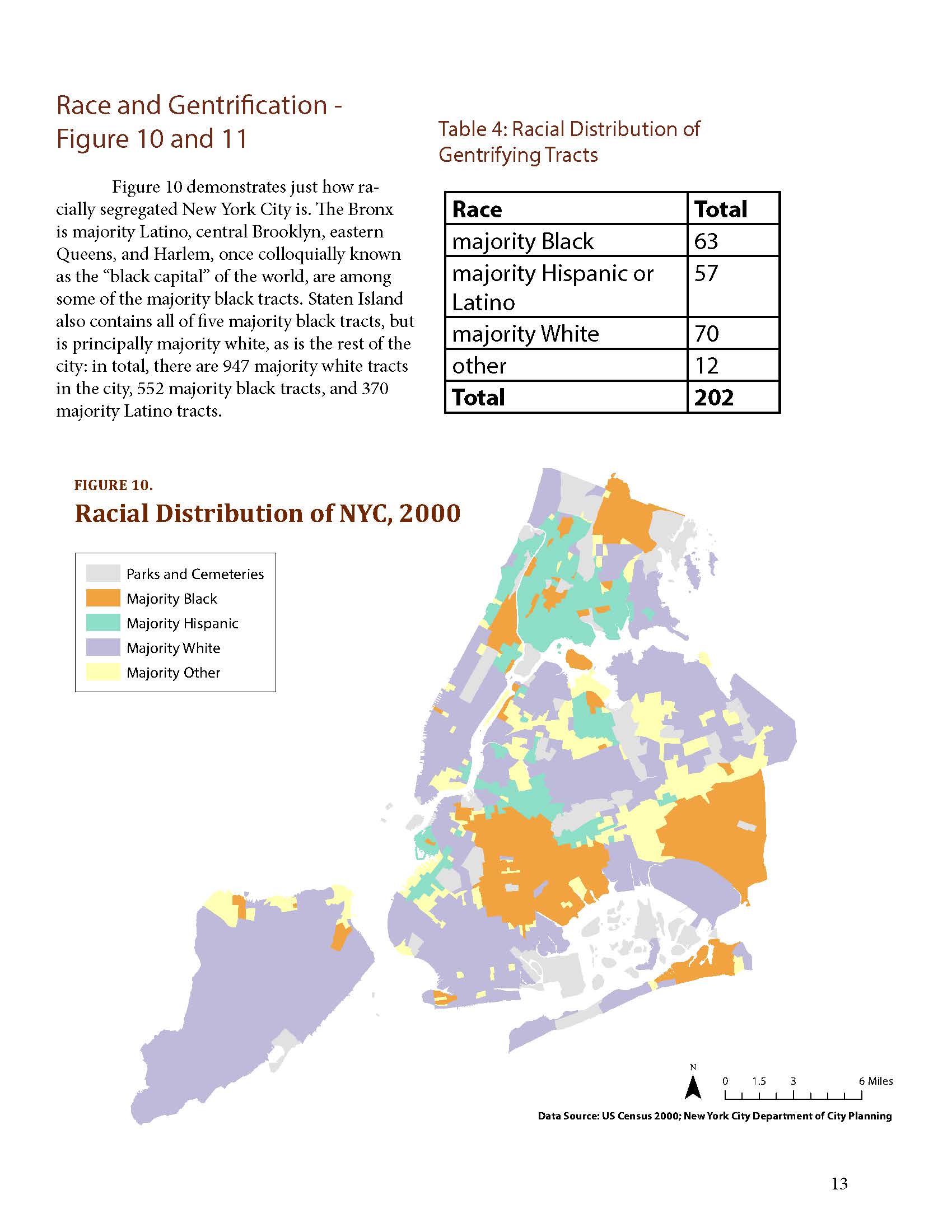
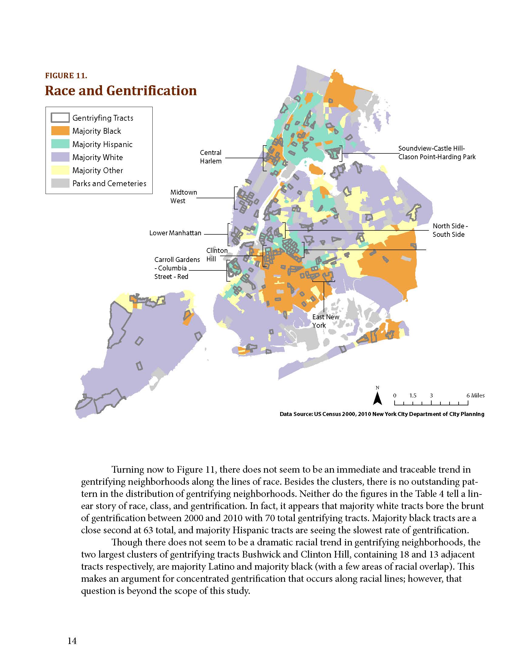
Somala Diby. "Race and Gentrification in New York City."
(GIS Methods & Case Studies, Fall 2013)