Participatory Basemapping
with Caerus Associates (2012)
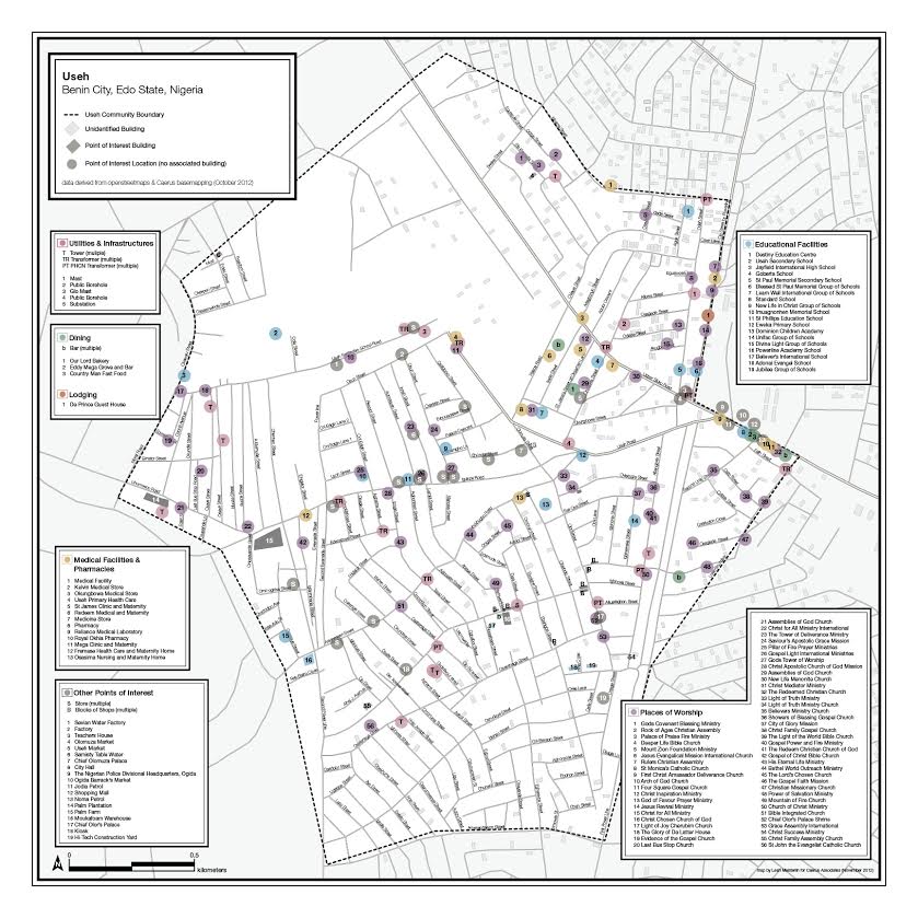
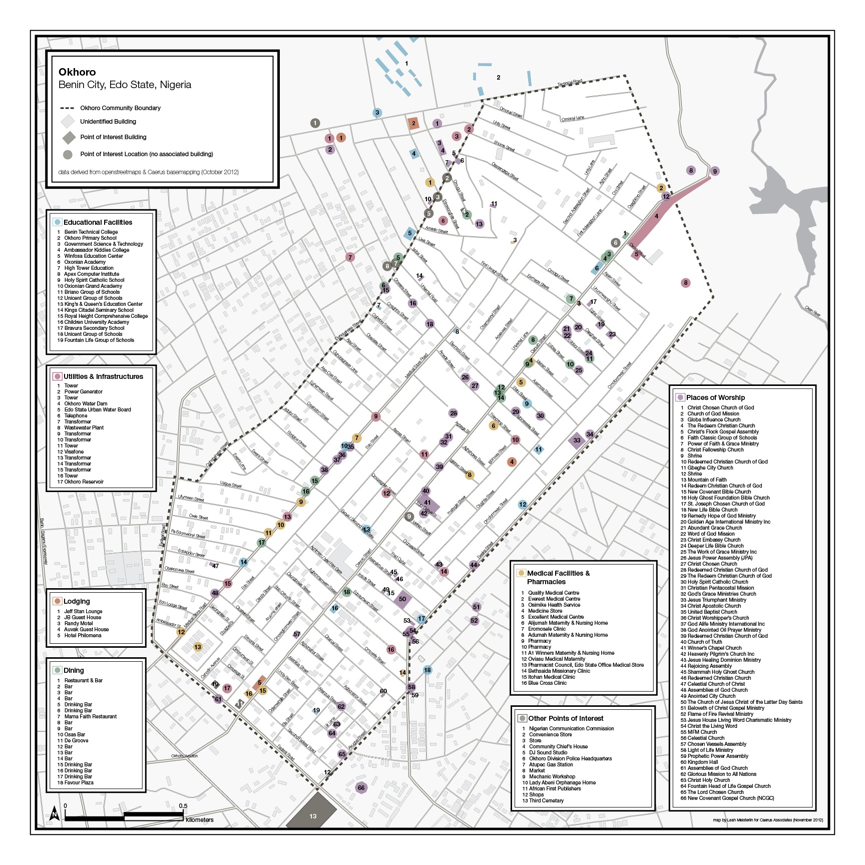
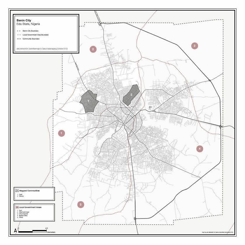
Okhoro & Useh, Benin City, Nigeria: Participatory Basemapping
24 inches x 24 inches (each)
Maps were produced for Caerus Associates following basemapping field work in two neighborhoods of Benin City, building mapping capabilities for the local ICT Directorate, supported by the World Bank. Basemapping data collection activities were facilitated by Jamie Lundine of Spatial Collective. All information gathered has been shared on Open Street Maps.
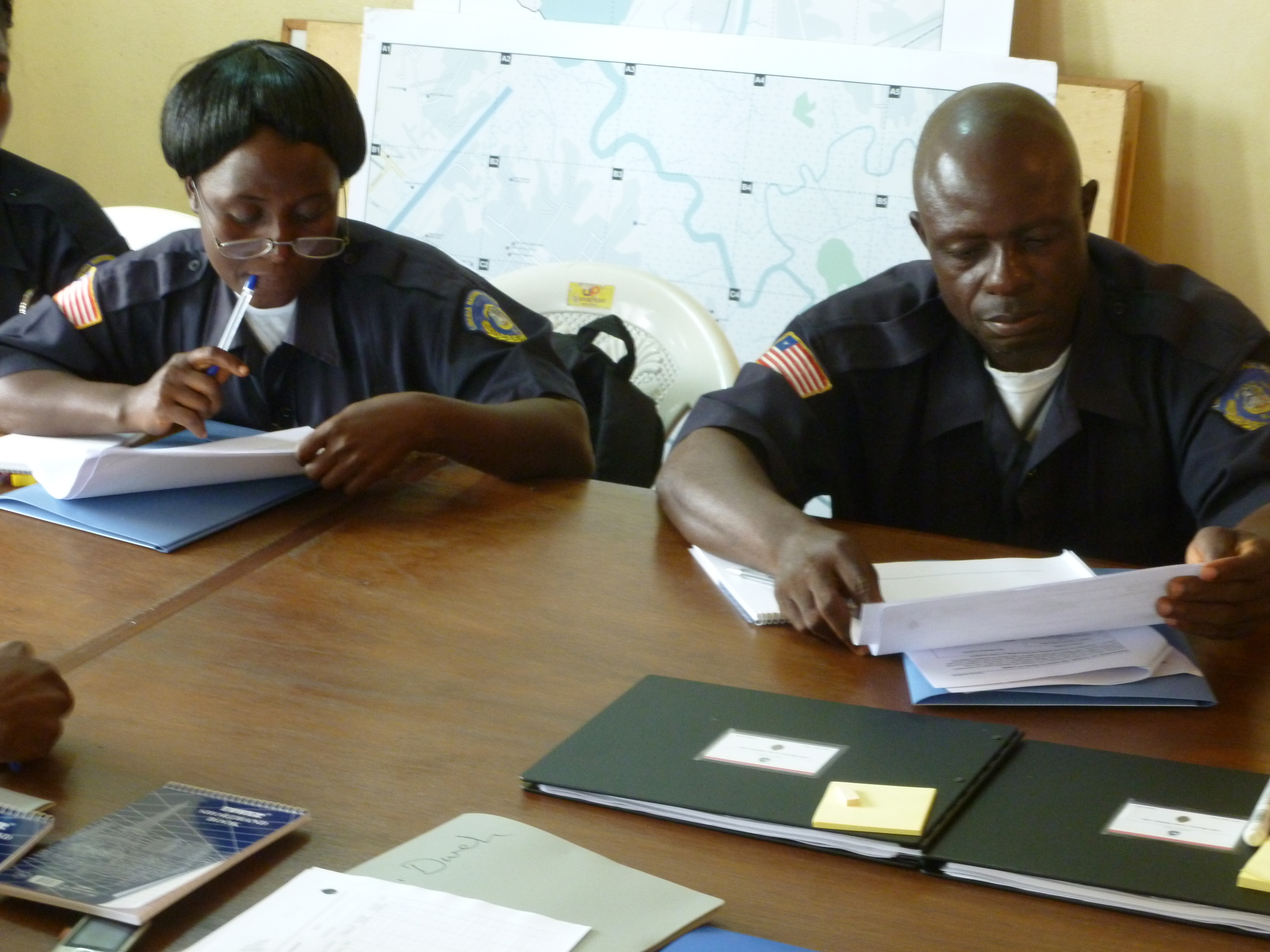
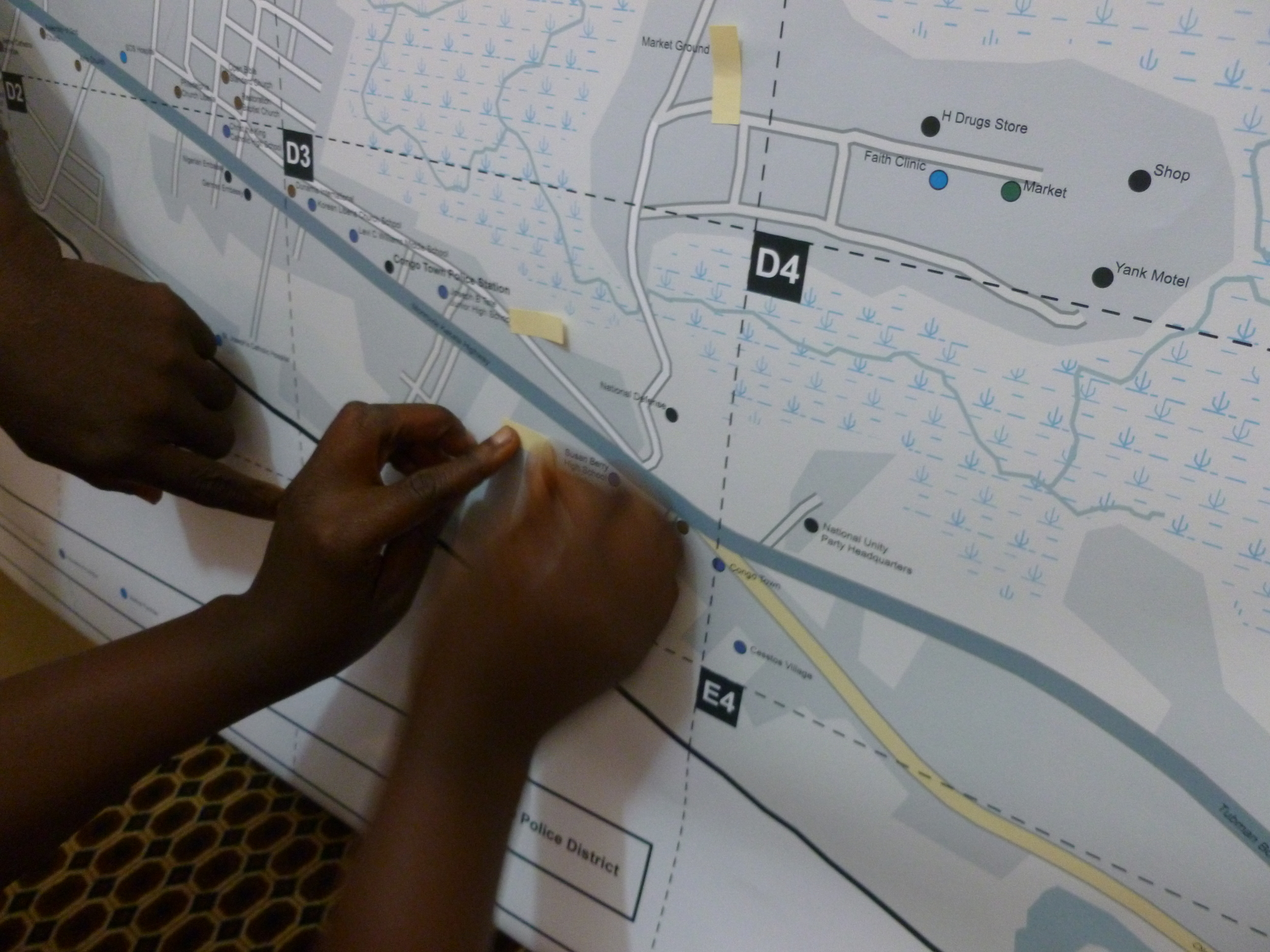
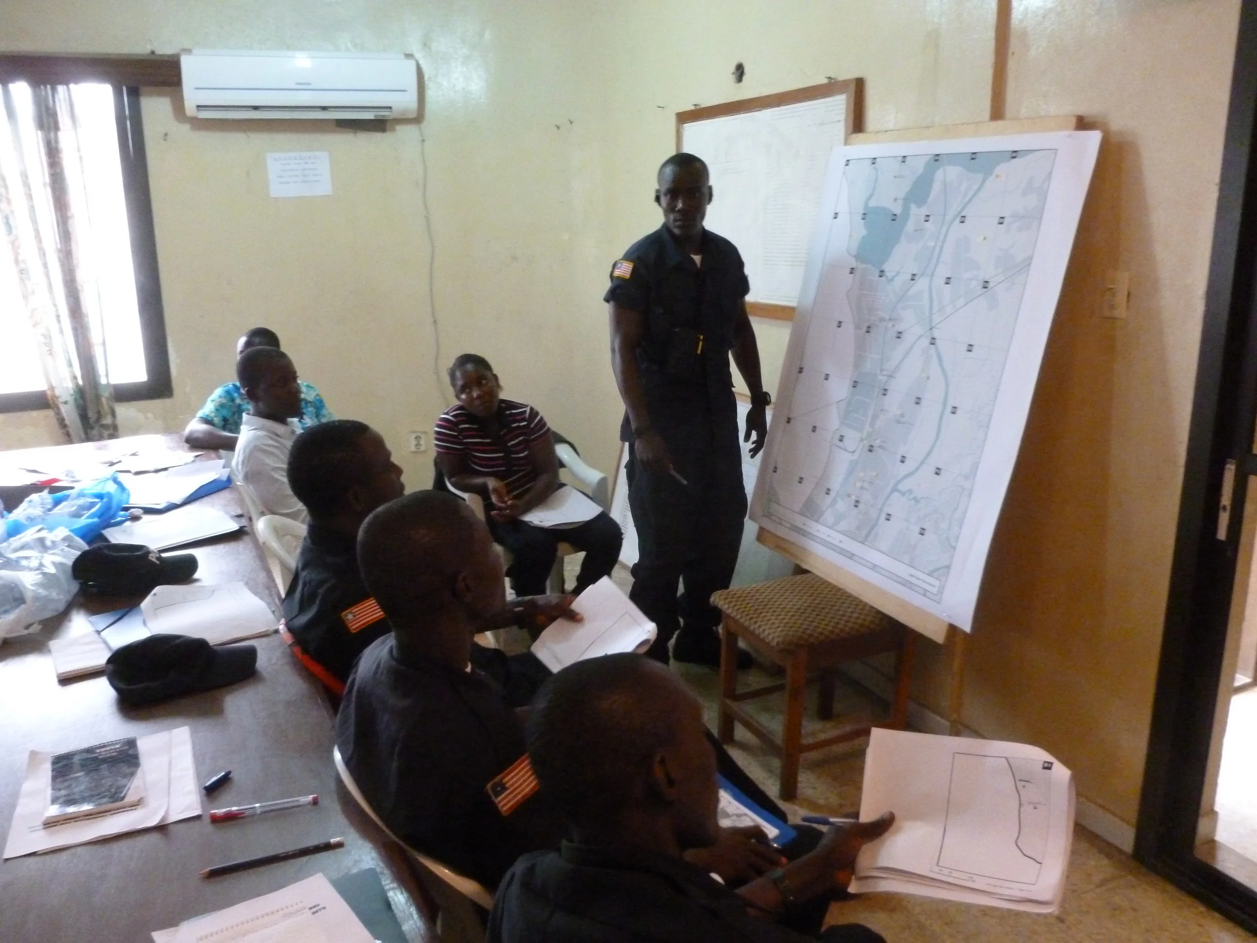
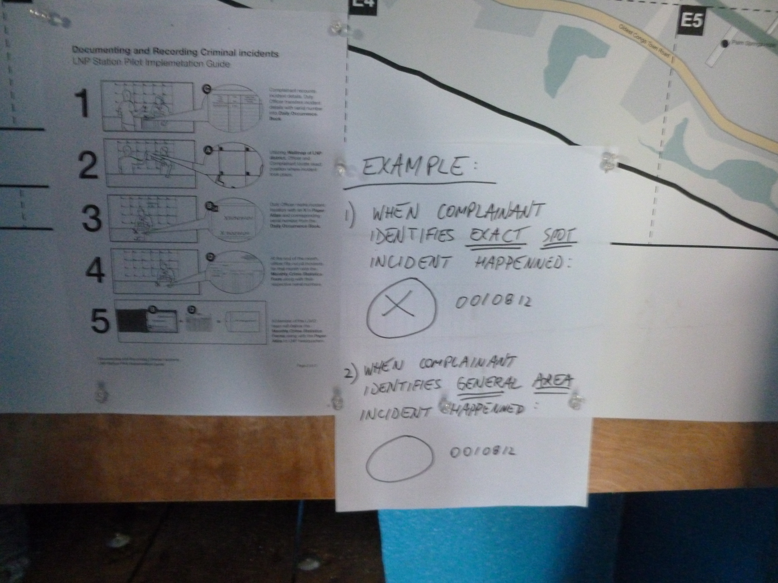
Congo Town, Logan Town, & Peace Island, Monrovia, Liberia: Mapping for Local Data Collection
Top: 36 inches x 48 inches (each); Bottom: 36 inches x 36 inches (each)
Maps were produced for Caerus Associates to support two distinct projects within the same neighborhoods. For both, maps were styled to visually reference the conventions used in Open Street Maps to facilitate users' moving between the page and the screen.
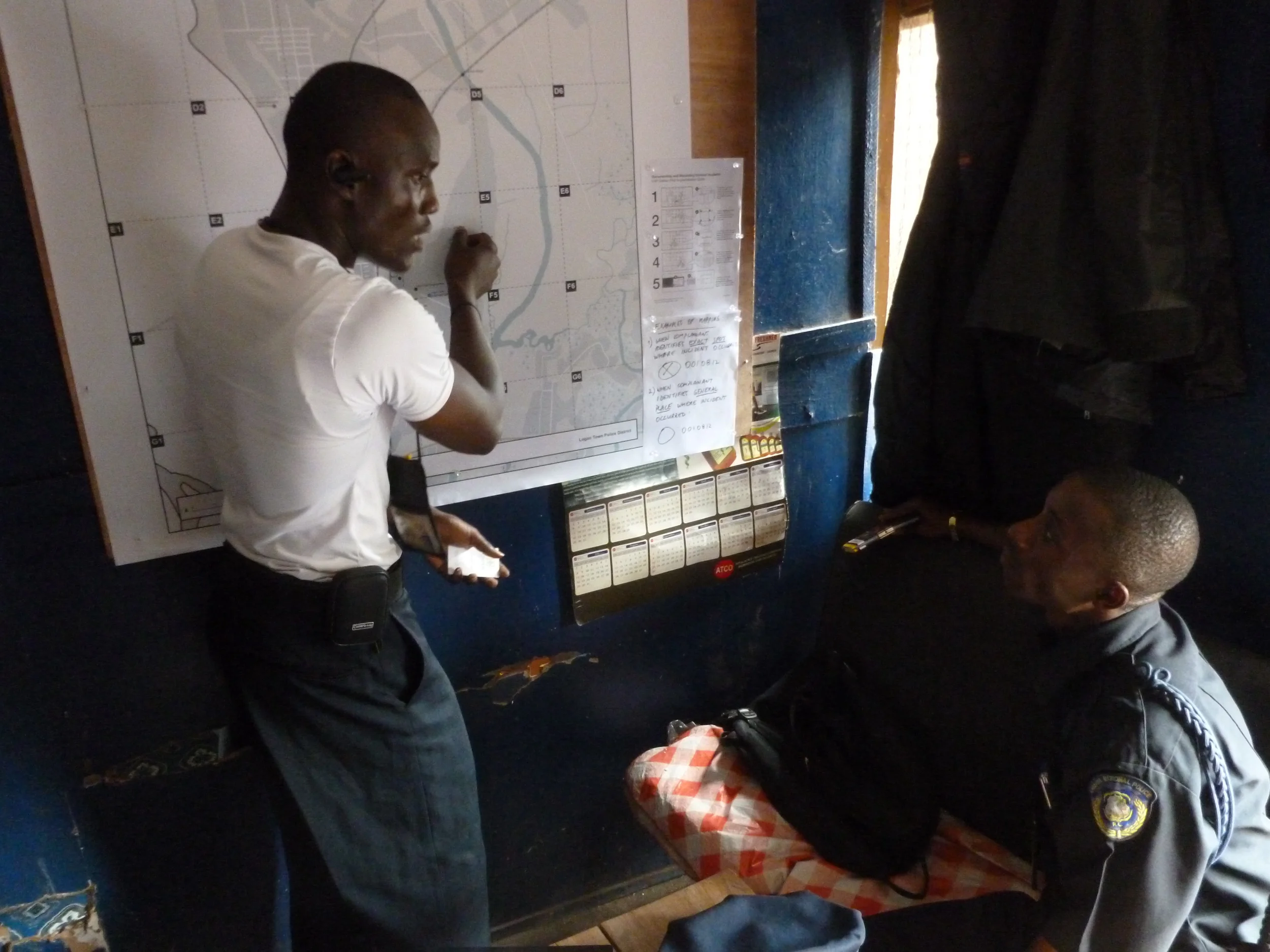
(top): Police training sessions on data collection and map literacy.
(middle): Large wall maps used for location reference are gridded to index corresponding pages within a handheld atlas for initial manual recording of event locations.
(bottom): Printed maps were used for focus groups to identify areas of community significance and the planning and coordinating of local participatory basemapping data collection field work. Services also included providing guidelines for GPS data collection.