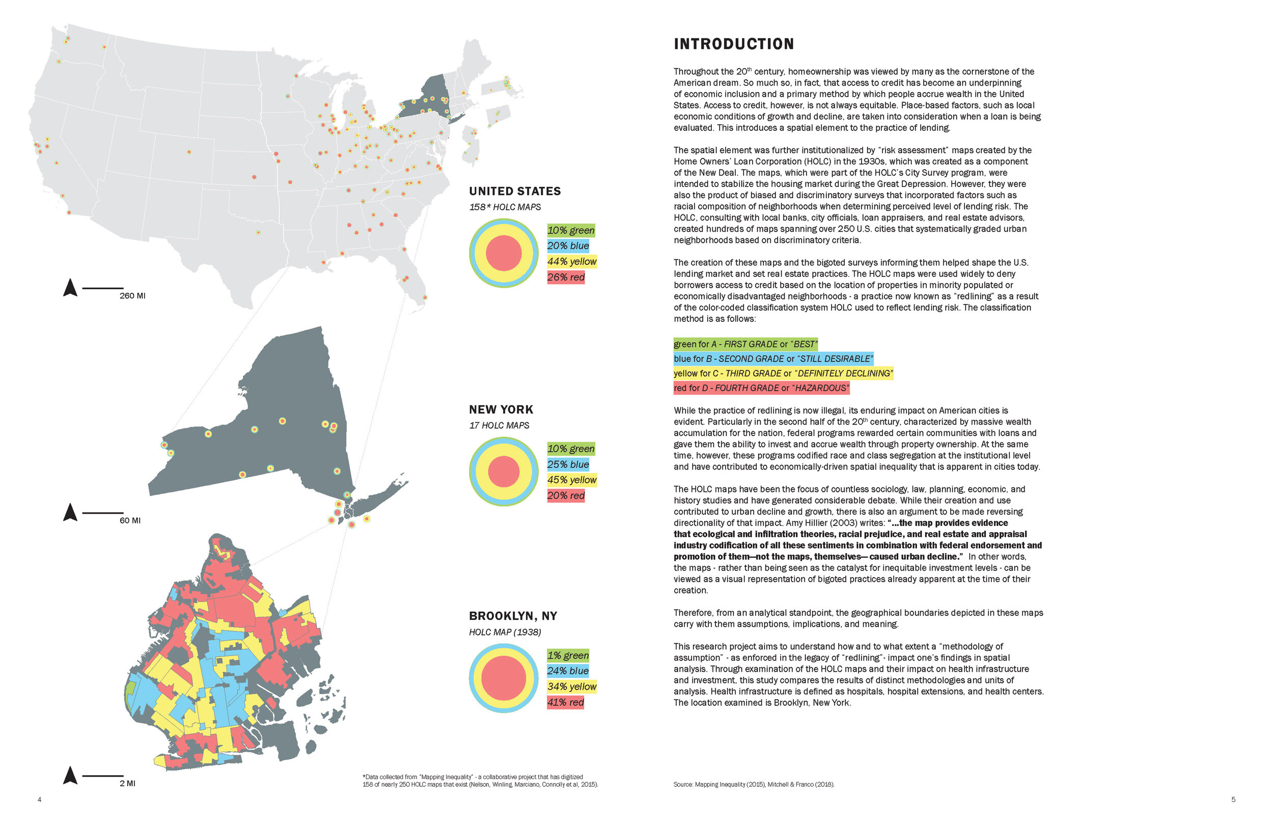
Advanced Research Methods in Geographic Information Systems & Science
Advanced Spatial Analysis (Spring 2019), taught in the Urban Planning department of Columbia's Graduate School of Architecture, Planning and Preservation (GSAPP), is a hybrid course simultaneously teaching concepts of human and physical geography, critical GIS, and comparative spatial research methodologies, and decision support within the context of questions relevant to planning in urban environments. Its primary aims are teaching contextualized and thoughtful approaches to spatial methodologies, questioning the measures used in planning research, and developing sensitive and mixed methods of answering complex research questions that are often open to several interpretations.
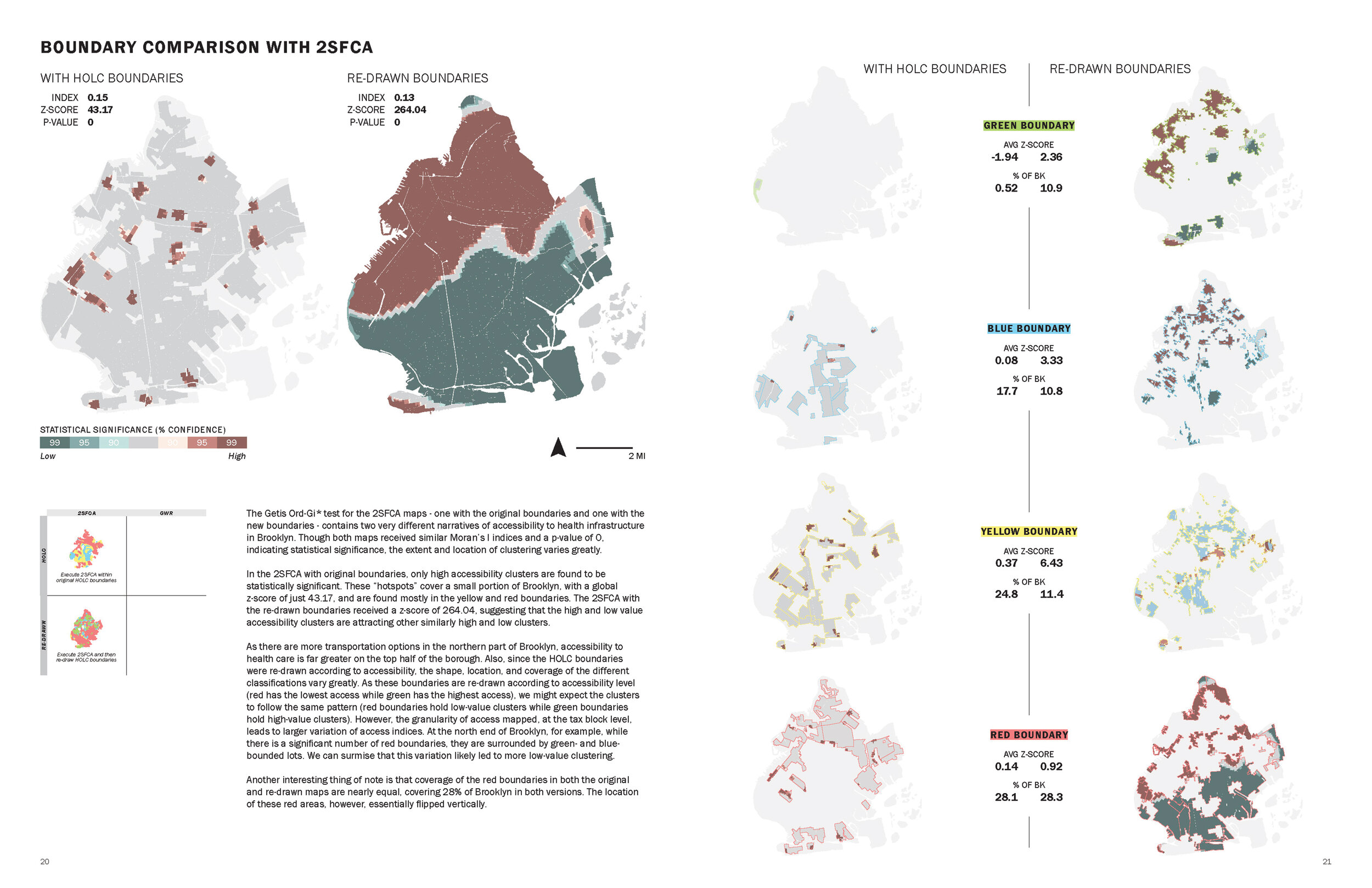
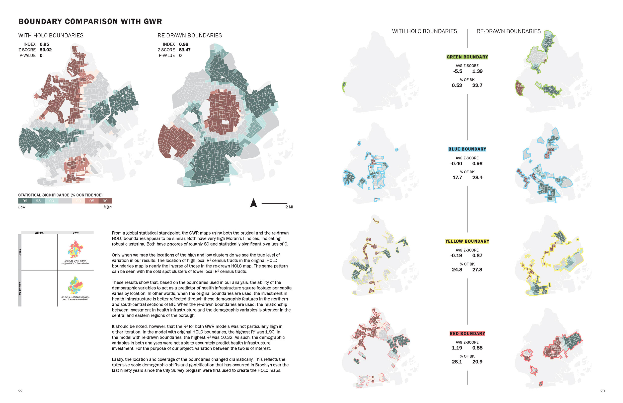
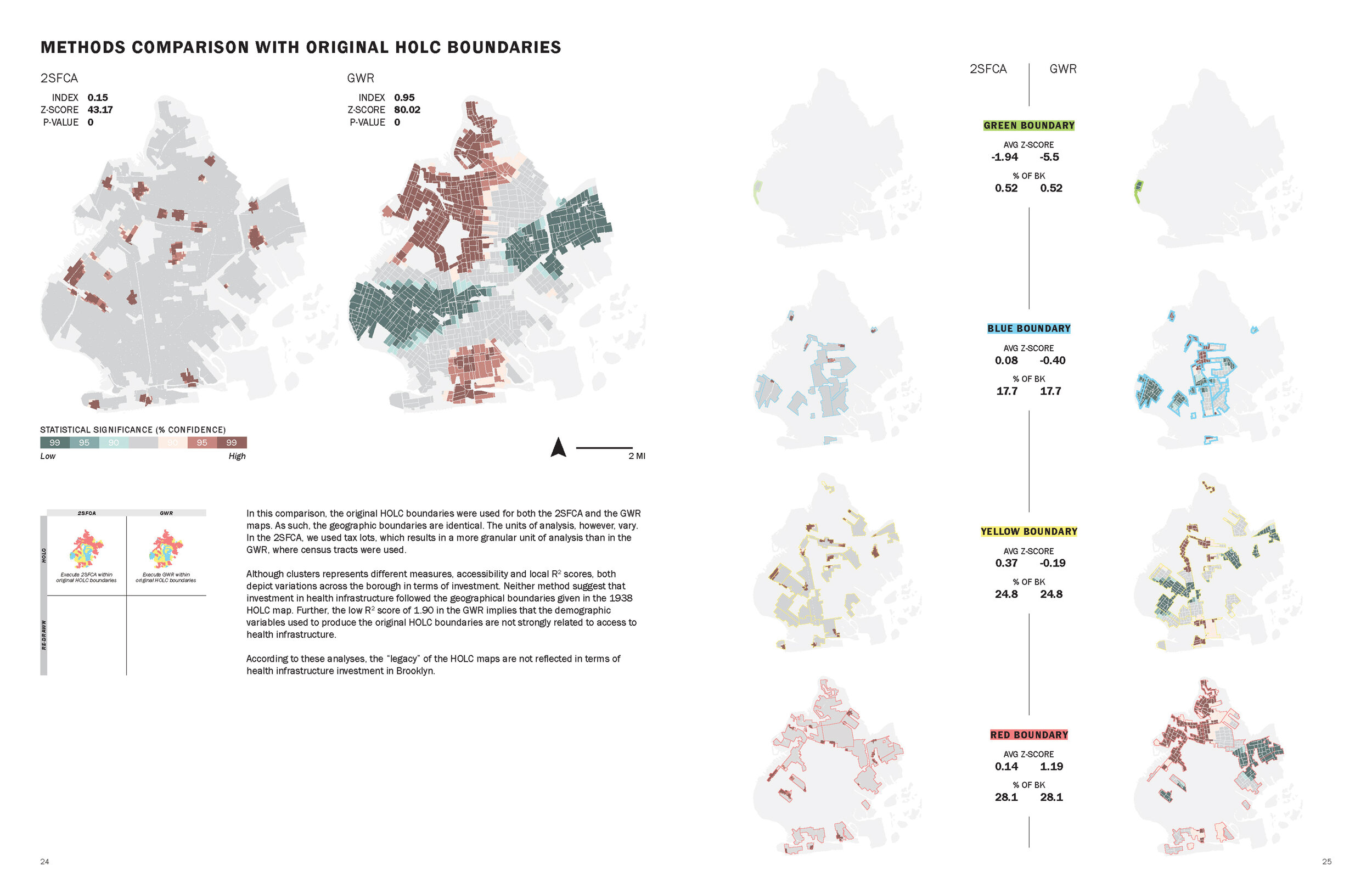
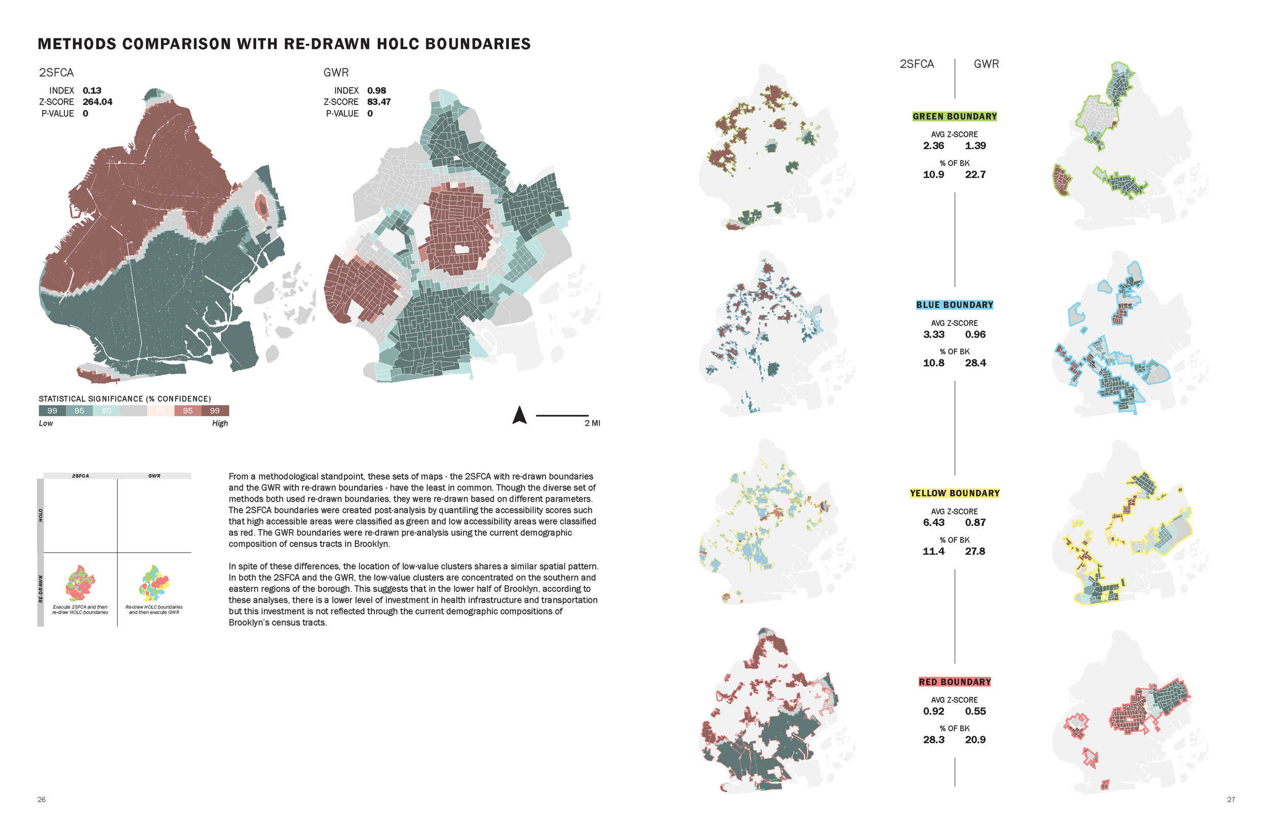
Featured here are example student projects from the course. The final deliverables include a research poster and an elaborated report.

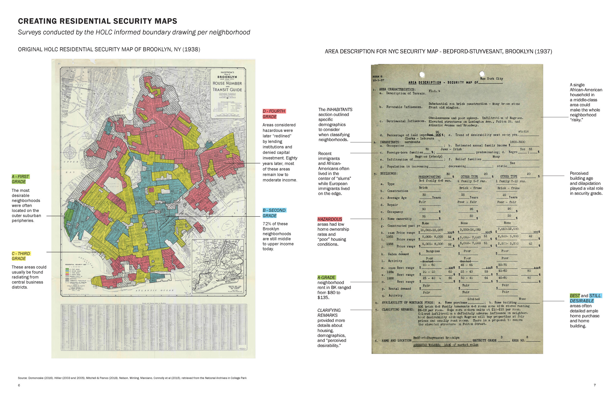
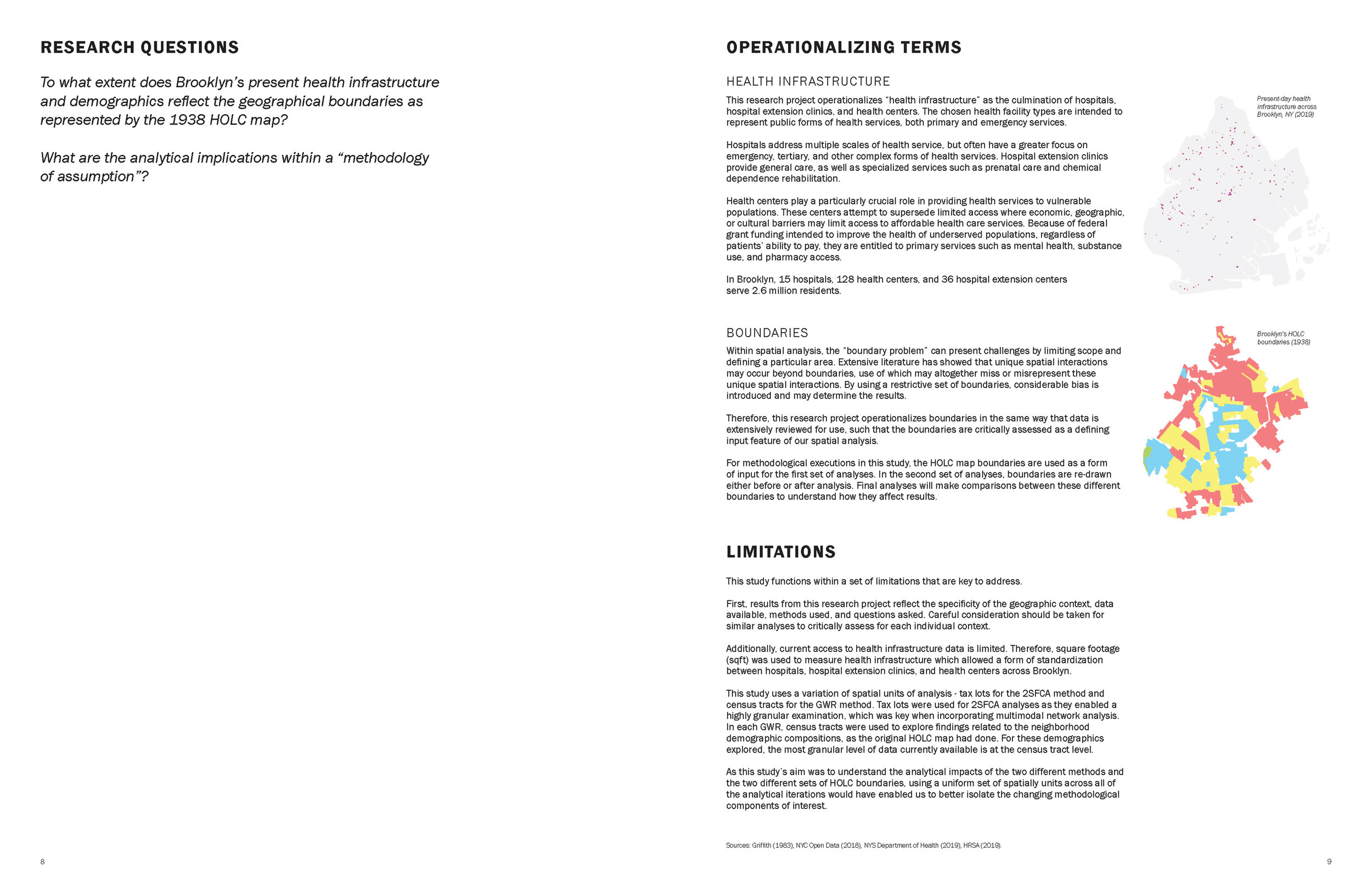
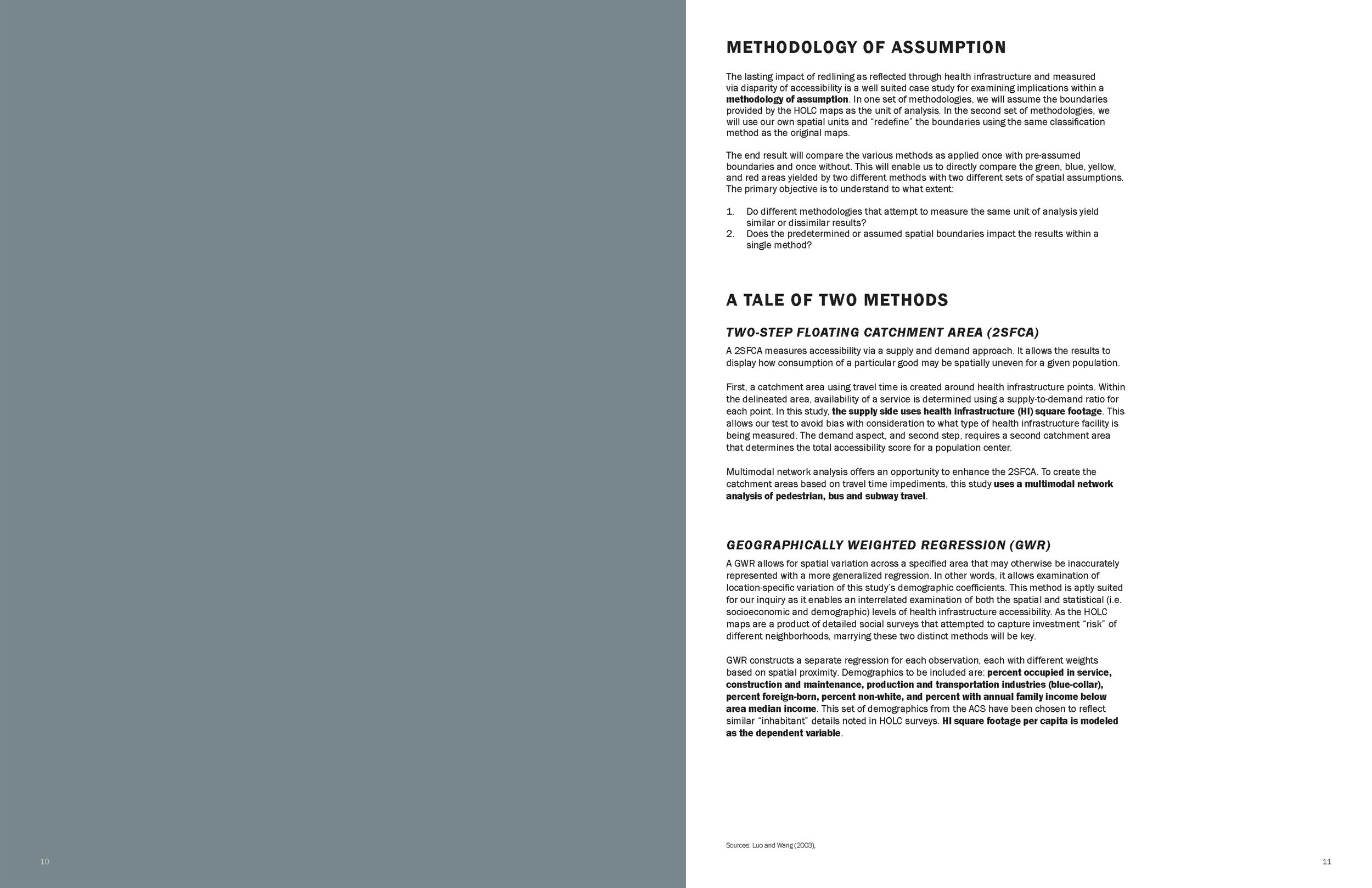
Alanna Browdy, Shelby Smith, and Jade Watkins. “Accessibility & Assumption”

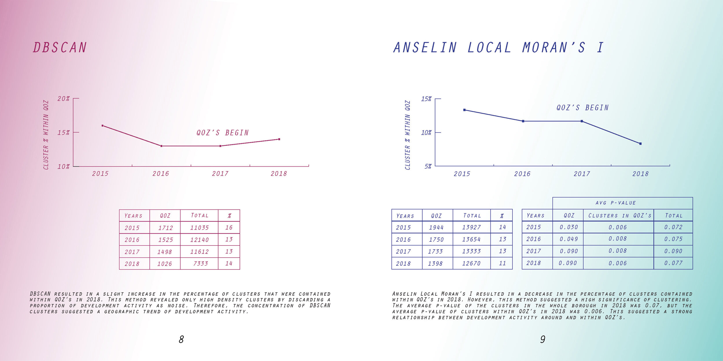
Nick Kunz and Suprima Bhele. “Signal or Noise? QOZ’s in Queens: Qualified Opportunity Zone Effect on Development Activity in Queens, New York, 2015-2018.”


Dare Brawley, Gayatri Kawlra, and Francis Yu. “Ethics and/of Uncertainty: Speculative Urbanism and the Rise of Synthetic People.”

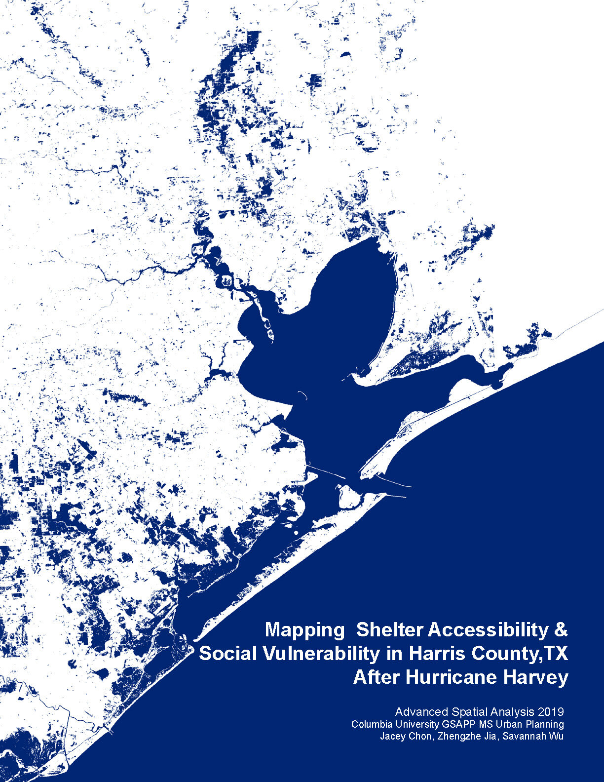
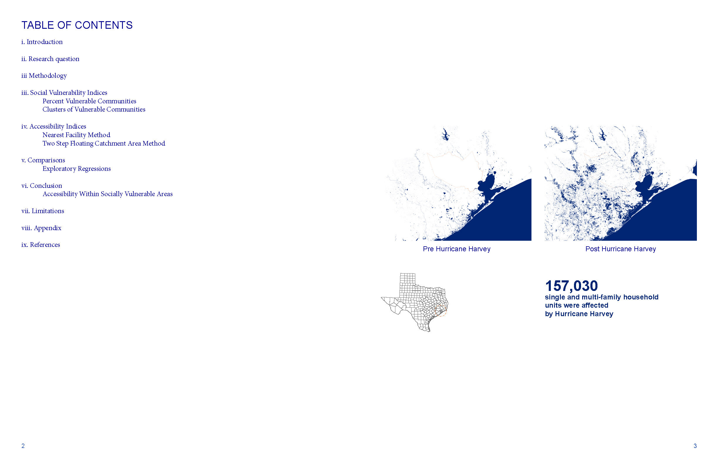
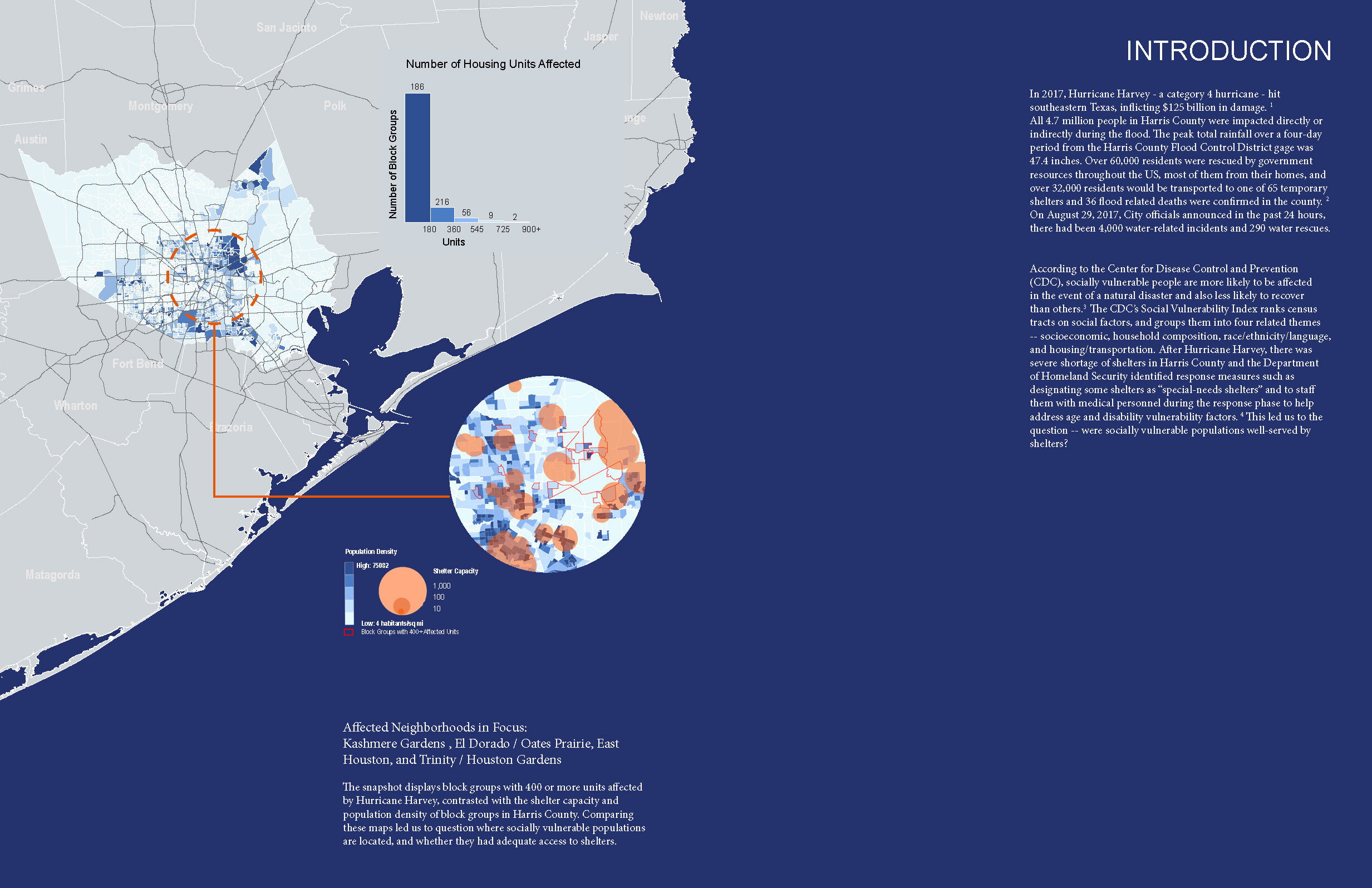
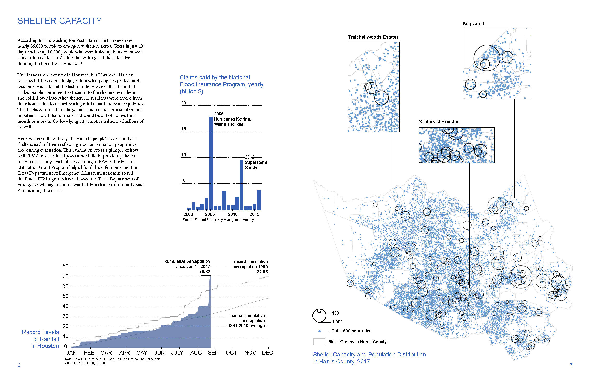
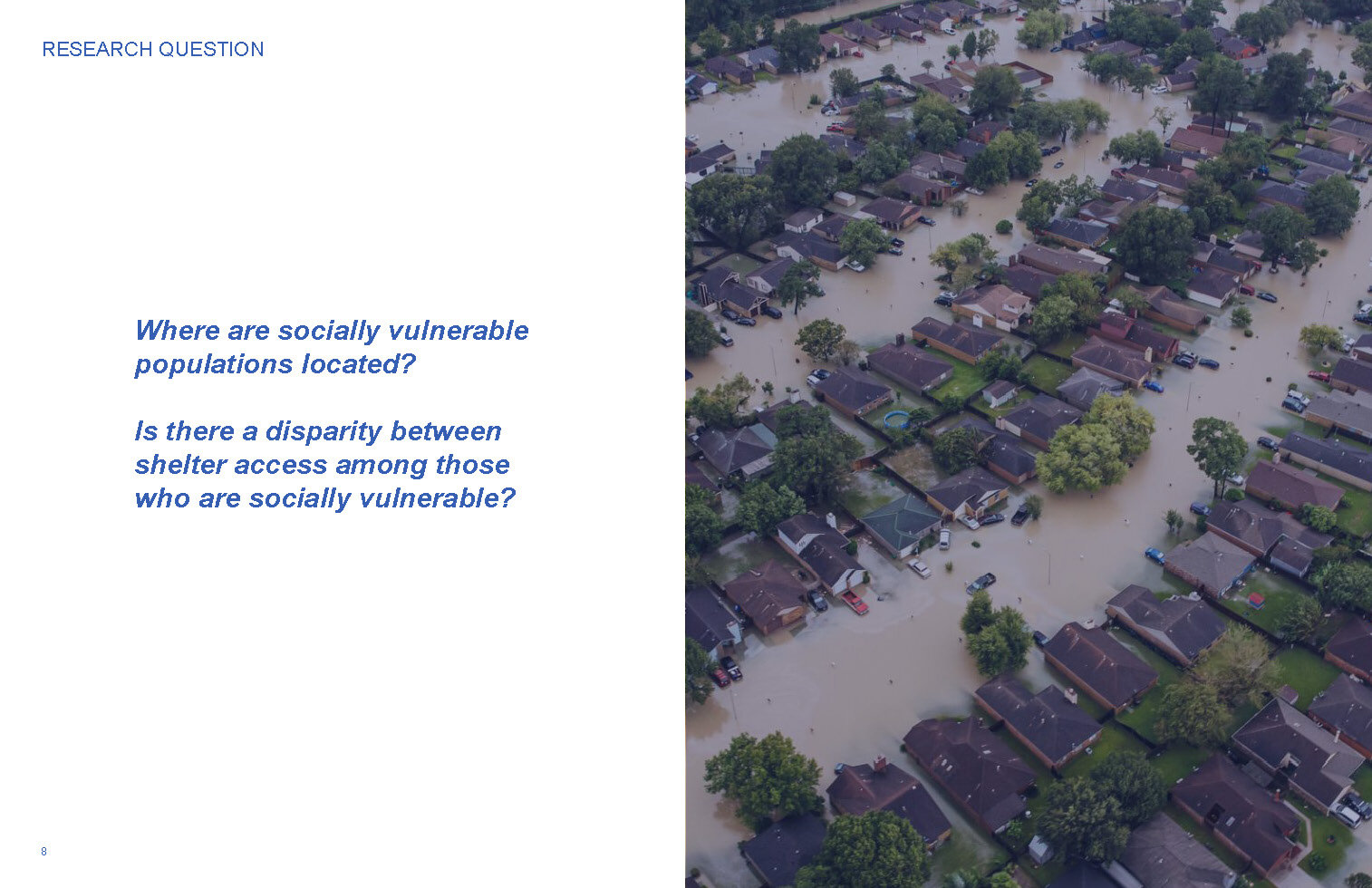
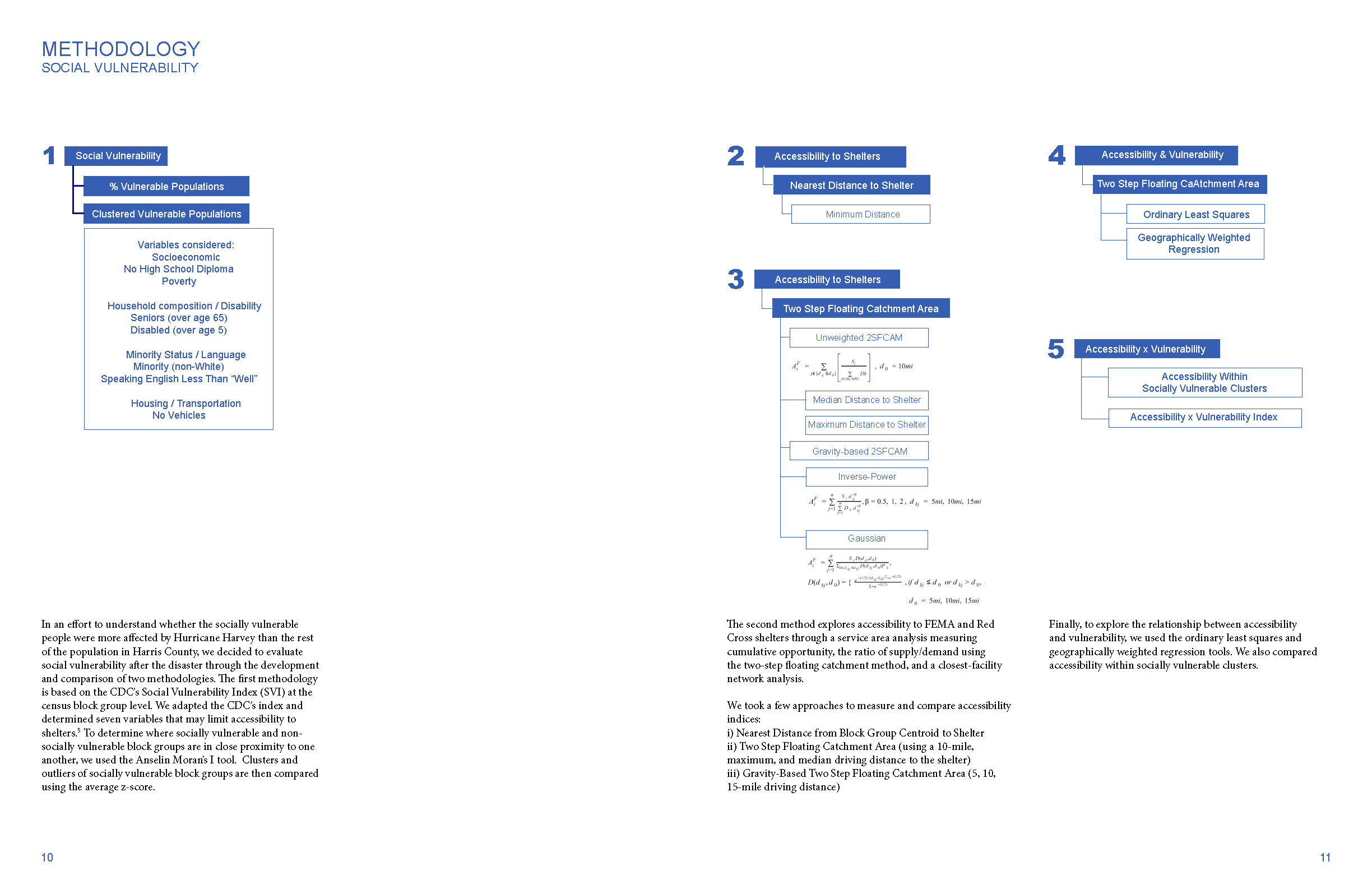
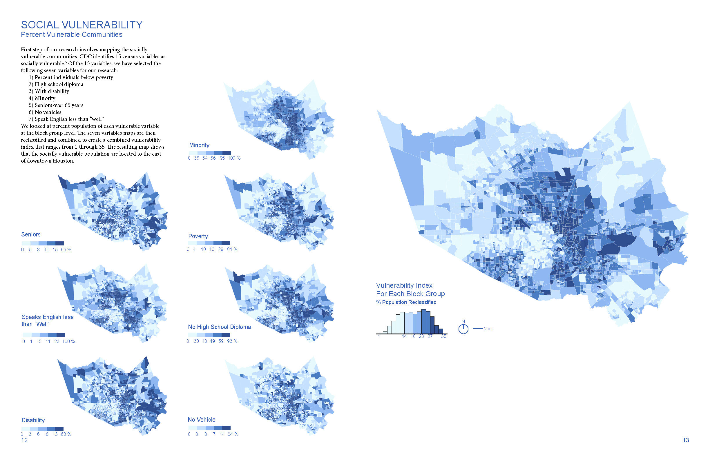
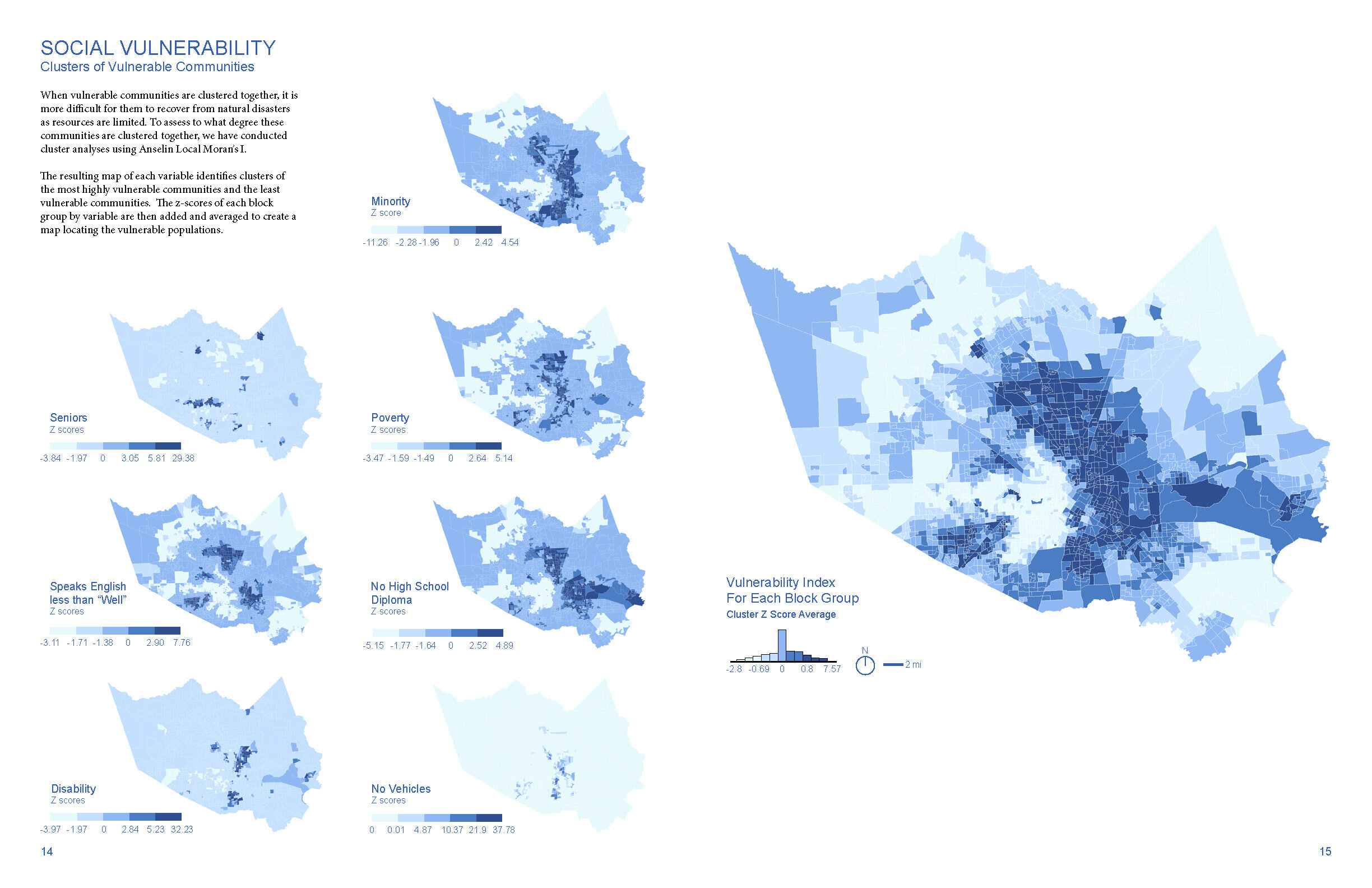
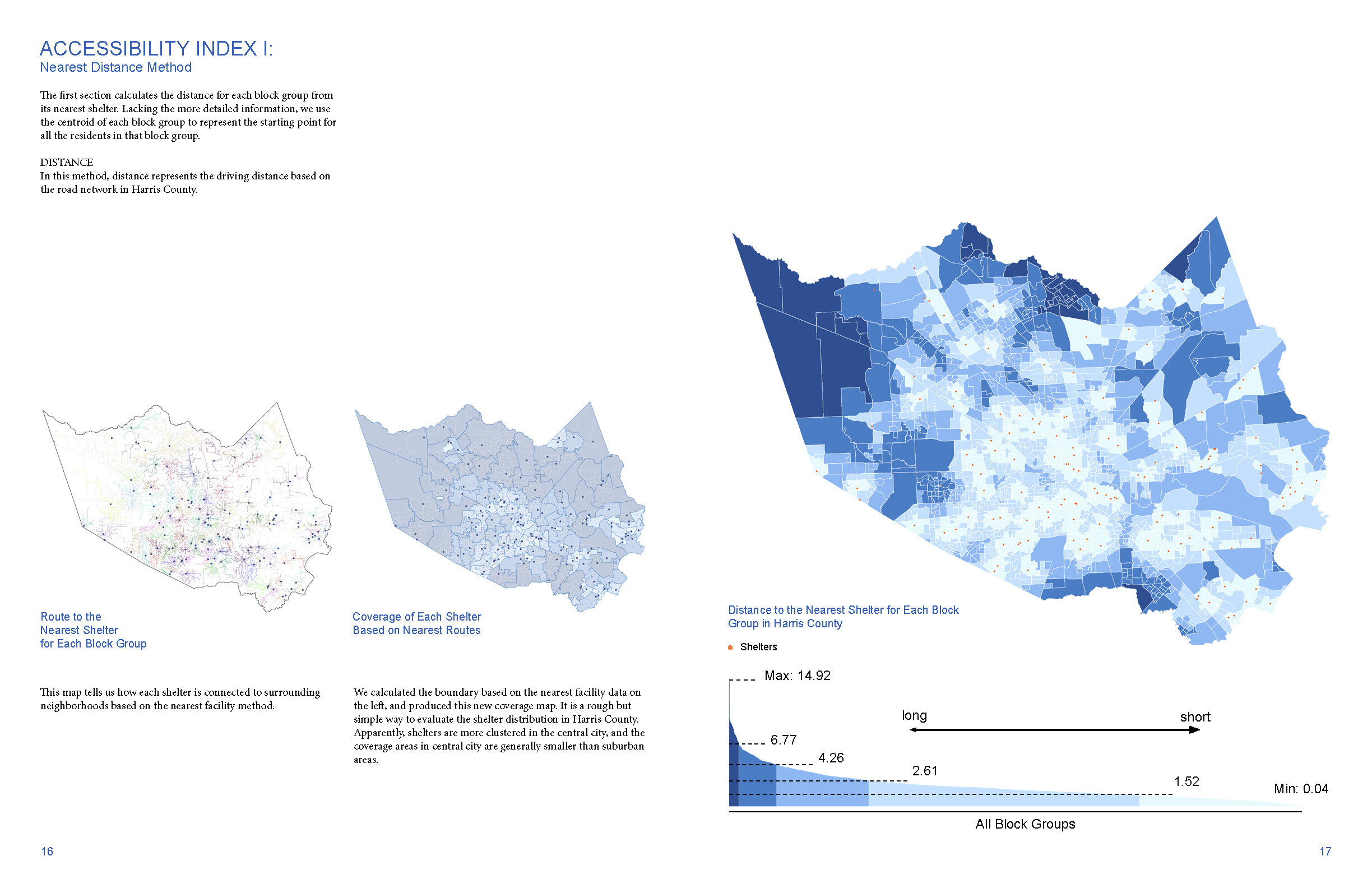
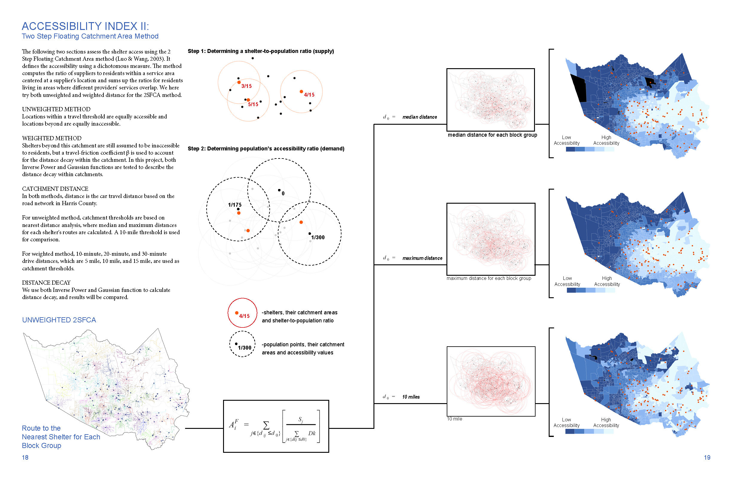
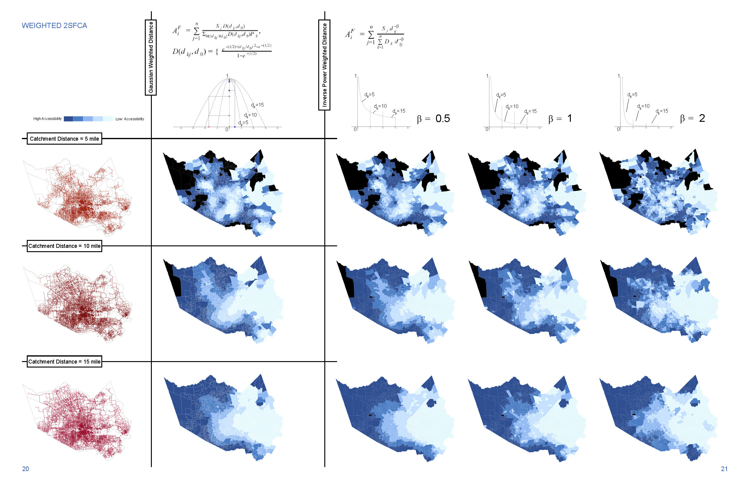
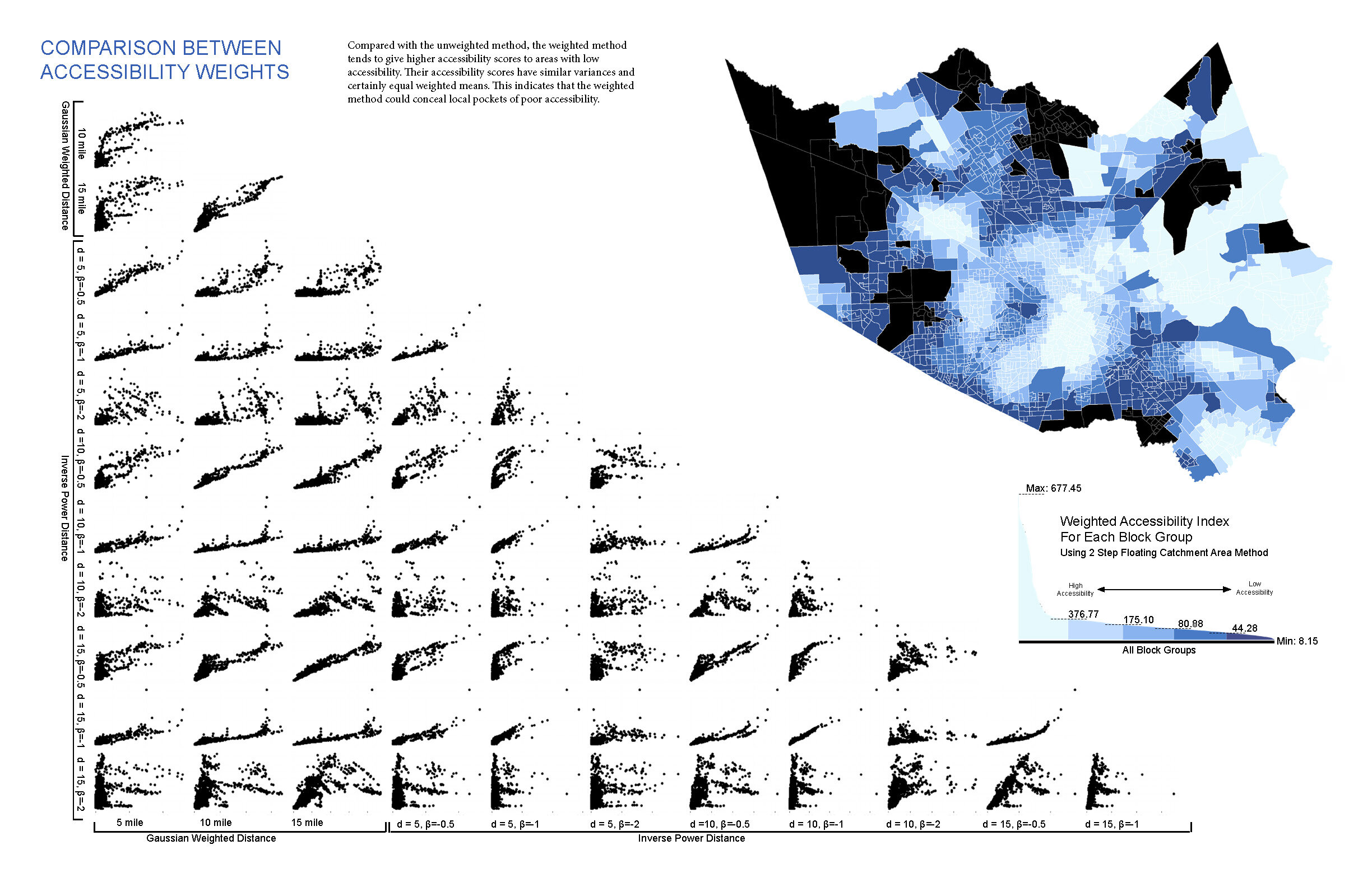
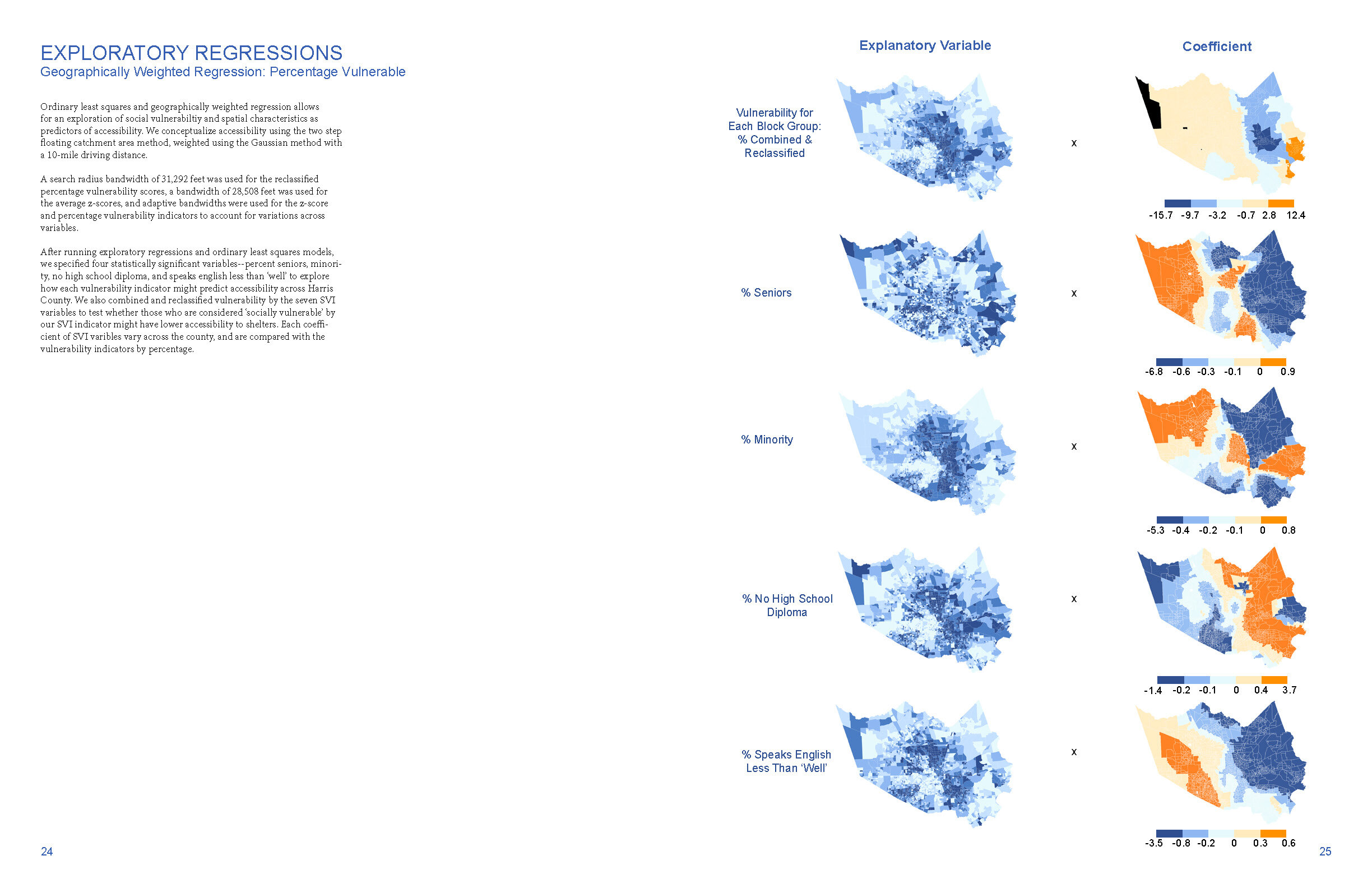
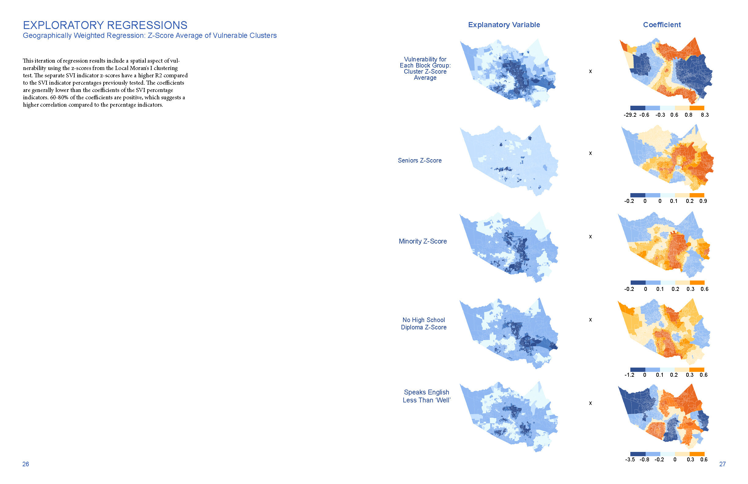
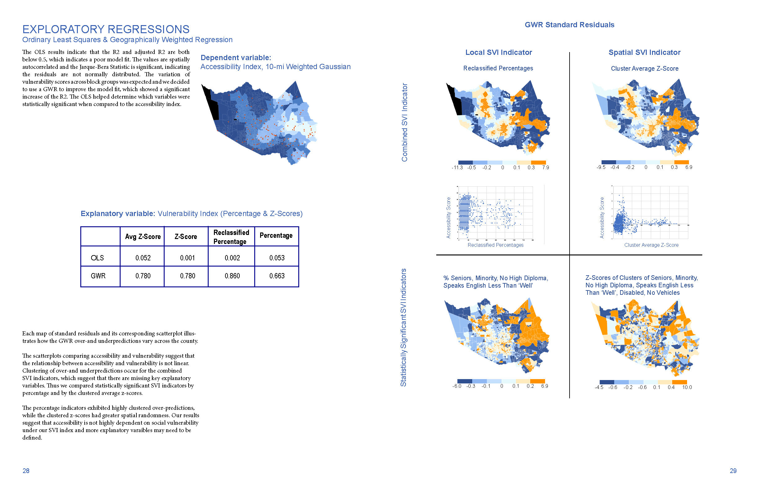
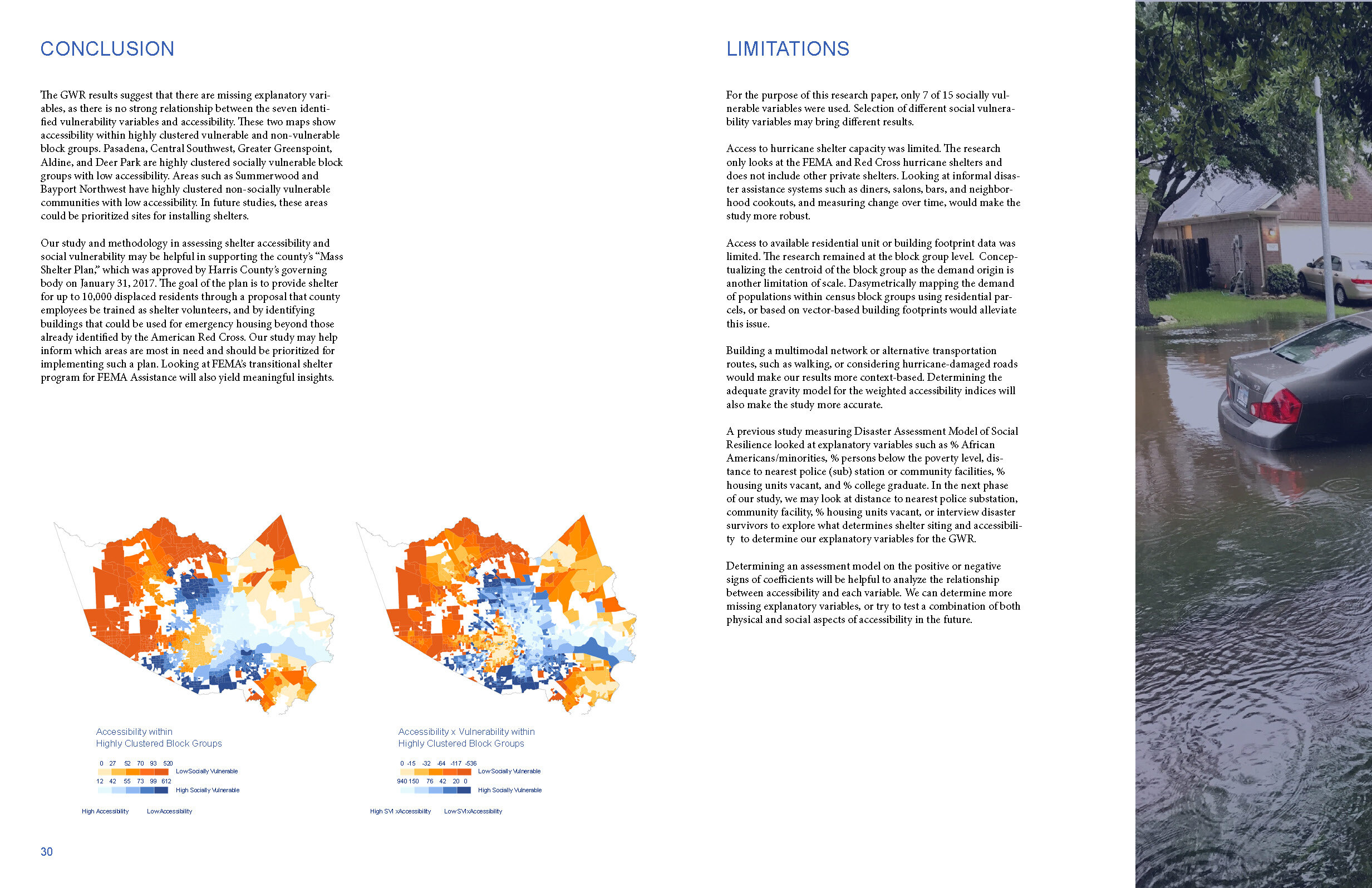
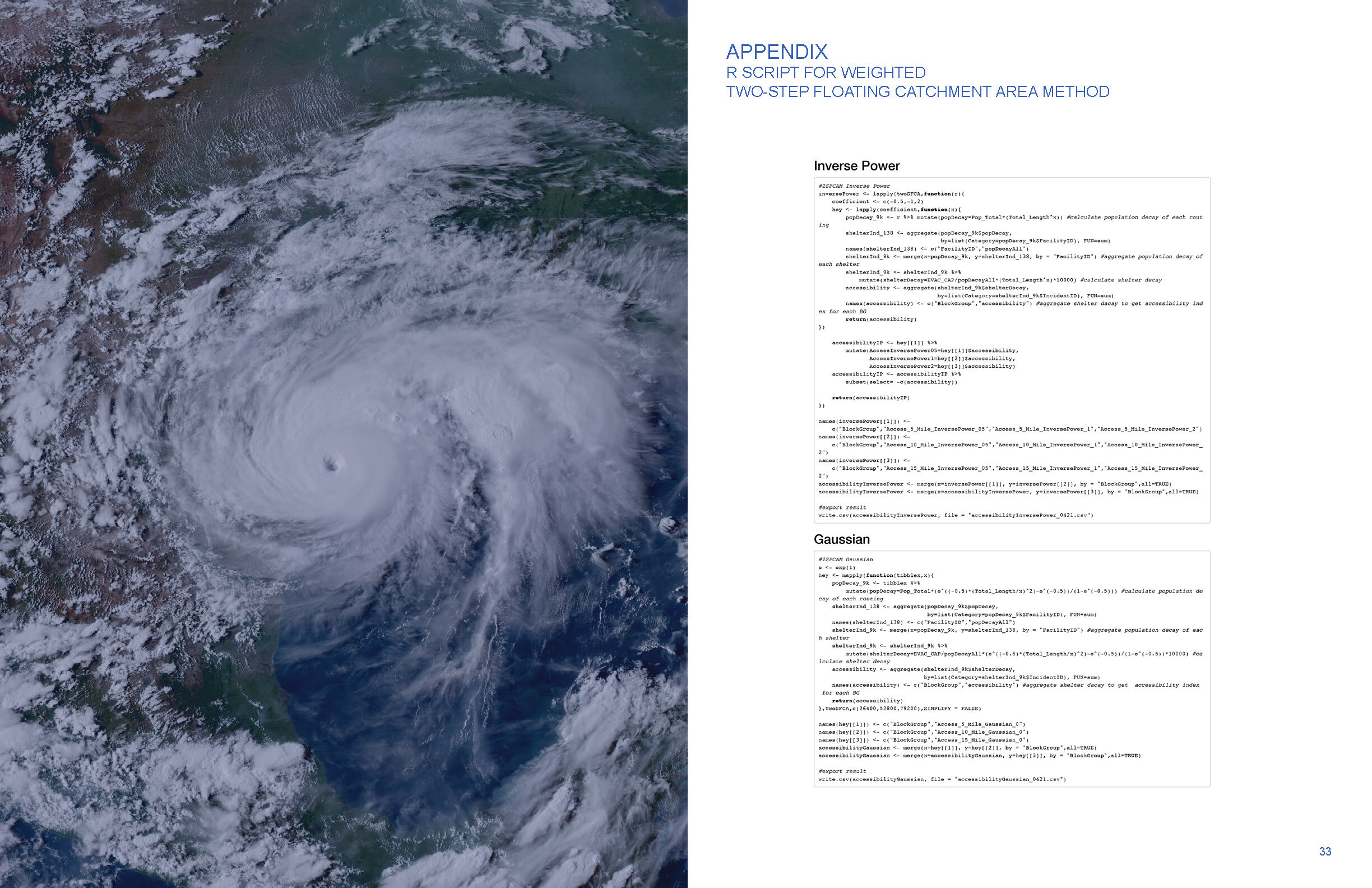
Jacey Chon, Zhengzhe Jia, and Savannah Wu. “Mapping Shelter Accessibility and Social Vulnerability in Harris County, TX, after Hurricane Harvey.”


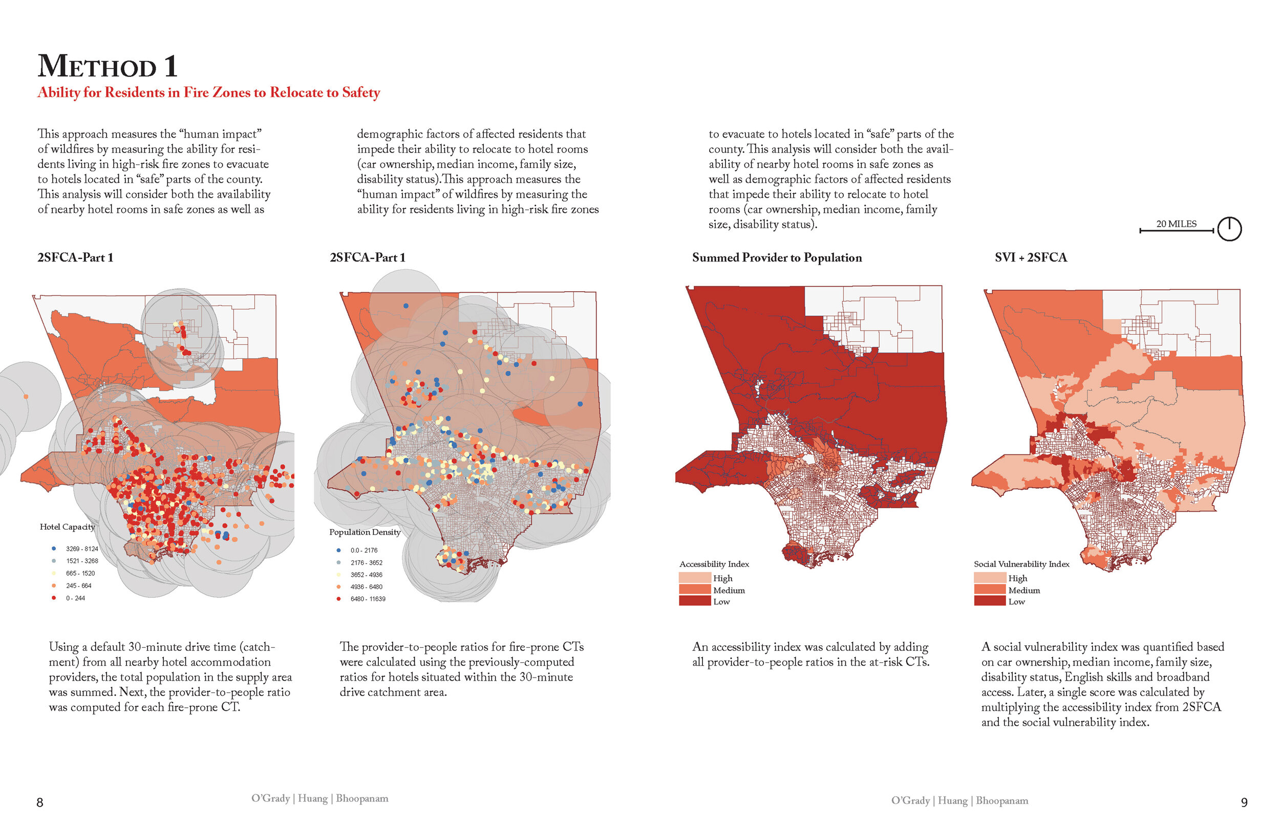
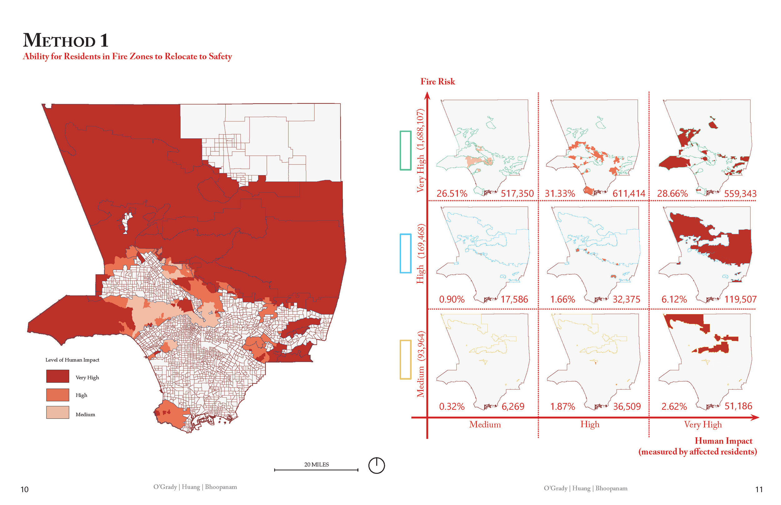
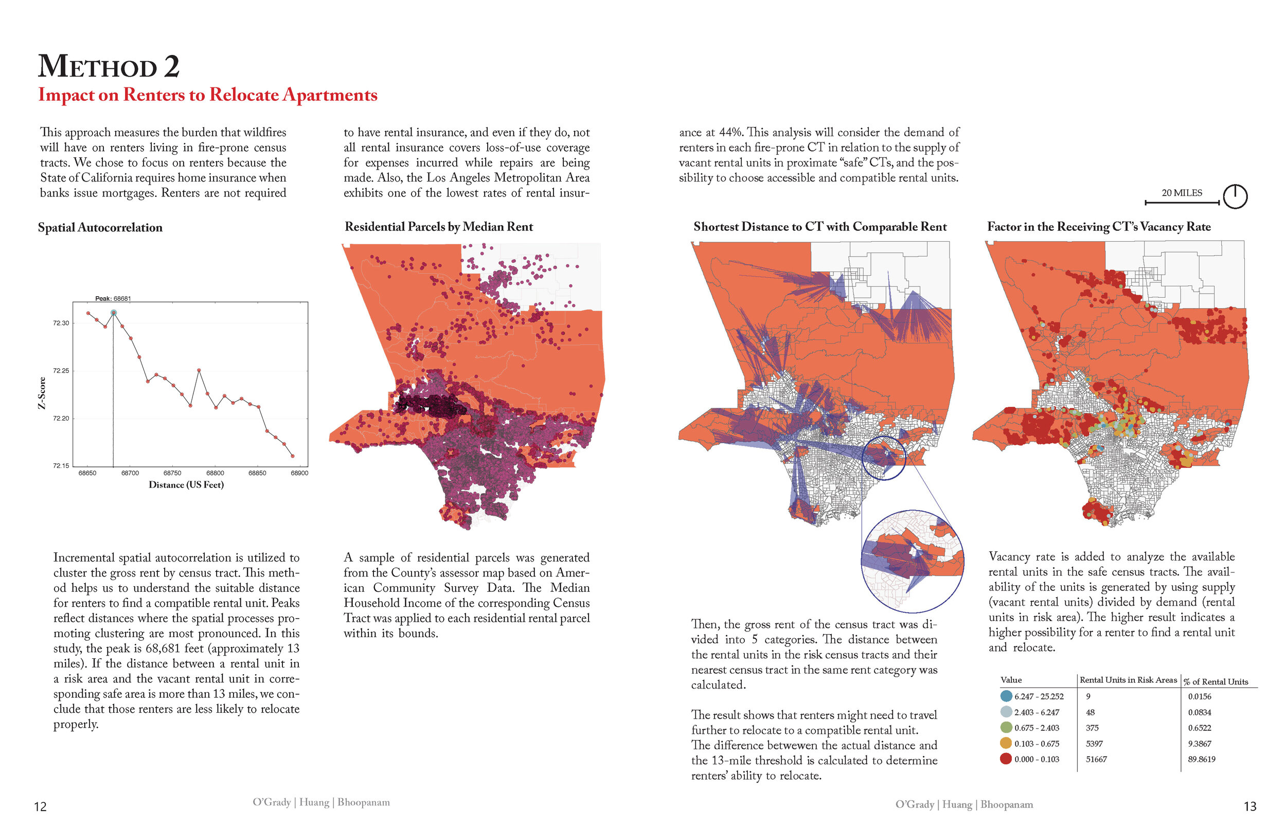
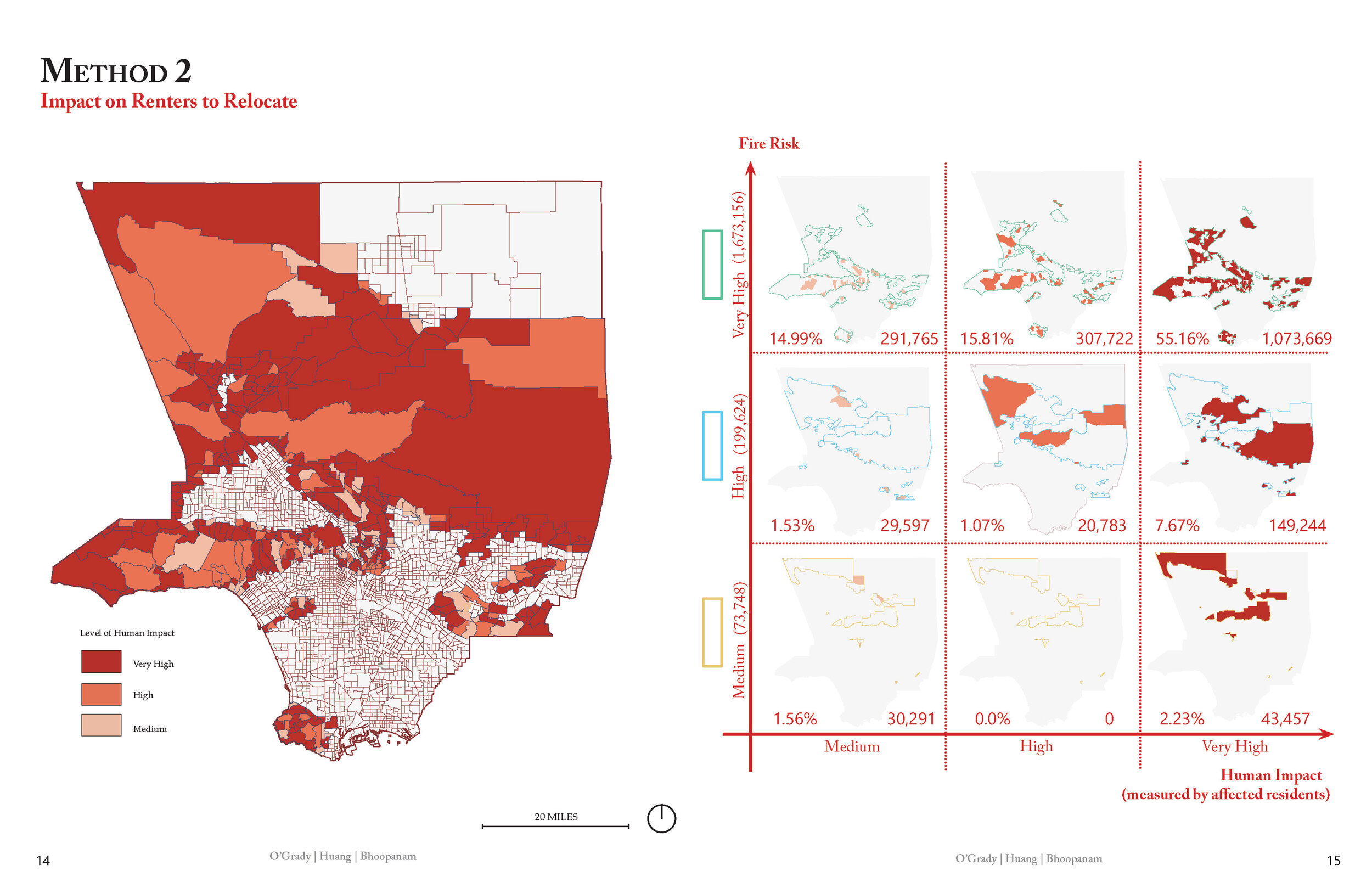
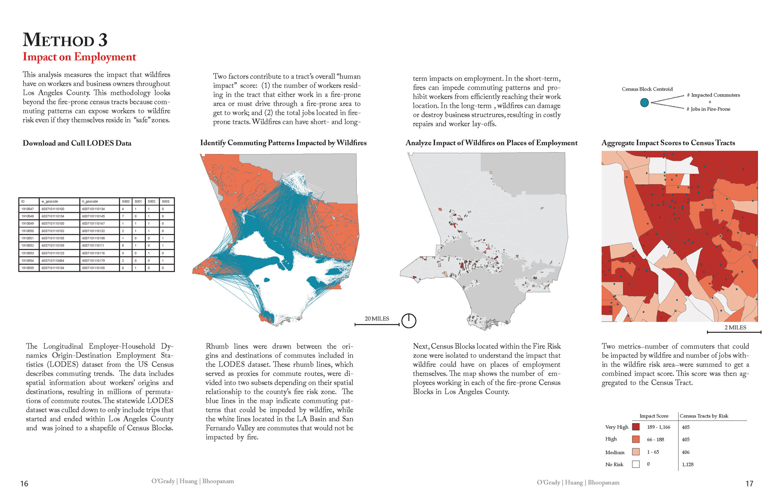
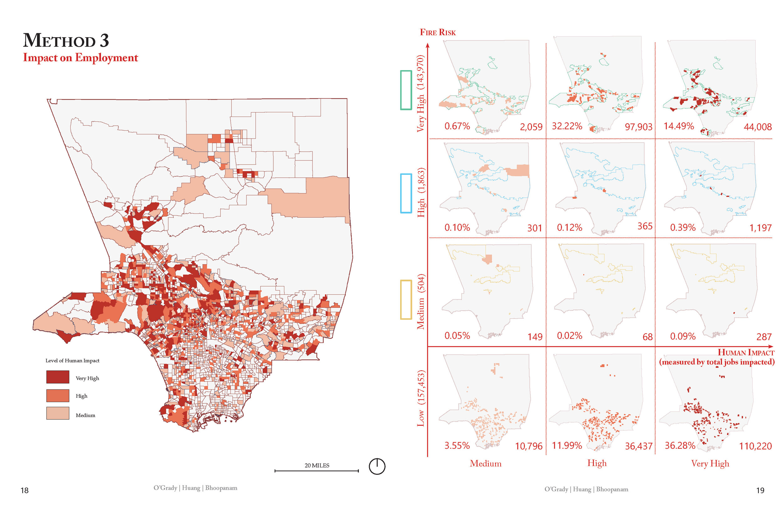
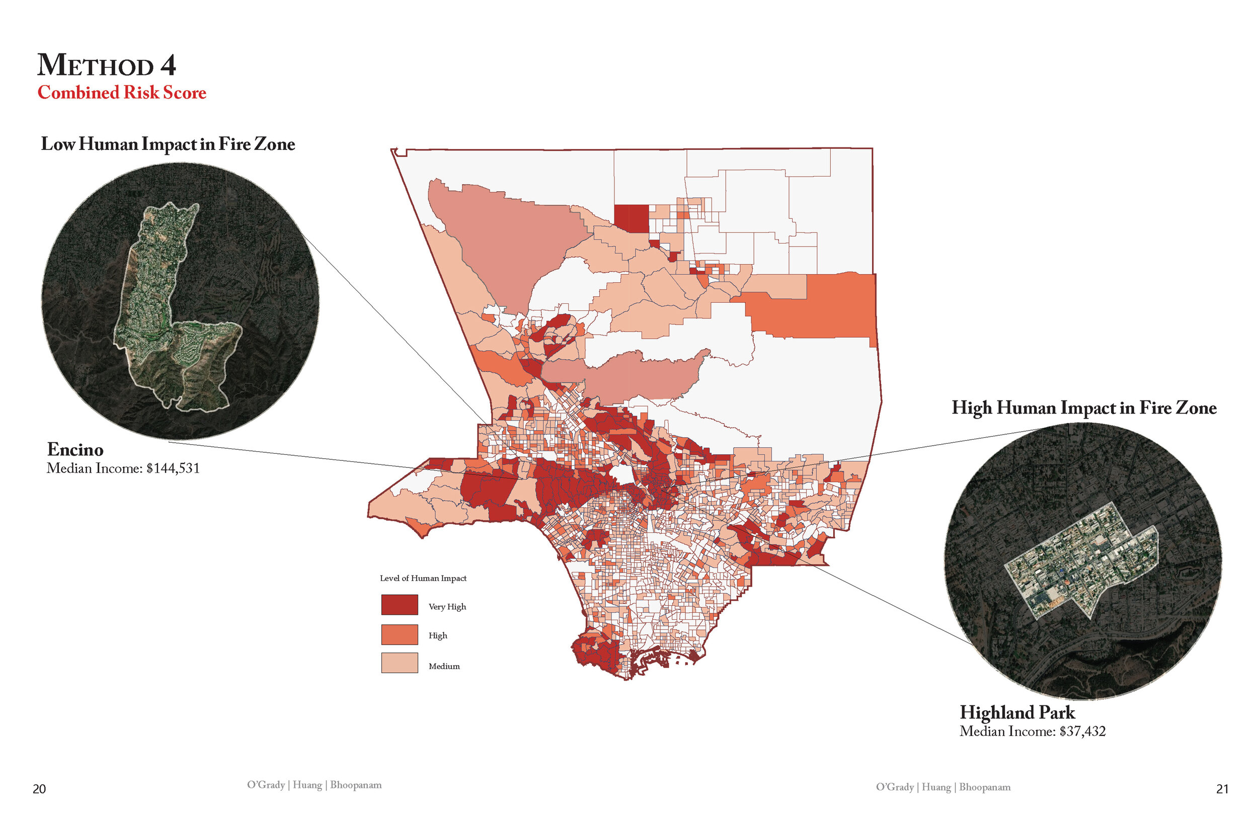
Timothy O’Grady, Shuyang Huang, and Srujana Bhoopanam. “Measuring Human Impact of Wildfires in Los Angeles County.”