Advanced Research Methods in Geographic Information Systems & Science
Advanced Spatial Analysis (Spring 2021), taught in the Urban Planning department of Columbia's Graduate School of Architecture, Planning and Preservation (GSAPP), is a hybrid course simultaneously teaching concepts of human and physical geography, critical GIS, and comparative spatial research methodologies, and decision support within the context of questions relevant to planning in urban environments. Its primary aims are teaching contextualized and thoughtful approaches to spatial methodologies, questioning the measures used in planning research, and developing sensitive and mixed methods of answering complex research questions that are often open to several interpretations.
Featured here are example student projects from the course. The final deliverables include a research poster and an elaborated report.

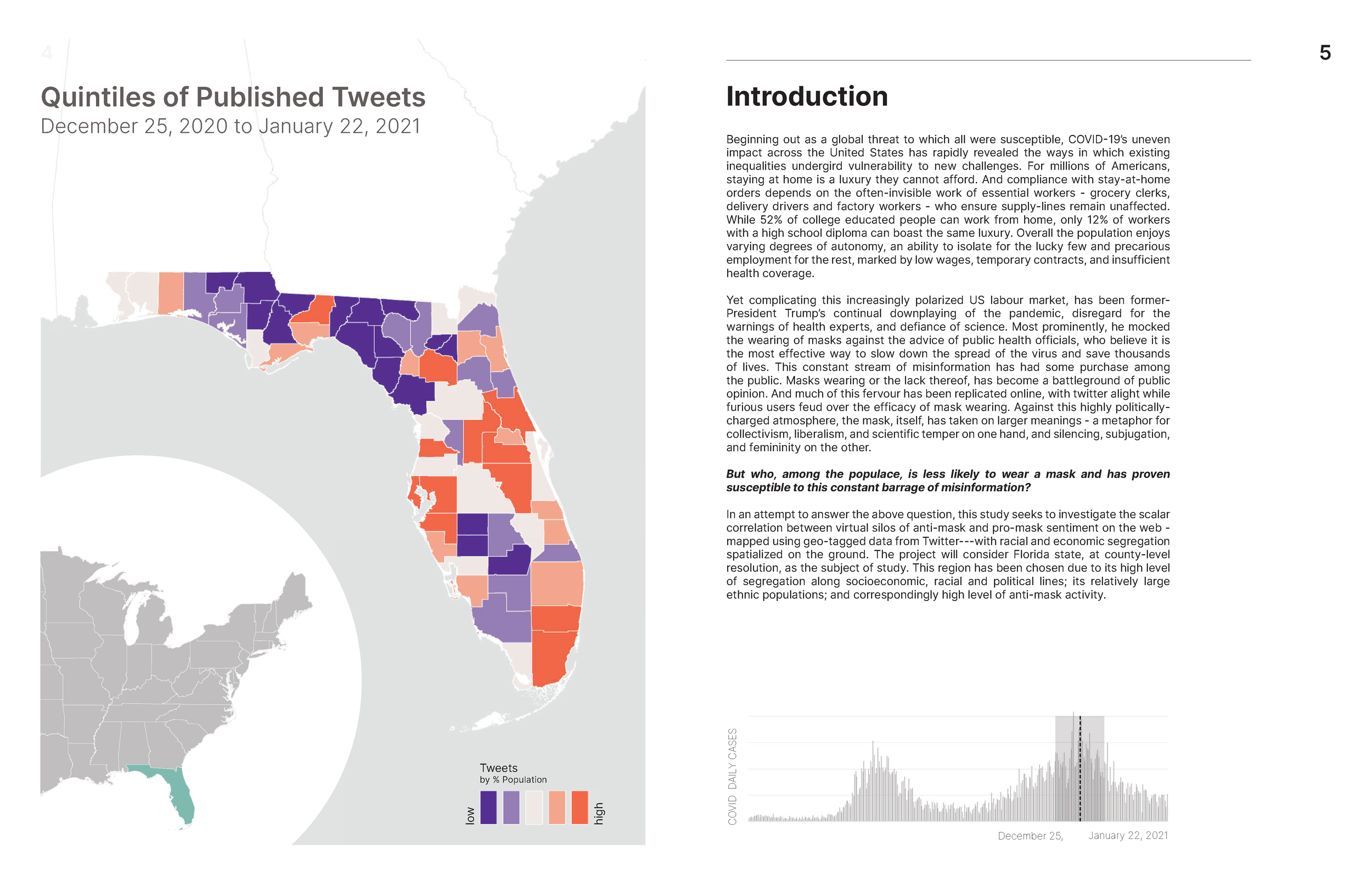
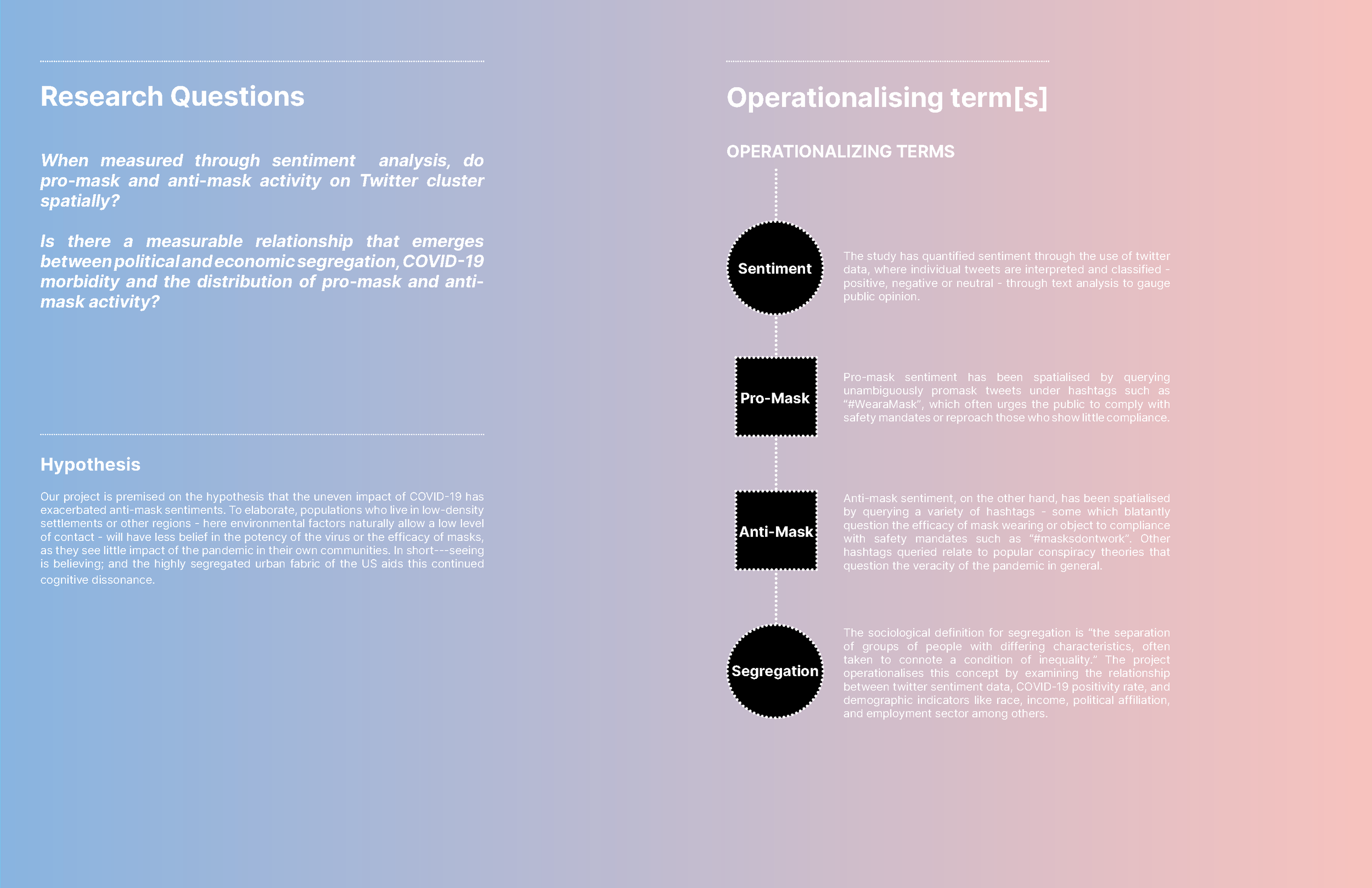
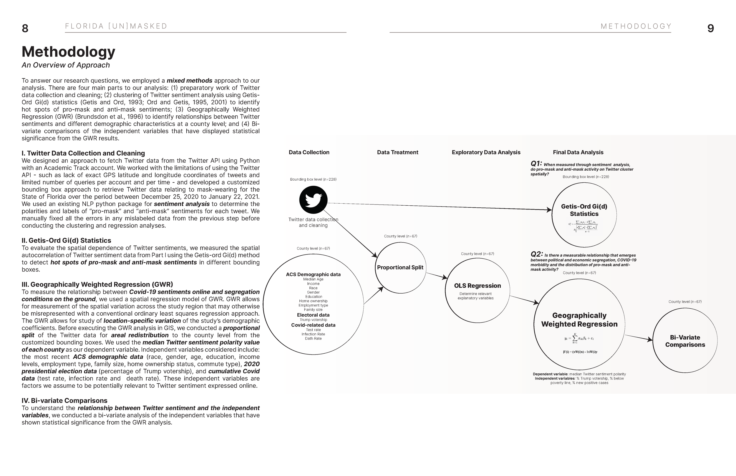
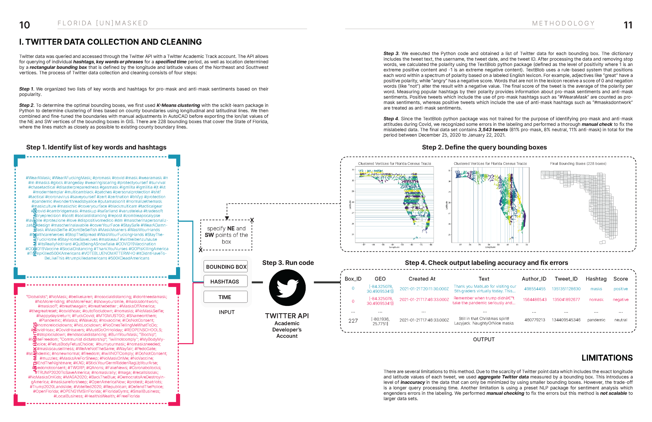
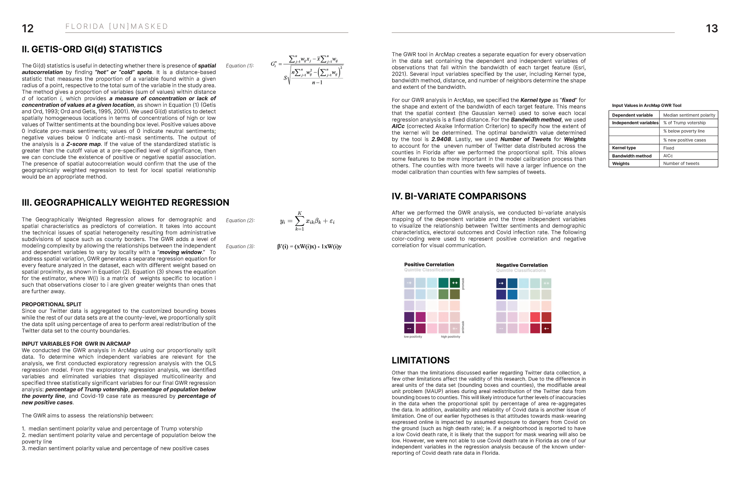
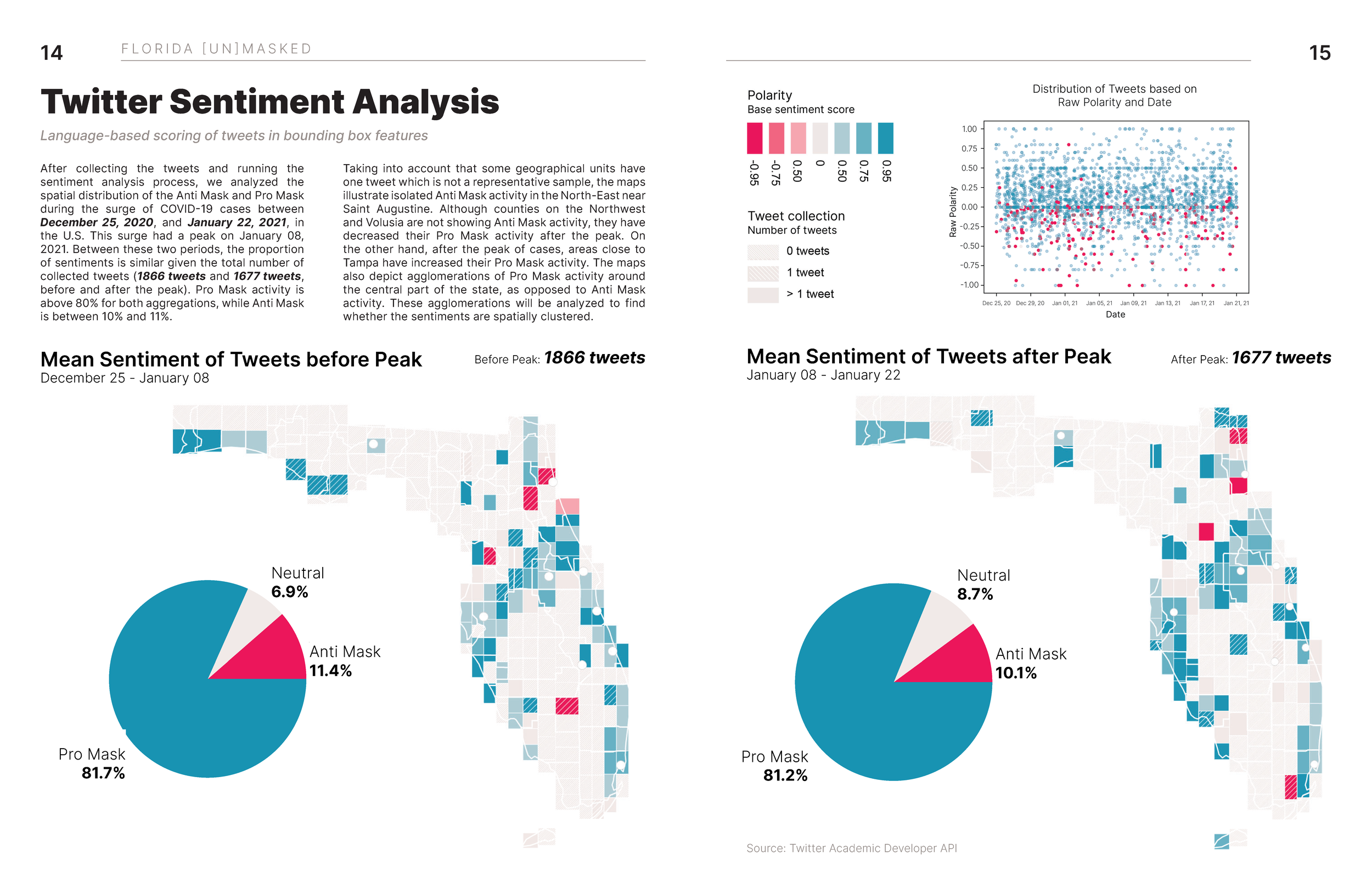
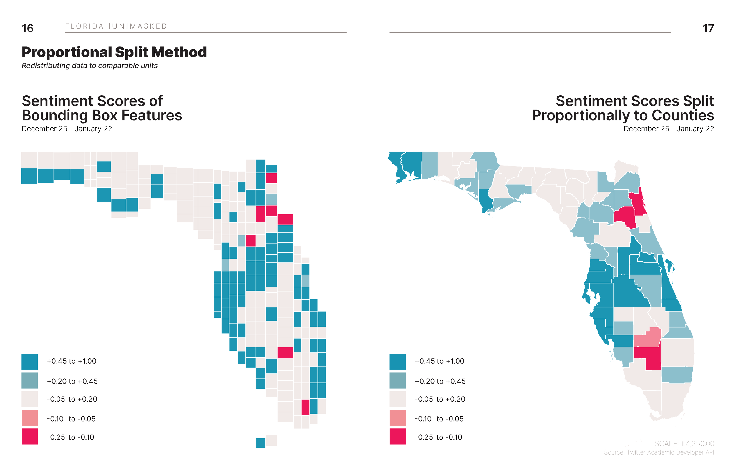
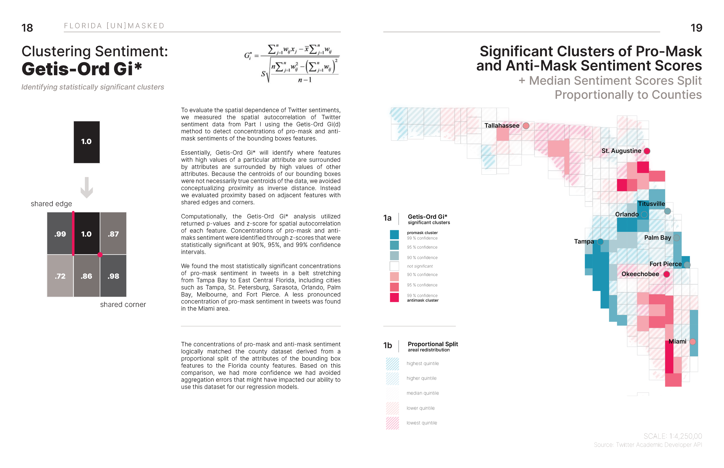
Will Cao, Mauricio Orellana, Helena Rong, and Ranjani Srinivasan. “Florida [Un]Masked: Comparing Twitter Sentiment on Masks with COVID-related factors in Florida (2021).”


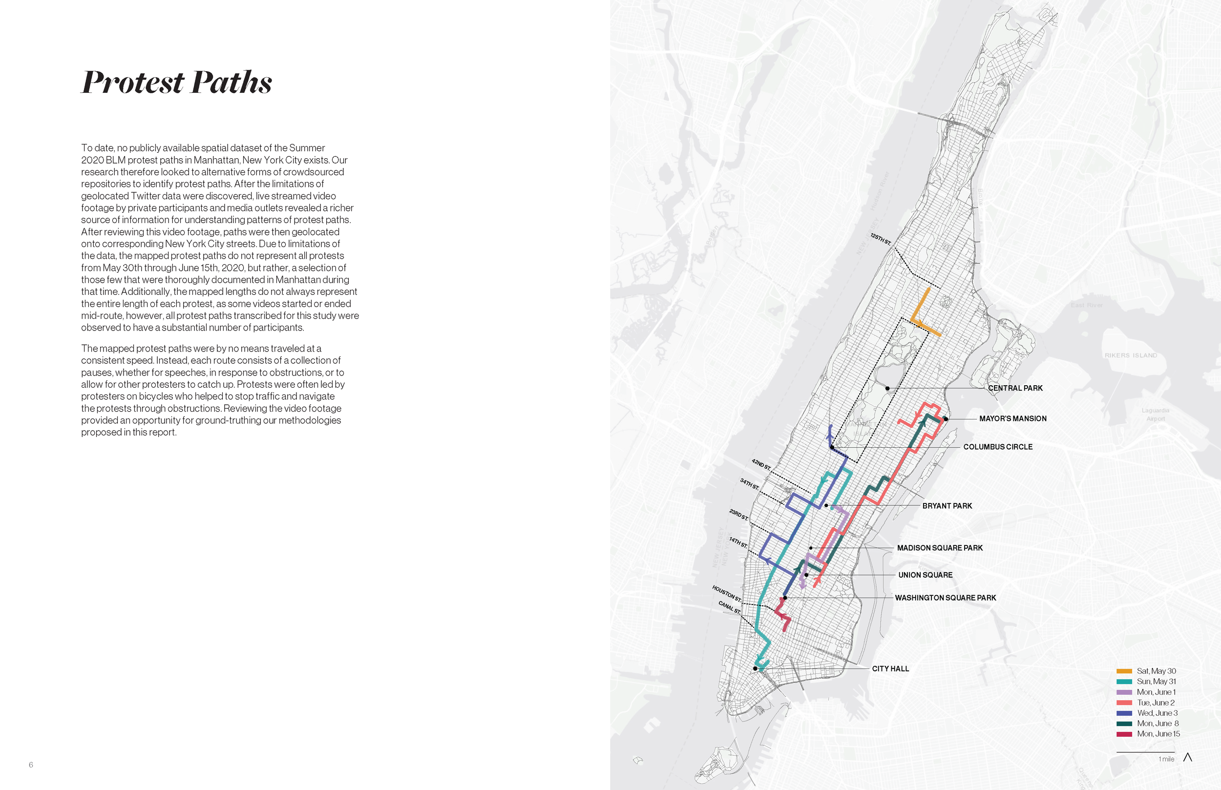
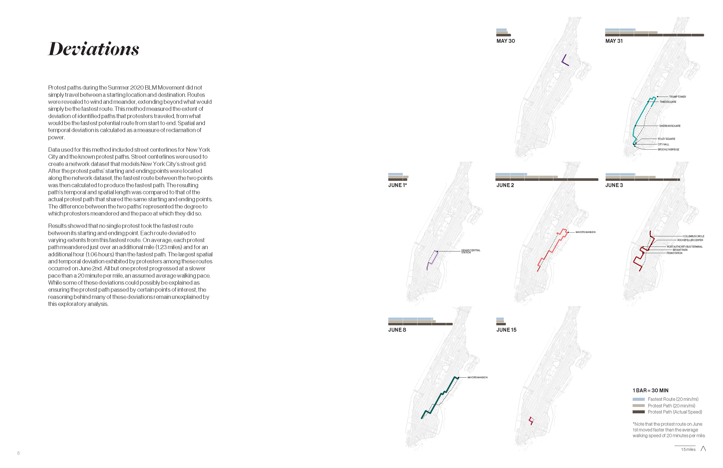
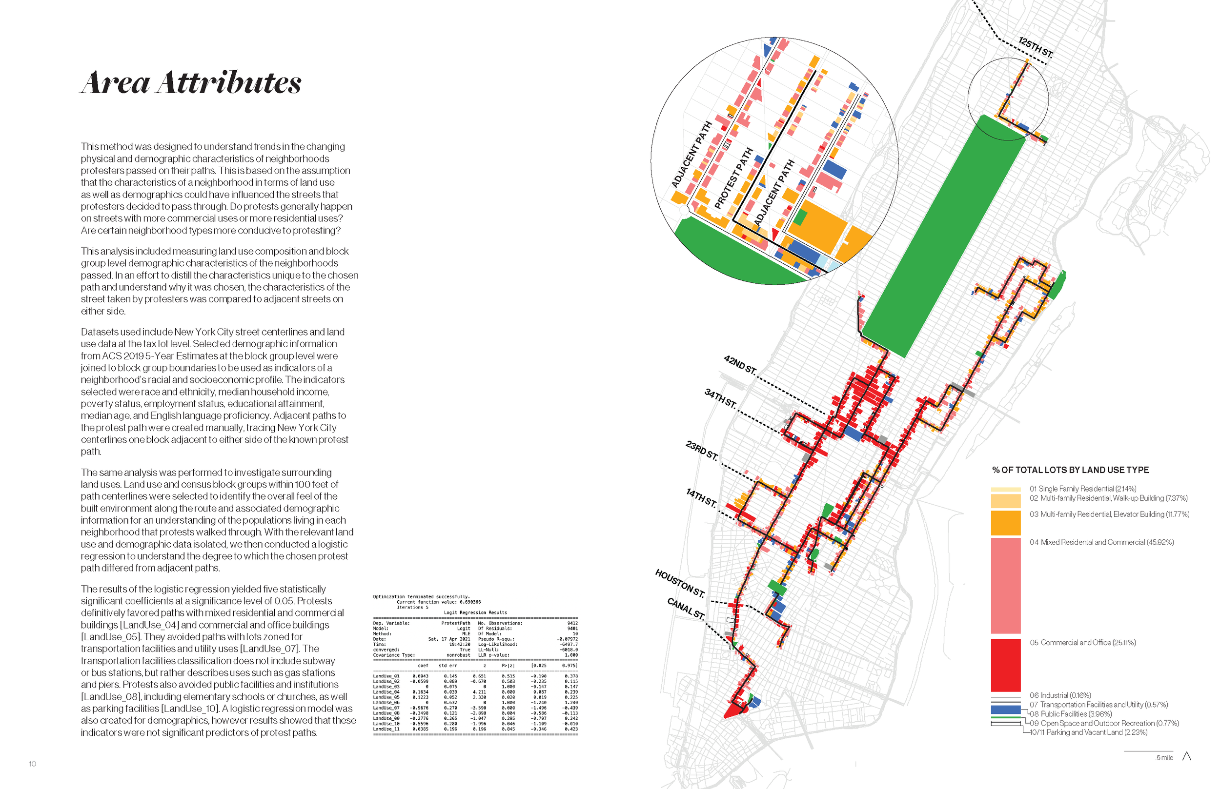
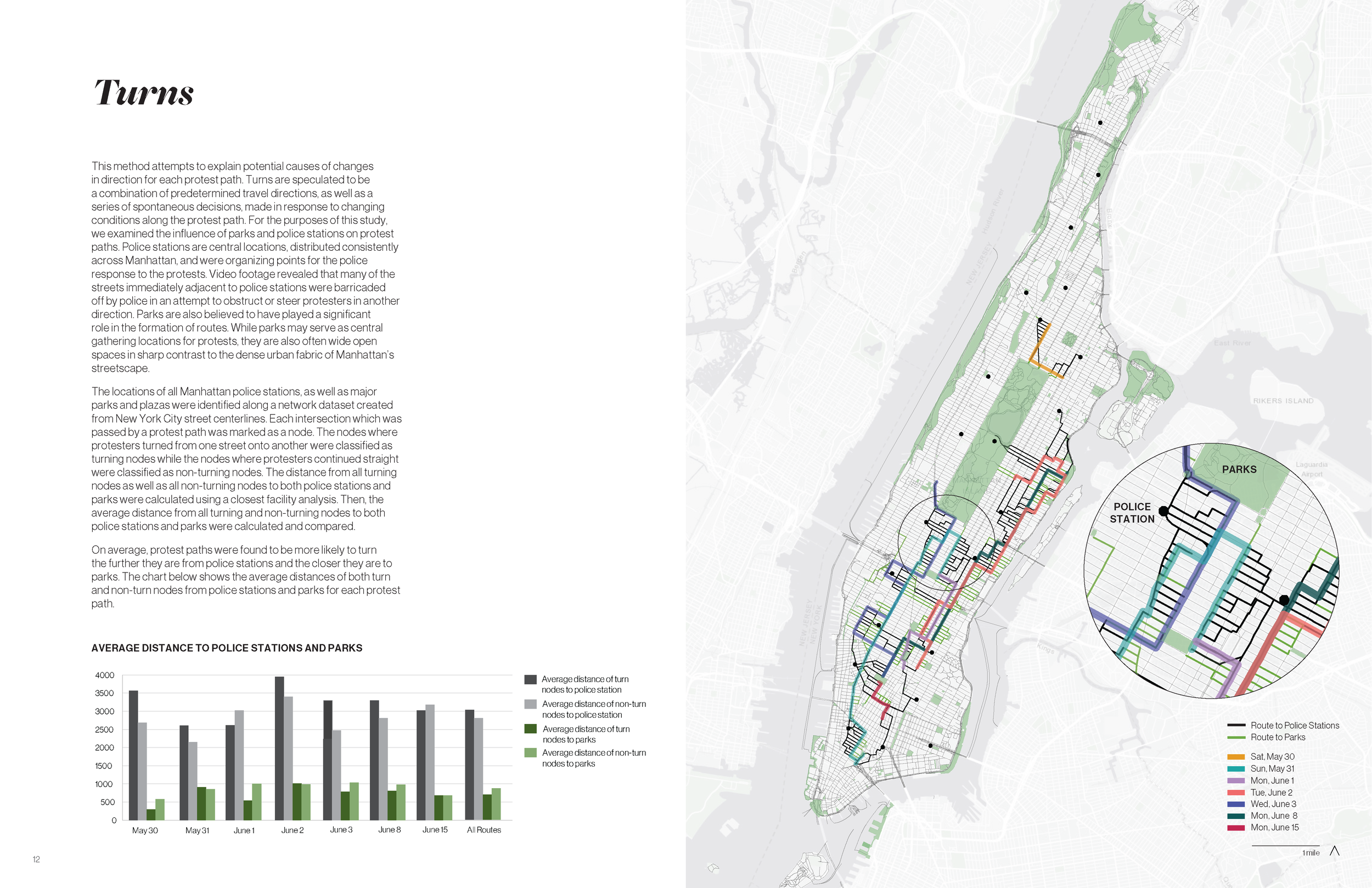
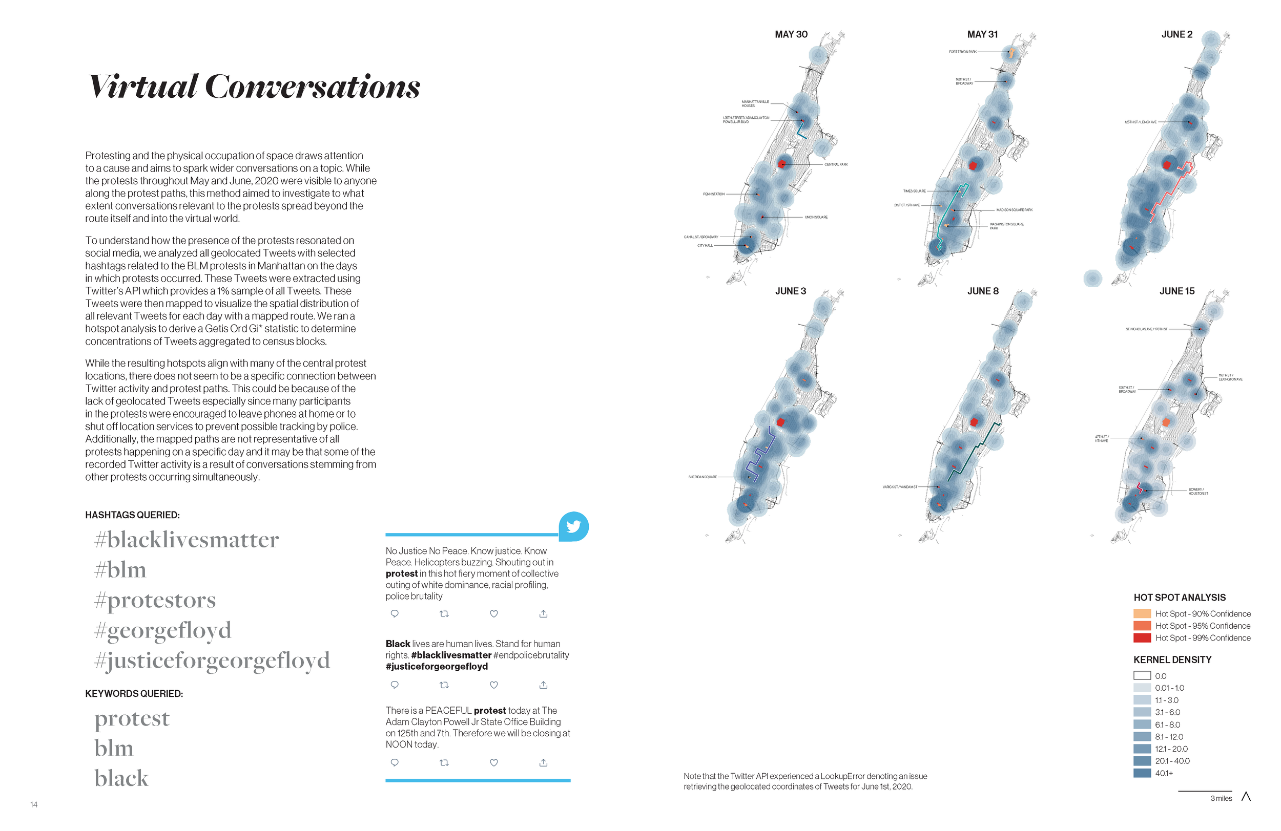
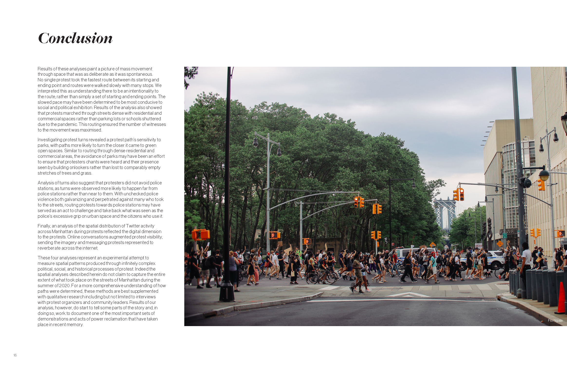
Myles Agudelo, Regina Alcazar, Lanier Hagerty, and Elaine Hsieh. “Mapping Patterns of Power Reclamation.”
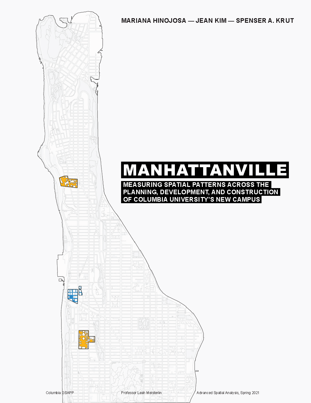
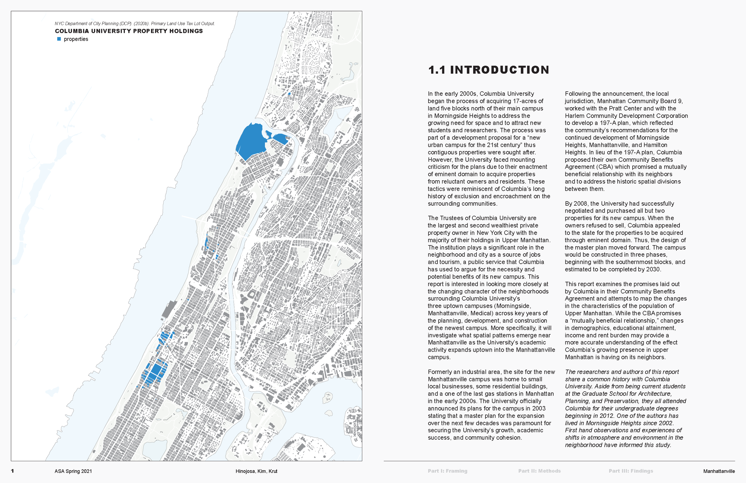
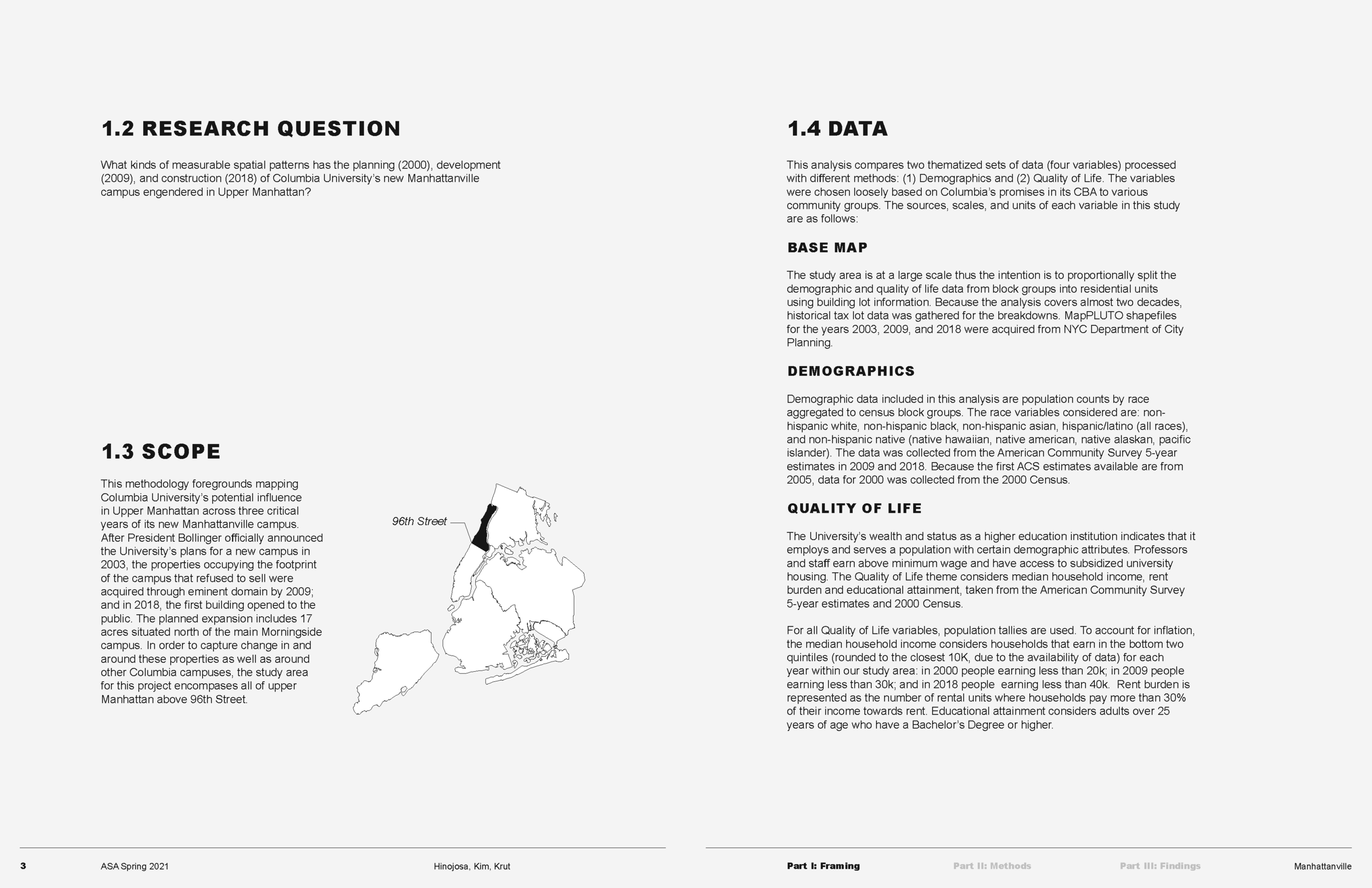
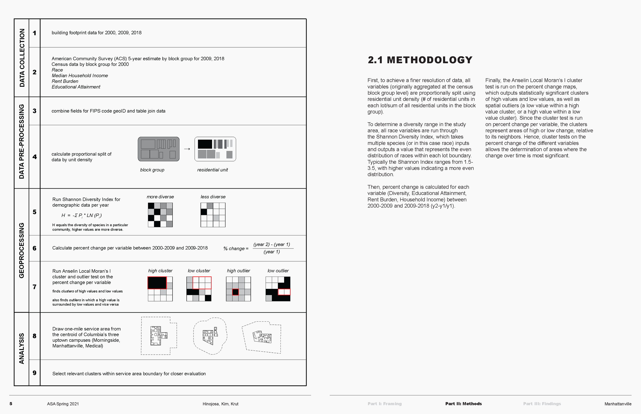
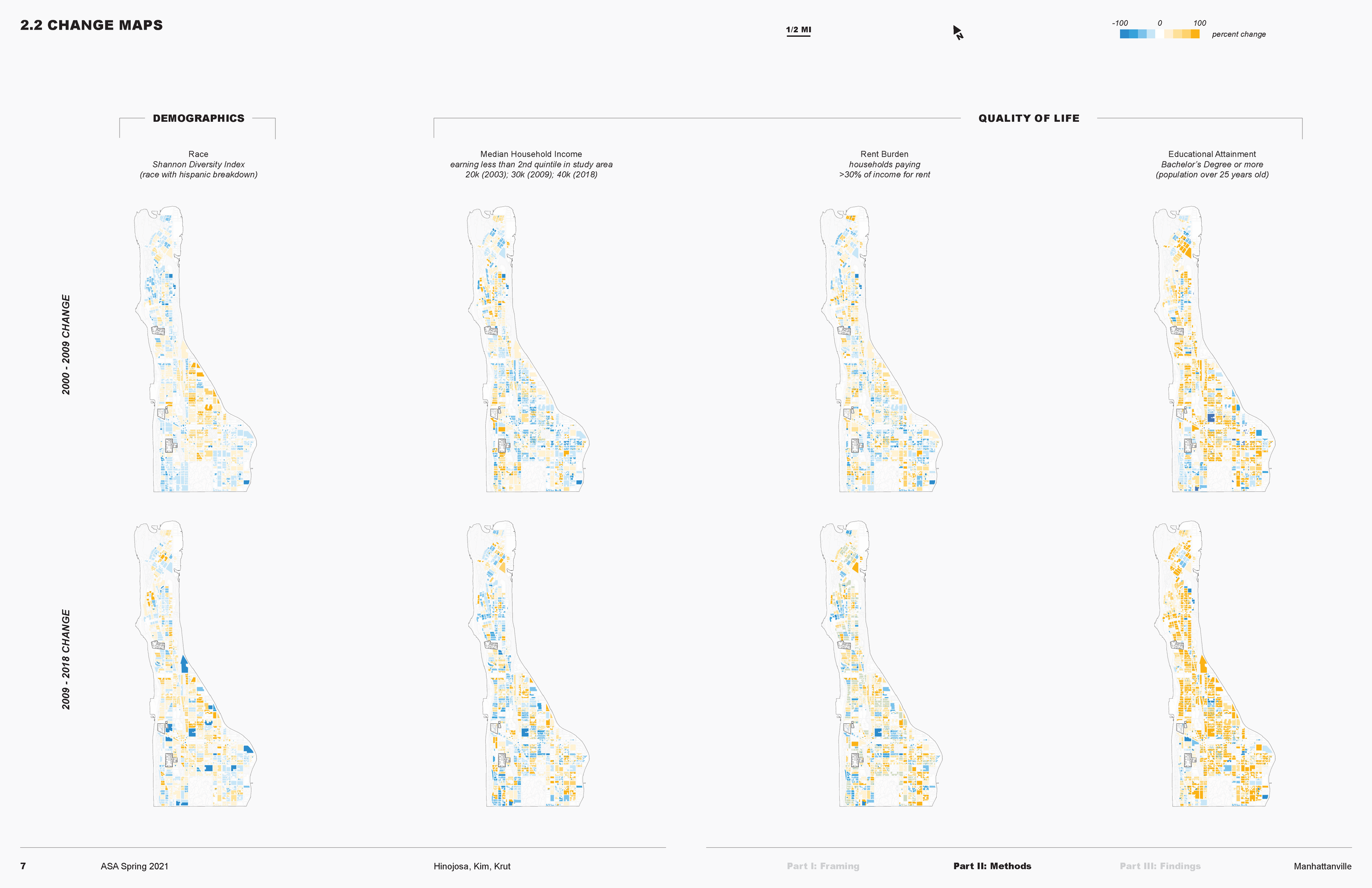
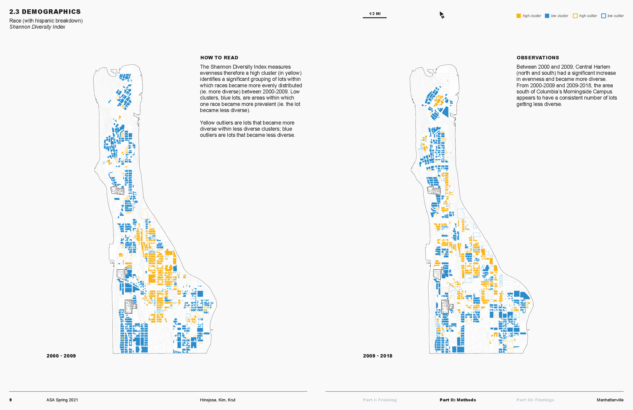
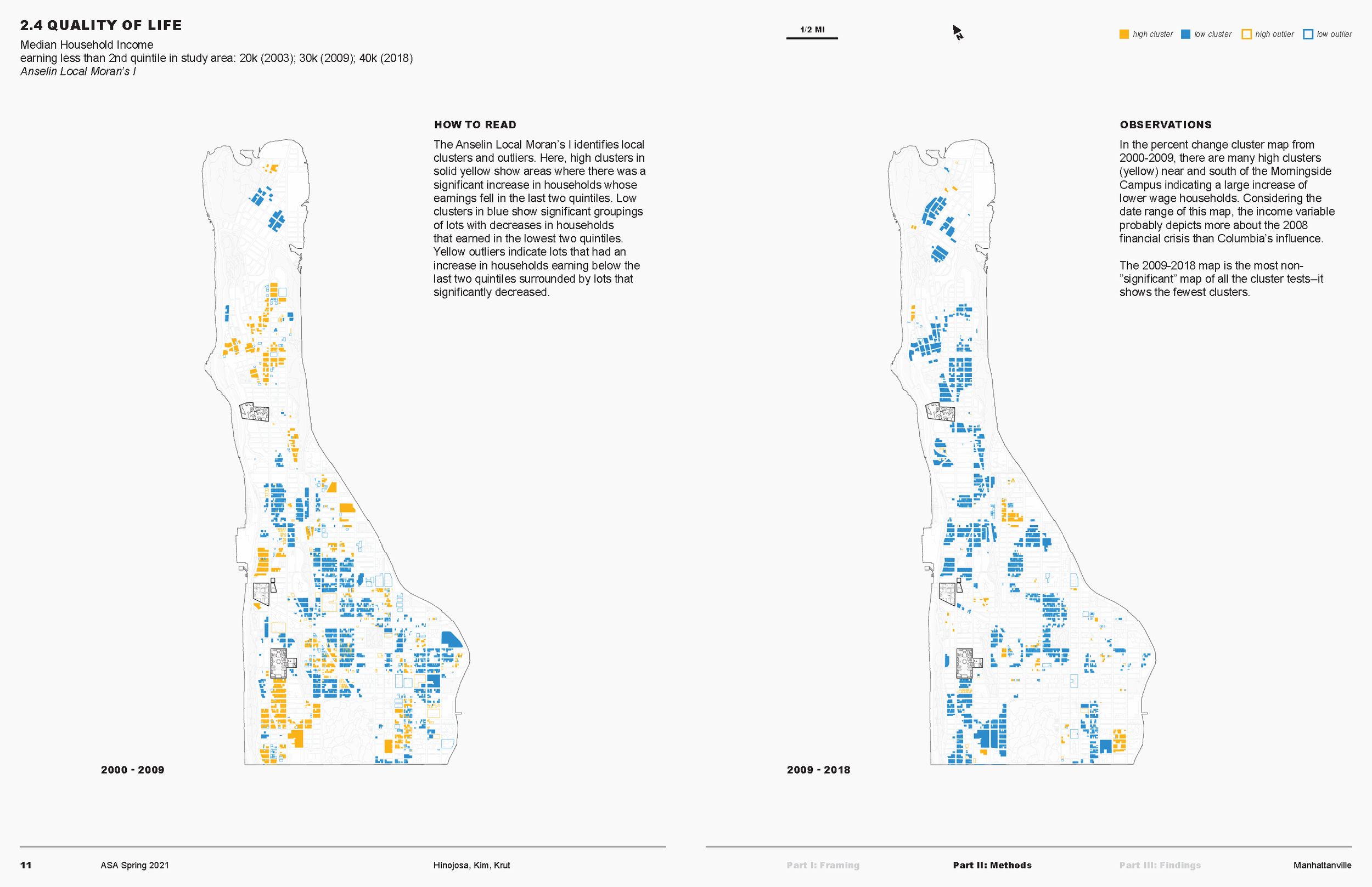
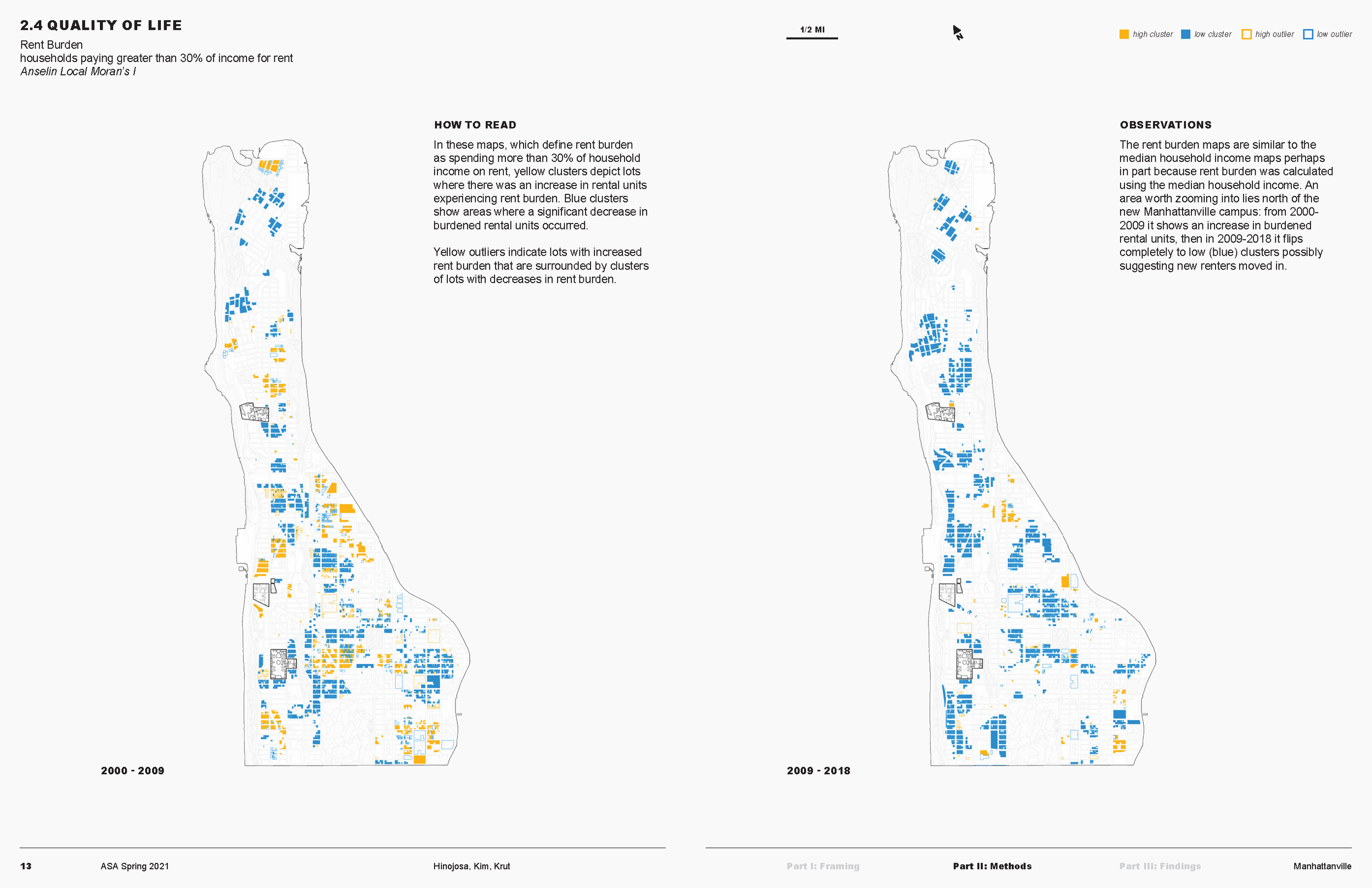
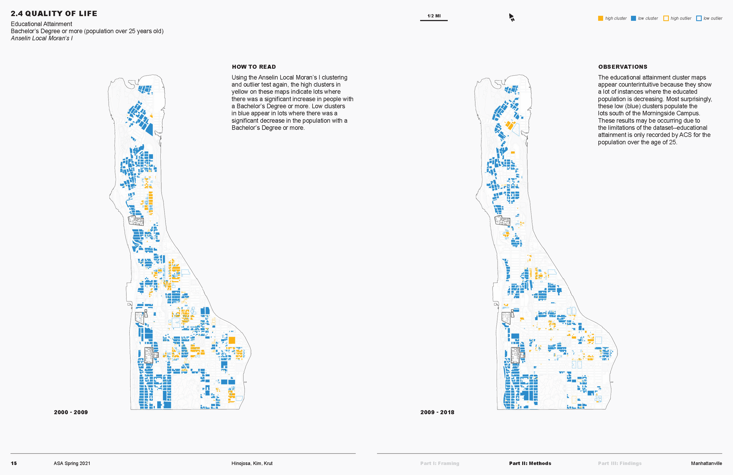
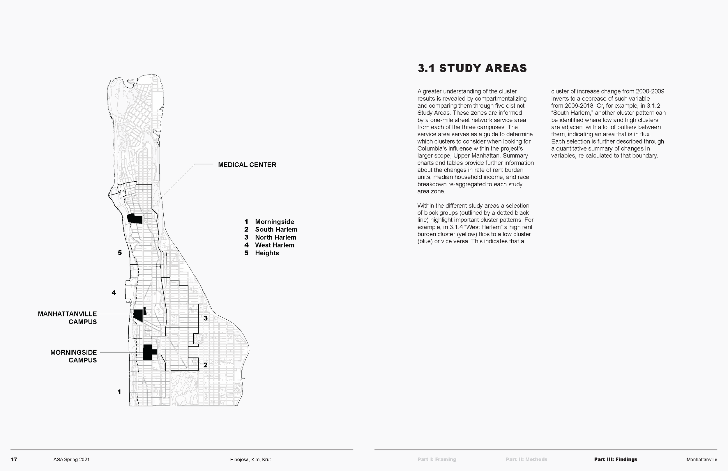
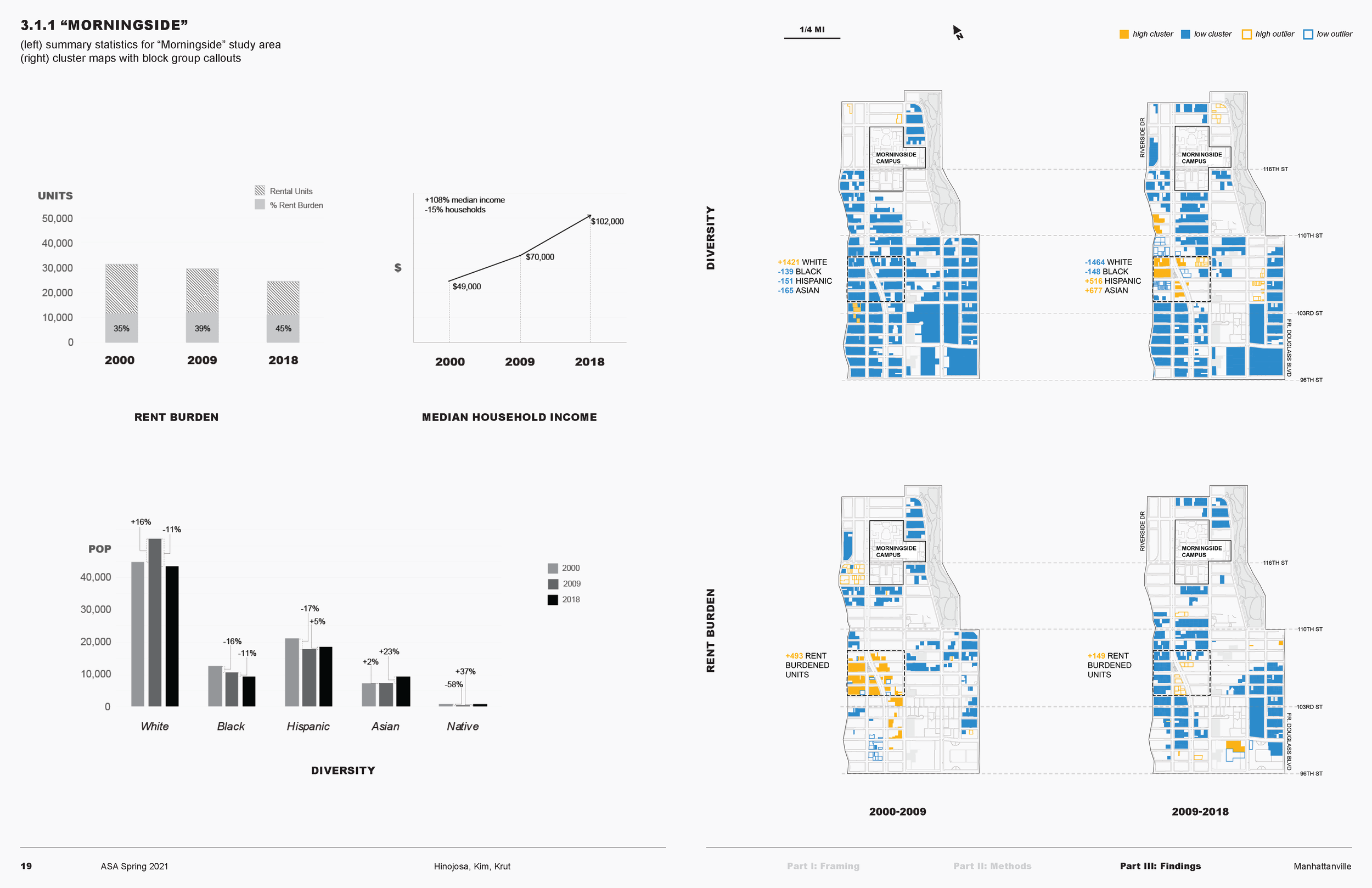
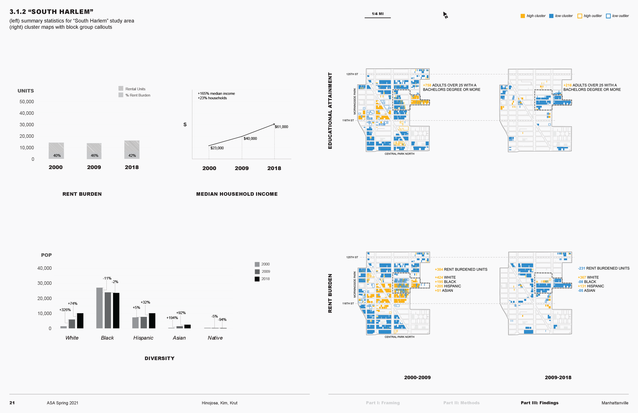
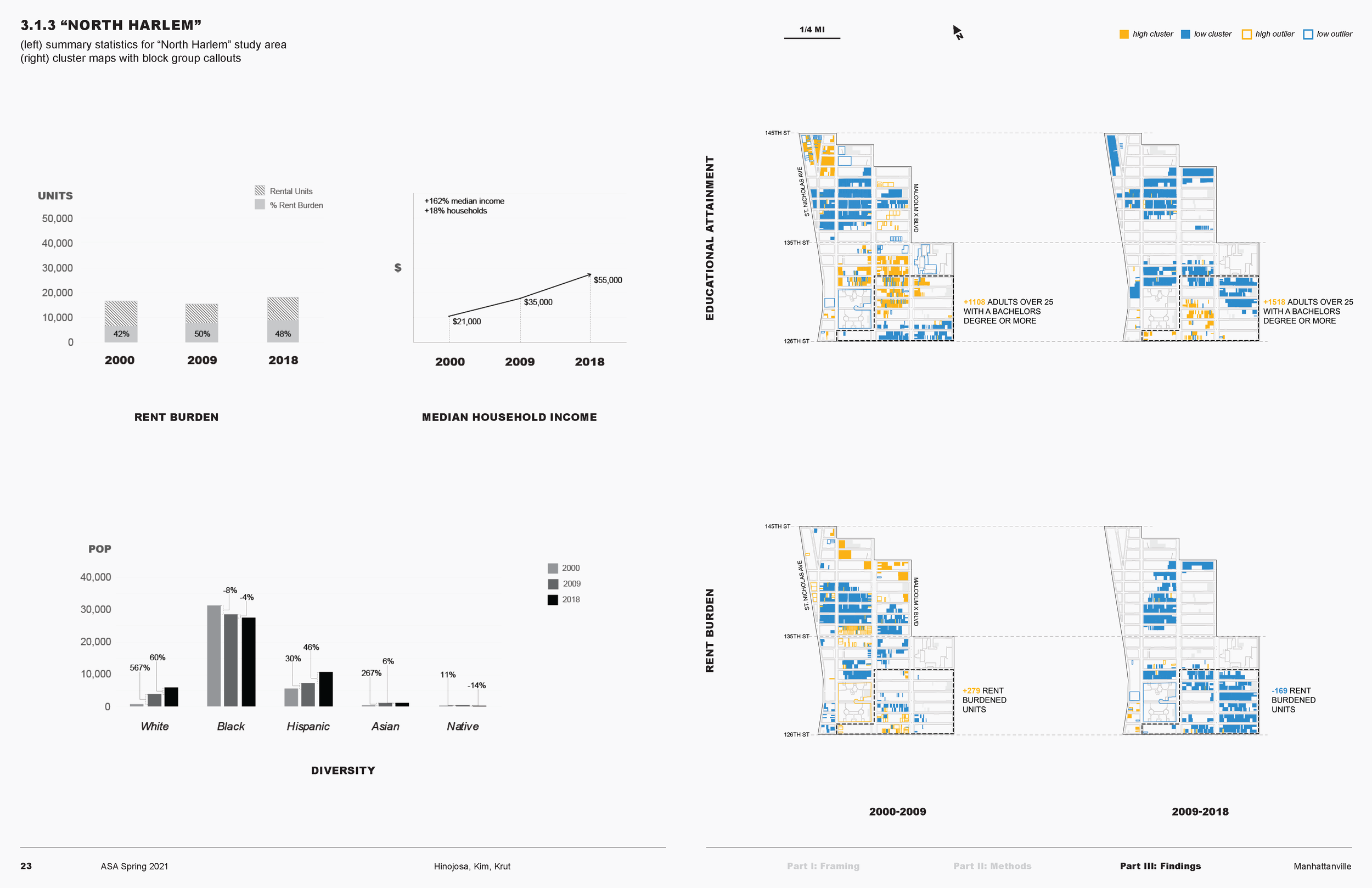
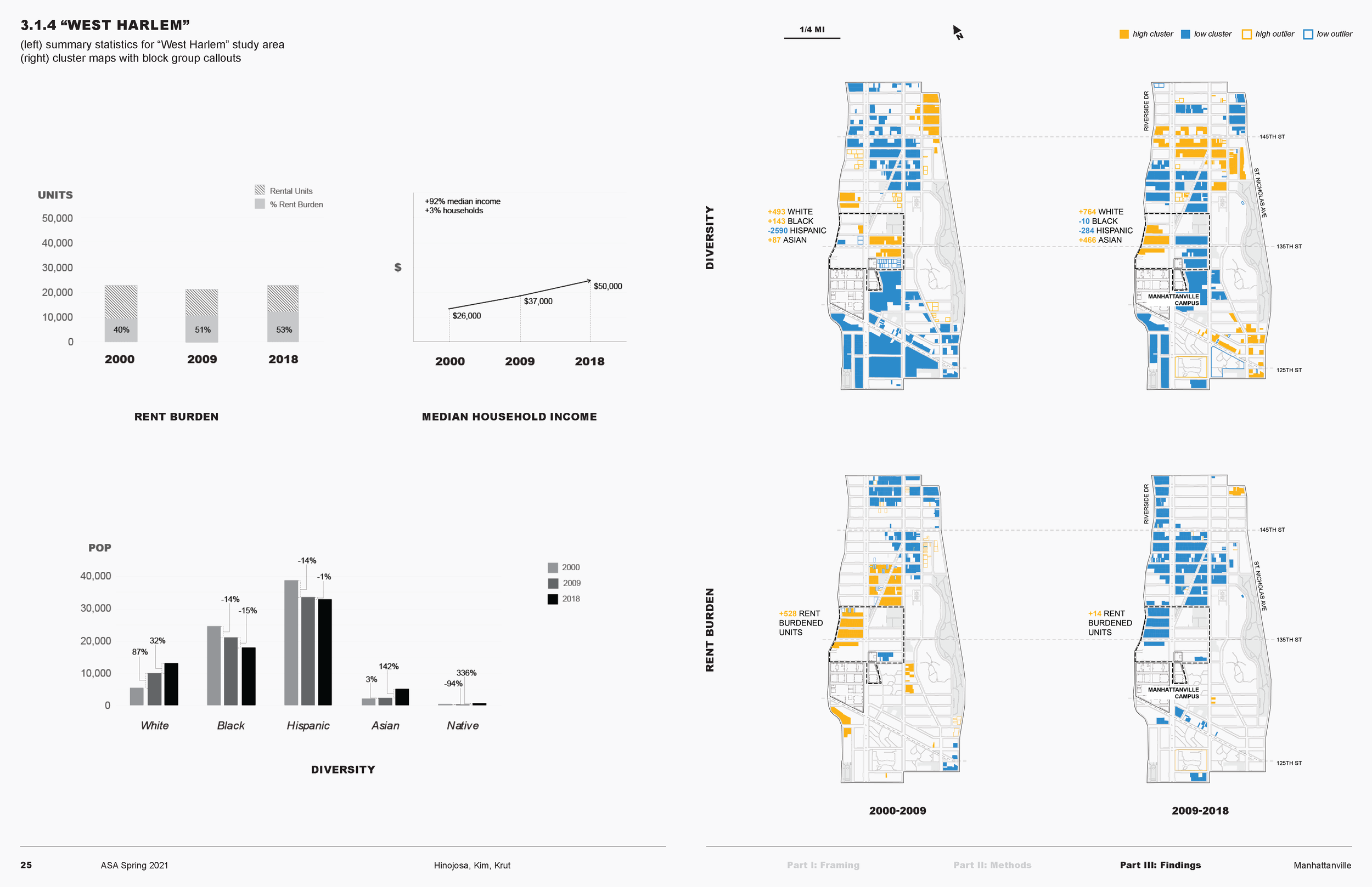
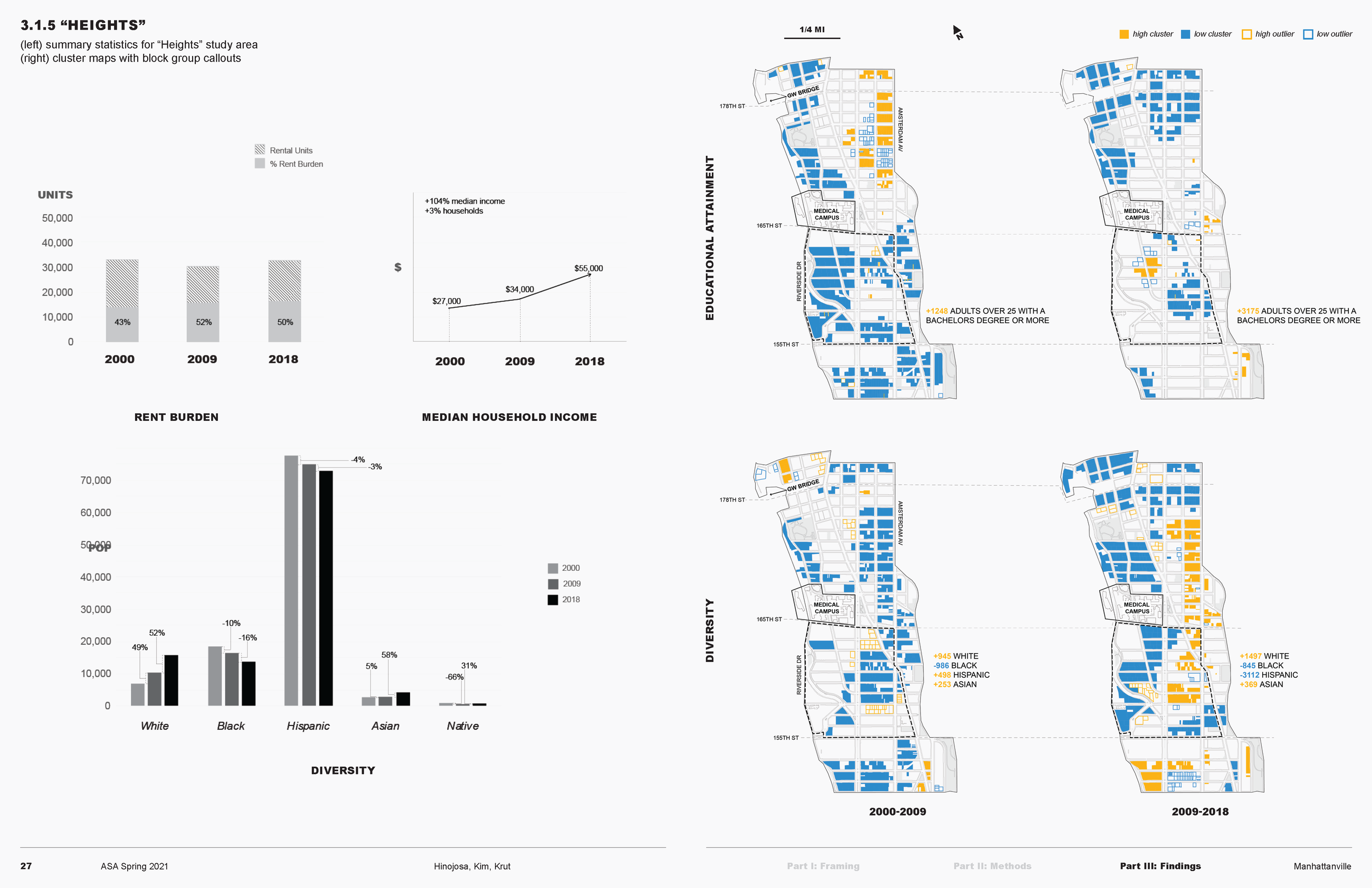
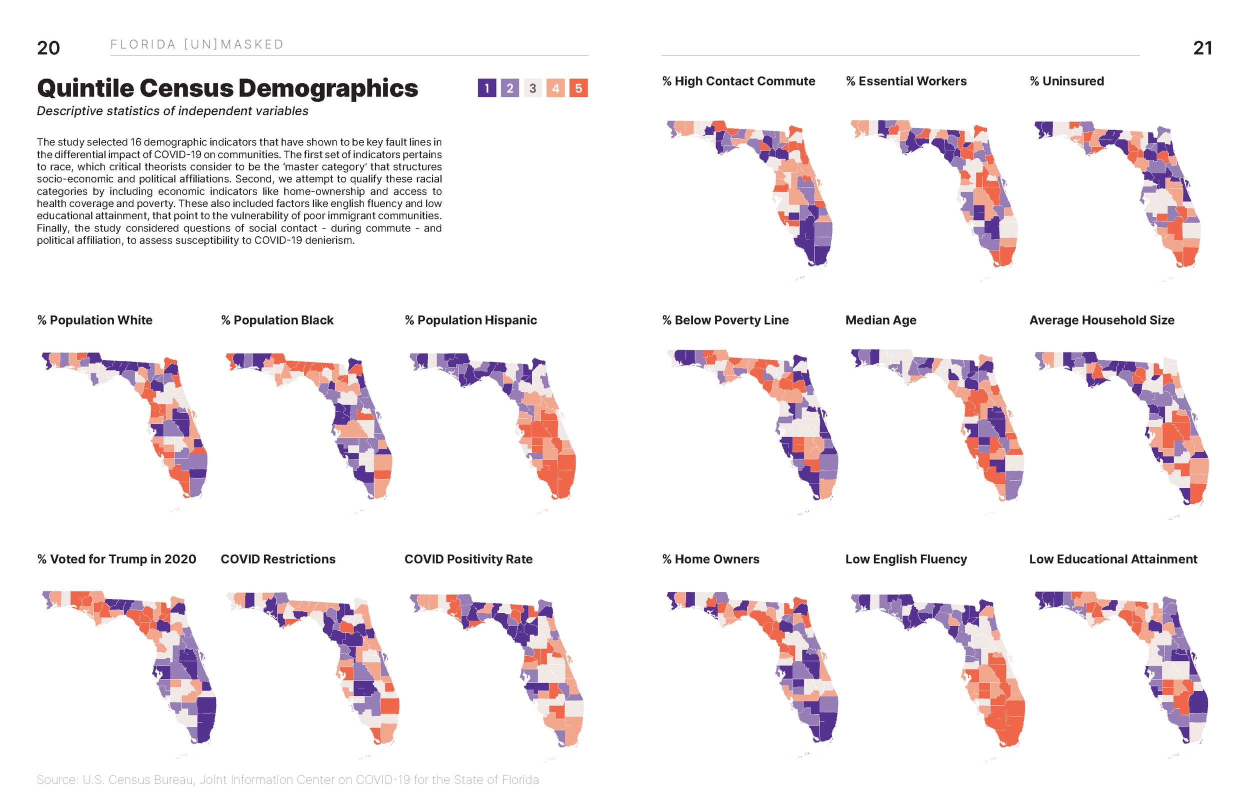
Mariana Hinojosa, Jean Kim, and Spenser A. Krut. “Manhattanville: Measuring Spatial Patterns across the Planning, Development, and Construction of Columbia University’s New Campus.”